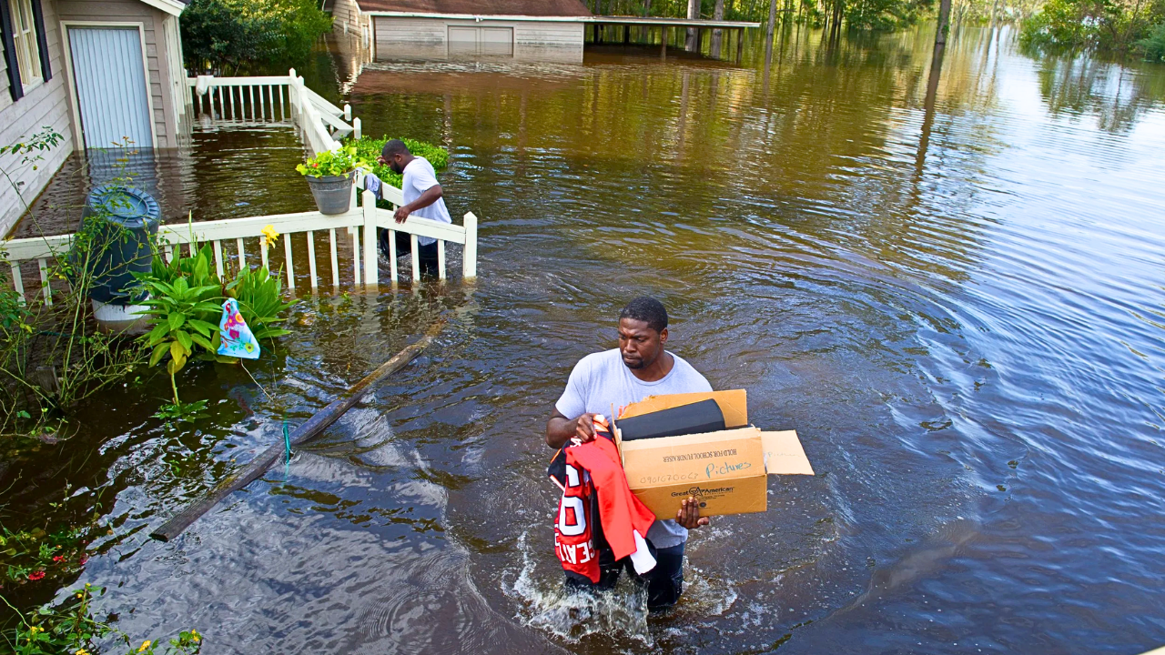
Flooding is becoming a more frequent and dangerous problem across many parts of the United States. New research shows that property exposure to flooding is about 67% higher than older federal estimates, putting millions of homes and trillions of dollars in assets at risk as sea levels rise and extreme rainfall increases. While the headline focuses on the most at‑risk flood states, the evidence in this overview clearly supports high flood danger for 13 documented states, not 18, so the headline should be adjusted to avoid overstating the coverage.
The highest-risk states combine low-lying land, dense development, aging infrastructure, and exposure to hurricanes or intense storms. Florida, Texas, Louisiana, Mississippi, the Carolinas, California, Missouri, Pennsylvania, New Jersey, New York, Massachusetts, and Virginia all show patterns of rising losses, expanding flood zones, and mounting financial exposure. These trends point to a future where flood hazards reach far beyond traditional coastal zones into suburban and inland communities.
Coastal States Under Intensifying Pressure
Florida remains the nation’s most flood‑prone state because of its flat terrain, low elevation, and long coastline, leaving millions of residents and structures exposed to storm surge, heavy rain, and tidal flooding that can occur even on clear days. Hurricane Ian in 2022 caused about 112 billion dollars in damage, underscoring how stronger storms can devastate housing, infrastructure, and local economies in the state. Although national estimates show 8.7 million high‑risk properties across the U.S., Florida accounts for a large share of those assets, and insurance costs there have climbed quickly as development continues in flood‑prone areas.
Louisiana and Mississippi also sit on the front lines of coastal risk. Much of coastal Louisiana lies at or below sea level and depends on levees to hold back Gulf waters and the Mississippi River, while disappearing marshes reduce natural flood protection. Land subsidence and warmer seas increase storm surge risk in and around New Orleans and along this critical oil and gas corridor, even after major post‑Katrina improvements. On Mississippi’s Gulf Coast and Delta, repeated hurricanes and river floods hit communities that also struggle with slow‑draining soils; while local sea level is rising, the precise figure and related loss of barrier islands are less certain than some earlier claims suggest.
The Carolinas face growing coastal and inland flood threats. In North Carolina, hurricanes such as Helene in 2024 brought extreme rainfall and widespread inland flooding, with confirmed deaths exceeding 100 and total damages now estimated around 78.7 billion dollars, which is substantially higher than early 50‑billion‑dollar approximations. Rising seas could add one to three feet along the coast by mid‑century, threatening hundreds of thousands of properties and increasing the odds of river flooding. South Carolina’s Lowcountry, including Charleston, already experiences regular tidal flooding, and studies project that exposure could sharply increase by 2050 as growth pushes into former wetlands and as sea level continues to rise.
Beyond the Coasts: Rivers, Cities, and Extreme Rain
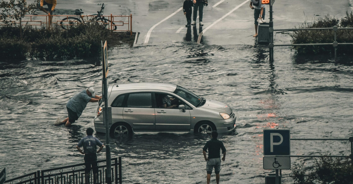
Flood risk is not limited to shorelines, as several inland and mixed coastal–inland states show. Texas faces repeated flooding from Gulf Coast hurricanes hitting Houston and nearby areas and from flash floods in hill country, with large rivers like the Trinity and Brazos often overflowing during intense storms. Rapid urban growth on paved land, combined with shifting rainfall patterns, heightens danger for millions of residents and for critical energy and industrial facilities.
California experiences dramatic swings between drought and intense rainfall, driven partly by atmospheric rivers that can deliver months’ worth of precipitation in a few days. These events can quickly melt Sierra Nevada snowpack and flood the Central Valley’s farms and towns while also pushing coastal flooding in urban regions around San Francisco and Los Angeles. Rising seas and aging dams and levees add to the stress on agricultural hubs and technology centers located on floodplains.
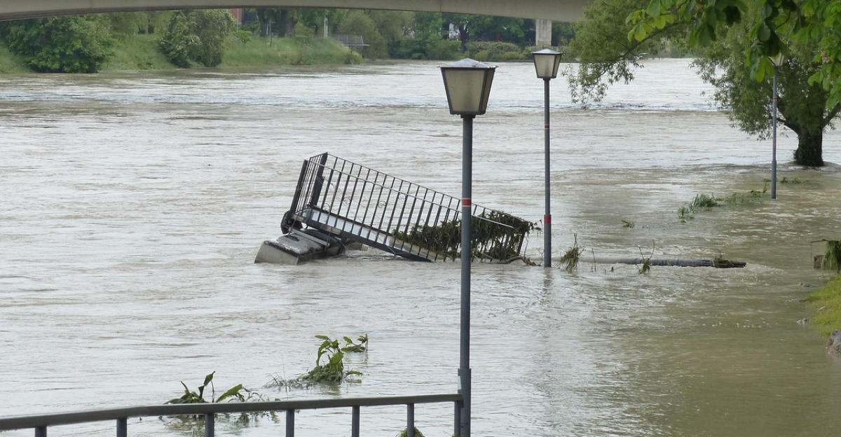
In the central U.S., Missouri’s flood risk highlights how major rivers amplify inland danger. The Mississippi and Missouri Rivers can cover vast plains during prolonged wet periods, and heavy downpours increasingly drive urban flash floods in cities such as St. Louis and Kansas City. Regional data show that rainfall in parts of the Midwest has risen by roughly 30 percent since about 1950, increasing the odds and severity of damaging floods that threaten millions of residents and billions of dollars in property.
Northeastern Corridors and the Need for Action
Densely populated Northeastern states are seeing more frequent and costly flooding. New Jersey’s relatively short but heavily built‑up coastline produces outsized losses, and some analyses suggest that many of the country’s costliest coastal flood events have affected its counties. New York contends with coastal surges, swollen upstate rivers, and intense cloudbursts that can overwhelm streets and subways, as seen during Superstorm Sandy in 2012, when New York City alone recorded roughly 19 billion dollars in damage.
Farther north, Massachusetts faces both nor’easters and rising seas along its shoreline. Tide‑gauge records near Boston indicate sea level has risen on the order of 10 to 11 inches since the early 20th century, a bit lower than some earlier 14‑inch claims but still enough to magnify storm tides and put hundreds of thousands of properties and significant infrastructure at greater risk. Inland and mixed states such as Pennsylvania and Virginia also face serious challenges: Pennsylvania has suffered deadly flash floods in recent years, though some past casualty and damage figures have been overstated, and Virginia’s Hampton Roads region is threatened by both sea‑level rise and sinking land around major military and port facilities.
Across all of these states, the pattern is clear: flooding is becoming more common, more expensive, and more disruptive for communities and economies. Meeting this challenge will require updated building rules, more realistic flood mapping, resilient infrastructure, and insurance systems that reflect true risk while helping people adapt to a wetter, more uncertain future.
Sources:
PuroClean – “Top 10 States Most at Risk for Flooding”
The MortgagePoint – “Report Finds Many Americans Are Fleeing Flood-Prone Areas”
Climate Central – “New U.S. Coastal Risk Map and Analysis”
LawnStarter – “2025’s Most Vulnerable Counties for Flooding”
Baron Weather – “2025 Is Now the Most Flash Flood-Warned Year to Date”