Southern California experienced a series of hazardous storms between late December 2025 and early January 2026. These atmospheric rivers—massive bands of moisture in the sky—dumped extraordinary amounts of rain across the region. Mountain areas received 10 inches of rain in less than a week.
The coastal community of La Conchita in Ventura County got more than 7 inches in just 14 days. Weather experts issued rare Level 2 excessive rainfall warnings, which signal flood risks that typically happen only once per decade. The National Weather Service and private forecasters referred to this series of storms as a “conga line” because they struck one after another throughout the first week of January.
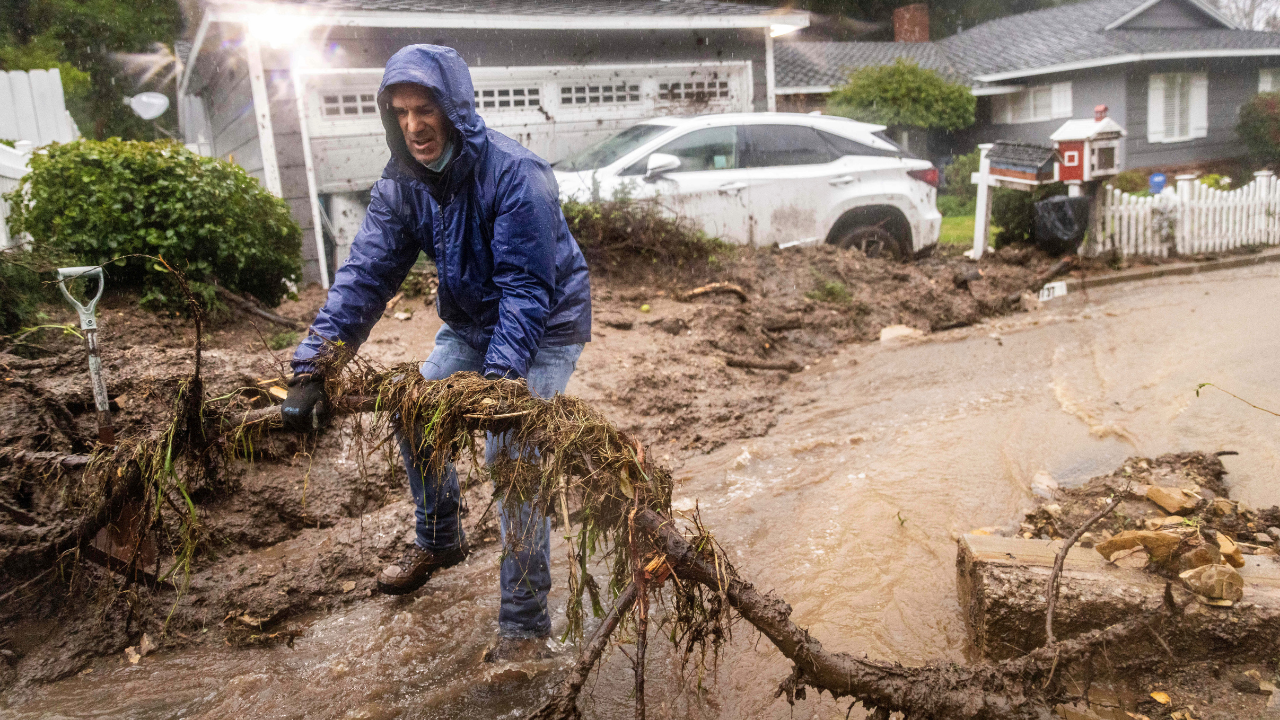
La Conchita residents remember the terror of 2005, when a debris flow killed 10 people after 8 inches of rain fell over 30 days. Now they watched as the 7 inches fell in half in that time. Debris flows move differently than regular floods—they surge down hillsides as fast-moving rivers of mud, rocks, and debris that can destroy everything in their path. Scientists at the Weather Prediction Center closely monitored the incoming storms.
By January 2, forecasters elevated their warnings for coastal Southern California. Governor Gavin Newsom responded by dispatching swift-water rescue teams, helicopters, and high-capacity pumps to Los Angeles and Ventura counties. Emergency managers even pre-positioned medical helicopters, anticipating that people would get hurt.
Wildfires Created Perfect Conditions for Mudslides
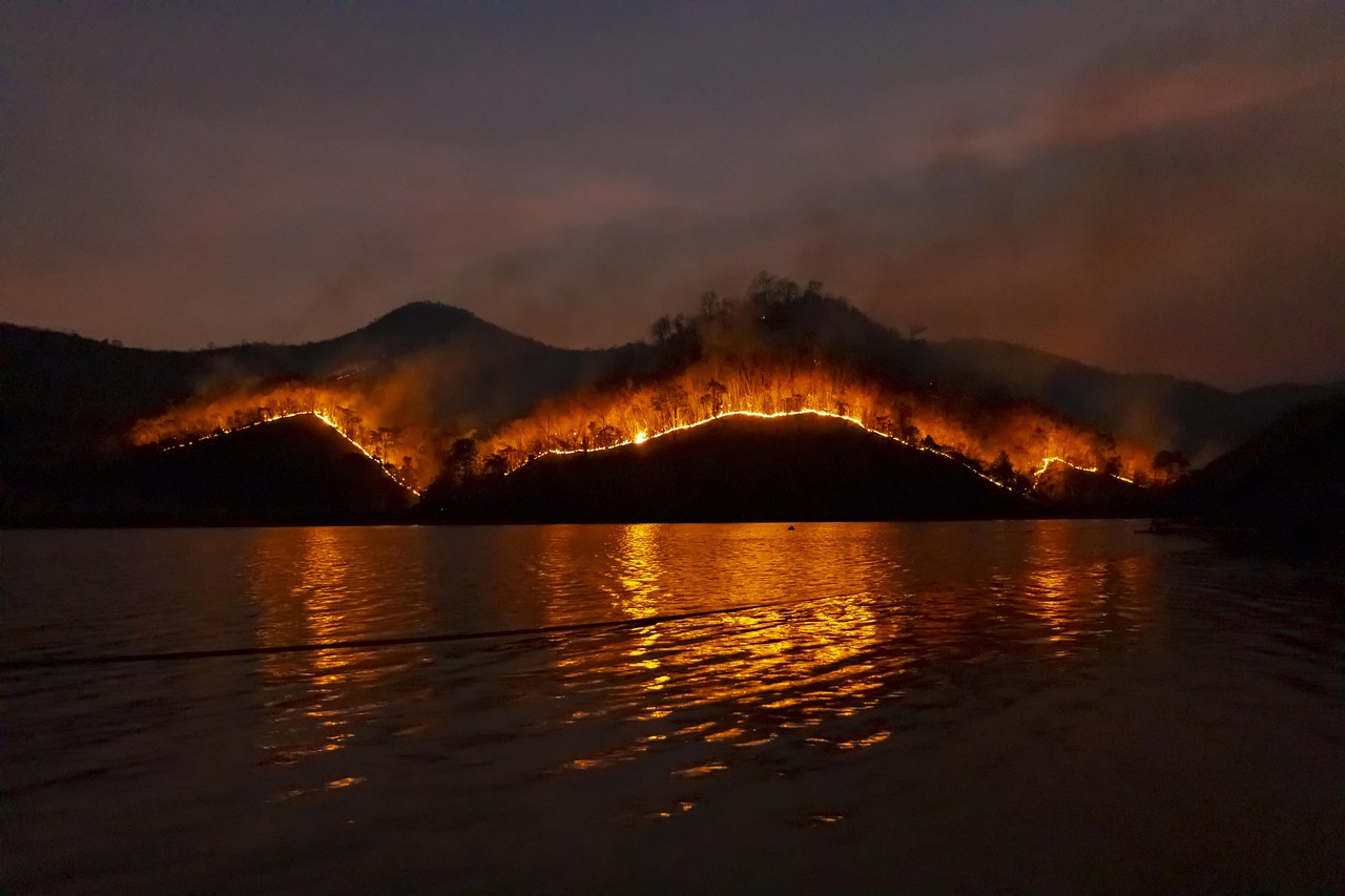
The 2025 Los Angeles wildfire season set a new record, surpassing all previous records. The blazes forced more than 180,000 people to evacuate their homes. The Palisades Fire became the largest wildfire in Los Angeles County history.
These fires did more than burn homes—they stripped vegetation from hillsides and destroyed the natural root systems that normally hold soil in place. Fire turns the ground surface into something almost waterproof, which means rain can’t soak in normally. Instead, water rushes downhill, picking up loose soil, rocks, and debris as it accelerates.
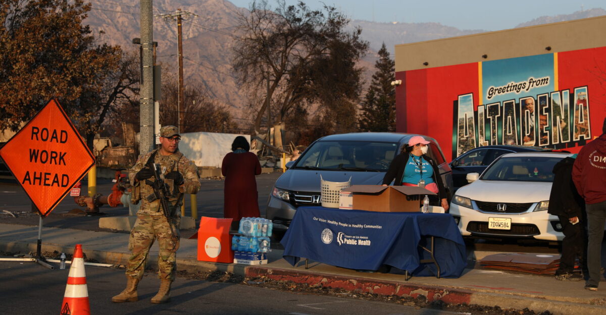
LA County’s Fire Department identified at least 14 vulnerable burn scar zones. Twelve of these sat in the Mandeville Canyon complex alone. On January 3 at 10:00 a.m. Pacific Time, the Los Angeles Fire Department issued evacuation warnings for all 14 zones. The list included 12 areas in Mandeville Canyon (LFD-1081, 1083, 1085, 1087, 1089, 1091, 1092, 1093, 1095, 1096, 1097, 0891), plus the Hurst Fire area (LFD 0001-B) and Sunset Fire area (LFD-0835).
Initial news reports said only nine zones faced evacuation warnings, but officials later clarified the full count. These warnings urged thousands of residents to prepare for quick exits. Meanwhile, Ventura County Emergency Services issued a statement explaining that they cannot reliably predict when hillsides will fail. Rainfall amounts, soil saturation, underground water pressure, and local geology all interact in unpredictable ways.
California Faces a New Reality
These storms revealed a troubling pattern that scientists refer to as the fire-flood cycle. Megafires in the 2020s burned more than 500,000 acres across California in 2025 alone. Each fire leaves behind vulnerable terrain that becomes dangerous when heavy rains arrive.
Road closures starting January 2 cut off communities along the Pacific Coast Highway near Malibu. Hospitals prepared emergency protocols. Utility companies braced for mudslides that could damage power lines. Many residents faced evacuation orders for the second or third time in 2025.
Even the famous Rose Parade in Pasadena felt the impact. For the first time since 2006, the New Year’s Day parade marched through rain—between 1 and 2 inches fell on the floats and spectators. Officials monitored every rainfall measurement because they knew hillsides 50 miles away could collapse from the added water weight. Climate scientists link these more frequent and intense atmospheric rivers to rising temperatures that allow the atmosphere to hold more water vapor. Wind patterns in the jet stream have also shifted.
California has made progress in preparing for these disasters. Emergency managers now deploy debris barriers and drainage pumps before storms arrive. LA County improved its smartphone alert system. Ventura County clarified the difference between evacuation warnings and mandatory evacuation orders. However, experts at UC San Diego and the USGS acknowledge that current technology cannot precisely predict when or where a hillside will fail.
Sensors and satellites help monitor conditions, but soil stability varies too much from place to place. As the storms eased and officials lifted warnings by January 5, California faced difficult questions about whether communities can keep rebuilding in high-risk canyons during this era of more intense fires and floods.
Sources
CBS Los Angeles, LAFD issues evacuation warning for Hurst and Sunset burn scars, January 1, 2026
UC San Diego Center for Western Weather and Water Extremes, 2 January 2026 An atmospheric river is forecast, January 2, 2026
California Governor’s Office, Governor Newsom prepositions emergency resources in Southern California ahead of New Year’s storm, December 29, 2025
Los Angeles Times, First rainy Rose Parade in decades rolls through Pasadena, December 31, 2025
KEYT News, La Conchita rain totals raise concerns, December 30, 2025
CNBC, Los Angeles wildfires latest: 180,000 people forced to evacuate, January 9, 2025