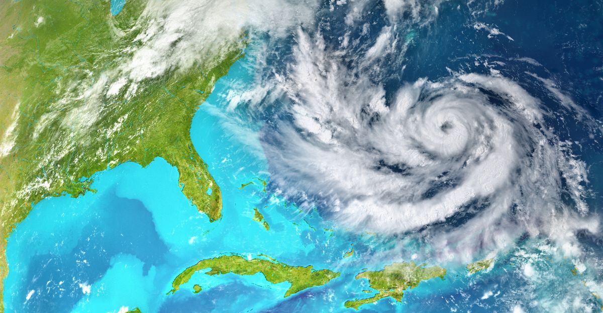
An unusual late-season disturbance churning through the central Caribbean has meteorologists on high alert, with formation probabilities reaching 90%—among the highest forecasts issued this season. The system, designated Invest 98L by the National Hurricane Center, already generates rough seas and sustained winds exceeding 30 knots, threatening a rapid transformation into Tropical Storm Melissa and potentially a major hurricane within days.
The timing alone sets this system apart. October typically marks a quieter phase of hurricane activity in the region, yet exceptionally warm ocean temperatures and diminished wind shear have created a volatile breeding ground for tropical development. Sea surface temperatures hover approximately 2°C above seasonal norms, concentrated energy that forecasters warn could fuel swift intensification as the system drifts westward across Caribbean waters.
Unusual Timing Amplifies Risk

While hurricanes routinely threaten the Caribbean during peak season, late October formation remains statistically rare. Data reveals only five comparable storm events have emerged in the region during October since 2000, making Melissa’s potential development a noteworthy outlier. The scarcity of earlier storms this year allowed Caribbean waters to accumulate heat undisturbed, creating optimal conditions for rapid cyclogenesis when atmospheric patterns finally aligned.
Meteorological analysis points to a convergence of risk factors: minimal wind shear that would normally disrupt storm organization, abundant atmospheric moisture feeding thunderstorm development, and those unusually warm waters acting as high-octane fuel. Combined, these elements not only elevate formation probability but increase the likelihood the system will strengthen quickly once circulation organizes.
Islands Mobilize Emergency Response
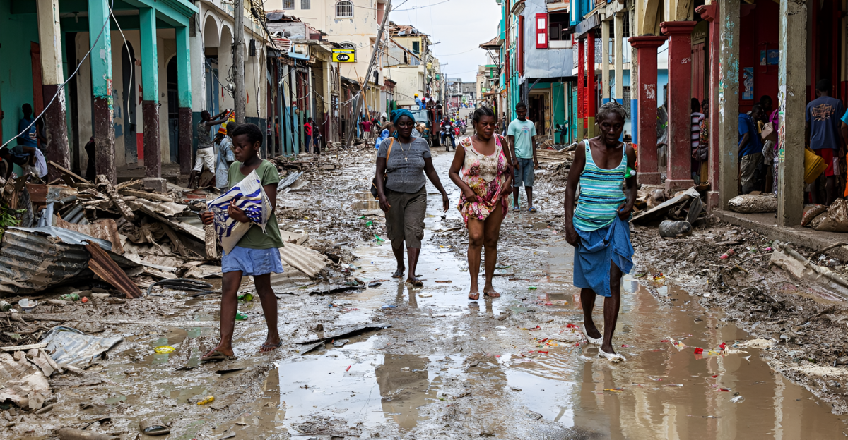
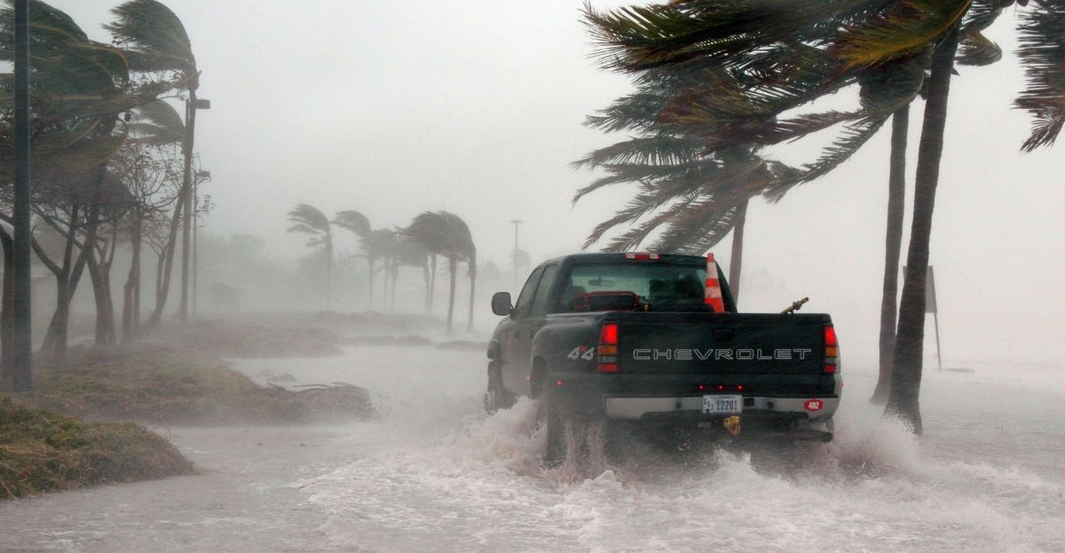
Across the Windward Islands and Greater Antilles, governments activated emergency protocols as forecast models consistently showed westward tracking toward vulnerable coastlines. Saint Lucia, St. Vincent, and Grenada face the prospect of first impacts, with heavy rainfall potentially exceeding 10 inches in localized areas. The Caribbean Disaster Emergency Management Agency referenced lessons learned from past flooding disasters as communities opened shelters, broadcast public warnings, and stockpiled essential supplies.
Jamaica and Cuba issued storm watches while mobilizing evacuation centers and clearing drainage systems ahead of anticipated torrential rains. Cuban civil defense officials stressed the urgency of early preparation, noting that current projections indicate significant potential for destructive impacts should the system curve northward. For coastal residents throughout the region, memories of previous hurricane devastation drove swift action—boarding windows, securing property, and reviewing family emergency plans before official warnings escalated.
The dual threats of landslides and flash flooding loom largest for mountainous terrain. Forecasters emphasized that prolonged rainfall over steep slopes could trigger catastrophic mudslides, particularly in areas where ground saturation from recent weather has already compromised soil stability.
Economic Vulnerability Deepens

Beyond immediate safety concerns, the approaching storm carries substantial economic implications for island nations still recovering from previous hurricane seasons. Historical data shows major tropical systems routinely trigger export declines of up to 20% in the months following landfall, with cascading effects across agriculture, tourism, and manufacturing sectors. Rebuilding critical infrastructure drains public budgets while lost revenue and mounting debt slow regional development for years.
Marine warnings have already diverted shipping traffic around the storm’s projected path, creating immediate trade delays. Airports in at-risk zones prepared for possible closures and flight cancellations, while agricultural producers expressed alarm that heavy rains could devastate crops. These logistical disruptions compound existing economic fragility across Caribbean island economies heavily dependent on seasonal tourism revenues and agricultural exports.
Tourism operators and hotel chains developed contingency plans to minimize operational downtime, stockpiling supplies and establishing backup communication networks. The Caribbean Development Bank announced emergency grant programs targeting storm resilience and rapid recovery for severely affected sectors.
Forecast Uncertainty Persists
Despite high confidence in tropical storm formation, meteorologists cautioned that precise track and intensity forecasts remain inherently uncertain. Atmospheric conditions can shift rapidly, producing significant variations in the system’s eventual path and strength. The National Hurricane Center advised all communities within the broad forecast cone to prepare for multiple scenarios, emphasizing that small changes in steering patterns could dramatically alter which islands face the worst impacts.
Computer forecast models diverge notably beyond 72 hours, with some solutions showing continued westward drift toward Central America while others depict a sharp northward curve toward Hispaniola and the Bahamas. Forecasters explained that development timing will largely determine trajectory—faster organization increases the likelihood of northward steering by upper-level atmospheric disturbances.
If Melissa reaches hurricane intensity, climate researchers will study whether warming ocean patterns and climate change contributed to this unusually late and potentially powerful Caribbean cyclone, adding another data point to ongoing analysis of evolving tropical weather patterns in a warming world.