Millions of people across the United States confronted a dramatically different commute as a widespread winter storm spread snow, wind, and hazardous driving conditions from Alaska to Virginia over a span of two to three days, according to the National Weather Service. What began as a Sunday weather watch quickly intensified into a multi-day event, with forecasters warning that conditions would be “hazardous” and urging people to avoid travel where possible. Winter storm alerts or advisories were posted across 10 states—Wyoming, Montana, Virginia, Alaska, Michigan, Tennessee, Kentucky, Washington, North Carolina, and Illinois—each experiencing a distinct mix of snow totals, wind, and visibility problems that complicated travel at the start of the workweek.
Virginia and the Eastern States
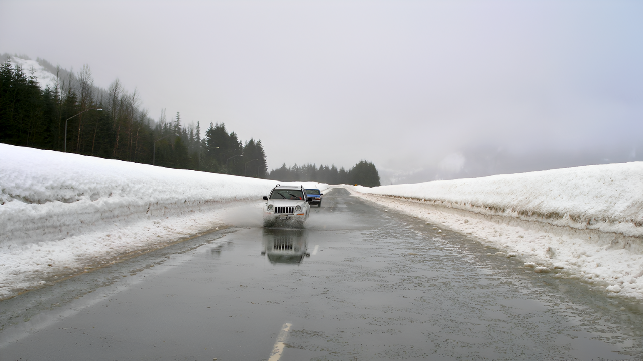
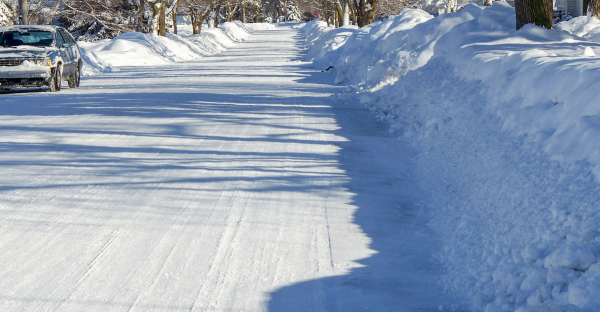
In Virginia, central and southern areas more accustomed to light snow faced forecasts of roughly 3 to 5 inches, timed almost exactly with the Monday and Tuesday rush hours. The setup meant many drivers encountered snow-covered roads at peak travel times rather than during off-hours, increasing the risk of spinouts and fender benders. The Virginia Department of Transportation chose not to pretreat highways and major roads, explaining that wet surfaces and high humidity would likely wash away brine or other treatments before the snow arrived. Instead, crews planned to focus on plowing once accumulations built up.
That decision placed more responsibility on motorists. Transportation officials and meteorologists urged drivers to reduce speed, allow extra following distance, and recognize that bridges, overpasses, and entrance or exit ramps can freeze before main roadways. The National Weather Service’s Virginia office advised people to delay trips where possible, noting that if travel was unavoidable, drivers should be prepared for rapidly changing visibility and avoid sudden braking or acceleration, particularly on hills and curves.
Farther north around the Great Lakes, parts of Michigan along the Mackinac and Chippewa County border saw about 8 inches from lake-effect snow bands. Cold air passing over the relatively warm lake water produced narrow corridors of heavier snow that could transform dry pavement into slick, snow-packed stretches within a few miles, catching some drivers off guard as they moved in and out of these localized bands.
Mountain West: Deep Snow and Dangerous Winds
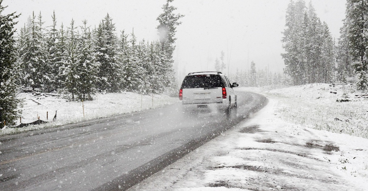
In the higher terrain of Wyoming and Montana, the storm was both more intense and more prolonged. The Tetons and Snake River ranges were forecast to receive 6 to 14 inches of snow through midweek, with Teton Pass—a key east–west route—designated “very difficult” for travel by forecasters. Winds in these mountain corridors frequently gusted between 50 and 60 mph, blowing snow across open stretches and producing drifting that could obscure road markings and create sudden whiteouts.
Conditions were even more severe in the Absaroka and Beartooth Mountains, where a Winter Storm Warning called for 1 to 2 feet of snow coupled with wind gusts up to 70 mph from Monday afternoon through Wednesday. National Weather Service forecasters in Billings said the high country would be “significantly impacted,” with whiteout conditions and severe blowing snow expected to challenge even experienced mountain drivers. The combination of deep snow and powerful wind not only threatened travel but also raised the likelihood of road closures and infrastructure strain in exposed areas.
In addition to travel problems, these same mountain regions faced an increased risk of power outages. Heavy, wet snow collecting on tree limbs and overhead lines, combined with strong gusts, led to broken branches and downed power lines in scattered locations. Emergency managers urged residents in these zones to prepare for short-notice outages by charging electronics, keeping basic supplies on hand, and using generators only outdoors to avoid carbon monoxide buildup.
Coast-to-Coast Dynamics
Meteorologists noted that this system stood out because it spanned such a wide swath of the country. Rather than a single localized storm, strong jet stream energy and sharp temperature contrasts helped organize multiple low-pressure centers across the continental United States. Each tapped different sources of moisture—Pacific air in the West, Gulf or Atlantic moisture in the East—yet remained linked under the same upper-level pattern. The result was a coordinated cross-country winter episode that produced snow in the Pacific Northwest, heavy mountain accumulations in the Rockies, lake-effect bands in the Upper Midwest, and a disruptive snowfall for parts of the Mid-Atlantic.
In Southeast Alaska, the same broad pattern contributed to local impacts of its own. The National Weather Service reported that Hyder picked up about 7 inches of snow, with Petersburg and Wrangell receiving around 6 inches as moist Pacific air collided with colder interior air. Visibility during heavier bursts of snow could drop to around a mile or less, with snowfall rates approaching an inch per hour—conditions that can be particularly challenging in a region where wildlife may be present on roadways and mountain passes are often narrow and winding.
Impacts in Tennessee, Kentucky, Washington, and the Midwest
In the southern Appalachians, including parts of Tennessee and eastern Kentucky, the storm brought lighter but still disruptive totals. The National Weather Service estimated up to about 3 inches of snow in Tennessee counties such as Blount, Cocke, and Sevier, with similar amounts possible above 2,000 feet in eastern Kentucky. Complex terrain in these areas—marked by steep grades, sharp curves, and secondary roads cutting through hollows—often turns relatively minor accumulations into significant travel hazards, especially on less-maintained side routes that can become slick and isolated quickly.
On the West Coast, coastal and central counties in Washington saw roughly 3 to 5 inches as colder air pushed inland. The timing of this snow threatened to slow morning traffic around metropolitan hubs as roads shifted from wet to slushy and plow operations worked to keep main corridors clear. Around Chicago, forecasters reported 3 to 4 inches across Lake and northern Cook counties, with southern Cook County totals closer to 5 inches. Those amounts were enough to convert major expressways into slower-moving, slush-covered routes, with temporary lane reductions and occasional closures as crews responded to accidents and heavier bursts of snow.
Looking Ahead
Across the 10 affected states, millions of residents live or commute in areas covered by winter storm warnings or advisories, and transportation officials expected hundreds of thousands to encounter at least light to moderate snow during their Monday and Tuesday trips. Road agencies anticipated ramping up plowing once accumulations reached a couple of inches but warned that even well-treated routes would see slower travel times when heavier bands passed over.
Forecasters said the harshest conditions would continue through midweek in the Absaroka, Beartooth, Teton, and Gros Ventre ranges, where snow and wind were forecast to persist on high passes and ridges into Wednesday. After that, attention was expected to turn to lingering lake-effect snow in the Great Lakes, any wraparound snow that might brush the Mid-Atlantic, and the possibility of a second round of mountain snow later in the week as colder air settled in. For now, meteorologists and transportation officials emphasized a consistent message for those in the storm’s path: stay informed, adjust travel plans where possible, and use extra caution on the roads until the pattern eases.
Sources:
NOAA SSW November 2025 briefing
National Weather Service long-range discussion
NOAA Climate Prediction Center ENSO Diagnostic Discussion
NOAA CPC Seasonal Outlook and hazards guidance
USDA freeze tolerance and hardiness guidance
University of Florida IFAS Extension freeze and winter plant protection guidance