Since December 8, an atmospheric river has pummeled the Pacific Northwest, dumping 10 to 18 inches of rain on western Washington’s Cascade and Olympic mountain ranges. This deluge has broken precipitation records, saturated soils, and sparked warnings for landslides and mudslides, especially in burn scar areas, as rivers swell and threaten communities.
Rising Alarm
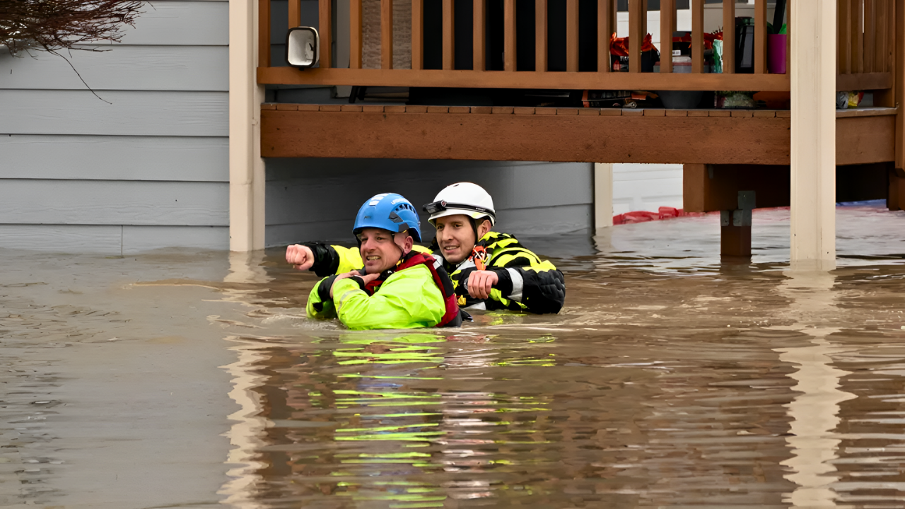
By December 11, flooding intensified dramatically. The Snohomish River crested nearly a foot above its prior record, and the Skagit River endangered agricultural areas. Evacuation orders reached about 100,000 residents in western Washington, including Skagit County, where long-standing homes were abandoned.
Emergency teams raised alerts to maximum levels, prioritizing search and rescue amid the spreading crisis.
A History of Vulnerability
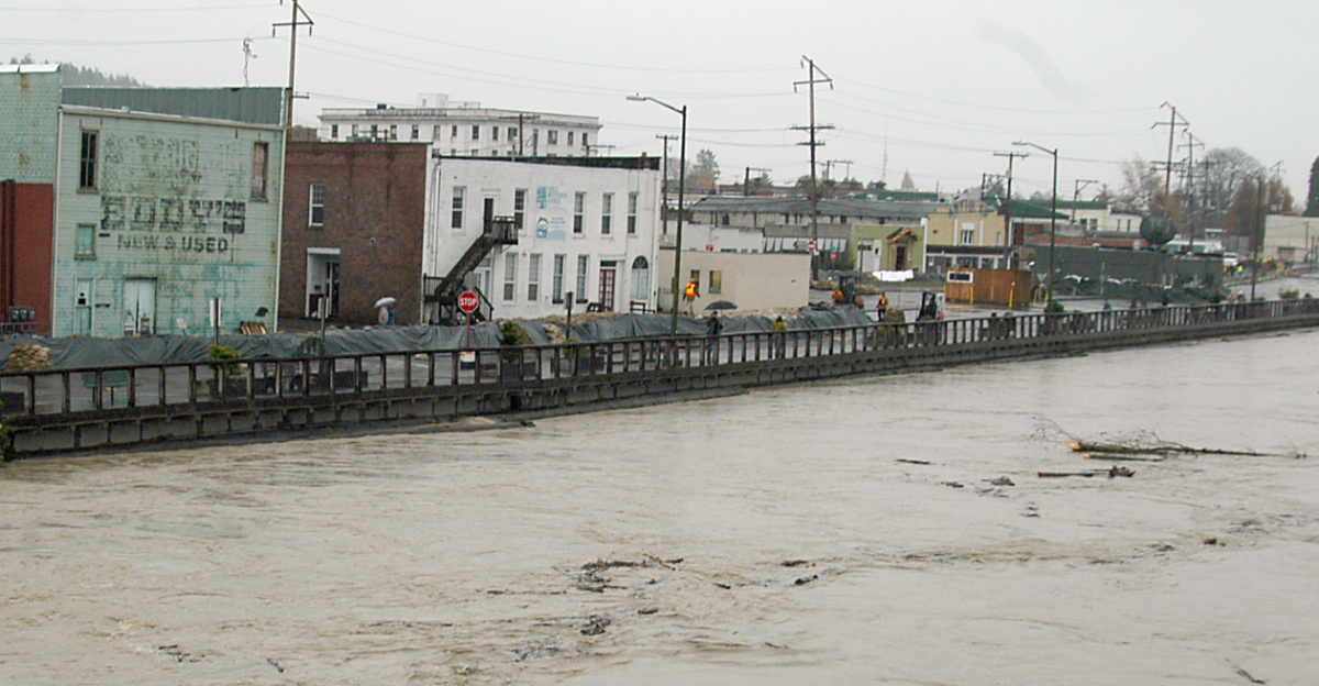
Mount Vernon, Skagit County’s largest city, knows flooding’s toll. After 2003’s devastation, leaders built a floodwall finished in 2018. The 2021 floods strained it, but this event presents greater dangers, testing the structure’s limits.
Officials worry about past lessons amid new pressures on infrastructure.
A Perfect Storm Converges

A high-pressure system over California blocked typical patterns, forcing cold fronts into warm, moist air and channeling extreme rain into a tight band. The Center for Western Weather and Water Extremes classified it as a significant atmospheric river with moderate-to-strong conditions.
Air Force Reserve flights gathered data from the storm’s heart, underscoring questions about infrastructure resilience and future weather extremes.
The Emergency Declaration

Governor Bob Ferguson issued Proclamation 25-07 on December 10, declaring a statewide emergency due to extreme rainfall, high winds, and flooding. The order mobilized the National Guard, starting with 100 members and anticipating more, while opening doors to federal aid.
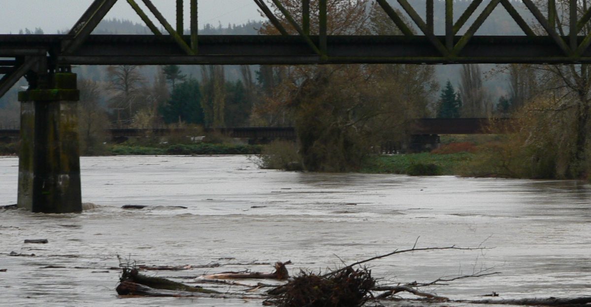
In Concrete, along the Skagit River, waters were projected to hit 47 feet, topping the 1949 record. Residents in Mount Vernon held tense hopes for their floodwall as highways closed, isolating areas and complicating aid.
A Landslide Threat Emerges
Saturated ground heightened landslide risks, particularly in burn scars with sparse vegetation. Forecasts of more rain amplified dangers to lives and property.
Closures sealed Cascade access routes against heavy snow and winter weather. Evacuation centers overflowed, with nearly 100,000 displaced and resources stretched thin.
The Recovery Outlook
Rescue efforts prioritize immediate safety, while FEMA and locals assess damage for aid eligibility. Evacuated zones delay evaluations, but the focus shifts to rebuilding.
Washington’s events highlight climate-driven weather shifts, with warmer temperatures intensifying rain and snow. Updated models and planning are essential as communities adapt infrastructure and strategies for rising risks. Enhanced preparedness will determine resilience against intensifying storms.
Sources:
NASA Earth Observatory atmospheric monitoring and analysisNational Weather Service winter storm forecasts and atmospheric river assessmentsAssociated Press and Reuters reporting on Pacific Northwest emergency responseFEMA Region 10 damage assessment and disaster recovery protocolsWashington State Governor’s Office official emergency declarations and updatesNOAA Center for Western Weather and Water Extremes atmospheric river classification system