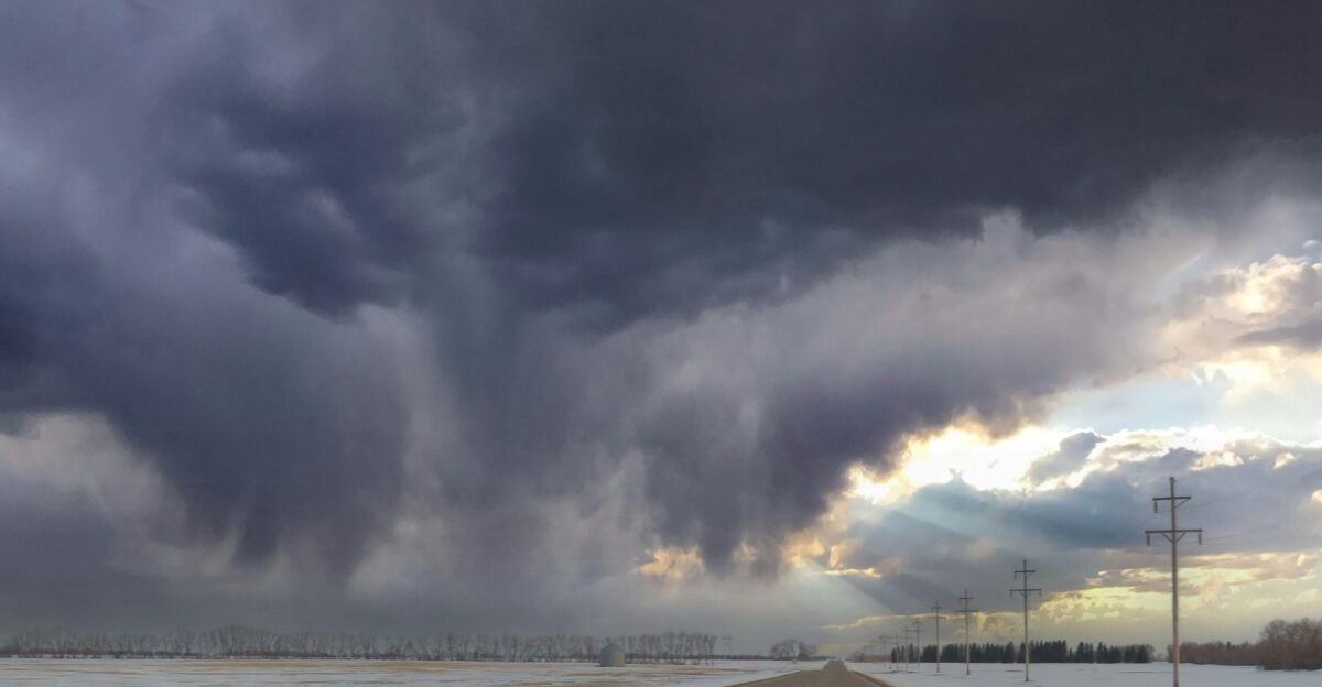
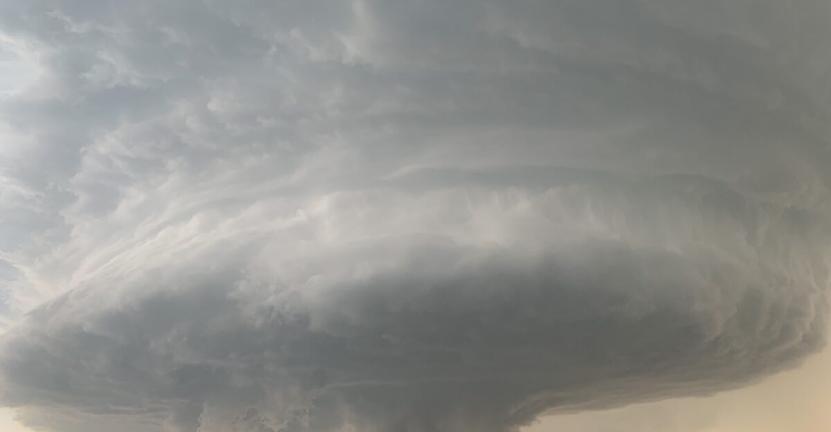
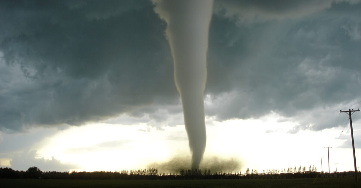
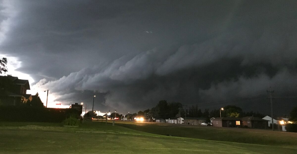
What began as a calm September day turned chaotic when towering storm clouds spawned at least 15 tornadoes across central North Dakota, according to the National Weather Service office in Bismarck. The sudden outbreak was a shock for residents used to quiet autumn weather. Funnel clouds formed in multiple counties, scattering debris and rattling small towns.
Meteorologists said the atmosphere more closely resembled midsummer than early fall. The outbreak was part of a year already marked by relentless severe weather, leaving many communities feeling like they had little time to recover before the next storm struck.
A Record No One Wanted to Break
North Dakota has officially logged 73 tornadoes in 2025, surpassing the previous record of 61 set in 1999, according to the National Weather Service offices in Bismarck and Grand Forks. This marks the highest total since systematic records began in 1950. Behind the numbers are farms, businesses, and families coping with repeated losses.
Local broadcasters noted that many residents described the season as unlike anything they had experienced in decades. The new record highlights not only the scale of the storms but also their unpredictability regarding when and where they strike.
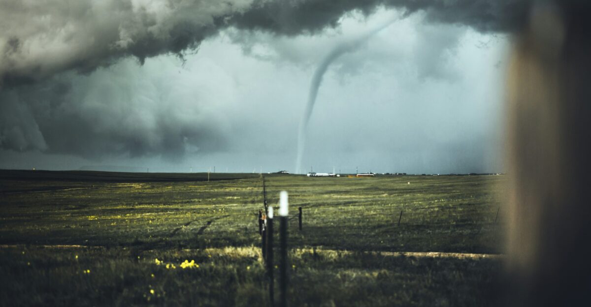
Storms Arrive in an Unlikely Month
September rarely sees tornadoes in North Dakota, making the latest outbreak even more unusual. NOAA’s Storm Prediction Center records show only 27 tornadoes in the state during September since 1950. The last significant September twister touched down near Litchville in 2017.
This year’s outbreak stands out for its timing as much as its size, catching families off guard after the summer season had ended. Emergency officials said the event has forced them to reconsider preparedness strategies that traditionally focused on late spring and early summer.
Survey Crews Trace the Twisters’ Paths
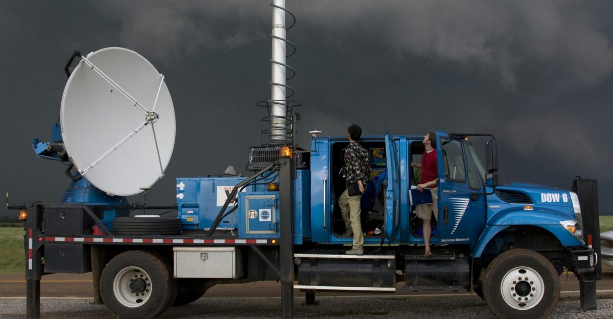
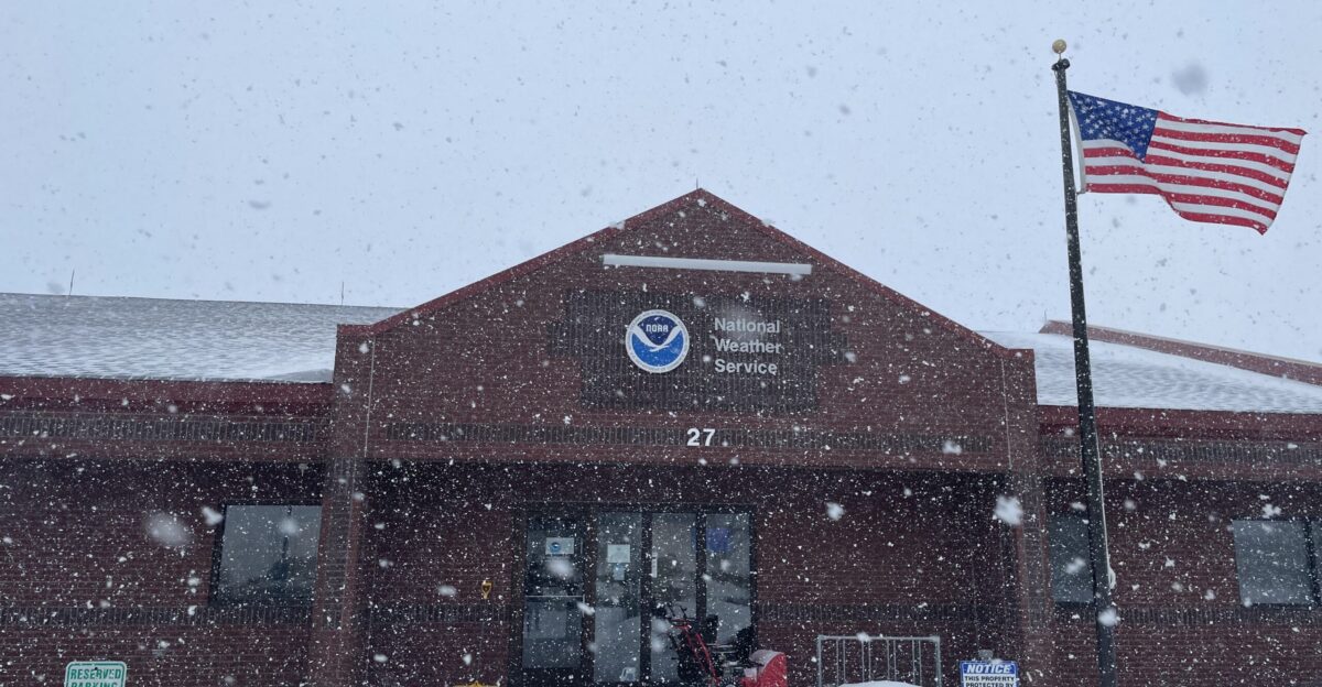
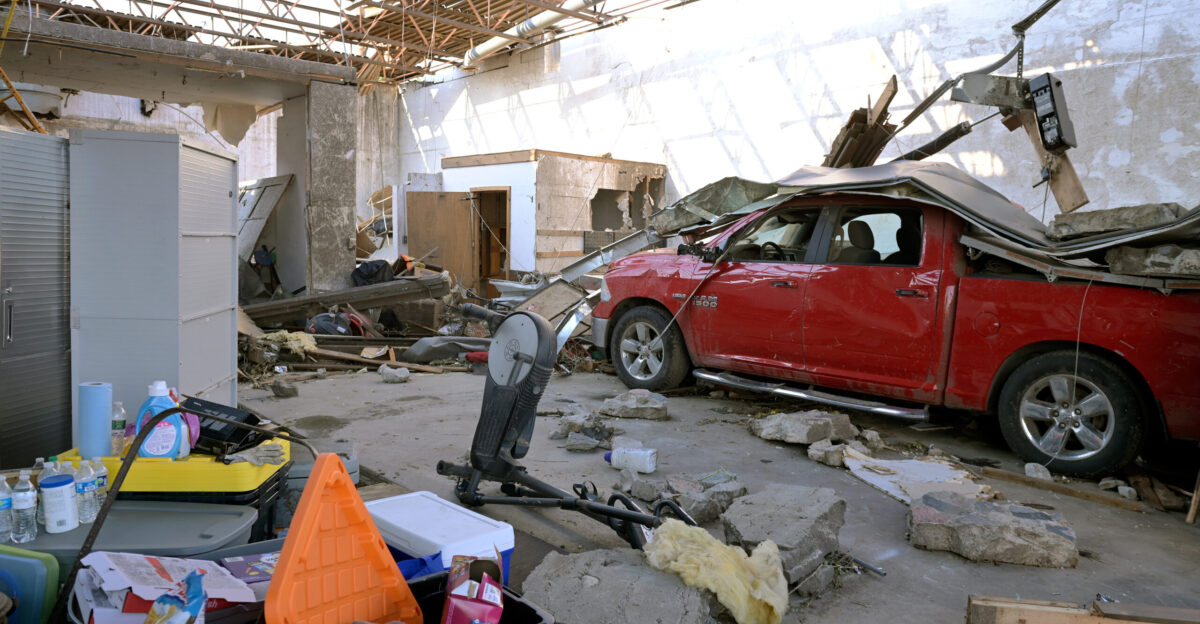
National Weather Service survey teams inspected damage within hours of the skies clearing. According to the NWS Bismarck office, preliminary findings included an EF-1 near Mercer in McLean County and EF-2 tornadoes near Denhoff in Sheridan County and Beaver Bay in Emmons County.
Officials said surveys could take several days to finalize as crews log damage patterns and track storm paths. This painstaking process is critical not only for record-keeping but also for improving forecasting tools that depend on accurate field data.
Experts Say Setup Was Rare
“This was an unusual event, more reminiscent of outbreaks in the southeastern U.S.,” said Jeff Schild, a meteorologist with the National Weather Service office in Bismarck, in an interview with WeatherNation TV. Schild explained that high wind shear allowed tornadoes to form more easily, while hail was surprisingly scarce.
For residents, the storms highlighted how quickly severe weather can strike outside of traditional patterns, leaving little time to prepare.
Rainfall Records Fall Alongside Tornado Records
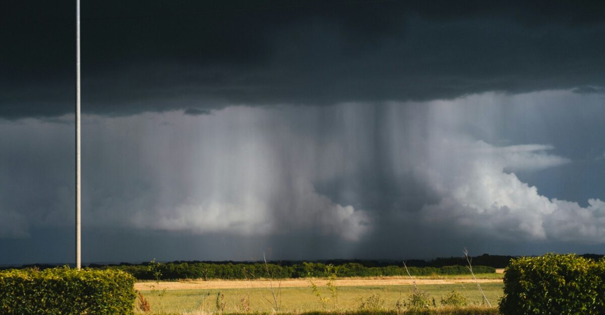
The tornadoes were accompanied by historic rainfall. According to National Weather Service daily climate reports, Bismarck recorded 2.44 inches of rain on September 14, breaking the previous daily record of 1.50 inches set in 1900. That single day of rain exceeded the city’s average for September, which is 1.72 inches.
Streets across the city flooded quickly, stranding vehicles under viaducts and seeping into businesses. For many residents, the combination of wind and water damage made the storm feel like two disasters in one.
This Year’s Totals Tower Over Averages
In a typical year, North Dakota sees about 22 to 29 tornadoes. The National Weather Service reports a long-term average of 22.5 from 1950 to 2024. By contrast, the 73 tornadoes documented so far in 2025 more than triple that figure. Meteorologists said the sheer number illustrates how extreme this season has been.
Researchers at NOAA’s Storm Prediction Center added that this year’s clustering of events makes it a standout case in the historical record, offering new insight into how severe weather can shift in the northern Plains.
An Active Season Well Before September
Even before the September outbreak, 2025 was already historic. By early September, 58 tornadoes had been confirmed statewide, leaving North Dakota just shy of the 1999 record, according to National Weather Service data. The old record was easily surpassed when the September 14 outbreak added 15 more.
Local emergency managers told the Bismarck Tribune that communities had already endured months of warnings, watches, and cleanup. For many residents, the September outbreak felt less like an isolated disaster and more like the culmination of a relentless season.
Flooding Deepens the Crisis
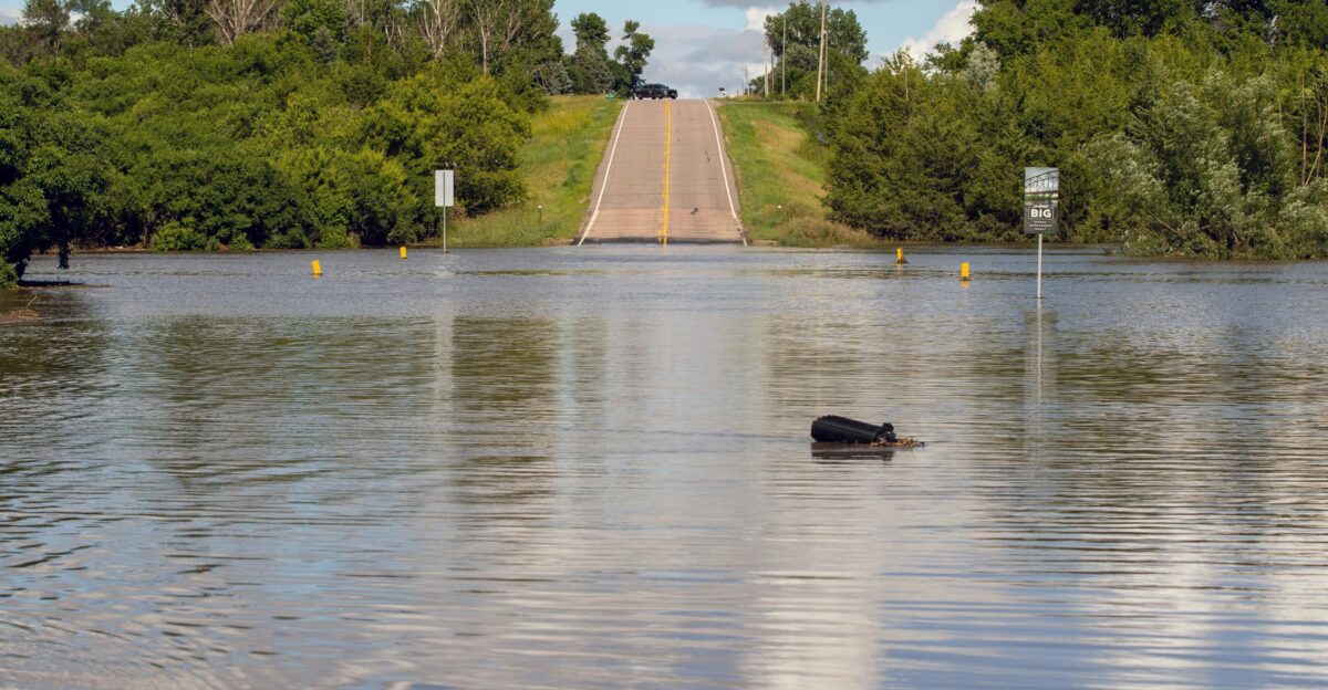
Alongside tornadoes, flash flooding compounded the damage. Bismarck’s streets filled rapidly, leaving cars stranded in underpasses and businesses flooded, according to local reports from the Bismarck Tribune. In Jamestown, rain forced road closures and disrupted commerce. Emergency crews scrambled to handle both wind and water damage on the same evening.
Officials said the dual impact stretched response capacity thin. For families cleaning up, the floodwaters were often as destructive as the winds, highlighting how severe thunderstorms can bring multiple hazards simultaneously.
June’s Tragedy Set the Tone
Months earlier, on June 20, a deadly tornado outbreak claimed lives and set the tone for the season. An EF-3 tornado near Enderlin killed three people, according to the National Weather Service. The same storm system produced a derecho with winds topping 100 mph.
The Associated Press reported that Governor Kelly Armstrong declared a statewide disaster in the aftermath, activating the State Emergency Operations Plan. For survivors of that tragedy, September’s storms reopened raw wounds and heightened fears about what else 2025 might bring.
Teams Work Methodically to Rate Tornadoes
Damage survey teams study every snapped tree and collapsed roof to understand storm strength. Officials said this work helps finalize tornado ratings and informs insurance claims and long-term safety planning. According to the National Weather Service, these investigations often take several days to complete, especially after widespread outbreaks.
This year, the volume of tornadoes has stretched survey crews to the limit, requiring extensive coordination. For residents awaiting answers, the ratings provide both official recognition of their losses and a record for future preparedness.
Disaster Declarations Test Readiness

Governor Armstrong’s earlier disaster declaration, reported by the Associated Press and the Bismarck Tribune, showed how heavily the state has leaned on emergency plans this year. The declaration mobilized state agencies and the National Guard. Local officials said 2025 has tested the limits of North Dakota’s response systems, forcing coordination across multiple counties at once.
First responders have worked through repeated tornado events, often with little recovery time. State leaders said the season highlights the importance of readiness in the face of increasingly unpredictable storms.
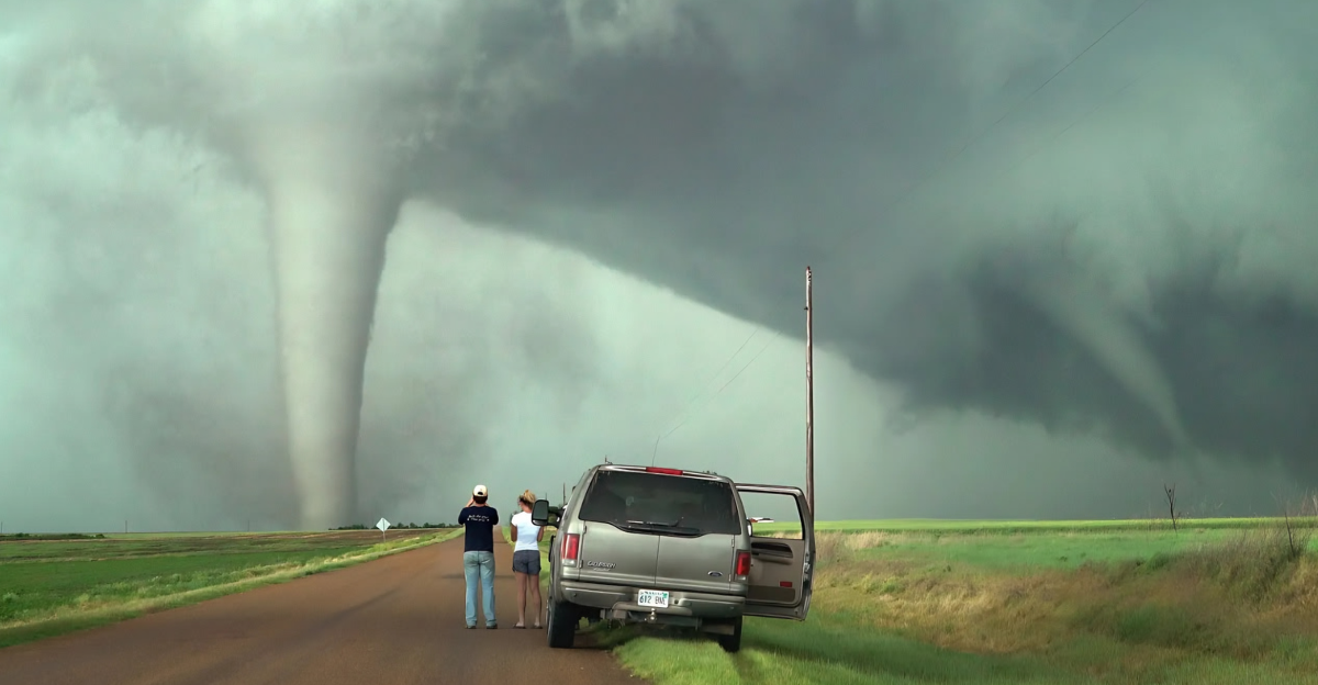
Unusual Tornado Types Spotted
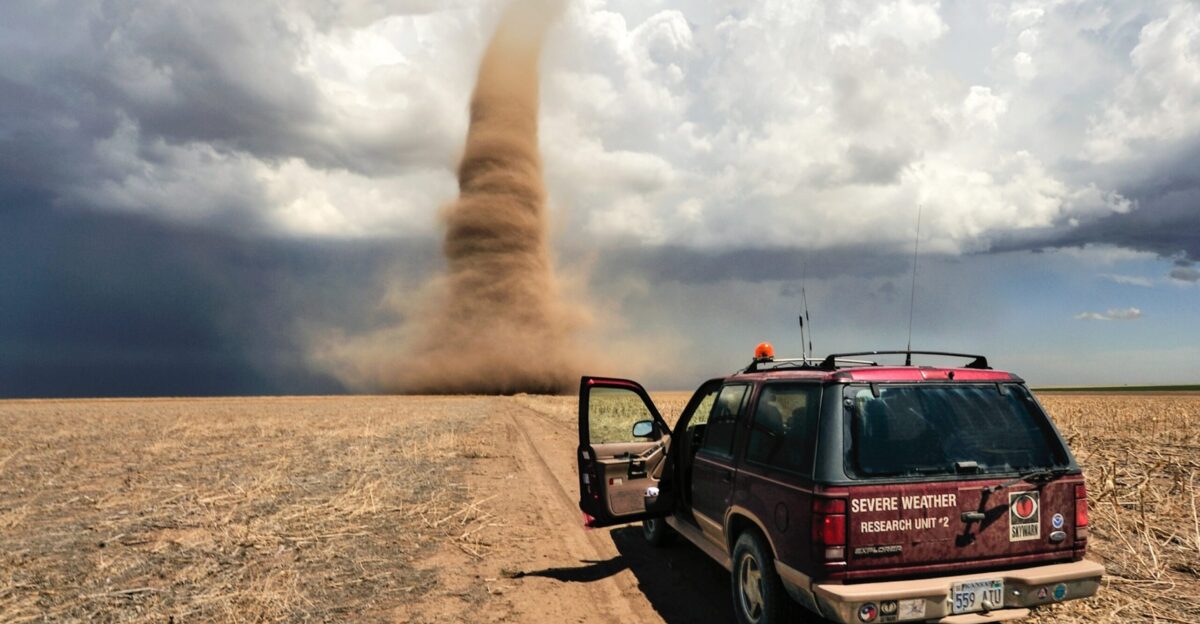
According to National Weather Service storm spotters, multiple-vortex tornadoes were reported near Arena and Fort Rice. These rare formations, where smaller funnels orbit inside a larger tornado, are often linked to especially unstable conditions.
Meteorologists explained that such tornadoes can cause erratic, unpredictable damage. For residents who witnessed them, the sight was unforgettable and frightening. Spotter reports will be included in the NWS survey findings, detailing one of the most extraordinary storm days in recent state history.
Historic Outbreaks Put Into Perspective
North Dakota’s most intense single day remains June 11, 1976, when 24 tornadoes were recorded, according to NOAA’s Storm Prediction Center. While the September 14 outbreak with 15 tornadoes did not break that daily record, it still ranked as one of the most active days in decades.
Meteorologists said the event highlights how North Dakota, though not traditionally a tornado hotspot, can experience large-scale outbreaks when conditions align. For families dealing with damage, the historical comparisons matter less than the immediate task of rebuilding.
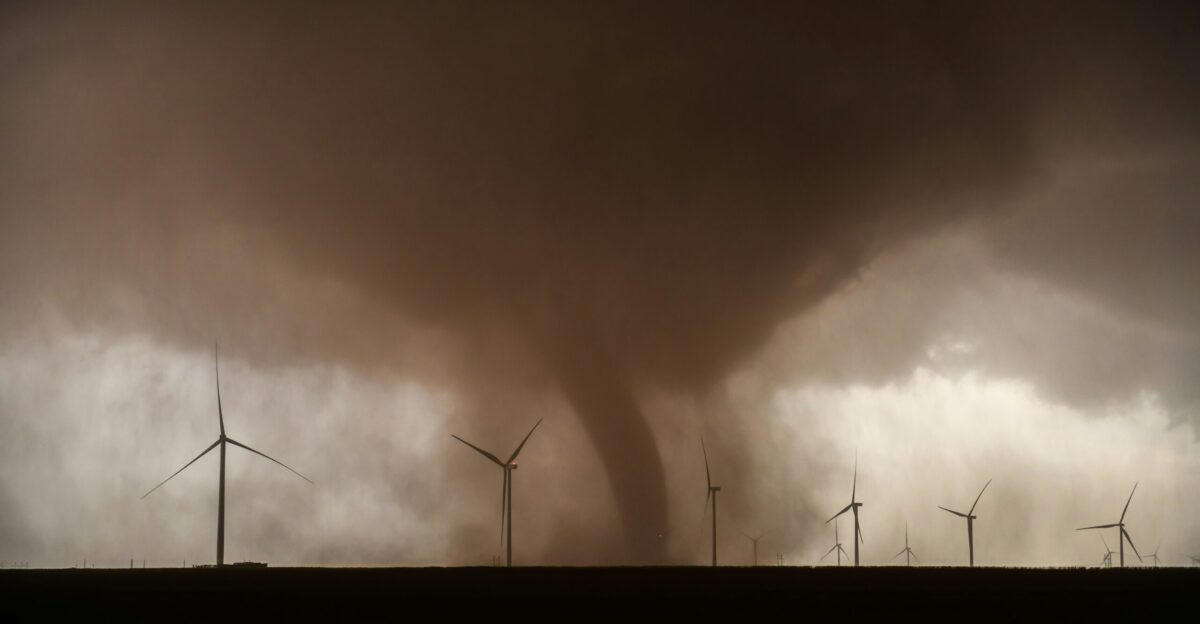
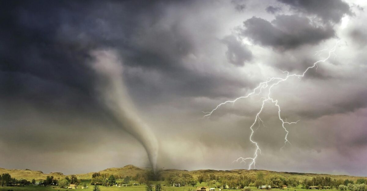
Regional Weather Patterns at Play
The September outbreak was part of a larger regional system that spawned more than 20 tornadoes across a 200-mile stretch from Mobridge, South Dakota, into central North Dakota, according to NOAA’s Storm Prediction Center.
Meteorologists explained that warm Gulf air collided with cooler northern systems, creating a corridor ripe for severe weather. The scale of the outbreak meant multiple states shared in the destruction. For communities in both Dakotas, the skies felt threatening from horizon to horizon, with warnings stretching late into the night.
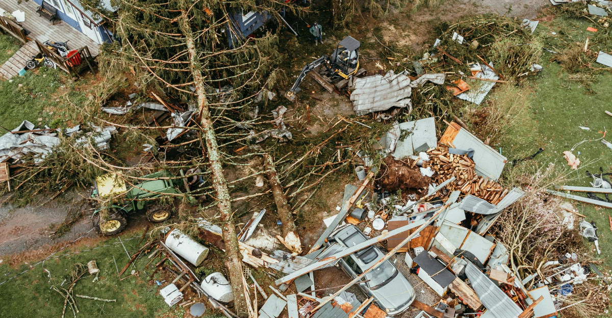
Damage Tallied Across the Plains
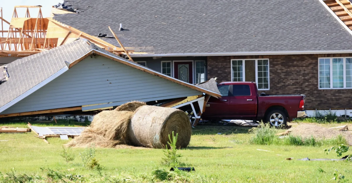
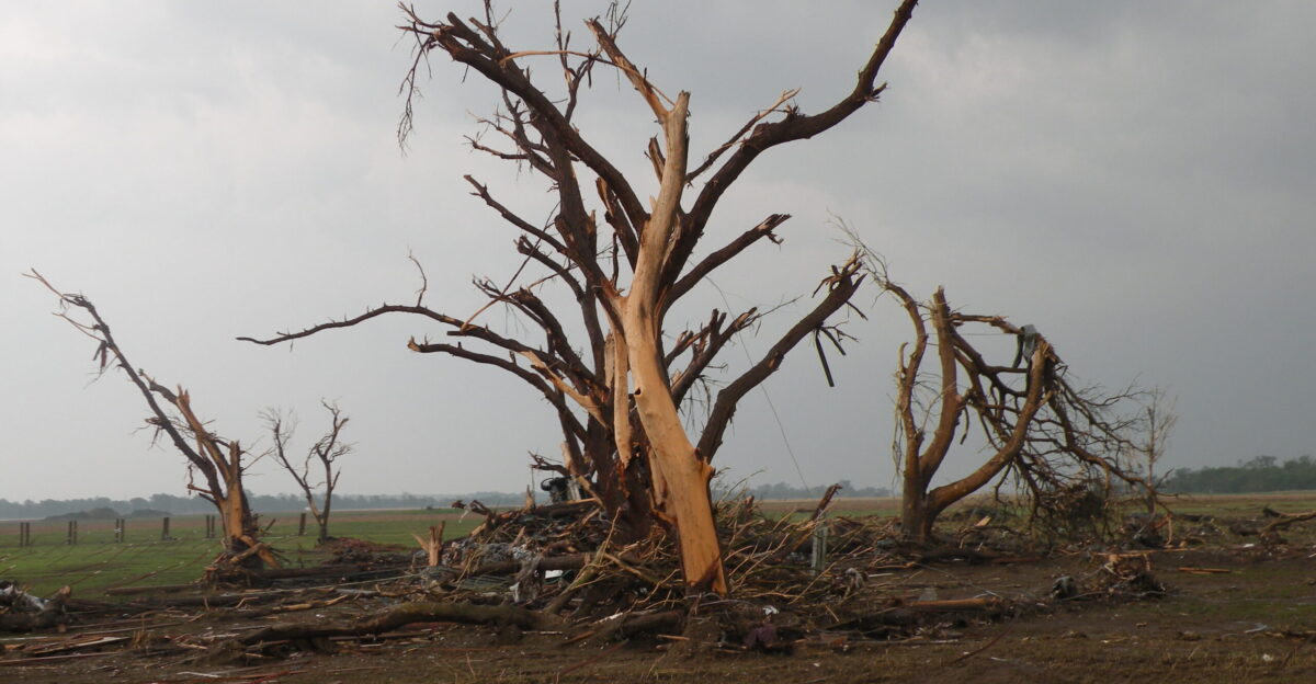
Rural infrastructure and farms took some of the heaviest hits. Reports of crushed grain bins, damaged barns, and downed power lines were widespread, according to early assessments by the National Weather Service. Thousands of residents lost electricity as utility poles snapped under the strain of high winds.
While initial casualty numbers were limited, officials cautioned that calculating the full scope of damage could take weeks. The storms struck during a critical harvest period for agricultural communities, amplifying the economic toll.
Researchers Take Notice of the Trends
The record tornado season is drawing close study from scientists. Researchers at NOAA and universities across the Plains said the unusual September outbreak raises questions about changing atmospheric patterns. While a single year cannot prove a trend, the clustering and timing of storms in 2025 are noteworthy.
According to NOAA climate researchers, shifts in severe weather seasons could complicate emergency planning. Residents’ experiences—unexpected tornadoes in September, longer seasons—now mirror concerns raised by meteorologists studying the Great Plains.
The Weight of 75 Years of Records

North Dakota’s tornado records, maintained since 1950, show that 2025’s total of 73 tornadoes is the highest in 75 years of systematic record-keeping, according to the National Weather Service. The previous high of 61 in 1999 had stood for 26 years.
Historians and meteorologists say the new benchmark will be a reference point for future studies. For residents, though, it represents more than a statistic. Many longtime farmers and homeowners told the Bismarck Tribune they have never lived through a season this relentless.
Communities Begin Clearing the Wreckage
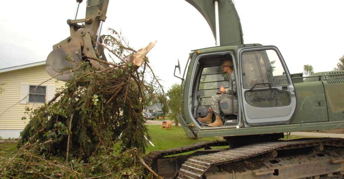
Recovery is now the focus across affected towns. Local crews are clearing debris, while power companies work to restore service. According to reports from the Bismarck Tribune, volunteers and relief groups are delivering supplies.
The National Weather Service continues to update tornado counts as surveys finish, but families say their priority is rebuilding homes and restoring daily life. Stories of resilience have begun to surface: neighbors lending equipment, strangers offering shelter, and communities coming together to shoulder the long cleanup ahead.
Looking Ahead With Uneasy Lessons
Emergency managers said the 2025 tornado season has forced new conversations about preparedness. Officials stressed the importance of early warnings, community shelters, and public education. “This year shows why readiness matters,” one meteorologist told WeatherNation.
The Associated Press reported that state agencies are already reviewing response strategies for future years. For North Dakotans who spent nights in basements and days repairing damage, the lesson is already clear: severe weather is arriving in new ways, and being ready is no longer optional.