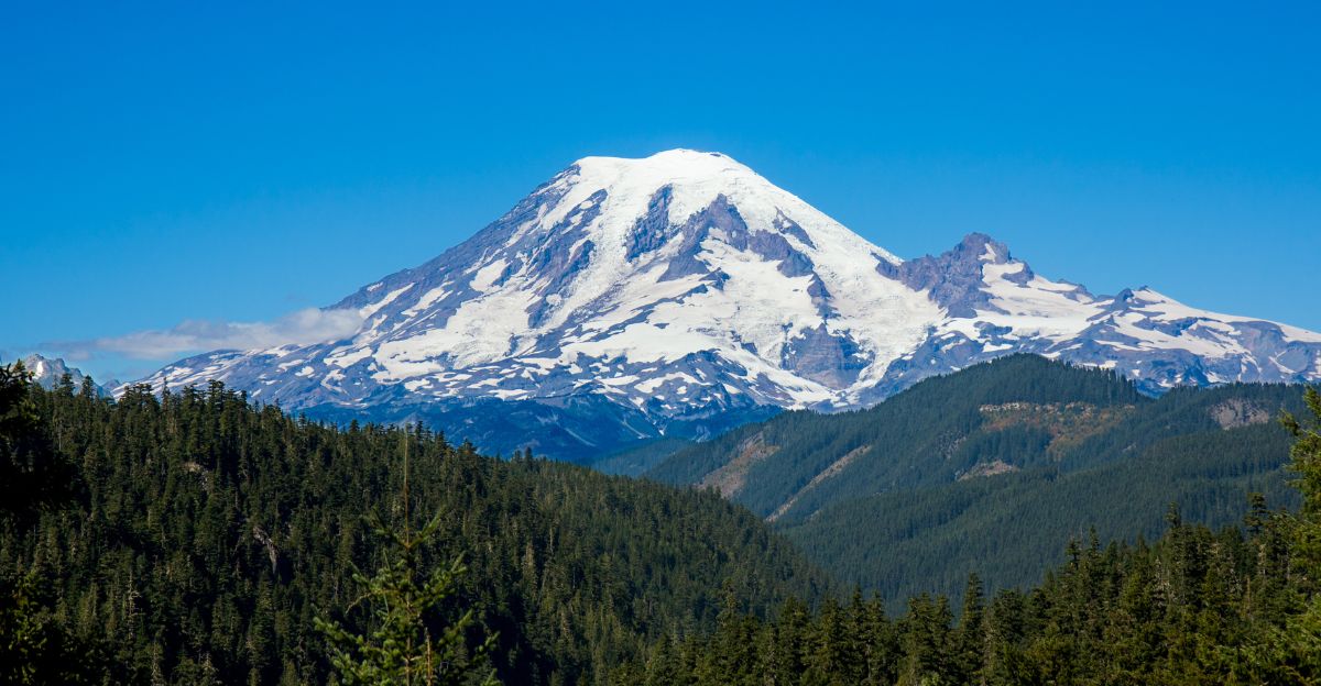
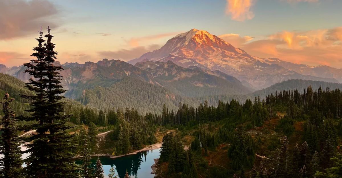
On November 19, 2025, seismologists across the Pacific Northwest held an emergency meeting—not because Mount Rainier was erupting, but because the internet had mistakenly reported it was. Viral headlines screamed that the volcano 54 miles southeast of Seattle faced an unprecedented “72-hour tremor phase,” with claims of 10,000 earthquakes and a “95% chance of major eruption” based on a USGS alert.
Thousands of residents panicked. Emergency managers fielded calls. News outlets amplified the fear. Within hours, scientists discovered the terrifying “seismic signals” were actually ice buildup on a monitoring station antenna.
When Viral Headlines Collide With Scientific Reality
The Mount Rainier eruption scare reveals a dangerous pattern in the age of social media: real volcanic events get distorted into apocalyptic narratives. The earthquake swarm was genuine.
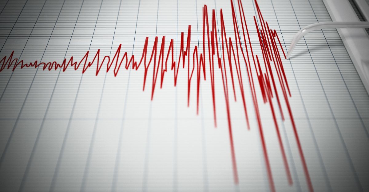
Starting July 8, 2025, Mount Rainier experienced its most seismically active period in recorded history, with over 1,350 earthquakes located, as well as thousands more that were too small to be precisely measured. Peak activity hit approximately 40 earthquakes per hour.
What Actually Triggered the July Earthquake Swarm
Seismic data told scientists exactly what was happening: hydrothermal circulation—hot water and steam moving through the volcano’s underground plumbing. The largest earthquake measured a magnitude of 2.4, far below the threshold for human detection. All tremors occurred at an average depth of 2.8 miles beneath the summit, consistent with hydrothermal activity rather than rising magma.
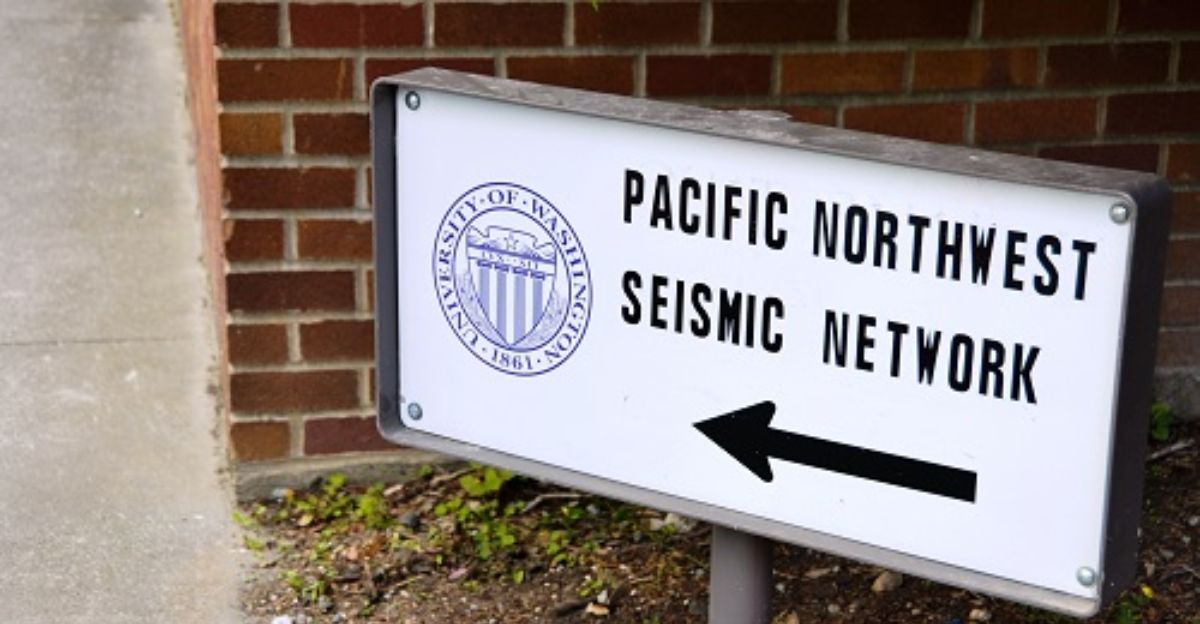
Harold Tobin, director of the Pacific Northwest Seismic Network, confirmed this was the “most energetic swarm ever documented at Mount Rainier” but emphasized: “There are no indications of unusual magma movement.” Gas emissions remained normal.
The November Misinformation Cascade That Changed Everything

Mid-November brought a watershed moment for volcanic misinformation. International tabloids, particularly the UK Daily Mail, published dramatic headlines claiming Mount Rainier’s monitoring stations detected “unprecedented 72-hour tremor phase” with “eruption threat.”
YouTube channels posted videos titled “NASA Issues RED ALERT” and “USGS Warns 95% Eruption Probability.” The narrative was crafted, compelling, and completely false. The Pacific Northwest Seismic Network immediately investigated. Doug Gibbons, PNSN scientist, confirmed the truth: “There’s absolutely no cause for alarm, no interesting seismic activity, and no increase in earthquakes whatsoever on the mountain at this time.”
Why the “95% Eruption Probability” Claim Is Fiction
No USGS scientist issued a “95% eruption probability” forecast for Mount Rainier. The claim appears nowhere in official Cascades Volcano Observatory documents, peer-reviewed literature, or public statements.
The 95% figure may reference Vulcano Island in Italy, but it was weaponized in headlines to create false urgency around Mount Rainier. USGS volcano alert levels operate on a four-tier system: GREEN (normal), YELLOW (advisory), ORANGE (warning), and RED (alert). Mount Rainier remains at GREEN as of December 10, 2025. No escalation to advisory level has been considered.
The Real Threat: Lahars, Not Imminent Eruption
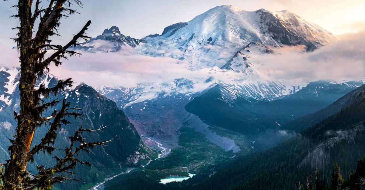
Mount Rainier’s actual danger comes not from lava but from lahars—rapidly moving mudflows composed of water, volcanic debris, ash, and boulders. Approximately 300,000 people live in lahar hazard zones downstream from the volcano. The mountain contains 26 major glaciers and approximately 34 square miles of permanent snow and ice—more than all other Cascade volcanoes combined.
This glacial volume represents the core lahar risk: catastrophic mudflows could travel at speeds exceeding 45 miles per hour, reaching nearest inhabited areas in approximately 10 minutes.
Mount Rainier’s Actual Ranking Among U.S. Volcanoes
The headline describing Mount Rainier as “America’s deadliest volcano” is technically false. The volcano ranks as the third most dangerous according to the USGS National Volcanic Threat Assessment, behind Kīlauea (Hawaii) and Mount St. Helens (Washington).
However, this ranking reflects potential impact, not historical death toll. Kīlauea has killed approximately 75 people since 1750, primarily through lava flows and toxic gases. Mount St. Helens erupted catastrophically in 1980, killing 57 people. Mount Rainier hasn’t erupted since 1894, but its lahar potential, combined with 300,000 residents in hazard zones, makes it exceptionally dangerous in a modern population context.
The July Swarm’s Significance: Historic, But Not Ominous
Scientists weren’t dismissing the July 2025 swarm as irrelevant. The 1,350+ earthquakes that broke Mount Rainier’s previous seismic record, documented through 40+ years of continuous monitoring. The event generated valuable data about hydrothermal systems beneath volcanoes.
Researchers are studying the swarm’s mechanisms to gain a better understanding of similar episodes at other Cascade volcanoes. However, historic significance does not equal an eruption warning. USGS volcanologists have noted that magma-driven eruptions typically produce distinctly different seismic signatures, including shallow earthquakes, progressive ground tilt, gas emission spikes, and sustained activity escalation.
How Misinformation Spreads in the Age of AI

The Mount Rainier false alarm illuminates modern information hazards. Viral headlines mix real events (the July swarm) with exaggerated interpretation (calling it “unprecedented threat”) and fabricated claims (the 95% probability). AI-generated news content, lacking fact-checking, amplifies sensational narratives. Social media algorithms prioritize engagement over accuracy.
International tabloids seeking clicks republish unverified claims. Readers share alarming headlines without clicking through to verify details. By the time scientists debunk the misinformation, it has already circulated globally.
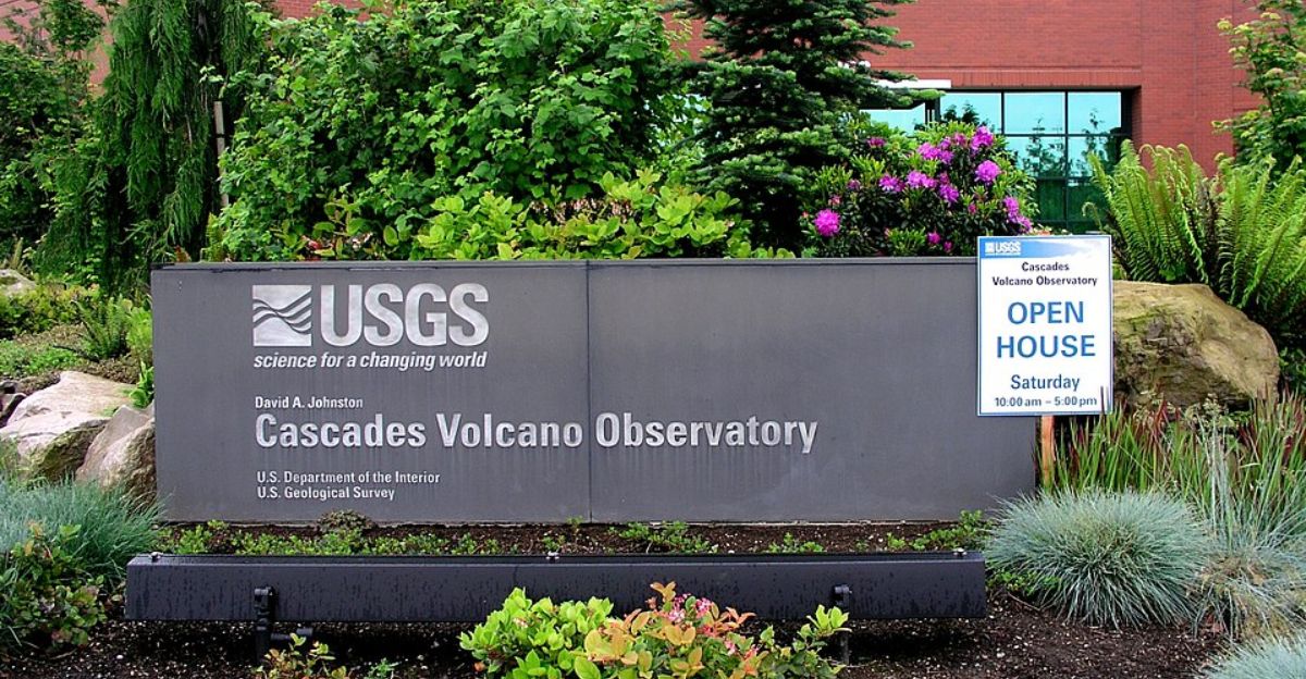
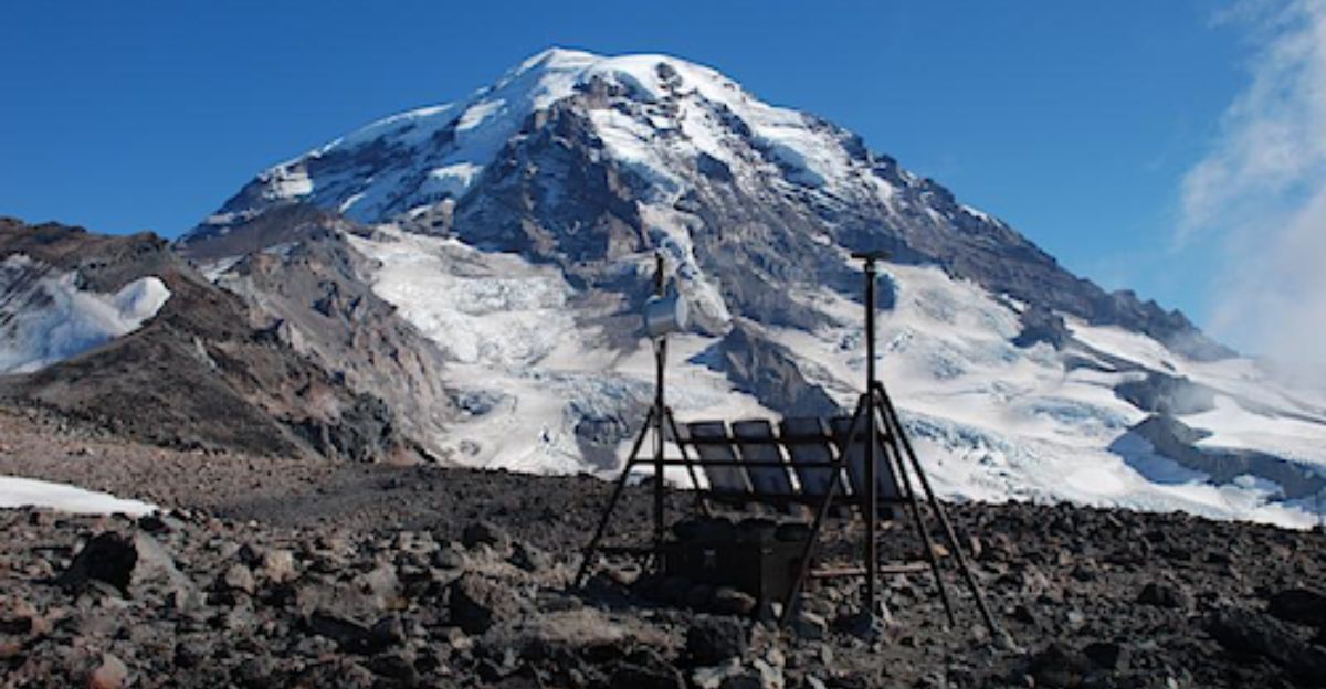
USGS Monitoring: One of Earth’s Most Sophisticated Networks
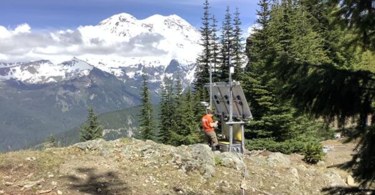
Mount Rainier benefits from world-class volcanic monitoring infrastructure. The USGS Cascades Volcano Observatory operates dozens of seismometers capable of detecting earthquakes with magnitudes as low as -1.0 (microseismic scale). GPS stations measure ground deformation with millimeter precision. Infrasound microphones detect acoustic signals from volcanic activity. Multiple webcams provide real-time visual monitoring 24/7. Gas emissions are regularly sampled and analyzed.
Thermal imaging detects heat anomalies. Scientists integrated this data into a comprehensive model that definitively identified the July swarm as hydrothermal, not magmatic.
Why Communities Practice Preparedness Without Panic
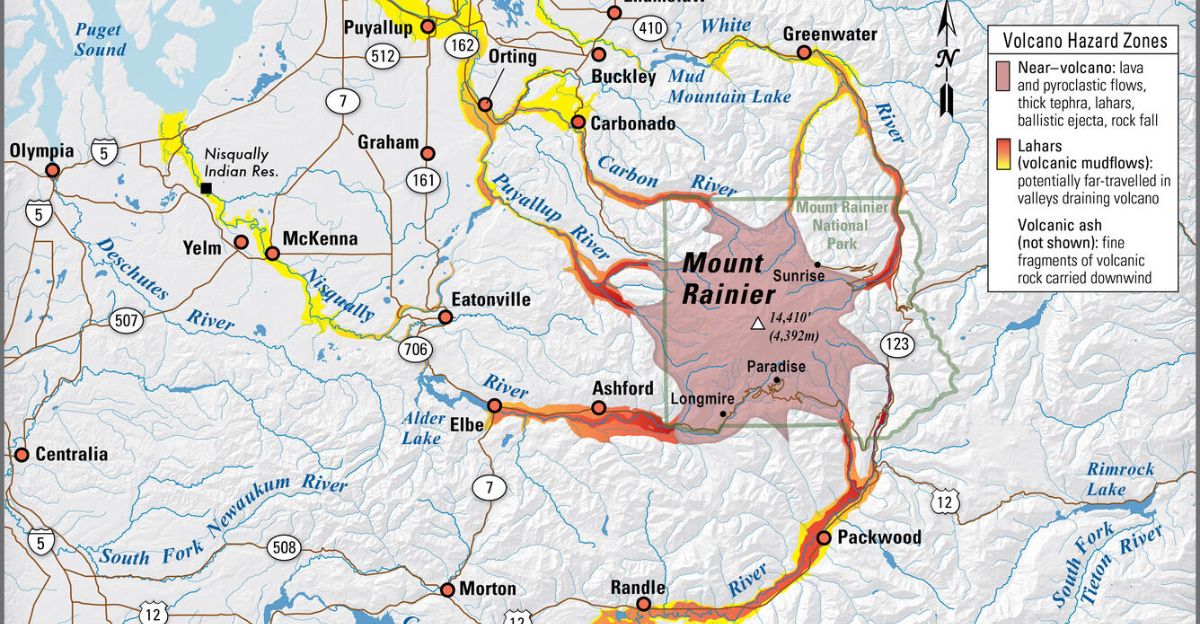
Pierce County and surrounding jurisdictions maintain rigorous lahar emergency response plans. Schools in lahar zones conduct evacuation drills. In 2024, approximately 13,000 students from schools in hazard areas trekked to designated safe zones outside lahar-affected areas.
The Lahars Early Warning System uses acoustic sensors to detect rapidly moving mudflows and alert downstream communities. Emergency management officials coordinate regularly with USGS scientists. Evacuation routes are maintained and clearly marked.
What Scientists Know About Mount Rainier’s Eruption History
Mount Rainier’s last major eruptive episode occurred between 1820 and 1854, producing lahars that reached the Puget Sound lowlands. Smaller eruptions continued sporadically through 1894. Geological evidence suggests that Mount Rainier has erupted approximately every 500 to 1,000 years over the past 500,000 years.
The volcano remains geologically capable of eruption—it’s a young, active stratovolcano with ongoing hydrothermal systems and deep magma sources. But “capable of eruption” differs drastically from “will erupt soon.”
The Critical Difference Between Alert Levels and Background Activity
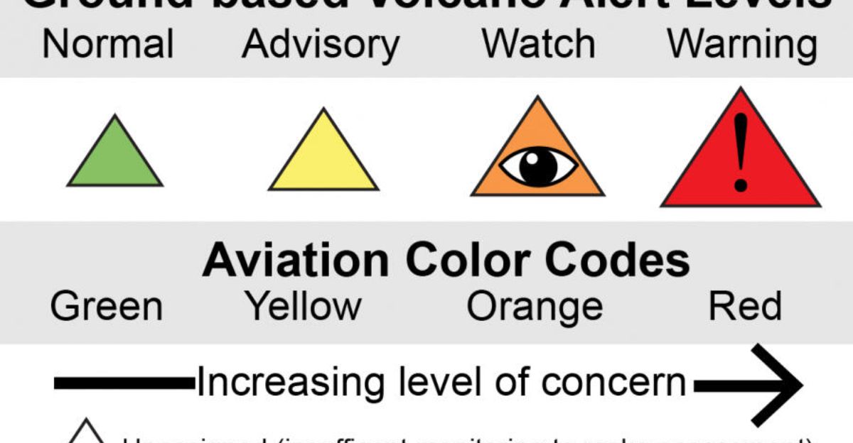
Understanding USGS volcano alert levels protects against panic-inducing misinformation. GREEN (normal) represents background seismic activity, normal gas emissions, and no unusual ground deformation—essentially, the volcano’s dormant state. YELLOW (advisory) indicates heightened unrest: sustained earthquake swarms, gas emission increases, minor ground deformation suggesting magma is rising. ORANGE (warning) means scientists detect clear evidence of eruption potential: significant magma movement, rapidly escalating seismic activity, substantial gas changes.
RED (alert) indicates eruption is imminent or occurring. Mount Rainier has remained at GREEN continuously through 2025. No credible scientist has suggested elevation to YELLOW.
What the Public Should Know Right Now
Mount Rainier is monitored continuously by world-class scientists using the most sophisticated instruments available. The volcano currently shows absolutely no elevated activity or eruption risk. The “1,000+ earthquakes” and “95% eruption probability” claims have no basis in USGS data or scientific assessment.
Residents should ignore sensationalized viral headlines and instead consult official sources: USGS Cascades Volcano Observatory (volcanoes.usgs.gov), Pacific Northwest Seismic Network (pnsn.org), and Mount Rainier National Park. Legitimate lahar hazards warrant preparation and awareness without panic.
The Broader Trend: Sensationalism vs. Science in the Climate Age
The Mount Rainier case reflects a larger pattern: as climate change and environmental risks receive legitimate scientific attention, sensationalized narratives increasingly exploit public concern. Viral headlines about volcanic eruptions, earthquake swarms, tsunamis, and mega-storms circulate before fact-checking occurs. AI-generated content lacks editorial oversight.
International outlets republish unverified claims for clicks. Social media algorithms optimize for engagement rather than accuracy. Scientists respond with careful, nuanced corrections—which receive a fraction of the sensational story’s visibility.
Sources:
USGS Cascades Volcano Observatory volcanic activity reports and alerts, July-December 2025
Pacific Northwest Seismic Network earthquake data and official statements, July-November 2025
USGS National Volcanic Threat Assessment; Mount Rainier lahar hazard zone documentation
CNN volcano science reporting and geological hazard analysis
Pierce County Emergency Management lahar preparedness and evacuation protocols