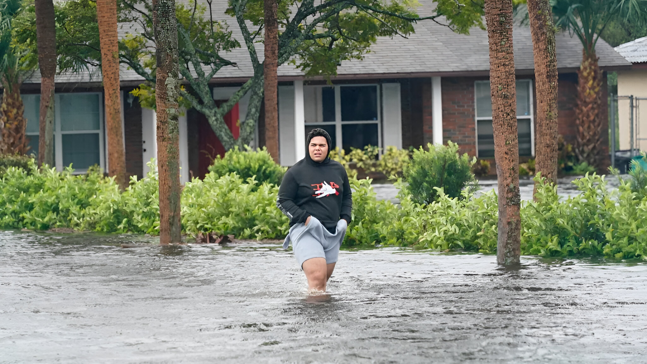
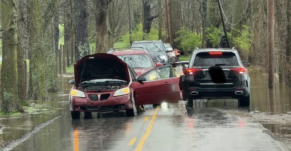
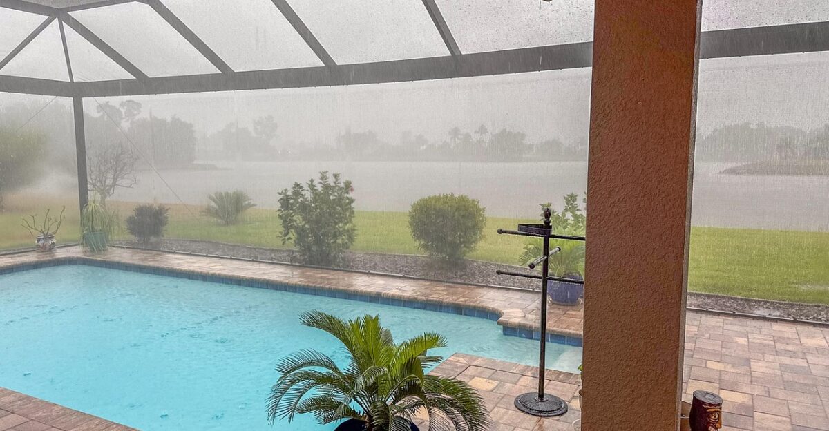
Brown floodwater pressed against doorsteps as residents waded knee-deep down Main Street in Eustis, their reflections rippling under gray skies. Trash bins floated past parked cars; fire-rescue trucks idled at intersections where stop signs disappeared beneath the waterline.
By Monday morning, October 27, 2025, the town had endured 19.70 inches of rain—the highest total in Central Florida. Six counties were under a flood watch, and meteorologists called the rainfall “historic.”
Why Is Central Florida Flooding?
Meteorologists say the deluge erupted when a powerful cold front met saturated tropical air hovering over Central Florida. This collision triggered slow-moving thunderstorms that “trained” repeatedly over the same areas.
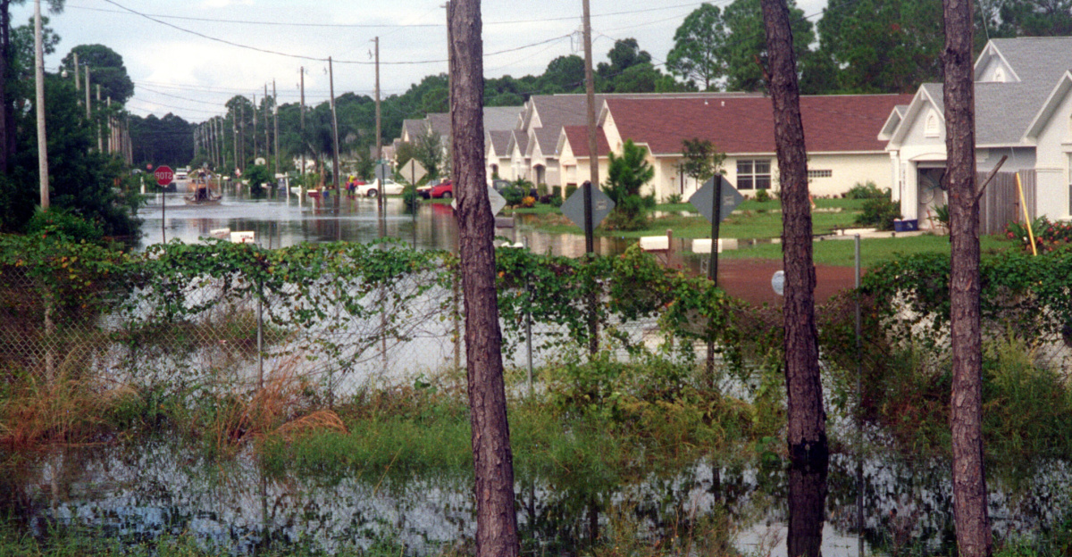
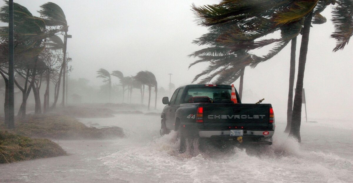
With soil already water-logged from prior rain, runoff overwhelmed storm drains. The National Weather Service issued multiple warnings as totals soared, transforming low-lying neighborhoods into shallow lakes and forcing emergency alerts across the region.
Immediate Impact on Residents and Commuters

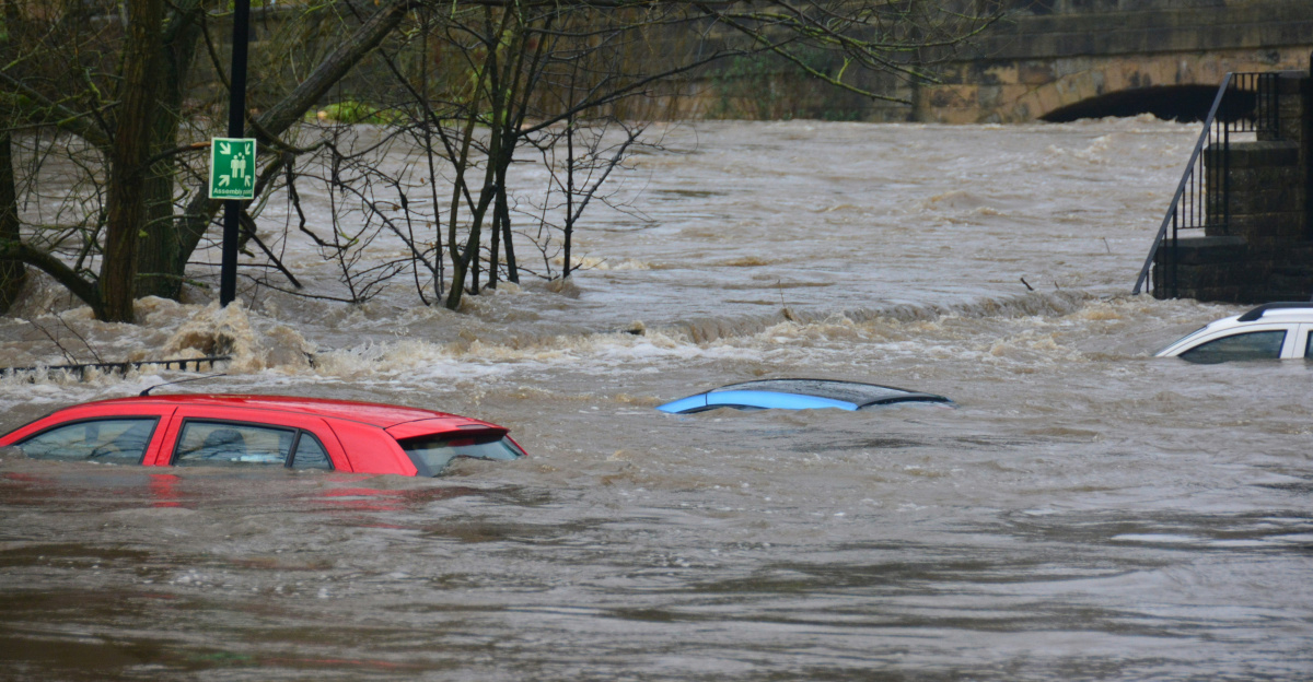
Across Lake and Orange Counties, rescue boats replaced sedans. Motorists stranded along Highway 441 called for help as water rose above door handles. In Mount Dora and Orlando, firefighters closed flooded intersections and utility crews battled widespread outages.
Families carried pets through waist-deep water to reach higher ground, while others sheltered in community centers hastily opened for evacuees.
Business Disruption: Retail and Logistics
A Kroger delivery truck sat half-submerged beside a Circle K, its headlights glowing underwater. Across flooded corridors, delivery routes collapsed—grocery shipments stalled, gas supplies delayed, and storefronts shuttered.
The flooding strangled local commerce and underscored how dependent everyday life remains on vulnerable logistics networks that falter quickly when roads vanish beneath rising water.
Insurance and Construction in the Crosshairs

Insurance adjusters are bracing for a surge of claims—flooded cars, soaked drywall, lost inventory. Meanwhile, construction crews prepare for weeks of cleanup and rebuilding.
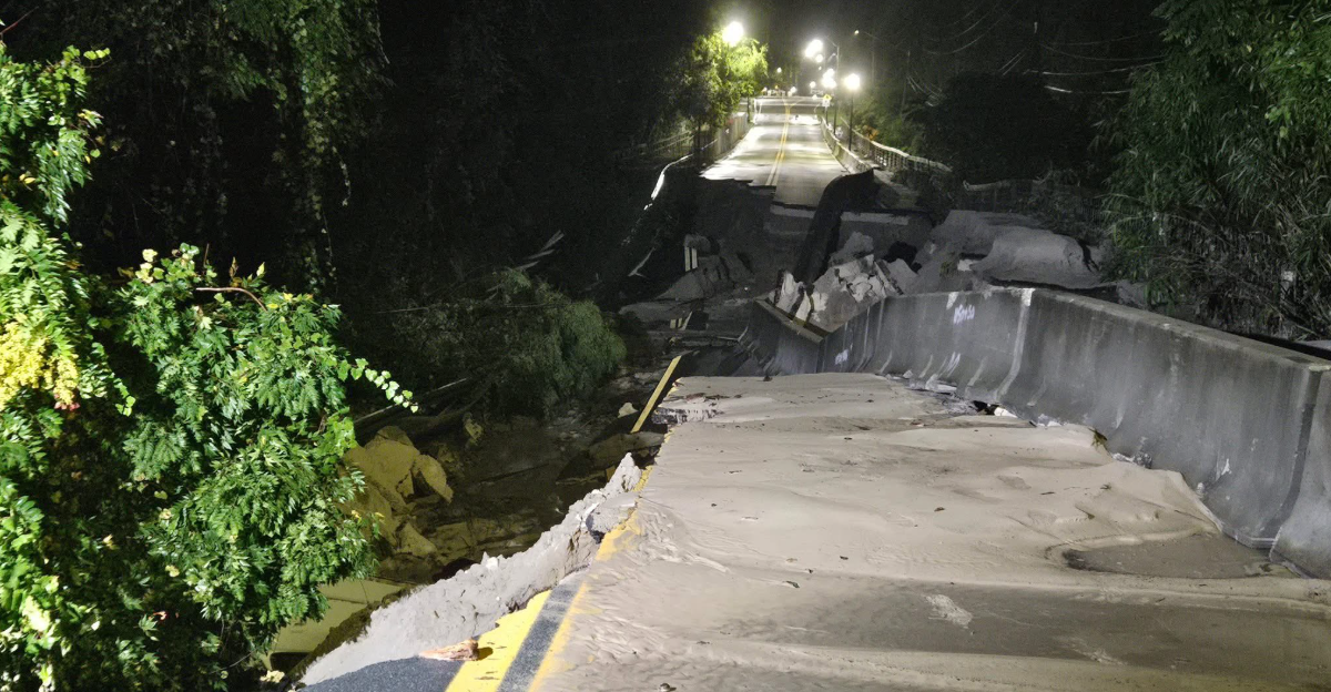
The storm’s devastation is prompting scrutiny of Florida’s drainage design and building codes. Analysts expect insurers to raise rates while contractors scramble to meet the sudden wave of repair demand.
Tourism Takes a Hit

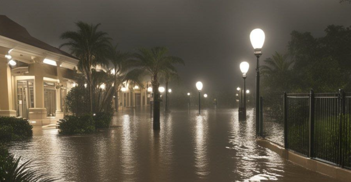
Even Orlando’s glittering tourism corridor wasn’t spared. Theme parks curtailed hours, airport delays rippled across flight boards, and some travelers abandoned plans altogether. Hotels offered discounts to stranded guests.
The broader hospitality industry—normally buoyed by fall festivals—now faces cancellations and cleanup bills, a stark reminder that extreme rain can drown even the Sunshine State’s biggest attraction.
First Responders and Front-Line Workers

Fire-rescue teams, paramedics and meteorologists worked through sleepless nights. Some crews navigated narrow residential lanes in inflatable boats, guiding residents to safety.
Local journalists documented drenched utility workers repairing transformers amid lightning flashes. In countless images, the storm revealed both chaos and compassion—neighbors passing sandbags hand-to-hand as the rain refused to stop.
Emergency Policy and Government Response
Florida’s Division of Emergency Management coordinated alerts while county officials urged residents to “turn around, don’t drown.”
As water levels rose, policy leaders renewed calls for federal disaster aid and resilient infrastructure funding. Municipal engineers began evaluating pump systems and culverts—critical steps to ensure the next deluge doesn’t repeat the same destruction.
Health Risks and Lifestyle Shifts

Health departments are cautioning residents about contaminated floodwater carrying bacteria and debris. Prolonged dampness raises concerns about mold, respiratory illness and mosquito surges.
Officials urge bottled water use and protective gear during cleanup. Schools closed for safety, remote work returned overnight, and households are adjusting to new routines shaped by recovery and caution.
Environmental and Climate Debate
The storm reignited debate over whether Florida’s development pace is outstripping its infrastructure. Environmental advocates point to disappearing wetlands that once absorbed floodwater naturally.
City planners face mounting pressure to integrate green infrastructure—retention ponds, tree canopies, permeable pavements—to buffer future storms. The discussion signals a broader shift toward resilience rather than reaction.
The Road to Recovery
As pumps drain neighborhoods and skies finally clear, Central Florida begins the slow process of rebuilding. Officials prioritize infrastructure upgrades and drainage improvements, while volunteers distribute supplies and cleanup tools.
For many, the storm is a turning point—a call to invest in resilience so future rainfall, however fierce, won’t rewrite local history so painfully.
Storm Totals That Define the Event
Numbers reveal the storm’s magnitude: Eustis 19.70 inches, Mount Dora 17.86, Port Saint John 15.57, Titusville 14.67. Across six counties under flood watch, rainfall eclipsed monthly records.
St. Johns River near Astor remains under flood warning—minor flooding ongoing, moderate possible. Meteorologists estimate another two inches possible Monday before the system clears.
What 19.70 Inches Really Means

That single total equals 1.64 feet of rain in under 48 hours—nearly 20 soda cans stacked high. Spread evenly over one square mile, that’s 337 million gallons of water, enough to fill about 510 Olympic pools.
The average Eustis home roof would have caught around 24,600 gallons. The figures transform abstract inches into staggering physical reality.
Historical Context: Breaking Records
Eustis’s total rivals entire yearly rainfall in U.S. desert cities like Phoenix, which averages just eight inches annually. Nearly 20 inches in one weekend approaches Florida’s wettest monthly records.
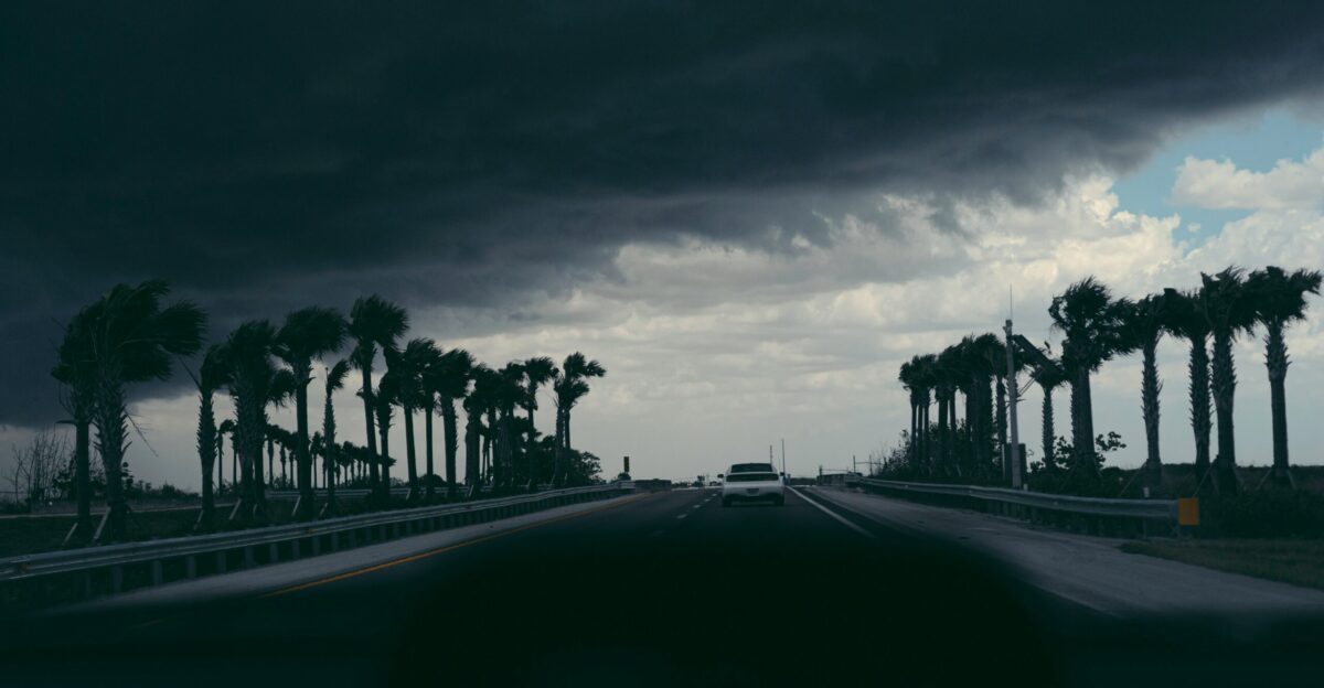
Meanwhile, forecasters note the coincidence of a Category 5 Hurricane Melissa heading toward Jamaica and an impending cold front set to drop Florida lows into the 40s—weather whiplash few expected in late October.
From Flood to Freeze
Just as flood alerts wind down, a dramatic cold front approaches. Forecasters expect overnight lows to plunge into the 40s °F by Halloween weekend—a jarring swing from subtropical humidity to autumn chill.
And far to the south, Hurricane Melissa, a Category 5 storm, barrels toward Jamaica. Central Florida, drying out from record floods, braces for its next atmospheric shock.