On September 14, 2025, an extreme weather outbreak exploded across the northern Plains. Tornado warnings flashed as supercell thunderstorms spun up dozens of twisters over central North Dakota.
Live reports poured into the National Weather Service: by evening the NWS had logged 20 tornado reports in just six hours.
Forecasters and storm chasers alike watched in disbelief. Only after survey teams inspected the damage did the full scale emerge – one of the largest single-day outbreaks in the state’s history.
Record Watch
All summer long, meteorologists had been tracking North Dakota’s tornado tally. Through September 13, the state had already seen 58 confirmed twisters – perilously close to the all-time record of 61 set in 1999.
Each new report put pressure on that old benchmark.
As the mid-September storm system organized, forecasters watched with mounting urgency, knowing that any additional tornadoes could tip the balance. By nightfall it was clear the old record was within reach.
Plains Legacy
For decades North Dakota’s tornado season peaked in June, then quieted. The state averages roughly two dozen tornadoes per year.
Late-season twisters are almost unheard of: NOAA data show only 27 September tornadoes in ND since 1950, and no September outbreak had ever caused major damage.
This stark climatology made the mid-September storms all the more shocking. Farmers and meteorologists recalled that before 2025, the last damaging September tornado was an EF0 in 2017 – hardly anything to prepare for on Sept. 14.
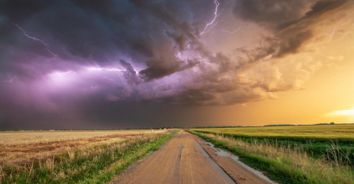
Pressure Building
Unusual heat and humidity set the stage. In early September, North Dakota was unusually warm by night and day. Central ND’s overnight lows crept into the mid-60s°F – records were tied or broken on many dates.
Deep moisture surged northward as well: NWS forecasters noted precipitable-water values near the climatological maximum.
The atmosphere was primed to dump 2+ inches of rain if storms fired. This warm, moist air sat beneath a strengthening low-pressure trough. The ingredients – heat, humidity, and wind shear – were all converging in a way rarely seen for mid-September.
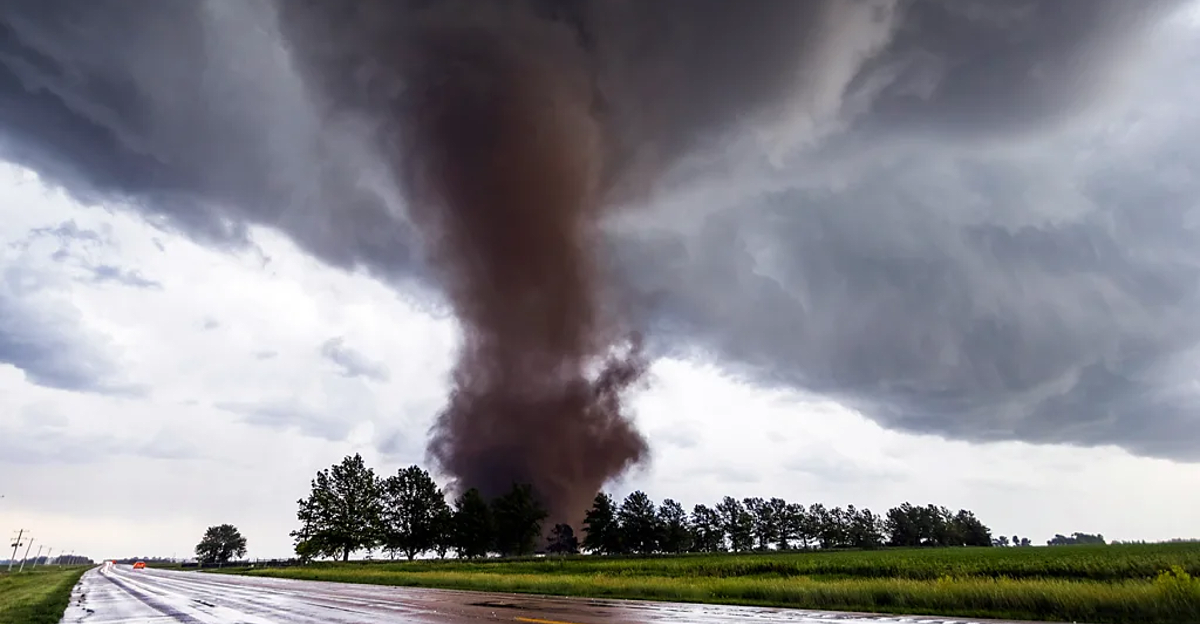
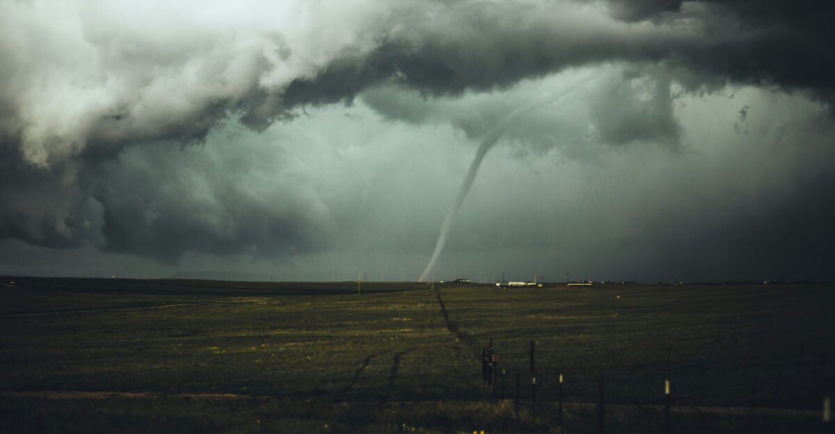
Sunday Eruption

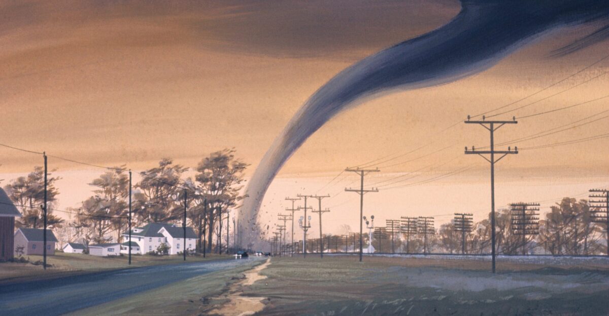
By Sunday afternoon, the ingredients clicked into a violent outbreak. Supercells blossomed across the Dakotas, and tornadoes began touching down almost simultaneously. In just over six hours on Sept.14, the NWS recorded 20 tornado reports.
At least 15 of these have since been confirmed in central North Dakota.
Many were strong, multi-vortex tornadoes funneling through farmland. Incredibly, despite widespread destruction, there were no reported deaths or serious injuries.
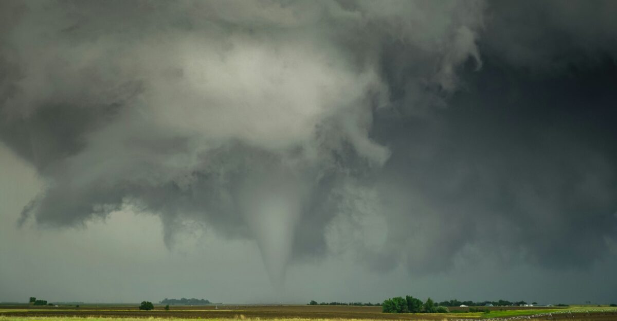
Central Strike
The tornado paths crisscrossed a wide swath of counties. NWS surveys later identified powerful EF2 twisters in Emmons, Burleigh, Sheridan, and McLean counties. For example, one EF2 near the Beaver Bay Recreation Area (Emmons County) obliterated an 80×124-foot pole barn, embedding lumber in the ground and damaging nearby crops.
Another EF2 south of Denhoff (Sheridan County) destroyed a 30×60-ft barn, ripped roofs off two mobile homes (one flipped end over end), and scattered debris up to a quarter-mile.
Across isolated farms, the toll was grim, but all the buildings struck were empty or evacuated.
Eyewitness Terror
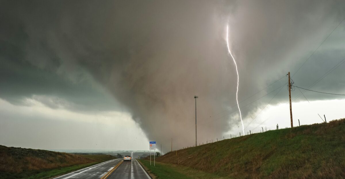
“This was a unique environment,” said NWS-Bismarck science officer Chauncy Schultz. The storms brewed with little hail or lightning but intense low-level spin as a warm front slid through North Dakota.
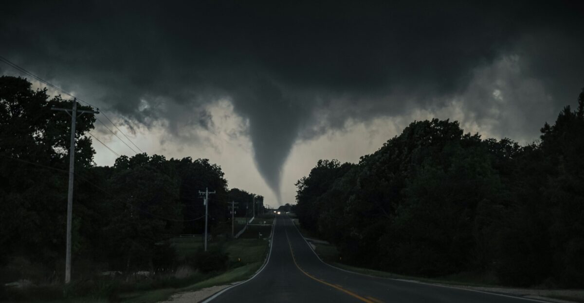
Storm chasers on the ground captured fearsome footage: twin funnels danced over the prairie, and multiple-vortex tornadoes churned side by side.
FOX Weather storm tracker Brandon Copic chased two simultaneous twisters near Denhoff, describing one as “huge” on live video. Locals later compared the scene to something they’d only ever seen on the weather channel – until it happened in their own backyard.
Neighboring Impact
The system actually started in South Dakota before racing north. East of Mobridge, SD, an EF1 tornado tossed vehicles and downed power poles – even flipping a semi-truck – before crossing into North Dakota.
Emergency managers in both states coordinated watches and warnings as the squall line moved up the Missouri River Valley.
Fortunately, beyond that initial SD twister, no other Plains states saw similar late-season tornadoes that day. North and South Dakota bore almost the entire brunt of this bizarre storm line.
Climate Anomaly
By the next morning, it was clear this outbreak was off the charts. Nearly a year’s worth of North Dakota tornadoes had been unleashed in hours. North Dakota’s annual average is about 22–29 tornadoes; one afternoon’s storms nearly equaled that normal total. Coming into Sunday, the state had 58 tornadoes for 2025.
The 15+ twisters that afternoon more than doubled the typical September count.
As one analyst noted, the peak-season activity “spawned a significant chunk” of the yearly average. In short, meteorologists never expected to see “almost an entire year’s worth of tornado activity in just one day” in the Peace Garden State.
Record Crowned

When the dust (and debris) settled, North Dakota had rewritten its record books. On September 15, the NWS confirmed the official tally: North Dakota logged at least 73 tornadoes in 2025.
That shatters the old record of 61 twisters from 1999. The National Weather Service in Bismarck announced that 2025 is now “the most active tornado year in state history”. For context, ND’s storm records reach back to 1950, and never has a single year come close to this total.
Even the entire season’s worth of storms now looks tiny compared to what Sept. 14 delivered.
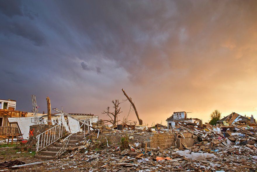
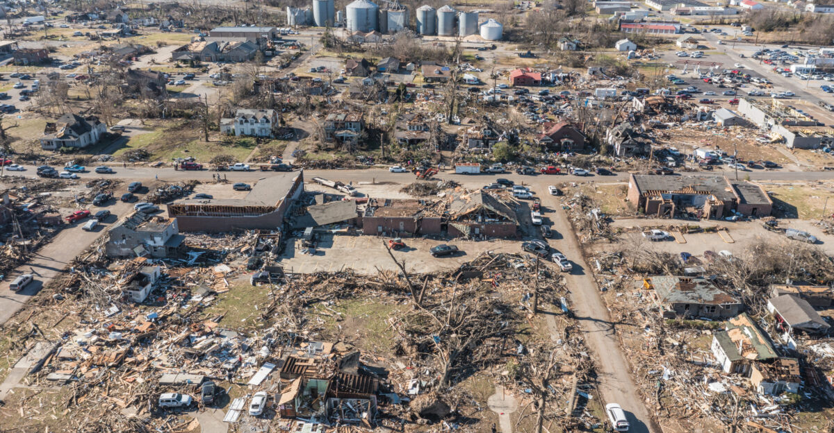
Survey Struggle

Piecing together the outbreak’s damage was a huge task. Teams of NWS surveyors fanned out across hundreds of square miles of rural land, often working through tangled fields and scattered wreckage.
Multiple tornadoes had occurred almost simultaneously, so crews had to determine where one vortex ended and another began. “After an event like this, some of the reports end up being from the same tornado,” noted NWS meteorologist Megan Jones, as crews compared witness reports and aerial images.
Each confirmed track had to be mapped by hand — a process taking days of work. Meteorologists warned that final wind-ratings might change as more surveys came in.
Infrastructure Toll
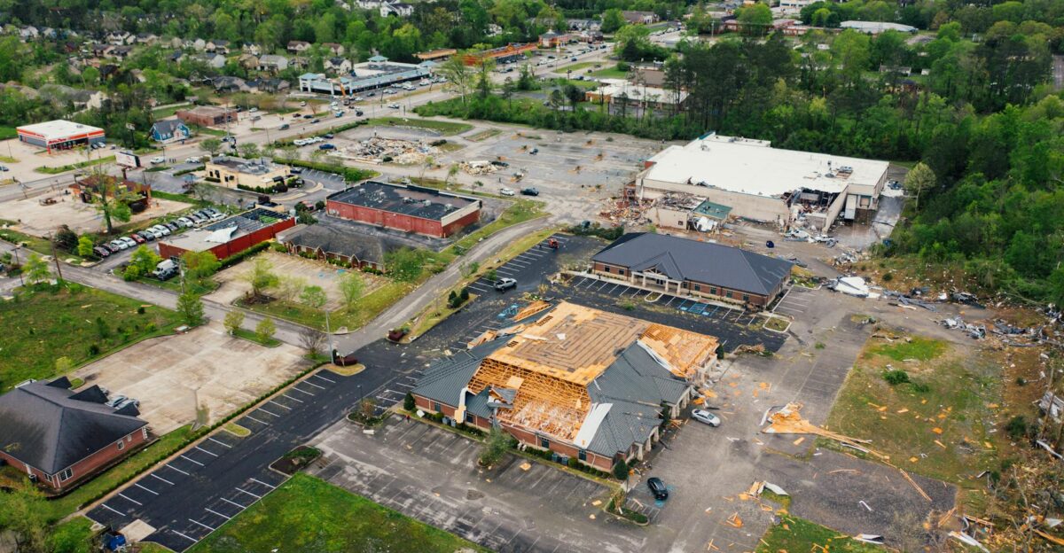
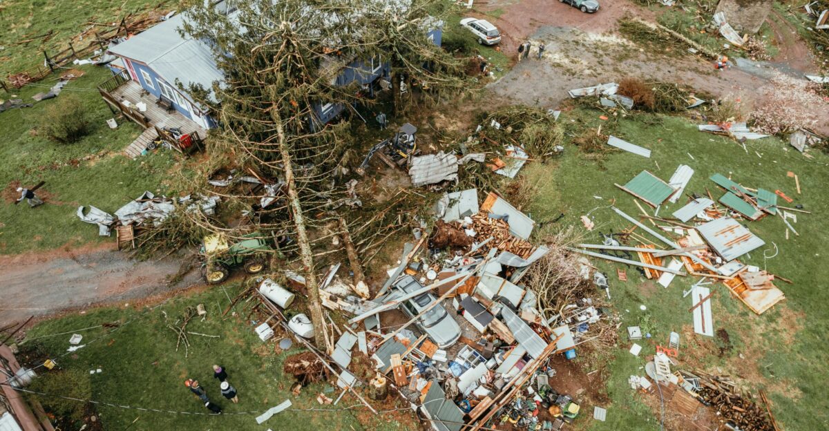
Farm and ranch infrastructure paid the price. Damage surveys documented dozens of flattened buildings. For example, one twister in Emmons County punched through a farmyard and totally razed an 80×124-ft grain bin.
Near Denhoff, crews found two demolished barns (one 30×60 ft) and two mangled mobile homes on the same property.
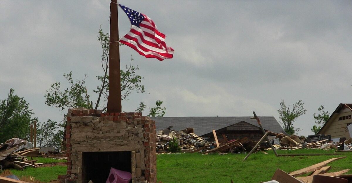
Vehicles, trailers and heavy equipment were overturned, and hundreds of yards of siding and tin roofing littered fields. Even tree rows and fence lines were shredded along the tracks. Remarkably, all the hardest-hit sites were remote farmsteads — no towns or cities took a direct hit.
Recovery Begins
With no casualties to tend to, attention turned immediately to cleanup. County emergency managers in Sheridan, Emmons, and neighboring areas began mapping out debris and providing guidance for affected landowners.
Sheridan County Emergency Manager Delbert Hoffmann reported that survivors like homeowner Kevin Vietz had food and shelter arranged as neighbors and aid groups stepped in.
Electric crews worked around the clock to restore power to downed lines, while farmers grabbed chainsaws and tractors to open blocked roads. Churches, civic groups and local fire departments organized help for each other. Within hours, communities were passing out water, blankets and rebuilding tools – a testament to rural North Dakota’s can-do spirit.
Forecast Future
Meteorologists now warn this could be a harbinger, not just a one-off. One big focus is the Pacific Ocean. In mid-September 2025, sea-surface temperatures across the North Pacific were 2–7°F above normal.
Such warm ocean waters can inject extra moisture and instability into the atmosphere when their air mass gets drawn inland. Climatologists point out that other late-season outbreaks have been linked to distant warm pools of water.
As DTN meteorologist Bryce Anderson noted, scientists are asking if the warm Pacific added “moist air” and energy to fuel the Plains supercells. Any confirmation could extend our forecast radar: forecasters may need to watch global patterns year-round.
Pattern Shift
This unprecedented outbreak is already reshaping thinking about Northern Plains tornado climatology. If September twisters can be this big, can forecasters still say tornado season ends with August? Officials warn that changing climate and weather patterns could make anomalies like this far more common.
Emerging research suggests that what was once “extreme” might become the new normal.
Bryce Anderson summed it up: this event “will no doubt be studied closely, with the ocean temperatures and atmospheric patterns as prime features”. 2025’s storms may rewrite how we prepare for storms in every season to come.
Agricultural Concerns
The timing could not have been worse for farmers. By mid-September, many North Dakota crops were scheduled for harvest. The late outbreak tore through fields and equipment needed for combining. In one case, a half-built grain bin was destroyed just as harvest crews planned to empty it.
Debris-strewn fields slowed tractors and could reduce yields if damaged crop went unpicked. Farmers are now doing yield checks: for many, it’s grim. Tony Richards, a North Dakota bean farmer, surveyed his battered fields this week and said, “Honestly, it’s just sad… kind of depressing”.
With already-thin margins, any lost acres translate to big financial hits. State ag officials say they’re tallying the damage, but warn that even a few stricken fields can ripple through the local rural economy.
Broader Implications
North Dakota’s record-setting season is mirrored by a nationwide uptick in severe weather. As of mid-September, the US had recorded over 1,400 tornado reports for 2025 – a pace well above average.
Scientists suspect that an unusually active jet stream and ample Gulf moisture have fueled multiple intense outbreaks across the country.
The Plains aren’t the only place seeing break-the-mold storms; all over the map, extreme events are happening outside the old calendar constraints. Emergency managers in other states are taking note: if ND can get Tornado Valley’s record in September, other regions may need to rethink their risk calendars too.
Research Opportunity

For weather researchers, this outbreak is a gold mine of data. Experts are already poring over satellite and radar records to untangle how the storm evolved. The role of the warm North Pacific, for instance, will get special attention: DTN weather analysts pointed out that those unusually high ocean temperatures could have added fuel to the system.
Meanwhile, the huge 2.44 inches of rain in Bismarck on Sept.14 (a 31-year daily record) suggests massive moisture feed.
Studying such a scenario can improve forecast models: by seeing exactly how ingredients came together for one of the coldest months, forecasters may better anticipate surprises next season. In short, atmospheric scientists will be taking this one storm and testing it from every angle.
Community Resilience
Perhaps the most uplifting outcome is how communities pulled together. There were no fatalities and only a handful of minor injuries. Locals credit that to preparation and quick action. Denhoff rancher John Strobel had emergency alerts on his phone that night, and he heeded them – even though he never expected a tornado at home.
As Strobel said, “when you get those alerts coming across your phone, just take it seriously”. He lost a barn but knows people nearby did worse; neighbors have since been bringing him hay and power generators.
Throughout central North Dakota, volunteer crews and neighbors were already clearing roads and checking on each other while the sky was still dark. The event proved that strong community ties and early warning systems can save lives when nature crosses the line.
New Normal

North Dakota’s new tornado record signals that the era of strict seasonal rules may be over. The late-September outbreak upended assumptions built over decades. If warming oceans and volatile weather patterns are the new backdrop, communities must adapt.
Meteorologists may need to issue warnings and watch fronts later into the year than before. Farmers may need to consider weatherproofing more of their equipment year-round.
For now, officials are treating 2025 as a wake-up call: the storms of tomorrow may arrive when you least expect them, and yesterday’s “anomaly” could be a big piece of our new forecast reality.