Scientists warn that Cascadia’s megathrust quake might not act alone. Recent deep-sea sediment analysis reveals stress connections between the Cascadia Subduction Zone and California’s San Andreas Fault.
If confirmed, one massive quake could literally “tune up” the other, threatening an unprecedented Pacific Coast catastrophe far deadlier than previously estimated.
Twin Faults, Twin Quakes
Chris Goldfinger’s research suggests a Cascadia rupture could trigger a San Andreas quake shortly after. He warns that if both faults snap, “San Francisco, Portland, Seattle, and Vancouver” would be in crisis together.
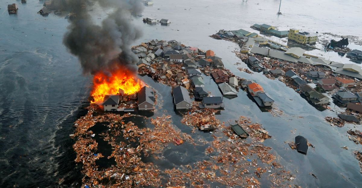
Cascadia’s last major rupture (1700) was magnitude ~8.7–9.2 with tsunamis to Japan, and the 1906 San Francisco quake was about M7.9.
Massive Faults, Massive Risk
The Cascadia Subduction Zone spans ~700 miles from Northern California to Vancouver Island and can unleash M9 shocks. Its last full rupture (year 1700) was roughly M9.
Farther south, the San Andreas Fault stretches ~800 miles up California’s coast; its great 1906 quake was M7.9. “It’s kind of hard to exaggerate what a M9 earthquake would be like,” notes Goldfinger.
Telltale Sediment Patterns
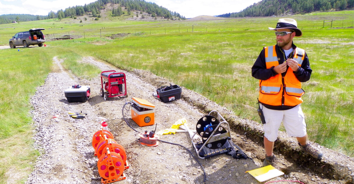
To study ancient quakes, researchers analyze offshore turbidite layers from submarine landslides. Goldfinger’s team found repeated “doublet” deposits: upside-down sequences where fine sediment is suddenly overlain by coarse sand.
These unusual paired layers cluster near the Mendocino junction, hinting that stress transfers between the two faults during big earthquakes.
Faults Synchronize
Goldfinger et al. (Geosphere, Sept 2025) report: Cascadia and San Andreas can rupture in a rapid sequence.
Sediment records show multiple cases where a Cascadia quake was followed almost immediately by a San Andreas tremor. This seismic linkage upends traditional hazard models and suggests West Coast disasters may be far more interconnected than assumed.
Nightmare Scenario
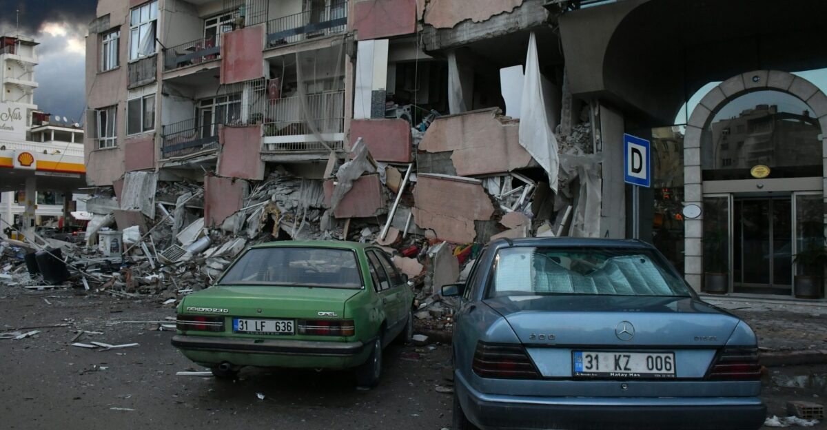
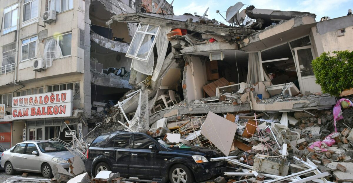
Emergency planners fear the numbers. FEMA estimates a full Cascadia rupture could cause ~14,000 deaths, 107,000 injuries, and destroy 620,000 buildings.
A second quake on the San Andreas might more than double casualties and damage. Cities like Seattle, Portland, and San Francisco could simultaneously face overwhelming rescue and medical needs.
Schools and Hospitals at Risk

An Oregon plan warns “every coastal hospital will either be completely or extensively damaged” in a megathrust quake. Nearly 1,000 Oregon public schools are rated high risk of collapse.
In response, Gov. Tina Kotek in Sept. 2025 ordered new state buildings (>10,000 sq ft) to be quake-resistant and mandated retrofitting of existing ones by 2060. Goldfinger notes “an M8–9 earthquake… is inevitable”.
Building for Resilience

Officials urge communities to “Be 2 Weeks Ready” with emergency plans and supplies. Many Oregon and Washington districts are raising standards on their own. Washington Emergency Management Director Robert Ezelle warns, “We have the second highest earthquake risk in the country… [a] major quake… will be extremely damaging”.
Some school districts (Beaverton, Eugene, Seaside) are building new facilities with extra bracing and backup generators so they can double as emergency shelters.
Regional Faults, National Risk
Meanwhile, beyond Oregon and Washington, the Pacific Northwest faces additional seismic threats. A developing megathrust off British Columbia’s Haida Gwaii – the Queen Charlotte Fault – could unleash magnitude 8–9 tremors. One study calls Queen Charlotte “the greatest seismic hazard in Canada”.
These findings underscore a shared West Coast vulnerability and have prompted U.S. and Canadian agencies to coordinate tsunami and earthquake response drills.
Doublet Discovery

Sediment cores have revealed a startling detail: paired “doublet” earthquakes. In some layers, scientists see evidence that the second event’s deposits arrived within minutes to hours of the first.
This suggests a Cascadia quake could be followed almost immediately by a San Andreas temblor, sharpening the urgency for joint quake response planning.
Planners Sound the Alarm
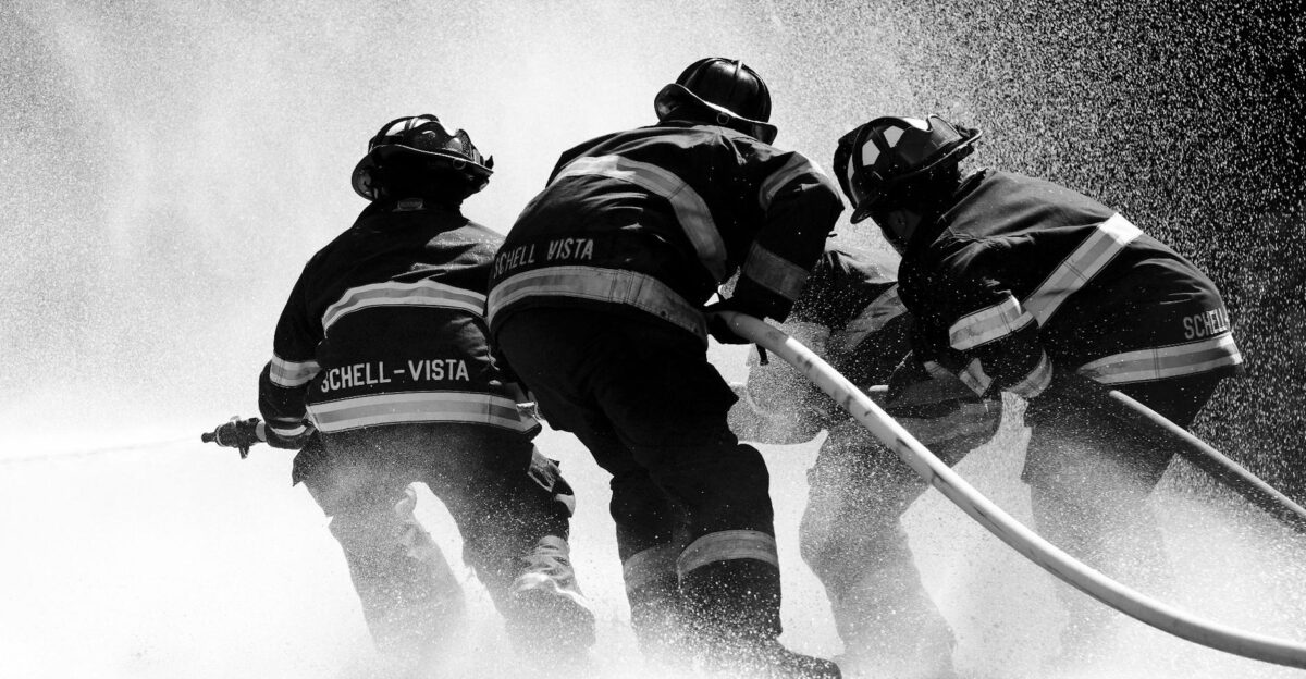
Emergency managers warn that local systems may not cope. Goldfinger told the media, “We have very, very fragile infrastructure in most of our towns and cities… [and] progress to replacing [it] is very, very slow”.
Aging bridges, water mains, and unreinforced masonry buildings would be hard-hit in a back-to-back quake scenario. Officials say federal support and fast upgrades are needed to avoid catastrophe.
Leadership Steps Up
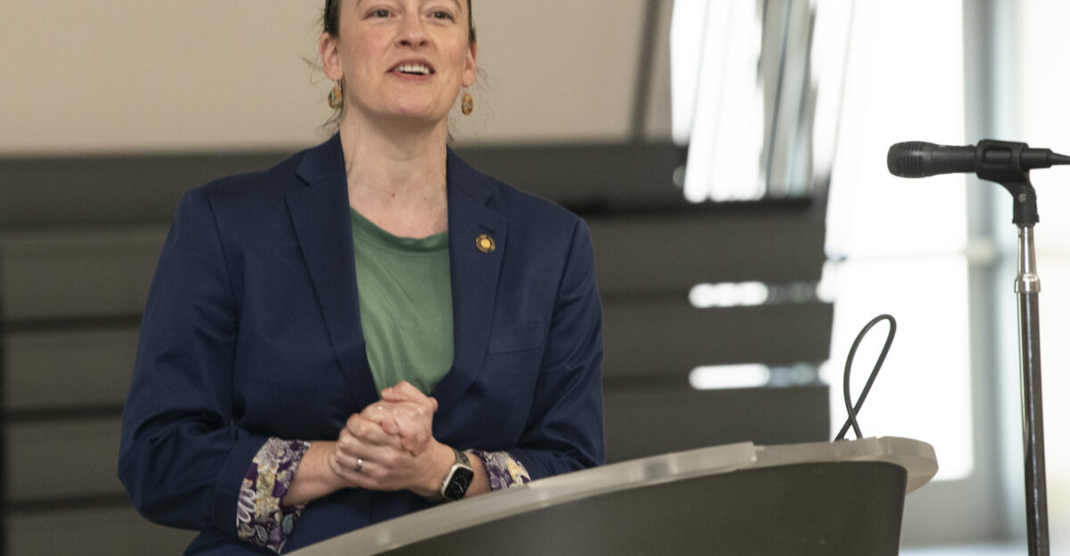
Confronted with this threat, leaders are responding. In Sept. 2025, Oregon’s governor mandated that new state buildings >10,000 sq. ft. be quake-ready and funded a retrofit program.
First-responder-legislator Dacia Grayber cautions Oregonians: “We are the only post-industrial region… that hasn’t lived through our worst natural disaster.” This marks a shift from warning to action, as states now prioritize seismic retrofits and emergency coordination.
Investing in Resilience
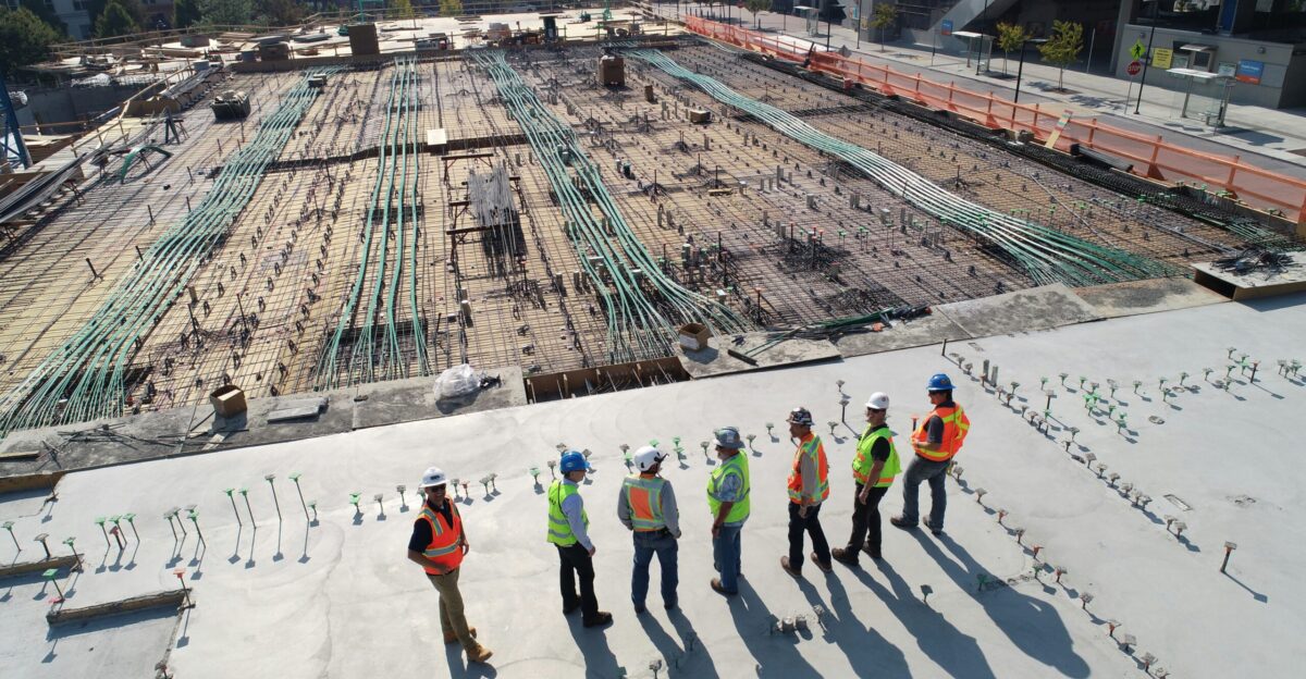
Meanwhile, communities are turning strategy into action. Beaverton approved bonds for seven new schools (2014–22), each incorporating extra structural bracing, tie-downs, generators, and water hookups.
Its former engineer found these “resilience” features added only ~1–2% to construction costs. Seaside, Oregon, even moved its high school onto a hilltop. Such projects can significantly reduce casualties and speed recovery.
Expert Caution
But scientists remain cautious. The sediment evidence points to “partial synchronization” – sometimes one quake nudges the other, but not guaranteed simultaneous rupture.
Geophysicist Meng Wei emphasizes, “Even if these two faults are synchronized, the time interval between earthquakes can still be decades”. Models now include paired-fault scenarios, but timing and strength remain uncertain.
Monitoring and Warning
Meanwhile, researchers are refining early warning and risk models. The USGS now factors quake-driven coastal subsidence into flood assessments.
Ongoing seafloor studies and seismic networks improve rupture forecasts. Public outreach has expanded: the 2025 Great ShakeOut drill and other campaigns stress that everyone should prepare for multiple quakes. Goldfinger stresses, “it’s pretty clear… we need to be prepared”.
Policy and Funding
These findings have spurred policy shifts. State legislators are debating tougher building codes for schools and hospitals. Washington agreed to $500 million over 10 years to upgrade its most vulnerable schools.
Governors are lobbying Congress for disaster-prep funds for highways, ports, and utilities. In short, both federal and state budgets are being reshaped to prioritize earthquake resilience.
Cross-Border Coordination
The seismic threat transcends borders. Canada’s Pacific coast shares the Cascadia and Queen Charlotte systems, so U.S. and Canadian agencies are collaborating. Joint exercises and data-sharing are increasing. For instance, earthquake drills now often run simultaneously in Seattle and Vancouver.
The Pacific Northwest’s geologists note: this is a regional problem demanding cross-border response plans.
Legal and Environmental Risks

Major quakes raise complex issues. Building-code debates may intensify (Who pays for retrofits? How to zone tsunami-threatened land?). Meanwhile, studies show a big Cascadia quake could sink coastal land 0.5–2 meters, instantly expanding flood zones.
That would inundate habitats and infrastructure previously on dry ground. Experts urge planners to integrate earthquake subsidence into zoning and climate resilience plans.
Culture of Preparedness

As awareness grows, the public is taking earthquake risk more seriously. Annual drills like the Great ShakeOut (mobilizing tens of millions) are now routine in schools and businesses. Community groups push emergency kits and family plans.
Media coverage of the Cascadia–San Andreas link has sparked broader understanding. Experts say this cultural shift – expecting earthquakes and prioritizing preparedness – may be the most important resilience boost yet.
The Coming Test
In conclusion, the Pacific Northwest’s seismic future is ominous but not unknowable. The Cascadia–San Andreas “superfault” connection signals a new era in earthquake science and public policy. If both faults roar in one sequence, the West Coast’s resilience will be truly tested. As Goldfinger warns, “we need to be prepared”.
The coming years in labs, legislatures, and neighborhoods will determine how well the region weathers the forces beneath its feet.