Sinking land is becoming one of America’s most dangerous climate-related crises, with major urban centers threatened by a convergence of land subsidence and sea level rise. Recent research reveals that the problem extends far beyond California’s coasts—Houston, Texas, now holds the distinction as America’s fastest-sinking city among the nation’s largest metropolitan areas.
Houston’s Rapid Descent
According to a May 2025 study published in Nature Cities, which analyzed the 28 most populous U.S. cities, Houston faces unprecedented subsidence challenges. Approximately 42% of Houston’s land area is subsiding at rates exceeding 5 millimeters per year, with some neighborhoods sinking as much as 5 centimeters annually. The combination of long-term groundwater extraction and oil and gas production has made Houston the most rapidly subsiding major U.S. city studied, significantly outpacing other major metropolitan areas including New York, Los Angeles, and San Francisco.
The study examined subsidence data collected via satellite-based radar between 2015 and 2021, using advanced interferometric synthetic aperture radar (InSAR) technology. Researchers estimate that at least 20% of urban area is sinking in all 28 cities examined, affecting approximately 34 million Americans nationwide.
California’s Coastal Vulnerability: A “One-Two Punch”
While Houston’s situation is most acute, California’s coastal communities face a distinct but equally serious threat. Recent NASA-led research using satellite radar to map over 1,000 miles of California shoreline reveals that land subsidence is accelerating in major coastal centers, compounding the threat from climate-driven ocean rise.
San Francisco Bay Area Under Pressure
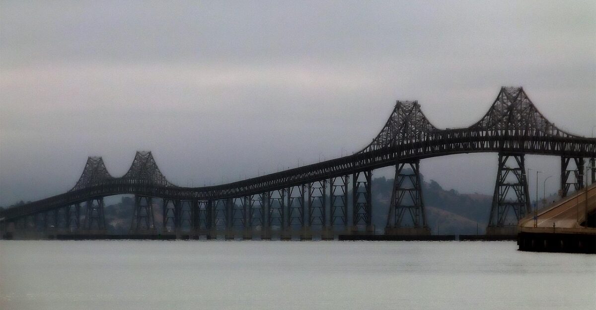
Communities in the San Francisco Bay Area—including San Rafael, Corte Madera, Foster City, and Bay Farm Island—are experiencing particularly severe subsidence, with rates exceeding 10 millimeters (0.4 inches) per year, primarily due to sediment compaction caused by excessive groundwater extraction. When combined with projected ocean rise, these areas could see local sea levels increase by more than 17 inches by 2050—more than double the 7.4-inch regional rise estimated by tide gauge projections alone.
Southern California’s Shifting Ground
Los Angeles and surrounding counties are experiencing varied subsidence patterns with significant local impacts. The Palos Verdes Peninsula has been sliding toward the Pacific Ocean at dramatic rates, with some measurements showing 10 centimeters (4 inches) of movement per week during certain periods in 2024, as detected by NASA’s satellite radar. In Los Angeles and San Diego counties, human-driven subsidence could add up to 15 inches to sea level projections, significantly increasing flood risk in low-lying, reclaimed areas such as Newport Beach.
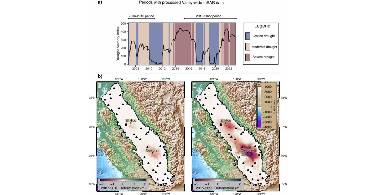
Central Valley’s Severe Subsidence
California’s San Joaquin Valley in the Central Valley represents the most severely affected region in North America. Average subsidence has reached nearly one inch per year since 2006, with some hotspots sinking even faster. Decades of intensive groundwater extraction for agriculture have transformed the valley into a landscape experiencing record-breaking vertical land motion.
The Root Cause: Groundwater Extraction
Both NASA researchers and the Nature Cities study identify groundwater pumping as the primary driver of subsidence in affected regions. When water is withdrawn from underground aquifers faster than it can be naturally replenished, sediments compact and the ground sinks. This process is largely irreversible and permanently alters the land’s ability to store water in the future.
The effect extends beyond coastal areas. In the San Joaquin Valley, periods of drought have intensified groundwater pumping, while reduced water deliveries from Northern California rivers have exacerbated the problem. Researchers estimate that the valley’s aquifers require approximately 220 billion gallons of annual recharge—through natural or engineered processes—to prevent continued subsidence.
A Dangerous “One-Two Punch”
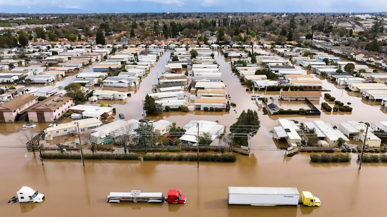
The combined effect of sinking land and rising seas creates what scientists call a “one-two punch” for coastal communities. While California’s oceans are projected to rise by 6 to 14.5 inches by 2050 due to melting glaciers and thermal expansion, subsiding land can double or even triple the relative sea level rise experienced locally. This means that some areas could face flooding regimes far more severe than previously anticipated, with even minor tidal events pushing ocean water ashore.
Compounding this threat nationwide, researchers analyzing the 28 major U.S. cities found that all are experiencing some degree of subsidence, with at least 20% of urban area affected in every city examined.
Infrastructure and Population at Risk
The human stakes are enormous. Between 4.3 million and 8.7 million people in California’s coastal communities are at risk from subsidence-driven sea level rise. Beyond California, approximately 33.8 million people across the 28 largest U.S. cities studied now live on sinking land.
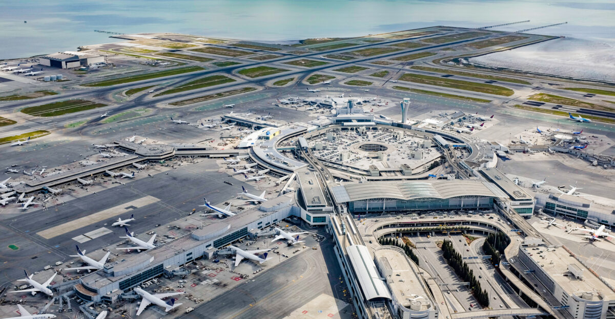
Critical infrastructure is already under threat. San Francisco International Airport, built largely on landfill and subsiding areas, could see nearly half its runways and taxiways submerged by 2100 if current trends continue. Other communities built on reclaimed land, such as Foster City, face similar existential risks. Ports, highways, and utility networks throughout California’s coast and in major cities nationwide are increasingly vulnerable to flooding and damage.
The Nature Cities study found that more than 29,000 buildings across the 28 studied cities are located in high and very high damage risk areas due to differential settlement from subsidence. In some cities, subsidence-related infrastructure damage poses risks comparable to or exceeding those from other geologic hazards.
Population at Risk by Region:
- San Francisco: 460,000 to 805,000 residents
- Los Angeles: 8,500 to 2.3 million residents
- San Diego: Up to 2.3 million residents
- Nationwide across 28 major cities: Approximately 33.8 million people
With nearly 70% of California’s 40 million residents living near the coast, and major population centers across the U.S. affected, the scale of potential impact is unprecedented.
Pathways to Solutions: Monitoring and Mitigation
Addressing subsidence requires both immediate monitoring and long-term management strategies. Researchers advocate for reducing groundwater extraction and implementing strategic aquifer recharge programs. California has invested in advanced monitoring technologies, including the NASA-ISRO Synthetic Aperture Radar (NISAR) satellite, which launched on July 30, 2025. This satellite can detect land movement down to fractions of an inch, enabling water managers to make informed decisions to protect infrastructure and public safety.
Water management approaches like flood-managed aquifer recharge (flood-MAR) are being widely adopted in California. This involves diverting excess surface water from precipitation and snowmelt to locations where water can percolate down and recharge aquifers. Research suggests that by strategically targeting areas where subsidence will cause the greatest social and economic damage, communities can implement feasible mitigation solutions.
Signs of Recovery

There are encouraging signs that recovery is possible with proper management. In Santa Barbara, groundwater levels have been rising since 2018 due to sustained replenishment efforts, with some areas experiencing measurable uplift. These successes suggest that with proper management and adequate water supplies, subsidence can be slowed or even reversed.
Long Beach has also shown uplift in areas where fluid extraction policies have been managed. These examples offer hope for other communities facing similar threats.
Looking Ahead
The convergence of sinking land and rising seas presents an urgent challenge for California, Texas, and other regions nationwide. Research from NASA, Stanford University, and the Nature Cities study underscore the need to update risk assessments and adaptation strategies, as traditional sea level rise projections significantly underestimate true threats when subsidence is not accounted for.
With critical infrastructure, economic stability, and millions of lives at stake, real-time monitoring and proactive interventions are essential to safeguard the future of America’s coasts and major urban centers. Cities must develop targeted mitigation and adaptation strategies tailored to their local subsidence drivers—whether groundwater extraction, hydrocarbon production, or natural processes—to effectively manage this slow-moving but transformative environmental challenge.