Parts of California are sinking faster than the sea is rising—and by 2050, some coastal cities could experience flooding twice as severe as scientists predicted. A January 2025 NASA study mapping over 1,000 miles of coastline found that land subsidence is accelerating across Los Angeles and San Francisco.
Between 2015 and 2023, satellite radar revealed alarming rates of ground collapse threatening millions of residents, critical infrastructure, and California’s economic future.
Houston Takes the Crown
While headlines mention Los Angeles, recent research identifies Houston, Texas, as America’s fastest-sinking city. A May 2025 study in Nature Cities found that 42% of Houston’s land area subsides at a rate faster than 5 millimeters per year.
Some localized areas experience annual drops of up to 5 centimeters. The study analyzed 28 major U.S. cities using satellite radar data, revealing that all are experiencing subsidence affecting over 34 million Americans across the nation.
San Francisco Bay Area Crisis
The San Francisco Bay Area is particularly vulnerable to subsidence. Communities including San Rafael, Corte Madera, Foster City, and Bay Farm Island are sinking at rates exceeding 0.4 inches (10 millimeters) per year.
This subsidence, combined with projected ocean rise, could produce local sea level increases exceeding 17 inches by 2050—more than double regional tide gauge estimates of 7.4 inches. Sediment compaction from water extraction drives this dramatic land loss.
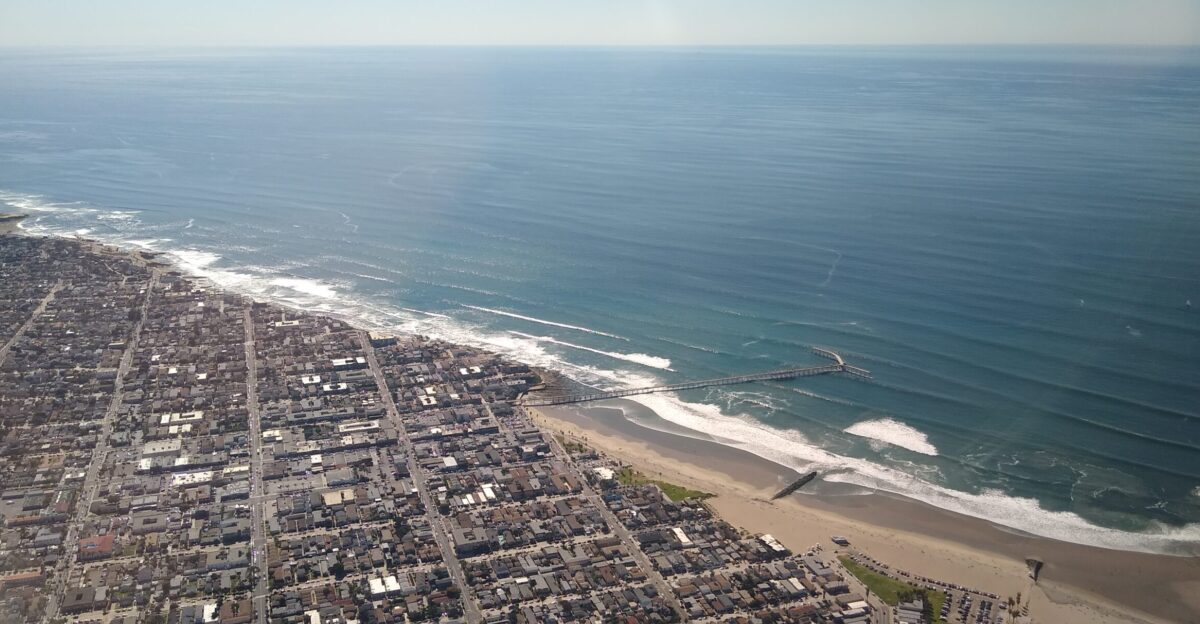
Los Angeles and Southern California Threats

Los Angeles experiences varied subsidence rates across neighborhoods, with the Palos Verdes Peninsula showing dramatic movement. Between September and October 2024, NASA’s radar revealed that parts of this coastal community were sliding toward the Pacific at a rate of 4 inches (10 centimeters) per week.
In parts of Los Angeles and San Diego Counties, human-driven subsidence increases sea level projections by up to 15 inches. Near Los Angeles, reclaimed areas like Newport Beach face significant future flooding risks.
Groundwater Pumping: The Root Cause
The NASA study identifies groundwater extraction as the primary driver of California’s coastal subsidence. When water is withdrawn from underground aquifers faster than natural replenishment occurs, sediment particles reorganize and compress permanently.
This process is largely irreversible, altering subsurface structure and reducing future water-carrying capacity. California’s Central Valley experiences the most dramatic subsidence in the nation.
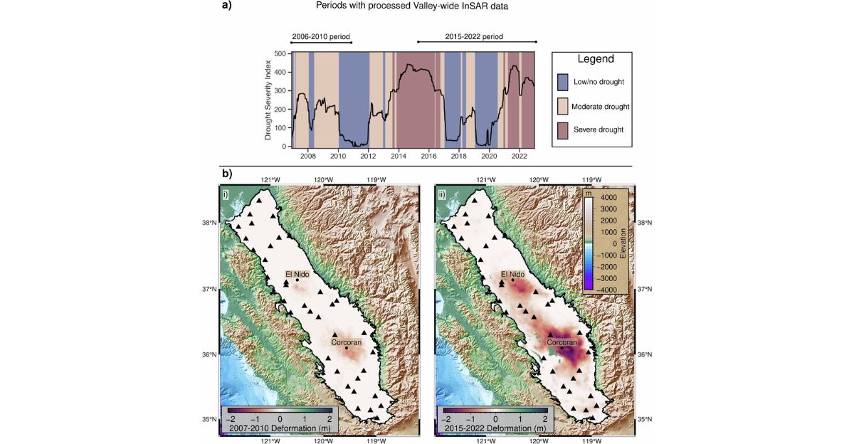
The San Joaquin Valley Crisis
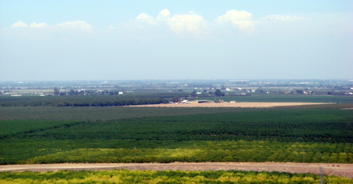
California’s San Joaquin Valley represents the epicenter of subsidence. A November 2024 study found unprecedented sinking rates since 2006, with average subsidence across the entire valley reaching nearly one inch per year. Some localized hotspots experience even more dramatic subsidence.
Extensive areas of the valley have been transformed by decades of intensive groundwater extraction for agriculture, creating the most severely affected region in North America.
Understanding the “Doubling” Effect
The claim that groundwater pumping “doubles sea level” refers to the combined impacts of land subsidence and rising oceans on relative sea level. California’s oceans are projected to rise by 6 to 14.5 inches by 2050 due to glacial melting, thermal expansion, and ice sheet loss.
However, in subsiding areas, relative sea level rise—where ocean meets land—can exceed these projections by 100% or more. This combined effect creates a dangerous “one-two punch” for coastal communities.
Study Leadership and Methods

Lead author Marin Govorcin, a remote sensing scientist at NASA’s Jet Propulsion Laboratory, emphasized: “In many parts of the world, like the reclaimed ground beneath San Francisco, the land is moving down faster than the sea itself is going up.”
The study employed high-resolution satellite radar data spanning 2015-2023 to analyze vertical land motion patterns across California’s 1,000+ mile coastline.
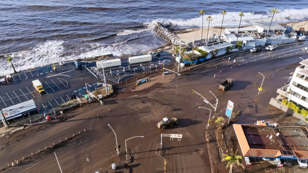
Infrastructure at Immediate Risk
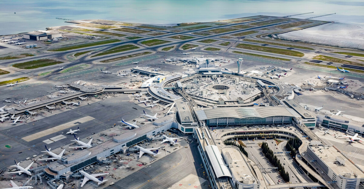
San Francisco International Airport, built largely on landfill and handling 200,000 annual landings with 56 million passengers, faces severe threats. Nearly half of its runways and taxiways could be submerged by water by 2100, when combining land subsidence with sea level rise.
Foster City and other communities built on reclaimed land face similar existential risks. Critical ports, highways, and utility infrastructure throughout California’s coast are increasingly vulnerable to flooding and damage.
Population Exposure and Vulnerability

Between 4.3 million and 8.7 million people in California’s coastal communities are at risk of subsidence. Approximately 460,000 to 805,000 residents live in San Francisco, 8,500 to 2.3 million in Los Angeles, and 202,000 to 2.3 million in San Diego.
Nearly 70% of California’s 40 million residents live near coasts, making them particularly vulnerable to combined threats. These communities face unprecedented adaptation challenges requiring immediate attention and resources.
Expert Warnings and Implications

NASA research scientist Ben Hamlington warned that communities will experience flooding regimes far more severe than anticipated. Even minor tidal events, posing no current threat, can send ocean water ashore. Regular El Niño events will be compounded atop this higher baseline.
The convergence of sinking land and rising seas represents what researchers describe as a “dangerous one-two punch” requiring urgent preparedness and adaptation strategies.
The Palos Verdes Peninsula Landslide Threat
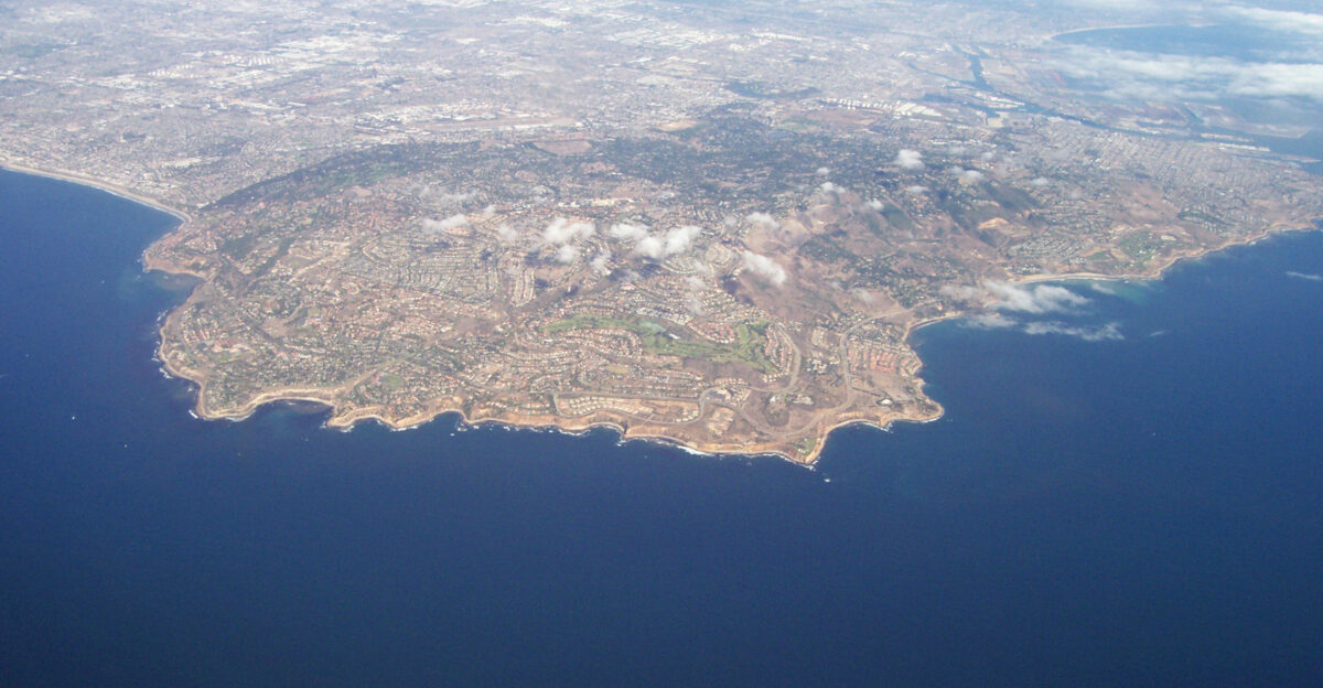
The Palos Verdes Peninsula’s rapid movement prompted Alexander Handwerger, NASA landslide expert, to warn that “the speed is more than enough to endanger human life and infrastructure.” The 4-inch weekly movement, exacerbated by heavy rains in 2023-2024, creates ongoing collapse risks.
NASA’s radar imaging provides critical monitoring data for emergency management officials. This represents one of North America’s most actively moving coastal landslide complexes.
Solutions and Mitigation Strategies
Researchers advocate addressing groundwater overdraft through reduced extraction rates or strategic aquifer recharging via natural channels or injection wells. California has invested in advanced monitoring technologies, including the NASA-ISRO Synthetic Aperture Radar (NISAR) satellite, which was launched in July 2025, and detects land surface movements down to fractions of an inch.
Enhanced data collection will enable water managers to make more informed decisions, thereby protecting infrastructure and ensuring public safety while planning for long-term adaptation.
Signs of Recovery

Some areas demonstrate recovery potential. The Santa Barbara groundwater basin has been slowly rising since 2018 through aquifer replenishment, with areas increasing by several millimeters annually. This evidence proves that with proper management, subsidence can be slowed or even reversed.
Strategic water management, reduced extraction, and artificial recharge programs show promising results. These successes offer blueprints for other California communities facing subsidence challenges.
The Urgent Call to Action

The convergence of sinking land and rising seas presents an existential challenge that requires immediate action. NASA’s study emphasizes a “critical need” to update criteria for assessing sea level rise and subsidence.
Regional estimates substantially understate sea level rise in San Francisco and Los Angeles, projecting more than double the expected rise by 2050. With California’s coastal infrastructure, economy, and millions of residents at risk, urgent real-time monitoring and strategic interventions are imperative for survival.