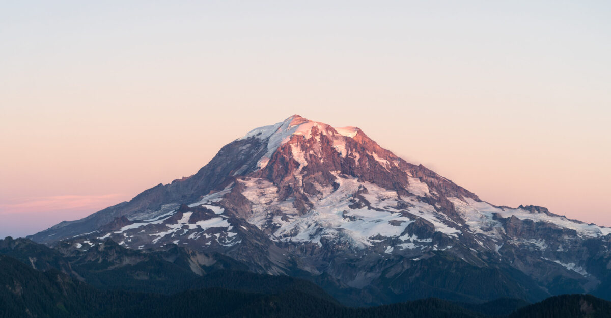
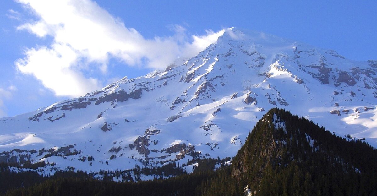
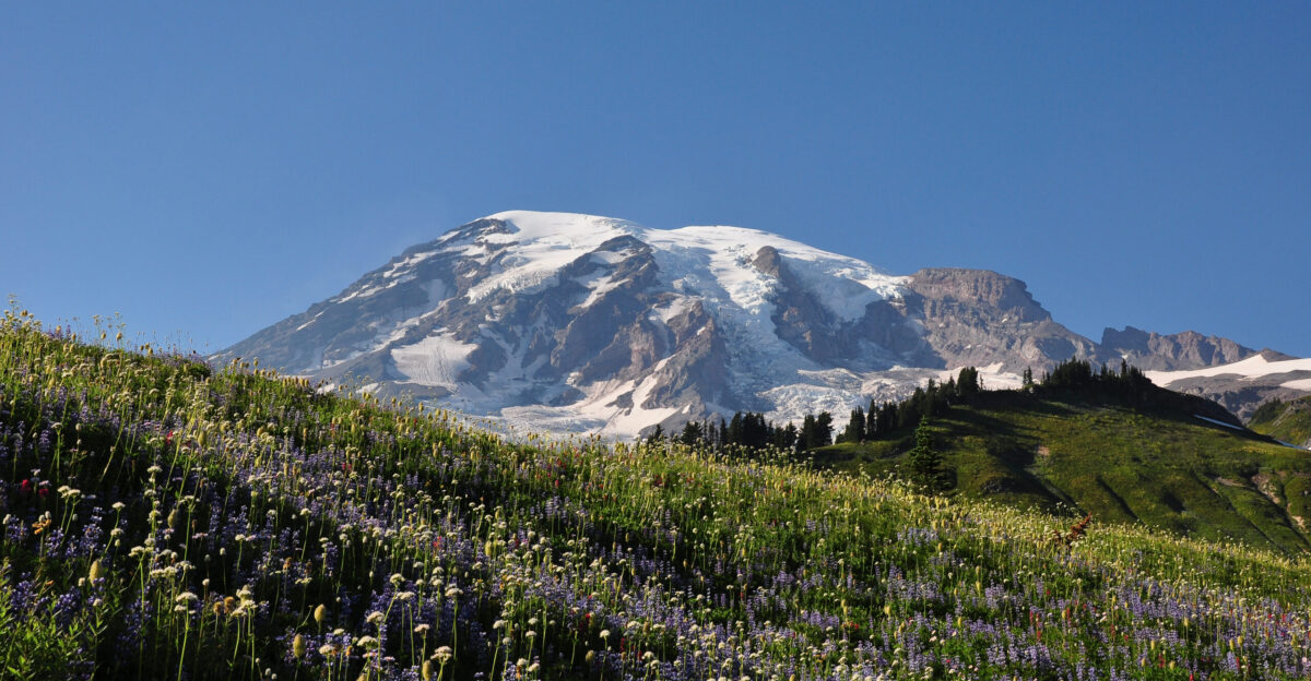
Something impossible happened on a frozen summit in Washington State. The top of Mount Rainier—the highest point that generations of climbers have fought to reach—simply ceased to exist. Not the mountain itself. Just the peak. The crown. The place where countless boots have planted American flags and claimed victory over 14,000 feet of rock and ice.
A new study reveals that Columbia Crest, the iconic summit that stood for centuries, melted away completely and silently relocated 400 feet south. The mountain moved, and nobody noticed.
The Highest Point Is No Longer Where It Used to Be
Imagine reaching the summit of America’s most glaciated peak, only to discover the actual high point is somewhere else entirely. That’s the reality now facing climbers and researchers.
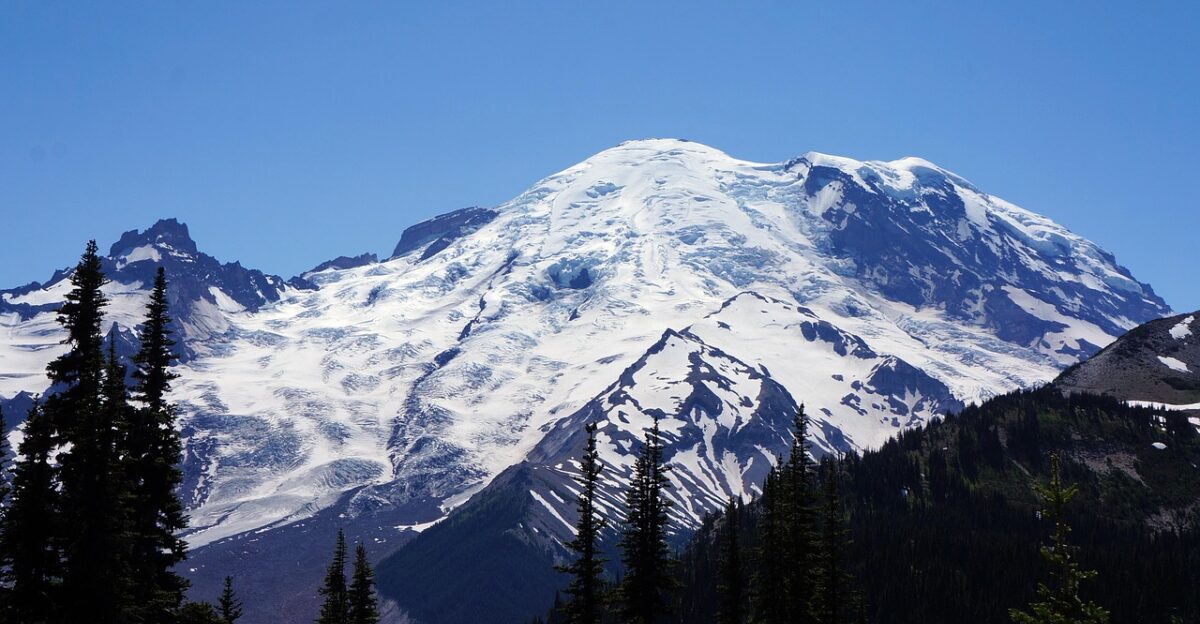
Columbia Crest—the iconic summit that once appeared on every map, guided every expedition, and defined the mountain’s identity—has melted down more than 20 feet since the mid-20th century, according to research published in November 2025 in Arctic, Antarctic, and Alpine Research. It is no longer the summit. The mountain has a new king of the hill.
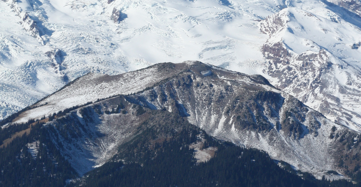
A Mysterious Rocky Outcrop Now Crowns the Mountain
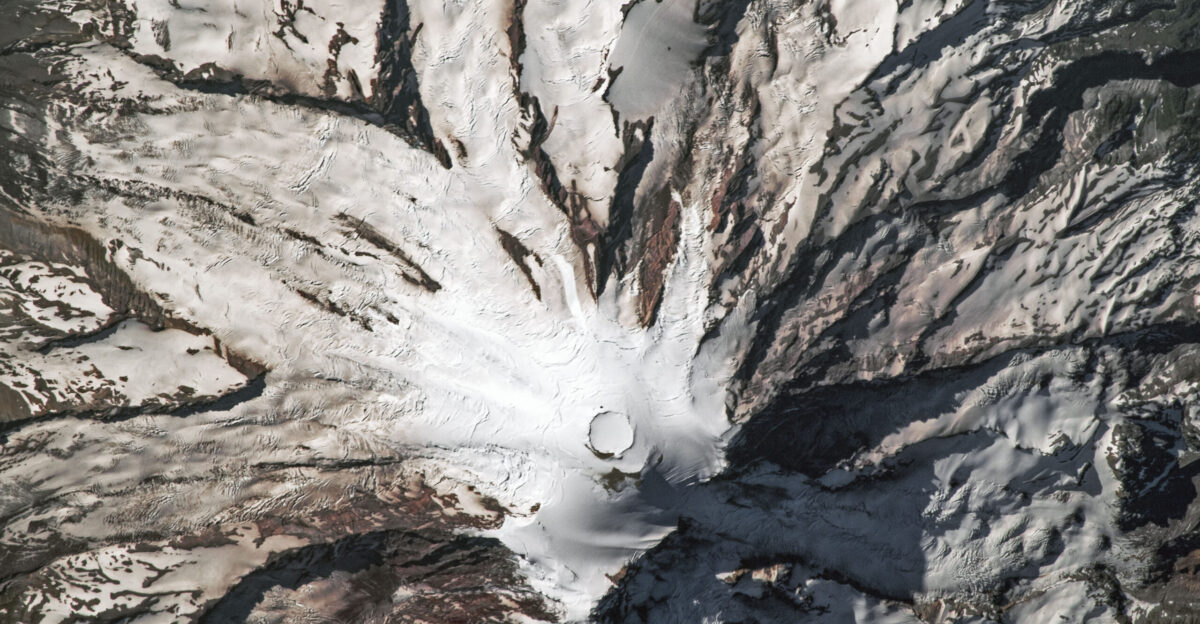
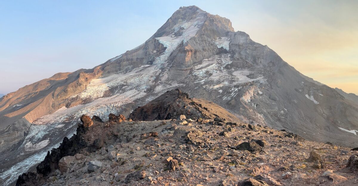
The new summit isn’t the dramatic ice dome climbers expected. It’s a rocky outcrop on the southwest crater rim—unglamorous, bare stone where ice once reigned. This spot, located roughly 400 feet (133 meters) from the traditional high point, stands taller than the melting ice that preceded it.
In a stunning twist, the climb to the top now ends on exposed rock, rather than the frozen tower that has defined the climb for generations. As lead researcher, Eric Gilbertson explained it bluntly: “Columbia Crest melted down over 20 feet and is no longer the summit. The new summit is on the southwest rim and is rock.”
One Researcher’s Desperate Trek Exposed the Truth
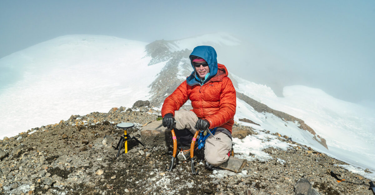
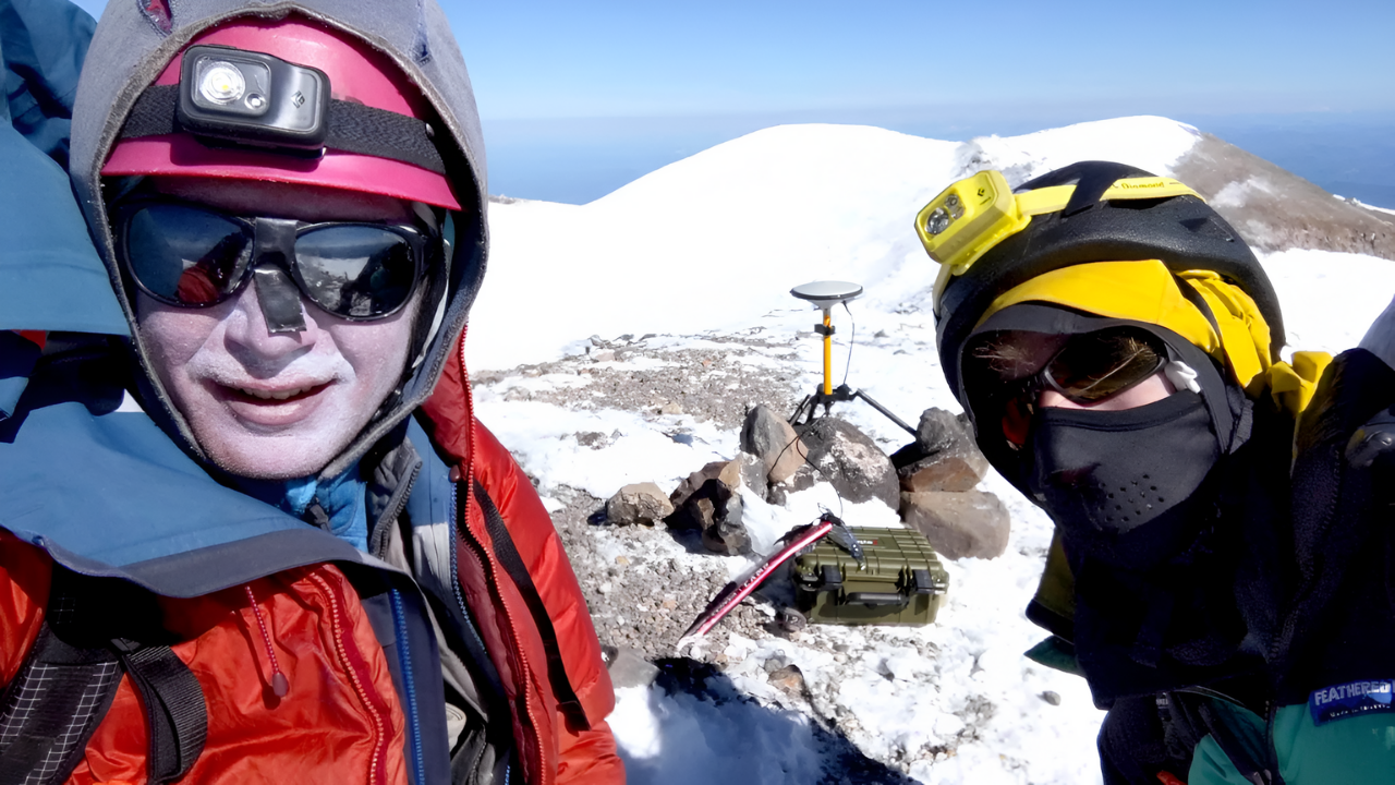
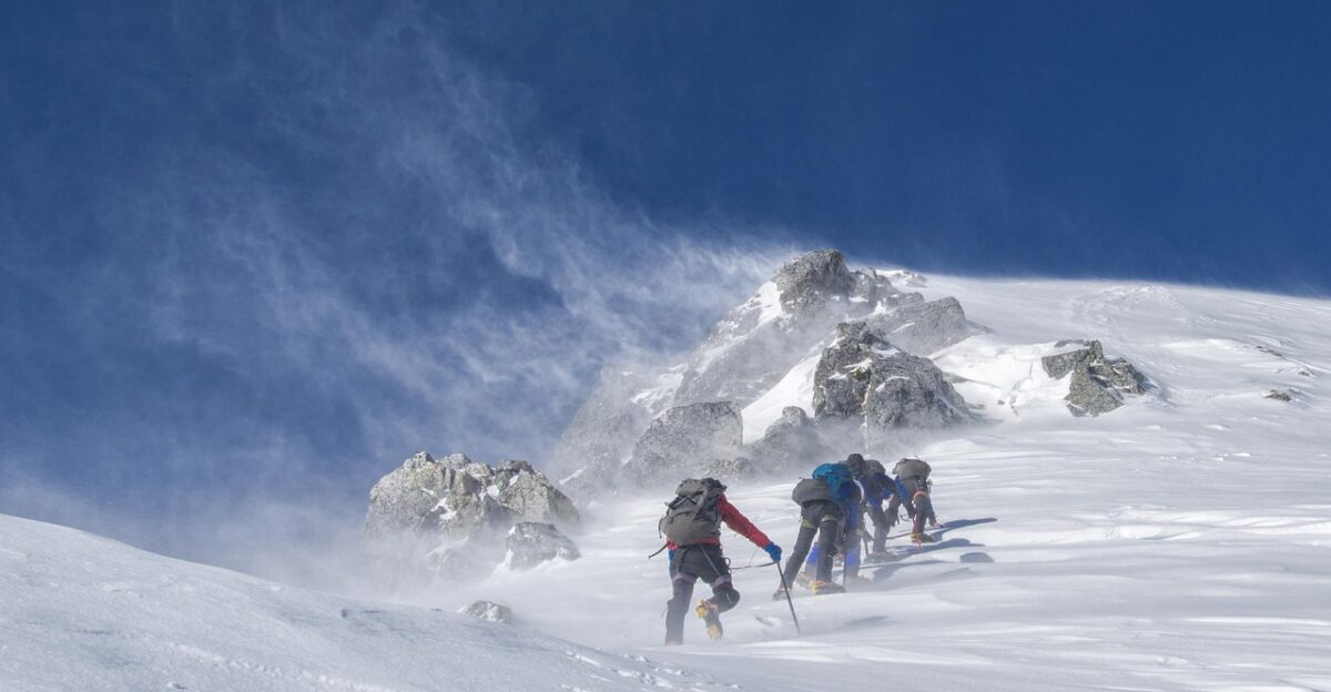
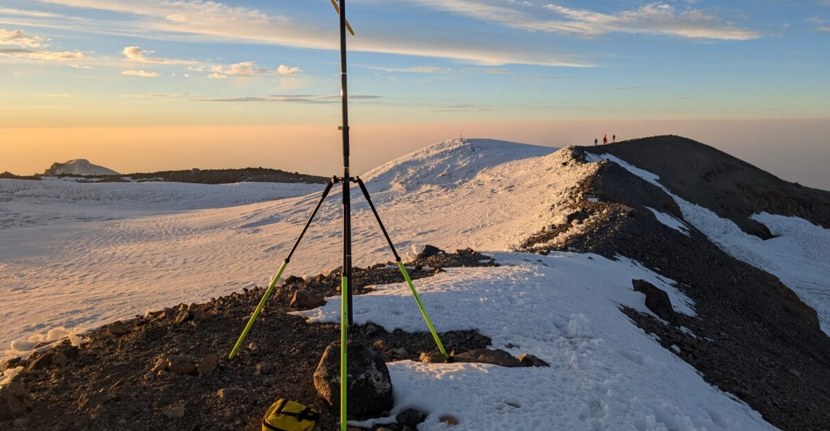
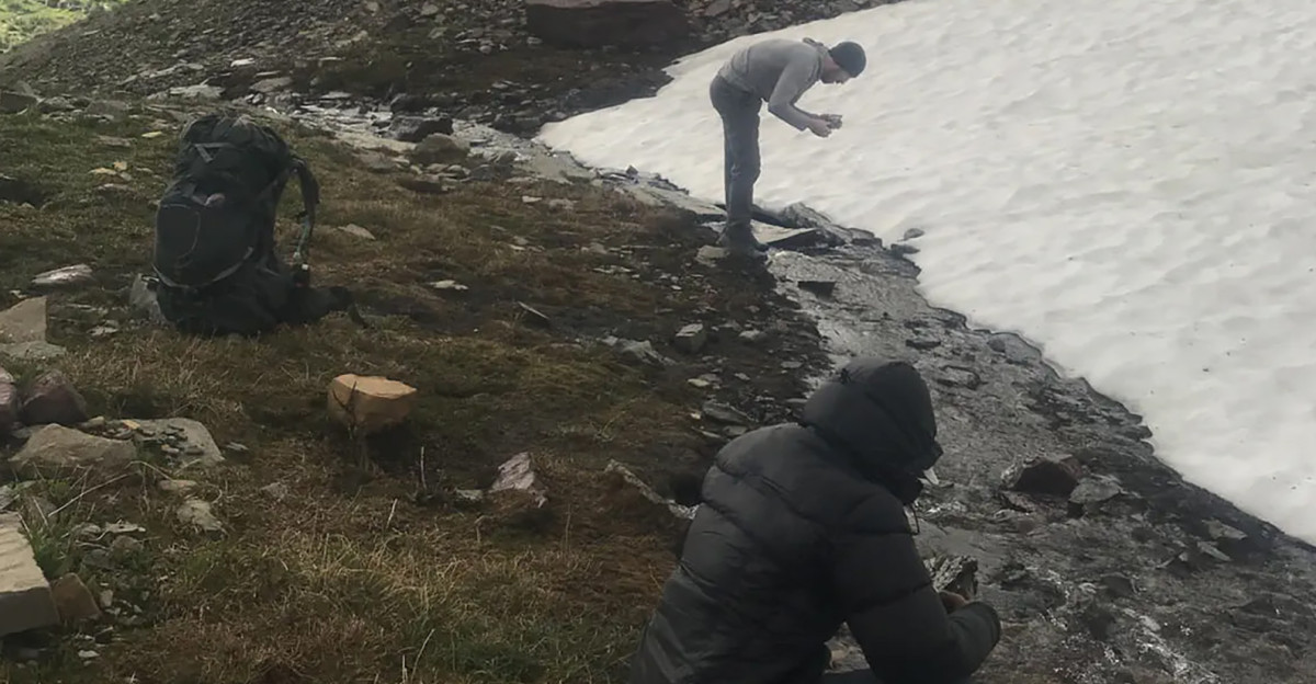
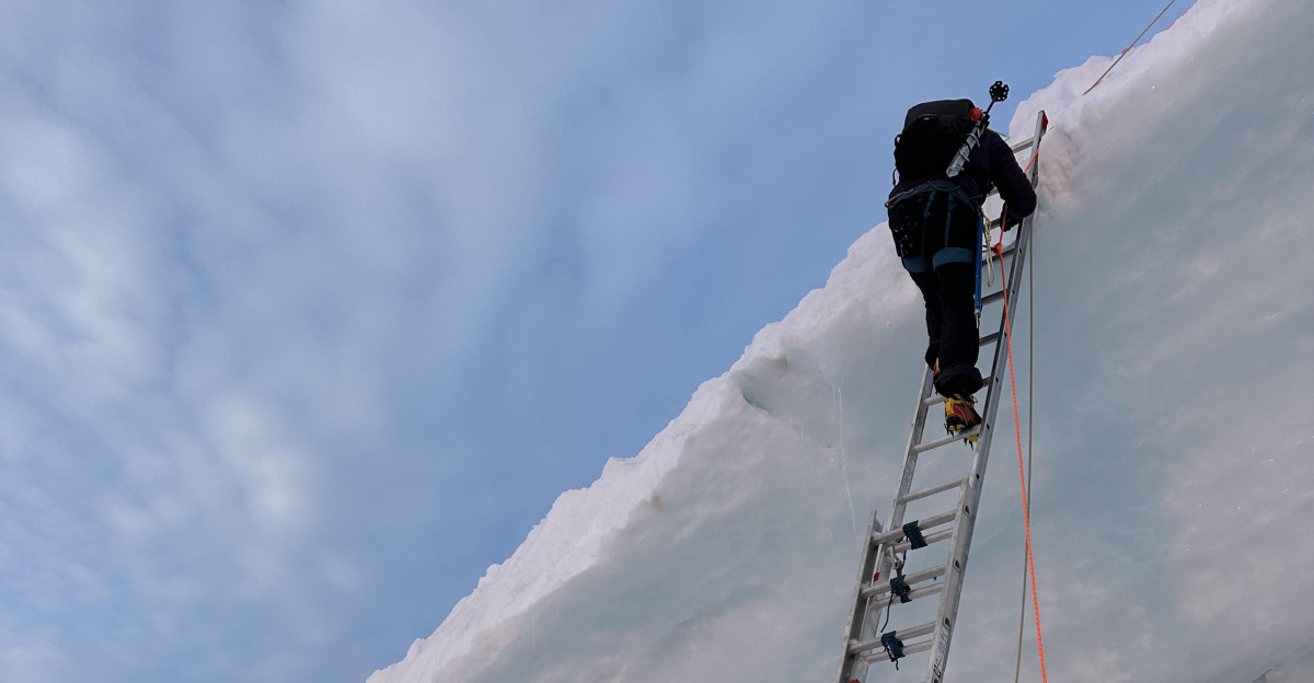
Here’s where the human drama takes a deeper turn. Eric Gilbertson, a mechanical engineering professor at Seattle University, knew something was wrong. He assembled a team and hauled 30 pounds of precision GPS equipment across 18 miles of crevasse-crossed glaciers to reach the summit in late August 2024.
They crossed ladders over gaping holes in the ice, navigated avalanche zones, and climbed through what had become an increasingly treacherous landscape. When he finally obtained the data, the numbers told a story that nobody had fully understood: the mountain was melting faster than anyone had imagined.
The 2023 Expedition Failed
Gilbertson had tried the year before. In September 2023, he attempted to survey Rainier’s summit but was unable to make it. “The mountain was too melted out,” he said. “I couldn’t even get to the top. Too many crevasses opened up.” That single failure speaks volumes.
A researcher trained to handle alpine conditions was stopped by deteriorating terrain. The ice that should have created bridges for safe passage had vanished, replaced by bottomless gaps.
A Study Published in November 2025 Changed Everything
The findings landed like a bombshell: researchers at Seattle University and Utah State University documented that Mount Rainier has lost elevation at an alarming rate—10 feet shorter than in the 1990s alone, with 20 feet of ice vanishing since 1998.
The peer-reviewed study in Arctic, Antarctic, and Alpine Research represents the first comprehensive measurement of how America’s ice-capped summits are collapsing under climate pressure.
The Thermometer at 14,000 Feet Is Rising Dramatically
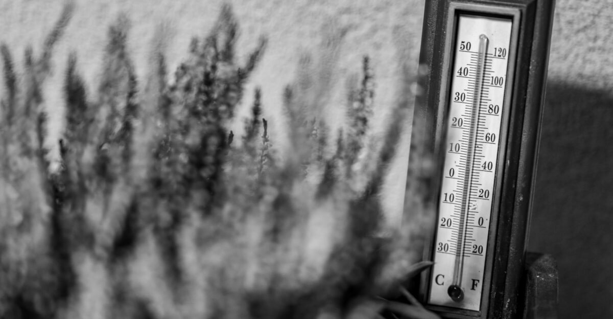
What’s causing this? The answer is both simple and terrifying. Summit temperatures have risen nearly 5.5 degrees Fahrenheit since the 1950s—a dramatic warming at elevations where cold was supposed to be permanent. That may not sound catastrophic at sea level, but at the summit of Mount Rainier, every degree matters.
A few degrees warmer means more melting, less accumulation, and a fundamentally altered mountain. The cold refuge is no longer cold enough.
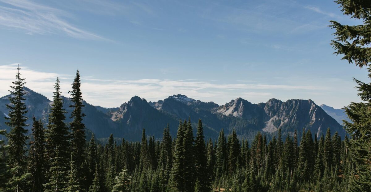
Four Other Washington Peaks Are Disappearing Too
Mount Rainier isn’t alone in this crisis. The continental United States has only five ice-capped summits—and all five are in Washington State. Four of them have now lost 20 feet or more of elevation.
This isn’t a localized phenomenon. It’s a coordinated collapse of the coldest, highest places in the continental U.S. Liberty Cap and Colfax Peak are the sole survivors still maintaining year-round ice at their peaks. The others are surrendering to rock.
Only Two Summits Remain Truly Frozen
The numbers are stark: of Washington’s five ice-capped peaks that once seemed eternal, only Liberty Cap (on Rainier’s flank) and Colfax Peak (near Mount Baker) still hold year-round ice at their highest points.
Eldorado Peak, East Fury, and now Mount Rainier have all watched their rocky cores emerge as the ice that buried them for millennia vanished. Future generations won’t recognize the mountains their grandparents described.
The Worst Is Happening Faster Than Anyone Expected
Here’s what should terrify climatologists: the most significant changes aren’t centuries old. They happened in the last 30 years. All the transformations that glaciologists spent decades documenting got compressed into a single human lifespan.
The acceleration is undeniable. What took generations to begin now races at breakneck speed. The ice isn’t retreating—it’s collapsing.
Rain Now Falls Where Snow Should Build Ice
The mechanism is deceptively simple. More precipitation at summit elevations now arrives as rain rather than snow, preventing the accumulation that would rebuild ice.
Rain at 14,000 feet was once unthinkable. Now it’s routine. The summits lose ice constantly and gain almost nothing to replace it. It’s a one-way process toward a rockier, drier future.
Mount Rainier Feeds Five Major Rivers That Sustain Millions
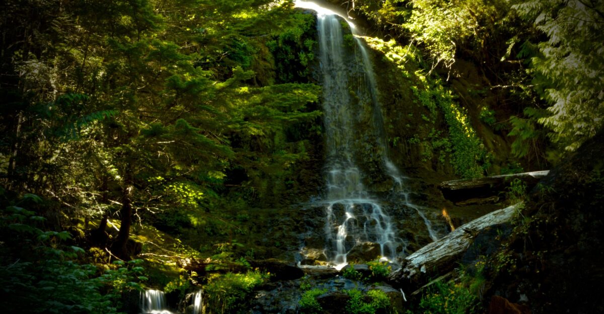
This isn’t abstract science. Mount Rainier’s glaciers are the headwaters of five major Pacific Northwest rivers—water systems that provide drinking water to millions, spawning grounds for iconic salmon runs, and power for hydroelectric dams.
Every foot of ice lost is a foot of summer water supply diminished. Downstream communities, cities, and ecosystems all depend on Rainier’s frozen reserve. The melting mountain poses a direct threat to the region’s future.
Half the Ice Has Vanished in a Single Human Lifetime
National Park Service data from 2023 showed the stunning scale: Mount Rainier has lost roughly 50 percent of its glacier mass since 1896. But here’s the heart-stopping part—losses have accelerated dramatically in recent years.
Three glaciers—Stevens, Pyramid, and Van Trump—are effectively gone or in terminal decline. A mountain that looked the same for centuries is being erased in decades.
A Renowned Scientist Called the Findings ‘Shocking’
Scott Hotaling, a watershed sciences professor at Utah State University and co-author of the study, worked as a climbing ranger on Mount Rainier. His reaction to preliminary measurements revealed how unexpected this was: “I was shocked… Because Mount Rainier is the highest, coldest mountain in the Western U.S., and climate change has such a dramatic impact, year over year, at the summit—that means it’s happening everywhere.”
Translation: if the coldest place is melting, nowhere is safe.
About 10,000 People Test Themselves on This Mountain Every Year
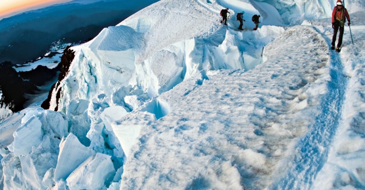
The human stakes extend to those who climb it. Roughly 10,000 adventurers attempt Mount Rainier’s summit annually, with about half succeeding. Many dream about it for years. They train, save money, and risk their bodies on ice and at high altitudes.
They’re chasing a mountaintop experience that their parents had. But the route is becoming more dangerous. The terrain is more exposed. The crevasses are deeper and more unpredictable. The mountain they’re climbing is becoming a different mountain.
Scientists Couldn’t Even Reach the Summit in 2023
The deterioration is happening faster than anyone can measure. When Gilbertson tried to survey Rainier in September 2023, conditions were so degraded that he turned back miles from the summit. “Too many crevasses opened up,” he explained.
A professional researcher trained for alpine hazards couldn’t proceed. That reveals the speed of collapse—crevasses that had existed for centuries can open and become impassable in a single season. The mountain is literally breaking apart.
The Park Says ‘Not So Fast’
Mount Rainier National Park hasn’t confirmed the study’s findings. Terry Wildy, the park’s chief of interpretation, stated the results are “not confirmed” and raised concerns about methodology. The National Park Service requested raw data for independent verification. It’s a necessary check on any dramatic claim—but it also means the scientific establishment is treating this cautiously.
Either way, independent verification is coming. In 2026, the Land Surveyors’ Association of Washington plans its own expedition.
The Verification Expedition Will Show Even More Loss
Here’s what makes this wait unbearable: by the time surveyors return to Rainier in 2026, more ice will have melted. More crevasses will have opened. The summit may have shifted further. The mountain won’t wait for institutional verification.
It will continue to change, melt, and become something new. Every month of delay means more data lost, more ice gone. The mountain is a moving target, literally.
Even America’s Most Glaciated Peak Cannot Escape
The most profound message arrives here: if Mount Rainier—America’s most heavily iced peak, sitting at 14,000 feet, in one of the coldest regions of the contiguous U.S.—cannot escape warming, then no mountain can.
There are no refuges left. No places too high, too cold, or too remote. The atmosphere has reached everywhere. The consequences are visible now, not in distant futures but in the ice melting under our feet, in the summits shifting, in the rivers running dry.
The Top of Washington State Just Moved—And Everything Downstream Will Feel It
A mountain’s summit seems permanent until it isn’t. Mount Rainier’s crown has shifted 400 feet south, from ice to rock. The change tells us something urgent: the world’s coldest, highest refuges are melting. Millions depend on the water that flows from Rainier’s glaciers.
Thousands chase the climbing experience it offers. Everyone downstream shares in the consequences of its collapse. The mountain just moved. And in moving, it’s rewriting the future of the Pacific Northwest.
Sources:
Arctic, Antarctic, and Alpine Research (November 2025) — Gilbertson et al., peer-reviewed study on Mount Rainier elevation loss and ice-capped peak shrinkage
Seattle University & Utah State University Research Team — Lead investigators Eric Gilbertson and Scott Hotaling; differential GPS survey data (August 2024)
National Park Service Mount Rainier Glacier Monitoring Program — Historical glacier mass balance and elevation data (1896–2023)
U.S. Geological Survey Climate & Cryosphere Research — Regional temperature trends and precipitation pattern documentation
Land Surveyors’ Association of Washington — Independent verification expedition planned 2026