Mid-December is shaping up to deliver a kind of cold most Americans have never felt. MIT climatologist Judah Cohen isn’t hedging his words, warning that what’s barreling toward the Northeast could bring “the most extreme cold on Earth.”
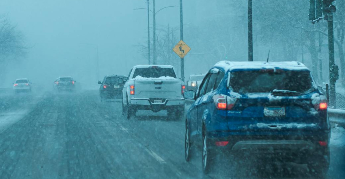
This isn’t the main event just yet—that’s still days away. What you’re feeling now is only the opening act sweeping across the Midwest, and even the so‑called warm-up is already brutally cold.
The Appetizer Nobody Ordered
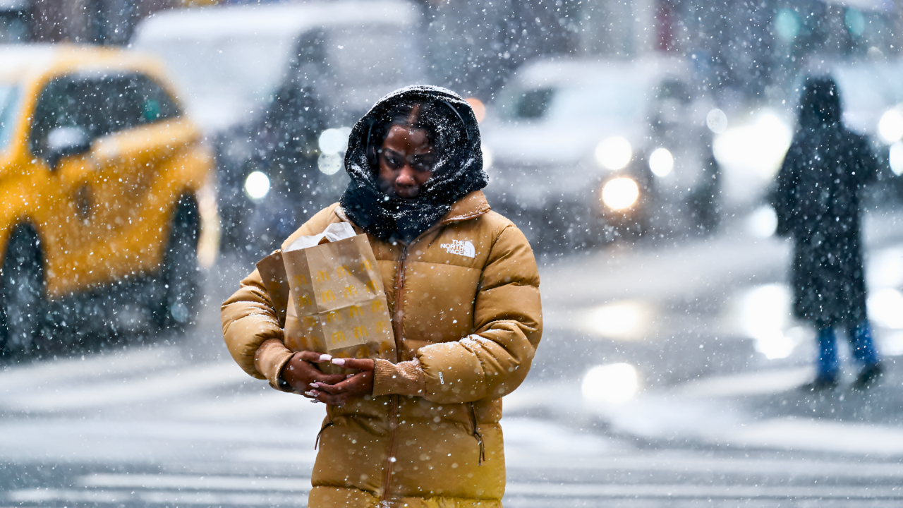
Chicago, Milwaukee, and Des Moines are cities bracing for single-digit temperatures by the end of the week. Some areas have already hit zero or dropped below. These aren’t February numbers. They’re November numbers, meaning something atmospheric has fundamentally shifted.
The culprit? A stretched polar vortex sliding south much earlier than expected, much lower than models predicted, carrying Arctic fury directly toward America’s heartland with unusual intensity.
When a Polar Vortex Wakes Up, It Changes Everything
You’ve heard “polar vortex” thrown around. But what’s actually happening? Normally, Arctic cold stays locked north. The polar vortex acts like a lid. When that lid weakens or stretches, frigid air breaks through like water breaching a dam.
According to the National Weather Service and Cohen’s analysis, this November-onset disruption is nearly unprecedented—a stratospheric warming event triggering a cross-polar flow bearing down on North America with rare intensity and persistence.
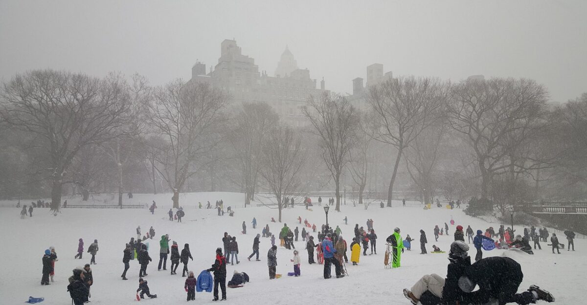
Thanksgiving Was a Travel Nightmare
Rewind to last weekend. Lake-effect snow dumped 12-plus inches across the Midwest, with some regions buried under 24 to 30 inches. Snowfall rates hit 2 to 3 inches per hour. Airlines canceled 2,679 flights.
Eighty million Americans attempted to travel, and millions experienced significant disruptions. It was chaos. But Cohen wants you to understand something crucial: that was just the appetizer. The main course arrives mid-December.
Americans Learned the Hard Way
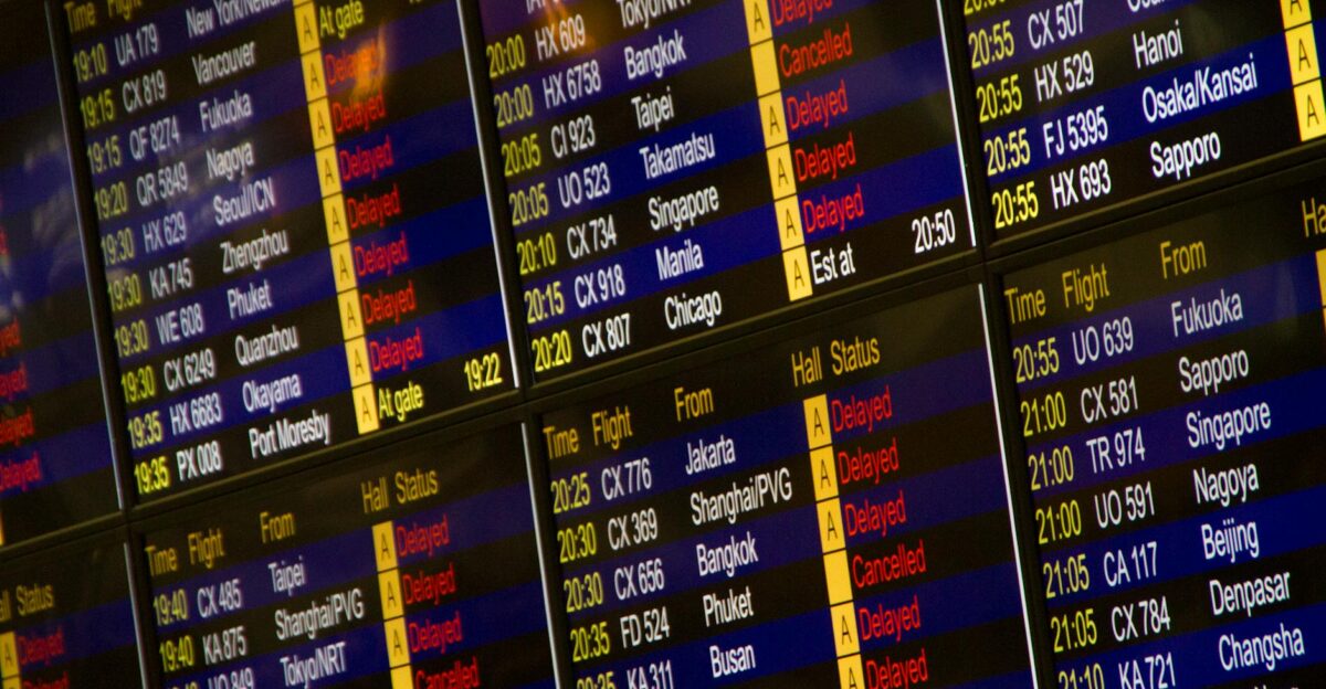
Over Thanksgiving, 2,000 flights were canceled on Saturday alone, with an additional 679 on Sunday. Thousands faced delays rippling through Chicago, New York, Detroit, and Minneapolis. The FAA clocked 232,000 flights during Thanksgiving week alone.
Despite record volumes and severe disruptions, that travel disaster was merely Phase One. Phase Two—the full force of the stretched polar vortex—arrives in roughly two weeks.
235 Million Americans Are About to Shiver Together
Approximately 235 million Americans face below-freezing conditions stretching from the Mountain West through the mid-Atlantic and the entire Interstate 95 corridor. Think about that scale: a geographic span from Canada’s plains to America’s most densely populated coastal cities, all experiencing simultaneous extreme cold.
Forecasters say this synchronized Arctic intrusion across heavily populated regions is practically unprecedented.
The Northeast Isn’t Ready for What’s Coming.
When mid-December arrives, the Northeast won’t just experience cold—it’ll experience cold far more severe than current Midwest conditions. Cohen’s models predict temperatures 15 to 20 degrees below normal December averages, with some areas potentially experiencing 30 to 50 degrees below seasonal expectations.
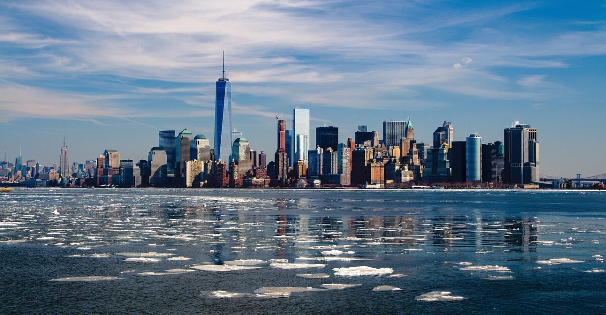
New York City, typically 37 degrees mid-December, faces potential persistent highs in the low 20s or teens. Philadelphia, Boston, all of Interstate 95? Their December might look like early February.
A Second Wave Arrives Right on Schedule
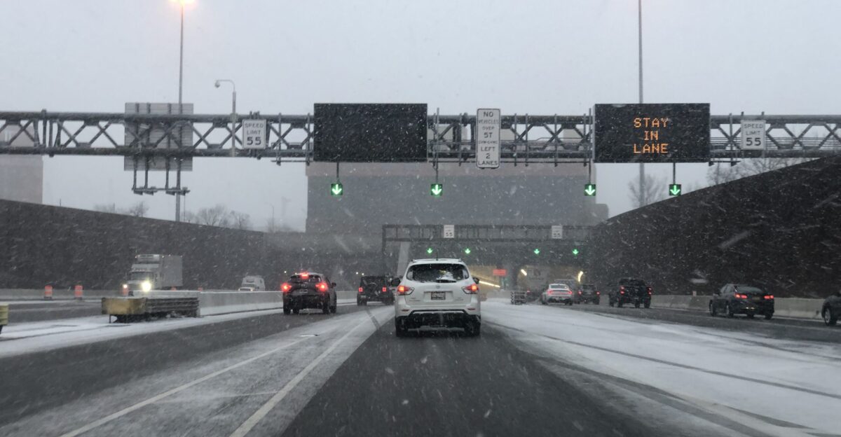
Before the extreme cold of mid-December fully settles, another winter storm is expected to target the Northeast on Monday into Tuesday. Forecasters predict 6 inches or more of snow for certain Northeast urban areas, with 3 to 5 additional inches expected across the Midwest.
According to AccuWeather meteorologist Brandon Buckingham, the rain-versus-snow boundary along Interstate 95 could shift northward—meaning snow reaching Philadelphia, New York, even Boston.
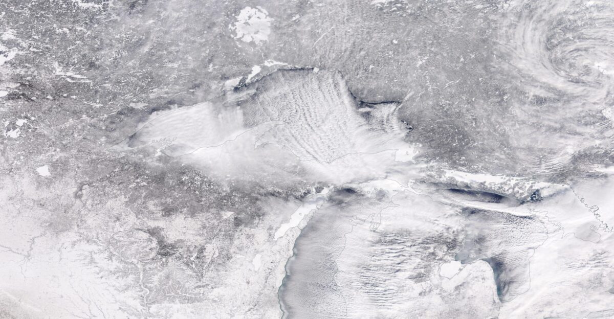
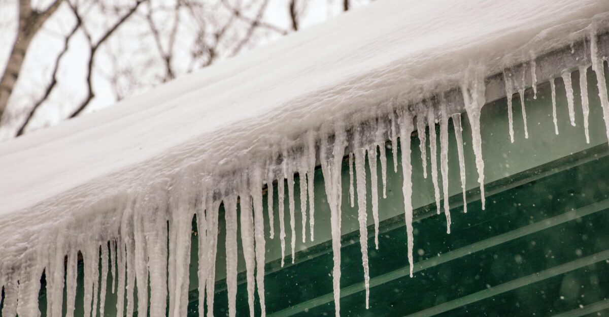
When the Great Lakes Turn Against You
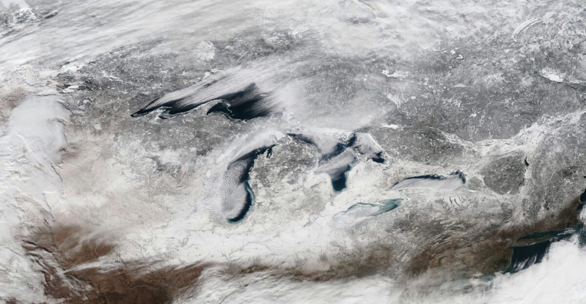
The Great Lakes have not yet entirely frozen. Cold air sweeping over still-unfrozen water unleashes intense lake-effect snow. Northwestern Pennsylvania and western New York remain under warnings through early December, with 12 to 24 additional inches possible.
Northern Michigan and Ohio face similar threats. The National Weather Service warns of 1 to 2 inches per hour of snowfall—creating whiteout conditions and life-threatening travel hazards that reshape holiday plans.
Will New York Finally Get a White Christmas?
New York City got its first white Christmas in 15 years during 2024—the first since 2009, when 2 inches blanketed Central Park. The National Weather Service officially declares a white Christmas when 1 inch or more of snow covers the ground at 7 a.m. on December 25.
Here’s the intriguing part: with mid-December bringing extraordinary cold and increased precipitation odds, meteorologists say a white Christmas is “more possible than normal” for NYC.
Anomalies Like 30 to 50 Degrees Below Normal
Temperature anomalies of 15 to 20 degrees below normal are already projected for the Northeast. But here’s what haunts meteorologists: some areas could experience 30 to 50 degree departures from seasonal expectations, rendering December conditions more typical of early February.
Wind chills could plummet dangerously into life-threatening territory. These dramatic departures occur once every decade, perhaps less frequently. When extreme cold combines with heavy snow, infrastructure cracks, emergency services overflow, and public health crises emerge.
Coast to Coast Gets Hit
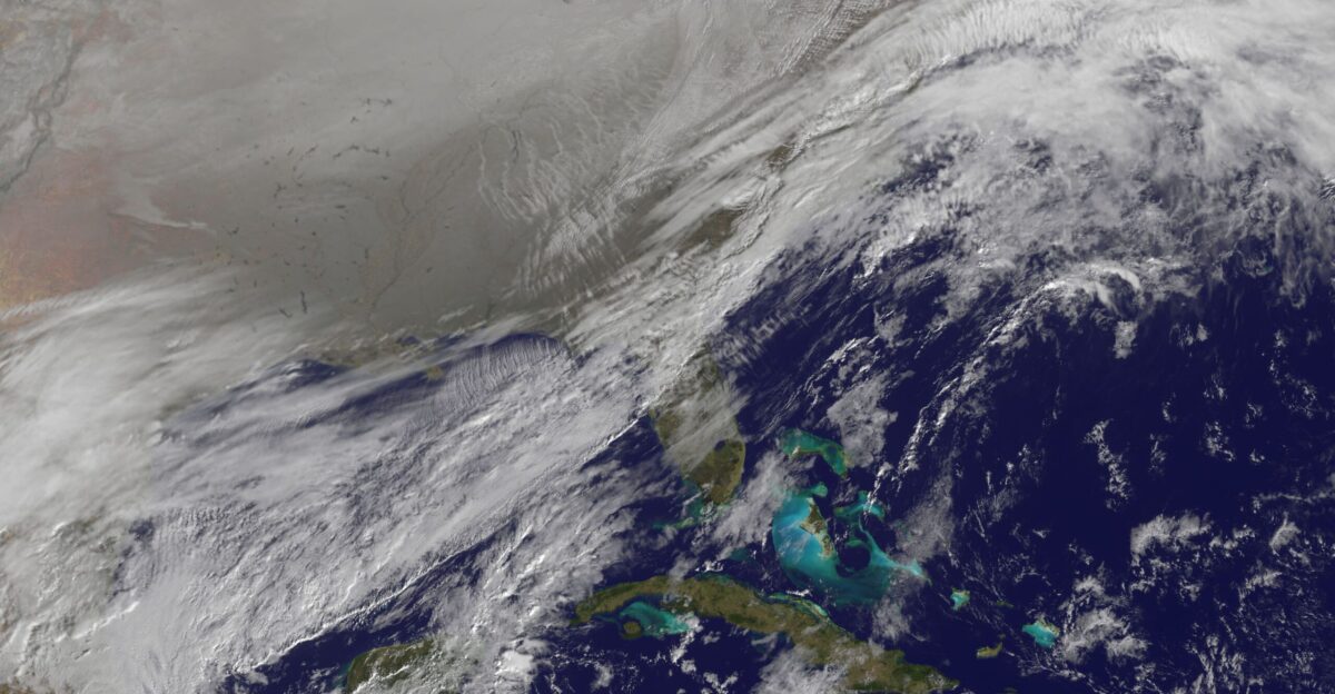
The National Weather Service Climate Prediction Center forecasts colder-than-normal conditions across the entire northern and northeastern United States, with subzero temperatures expected from eastern Montana through North Dakota, Wisconsin, Minnesota, and into the Great Lakes.
Below-freezing conditions extend southward through Texas and as far south as northern Florida. This isn’t regional. This is a coast-to-coast Arctic outbreak.
We Don’t Know Exactly How Cold
Here’s something refreshing about Judah Cohen: he doesn’t pretend certainty where none exists. “How cold will it get? We don’t know exactly,” Cohen stated plainly. However, his weather modeling system indicates that the East Coast will experience the most unusually cold air compared to monthly averages anywhere on Earth during the third week of mid-December.
The stretched polar vortex creates inherent forecast uncertainty. Yet, despite this, Cohen expresses genuine confidence that the mid-December cold will exceed current Midwest extremes.
Why Warming Creates Freezing

This event involves unusual stratospheric warming—air temperatures rising miles above where weather actually occurs. Counterintuitively, this unleashes severe ground-level cold when polar vortex winds reverse. According to NOAA meteorologist Amy Butler, it’s a physics lesson most people never needed.
Unlike typical sudden stratospheric warmings, which last up to two months, this prolonged polar vortex disruption will likely dominate December weather patterns for several weeks—an exceptionally rare early-winter pattern shift.
December Plans Are About to Complicate

Holiday travelers face significant disruption risks during the peak of the polar vortex in mid-December. Extreme cold combined with heavy snow potential threatens flight operations, highway safety, and ground transportation. Airlines already managing Thanksgiving’s chaos prepare contingency plans for potential December disasters.
The convergence of peak holiday travel volume and severe weather creates a perfect storm scenario. This isn’t fear-mongering. This is practical reality.
235 Million People Face Extreme Cold

Utilities, emergency services, and public infrastructure all face a compounded strain from the extreme cold, affecting 235 million Americans simultaneously. Power grids prepared for typical December demand may struggle under extreme conditions. Water pipes in unprepared areas are at risk of freezing and rupturing.
Homeless populations without adequate heating face life-threatening exposure. Healthcare systems prepare for cold-related injuries. This is an overlapping infrastructure crisis.
Buffalo 2022: A Cautionary Tale
Judah Cohen references December 2022’s Buffalo blizzard as a cautionary precedent. The stretched polar vortex event produced a record-setting blizzard, resulting in numerous fatalities and paralyzing the entire region.
While 2024’s event differs atmospherically, the underlying mechanism—a stretched polar vortex—shares fundamental similarities.
Winter 2013-14 Called. It Wants Its Polar Vortex Back.
Weather experts struggle to recall recent December events of comparable severity and geographic scale. This polar vortex disruption combines early-season timing with unprecedented reach. Historical comparisons suggest that winter 2013-14 was a notable example, as stretched polar vortex events recurred throughout the entire season.
Cohen indicates that such recurring patterns in rare winters continue unfolding month after month. If 2024-25 follows this precedent, December’s extreme cold represents only the beginning—a harbinger of an exceptionally harsh winter.
What Comes After Mid-December
Cohen predicts mid-December’s extreme cold represents the season’s most severe period as currently forecasted. However, here’s what complicates this: his models suggest that another stretched polar vortex may develop in the latter half of December.
This could bring milder air briefly mid-month—breathing room before conditions shift colder near the holidays.
December Is About to Become Unforgettable

Two weeks separate us from the arrival of mid-December. That’s enough time to prepare—check on vulnerable neighbors, winterize your home, stock up on supplies, adjust travel plans, and monitor forecasts regularly. Cohen’s “main course” isn’t speculation. It’s based on atmospheric science that most people never learn.
The polar vortex isn’t breaking rules for entertainment. It’s fundamentally shifting because global atmospheric patterns are creating rare and dangerous weather events. The cold is coming. The snow is coming. How prepared will you be?
Sources:
Judah Cohen, MIT Climatologist – Polar vortex modeling, temperature anomaly forecasts, stratospheric warming analysis (USA Today, Yahoo News, November–December 2025)
National Weather Service – Official polar vortex timeline, temperature forecasts, lake-effect snow warnings, coast-to-coast cold outbreak alerts (NWS Climate Prediction Center, December 2025)
NOAA – Stratospheric warming event analysis, polar vortex disruption mechanics, sudden stratospheric warming (SSW) briefings (NOAA Climate.gov, November–December 2025)
FAA Records – Thanksgiving flight operations data, cancellation statistics, record flight volumes (FAA, November 2025)
National Weather Service Lake-Effect Snow Warnings – Pennsylvania and New York snowfall predictions, 12–24 inch accumulation forecasts, whiteout condition alerts (NWS, November–December 2025)