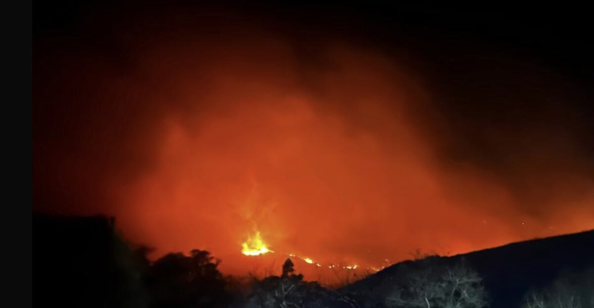
As Chelan County residents awoke on September 28, 2025, an urgent message reverberated through the community: the Labor Mountain Fire had more than doubled in size overnight. Flames raced through thick timber near Blewett Pass, fueled by strong winds and dry conditions that significantly worsened the outlook.
The threat was not just to homes but also to vital roadways, prompting officials to issue stark “Get out now!” orders. “We’ve never seen anything like this,” remarked a local farmer, highlighting the community’s alarm. The urgency was apparent; this was not just another wildfire but an unfolding crisis.
Urgent Warnings Widen

By September 30, the situation had evolved rapidly as evacuation orders expanded beyond initial zones, with containment efforts lagging behind the fire’s explosive growth. “It feels like the fire is staring us down,” expressed a concerned resident as they packed their belongings with urgency. Chelan County Emergency Management issued an immediate evacuation warning to thousands, while road closures further compounded the already dire situation.
The air quality reached hazardous levels, prompting many to consider health risks in addition to safety concerns. Officials emphasized the unpredictability, noting that the fire was “evolving hourly.” The community faced uncertainties that left everyone on edge.
A Historic Wildfire Region
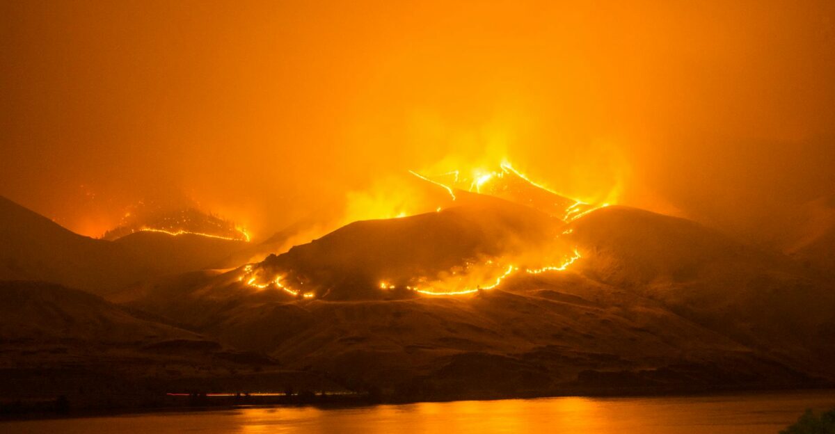
Central Washington’s forests boast a long and formidable history with wildfires, as seen in the Okanagan-Wenatchee National Forest. This area, known for its rugged and fuel-dense terrain, presents colossal challenges for firefighting efforts. “If the fire can find a way to spread, it will,” noted a local forest analyst, emphasizing the steep hills and dense brush that regularly thwart containment strategies.
With climate factors shifting, managing these challenges has become increasingly complex. Many residents have watched these landscapes transform, anxious over what this means for their homes and livelihoods. The stakes couldn’t be higher.
Increased Drought, Fewer Defenses
Years of intense drought and heat have become a relentless pressure on Washington’s forests. State officials, including Commissioner of Public Lands Dave Upthegrove, have consistently warned against the consequences of budget cuts: “We’re only setting ourselves up for more and bigger fires,” he stated.
As the Labor Mountain Fire raged, the community grappled with a stark reality: inadequate resources were heightening the risks. Firefighters pushed back against the flames, but every day’s delay felt like a ticking clock. Residents were left contemplating the implications of these relentless conditions on their beloved landscapes and homes.
Sudden Surge: The Nugget
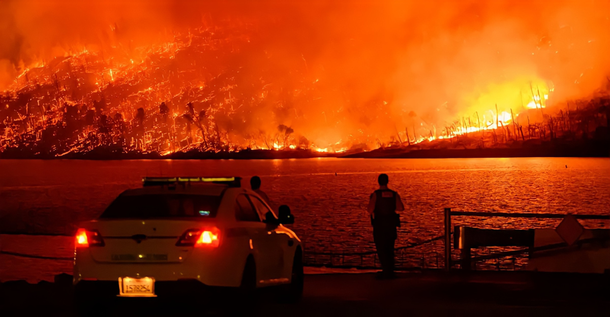
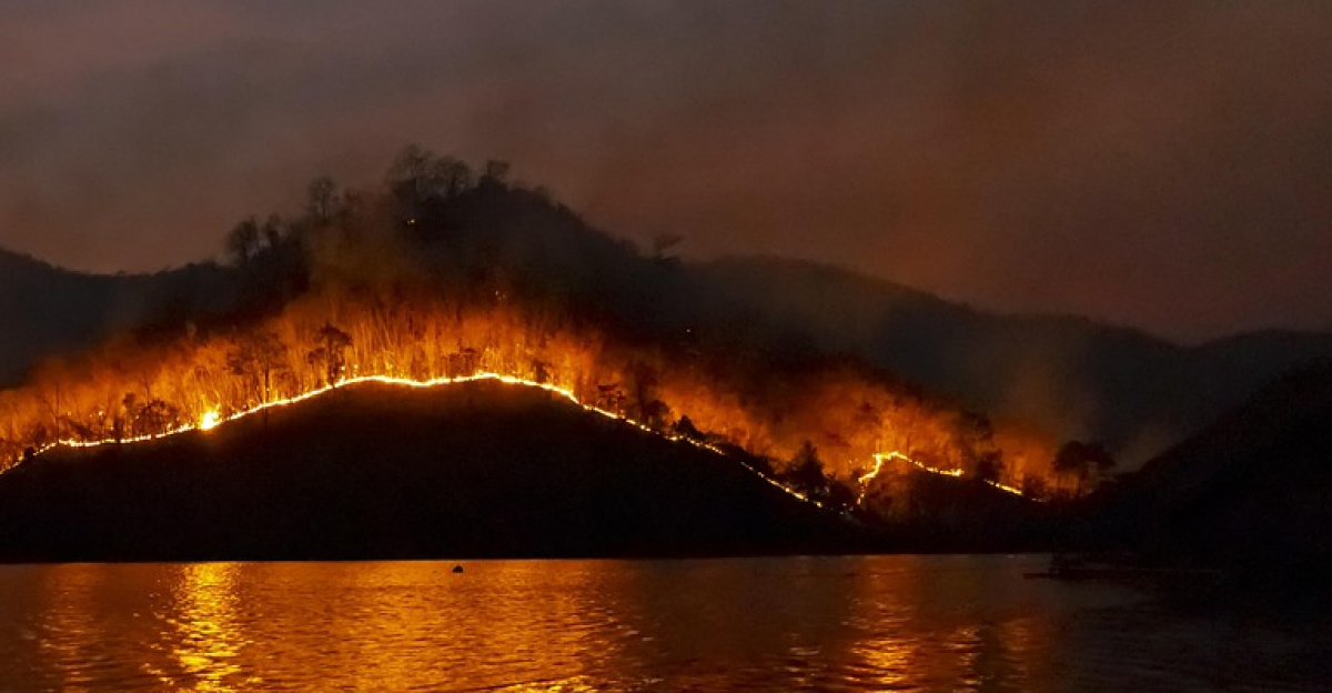
On that fateful day, September 30, the Labor Mountain Fire surged past an alarming 35,000 acres, prompting Level 3 “Get out now!” evacuation orders across areas including Mission Creek Road and the US 97 corridor. As officials urged residents to “Leave immediately,” the urgency could be felt.
“This is a nightmare,” stated a resident as they hurriedly packed their car. In the face of fear and uncertainty, survival instincts kicked in. The community braced for the worst, aware that this catastrophe was unfolding with alarming speed, showcasing the unpredictability of nature.
Communities in Peril
The unfolding disaster forced thousands of residents in Chelan County to flee, leaving behind homes and precious belongings. “My heart is heavy; we can’t just pack up memories,” said a local mother as she prepared to evacuate. A 30-mile closure of US 97 further isolated some areas, creating a sense of panic and desperation.
Valley Hi and parts of Cashmere were particularly vulnerable, with shelters quickly reaching capacity. Coupled with anxious families waiting for news, the situation highlighted the fragility of community bonds and the overarching struggle against nature’s unyielding forces.
Everything Changed in Hours
Resident Lisa Martinez captured the chaos of the moment, stating, “I grabbed what I could, but there was no time.” Standing outside the Christ Center Church shelter, she described how unexpected the evacuation had been.
Red Cross volunteers worked around the clock, assisting those who arrived with little warning. “People are traumatized,” shared a volunteer, emphasizing the emotional toll on evacuees. For many, their lives changed in a matter of hours, and the uncertainty that lay ahead loomed large, hinting at a long road to recovery for the community.
Strain on Emergency Systems
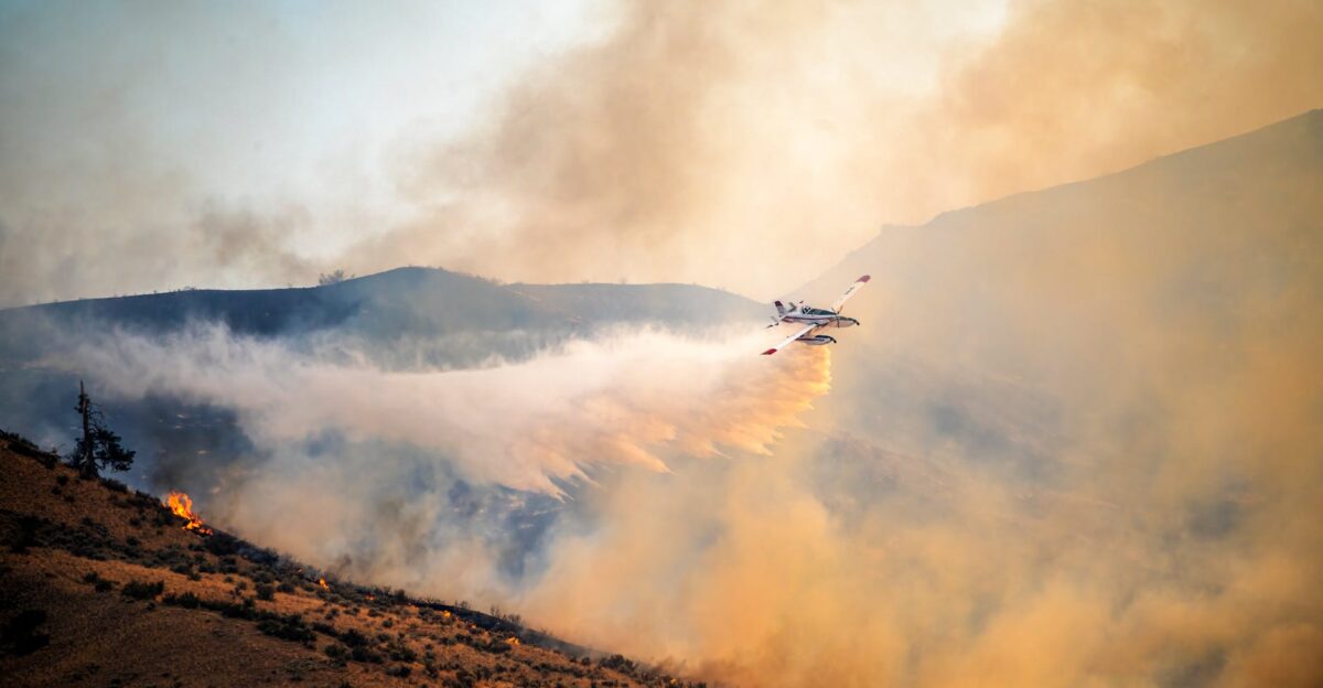
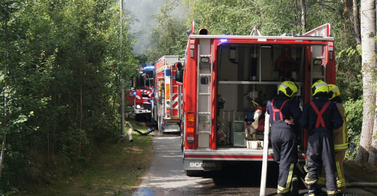
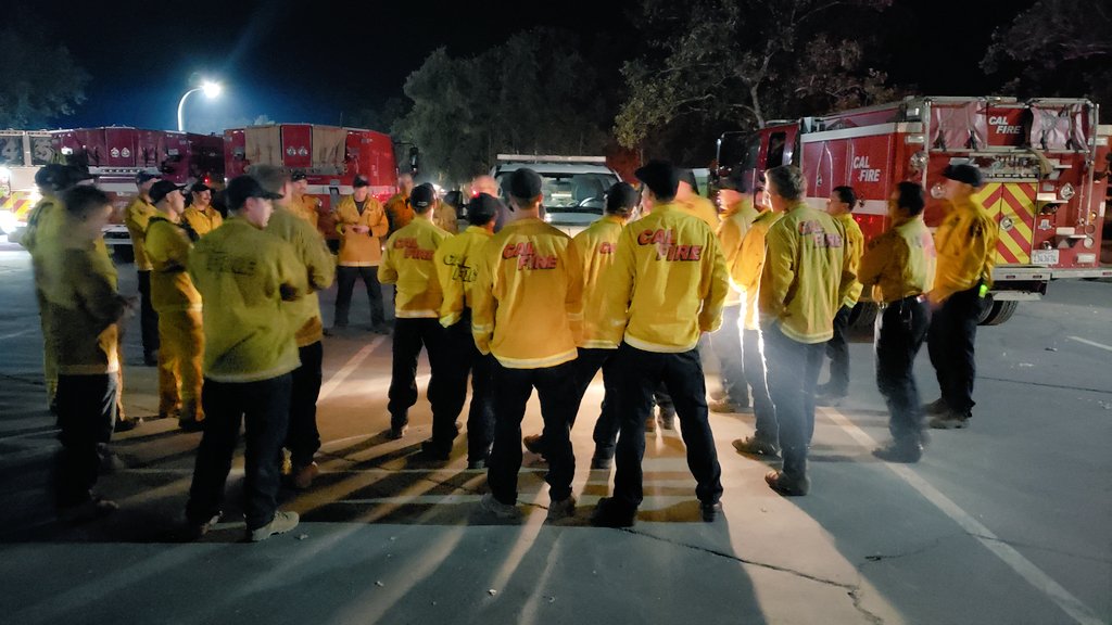
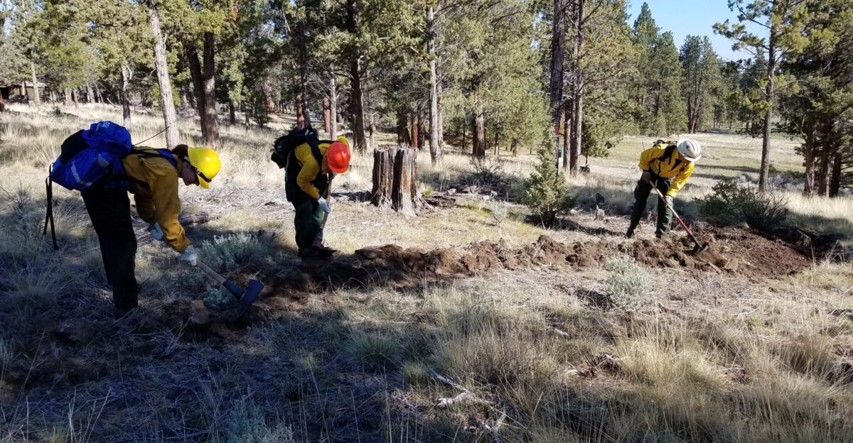
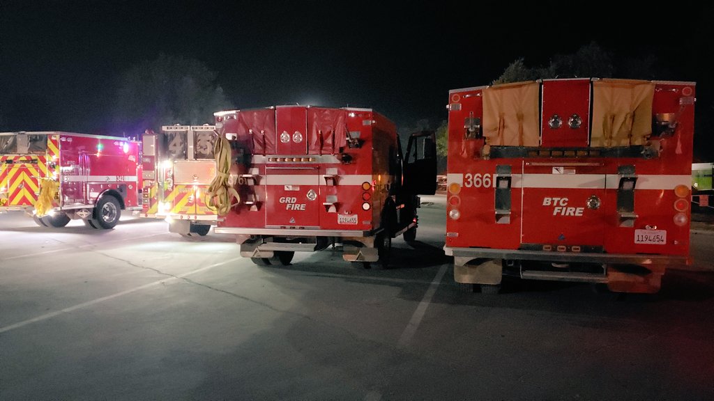
The rapid escalation of the Labor Mountain Fire tested the resilience of Washington’s emergency infrastructures. “We have to mobilize resources fast,” stated State Patrol Chief John Batiste, who authorized the mobilization of outside crews at the request of Fire Chief Andy Lee. Hundreds of additional firefighters arrived, intensifying the containment efforts.
As communities watched from the sidelines, the coordination between local, state, and federal agencies became crucial. “Every available person is a lifeline,” remarked an emergency responder, underscoring the critical teamwork required in such dire situations. Residents awaited updates, hoping for effective action amid chaos.
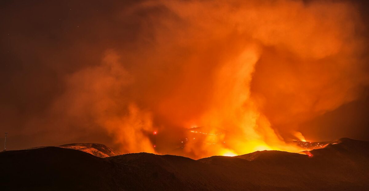
Wildfires on the Rise
By the end of September 2025, the scale of wildfires across Washington had reached alarming heights, with more than 237,000 acres consumed and 11 major blazes active. Incident Commander Jeff Dimke reported that 567 homes were under threat, a figure that sent shockwaves through the community.
“It’s a somber reminder of our changing climate,” he reflected, as residents faced the harsh reality of escalating wildfire challenges. The struggle was not just against fire, but against shifting land management practices and climate impacts, leaving everyone to ponder the road ahead.
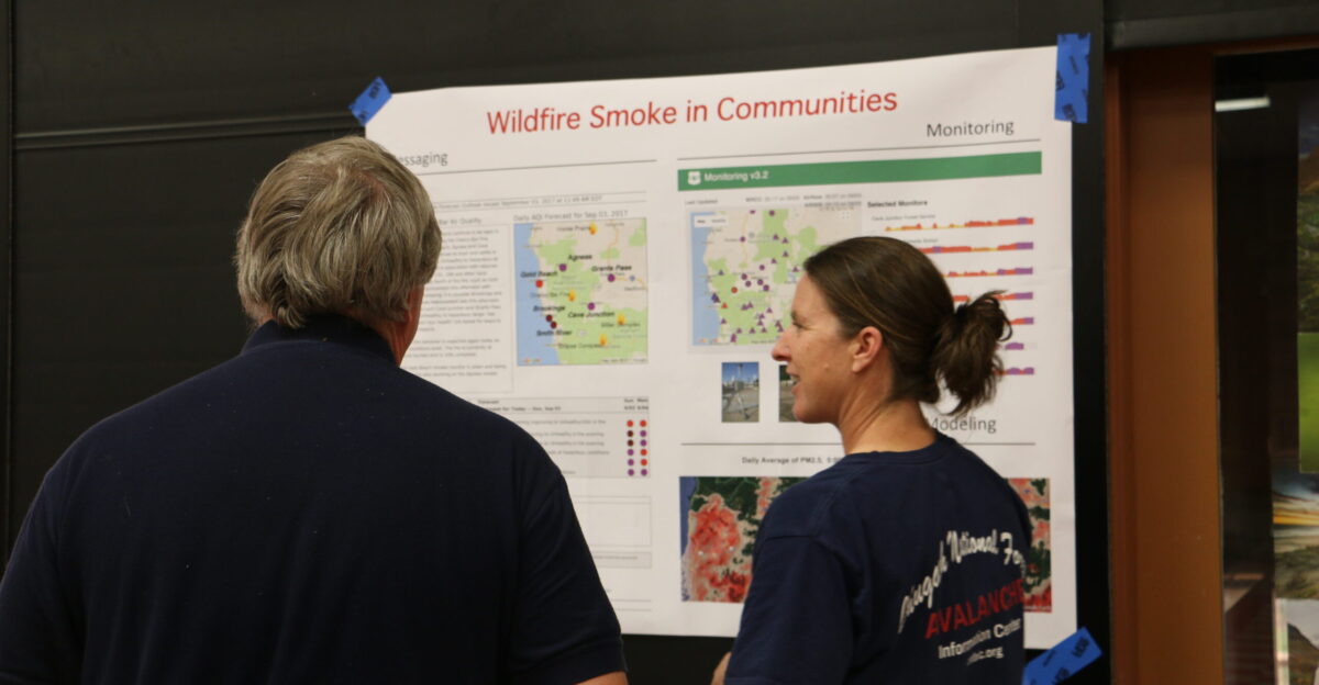
Smoke and Falling Rocks
Beyond the fire itself, the aftermath presented new risks, particularly with smoke and hazardous conditions on US 97. “It’s a different type of danger now,” warned Nancy Jones, an incident spokesperson, highlighting the instability of burned terrain.
Falling rocks and trees posed threats even beyond the immediate fire zones. For those who evacuated swiftly, the future seemed uncertain, and the lingering effects would last far beyond the flames extinguished. Officials noted that worsening air quality and debris would likely delay road openings for months, adding another layer of worry for the impacted communities.
Frustration Mounts
The situation elicited frustration from residents and travelers alike. “There’s no way out except through gridlocked detours,” lamented a Valley Hi evacuee, echoing widespread sentiments. As roadblocks climbed and conflicting updates circulated, anxiety engulfed the community.
Local businesses struggled under mounting challenges, with many being tied up in emergency response efforts. “We’re worried about our livelihoods,” shared a local shop owner, emphasizing the long-term consequences of the fire. The sense of helplessness was palpable as the community sought a way forward through the uncertainty.
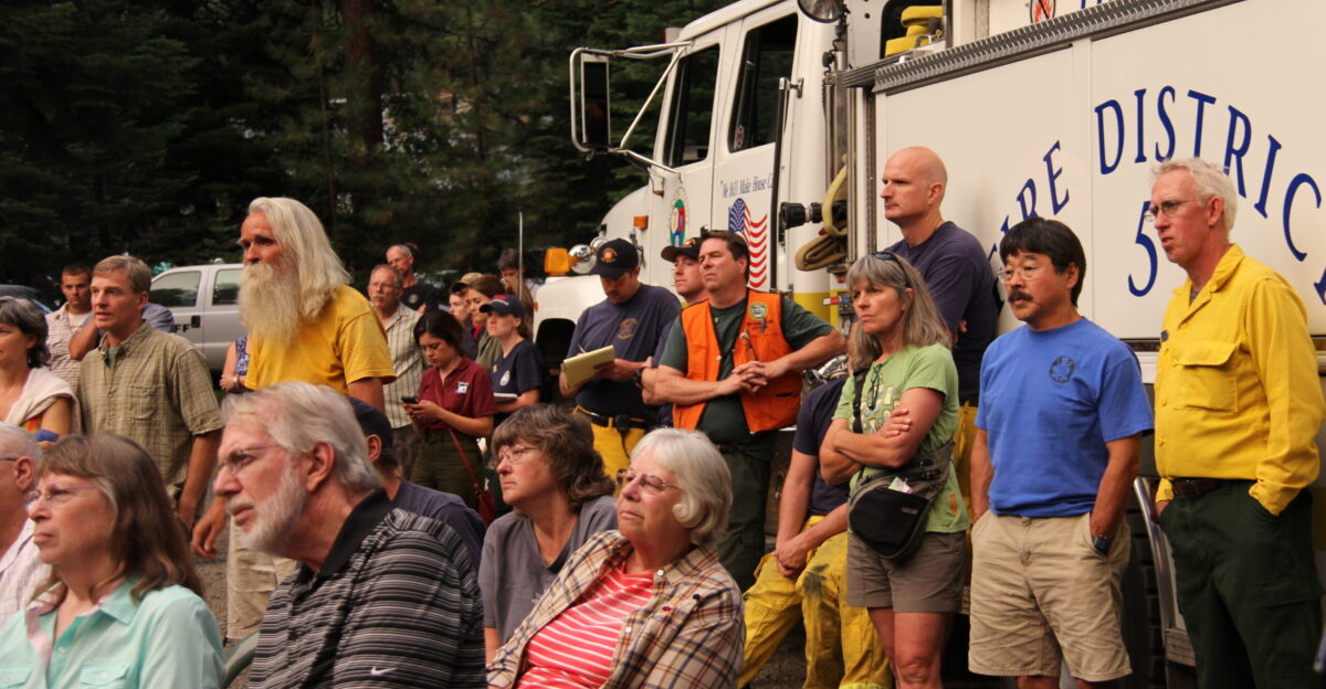
Coordinating Leadership Shift
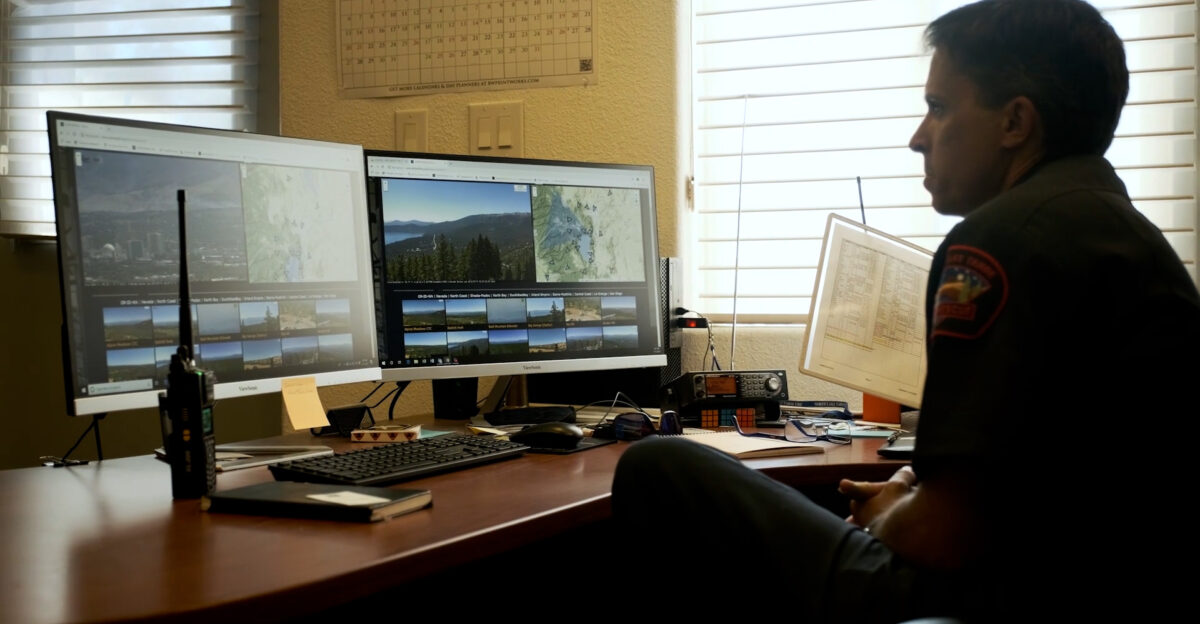
Within this chaotic environment, effective communication and coordination became paramount. Local officials, state agencies, and federal responders worked closely, immersing themselves in the real-time crisis. Incident Commander Jeff Dimke and Fire Chief Andy Lee spearheaded response initiatives, while Emergency Management staff focused on mapping evacuation boundaries.
“We can’t afford any missteps right now,” remarked an emergency manager, stressing the need for ongoing updates to keep residents informed and safe. As the efforts unfolded, community resilience and leadership emerged as crucial anchors amid an ever-changing landscape of challenges.
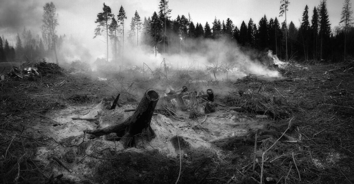
The Aftermath Begins
With the flames extinguished, the real work started. The aftermath revealed the depth of destruction and required a collective effort for recovery. “Our lives will never be the same,” reflected a resident, surveying the damage to homes and the landscape.
Restoration needs loomed large, with many families left wondering how they would rebuild their lives. Federal and state assistance flowed into the region, as officials focused on both immediate relief and long-term recovery strategies. The community faced the prospect of healing together, but the scars of the fire would linger for years to come.
Rebuilding Community Resilience
In the face of adversity, the spirit of Chelan County was evident as communities began the slow journey toward rebuilding. “We’ve always been strong, and we’ll come back stronger,” said a local leader during a community meeting. Efforts to prepare for future fires became a priority, sparking discussions on funding for firebreaks and improved land management practices.
“We need to learn, adapt, and prepare,” emphasized a wildfire expert. The community’s commitment to resilience shone through as neighbors supported one another, united by a shared determination to rebuild their lives and homes after the trauma.
The Role of Technology in Recovery
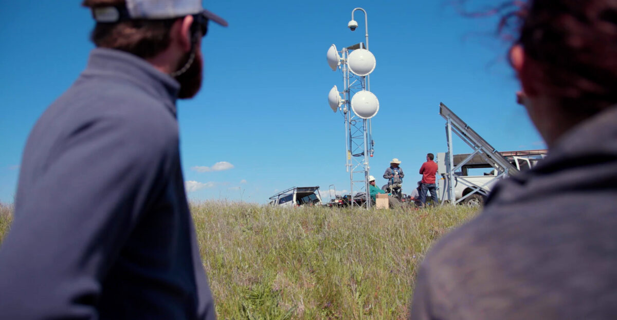
Amid the rebuilding process, technology emerged as a beacon of hope. Digital platforms provided residents with tools to track recovery resources and stay connected. “We’re using every tool at our disposal,” mentioned a local tech developer involved in creating recovery apps.
Real-time updates on road conditions, assistance programs, and safety information became vital lifelines for evacuees returning to their homes. Communities banded together to harness technology for recovery, demonstrating the innovative spirit that thrived even in challenging times. Embracing the future required lessons learned from the past, and technology played a pivotal role in this process.
A Call for Policy Change
The Labor Mountain Fire prompted not only community action but also a sought-after policy change at the local and state levels. “We need a united front against the growing threats of wildfires,” remarked a state legislator in discussions on new fire management initiatives.
Advocates called for increased funding to enhance forest management practices, emphasizing the urgent need to tackle climate influences systematically. The ongoing dialogue around wildfire preparedness and resource allocation shifted focus toward comprehensive policy reformation. Residents rallied behind proposals aimed at creating a safer, more resilient future in the face of climate challenges.
Mental Health Support During Recovery

As the reality of the wildfire’s impact set in, mental health support became a focal point. “We need to ensure everyone has the resources to cope,” noted a community health worker at a recovery workshop. Emotional well-being was highlighted as vital for rebuilding efforts, with support groups forming to address trauma and loss.
Local organizations facilitated counseling sessions and community forums, where residents could express their fears and feelings. The importance of addressing mental health has become evident, highlighting the profound connections between emotional healing and community resilience. Together, they began to navigate the psychological landscape of recovery.
Community Leadership and Volunteerism

In the wake of adversity, community leaders emerged as beacons of hope. “Everyone played a part in helping each other through this,” said a local volunteer coordinator who mobilized relief efforts. The outpouring of volunteerism illustrated the strength of community bonds as residents came together to provide aid to one another.
From distributing supplies to organizing events for families, people from all walks of life contributed to recovery efforts. Community leadership shone through during this crisis, emphasizing unity and compassion as guiding principles that would help Chelan County rise together from the ashes.
The Future of Chelan County
As Chelan County looked toward the future, conversations turned to sustainable practices that could prevent future wildfires. “We’re committed to making changes,” said a resident involved in conservation efforts, highlighting reforestation initiatives and education programs. The collective resolve to adopt a new way of living in the face of fire and climate change emerged as a promising path forward.
Through collaborative efforts, Chelan County aimed not only to recover from the Labor Mountain Fire but also to thrive in a way that respects the land and fosters a more sustainable community. Together, they envisioned a resilient future that honors both nature and humanity.
Lessons Learned and Moving Forward
As the community reflected on the Labor Mountain Fire, they acknowledged the lessons learned through hardship. “We’re more aware now,” noted a local educator, vowing to integrate wildfire awareness into school curricula. The narrative of survival transformed into a powerful testament of resilience and adaptation, reminding everyone that preparation is key.
Local government agencies began implementing educational workshops and outreach programs focused on wildfire risks and preparedness. The hope was to instill knowledge and foster a community that not only survives but learns and grows from its experiences, ensuring no one faces such disasters alone in the future.