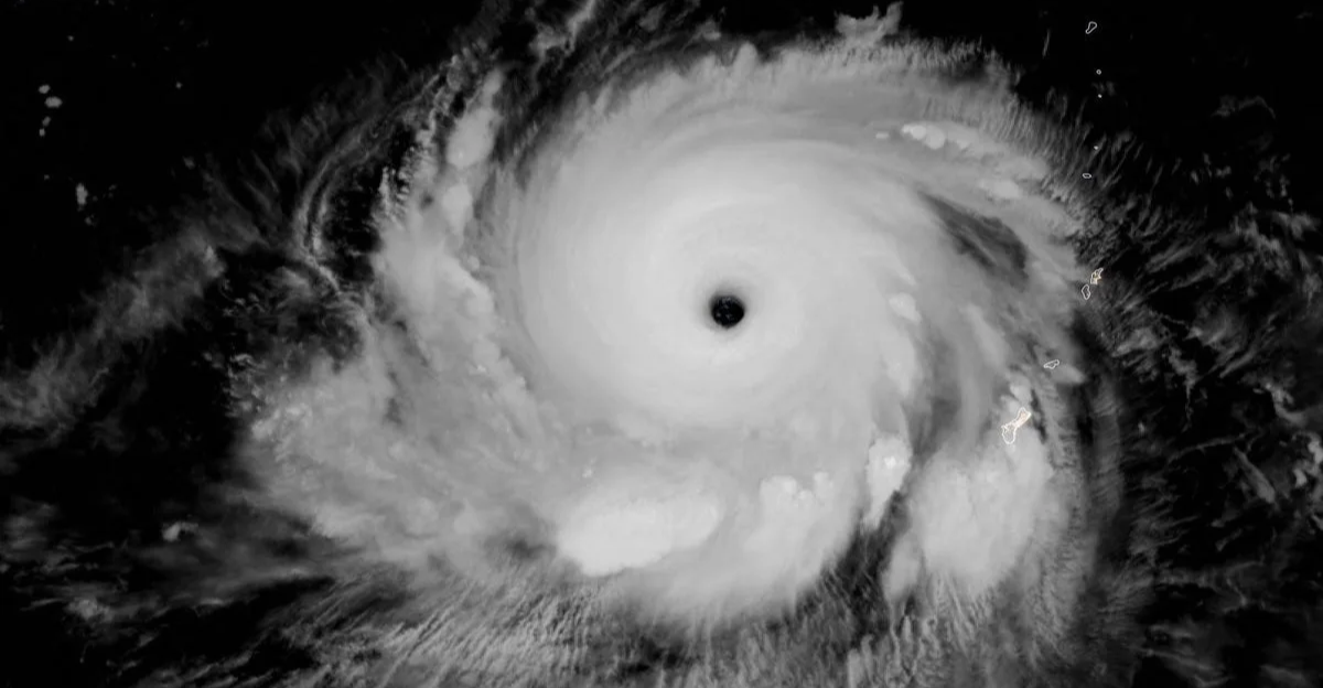
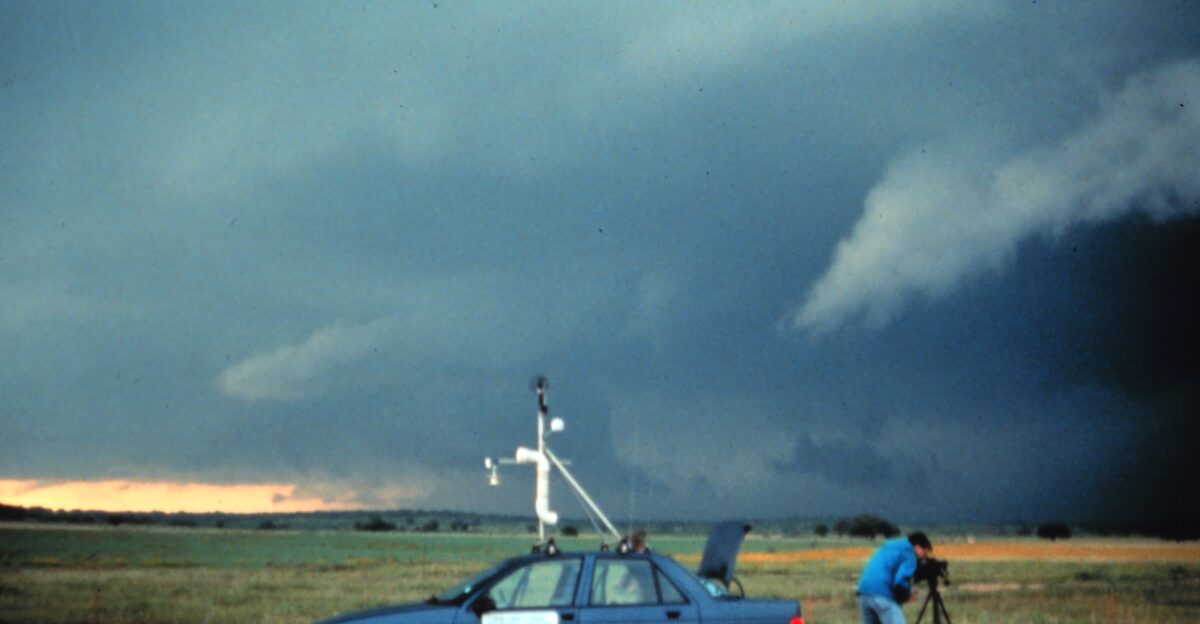
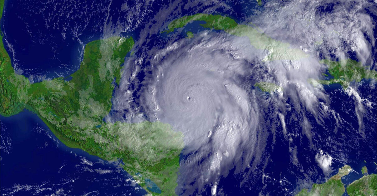
After a stretch of quiet seas, the Atlantic is alive again. Two developing systems, Invest 93L and 94L, are stirring and pushing toward the U.S. East Coast.
Meteorologists say the next 48 hours will be crucial, with heavy rain, gusty winds, and rough surf already in the picture. The National Hurricane Center (NHC) warns that conditions are ripe for rapid development.
A Calm September Ends Abruptly
September had brought an unusual calm, lulling many into a false sense of security. But warm ocean waters and fading wind shear fuel storms with surprising speed.
Experts remind us that hurricane season doesn’t need constant activity to be dangerous. Just a few days can dramatically change the outlook. That shift is happening now, leaving communities with less time to prepare.
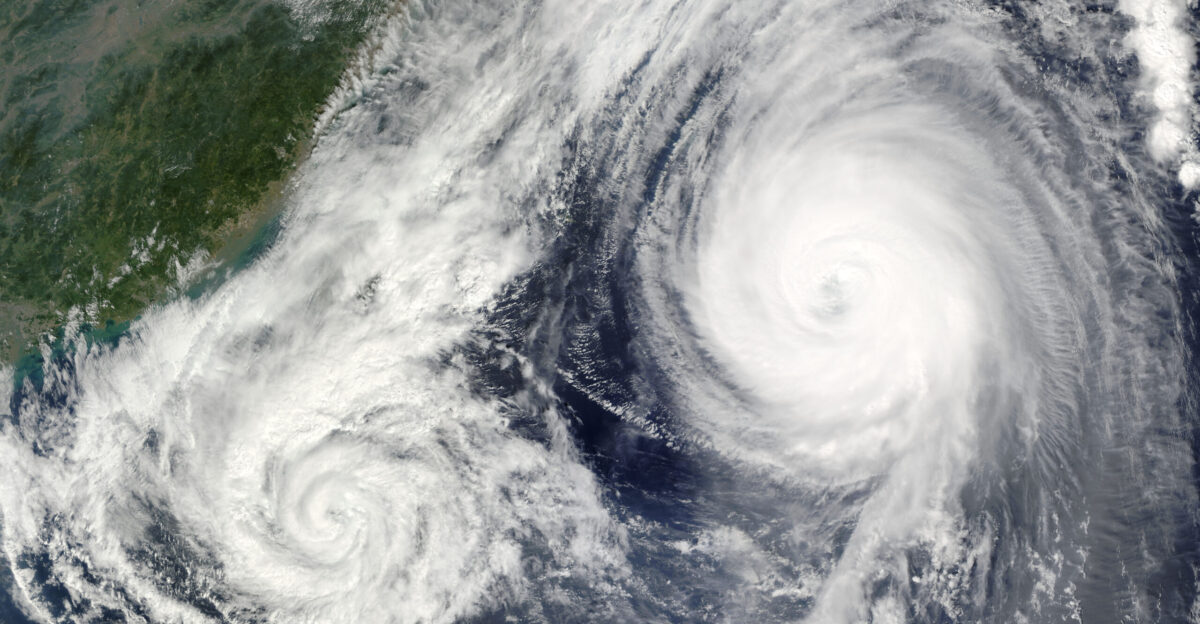
Systems Take Shape Over Warm Waters
Invest 93L is hovering east of the Leeward Islands, slowly finding structure, while Invest 94L edges past Puerto Rico, already sending bands of rain and wind across the region.
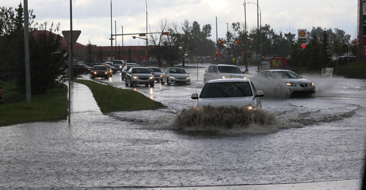
The NHC is monitoring the storms closely and is releasing frequent updates as they evolve. The impacts have already begun for the Caribbean—flooded roads, delayed flights, and power cuts long before U.S. landfall is in play.
East Coast Watching Closely
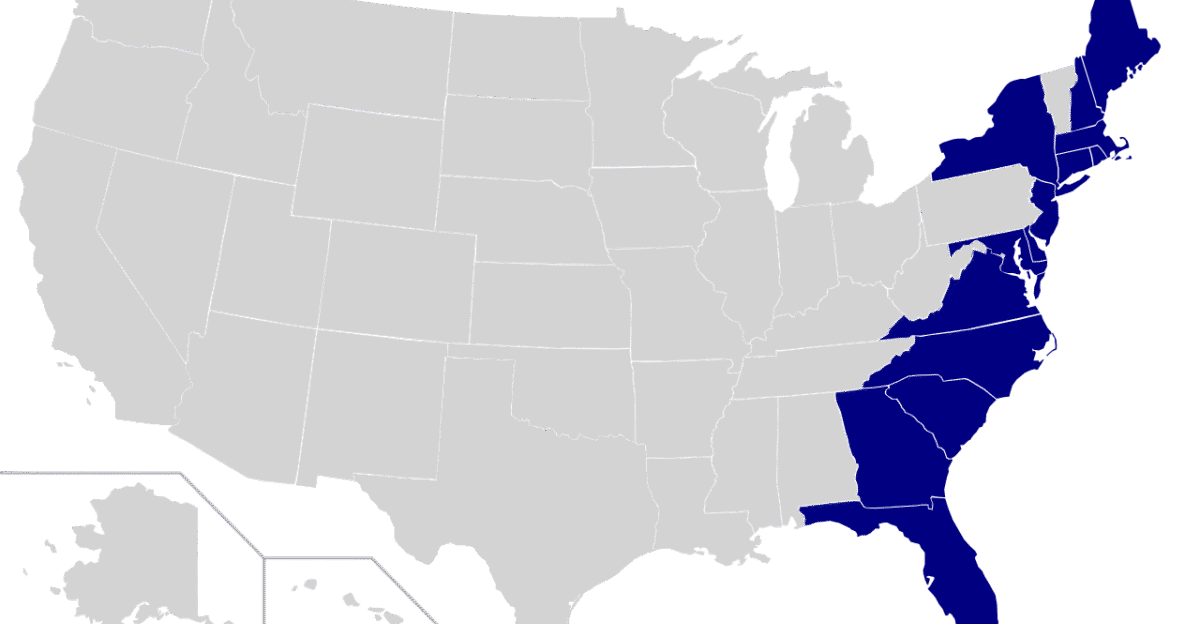
From Florida to New York, eyes are on the horizon. Forecasts suggest at least one storm could brush or strike the U.S. East Coast by the weekend.
The exact path remains uncertain, but the risks are clear: flooding rains, coastal erosion, and dangerous winds. Even offshore systems can churn up hazardous surf, so residents are urged not to wait before making preparations.
High Likelihood of Development
Meteorologists say the chances of intensification are unusually high. The NHC gives Invest 93L a 90% chance of strengthening into a tropical storm within two days, while Invest 94L follows close behind at 80%. Those odds reflect the near-perfect storm environment at play.
Emergency planners in several states are already checking response plans, knowing how quickly weak systems can transform.
Caribbean Already Feeling the Strain

In Puerto Rico, heavy downpours flood streets, prompting flash flood alerts. The Virgin Islands and parts of the Dominican Republic are also under watch as gusty winds cause scattered damage.
These aren’t fully formed storms, but their reach is already disrupting daily life. For many across the Caribbean, this week’s forecast is no longer distant—it’s personal.
Experts Urge Early Preparation

Tropical systems that form closer to land leave far less time to react, warned Alex DaSilva, lead hurricane expert at AccuWeather. In an interview with Yahoo News, he explained that storms in the western Caribbean or Gulf often give communities only a narrow window to prepare.
His advice highlights why residents along the East Coast should secure supplies and review plans now, before conditions worsen. DaSilva added that preparation is always easier before winds rise, a reminder that readiness, not reaction, protects communities when storms close in.
Two Storms Could Interact
Adding to the complexity is the possibility of the Fujiwhara Effect, where two nearby storms spin around one another. If that happens, tracks could shift suddenly, or the storms could merge into something much stronger.
It’s not a guaranteed outcome, but the potential keeps forecasters on edge. For coastal residents, it’s one more reason to stay flexible and alert.
How the Fujiwhara Effect Works

The National Weather Service describes the Fujiwhara Effect as a storm dance with the two systems influencing each other’s movement, sometimes drawing closer, other times flinging apart. In rare cases, they can even combine.
Such interactions are uncommon in the Atlantic, but it is possible this week. That uncertainty is why meteorologists caution against focusing too heavily on early track models.
Forecast Still Clouded With Uncertainty
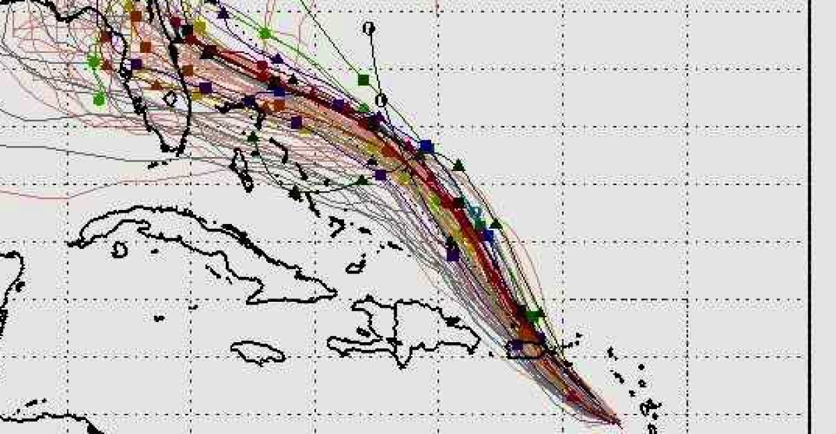
Computer models are split, with some suggesting Florida could face direct impacts while others point toward New England. The spread highlights the limits of forecasting at this stage. But uncertainty doesn’t mean safety.
Even if neither storm makes landfall, dangerous surf, coastal flooding, and rip currents remain likely. Forecasters urge communities to prepare for multiple scenarios, not just one.
A Season That Just Shifted Gears

The 2025 Atlantic season had looked quiet, producing seven named storms, with only Erin and Gabrielle reaching hurricane strength. That calm now feels misleading.
NOAA has long said, “It only takes one storm to define a season. ” The sudden appearance of two in quick succession proves this point. The weeks ahead could reshape how this season is remembered.
Why Conditions Turned Favorable

Earlier in the year, high wind shear had been breaking storms apart before they could form. But now, with calmer winds aloft and ocean temperatures running unusually high, the Atlantic has become a breeding ground.
Meteorologists note that late-season storms tend to develop closer to U.S. shores, where millions live, raising the stakes as conditions continue to shift.
Names Waiting in Line

Should these systems strengthen as expected, they’ll be named Humberto and Imelda, the eighth and ninth storms of the season. Names make storms feel tangible, shifting them from abstract weather systems to identified threats with their own histories.
For residents watching forecasts, that transition is often when the reality of preparation becomes harder to ignore.
Bermuda Faces Rising Risks

Bermuda may be in the crosshairs by Sunday. Officials are preparing shelters and stockpiling supplies, while residents are urged to review plans early. The island has weathered many storms, but the uncertainty of two developing systems adds strain.
Authorities there stress that no matter how forecasts evolve, advance preparation is the surest way to protect lives and infrastructure.
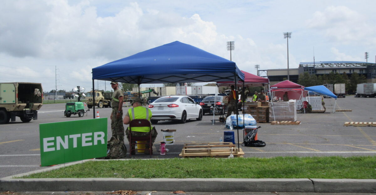
East Coast Emergency Plans Reviewed
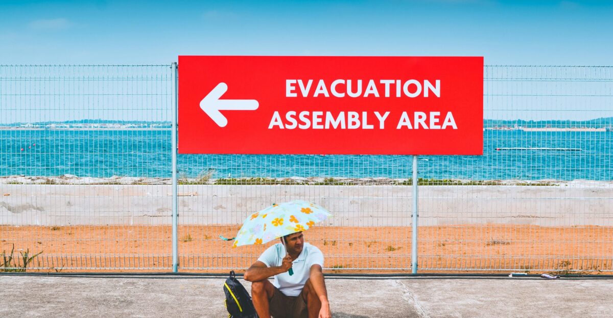
Across the U.S., state and local leaders are revisiting evacuation routes and staging resources. Officials in Florida, the Carolinas, and the Northeast have already said teams are on standby.
The emphasis is on readiness, not reaction. Even storms that only bring tropical-storm-force winds can knock out power and flood neighborhoods, making early planning vital for safety.
Fall Brings the Storms Closer

Meteorologists note that storm formation often shifts closer to land as autumn settles in. That seasonal trend increases the likelihood of U.S. impacts, particularly for heavily populated areas along the East Coast.
With waters still warm and activity ramping up, the coming weeks demand extra attention. Communities that prepare now can avoid a frantic scramble later.
History Reminds Us What’s Possible
Late-season storms often catch people off guard. Hurricane Wilma intensified late in 2005, while Superstorm Sandy in 2012 left lasting scars across the Northeast.
Experts point to those examples as reminders that a quiet season can still deliver devastating blows. This week’s twin systems underline that history can repeat when conditions align.
Hazards Beyond the Storm Center

Even if neither storm makes landfall, their offshore churn is expected to create dangerous surf along the East Coast. Rip current advisories and potential beach closures from Miami to Cape Cod may expand throughout the week.
Meteorologists warn that rough seas are often underestimated, yet they remain one of the leading storm-related hazards for coastal communities.
Cities Move Into Action Mode
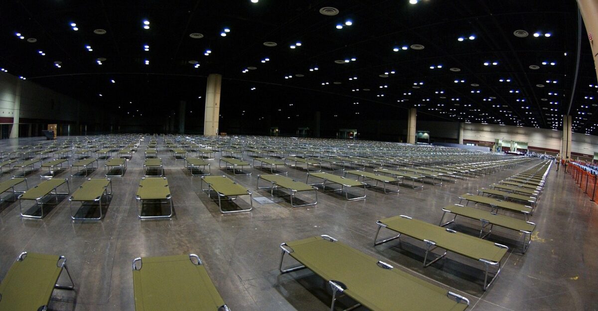
Local governments are not waiting. Supplies are being pre-staged, shelters reviewed, and emergency declarations considered. Officials say such steps allow for quicker aid if conditions deteriorate suddenly.
For residents, these actions are more than bureaucratic; they are signals that forecasts are severe and that preparation should no longer be delayed as the systems grow stronger.
Critical Hours Ahead
Meteorologists stress that the next 48 hours could define what happens next. Systems at this stage can strengthen quickly, leaving little room to respond. “These storms can intensify quickly, and preparation is the best defense,” DaSilva said.
For coastal residents, the message is clear: check supplies, secure property, and follow NHC updates. The Atlantic is wide awake again.