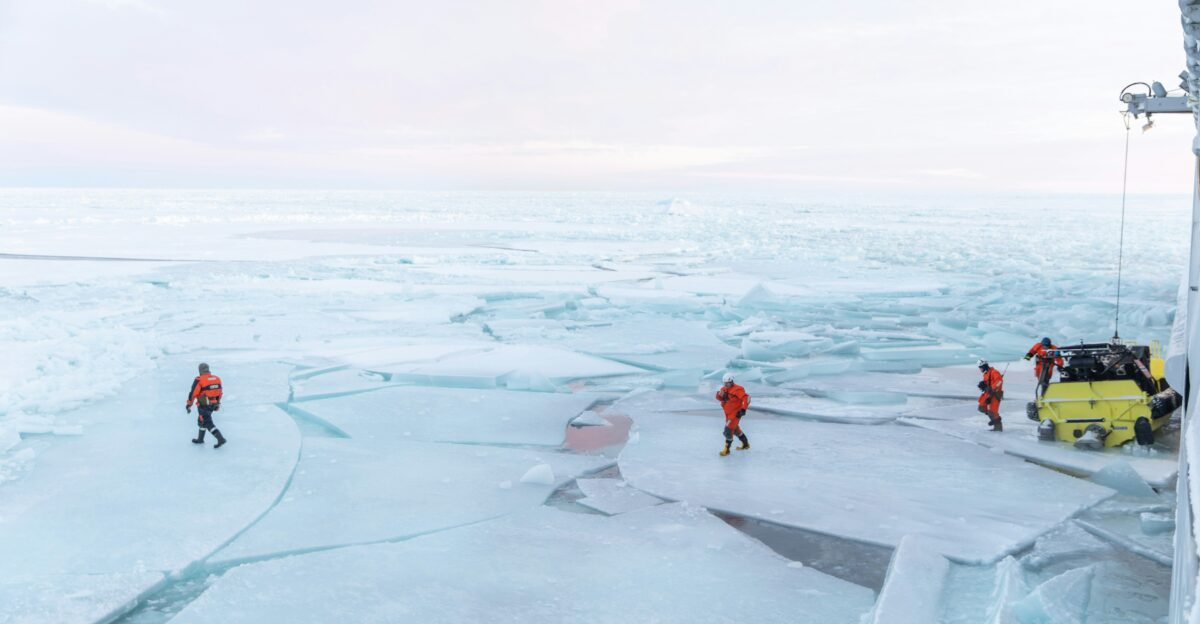
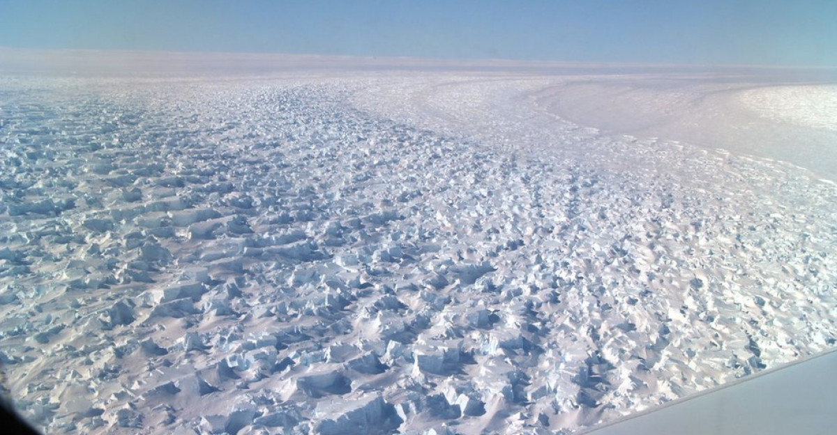
For months, scientists feared their Antarctic ocean robot was gone for good, locked somewhere under meters of ice. In reality, the float had continued its pre-programmed mission, diving and rising through the water column every five days and silently storing data while the ice overhead blocked its satellite link.
During roughly eight to nine months under the ice shelves, it drifted through a dark, unmapped space, returning only brief, indirect clues, such as impacts with the ice base, once it finally escaped to open water and could reconnect. By the time researchers pieced together its full track, the float had collected nearly 200 vertical profiles over a journey of about 300 kilometers spanning the Denman and Shackleton ice shelves, turning what looked like a lost asset into one of the most scientifically valuable ocean missions ever attempted in Antarctica.
The Mission Beneath the Ice
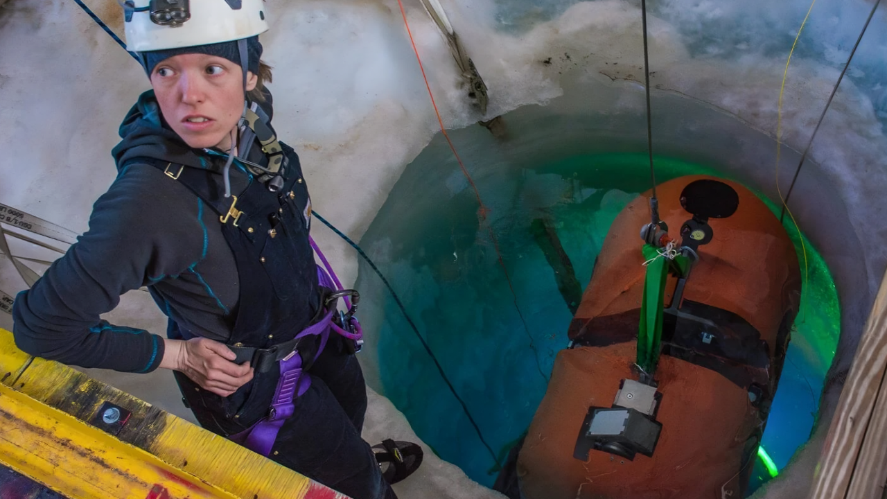
The robot was built on the proven Argo float design: a free-drifting, torpedo-shaped platform that can change its buoyancy to move up and down in the water but cannot steer horizontally. Programmed before deployment in September 2020, this ice-capable float was set to dive from near the surface to the seafloor, then ascend, collecting high-resolution measurements of temperature and salinity on each profile.
Every five days it repeated this cycle, eventually recording nearly 200 profiles over two and a half years, including its months-long, unsupervised drift beneath Denman and Shackleton.
A Scientific First for East Antarctica
Until this mission, no instrument had ever traced a full, continuous path of measurements directly beneath an East Antarctic ice shelf. The ice-covered cavities in this sector of Antarctica had remained largely speculative, with scientists dependent on models, sparse ship-based measurements at the ice edge, and satellite data to infer what was happening below.
The float’s transect changes that, offering a rare, ground-truth view of the ocean conditions and circulation beneath Denman and Shackleton. The results support a central concern in polar research: that parts of East Antarctica are far more sensitive to ocean-driven melting than previously assumed, despite long being treated as relatively stable compared with the more rapidly changing West Antarctic ice sheet.
Unexpected Warmth Under the Ice
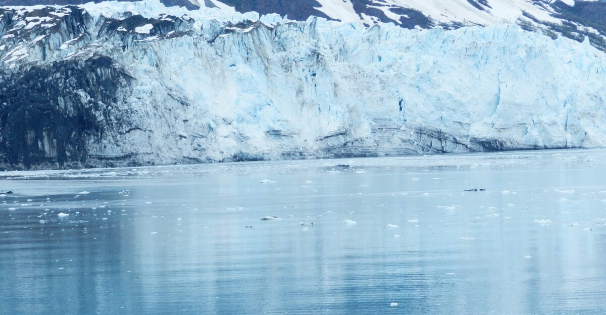
One of the most striking findings is the presence of relatively warm, salty water reaching the base of Denman Glacier, in contrast to the colder conditions detected beneath Shackleton. The float’s profiles show that Denman is exposed to modified circumpolar deep water, warmer ocean water capable of melting ice from below, flowing into the cavity along the seafloor and then rising along the glacier’s base.
That warmth, concentrated in a relatively thin but crucial boundary layer roughly 10 meters thick immediately beneath the shelf, can significantly accelerate melt rates when it brushes against the ice.
The Denman Glacier’s Hidden Threat
Denman Glacier is not just another piece of Antarctic ice; it sits in a deep, landward-sloping basin that makes it especially vulnerable to retreat once warm water reaches its grounding line. Scientists estimate that if Denman’s catchment were to lose most of its ice to the ocean, it could raise global sea levels by about 1.5 meters, roughly five feet.
Nearby Totten Glacier, also influenced by warm ocean water, holds enough ice to raise seas by about 3.5 meters, bringing the combined long-term potential of the two systems to around five meters. The new under-ice measurements confirm that warm water is already reaching beneath Denman, suggesting its delicately poised state could tip toward unstable retreat if the thickness or temperature of that warm layer changes.
100 Million Americans in the Flood Path

The long-term implications of a multi-meter sea-level rise reach deep into the United States. Federal assessments show that roughly 127 million people, nearly 40 percent of the U.S. population, live in coastal counties. That number provides context for describing on the order of 100 million Americans as potentially exposed to the cascading consequences of significant sea-level rise, even though not all would face equal levels of inundation or disruption.
Cities like New York, Miami, and New Orleans sit in low-lying coastal zones where even lower-end projections of sea-level rise, well below the full long-term potential of Denman and Totten, would dramatically increase the frequency of flooding and storm-surge damage. Studies have already identified hundreds of billions to more than a trillion dollars in coastal U.S. residential property at risk this century under plausible sea-level-rise scenarios.
$14 Trillion in Global Assets at Risk
Globally, the stakes are even higher. The Intergovernmental Panel on Climate Change has estimated that between roughly 7 and 14 trillion U.S. dollars in coastal infrastructure and assets could be threatened under high sea-level-rise scenarios by 2100, depending on emissions and adaptation choices. These vulnerable holdings include major ports, industrial zones, energy facilities, and dense urban areas that anchor national economies and global trade.
Many of them are located only a few meters above present sea levels and were designed for a relatively stable shoreline, not for the slow but relentless encroachment implied by accelerated Antarctic melt. The data from the Denman–Shackleton float tighten the link between under-ice processes and these economic risks, showing how warm ocean water can quietly erode the foundations of ice sheets that help keep sea levels in check.
A Turning Point for Climate Models
For years, many climate and ice-sheet models treated East Antarctica as relatively slow to respond to warming, partly because of its size and the extreme cold of its interior. The new observations challenge that comfort, demonstrating that in key sectors like Denman, ocean heat is already interacting with the ice in ways that can drive significant change.
The float’s data are now being used to refine how models represent the transfer of heat from the ocean to the ice, especially within the thin boundary layer beneath the shelf where melt rates are determined. This is crucial because under-ice ocean conditions have been one of the largest sources of uncertainty in projections of future sea-level rise.
Fast and Uneven Currents

The robot’s profiles reveal a complex and dynamic circulation beneath the ice shelves rather than a static, layered ocean. The data, combined with modeling, show that water flows along the seafloor into the cavity, then rises along the sloping underside of the ice, delivering heat directly to critical grounding zones before exiting at the shelf front.
This circulation creates narrow pathways that concentrate warm water at the most vulnerable points of the glacier, where ice shifts from resting on bedrock to floating, locations that strongly influence stability and retreat. The thin, roughly 10-meter-thick boundary layer just beneath the ice is especially important, controlling how efficiently heat is transferred from the moving water into the ice itself.
Why the Robot Vanished

The float’s “disappearance” is best understood as a technical consequence of operating under ice, rather than a mystery in the traditional sense. Once the float drifted beneath the shelves, the ice prevented it from reaching the open surface, which is normally how Argo floats obtain GPS fixes and transmit their data via satellite. Trapped below, it continued to follow its program, diving, measuring, and ascending, without any way to send its measurements home or update its position estimates.
During this period, scientists on the surface saw no new signals and reasonably feared the float was lost for good. Only when it finally emerged near the ice front, after about eight months under the Denman and Shackleton shelves, could it re-establish contact and offload its stored profiles.
A Message From the Ice
To many in the research community, the float’s survival and data feel like a direct message from a part of the planet few will ever see. Rintoul has described the mission as both fortunate and sobering. “We got lucky,” he said, emphasizing that the float was never designed to spend so long under such thick ice. Yet he has also warned that the processes revealed by this lucky outcome are anything but reassuring.
In commentary on East Antarctica’s emerging vulnerability, he noted that once ice in basins like Denman begins an unstable retreat, humanity is effectively locked into long-term sea-level rise. “It may take centuries for the full sea-level rise to be realized, but there’s no going back,” he said.
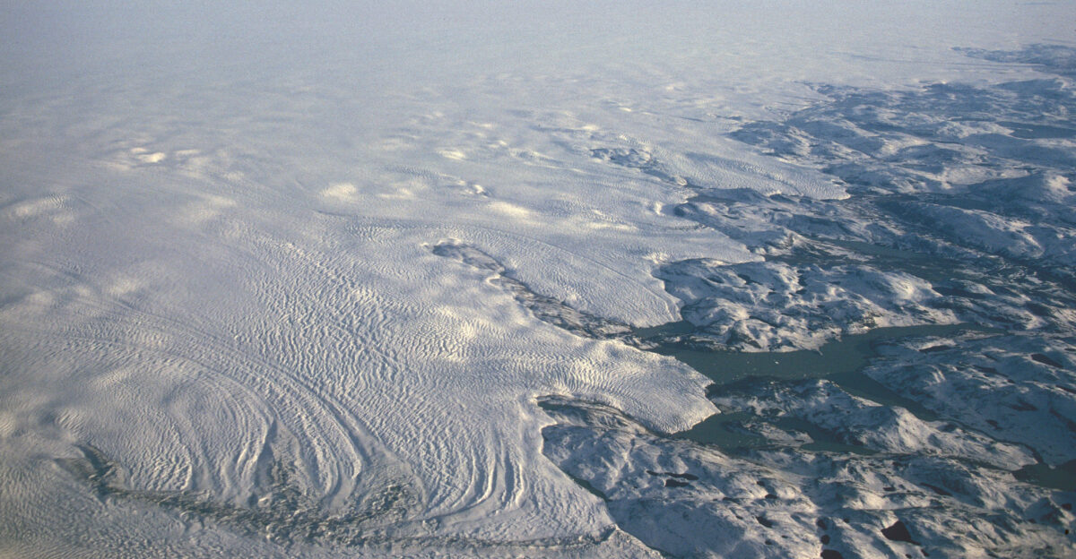
East Antarctica Was Supposed to Be Safe
For decades, East Antarctica was often treated as a relatively stable counterweight to the more visibly unstable West Antarctic Ice Sheet. Earlier studies and models suggested its thick, cold ice and high plateau would protect it from rapid change, at least on human timescales. That perception is now eroding.
The Denman float results show that even in East Antarctica, warm ocean water can infiltrate deep basins and interact with ice in ways that prime the system for retreat.
The Ocean’s Hidden Reservoir of Heat
The Antarctic discoveries connect to a broader climate reality: most of the planet’s excess heat is stored in the ocean, not the atmosphere. Analyses from agencies such as NOAA show that more than 90 percent of the additional heat trapped by human-generated greenhouse gas emissions has gone into the oceans.
As currents move this heat around the globe, some of it is now surfacing, both literally and figuratively, at the fringes of Antarctica, where it can interact with ice shelves and glaciers. Recent studies also report an acceleration in global ocean heat content, meaning the system is accumulating energy faster than before.
A Technological and Human Triumph
From a technological standpoint, the mission is being hailed as a breakthrough in under-ice observing. The float, designed as a slightly modified ice-capable Argo, withstood crushing pressures, near-freezing temperatures, and prolonged darkness while maintaining sensor accuracy and power over years.
Its success illustrates how relatively small, relatively inexpensive autonomous platforms can reach critical environments that ships, crewed submersibles, and even satellites cannot directly access.
“No Going Back”—The Century Ahead
Taken together, the robot’s measurements confirm that ocean-driven melting has already begun in parts of East Antarctica, and some of the processes involved may be difficult or impossible to reverse on human timescales.
The critical unknowns are how fast that rise will occur and how effectively societies will adapt. With about 127 million people living in U.S. coastal counties and trillions of dollars in global coastal assets at stake, the stakes are unmistakably high.
Sources:
CSIRO – Adrift like Shackleton: Robot float survives Antarctic ice – 5 December 2025
The Conversation – What our missing ocean float revealed about Antarctica’s melting glaciers – 29 April 2025
Interesting Engineering – Robot survives months in never-seen Antarctic cavity, finds … – 8 December 2025
The Cryosphere (EGU) – Recent acceleration of Denman Glacier (1972–2017), East Antarctica – 10 February 2021
Nature Communications – Recent acceleration in global ocean heat accumulation by … – 27 October 2023