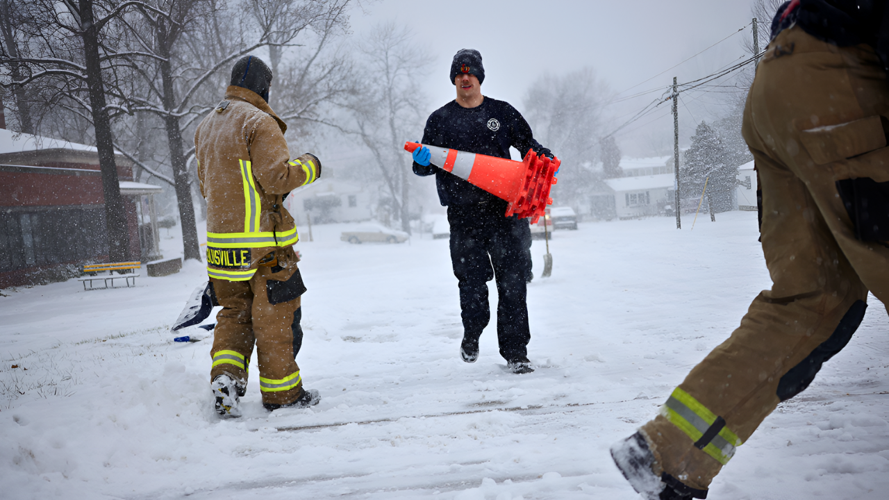
A blizzard grips the Northeast and Great Lakes, burying highways under relentless snow by mid-morning on January 20, 2026. Visibility drops to near zero as snow falls at 4 inches per hour in spots, with 50 mph winds whipping flakes into whiteout chaos and temperatures plunging to -18°F.
Polar Vortex Disruption Unleashes Fury
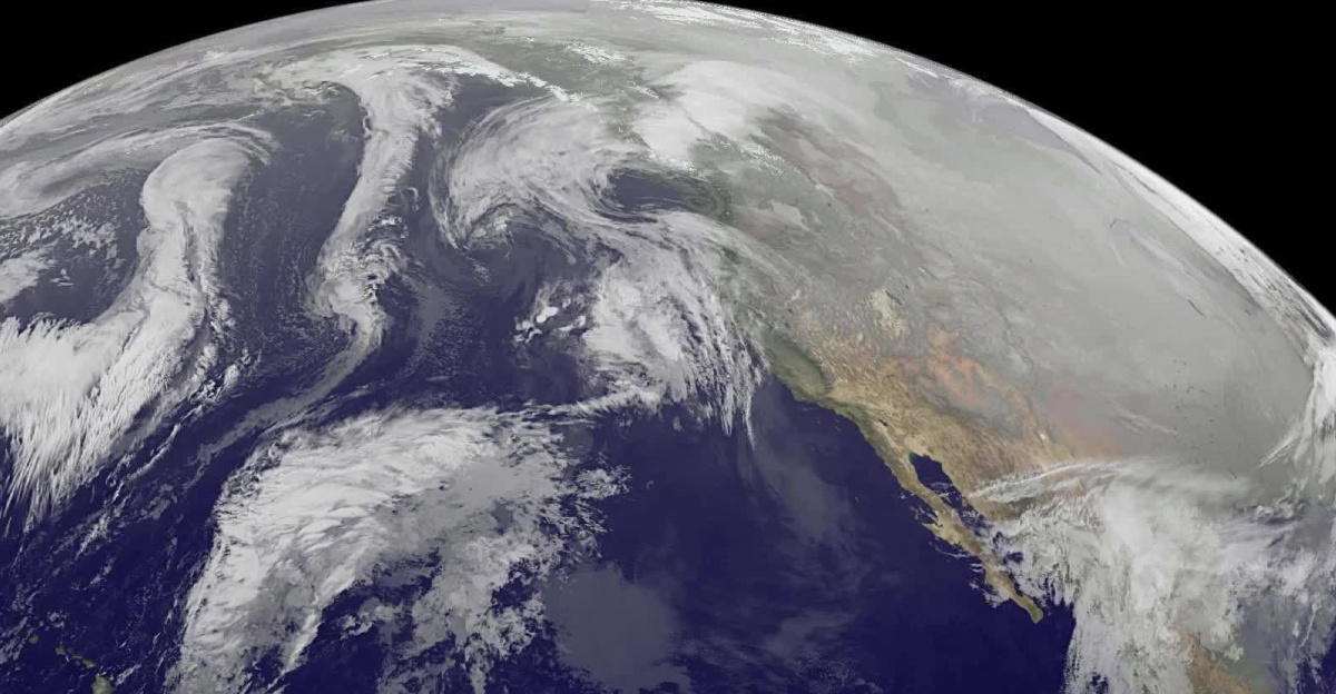
A fractured polar vortex, the Arctic’s usual cold-air stronghold, has shattered and plunged southward. This icy surge clashes with warmer Great Lakes waters, fueling ferocious lake-effect snow bands. Snowfall rates hit 4 inches per hour, while high winds and subzero cold persist through January 21, turning travel into a deadly gamble across the region.
Warnings Span Seven States
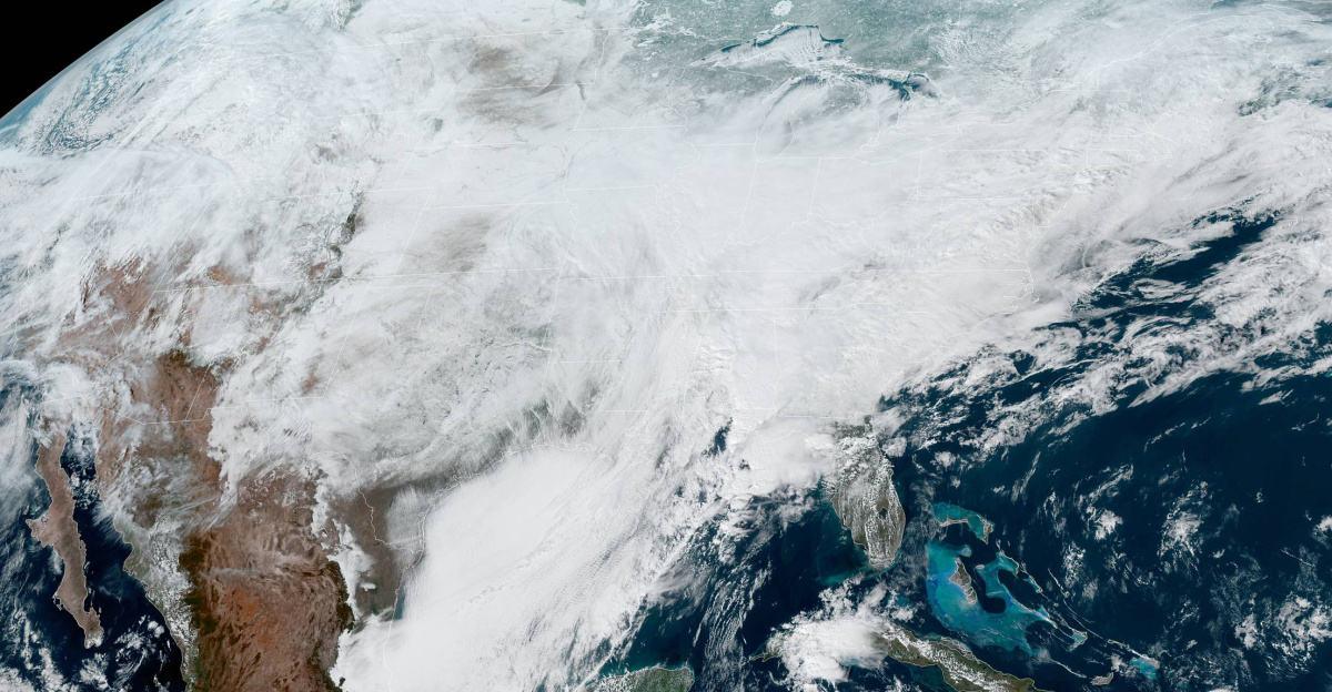
The National Weather Service blankets Michigan, Wisconsin, Indiana, New York, Pennsylvania, Maine, and New Hampshire with winter storm warnings, advisories, and blizzard alerts. Blizzard warnings—the gravest—target counties with sustained 35+ mph winds and visibility under a quarter mile for hours. Great Lakes downwind zones face the worst, as conditions escalate to blizzard strength during the peak.
Tug Hill Faces Historic Onslaught
New York’s Tug Hill plateau, a lake-effect snow hotspot averaging 180-200 inches yearly, braces for up to 4 feet in 48 hours—one of its heaviest barrages in years. Western New York counties like Niagara and Erie expect 10-20 inches. Michigan forecasts up to 14 inches, with Pennsylvania downwind areas matching that total. Blowing snow seals roads in ice, rendering highways like New York’s I-90 and Michigan’s I-196 impassable.
Extreme Winds and Chills Amplify Risks

Gusts topping 50 mph in New York and Pennsylvania scour snow into blinding walls, slashing visibility. Wind chills in western New York sink to -18°F, where frostbite strikes in 10-15 minutes and hypothermia stalks stranded drivers. Airports in Buffalo, Rochester, and Syracuse grind to delays. Multi-vehicle crashes loom as whiteouts erase road edges, stranding motorists beyond emergency reach. Power outages from heavy snow snapping lines and toppling trees affect communities across the region, with restoration efforts expected to take 24-72 hours.
Storm Timeline and Safety Imperatives

The onslaught builds from January 18-19, peaking January 19-20 with 4-inch-per-hour rates. Worst perils hit late January 20 into early 21, easing by January 22 amid lingering hazards. Affecting 2-3 million under warnings—and millions more across 10 states—the vulnerable, including elderly, homeless, and outdoor workers, bear heightened threats from cold and blackouts. Authorities implore staying indoors through January 21, stocking food, water, meds, and winter kits. If travel can’t wait, opt for four-wheel drive, slow speeds, and survival gear; if stuck, hunker in vehicles and signal help.
This rare polar vortex split underscores shifting atmospheric patterns, with experts noting more frequent disruptions amid Arctic warming and jet stream wobbles. As climate volatility rises, such events test infrastructure and readiness, pressing communities to fortify against intensifying winter extremes.
Sources:
“Winter storm update: Tug Hill region braces for 4 inches of snow per hour starting on Monday.” Syracuse.com, 19 Jan 2026.
“Brutal’ cold to continue as forecasters warn of late-week storm.” USA Today, 19 Jan 2026.
“Winter storm and blizzard alert across the U.S.: Michigan, New York and other regions hit by heavy snow.” AS USA, 17 Jan 2026.
“Polar Vortex 2026 Update: New Stratospheric Warming Event Bringing Cold United States and Canada.” Severe Weather Europe, 11 Jan 2026.