Federal weather experts have put out a “La Niña watch” because there’s a 71% chance La Niña will develop in late 2025. La Niña is a climate pattern involving the cooling of waters in the eastern Pacific Ocean.
This natural shift can significantly alter U.S. weather: it generally makes hurricanes in the Atlantic more likely and stronger, especially late in the season, and pushes the jet stream north.
This means a jump in hurricane risk and significant changes in how winter storms move across the country.
More Storms on the Way
Meteorologists expect La Niña to start just as the last part of hurricane season progresses. Forecasters like AccuWeather’s Alex DaSilva warn that there’s a much higher chance of La Niña late this season, especially in October and November.
The Atlantic Ocean is already warmer than usual. Hurricane formation is significantly boosted when the ocean is warm and the winds are light.
This combination is sometimes called the perfect storm for growing hurricanes, particularly late in the year.
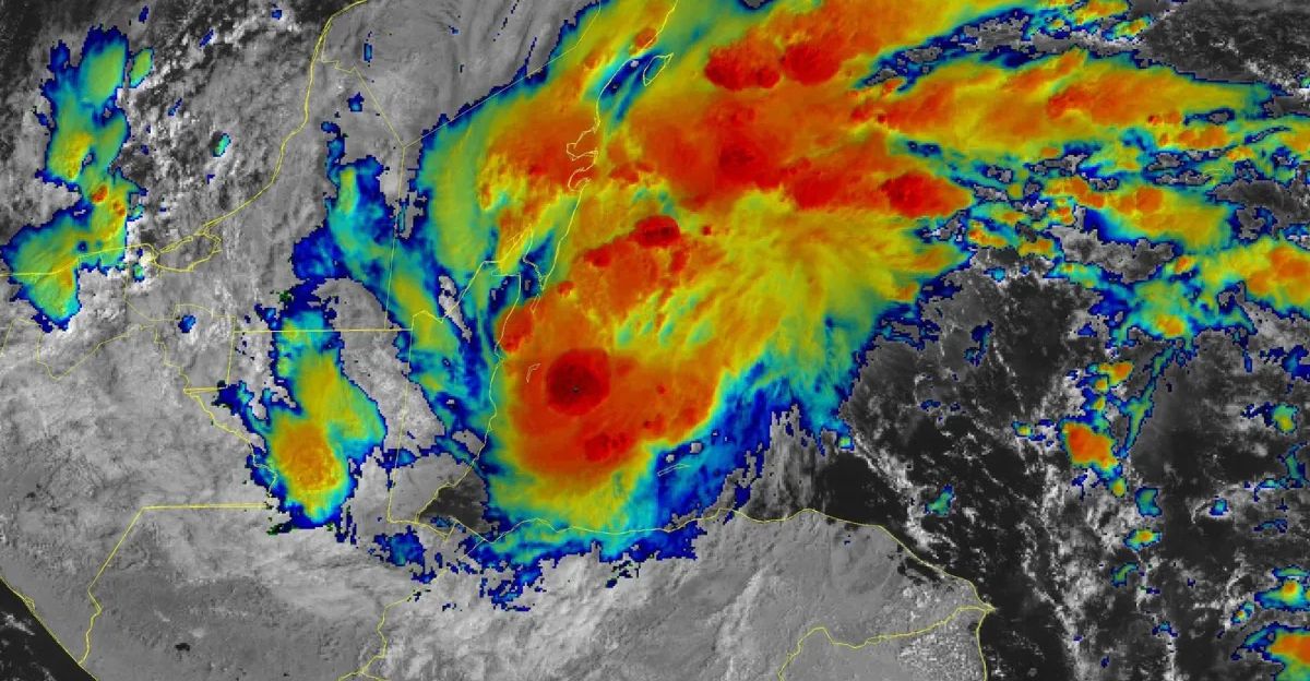
Why La Niña Matters for Hurricanes
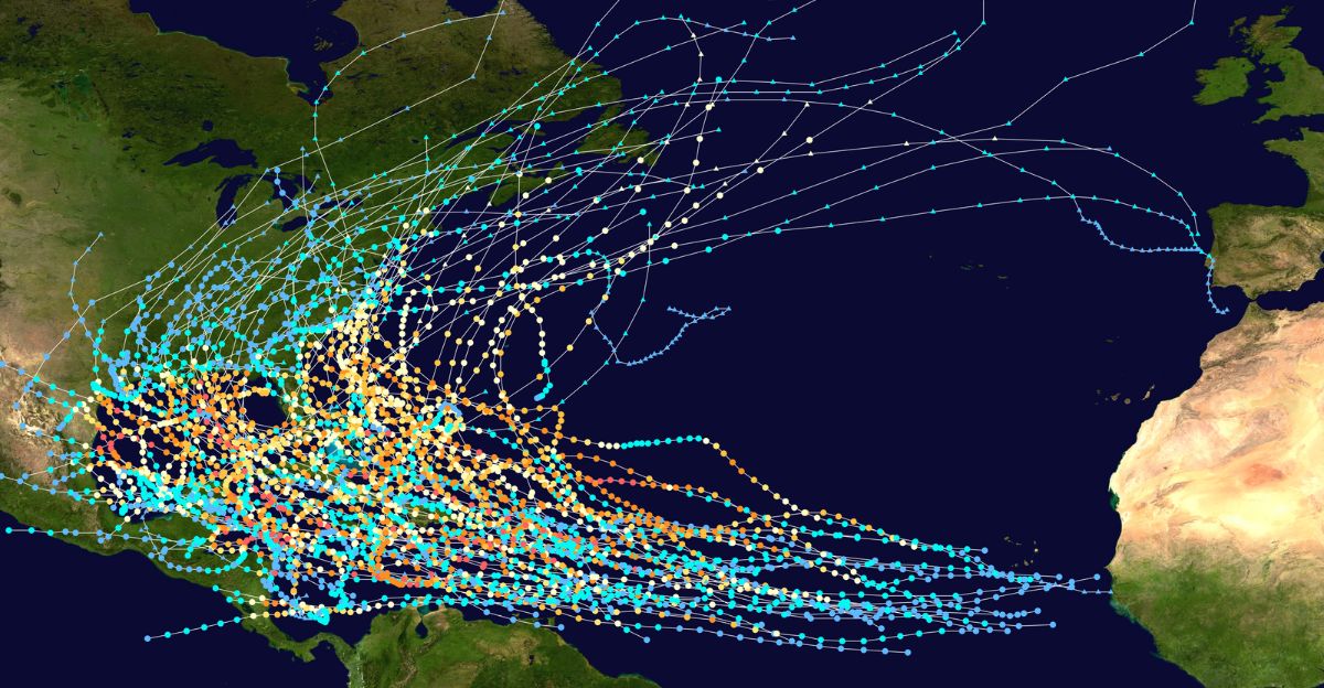
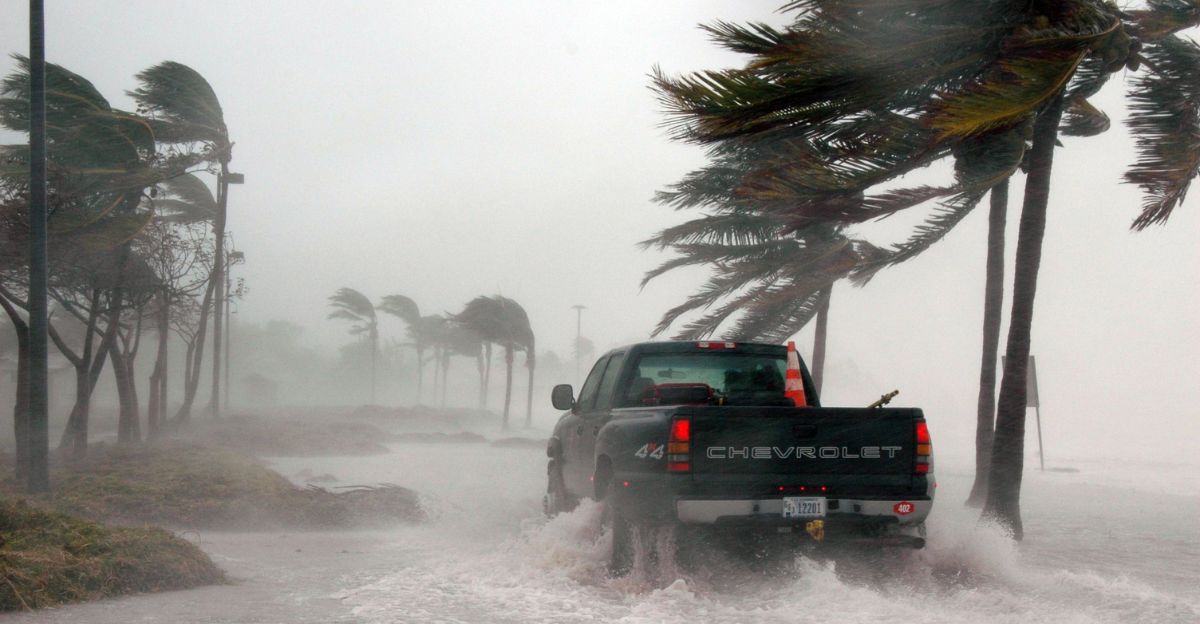
History shows a strong link between La Niña and busy, destructive hurricane seasons.
In years with La Niña, the chance of significant hurricane damage is about 77%, compared to just 32% in years with its twin pattern, El Niño.
For example, the 2020 season saw 30 named storms and over $19 billion in losses, all during La Niña. The pattern makes it easier for storms to form and get more intense.
How La Niña Fuels Hurricanes
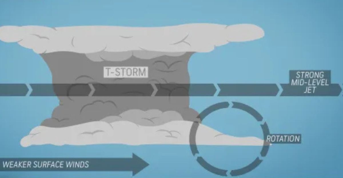
La Niña boosts hurricanes by changing wind patterns over the Atlantic. Strong winds high in the atmosphere usually tear storms apart, causing a “wind shear.”
But during La Niña, changes that start in the Pacific make winds less disruptive in the Atlantic.
With less wind shear, tropical clusters of storms can grow vertically and become massive hurricanes. This happens most frequently in October and November, which are usually the tail ends of hurricane season.
Don’t Let Your Guard Down
NOAA’s top hurricane forecaster, Matthew Rosencrans, warns that La Niña can double the number of hurricanes in November compared to typical years.
The problem is that people usually relax after the traditional peak hurricane season in September and October, but with La Niña, storm chances stay high until winter.
These last-minute storms can hit the U.S. Gulf Coast and Southeast when people least expect them, and often do the most damage because communities aren’t as alert later in the season.
Trouble for the Gulf Coast
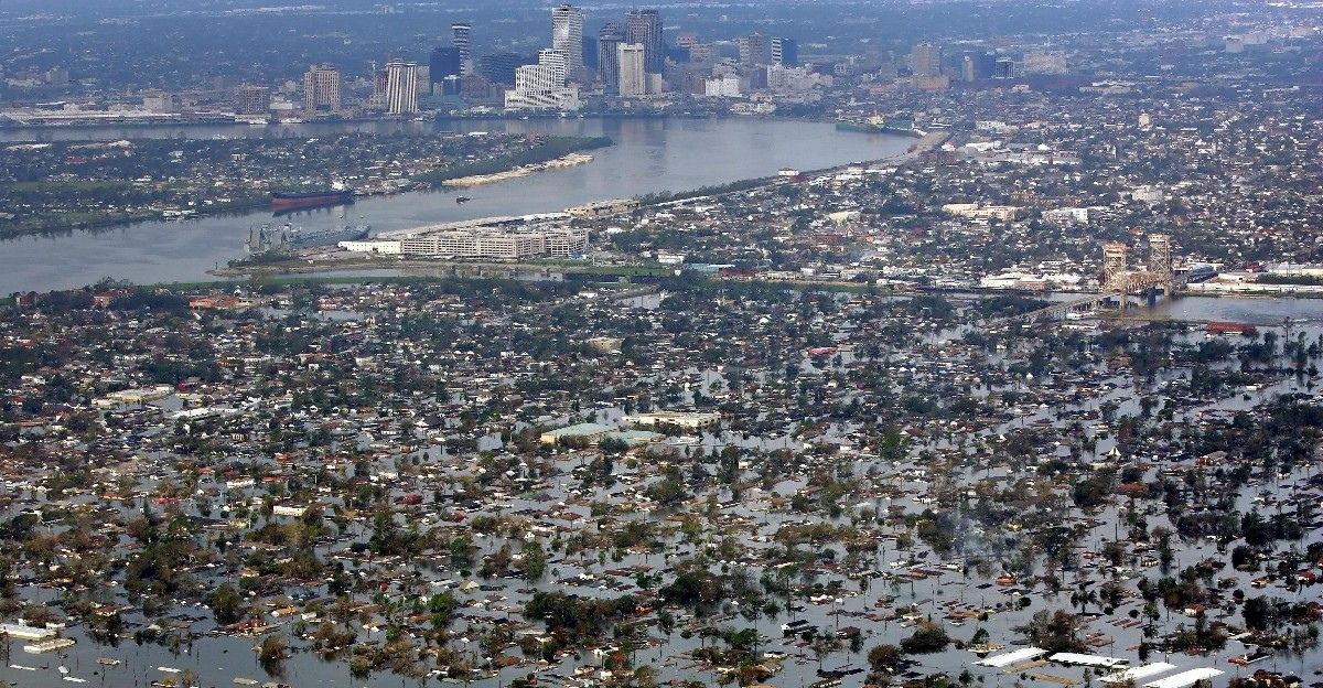
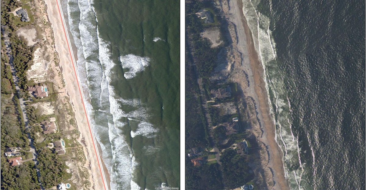
Coastal residents from Texas through Florida are at special risk during La Niña years. Warm, shallow waters in the Gulf of Mexico make an excellent breeding ground for intense storms if wind shear is low.
Past hurricanes like 2005’s Katrina and 2020’s Laura struck in La Niña years and showed just how quickly a killer storm can explode in size and power. Louisiana, Florida, and surrounding areas are already reviewing emergency plans and encouraging families to do the same.
Insurance Worries Rise
Insurance companies are nervously watching this La Niña forecast.
Data shows moderate to significant hurricane damage is much more common in La Niña years, and insurers in Florida, Texas, and Louisiana are already setting aside extra money for possible claims.
Even a slight increase in hurricane numbers can mean billions more in damages. Reinsurance companies treat La Niña as a significant reason to hike rates in 2026.
Challenges for Farmers
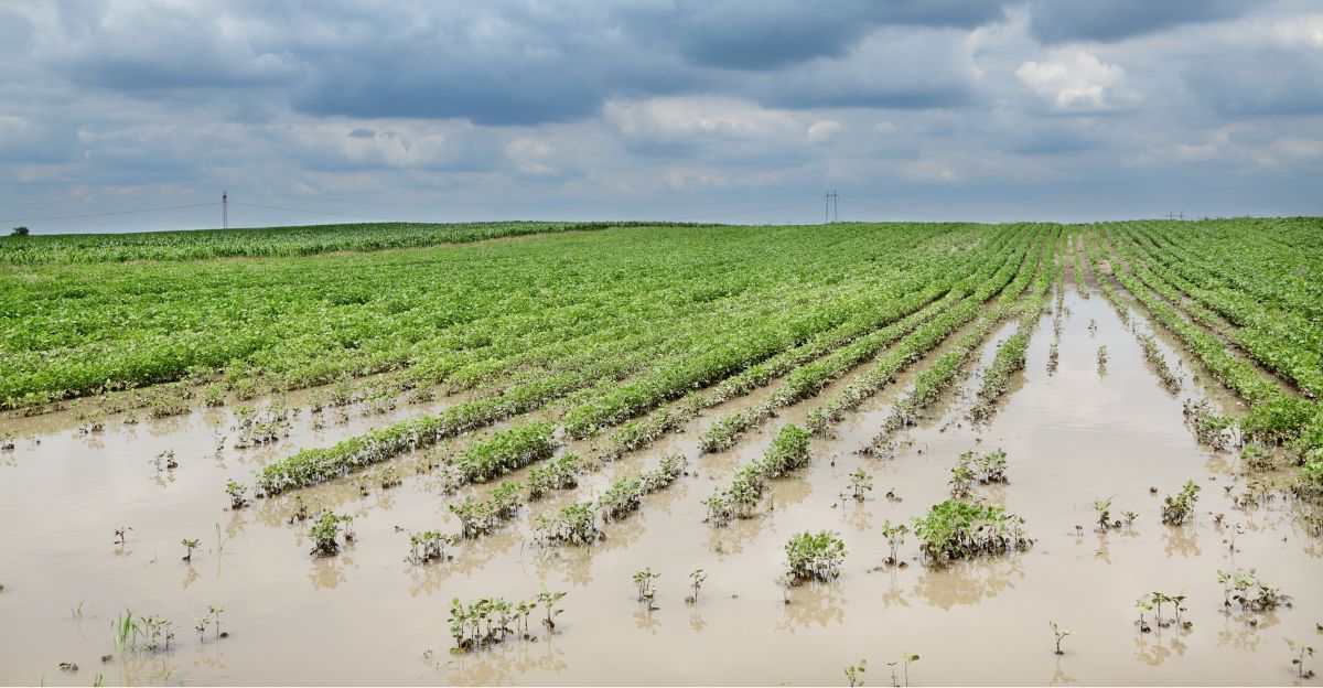
La Niña also threatens farms in the Southeast with more hurricanes and storms during harvest seasons when many crops like cotton, soybeans, and corn need to be harvested.
Late hits from hurricanes can ruin crops still in the field and cause huge losses, as happened during Hurricane Michael in 2018.
In Florida, the citrus industry is apprehensive about trees and fruit being wiped out during the late hurricane period. Economists warn that crop prices could change if storms destroy the autumn harvest.
Energy Sector on High Alert

Hurricane threats don’t just end with fields and homes. Oil and gas companies in the Gulf of Mexico are being told to keep up hurricane precautions even into November, rather than letting their guard down after October.
In 2021, Hurricane Ida during La Niña caused significant disruptions to oil and gas production, making energy prices jump.
Facilities along the coast, especially those handling natural gas, are double-checking their emergency plans in case late-season storms hit, when fuel demands for winter heating are also high.
Storm Tracks Change
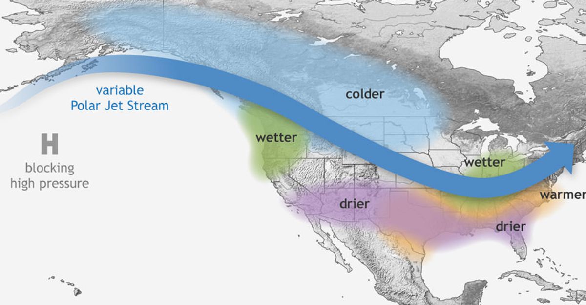
It’s not just hurricane season that changes with La Niña—winter weather also shifts dramatically.
The polar jet stream moves north, diverting wet, wintry storms away from the South and sending them into the Pacific Northwest, the Great Lakes, and other northern states.
The South usually gets drier, with less rain in winter, while regions like Washington and Oregon get more storms, snow, and overall precipitation.
More Rain, More Snow
La Niña is usually good news for the Pacific Northwest. History shows this pattern brings more rain and snow to states like Washington and Oregon.
In the record-setting La Niña winter of 1998-1999, Mount Baker in Washington got over 95 feet of snow! More snow keeps rivers and reservoirs full, which is excellent for farming and generating hydropower.
Ski resorts welcome these extra-snowy winters, and forecasters say the odds for a strong ski season are higher when La Niña takes over.
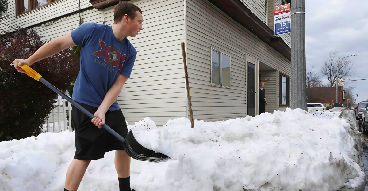
The North Snowbelt Stays Busy
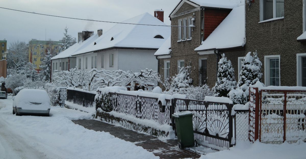
The shift in storm tracks gives the northern U.S. more snow, especially in Minnesota, Michigan, and parts of Pennsylvania.
With more storms coming from the northwest and more lake-effect snow around the Great Lakes, people in the northern tier should get out the snow shovels early.
Most La Niña winters bring above-average snow to northern areas, but forecasters caution that the snow boost might be less impressive if the developing La Niña is weaker.
Drought Returns to the Southern States
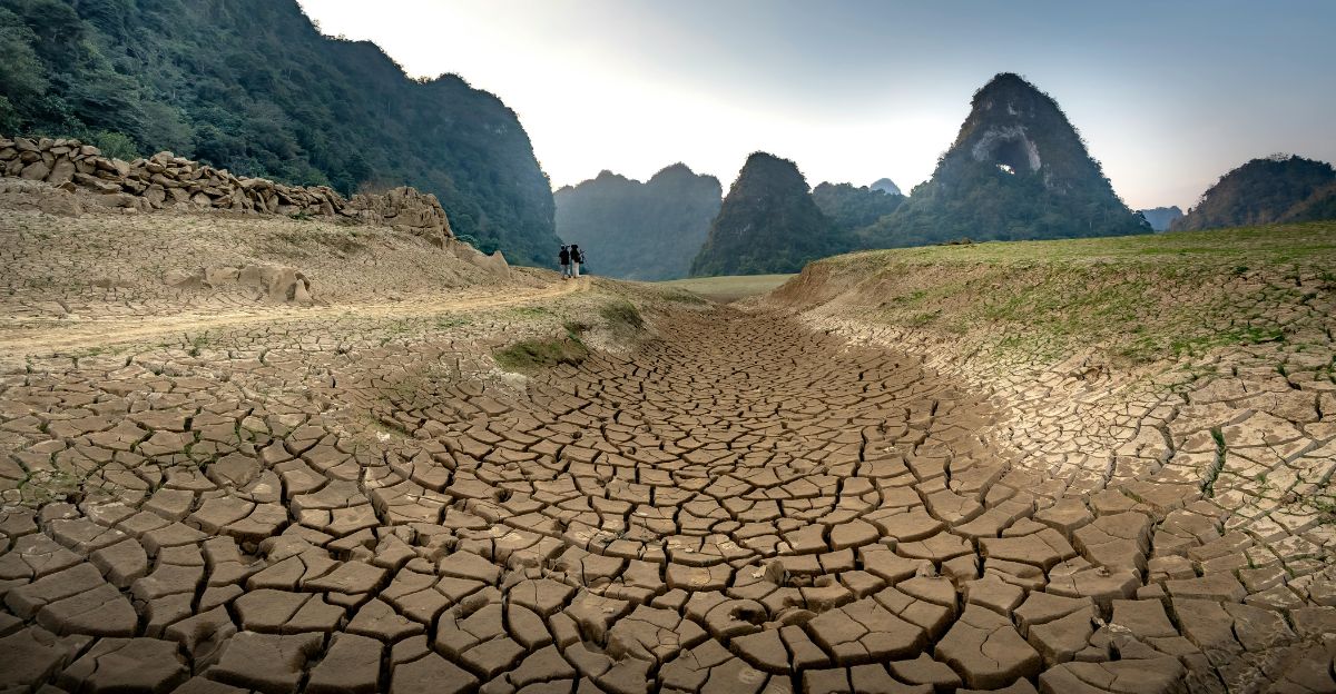
One downside to La Niña’s pattern is that the southern U.S., like California, Arizona, Texas, and beyond, usually gets less rain in winter.
This makes droughts worse and makes it hard for the land to recover before the spring growing season.
Water managers warn cities and farmers to conserve water now, since the dry spell could last until spring 2026.
A North-South Temperature Split
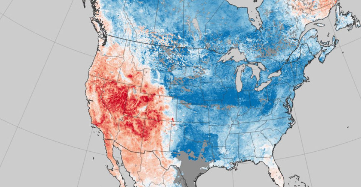
La Niña not only moves rain and snow but also divides the country’s winter temperatures.
The North and West, especially from Montana into western Canada, usually get colder winters. Meanwhile, the South and the Southwest might see milder, warmer temperatures.
These significant temperature differences create “battleground” areas with fast-changing or extreme weather.
The Wild Card
One thing that makes this upcoming La Niña different is the background of climate change. Ocean temperatures are at record highs, and warm Arctic air might make La Niña behave in new, unpredictable ways.
Some scientists warn that La Niña might not cool areas as much as before or could even cause more temperature swings.
Researchers are watching closely because no one has seen a La Niña in such a warm climate before, and the results could rewrite what we expect from hurricanes and winter storms.
Governments Take Action

With higher risks, both hurricane and winter, emergency agencies are getting ready. NOAA is spending more money on hurricane hunter planes, even keeping them ready into November.
Northern states are moving snow plows and salt supplies earlier. The U.S. Department of Energy is talking to power companies about keeping enough gas and electricity on hand for hurricane emergencies and a busy, cold winter.
Congress asks if the country’s disaster plans are ready for such a long stretch of dangerous weather.
Economic Domino Effect

La Niña’s impacts ripple through the whole U.S. economy. More hurricanes can mean $2–3 billion extra monthly costs in damages and business disruptions.
Snowy winters are suitable for ski resorts and snow removal businesses in the North, but they also cause double trouble for farmers in the South, who face both storms and drought. Businesses are changing how they stock up on goods to avoid delays from hurricanes and snowstorms.
Even tourism is affected, so ski towns might see a boom, while warm-weather spots could lose out if droughts and heat scare visitors away.
Social Media Stirs the Pot

News and advice about La Niña are spreading fast on social media, with millions of Americans preparing for hurricanes and winter.
But experts warn that misinformation is rampant, with wild or false claims about weather manipulation popping up online.
Meteorologists are trying to fight bad info with detailed, science-based updates, and social platforms are starting to flag or fact-check weather hoaxes more often.
How Past La Niñas Shape Today’s Plans
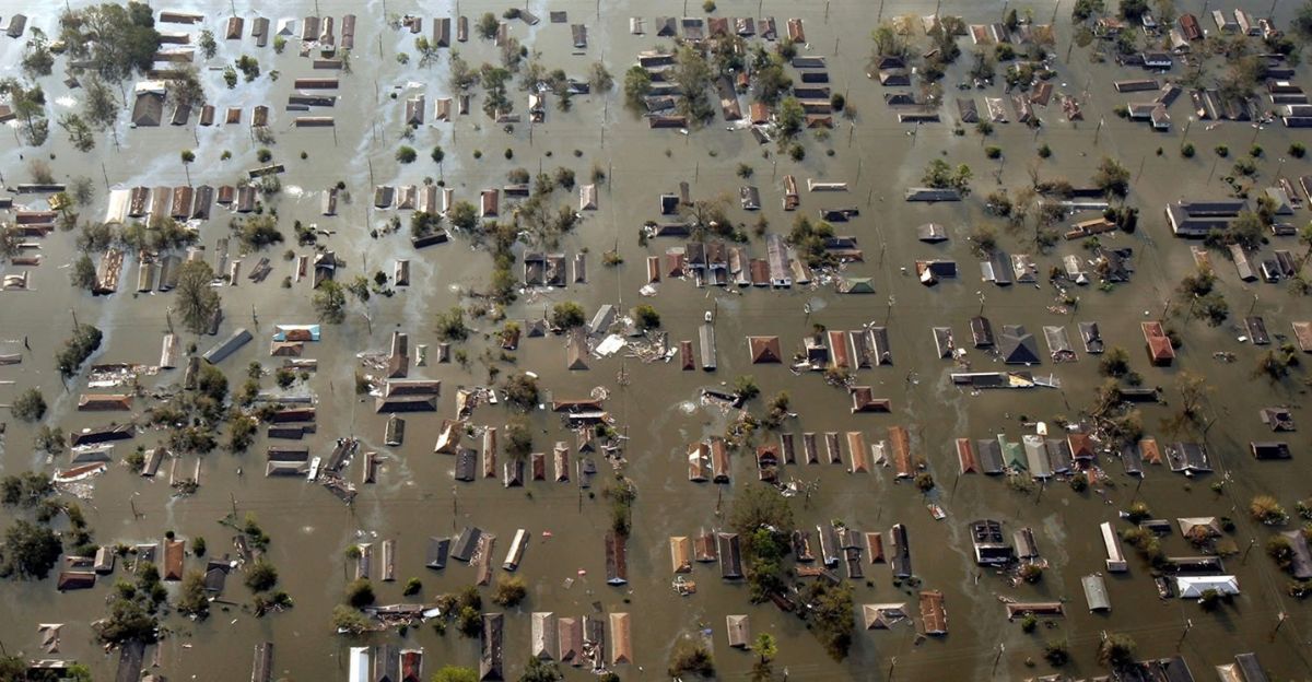
The last significant La Niña, from 2020 to 2023, brought three years of back-to-back hurricanes, massive flooding overseas, and severe droughts in the American South.
Thirty named storms in 2020 alone caused more than $120 billion in damage. Even in winter, La Niña’s reach was clear, bringing tons of snow up North, but drying out Texas and California.
Many communities are rebuilding from those years, so the new pattern keeps everyone alert.
Prepare and Adapt

In summary, with La Niña expected to arrive, Americans should anticipate more hurricanes this fall, a strange winter with more snow and cold up North, and more dry, warm weather in the South.
The challenge for everyone, from city managers to families, is to stay informed and prepare for whatever this powerful weather pattern brings.
Adapting quickly and understanding how La Niña interacts with climate change will help communities stay safe, minimize losses, and maybe take advantage of some of the benefits this influential climate pattern can bring.