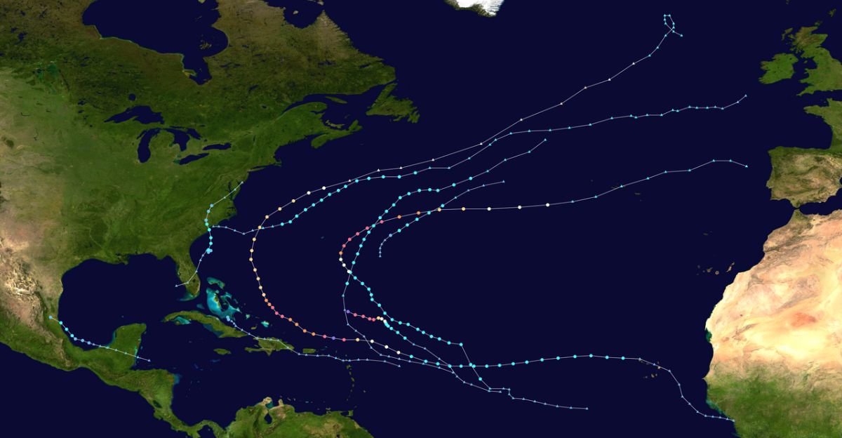
Hurricane Humberto has become a massive and mighty hurricane in the Atlantic Ocean. Over the weekend, it quickly became a Category 5 storm, with peak winds reaching 160 mph.
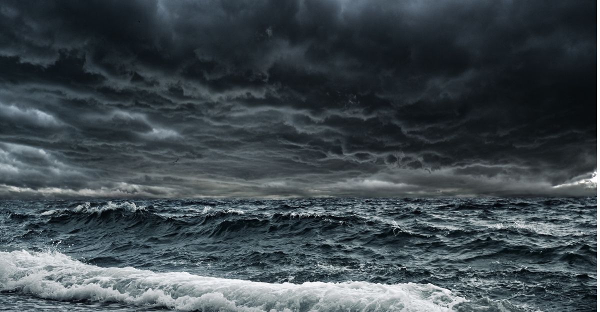
Even though Humberto’s eye is far out at sea, the massive hurricane is already sending dangerous waves and strong rip currents toward the entire United States East Coast.
From Florida to the Carolinas, officials warn people to stay off beaches and pay attention to emergency instructions, since big storms like this can be deadly, even far away.
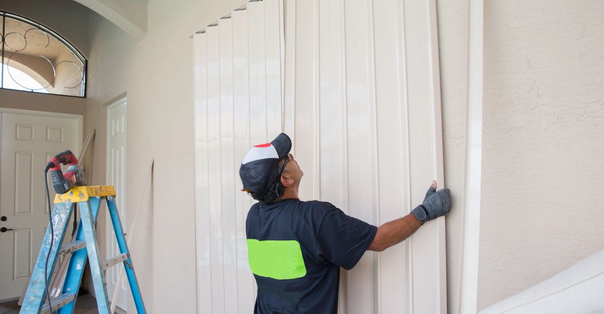
Many coastal cities began implementing their emergency plans days before the storm approached, showing how just the hint of a hurricane can cause significant changes for millions of people.
Record Breaking
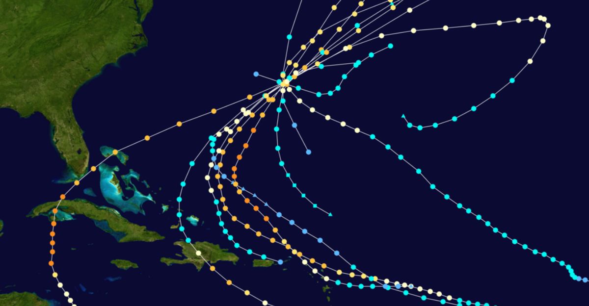
This year’s Atlantic hurricane season is making history. For the first time since 1935, the season’s first three hurricanes, Erin, Gabrielle, and now Humberto, have all grown into major hurricanes, which means Category 3 or higher.
Meteorologists say this early burst of powerful storms is sporadic and unusual. Almost no other season in the record books shows the same pattern.
Experts say it shows just how wild and intense this year’s weather is, and why forecasters are so concerned about what might come next in the months ahead.
Historical Context
To understand just how unusual 2025’s hurricane activity is, it helps to look back 90 years.
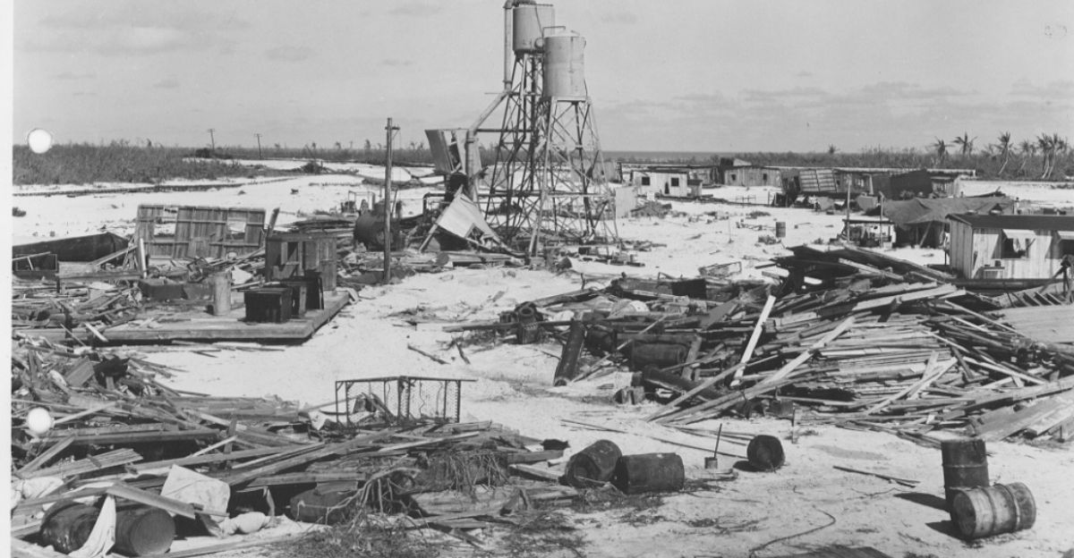
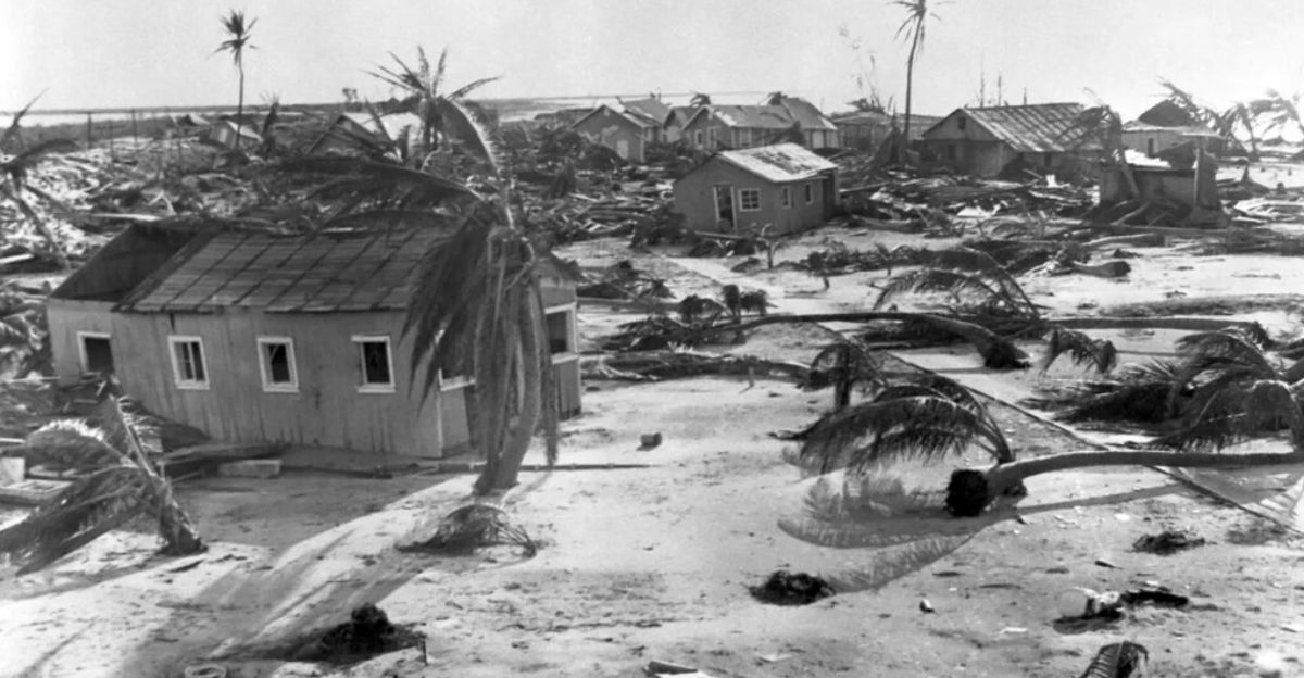
In 1935, the Atlantic was filled with terrifying storms, including the famous Labor Day Hurricane that hit Florida with Category 5 power, killing over 400 people.
That year’s storms killed nearly 2,800 people altogether, destroying cities across Florida, Haiti, and other islands.
Old photos show houses flattened and railroads twisted.
Weather historians compare 2025 to 1935, one of the most deadly and destructive hurricane seasons ever, as a warning of how bad things can get if these new major storms hit land.
Rapid Intensification
What makes Humberto and other recent hurricanes so frightening isn’t just their strength, but how fast they grow.
Over just one day, Humberto’s winds rocketed over 155 mph. This “rapid intensification” trend means storms can go from weak to extremely powerful in hours, not days.
Studies show storms this century are intensifying about 29% faster than similar ones just several decades ago, mainly because ocean water is warmer and contains more energy.
This rapid change leaves very little time for people to get ready or leave the area, making storm prep much harder.
Humberto’s Category 5 Moment
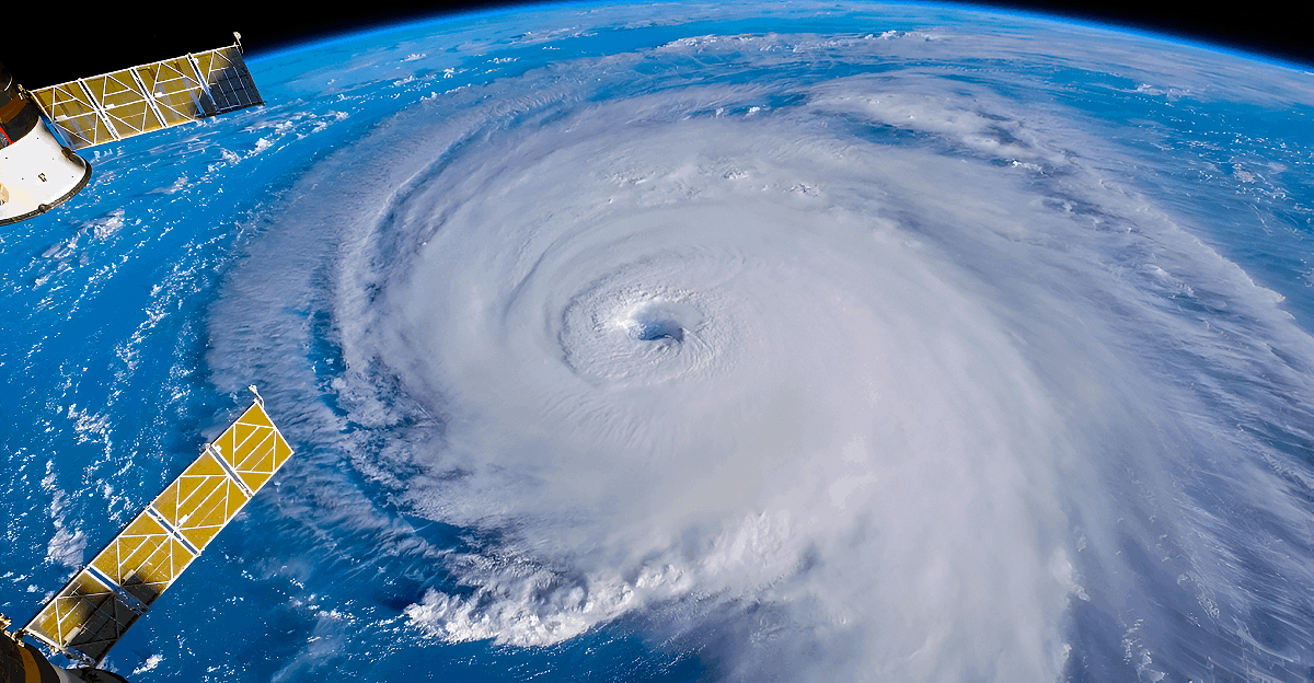
Humberto officially became a Category 5 hurricane at 5:00 PM Atlantic on Saturday, September 27. The hurricane’s winds hit 160 mph, and its very low central pressure of 925 millibars was a sign of extreme power.
This is rare: only 40 storms like this have been recorded in the Atlantic since 1851. Satellite pictures showed a textbook hurricane, with a perfectly round eye at its center and high “walls” of thunderstorms swirling around it.
After Erin reached the same level in August, Humberto is only the second Category 5 this season, proving how historic and dangerous 2025’s hurricane season has become.
Emergency Response
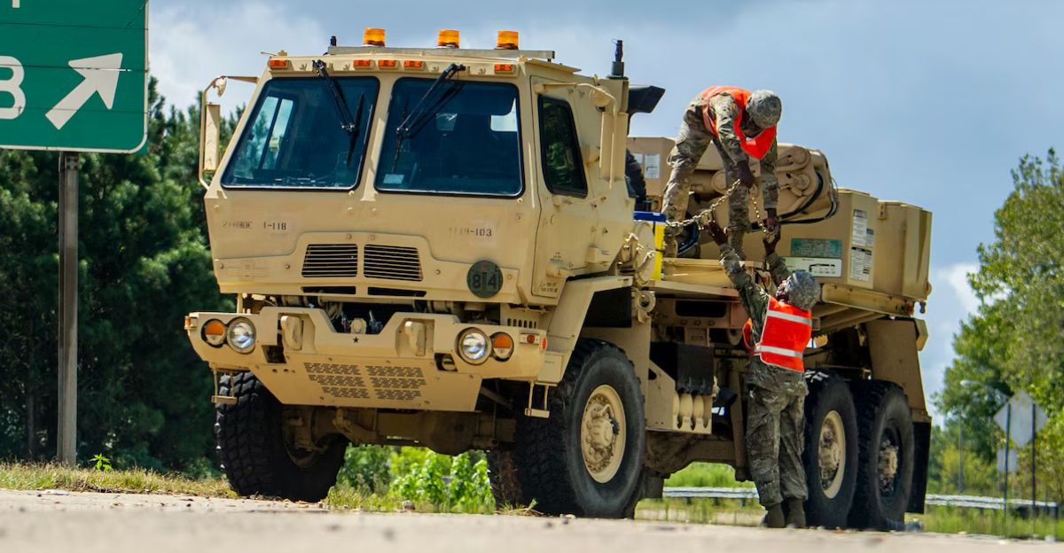
With Humberto churning closer, South Carolina declared a state of emergency. The governor called the National Guard, and cities like Charleston started piling up sandbags to keep water out.
Across the region, swift-water rescue teams set up in advance, while emergency workers cleaned storm drains and ensured flood-prone neighborhoods were ready.
Officials stressed that “the time to prepare is now”. Even if the storm stayed out at sea, its waves and wind could do plenty of damage.
This early action is now standard as hurricane threats grow more unpredictable.
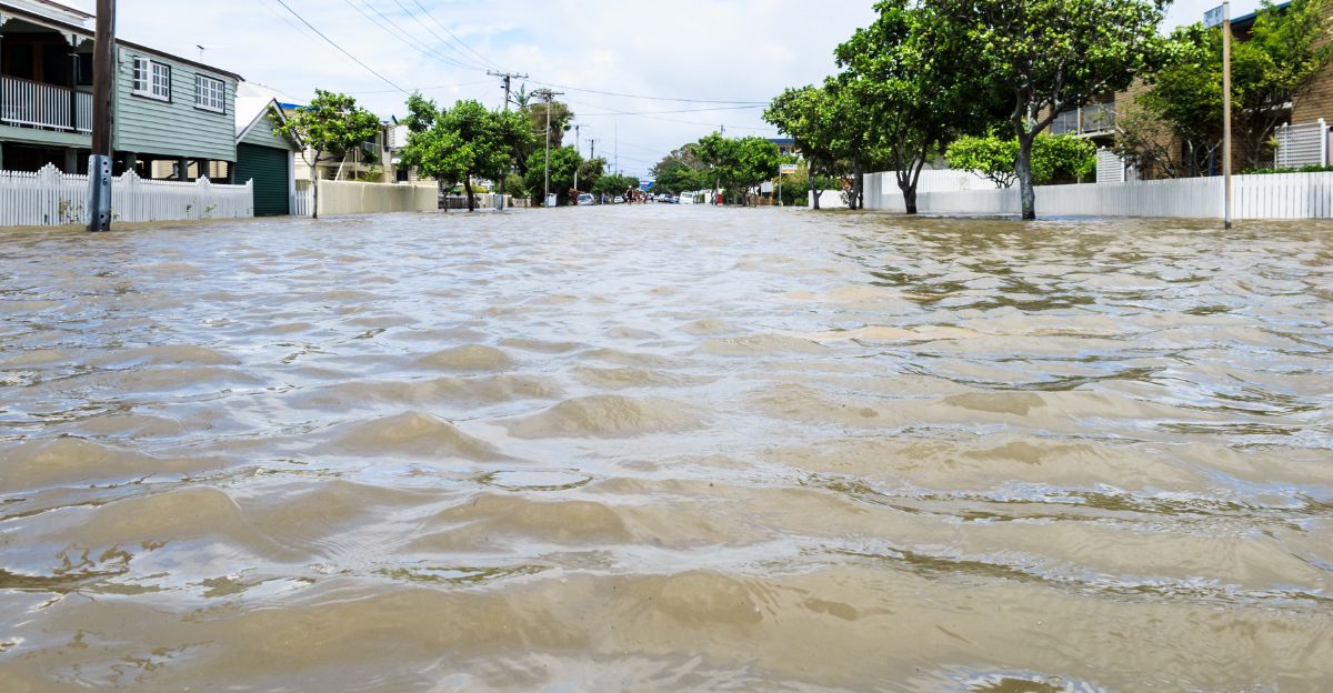
Coastal Impacts
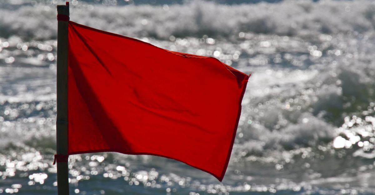
By Monday, powerful waves began hammering the U.S. coast from Florida to North Carolina, even as the hurricane’s eye was still hundreds of miles offshore.
Beaches were closed, and states posted warnings about deadly rip currents and dangerous surf—big enough to knock people down or pull them far from shore.
Some places braced for flooding as the hurricane’s winds pushed tides 1 to 2 feet higher than usual.
Even homes far from the eye felt the effects, with property damage, lost sand, and eroding beaches predicted along much of the coast.
Meteorologists warned that dangerous conditions could last for days, even if no direct hit occurred.
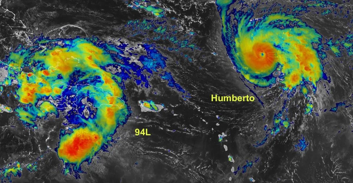
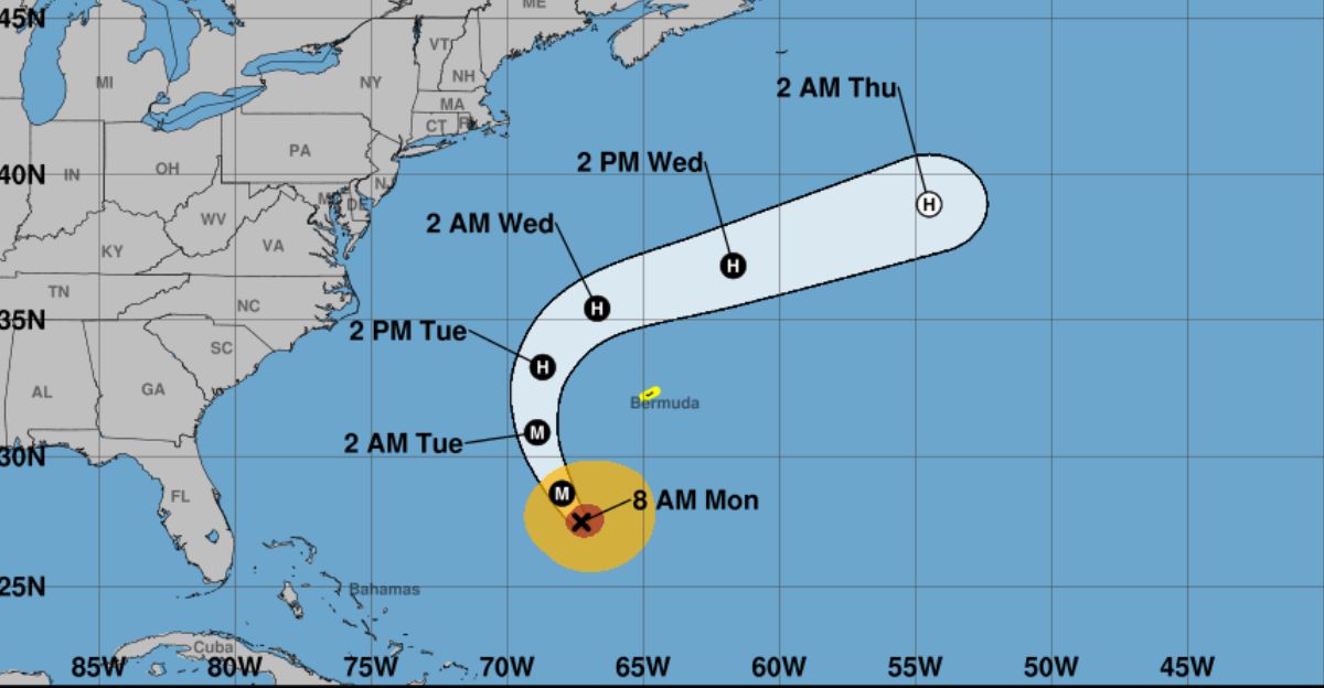
Bermuda’s Double Threat
On top of Humberto, Bermuda faced another scare. The small island, famous for its storm-ready homes, was caught between Hurricane Humberto to the south and strengthening Tropical Storm Imelda to the west.
For Bermuda, that meant the rare threat of back-to-back storms in a week.
Emergency workers on the island issued watches, opened shelters, and reminded everyone to stock up and stay alert for sudden changes.
Some described this as the most serious storm threat in years, because if the first storm left damage or debris, the second could worsen things.
Atlantic Basin Analysis
Humberto is part of a strange Atlantic hurricane season. It started with three major hurricanes, which haven’t happened since the deadly 1930s.
Meteorologists from universities like Colorado State say the current weather patterns favor storm growth, and the fast pace of powerful storms points to especially warm water and favorable winds.
This makes it more likely the season will keep delivering intense hurricanes right through the busy months of September and October.
Climate Connection
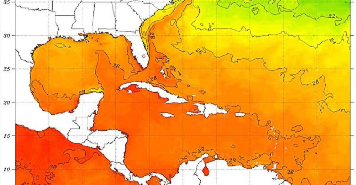
Why is this hurricane season so intense? The answer is partly climate change. The water in places where storms form is hotter than usual—sometimes setting records.
According to Climate Central, ocean warmth like this is up to 400 times more likely now because of human-driven climate change. W
Armer seas provide fuel for hurricanes, and more moisture in the air lets them grow quickly.
Many scientists now warn that the science is precise: storm seasons like 2025 will become more common as the world gets hotter.
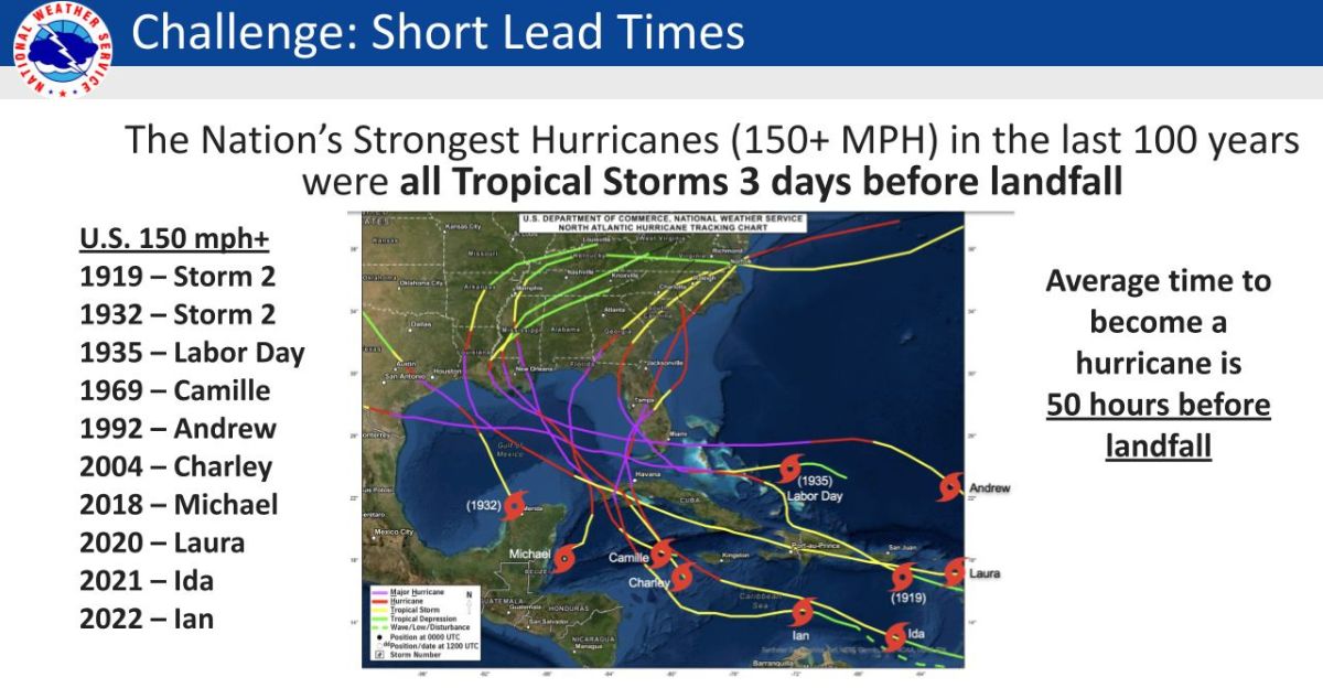
Forecasting Challenges
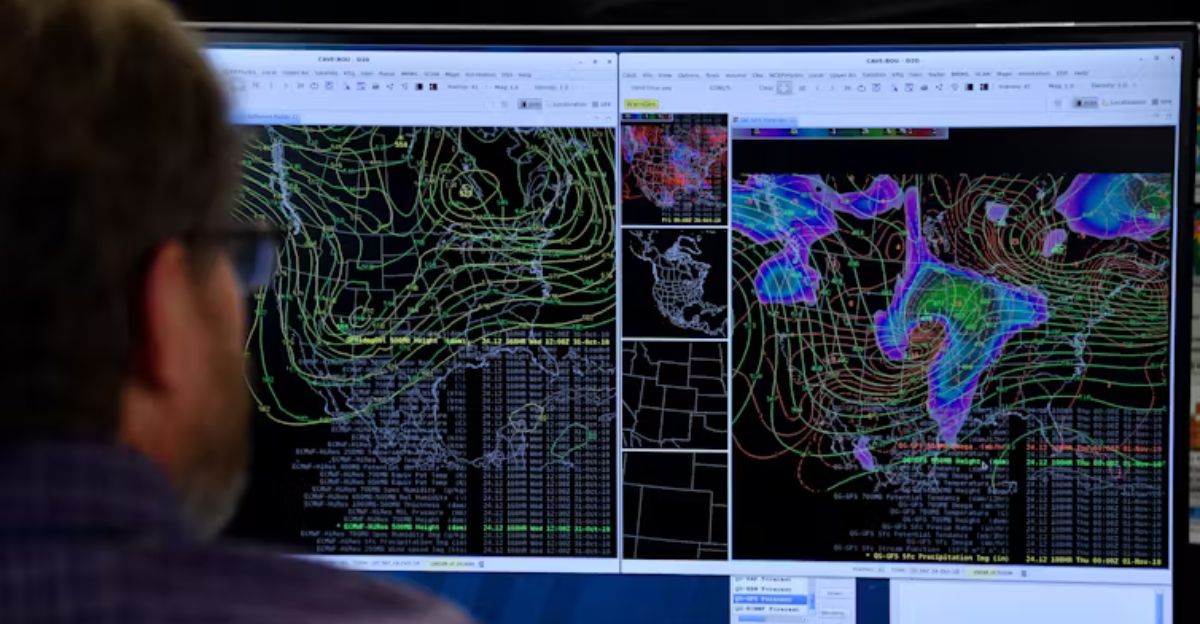
All these strange, powerful, fast-growing storms make life much more complicated for weather forecasters.
Even with the latest satellites and computers, predicting precisely when a storm will explode in strength is difficult. This means cities only have a few hours, not days, to prepare.
Humberto is a perfect example—a regular storm one morning, a Category 5 terror soon after.
Today’s tools are better, but experts say more research and new technology are needed to stay ahead of the world’s fastest-changing hurricanes.
International Impacts
The Bahamas, Cuba, and other Atlantic island countries also felt the early effects of Humberto and Imelda.
Up to eight inches of rain fell in places, causing local floods and raising mudslide risks in Cuba’s mountains.
Emergency workers in several nations worked together, sharing data and resources to prepare for these multiple storms simultaneously. This was a reminder that in the Atlantic, weather disasters often don’t respect national borders.
Infrastructure Resilience
In Bermuda, hurricane survival means engineering. The island’s unique white roofs and thick-walled homes are built to withstand powerful winds, thanks to lessons from centuries of storms.
The local power company, BELCO, put its storm plan into action, ensuring backup equipment and emergency crews were in place long before the storm could hit.
Public schools and big arenas turned into shelters.
The mentality: plan early, work together, and stay ready for whatever the Atlantic throws their way.
Economic Implications
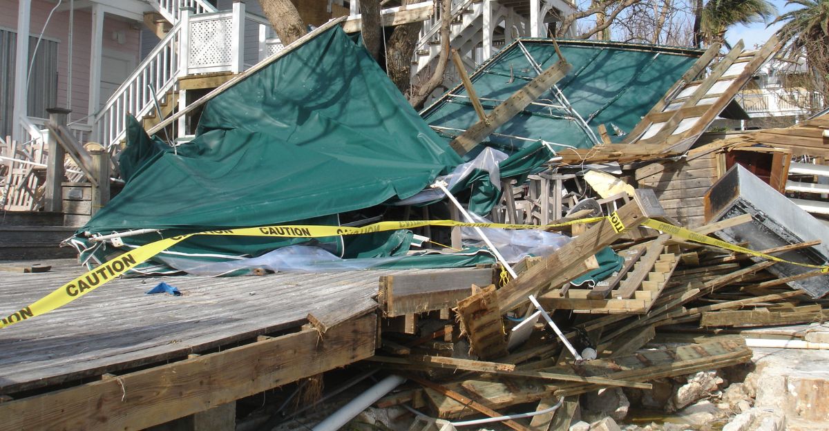
Every major hurricane comes with a significant price tag. Even if Humberto stays at sea, beach erosion, property loss, and lost business add up fast—often reaching billions.
Insurance companies are especially nervous. Records show that 70% of billion-dollar U.S. hurricanes underwent rapid intensification, just like Humberto and Erin did this year.
Several storms at once also strain emergency services, raising costs and recovery times for everyone, from homeowners to whole towns.
Looking Ahead
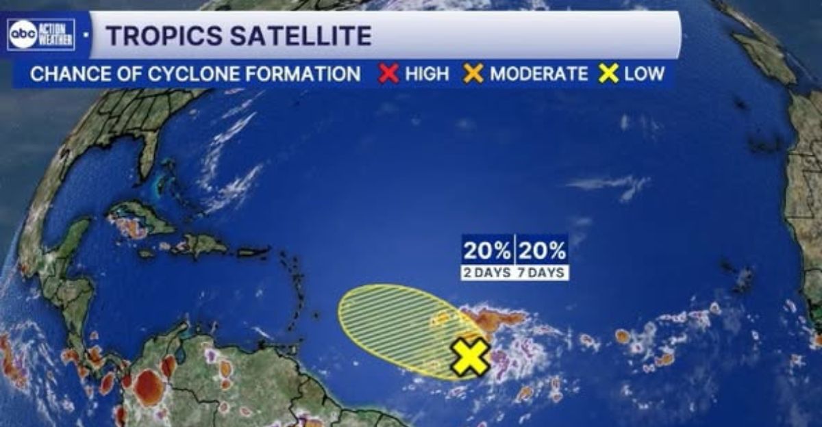
It’s not over. The hurricane season runs until the end of November, and the hottest storm period is still underway. Warm water and weather suggest more storms are likely.
Meteorologists are already watching new weather waves across the Atlantic, any of which could become the next big hurricane.
Computer models say that as the climate heats up, more storms will become Category 4 or 5, and the quiet times between big storms could shrink.
Emerging Research

New studies are investigating how climate change is speeding up rapid intensification. One found that the top 5% of storms have strengthened three to four mph faster every decade since the 1980s.
If this trend continues, we could see more storms like Humberto in the next 10–20 years.
Scientists are racing to understand these changes, improve prediction accuracy, and help the world prepare for “super-hurricanes” as ocean temperatures keep rising.
Insurance Industry Response

Insurance companies are overhauling their risk models as big storms become faster and stronger.
Many are raising prices or stopping coverage for homes and businesses in coastal danger zones.
More rapid intensification and grouped hurricane threats force the industry to rethink how it pools risk and helps clients recover from repeated disasters.
Social Media Impact

All eyes are on the storm. Millions follow hurricane trackers, forecasts, and live satellite views on social media.
Real-time updates help people evacuate faster and brace for trouble, but false information and rumors can spread just as quickly, sometimes causing panic or confusion.
Weather experts now use these platforms to correct misinformation and inform everyone, showing the power and risk of a globally connected world during disasters.
Historical Parallels
2025 brings eerie echoes of 1935, when a cluster of early major hurricanes changed American history and led to landmark disaster recovery efforts.
Just like then, forecasters today warn that when storm seasons start early with big hurricanes, even more are likely before the year is over.
The message from the past is not to let down your guard. The most damaging storms often come late in the season.
Prepare for Extremes
Hurricane Humberto is a sign of a new era in hurricane risk. It rapidly grew into a Category 5 monster that, while offshore, still threatened lives, businesses, and entire coastal communities.
There were three major hurricanes at the start of the 2025 hurricane season. It shows the power of nature when fueled by ever-hotter oceans.
This trend means that people, businesses, and governments must rethink how they prepare, warn, and recover all along the Atlantic coast.
With more unpredictable and powerful hurricanes expected in the future, “better safe than sorry” isn’t just advice; it’s also now a rule of survival.