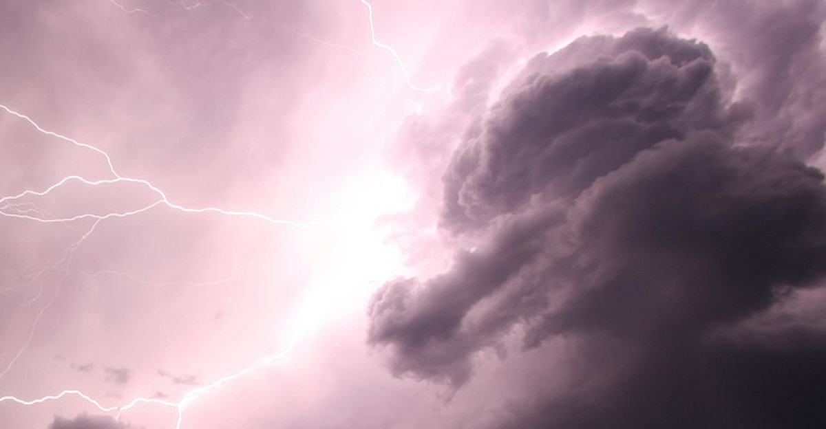
California’s most meteorologically volatile week of 2025 began unfolding Tuesday as forecasters issued urgent bulletins across multiple counties. The National Weather Service’s Weather Prediction Center elevated flood risks to “Slight Risk” levels, according to San Francisco Chronicle reports, while CAL FIRE braced for renewed lightning activity. Weather Prediction Center officials confirm that with remnant moisture from Tropical Storm Mario streaming north, conditions were aligning for a dangerous convergence of hazards.
Storm Models Show ‘Unprecedented’ September Moisture Surge
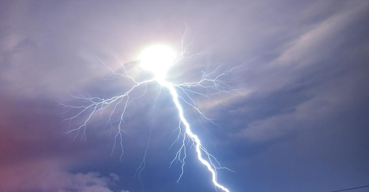
Weather models showed precipitable water levels climbing to three times September averages by Thursday evening, setting up what meteorologists describe as California’s most unstable atmospheric configuration since 2020. Colin McCarthy, a respected storm analyst, warned in Newsweek reports that the Bay Area faced its “most intense setup for a dry lightning event” in five years. Multiple counties received flash flood watches as the threat window narrowed, according to Chronicle weather data.
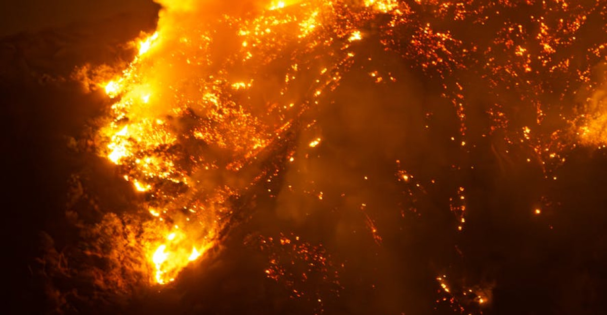
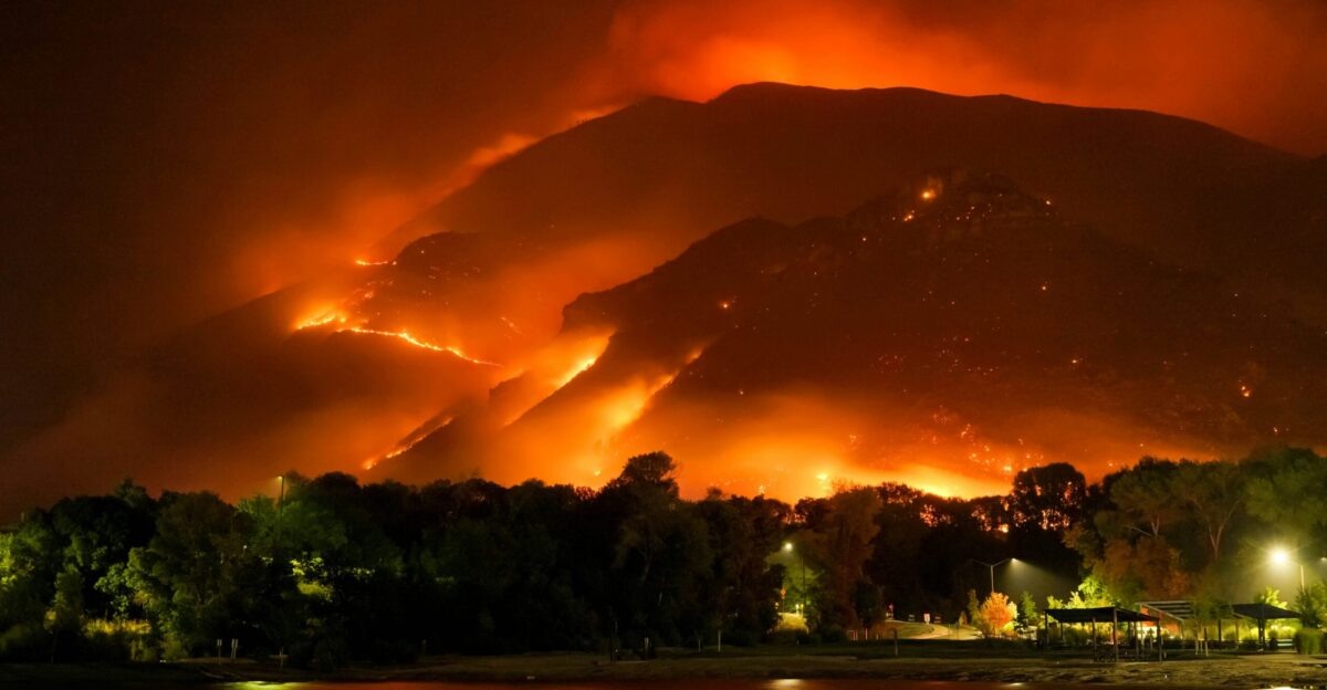
Lightning Strikes Already Devastated Historic Towns This Month
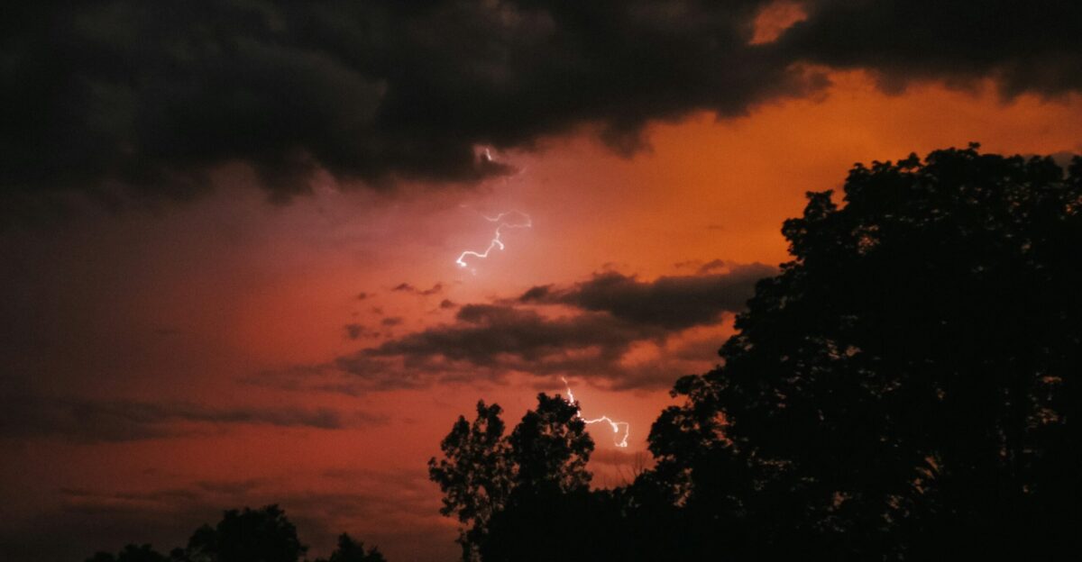
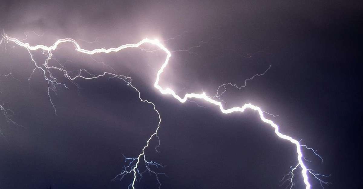
Earlier this month, California endured a devastating lightning outbreak that produced more than 10,000 strikes across the state in a single 24-hour period, NorCal Public Media reports. Those dry thunderstorms ignited dozens of wildfires, including the massive TCU September Lightning Complex that consumed 13,869 acres across four counties, CAL FIRE data shows. Historic Chinese Camp, a Gold Rush town with fewer than 100 residents, was nearly obliterated in the flames, CNN confirmed.
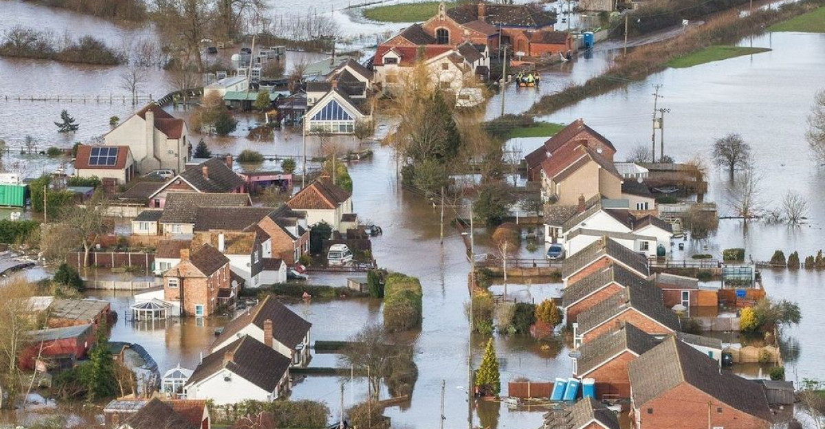
Burn Scars Create Perfect Storm for Catastrophic Flooding
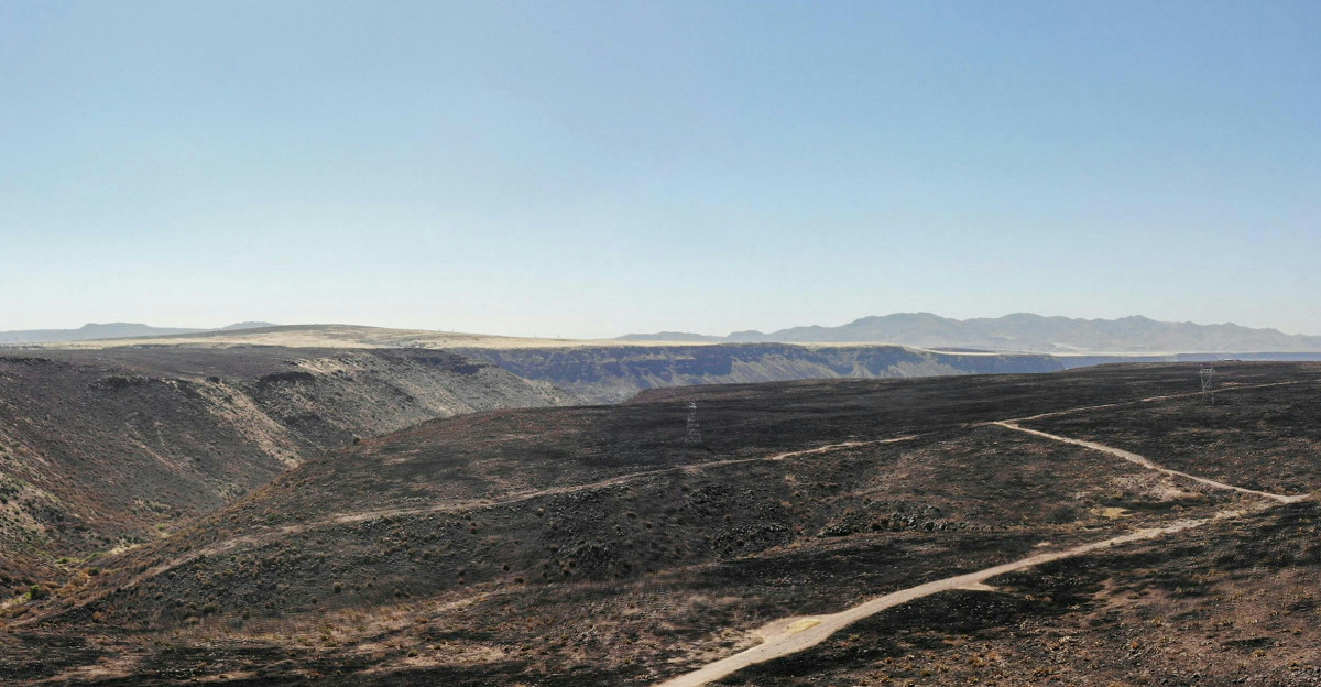
The timing could hardly be worse for California’s fire-scarred landscape. Recent burn areas from the 60,000-acre Garnet Fire in Fresno County and the 3,600-acre Blue Fire in Siskiyou County remain vulnerable to debris flows, CAL FIRE records indicate. Soil temperatures exceed 100 degrees in many foothill areas, while live fuel moisture readings have dropped to critically low levels after months without meaningful precipitation, seasonal outlook data suggests.
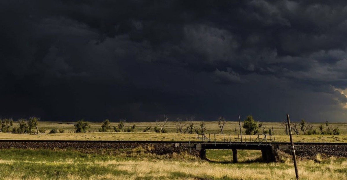
Tropical Storm Remnants Begin Multi-Day Weather Siege
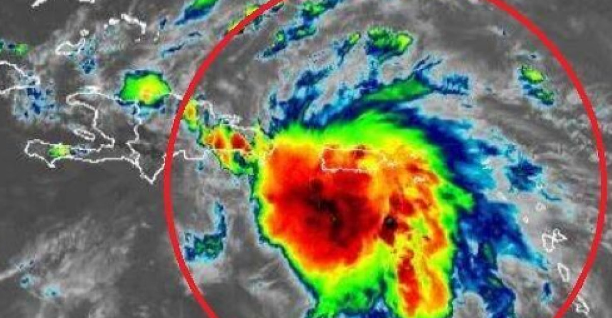
Tuesday evening marked the beginning of a multi-day weather siege as Tropical Storm Mario’s remnants began their northward journey from Baja California. Weather systems are carrying unprecedented moisture loads toward Southern California’s coast, meteorological data confirms. Weather Prediction Center meteorologist Frank Pereira warned in Newsweek interviews that the incoming system would be “accompanied by heavy rain,” with the greatest flooding concerns developing from Wednesday through Friday across the Southwest.
Southern California Takes First Hit from Dangerous Storms
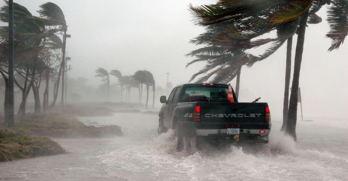
Southern California bore the first impacts Tuesday night, with scattered thunderstorms approaching Ventura, Santa Barbara and Los Angeles counties, Chronicle forecasters report. Meteorologists predict some cells could dump over an inch of rain in just hours, while others would produce dangerous dry lightning with minimal precipitation. The threat axis extends from coastal ranges inland through desert regions, affecting millions of residents according to regional weather services.
Emergency Officials Sound Alarm About ‘Uncharted Territory’

“We’re in uncharted territory for this time of year,” said Ryan Kittell, a National Weather Service meteorologist in Oxnard, describing the unusual September tropical moisture influx to Noozhawk reporters. Residents in Santa Barbara County were advised to prepare for the wettest Thursday in months, with humidity levels climbing toward tropical-like conditions. Emergency managers activated coordination centers as the storm window approached its peak intensity, Chronicle sources confirm.
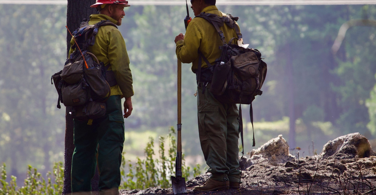
Fire Agency Deploys Hundreds as Lightning Threat Escalates
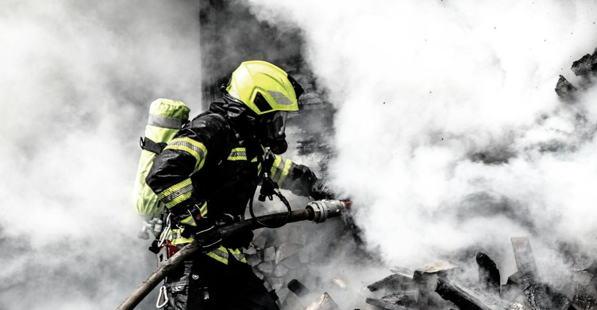
CAL FIRE elevated staffing levels statewide and issued Red Flag Warnings for northern counties where lightning-sparked fires remained active, agency Instagram posts reveal. The agency deployed over 600 firefighters to contain existing blazes while positioning resources for new ignitions. Governor Newsom’s office coordinated with federal agencies to ensure adequate air support, having learned from earlier lightning events that produced 74,000 strikes in recent weeks, state reports indicate.
Dangerous Weather Pattern Mirrors 2020 Lightning Disaster
The weather pattern resembled the notorious August 2020 lightning siege that devastated Northern California, meteorologists noted in Weather West analysis. A closed upper-level low was drawing tropical moisture northward while creating instability over already parched terrain. Atmospheric moisture content reached levels rarely seen in September, with dewpoints climbing 15-20 degrees above seasonal norms across interior valleys, Chronicle data shows.
Hidden Debris Flow Threat Emerges on Burned Hillsides
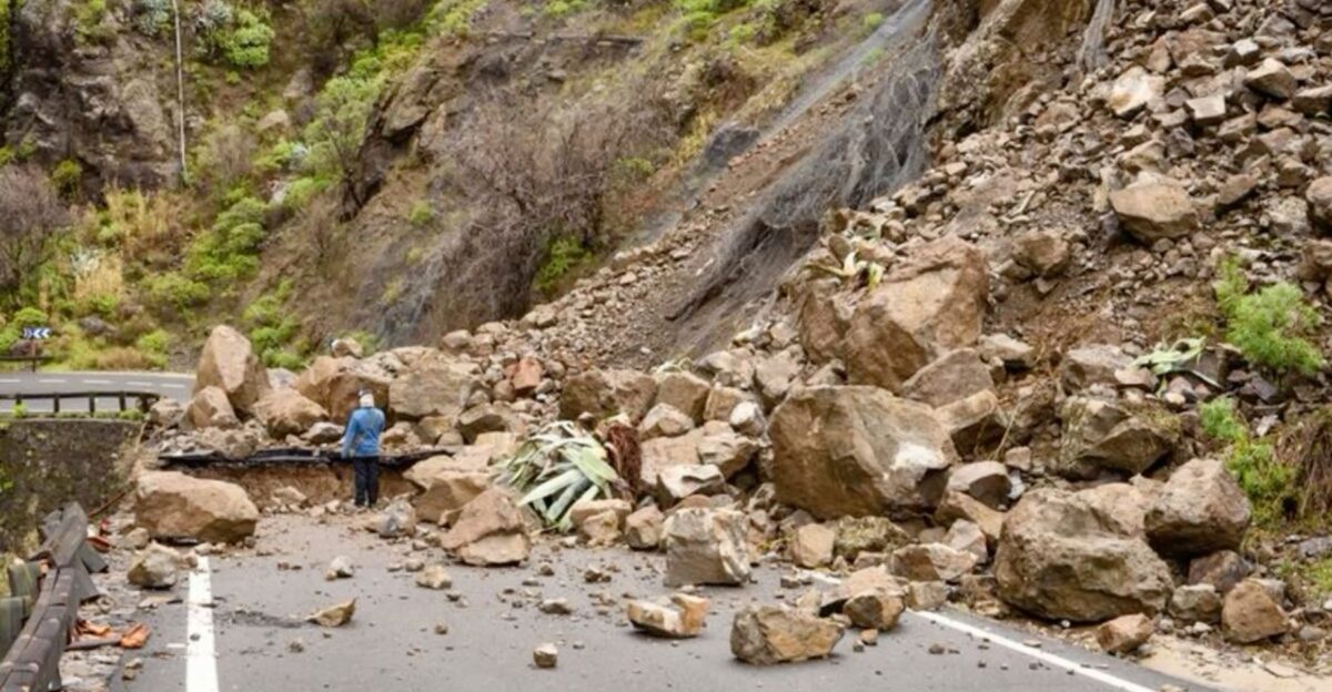
Beyond immediate fire and flood risks, a more insidious danger was materializing on recent burn scars according to scientific research. Scientists warned in The Conversation that rainfall on charred hillsides could trigger debris flows moving “with the speed of a freight train,” potentially carrying massive boulders, vehicles and trees downhill. The combination of impermeable burned soil and steep terrain created perfect conditions for catastrophic landslides in areas like the Garnet Fire footprint, Yahoo News reports suggest.
Local Officials Worry About Dangerous Public Complacency
Local officials expressed concern about public complacency following months of drought conditions, emergency coordination reports indicate. “People forget how quickly things can change,” said one Tuolumne County emergency coordinator, referencing the Chinese Camp devastation where residents had mere minutes to evacuate according to CNN coverage. Water rescue teams were placed on standby as flash flood potential increased across multiple watersheds, ABC News confirms.
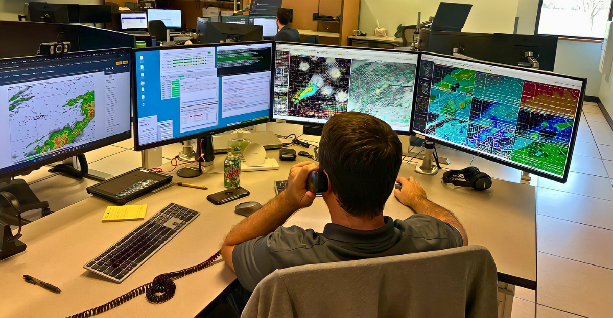
Weather Service Overhauls Warning Systems for Crisis
The National Weather Service restructured its warning protocols, implementing enhanced impact-based messaging for the tropical moisture event according to operational updates. Weather Prediction Center supervisors authorized extended forecast discussions and coordinated with local emergency management agencies. Staffing increases allowed for round-the-clock monitoring as the most dangerous period approached Thursday evening, according to center procedures.
Fire Crews Position Aircraft for Lightning Onslaught

Fire agencies pre-positioned aircraft and crews in strategic locations, learning from previous lightning events that sparked over 200 fires statewide, Governor’s office reports indicate. CAL FIRE’s aggressive initial attack strategy had kept 95% of recent lightning-caused fires below 10 acres, but the incoming moisture threatened to overwhelm suppression resources. Additional mutual aid agreements were activated with neighboring states according to seasonal outlook data.
Meteorologists Express Doubts About Storm Predictions

Some meteorologists cautioned that forecast models showed significant disagreement on storm placement and intensity, Weather West analysis suggests. “There’s still uncertainty about how far north the moisture will penetrate,” one Weather Service forecaster noted. Model guidance oscillated wildly between scenarios, making precise impact predictions challenging even 24-48 hours before the event’s peak, Chronicle weather experts report.
Thursday Emerges as Day of Maximum Danger Statewide
Thursday emerged as the day of maximum danger, when atmospheric instability would peak across Central and Northern California according to meteorological projections. Residents were urged to avoid burn-scarred areas, secure outdoor property, and monitor local advisories closely, Newsweek reports indicate. The question remained whether California’s fire-suppression infrastructure could handle simultaneous flood and fire emergencies across multiple regions, Chronicle analysis suggests.
Emergency Response Gaps Expose Critical Policy Failures

The event highlighted gaps in California’s multi-hazard emergency response capabilities, particularly regarding simultaneous fire-flood scenarios according to disaster preparedness research. State legislators had been considering enhanced debris-flow warning systems, but implementation lagged behind the accelerating pace of extreme weather events. Federal disaster declarations might be needed if widespread damage occurred, stretching already limited FEMA resources, policy analysis suggests.
Global Climate Crisis Creates Similar Disasters Worldwide
Similar tropical moisture events had recently devastated other Mediterranean climates worldwide, from Portugal’s 2023 flash floods to Australia’s 2022 fire-flood cycles according to international climate data. Climate scientists noted that warming oceans increase atmospheric moisture capacity by 7% per degree of warming, making such extreme precipitation events increasingly likely. California’s experience could provide crucial data for global climate adaptation strategies, research indicates.
Burn Scars Create Lasting Environmental Hazards for Years
The burn scar vulnerability represented a new dimension of wildfire impacts, where initial fire damage created cascading risks lasting months or years, The Conversation research shows. Scientists estimated that debris flow likelihood would increase 110% with the projected 18% rise in rainfall intensity from climate change. Previously safe areas downhill from burned slopes now faced unprecedented hazards according to environmental impact studies.
Historic Communities Face New Reality of Climate Threats
The Chinese Camp destruction symbolized how extreme weather increasingly threatens California’s historic heritage sites, CNN reports confirm. Communities once considered fire-safe due to their rural isolation now found themselves on the front lines of climate impacts. The psychological toll of repeated evacuations was creating “disaster fatigue” among foothill residents who faced recurring threats, Reuters analysis and Smithsonian Magazine coverage indicates.
California’s Weather Crisis Signals Troubling Climate Future
California’s September 2025 fire-flood convergence may represent a new normal as climate change intensifies extreme weather interactions according to climate research projections. The state’s emergency response systems, designed for single-hazard events, faced unprecedented stress from simultaneous threats. This week’s outcome could reshape how California prepares for an era where traditional weather patterns no longer apply, CAL FIRE seasonal projections suggest.