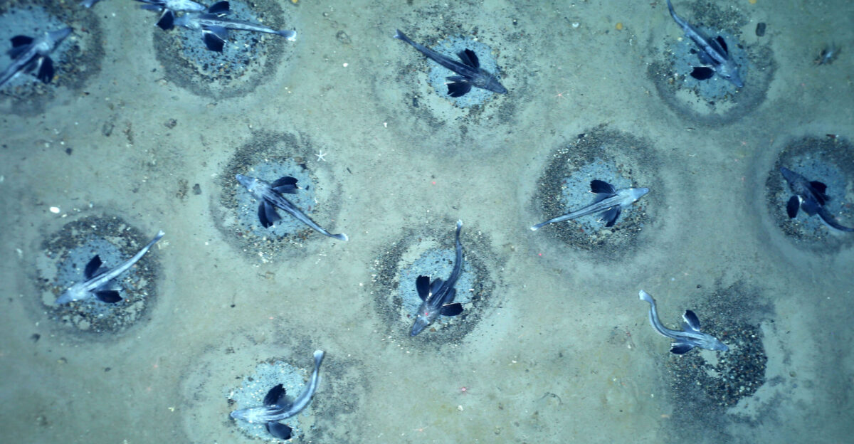
The ROV’s lights cut through frigid darkness 200 meters below Antarctica’s surface, revealing thousands of perfect circles carved into the seafloor. Each hollow sat empty, swept clean of debris—deliberate, geometric, haunting.
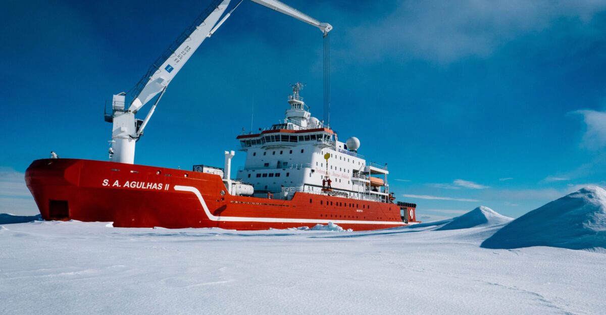
Marine biologist Russell Connelly, aboard the SA Agulhas II icebreaker, leaned closer to the monitor. “We thought maybe it was a Weddell seal bonking into the seabed,” he later recalled. But the marks were too uniform, too organized. What they’d found changed everything.
The Iceberg That Changed Everything
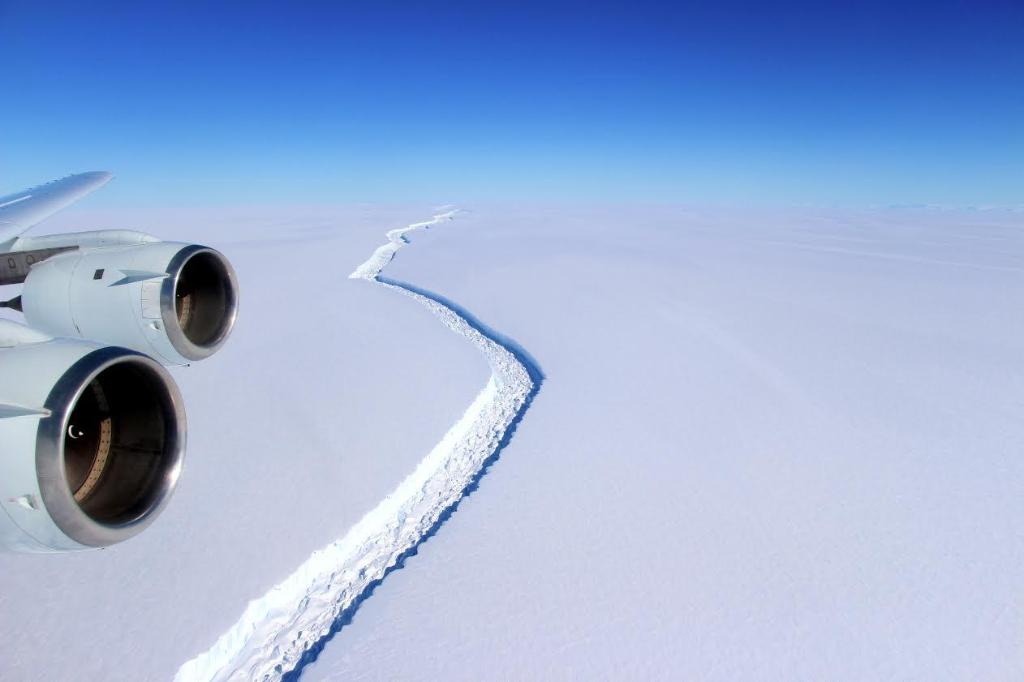
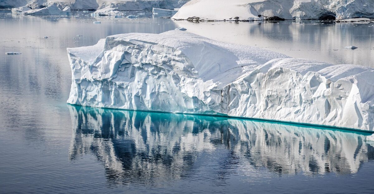
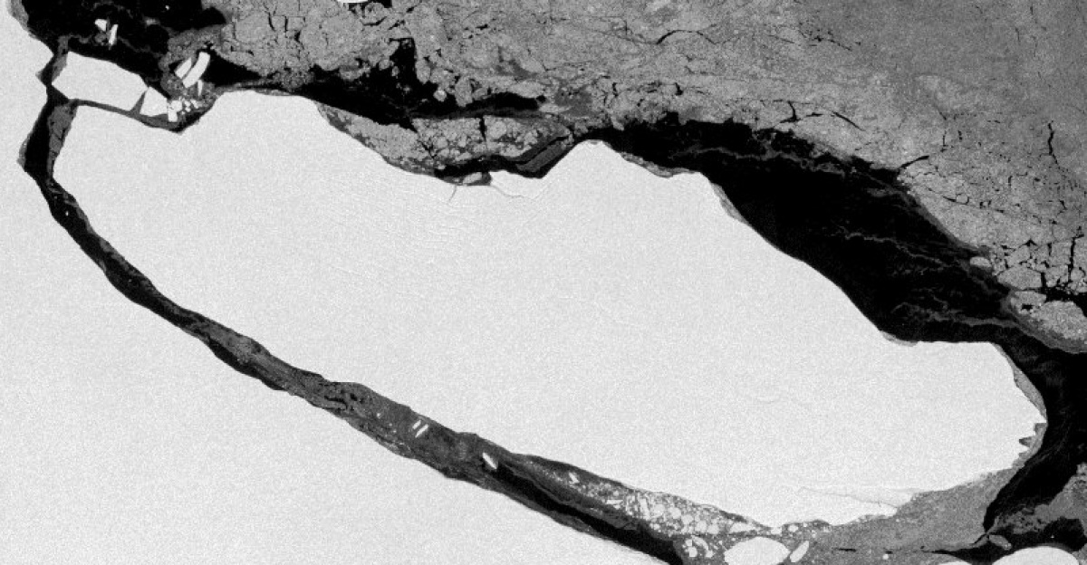
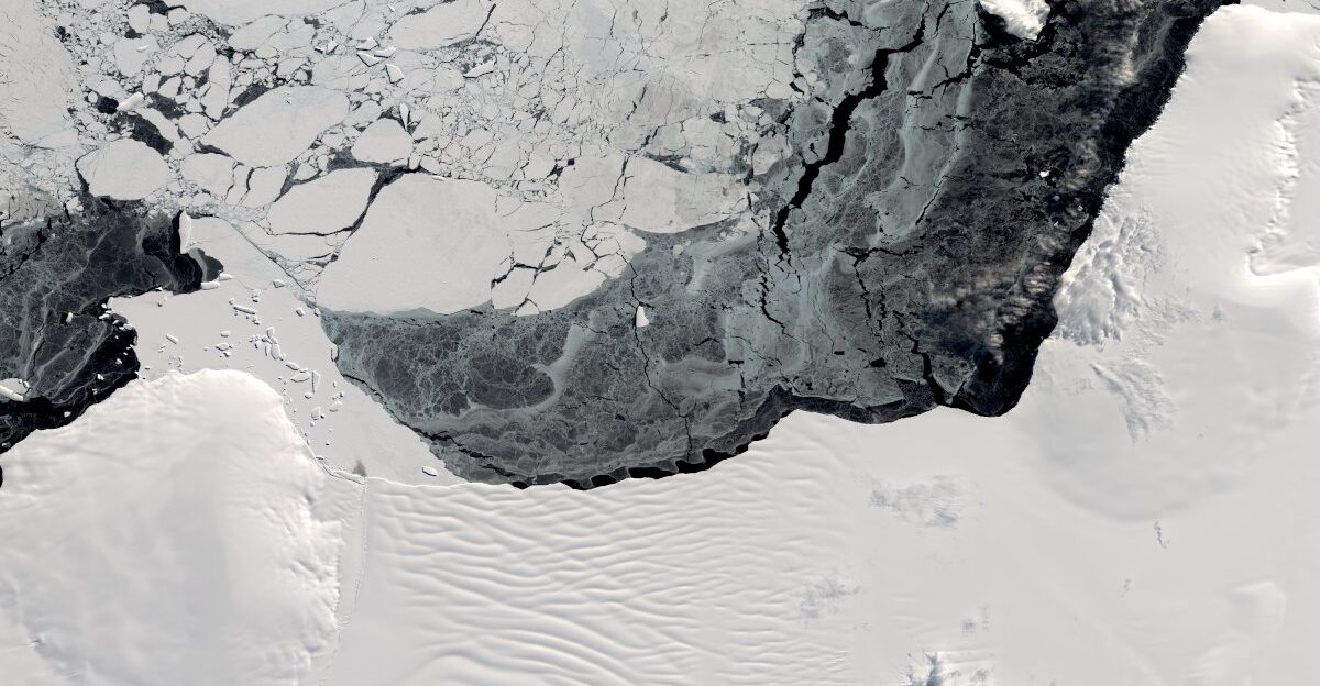
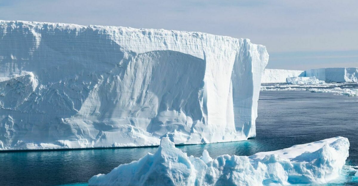
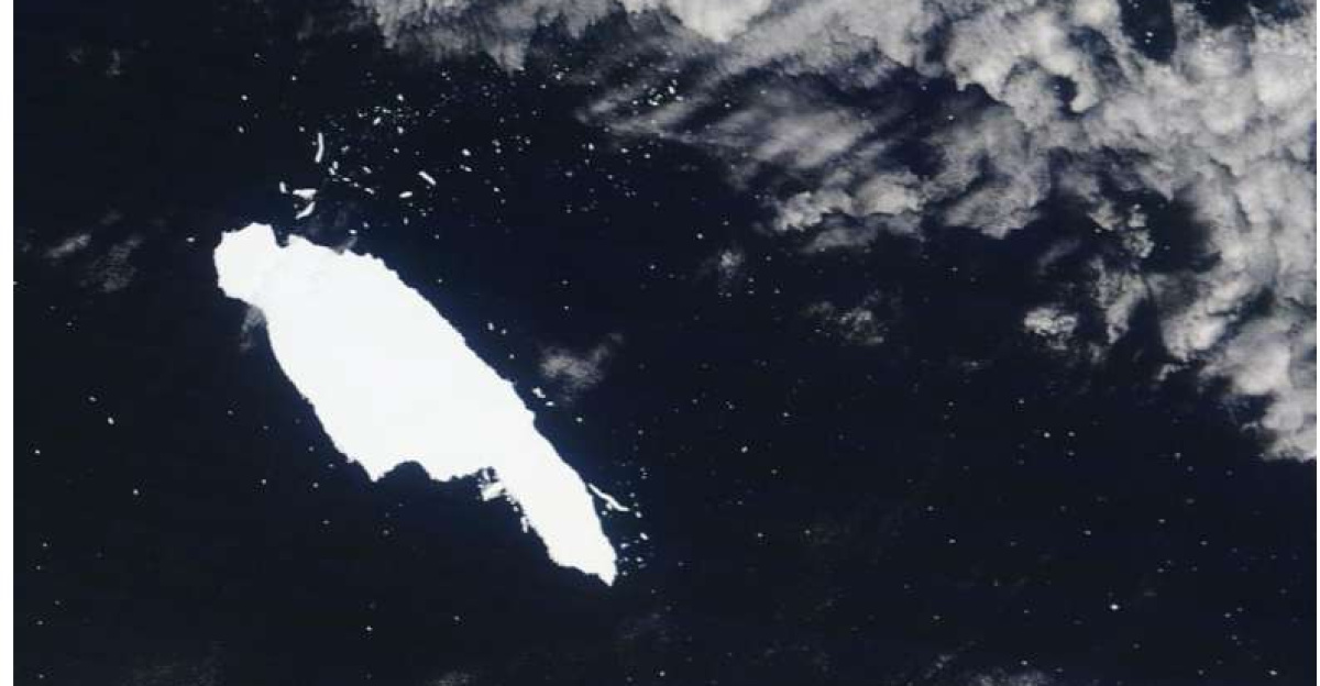
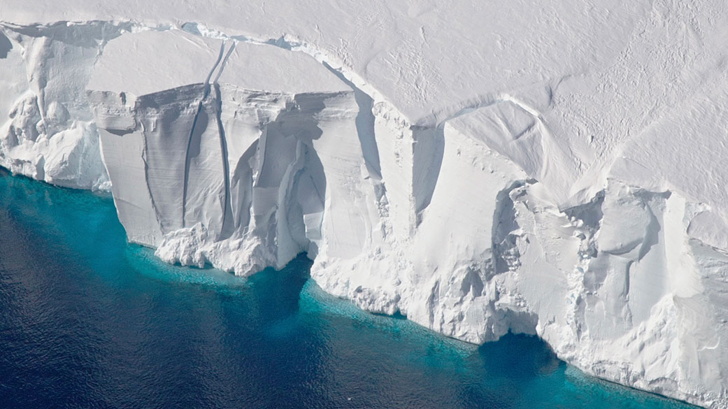
In July 2017, a trillion-ton slab of ice the size of Delaware ripped away from Antarctica’s Larsen C Ice Shelf. The A68 iceberg measured 5,800 square kilometers—175 kilometers long, 50 kilometers wide, and 200 meters thick.
For potentially 120,000 years, the ice shelf had sealed the seafloor beneath it from sunlight and human eyes. Now, melting away into the Atlantic, A68 left behind an underwater wilderness scientists had never accessed.
Racing Against the Ice
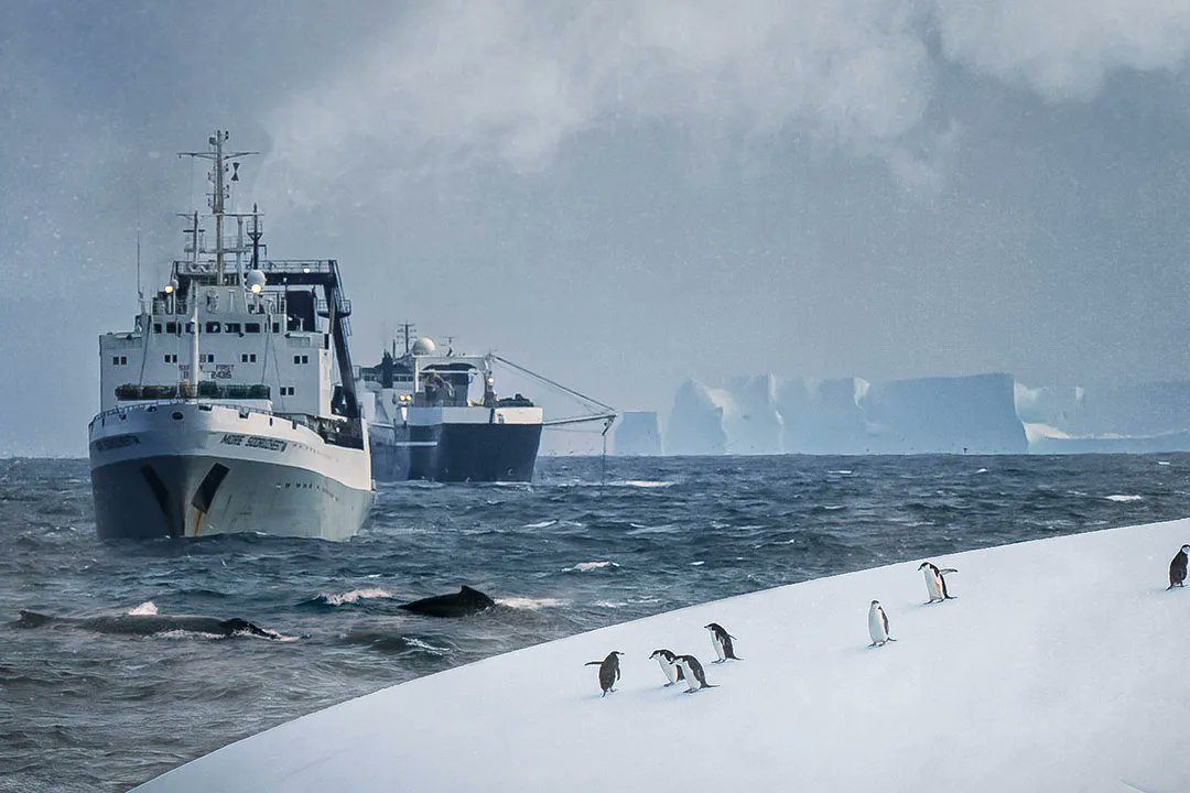
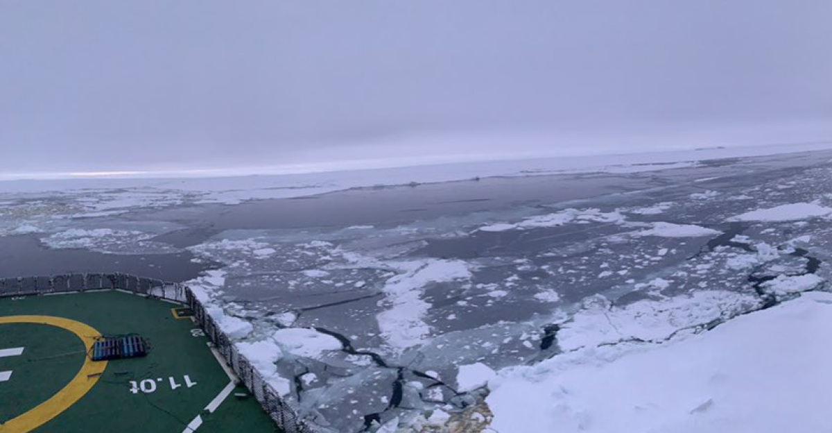
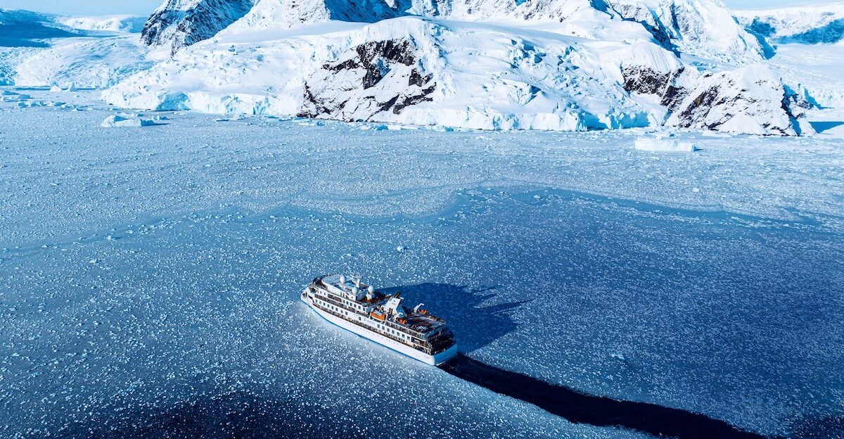
The Weddell Sea Expedition 2019 was launched with dual missions: to study the rapidly changing Larsen C region and locate Sir Ernest Shackleton’s legendary ship, the Endurance, which sank in 1915.
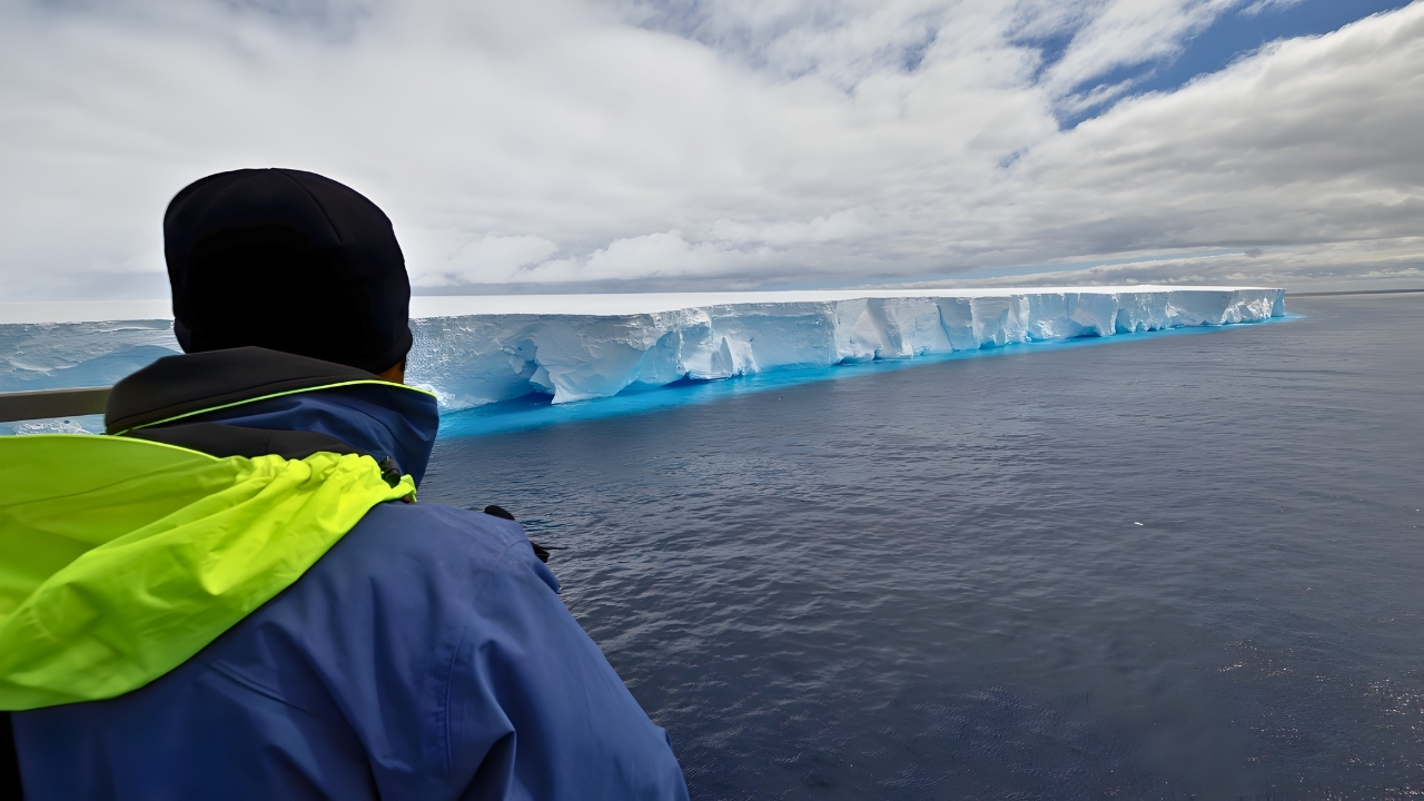
Aboard the South African icebreaker SA Agulhas II, scientists threaded through drifting ice floes, battling temperatures dropping from -5°C to -20°C. The same treacherous conditions that crushed Endurance now threatened to trap them. Time was running out.
Enter Lassie, the Deep-Sea Detective
Scientists deployed a remotely operated vehicle nicknamed “Lassie”—a tethered underwater robot bristling with cameras and sensors. The ROV descended through absolute darkness into waters never before explored. For 27 hours, Lassie glided over the exposed seabed, its cameras recording every detail.
The research team watched monitors aboard the icebreaker, sieving through freezing mud on the back deck for hours, searching for clues to what lay below.
A Fish Neighborhood on the Ocean Floor
The video showed over 1,000 circular depressions etched into the seafloor—each one swept completely clear of the plankton debris blanketing surrounding areas.
These weren’t random: some clustered tightly together, others curved like crescent moons, still others lined up in perfect rows or stood isolated. Scientists had discovered an underwater metropolis of fish nests arranged in six distinct geometric patterns spanning five locations.
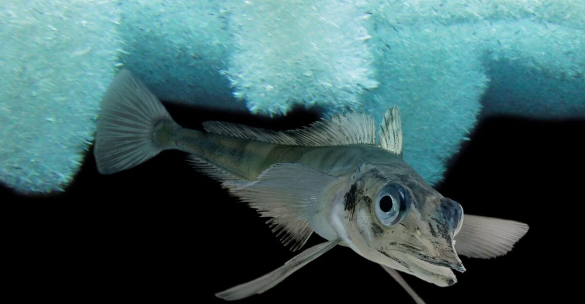
Meet the Yellowfin Notie
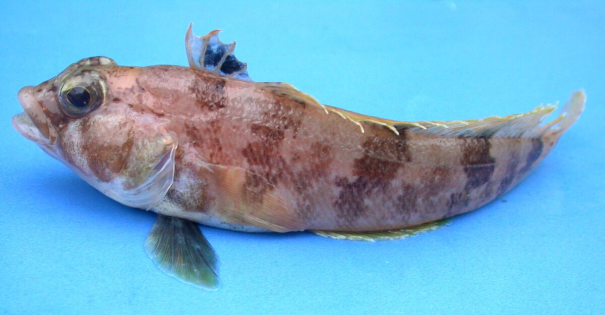
The nest builders turned out to be yellowfin noties (Lindbergichthys nudifrons), a species of rockcod uniquely adapted to Antarctica’s extreme conditions. These gray-blue fish thrive in waters below freezing, where they endure crushing pressure, their blood pumping antifreeze compounds to survive.
Each parent fish constructs a circular nest in fine sediment, with rims averaging about 12 centimeters (4.8 inches) across, then guards their eggs for approximately four months against relentless predators.
The Selfish Herd in Action
Scientists have identified why the nests formed such deliberate patterns: to provide predator defense. Clusters—the most common arrangement at over 42%—demonstrated the “selfish herd” theory in action.
Weaker fish nested in the center, shielded by neighbors on all sides. Larger, stronger individuals occupied the isolated perimeter nests where danger was highest. Each fish minimized personal risk by placing others between themselves and lurking threats below.
Predators of the Antarctic Deep
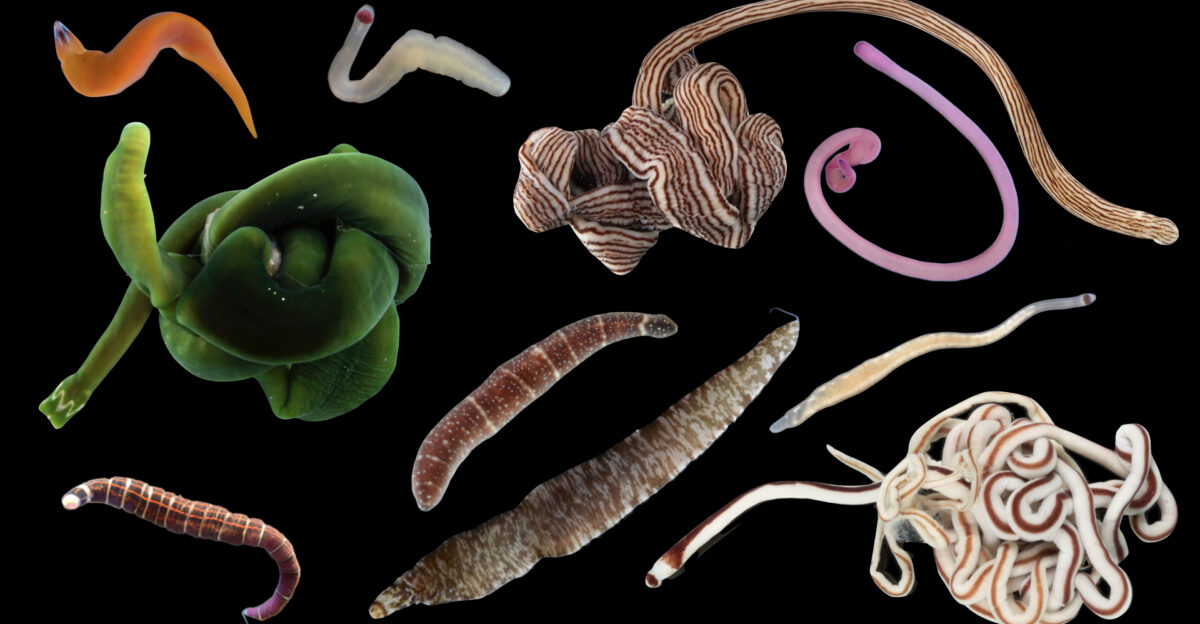
Ribbon worms, brittle stars, and predatory polychaete worms patrol the Weddell Sea floor, hunting for fish eggs. The nemertean ribbon worm Parborlasia corrugatus uses chemical cues from its environment to locate prey.
Scientists theorize that the clustered nests create a confusing sensory landscape—a chemical maze that complicates predators’ ability to target specific nests during the lengthy four-month incubation period of the eggs. Cooperation becomes survival.
Six Patterns, One Purpose
Researchers catalogued six distinct nest arrangements across 1,036 active sites: clusters (the most common), crescents (curved like moons), lines (evenly spaced rows), ovals (characterized by consistent perimeter spacing), sharp U-shapes, and singular, isolated nests.
Some nests overlapped. Many incorporated small rocks and pebbles, possibly to break currents or mask scent trails. Each pattern represented a different survival calculation, where fish weighed protection against territorial needs.
Life Under 200 Meters of Ice
The area had been sealed beneath the ice shelf for potentially 120,000 years—the last time this seafloor saw sunlight, Neanderthals were still walking the Earth. Temperatures hover around 1.8°C year-round. Nutrients arrive solely through lateral currents flowing beneath the ice.
Yet 72 of the discovered nests contained larvae or had fish actively guarding them when Lassie’s cameras arrived, proving this wasn’t an abandoned site but a thriving nursery.
A Window That Won’t Stay Open
Ice shelves, such as Larsen C, act as massive buttresses, restraining glacial flow from Antarctica’s interior toward the ocean. When shelves collapse or calve giant icebergs, that restraint disappears, accelerating ice flow and contributing to global sea-level rise.
The A68 calving event resulted in the loss of 12% of Larsen C’s total area. Scientists had perhaps two years to study the newly exposed seabed before shifting pack ice would seal it again forever.
The Endurance Connection
The expedition faced bitter irony: thick multi-year pack ice—the same conditions that crushed Shackleton’s Endurance—thwarted their 2019 search for the wreck. An autonomous underwater vehicle lost communication after 30 hours, possibly holding images of the ship on its unretrievable hard drive.
However, the icefish nest discovery provided invaluable experience navigating extreme conditions, directly aiding the successful Endurance22 expedition, which found Shackleton’s ship in March 2022 at a depth of 3,008 meters.
Vulnerable Marine Ecosystem Designation

The nest fields meet the UN Food and Agriculture Organization’s criteria for Vulnerable Marine Ecosystems—unique, fragile habitats crucial for biodiversity. These aren’t just nesting sites; they’re habitat builders that support wider Antarctic biodiversity. Bottom-trawling or other gear could destroy decades or centuries of established breeding grounds in minutes.
The discovery strengthened scientific arguments for the immediate and comprehensive protection of this region.
The Largest Marine Protected Area on Earth
Germany proposed the Weddell Sea Marine Protected Area to the Commission for the Conservation of Antarctic Marine Living Resources in 2016. Covering 2.2 million square kilometers (790,000 square miles)—larger than twice the size of Alaska—it would become Earth’s largest MPA.
The proposal divides the region into General Protection Zones (where commercial fishing is prohibited), Special Protection Zones (which include critical habitats such as nest sites), and Limited Fisheries Research Zones.
More Than Just Icefish
The Weddell Sea ecosystem supports roughly 14,000 seafloor species, including Antarctic petrels, emperor and Adélie penguins, multiple seal species, and whales. The yellowfin notie nests represent one node in a vast food web.
Their breeding success impacts krill populations, which in turn affects every predator up the chain. Protecting nesting grounds means safeguarding not just future icefish generations but Antarctica’s entire interconnected marine wilderness.
Climate Change’s Accelerating Impact
The Antarctic Peninsula is one of the fastest-warming regions on Earth. The Larsen A Ice Shelf disintegrated in 1995, followed by the Larsen B Ice Shelf in 2002.
Scientists cannot predict if Larsen C will stabilize or follow its predecessors into catastrophic collapse. Understanding how species like yellowfin noties adapt their breeding strategies provides crucial data for predicting how Antarctic marine life will respond to accelerating warming and acidifying oceans.
Similar Discoveries Multiply
In 2022, researcher Purser and colleagues documented one of Earth’s largest known fish breeding colonies in adjacent Antarctic waters—60 million icefish nests spanning 92 square miles.
In March 2025, when a Chicago-sized iceberg broke away from the George VI Ice Shelf, researchers discovered thriving ecosystems of corals, sponges, giant sea spiders, and octopuses at depths of up to 1,300 meters. Each iceberg calving event reveals that Antarctica’s sealed habitats are far more vibrant than previously believed.
Technology Enables Discovery
The next discovery was impossible without cutting-edge robotics. Autonomous underwater vehicles and ROVs equipped with high-resolution cameras and sensors can now explore larger seafloor areas than ever before, even in Earth’s most forbidding regions.
Sentinel-1 radar satellites tracked A68’s entire journey, while ice-penetrating imaging guided the icebreaker through leads in pack ice. Innovation opened doors to worlds humans could never physically reach.
The 30×30 Conservation Target
The United Nations established goals to protect 10% of global oceans by 2020 and 30% by 2030. Currently, only 8% has been achieved.
Designating the Weddell Sea MPA would represent a massive leap toward these targets, protecting virtually untouched marine wilderness as a reference point for studying human impacts elsewhere. Scientists emphasize that protection must precede irreversible damage, not follow it.
What Happens Next
The Commission for the Conservation of Antarctic Marine Living Resources meets annually to consider MPA proposals.
The Weddell Sea designation has faced delays that require a unanimous international agreement. Meanwhile, the yellowfin notie nests remain vulnerable. Scientists continue monitoring the region, documenting breeding patterns, tracking ice shelf stability, and gathering evidence. The discovery of over 1,000 nests added crucial weight to conservation arguments. Antarctica’s hidden ecosystems finally have champions.