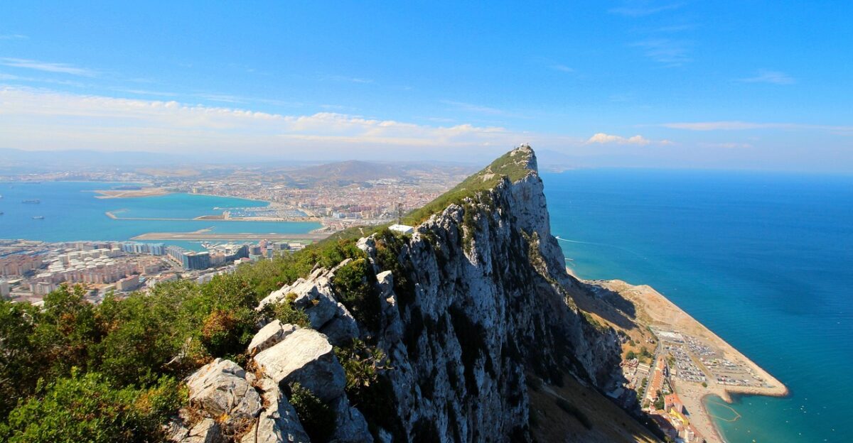
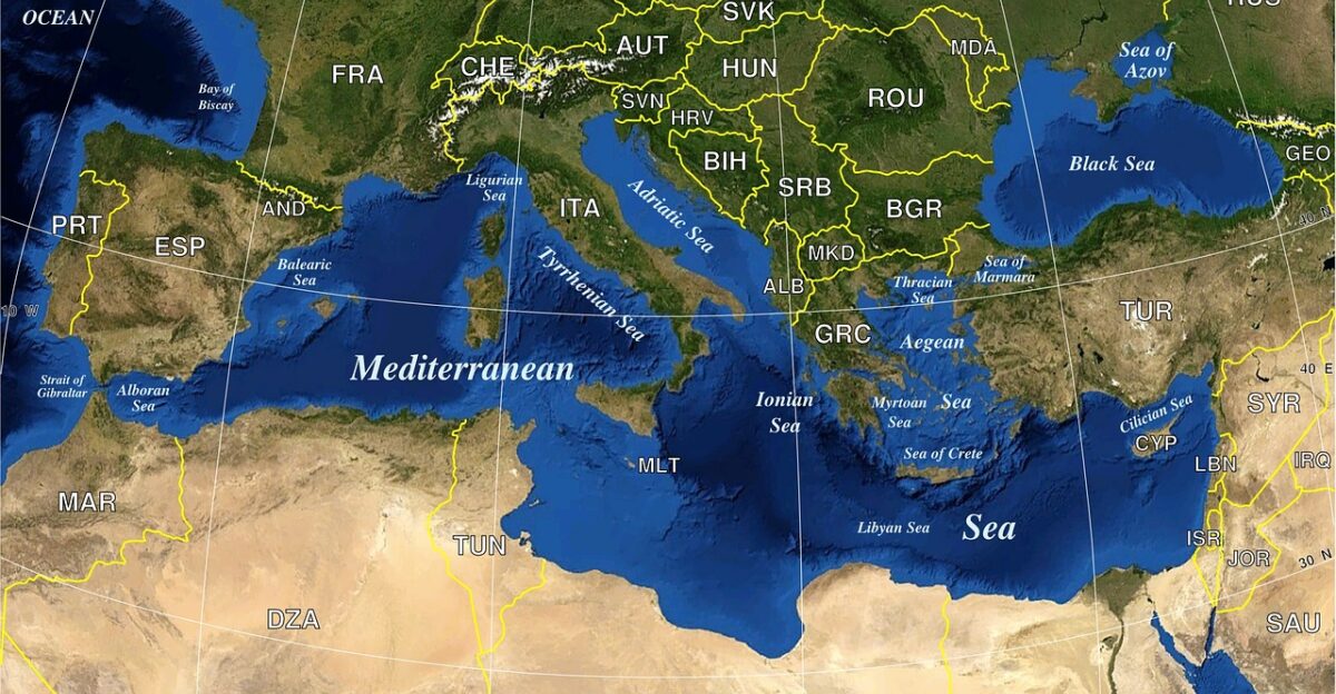
A sudden tremor rattled the quiet coast near Gibraltar as sensors picked up an unusual shift beneath the seabed—one hinting that a dormant fault line might be stirring after millions of years of silence. Muddy sediment rippled across the seafloor, pushed by a slow, deliberate motion deep below the crust.
Scientists monitoring the region exchanged quick glances, aware that even a subtle change here could signal the beginning of something far bigger. What they uncovered next reframed the Atlantic’s entire future.
A Dormant Subduction Zone Poised to Awaken
Researchers have identified a dormant subduction zone beneath the Strait of Gibraltar that could begin spreading into the Atlantic within the next 20 million years. This “subduction invasion” is one of geology’s rarest events, marking the moment when a quiet plate boundary begins pulling an ocean floor downward.
Scientists have modeled how this zone—long believed to be dying—may slowly migrate westward, eventually reversing the Atlantic’s expansion and reshaping global coastlines.
Understanding the Enormous Timescales Involved

The Atlantic’s future shrinkage won’t be noticeable for tens of millions of years. Models show that the basin may begin measurable contraction in 20–50 million years, with full closure occurring roughly 200 million years from now.
Though these changes sit far beyond human timelines, they fit precisely within the Wilson Cycle—a repeating process in which oceans open, expand, and close over hundreds of millions of years, continually reorganizing Earth’s continents.
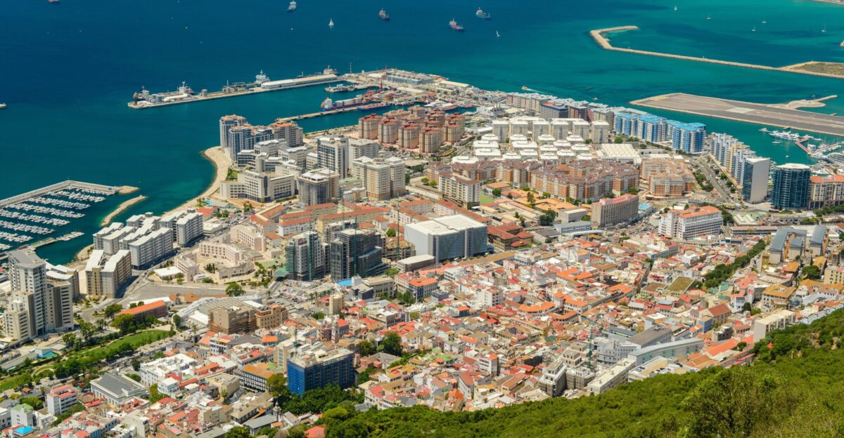
Seismic Activity Around Gibraltar Today
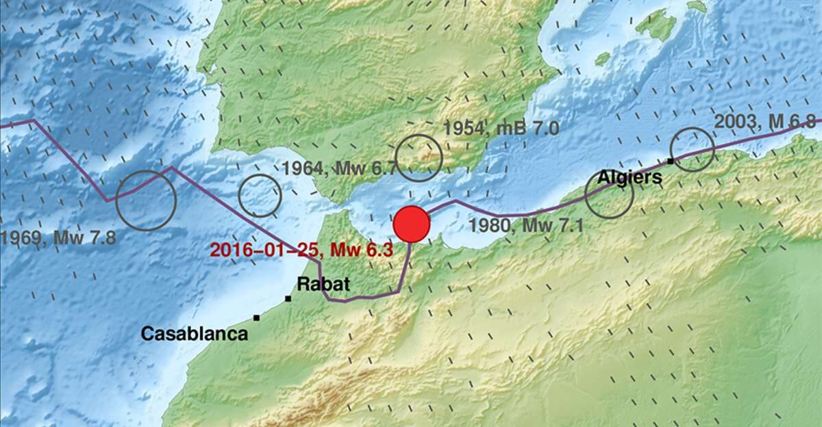
Gibraltar and the surrounding Mediterranean region already experience complex tectonic activity, including historical events like the 1755 Lisbon earthquake. But the dormant Gibraltar zone is not currently accelerating or producing new hazards.
Subduction initiation is a slow, multi-million-year process, and present-day seismic risks remain similar to longstanding patterns. Still, any future reactivation would carry long-term implications for earthquakes and volcanic activity in surrounding coastal regions.
Why This Discovery Is Scientifically Significant

Gibraltar offers scientists a rare glimpse into the earliest stages of a potential subduction zone. Subduction is vital to shaping Earth’s mountains, volcanoes, and ocean basins, yet the moment when it begins is notoriously difficult to observe.
Advanced supercomputer modeling now allows researchers to simulate the early processes that precede ocean closure—opening a new window into how continents collide, oceans disappear, and global geography reorganizes over deep time.
The Wilson Cycle Explained

The Atlantic Ocean is currently in the “mature ocean” stage of the Wilson Cycle, a framework describing how ocean basins are born, grow, and eventually collapse. This cycle explains why the Atlantic has been expanding at roughly 1.5 inches per year since Pangea broke apart.
Gibraltar’s reawakening signals the transition toward the next phase: slow contraction. This same cycle once shrank earlier oceans like the Iapetus and will eventually close the Atlantic entirely.
Inside the Research Team’s Methods
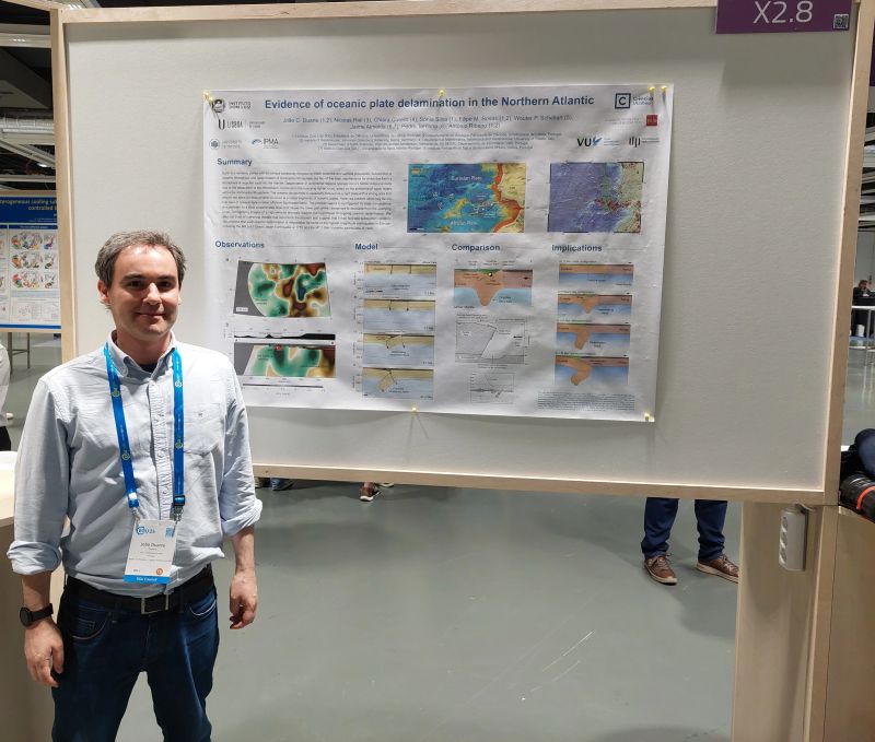
Geologist João Duarte and his team at the University of Lisbon use seismic imaging, plate-motion data, and high-resolution computational simulations to track the Gibraltar zone’s behavior.
Their approach allows them to model how the subduction front may migrate, how plates deform, and how new ocean-closing boundaries can form. This is the first time subduction invasion has been modeled in such detail, thanks to supercomputers capable of simulating deep Earth processes.
A Rare Chance to Observe Subduction Formation
Most subduction zones we observe today have been active for tens of millions of years, making Gibraltar uniquely valuable.
It represents the earliest visible stage of what may become a major tectonic boundary—an embryonic version of the powerful systems that created the Andes, the Himalayas, and the Pacific Ring of Fire.
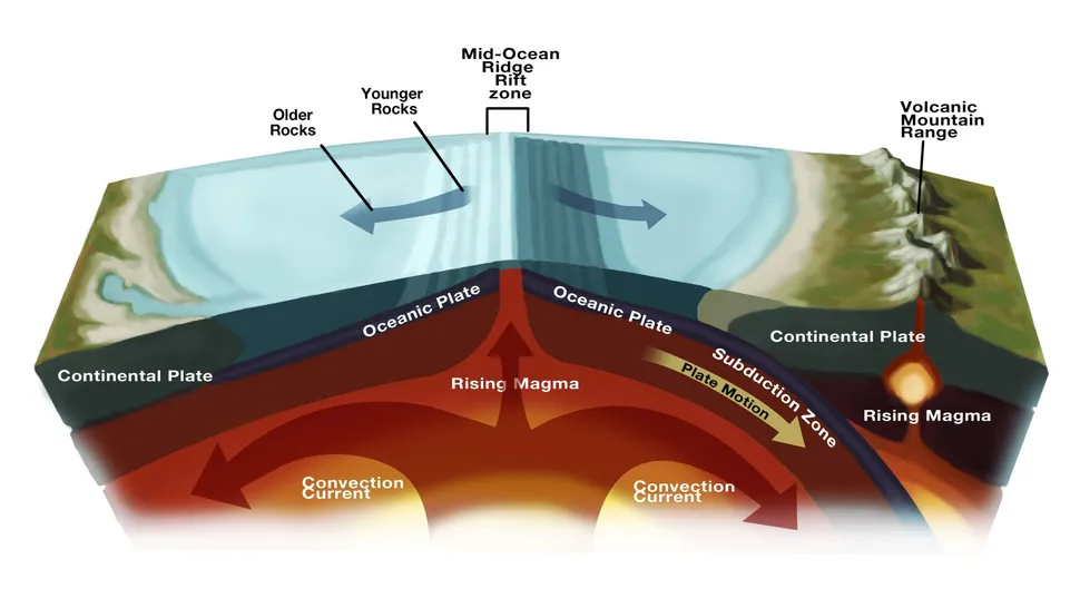
How Subduction Zones Reshape the Planet
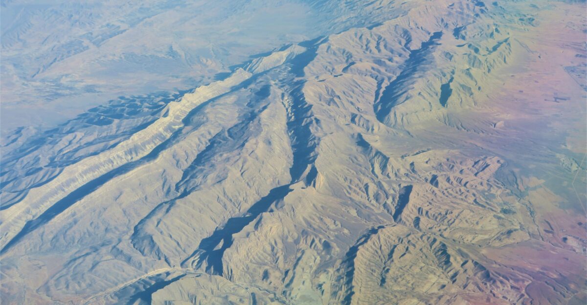
A subduction zone forms when one tectonic plate bends and sinks beneath another, creating intense geological activity. This process generates deep trenches, volcanic arcs, and major earthquakes.
If the Gibraltar zone becomes active again, the Atlantic seafloor will eventually start descending into the mantle, reversing its long-running growth. This is the mechanism through which entire oceans close, continents collide, and new supercontinents eventually form.
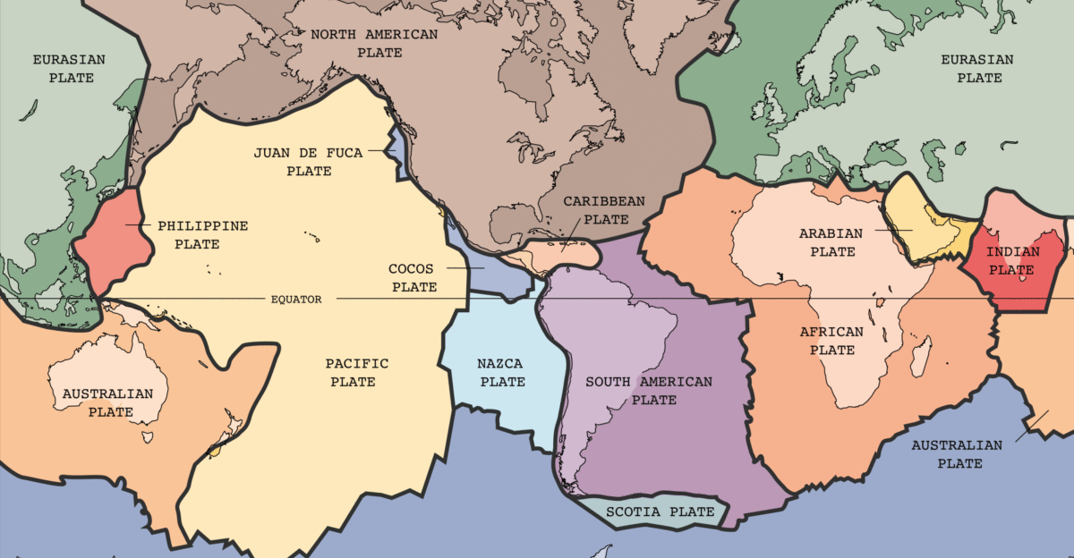
The Atlantic vs. Other Global Subduction Zones

Today, the Pacific Ring of Fire contains most of Earth’s subduction zones and produces nearly 80% of global seismic activity. The Atlantic, in contrast, contains only two: the Lesser Antilles and the Scotia Arc.
Adding a reactivated Gibraltar zone would significantly shift long-term tectonic dynamics and could eventually create an “Atlantic Ring of Fire,” bringing volcanic and seismic activity to regions unaccustomed to such extreme geological forces.
Predicting the Atlantic’s Far Future
Using advanced simulations, scientists project how the Gibraltar boundary could migrate into the Atlantic and initiate ocean closure.
These models suggest that over millions of years, subduction could gradually consume oceanic crust, reversing more than 4,000 miles of widening since the breakup of Pangea. While such predictions carry uncertainties, they provide the most detailed scenario yet for how the Atlantic may eventually disappear.
How Continents Could Reconnect
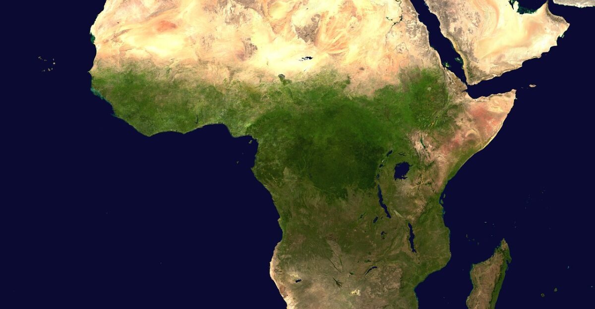
If the Atlantic begins to contract, Africa and Europe may slowly converge again, eventually forming a new supercontinent. Over tens of millions of years, this collision could close the Mediterranean, merge coastlines, and reshape global land distribution.
Similar cycles have produced earlier supercontinents like Pangea, Rodinia, and Nuna. The Gibraltar process may mark the earliest stirrings of the next cycle.
Earth’s Geography Has Never Been Permanent
Throughout Earth’s 4.5-billion-year history, oceans have opened and vanished, continents have merged and fragmented, and coastlines have moved thousands of miles.
The Atlantic is relatively young—only about 180–200 million years old. The discovery that it may enter a contraction phase confirms that Earth’s surface is in constant motion, governed by tectonic cycles far longer than the lifespan of human civilizations.
Why the Atlantic Is Still Expanding Today
Despite its long-term fate, the Atlantic is still currently widening at about 1.5 inches per year as magma rises along the mid-Atlantic Ridge.
This ridge pushes North America and Europe apart, continuing the same process that began with Pangea’s breakup. The next 20 million years will likely see the Atlantic widen by another ~473 miles before the contraction phase begins—a final expansion before the long decline.
What Researchers Will Monitor Next

Scientists are expanding seismic networks, GPS monitoring, and seafloor mapping near Gibraltar to better understand how dormant zones evolve.
Their long-term goal is to identify the triggers that initiate subduction—a process so rare that few modern examples exist. The Gibraltar zone is essential for testing theories about how plate boundaries migrate and how new tectonic systems begin to form.
Relevance for Earthquake Preparedness
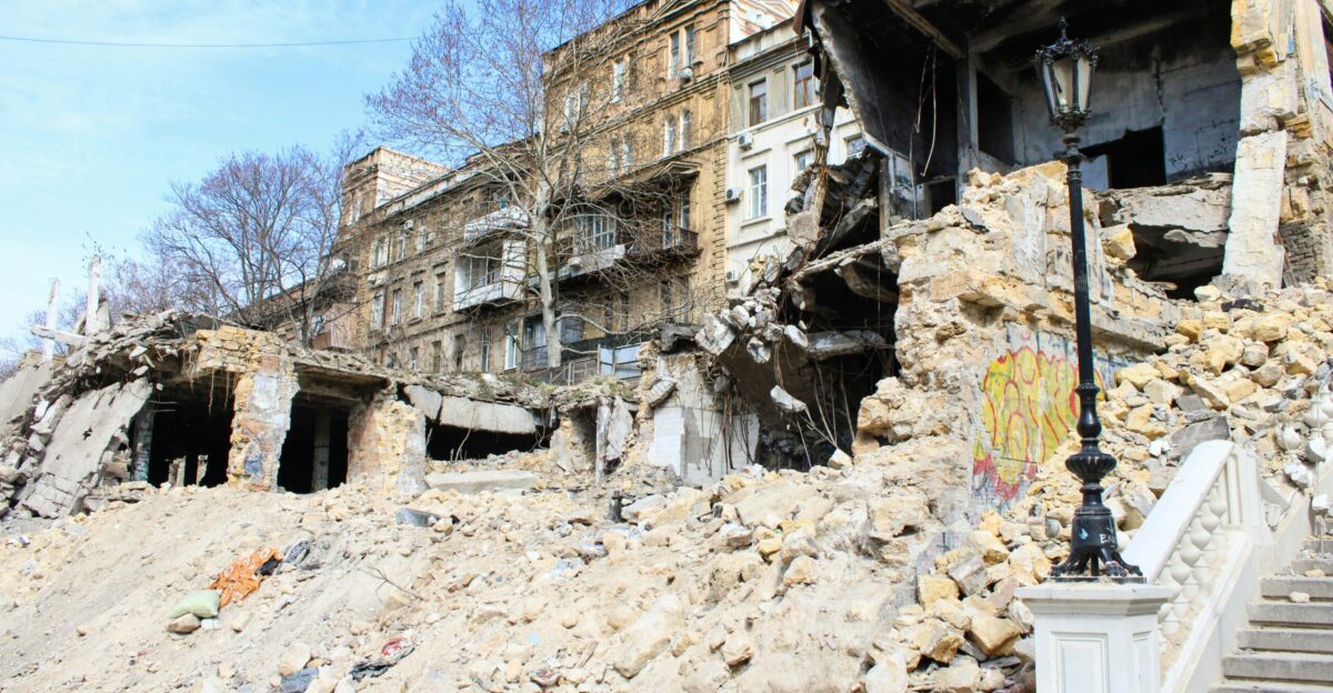
Although Gibraltar’s subduction zone remains dormant, its structure helps reveal potential long-term hazards. The Mediterranean region already sits in a complex tectonic environment, and better understanding of these deep structures can improve seismic response planning.
Knowing how and where stress accumulates in the crust contributes to more accurate models of earthquake risk, even if the biggest tectonic changes will occur on geological scales.
A Study That Captured Global Attention

The research was published in February 2024 in the journal Geology, a leading scientific publication. It drew international attention because it presented the first detailed model of subduction invasion in early stages—a breakthrough made possible by technological advances.
Geologists view the study as a milestone in understanding how oceans close and how new tectonic boundaries emerge.
Implications Across Multiple Fields of Science
Studying subduction initiation informs far more than plate tectonics. It affects research on volcanic hazards, deep-Earth mineral formation, mantle convection, and even long-term climate patterns influenced by volcanic outgassing.
By modeling how oceans close, scientists gain insights into how Earth maintains habitability, circulates heat, and recycles crustal material across deep time.
Visualizing Earth 200 Million Years From Now
Although no model can predict the exact configuration of future continents, simulations suggest a world where the Atlantic has vanished, continents have collided, and a new supercontinent has formed.
These visions allow scientists to explore how climate, ecosystems, and ocean circulation might operate when Earth’s geography undergoes its next dramatic transformation.
A Planet That Never Stops Changing
The discovery that the Atlantic may eventually disappear underscores one of Earth’s fundamental truths: its surface is in constant motion.
From the formation of mountains to the closure of oceans, tectonic processes continually reshape our world. While these changes unfold far beyond human timescales, they reveal the extraordinary dynamism of the planet we inhabit—and the powerful forces working silently beneath our feet.