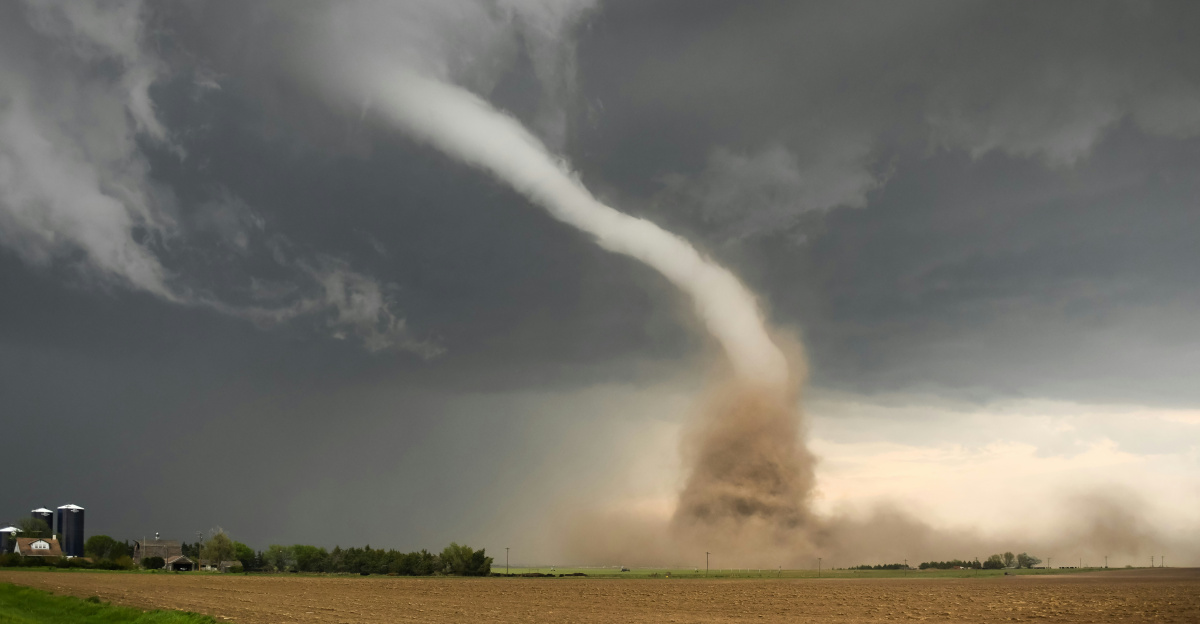
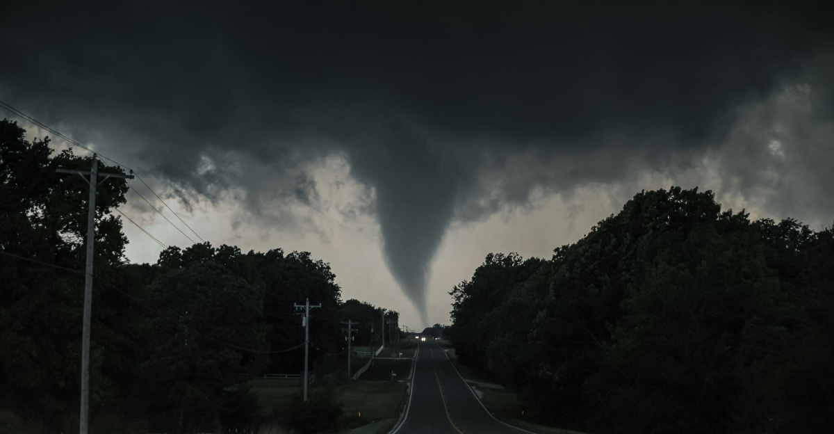
An EF-2 tornado with peak winds near 120 mph tore across central Illinois on December 28, 2025, carving a 23.6-mile path through Christian, Macon, and Piatt Counties.
The tornado remained on the ground for 34 minutes, causing concentrated destruction near Mount Zion and Long Creek. Eight homes were destroyed, while eight additional homes suffered catastrophic roof loss, marking one of the most damaging December tornadoes documented in the region.
Rare December Tornado Fueled by Spring-Like Conditions
The tornado formed under atmospheric conditions more typical of April than late December. Temperatures climbed into the low 70s°F, while dewpoints exceeded 60°F, creating unstable air across central Illinois.
Surface-based CAPE values rose above 1,000 J/kg, and low-level helicity exceeded 250 m²/s²—well above thresholds supportive of tornado development—setting the stage for a rare and dangerous winter outbreak.
Cold Front Triggers Violent Weather Transition

A powerful cold front swept eastward across Illinois on December 28, rapidly converting record warmth into severe storms. As the front passed, temperatures plunged nearly 30 degrees within three hours.
The sharp contrast between warm, moist air and advancing cold air intensified rotating thunderstorms, producing multiple tornadoes across the National Weather Service Lincoln forecast area, including the long-track EF-2 that struck near Mount Zion.
Homes Destroyed Near Mount Zion
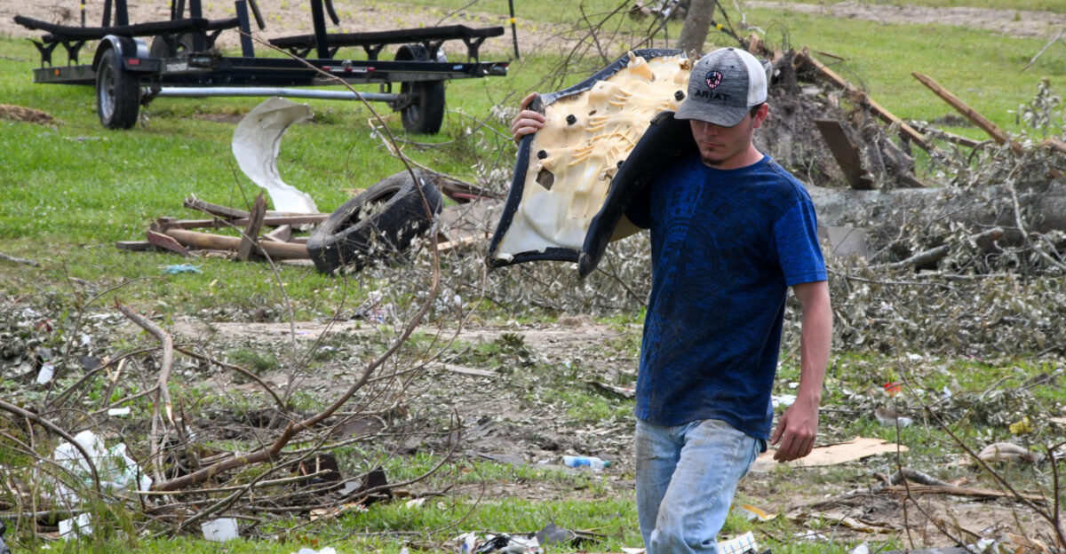
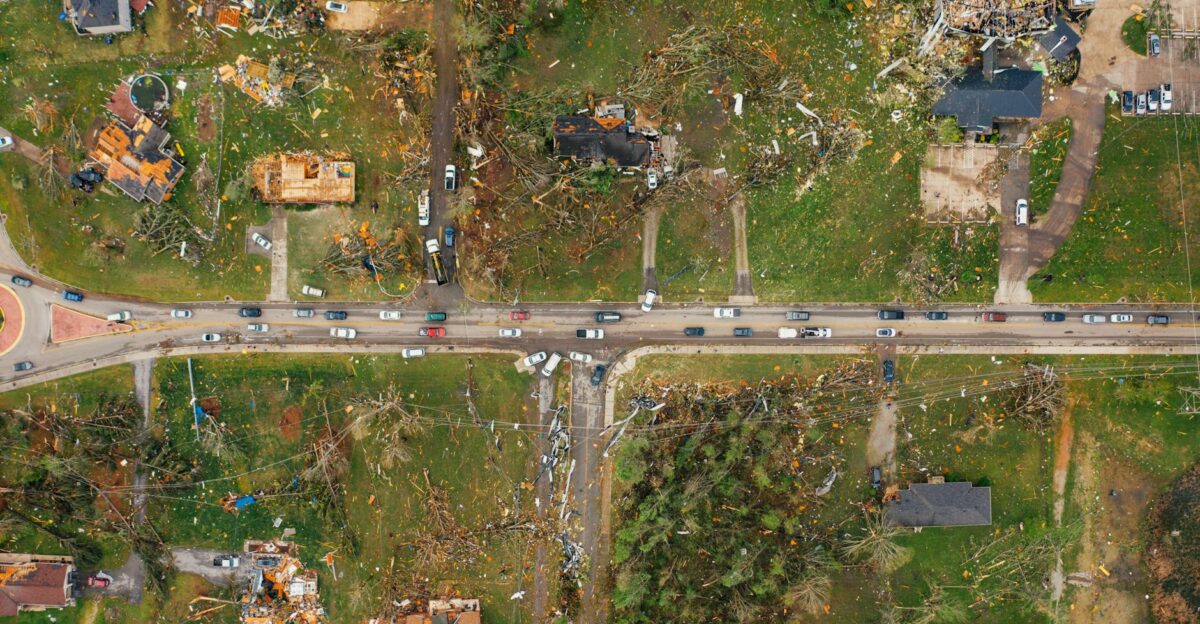
The most severe damage occurred near Mount Zion in Macon County, where eight homes were completely destroyed. Entire structures were reduced to debris fields, with walls collapsed and personal belongings scattered.
The tornado’s intensity was consistent with EF-2 damage indicators, including significant structural failure of well-built homes. Despite the devastation, no fatalities or serious injuries were reported, a fact emergency officials described as remarkable.
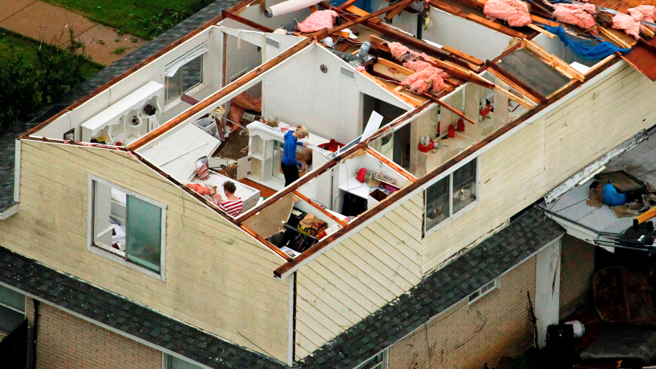
Roofs Ripped Off Homes Along E Skyline Drive
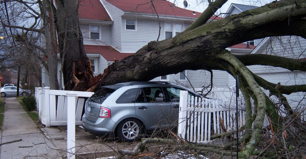
In Long Creek, the tornado tore the majority of roofing systems off eight homes along E Skyline Drive. Several residences were left exposed to the elements just as temperatures dropped sharply behind the cold front.
Garages were destroyed, trees were snapped, and debris was lofted across roadways. The roof damage alone rendered many homes temporarily uninhabitable in the middle of winter.
34 Minutes of Continuous Ground Contact
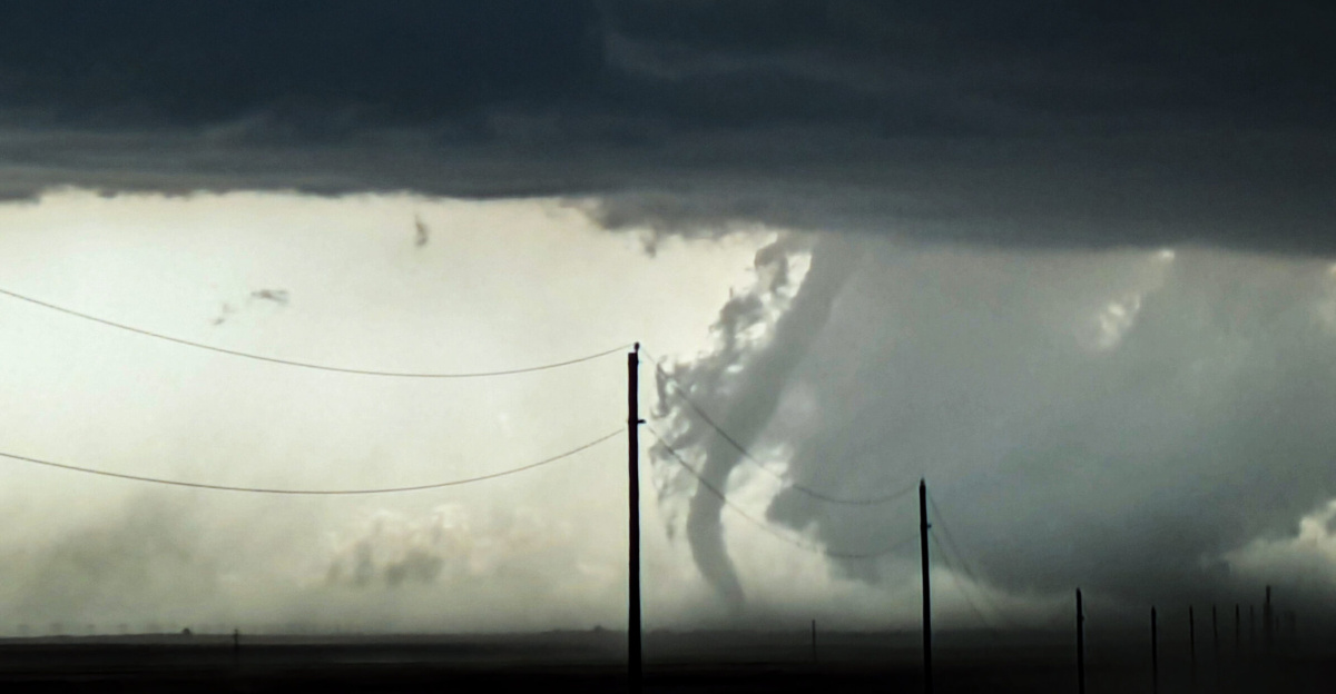
Unlike brief spin-ups often seen in winter storms, this tornado remained continuously on the ground for 34 minutes. Survey teams confirmed a consistent damage path stretching more than 23 miles, crossing multiple county lines.
The duration allowed the tornado to inflict repeated damage to rural homes, farm structures, and wooded areas, increasing overall losses and complicating emergency response across a wide geographic area.
Multiple Tornadoes Confirmed in the Outbreak
The EF-2 was not the only tornado produced during the event. The National Weather Service confirmed at least three tornadoes within its Lincoln warning area on December 28.
This included an EF-1 tornado in Tazewell County with estimated winds near 98 mph. Additional storm damage was reported across several central Illinois counties as rotating storms tracked northeastward.
Power Outages Follow Structural Damage

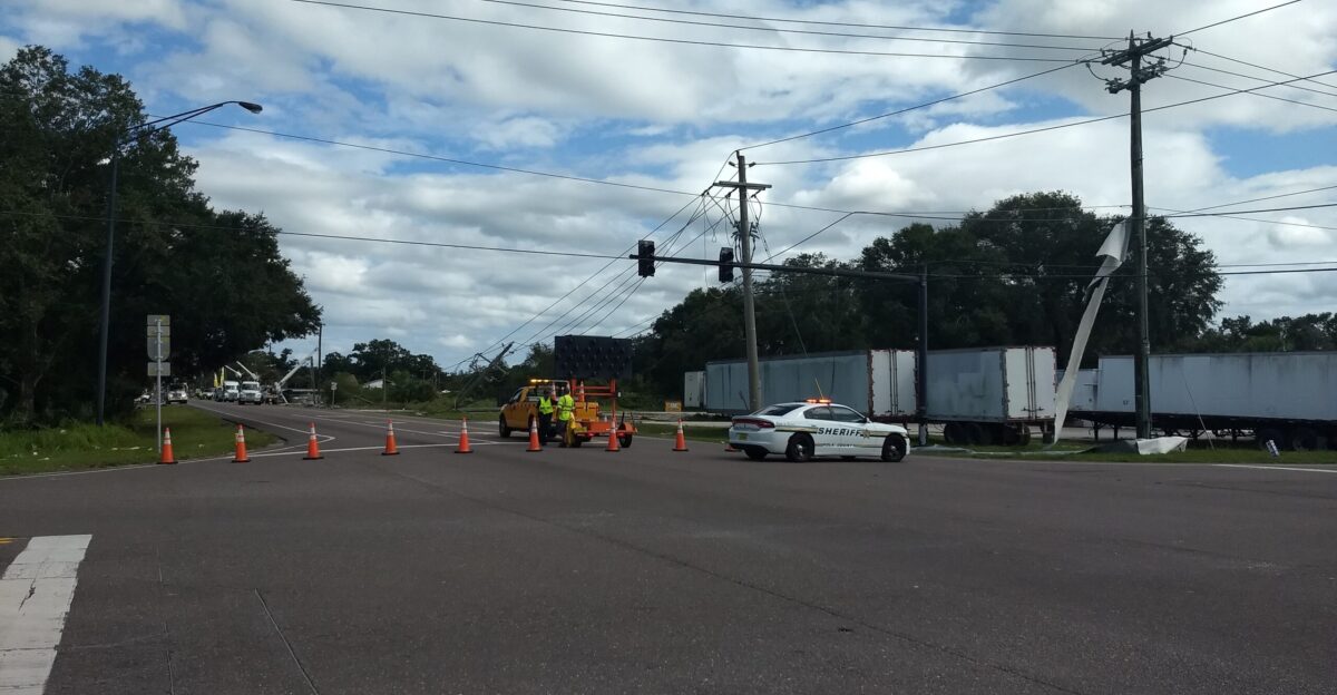
The tornado and associated severe storms knocked out power to thousands of customers across central Illinois. Downed lines, damaged poles, and fallen trees disrupted electricity in rural areas already facing rapidly falling temperatures.
Utility crews worked overnight to restore service as freezing air moved in, increasing urgency for residents whose homes had lost roofs or sustained structural damage.
Families Suddenly Displaced After Christmas
Eight families lost their homes just days after the Christmas holiday, facing immediate displacement as winter conditions returned. Emergency management agencies coordinated shelter options, temporary housing, and supply distribution for those affected.
The timing of the disaster—between holidays and during cold weather—compounded the hardship, as many residents lost not only shelter but personal possessions accumulated over decades.
Human Stories Emerge From the Damage Path
Survivors described terrifying moments as the tornado struck with little warning. In Long Creek, one mother shielded her daughter as the roof was torn away, debris raining into their home.
Such accounts underscored the speed and violence of the storm. Officials emphasized that quick sheltering decisions and sturdy interior refuge locations likely prevented serious injuries or loss of life.
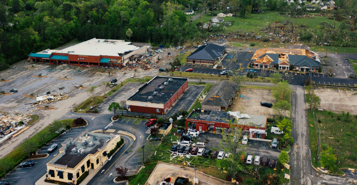
Emergency Declarations and Damage Assessments Begin

Following confirmation of the EF-2 tornado, state and local officials initiated damage assessments across affected counties. Emergency resources were directed to Macon County first, with surveys expanding into Christian and Piatt Counties.
Assessment teams documented destroyed homes, roof loss, and infrastructure damage, forming the basis for potential disaster assistance and recovery planning in the days ahead.
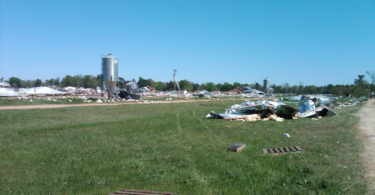
Agricultural Structures Also Take Hits
Beyond residential neighborhoods, the tornado damaged barns, outbuildings, and farm infrastructure along its rural path. Agricultural structures suffered roof loss, collapsed walls, and equipment damage.
While no large livestock losses were reported, the damage added financial strain to farm operations during the off-season, highlighting how tornadoes affect both residential and agricultural communities simultaneously.
Infrastructure Strained Across Multiple Counties
Roadways were briefly blocked by debris, fallen trees, and damaged power lines. Emergency crews coordinated cleanup across multiple counties, slowing response times due to the length of the tornado path.
The widespread nature of damage illustrated how long-track tornadoes place stress on regional resources, even when population density is relatively low.
Rapid Shift From Record Warmth to Winter Cold

The storm system delivered one of the sharpest temperature swings of the season. Locations that reached record or near-record warmth in the low 70s°F earlier in the day experienced near-freezing conditions within hours.
This abrupt change increased risks for displaced residents, exposed homes, and emergency responders working overnight in deteriorating weather.
December Tornadoes Remain Exceptionally Rare
Tornadoes in December are uncommon in Illinois, particularly those reaching EF-2 strength. Climatological records show most significant tornado activity occurs in spring and early summer.
The December 28 outbreak stands out for both its intensity and the number of tornadoes confirmed, reinforcing that severe weather can occur outside traditional seasonal expectations.
Meteorologists Highlight Unusual Instability
Meteorologists emphasized that the atmospheric setup was highly anomalous for late December. CAPE values exceeding 1,000 J/kg and helicity above 250 m²/s² created an environment strongly supportive of rotating supercells.
These parameters are more commonly observed during major spring outbreaks, making this event a notable case study for winter severe weather dynamics.
Storm Spotters Aid Rapid Tornado Surveys

Trained storm spotters and damage survey teams played a critical role in documenting the event. Visual reports and video evidence helped confirm tornado paths and intensities, allowing the National Weather Service to complete assessments quickly.
Accurate surveys ensure communities receive appropriate emergency support and help refine warning systems for future severe weather events.
Preparedness Lessons From a Winter Tornado

Officials urged residents to review tornado safety plans year-round, not just during spring. Winter tornadoes can occur with limited daylight and reduced public awareness.
Having multiple alert methods, identifying interior shelter locations, and understanding warning terminology remain critical, especially when severe storms coincide with rapid temperature drops and power outages.
Off-Season Severe Weather Raises Awareness
The December 28 tornado challenged long-held assumptions about seasonal risk in the Midwest. Emergency managers noted that preparedness messaging must reflect the reality that severe storms can occur at any time of year.
The event reinforced the importance of maintaining weather awareness even during periods traditionally considered low-risk.
A December Tornado With Lasting Impact
The EF-2 tornado that crossed central Illinois left a lasting mark on communities, families, and emergency systems. From destroyed homes and displaced residents to rare atmospheric conditions, the event illustrated how quickly normal life can be disrupted.
As recovery continues, the December 28 tornado stands as a powerful reminder that severe weather does not follow a calendar.
Sources:
- WAND-TV: “6 tornadoes hit central Illinois, including EF-2 in Long Creek”
- National Weather Service Lincoln, IL: “Late Season Tornadoes on December 28”
- National Weather Service Chicago: “December 28, 2025: Rare December Severe Weather Outbreak With Multiple Tornadoes”
- FOX Illinois: “At least 6 tornadoes impacted Central Illinois on December 28th”