
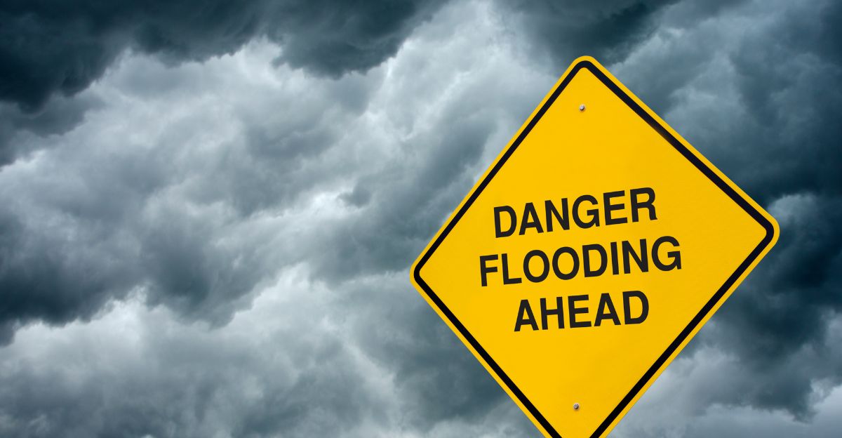
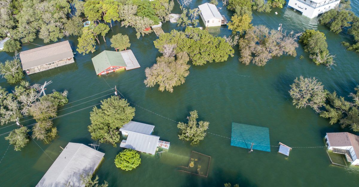
California faced a weekend of severe disaster as a massive atmospheric river unleashed record-breaking rainfall, forcing evacuations and resulting in at least six deaths.
The event, spanning November 13–17, 2025, shattered rainfall records and exposed the state’s vulnerability to extreme weather.
The consequences continue to unfold across the region as communities assess damage and begin recovery efforts. Emergency responders remain on alert for additional storm systems.
Why Did This Happen? The Science Behind the Storm
Meteorologists attribute the disaster to a powerful atmospheric river—a narrow corridor of concentrated moisture—that struck California with unprecedented intensity.
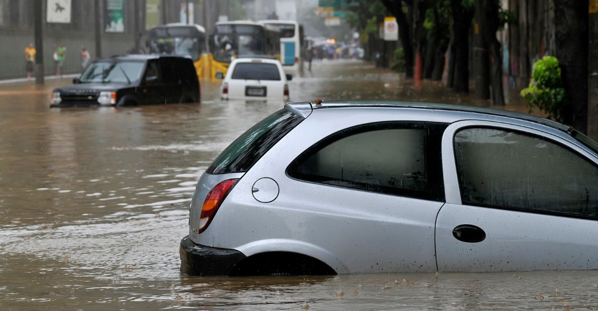
This system dumped historic rainfall, especially over wildfire burn scars, triggering flash floods and mudslides throughout Southern California.
Climate scientists warn that warming oceans are intensifying such atmospheric river events, making them more frequent and severe. The storm system stalled over the region, prolonging rainfall duration.
Record Rainfall Totals Across the Region
Santa Barbara County received 6.67 inches over three days, shattering the November rainfall record that had stood for decades. Los Angeles recorded 2.75 inches in under 48 hours—more than three typical Novembers combined.
Multiple areas reported their wettest November days on record as the atmospheric river stalled over Southern California. Forecasters warned that saturated soil conditions increased flooding risks even after rainfall ended.
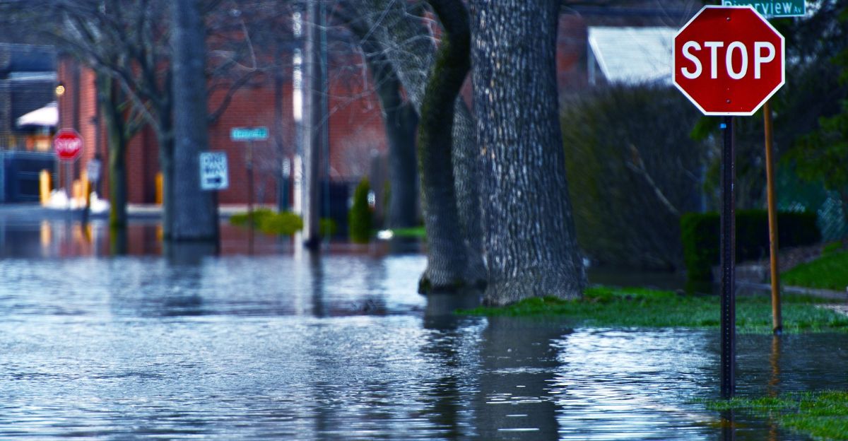
Evacuations Issued in Burn Scar Areas

Mandatory evacuation orders were issued for approximately 126 properties near the Palisades, Eaton, and other recent wildfire burn scars, where vegetation loss increased flooding risk.
Evacuation warnings were issued for additional areas threatened by potential mudslides and debris flows. Most evacuation orders were lifted by Saturday evening, November 16, as rainfall intensity decreased.
However, authorities maintained vigilance as saturated hillsides remained unstable and vulnerable to collapse.
Tragic Loss: Wave Victims at Garrapata Beach
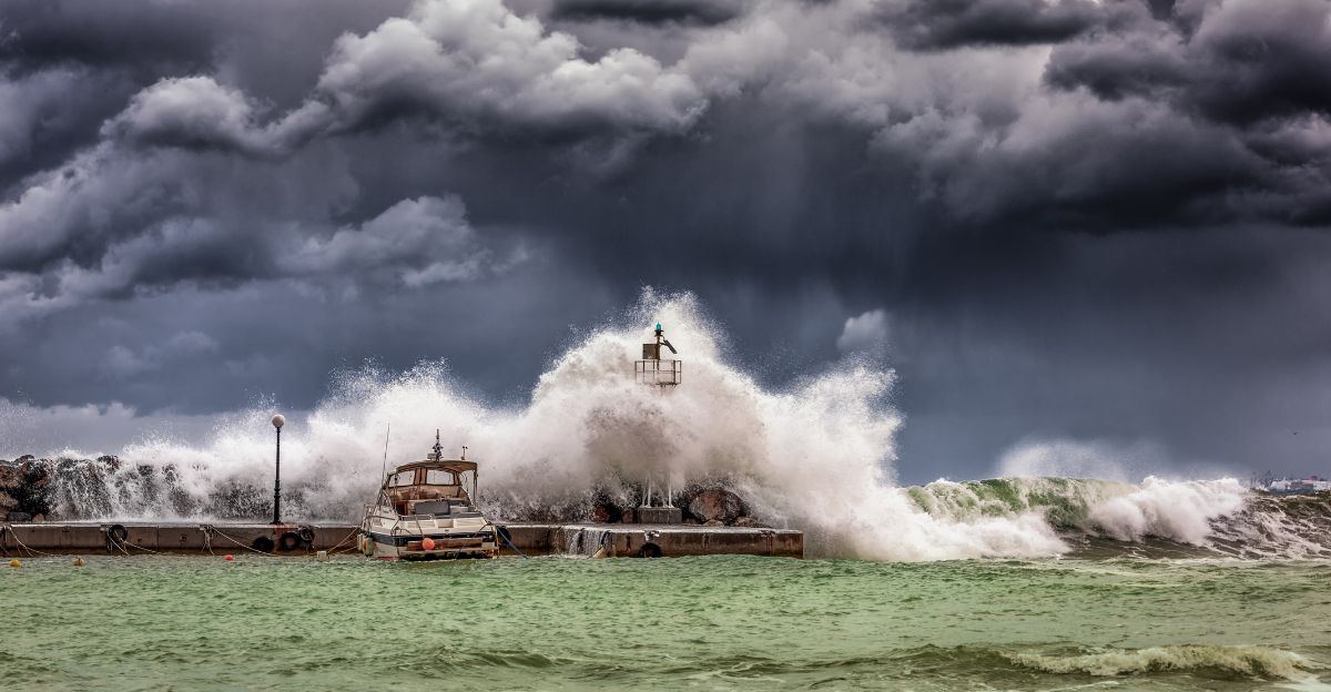
Yuji Hu, 39, of Calgary, Canada, died attempting to rescue his 7-year-old daughter, Anzi, who was swept into the Pacific Ocean by 15–20 foot waves at Garrapata State Beach near Carmel-by-the-Sea on Saturday, November 15.
Both father and daughter perished in the tragic incident despite heroic rescue efforts. The family had been walking along the beach when massive waves struck unexpectedly, pulling them into turbulent waters.
Additional Storm Fatalities Across California
A 71-year-old man died in Sutter County when his vehicle was swept off a flooded bridge during heavy rainfall.
Four migrants died when a panga boat capsized in stormy seas off Imperial Beach in San Diego County, overwhelmed by massive waves and dangerous conditions.
At least six total deaths were attributed to the atmospheric river storm system. Authorities continued search operations for any additional missing persons.
First Responders Stretched Thin
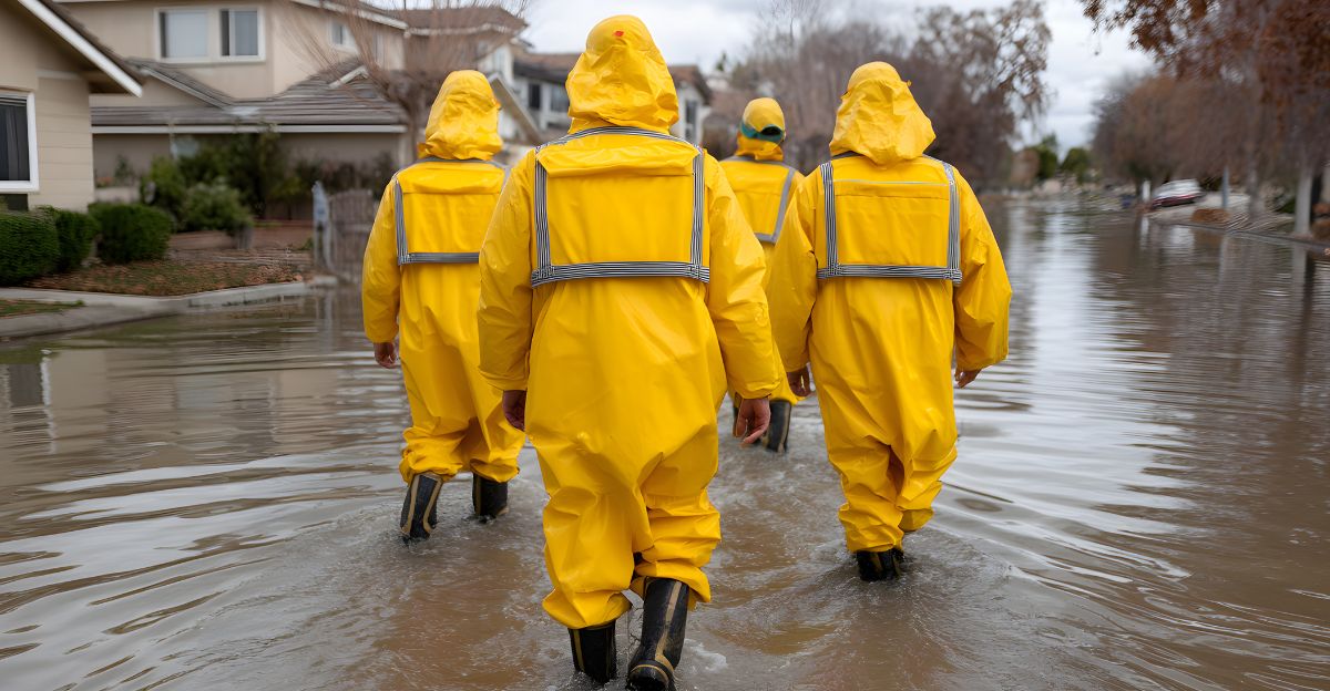
First responders worked around the clock, conducting water rescues and coordinating evacuations across multiple counties simultaneously.
Emergency personnel were stretched thin responding to numerous incidents, including stranded motorists, flooded homes, and coastal rescues.
Swift-water rescue teams were deployed to flood-prone areas. Fire departments, sheriff’s offices, and emergency management agencies collaborated closely to manage the multi-faceted crisis and protect vulnerable communities.
Dangerous Wave Conditions Persist
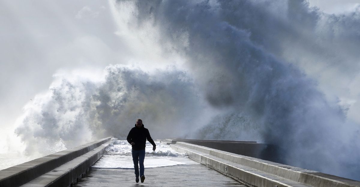
Beaches remained closed throughout the weekend due to dangerous wave conditions and significant storm surge that threatened coastal infrastructure.
The National Weather Service issued high surf warnings as waves reached 15-20 feet along exposed coastal areas.
Authorities warned residents to stay away from oceanfront locations, jetties, and piers. Several people required rescue after being swept off rocks by unexpected waves that exceeded forecasted heights.
Governor Takes Preventive Action

Governor Gavin Newsom pre-deployed emergency resources ahead of the storm, positioning personnel, equipment, and supplies in high-risk areas throughout Southern California.
State agencies coordinated with local authorities to manage evacuation efforts and emergency response in burn scar zones, particularly vulnerable to flooding and mudslides.
The proactive approach aimed to minimize casualties and ensure a rapid response. California National Guard units remained on standby for deployment.
Roads and Transportation Disrupted
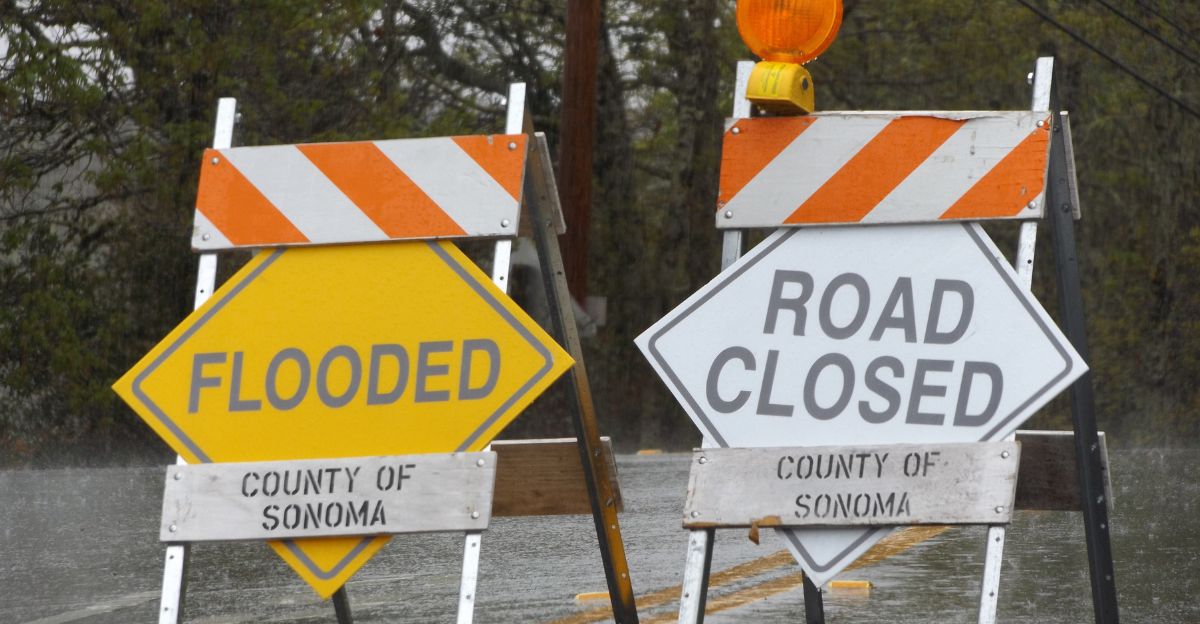
Numerous roads were closed due to flooding, debris flows, and mudslides, making travel hazardous. Highway 1 experienced closures in multiple locations along the scenic coastal route.
Mudslides blocked roadways in hillside communities, particularly in areas affected by recent wildfires, where vegetation loss increased runoff velocity.
Transportation officials warned drivers to avoid unnecessary travel. Some closures were expected to last days while crews cleared debris.
The Wildfire-Flood Connection: A Deadly Cycle
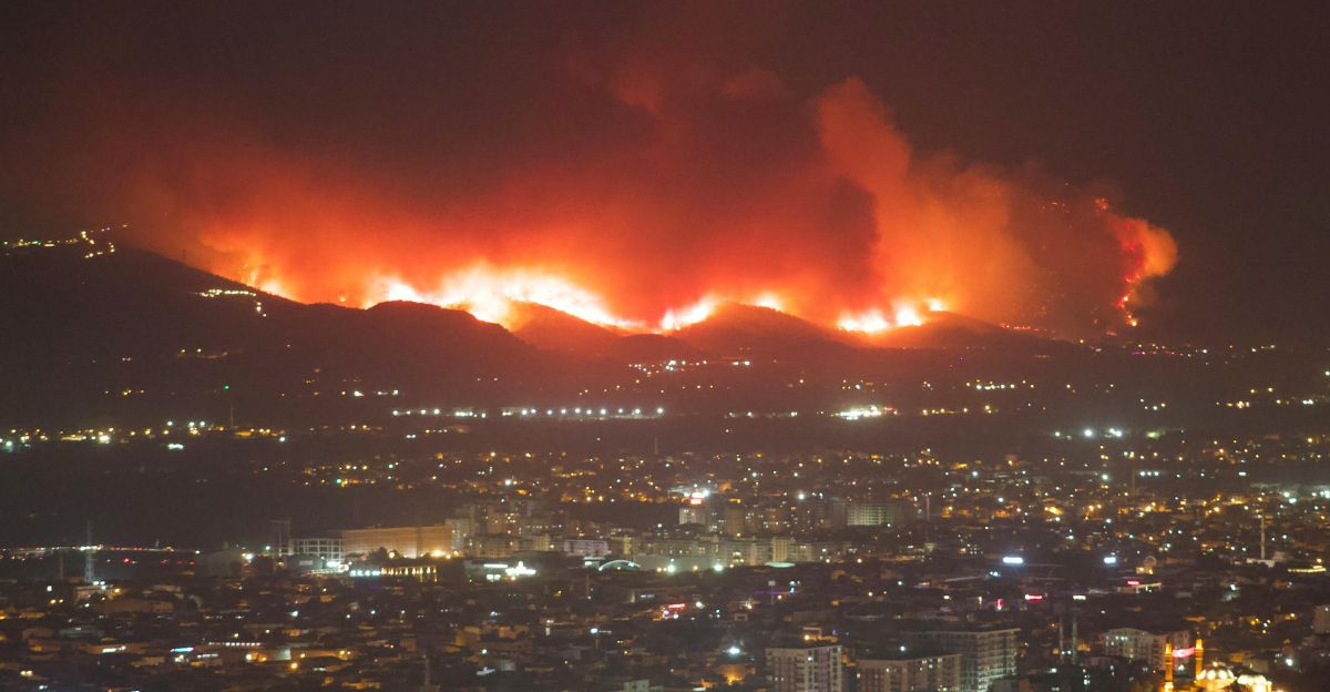
The disaster highlighted the dangerous link between wildfire burn scars and dramatically increased flood risk in subsequent rainstorms. Recent fires have removed vegetation that helps absorb rainfall and stabilize soil on steep slopes.
Saturated, barren hillsides became prone to catastrophic mudslides and debris flows during intense rainfall events.
This fire-flood cycle poses growing challenges as California experiences both intensifying wildfires and more powerful atmospheric rivers.
Insurance and Property Damage Assessment

Insurance companies are prepared for claims from storm damage, including flooding, water intrusion, and mudslide impacts to residential and commercial properties.
Emergency response contractors and cleanup services were mobilized to address property damage, remove debris, and begin restoration work.
The full extent of losses continued to be assessed as floodwaters receded and damage became visible. Preliminary estimates suggested millions in damages, though comprehensive assessments would require weeks.
Neighbors Helping Neighbors

Local volunteers provided shelter, hot meals, and essential supplies to displaced residents who were forced from their homes by evacuation orders. Community organizations mobilized quickly to support evacuation centers with donations and staffing.
Neighbors assisted each other with sandbagging efforts and property protection measures as the storm approached.
The crisis brought communities together, demonstrating California’s resilience and spirit of mutual aid. Churches and schools opened facilities as emergency shelters.
What Residents Should Know
Emergency management experts advise Californians to review their flood insurance policies, as standard homeowner policies typically exclude coverage for flood damage.
Residents should create emergency kits with food, water, medications, and essential documents. Stay informed about evacuation routes and heed official warnings immediately.
Residents in burn scar areas face a heightened risk during storms and should have evacuation plans in place. Monitoring weather alerts through multiple sources can save lives.
Preparing for Future Atmospheric Rivers

As California recovers, officials and residents face critical questions about building resilience in an era of increasingly extreme weather events.
The atmospheric river underscores the urgent need for long-term adaptation strategies including improved flood defenses, enhanced forest management in burn scar areas, and strengthened emergency response capabilities.
Scientists predict atmospheric rivers will intensify further, making proactive preparation essential for protecting lives and property in vulnerable communities.