Under Scottish farmland near Perth sits a 2,500-year-old mystery that farming almost destroyed.
In the 1960s, aerial photos showed ghostly shadows invisible from the ground—traces of an Iron Age hillfort that ploughing had erased.
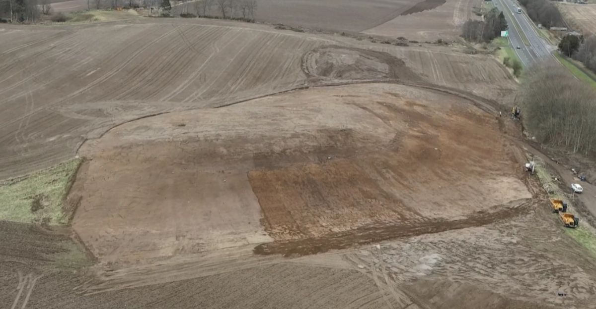
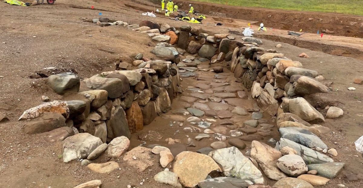
When crews began building Scotland’s £118 million Cross Tay Link Road in 2022, archaeologists could finally excavate what cameras had previously spotted sixty years earlier.
Agricultural Erasure
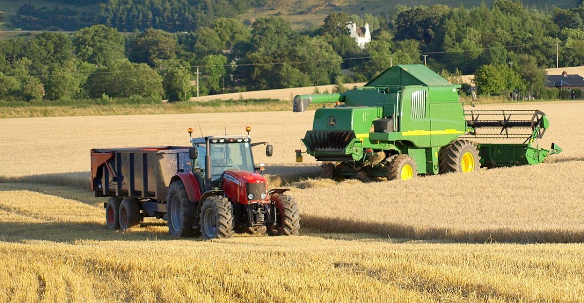
Scotland’s farmland hides thousands of archaeological sites that farming made invisible. Stone monuments on hills survive, but lowland settlements built from timber and earth vanish under the plow.
Only subtle soil changes show up from the air. Since the 1940s, aerial photographs have revealed approximately 8,000 previously unknown sites in farming areas.
Without these photos, most would stay hidden forever.
Infrastructure Opportunity
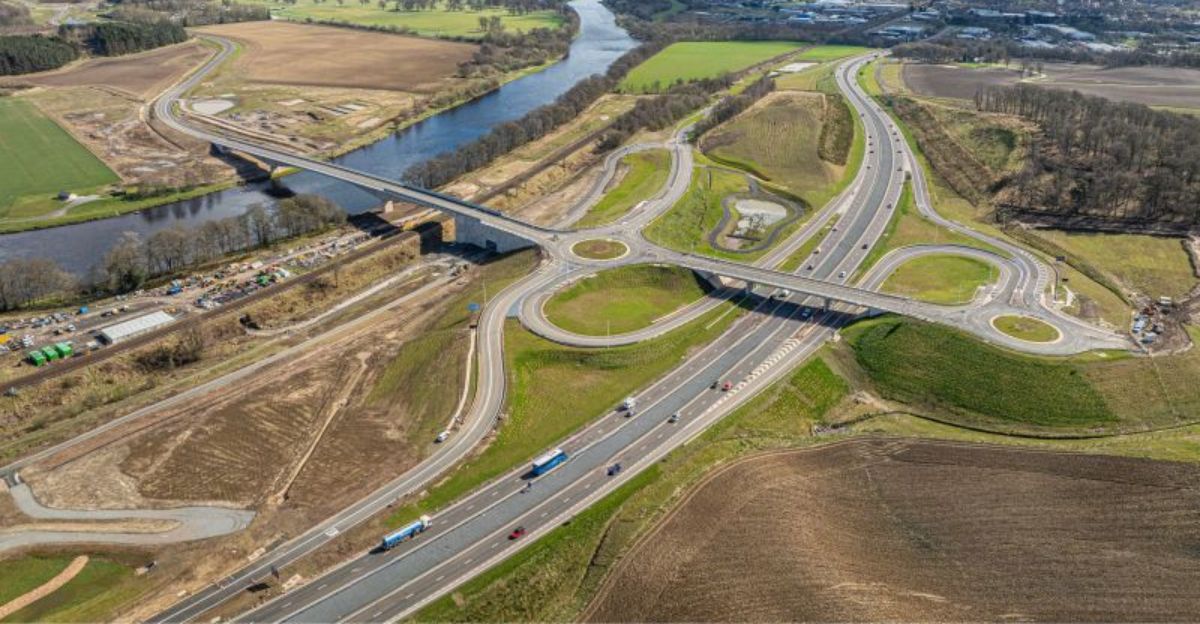
The Cross Tay Link Road project was Perth and Kinross Council’s biggest infrastructure job—a six-kilometer route connecting highways A9, A93, and A94.
The route crossed challenging terrain and included a 307-meter bridge over the River Tay. Before construction started, heritage experts assessed the area and found multiple important heritage sites.
They studied the land and investigated archaeological sites to protect Scotland’s cultural heritage.
Countdown Pressure
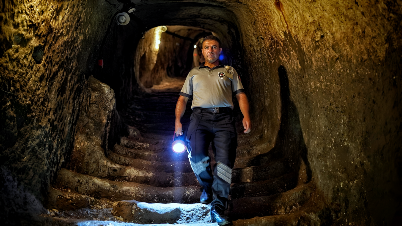
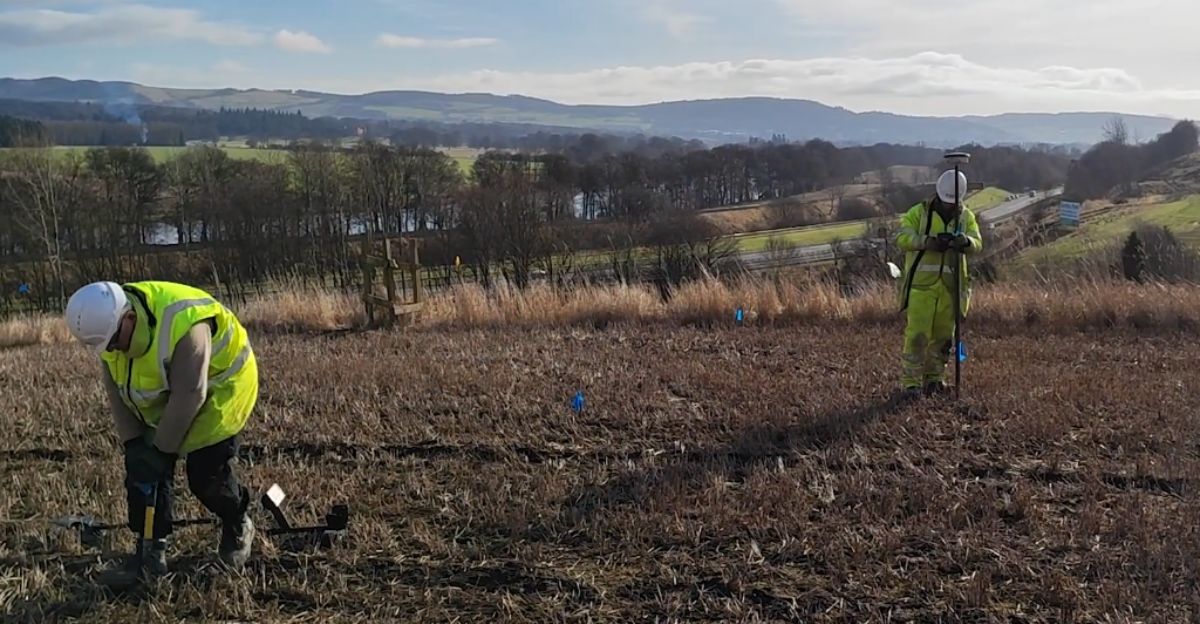
Excavation teams worked under intense pressure as construction deadlines approached. GUARD Archaeology Ltd worked with experts from National Museums Scotland, Glasgow, and Stirling universities to quickly and thoroughly investigate the Broxy Kennels Fort site.
The £150 million project needed efficiency—each day of archaeological work delayed road completion and raised costs.
Project officer Kenny Green noted that without those 1960s aerial photos, construction would have destroyed irreplaceable Iron Age remains.
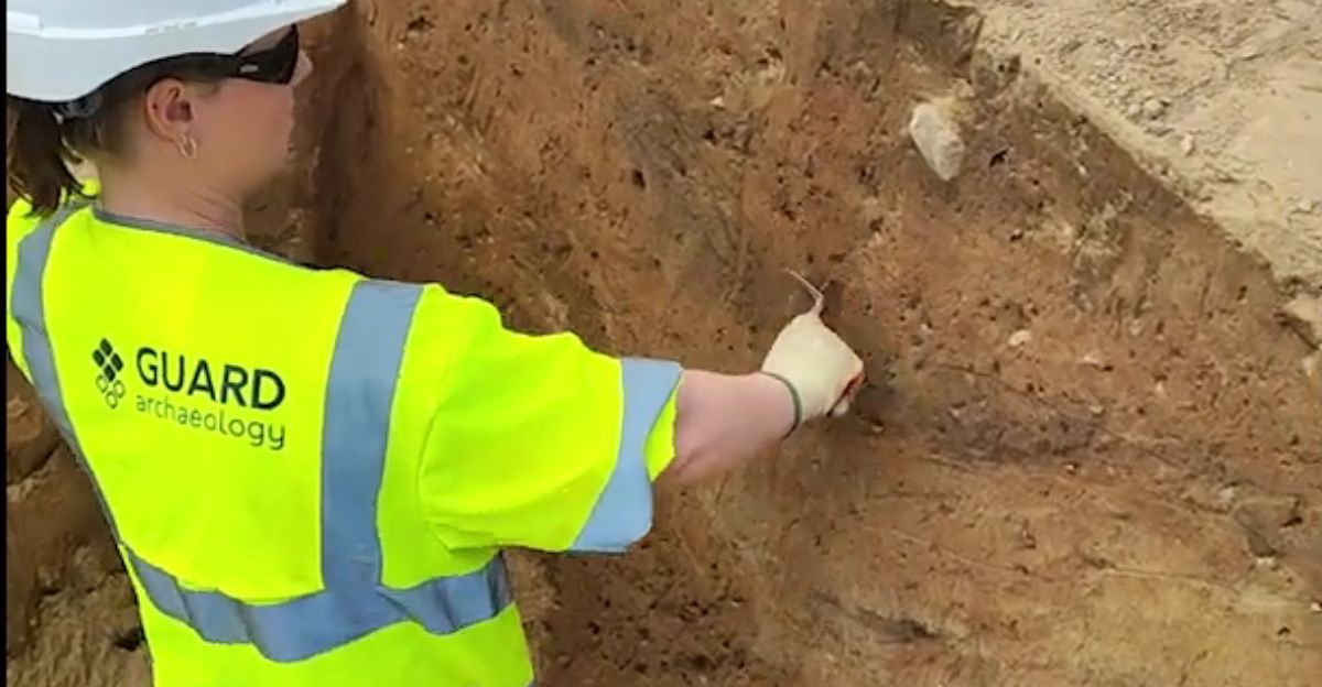
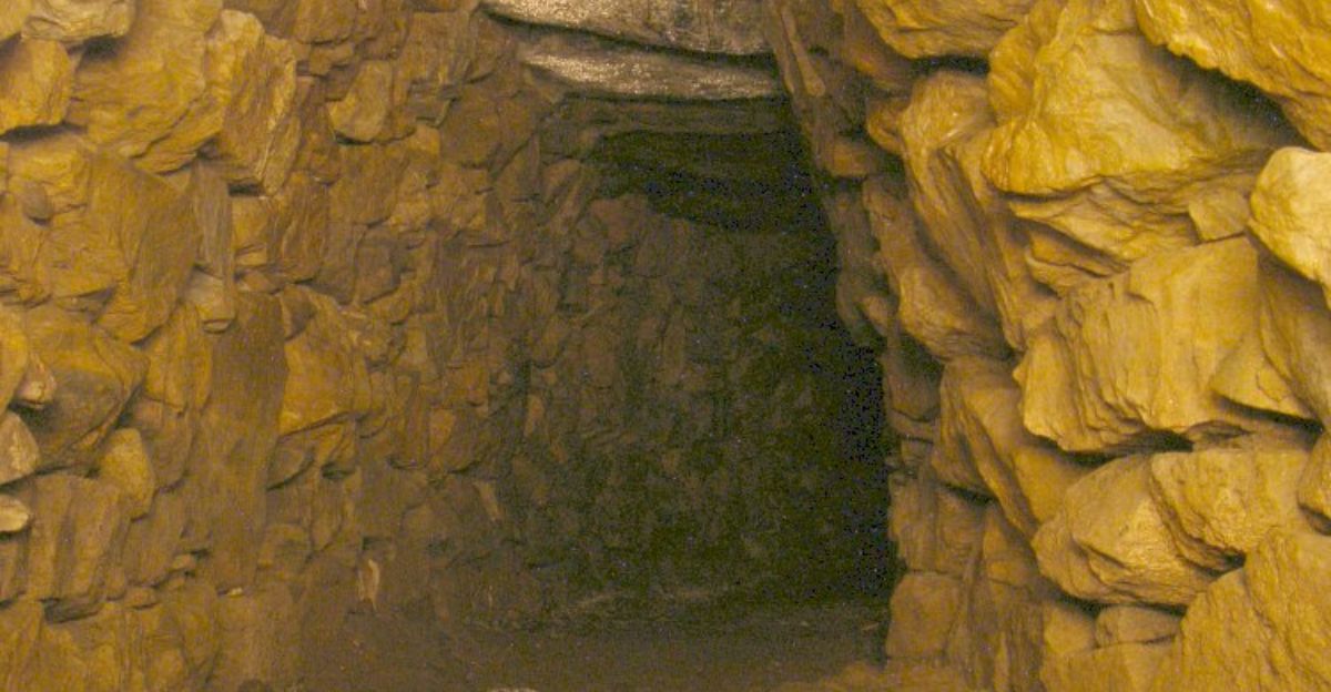
Underground Chamber Revealed
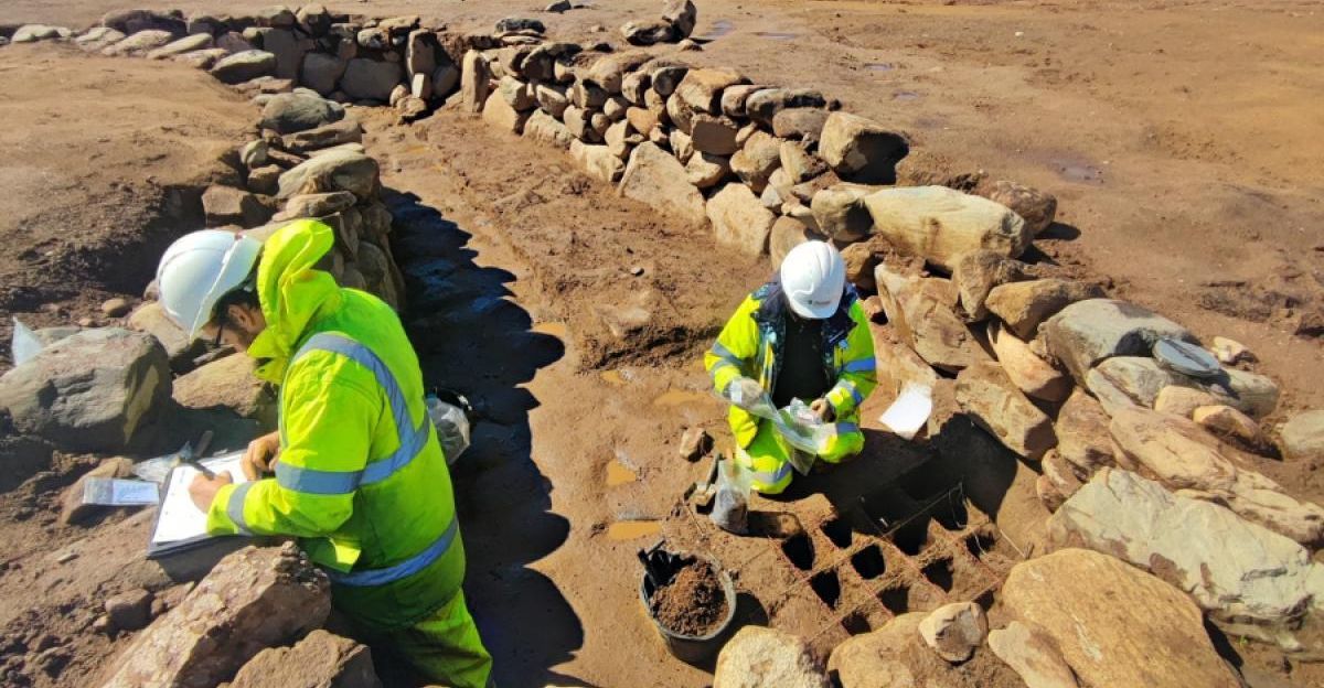
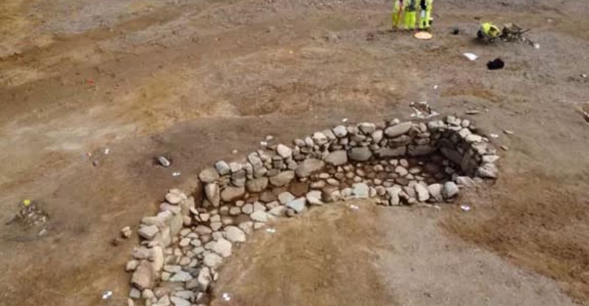
The dig uncovered a nine-meter-long underground stone chamber—a souterrain—sealed in the hillfort for over 2,000 years.
The structure measured four meters in width and more than one meter in depth. River boulders from the nearby River Tay reinforced its walls.
Workers paved the floor with carefully fitted stones. Radiocarbon analysis dated this sophisticated underground space to about 400 BC. Only 200 known souterrains exist across Scotland.
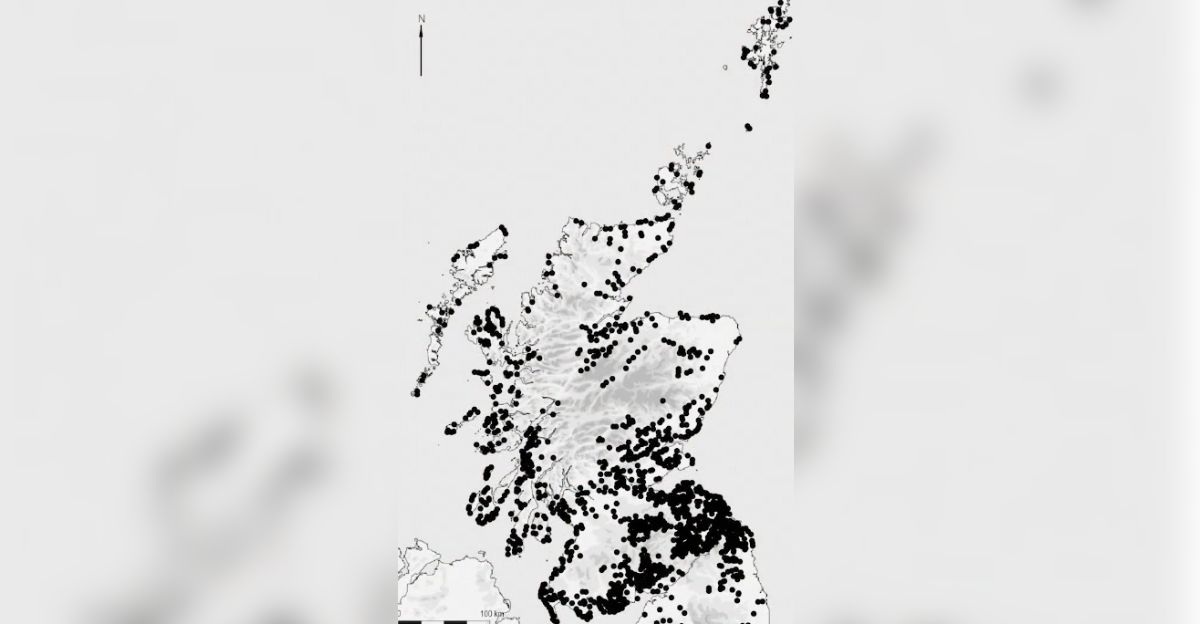
Regional Concentration
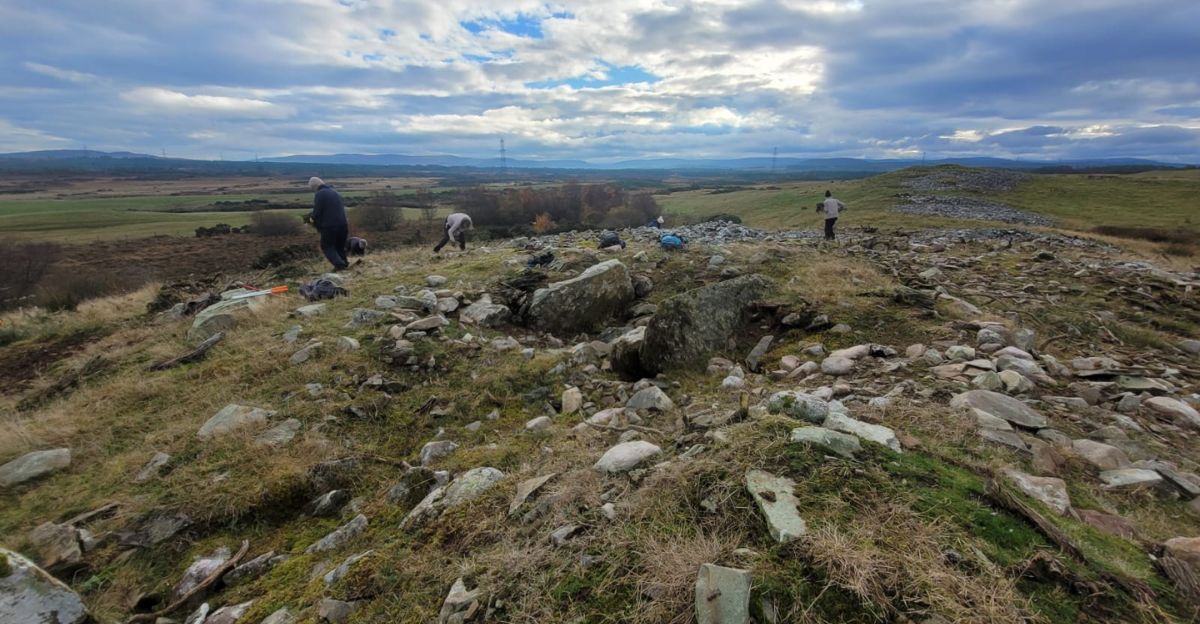
Souterrains show striking patterns across Scotland. Nearly 500 examples cluster in the Scottish Highlands, with more groups in Perthshire, northeast Scotland, and coastal areas.
Southern Scotland has fewer, while England has almost none.
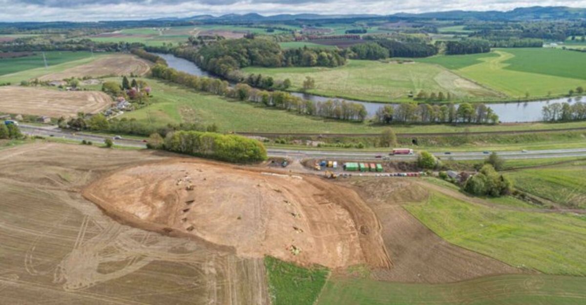
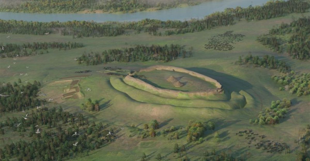
This sharp boundary raises big questions about cultural differences between Iron Age groups across modern borders. The Broxy Kennels site is situated within a 600-square-kilometer area around the Firth of Tay.
Construction Sophistication
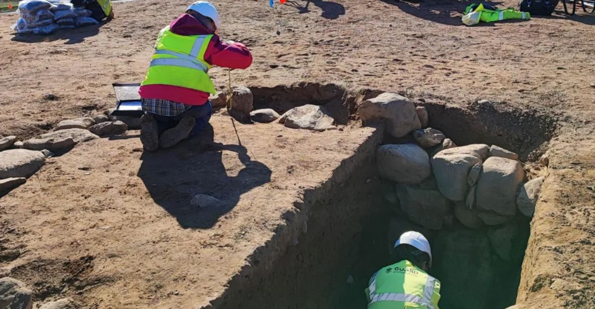
Building this chamber required moving about 400-500 tons of stone. Builders chose river boulders for their strength and hauled them from the banks of the Tay to the hilltop.
Walls were constructed using dry-stone methods—stones fitted precisely without mortar. The paved floor needed more stone selection and installation.
Radiocarbon dating indicates that the hillfort was constructed between 550 and 400 BC, with the souterrain added around 400 BC as a later upgrade.
Metalworking Evidence
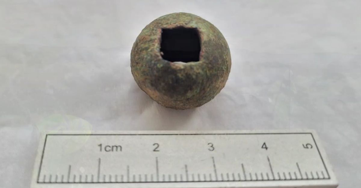
Excavators found clear signs of Iron Age metalworking alongside the souterrain. Bog ore fragments—iron-rich deposits from waterlogged soils—showed local metal sourcing.
Slag deposits proved that metalworking happened on-site. Most importantly, archaeologists found a vitrified clay tuyère fragment, part of a furnace bellows.
The tuyère showed at least two vitrification layers, proving repeated smelting operations. These finds connect Broxy Kennels to Scotland’s broader Iron Age metalworking tradition.
Storage Hypothesis Weakens
Chemical soil tests inside the chamber gave unclear results. Excavators found cereal grain samples on the floor, initially suggesting storage—the main theory for souterrain function.
However, grain amounts couldn’t support this interpretation. Modern research increasingly challenges the storage idea across Scottish examples.
Souterrains often made poor grain storage due to the presence of moisture. Alternative theories suggest security vaults, ritual spaces, or specialized storage for perishables, such as cheese.
Function Remains Unknown
Despite intense scientific study, the chamber’s actual purpose remains a puzzle.
Experts employed multiple techniques, including radiocarbon dating, chemical soil tests, architectural assessment, and comparison with over 200 known Scottish souterrains. Every method failed to explain its function definitively.
The sophisticated construction clearly served important purposes, yet evidence does not confirm whether those were practical, religious, social, or some combination that researchers have not yet imagined.
Settlement Evolution
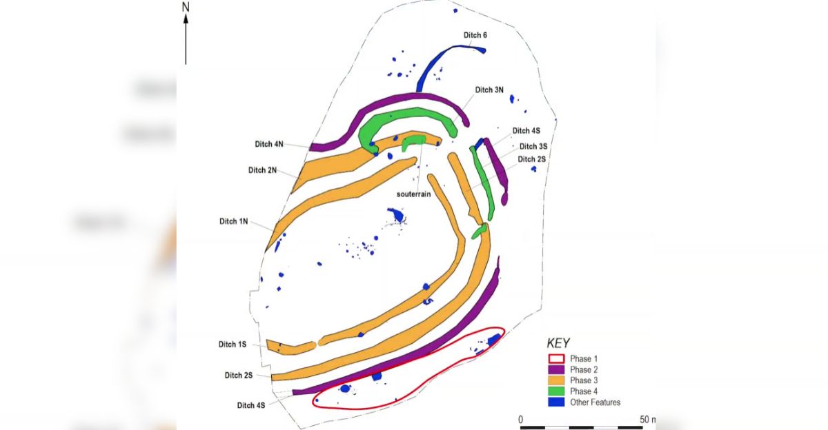
The hillfort underwent significant changes during its seven centuries of use. Initial construction, dating back to around 550-400 BC, featured two massive defensive ditches and earthen ramparts.
Archaeologists found charred wattle panels and daub fragments in ditch fills—debris from demolished roundhouses thrown into abandoned defenses.
This clearing suggests deliberate remodeling. The souterrain’s construction around 400 BC matched these modifications, possibly triggering or responding to changing settlement organization.
Roman Timing
People abandoned the site in the late first century AD—exactly when Roman forces arrived in southern Scotland.
Dating shows the settlement emptied just before Rome’s military campaigns reached the region. Whether people fled advancing legions, relocated due to social changes, or left for environmental reasons remains unclear.
The timing seems significant, but proves nothing definitive. Roman expansion profoundly impacted Scottish communities, although direct causation remains unproven.
Preservation Paradox
The site survived due to double luck: aerial photography captured evidence before it was completely erased, and major construction provided funding for excavation. Most hillforts lacking these advantages remain undiscovered or destroyed without records.
Kenny Green emphasized this narrow escape: “Without these aerial photographs, no one would have known there was a hillfort here as there was no trace of it on the ground.”
His statement highlights the systematic loss of heritage across Scotland’s farmland.
Community Response
Perth and Kinross Council balanced construction deadlines against heritage preservation through collaborative management.
The Cross Tay Link Road utilized early contractor involvement, allowing BAM UK & Ireland to collaborate with archaeologists to minimize excavation risks while maintaining schedules. Despite the complexity, the project was completed on time and within budget, securing £875,000 in benefits.
The council generated an estimated £50 million in social and economic value through local spending and community programs.
Thousand-Site Estimate
Based on known discoveries and aerial coverage, archaeologists estimate that several thousand souterrains originally existed across Scotland.
The confirmed 700+ souterrain records represent only surviving, documented examples. Many remain hidden beneath cultivated fields, visible only during optimal conditions for aerial photography.
Others have been completely destroyed by deep ploughing, drainage, or development without archaeological oversight. Each lost site erases unique information about Iron Age communities and construction techniques.
Ongoing Research

Recent scholarship challenges old assumptions about souterrain timing and distribution. A 2024 University of Edinburgh thesis, reviewing over 700 confirmed records, argues that souterrains exhibit greater diversity and a broader chronological range than previously thought.
Regional variations in construction, size, and mobility restrictions suggest that different communities adapted the basic concept for varying purposes.
Southern Scottish examples date to the same timeframe as northern ones—not later than older theories claimed.
Heritage Technology
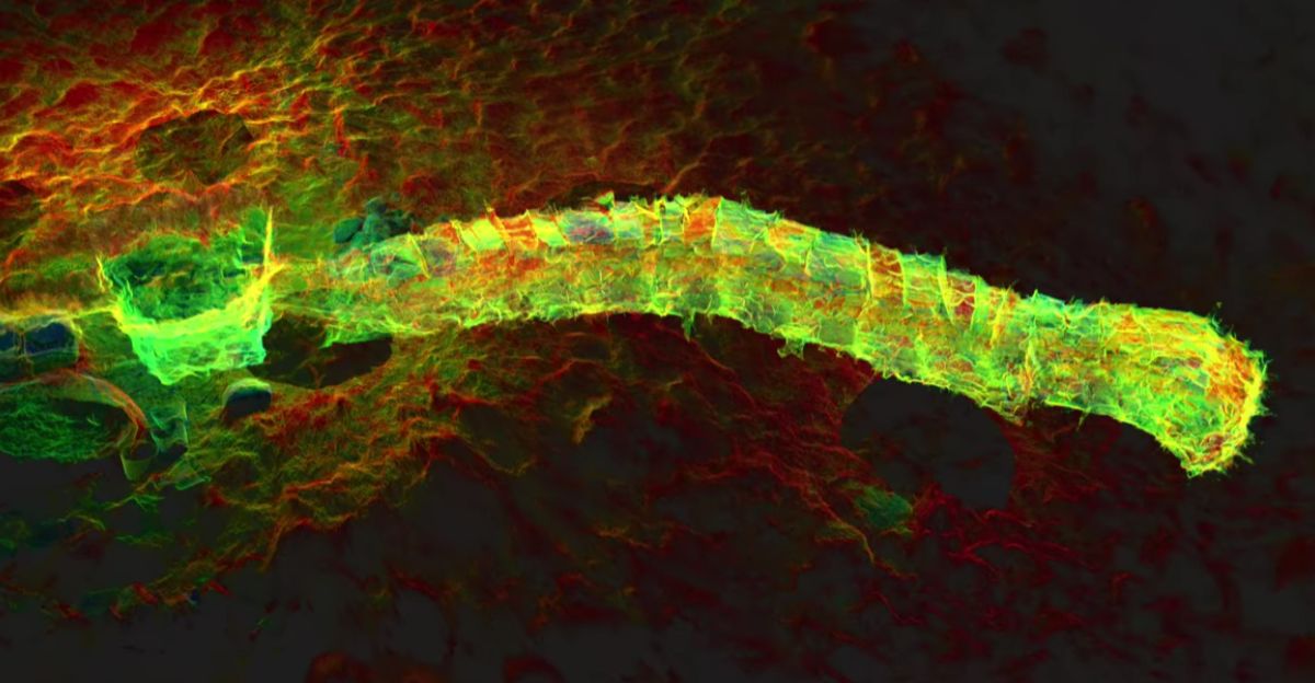
Modern techniques transform souterrain research. AOC Archaeology pioneered laser scanning of remote Highland souterrains using LiDAR technology, capturing 680,000 data points per second.
The Cracknie Souterrain in Sutherland—12.8 meters long—received complete 3D documentation, creating detailed point-cloud models accessible worldwide.
This technology overcomes accessibility barriers for fragile or remote sites while creating permanent digital records. Similar applications enable virtual visits and precise analysis without disturbance.
Public Fascination

The discovery of Broxy Kennels generated major public interest through news coverage and social media discussions.
Archaeological mysteries particularly captivate audiences—the combination of sophisticated ancient engineering and unknown purpose creates compelling stories. However, coverage occasionally amplifies speculative theories lacking evidence.
Some online discussions propose ritual sacrifice, alien involvement, or lost civilizations—claims archaeologists firmly reject. Experts emphasize the distinction between legitimate scholarly debate and pseudoarchaeological speculation.
Comparable Mysteries
Souterrain puzzles echo broader archaeological debates about prehistoric structures worldwide.
European examples include French caves mégalithiques, Cornish fogous, and Irish souterrains—all of which share construction timing and uncertain function. Even extensively studied sites, such as England’s Iron Age hillforts, retain mysteries despite decades of excavation.
The Broxy Kennels case shows how even well-preserved, professionally excavated sites can resist definitive interpretation. Ancient communities possessed cultural knowledge potentially incomprehensible through modern analysis.
Legacy Value
The Broxy Kennels excavation demonstrates the dual benefits of infrastructure archaeology: preserving cultural heritage while advancing historical understanding. Without the Cross Tay Link Road project, this souterrain would remain sealed and inaccessible to research.
The work contributed to Scotland’s growing souterrain database, supporting comparative studies refining chronologies and distributions.
Most importantly, it shows that even sophisticated modern analysis can’t always decode ancient purposes—a reminder that 2,000 years creates genuine knowledge barriers.