Imagine a signal traveling from 450 kilometers above Earth, carrying news of a change happening 25 kilometers beneath Antarctic ice. Scientists stare at data from multiple satellites, seismic networks, and GPS stations, all pointing to the same invisible phenomenon: something beneath the ice is rising.
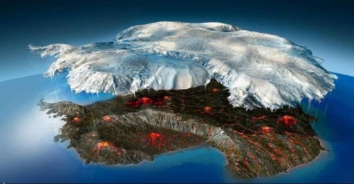
A magma plume pushes upward beneath West Antarctica’s ice, heating the ground and leaving a magnetic fingerprint detectable from space.
Hidden Antarctic Activity
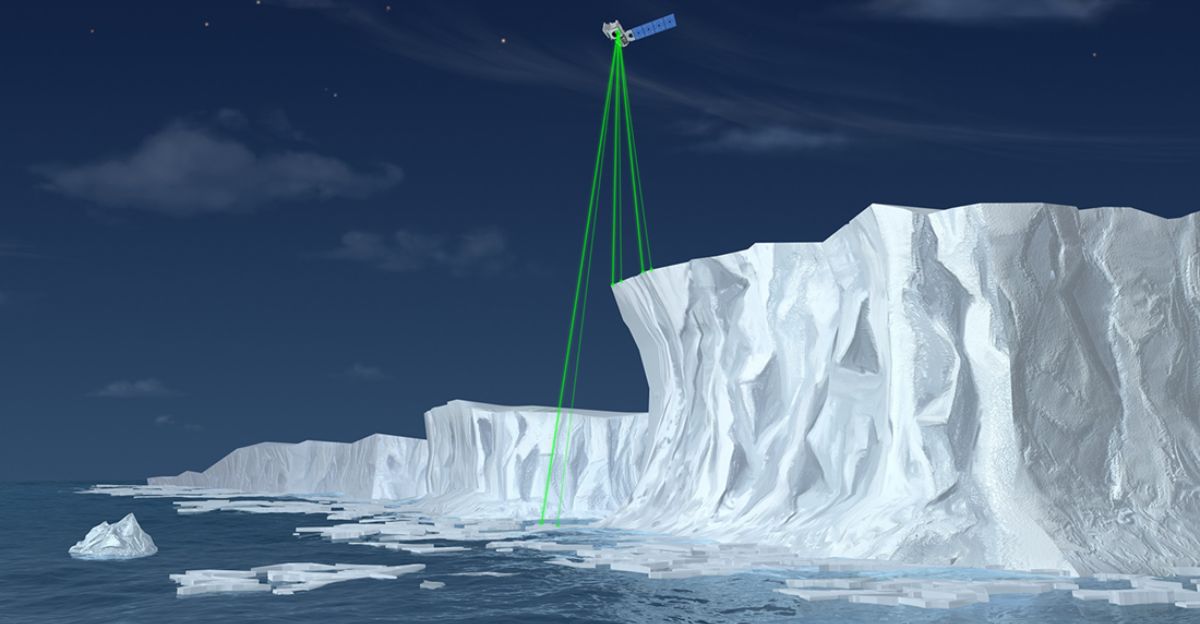
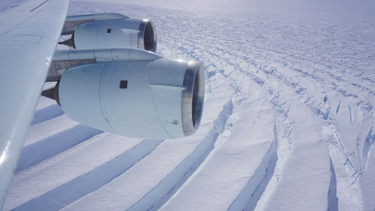
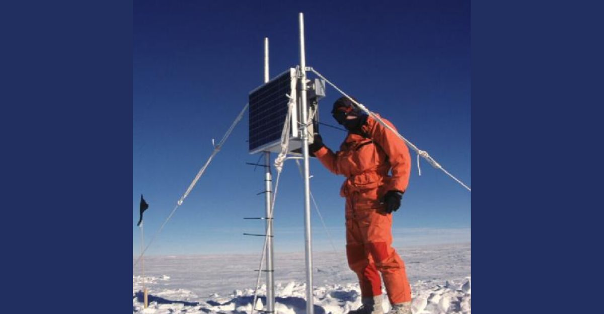
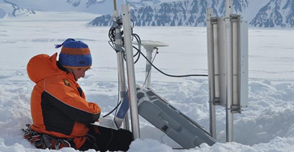
Three European Space Agency Swarm satellites continuously map Earth’s magnetic field with exquisite sensitivity from orbit. NASA’s ICESat-2 fires 10,000 laser pulses per second at Antarctic ice, measuring elevation changes down to the centimeter with precision. Below the ice, seismic stations detect subtle earthquakes signaling magma movement through the crust.
GPS receivers and radar satellites complete the comprehensive observational picture, mapping crustal deformation across vast areas.
Magma Moving Through Antarctic Bedrock
Between 2010 and 2016, Antarctic seismic networks detected persistent seismic activity in eastern Marie Byrd Land, characterized by long-period earthquake characteristics typical of active magmatic transport. These ‘long-period earthquakes’ signal magma moving through Earth’s cracks, not rock splitting under stress.
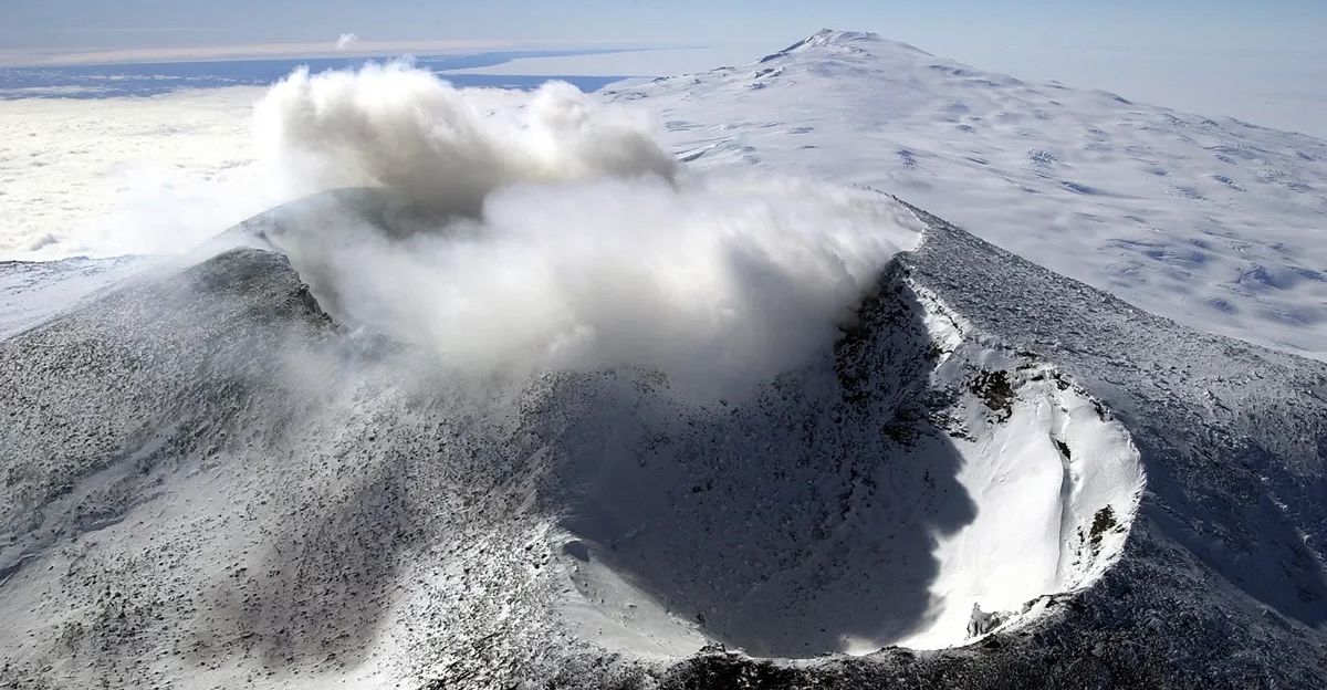
Recent investigations confirm that Mount Takahe, buried beneath Antarctic ice at the junction of the West Antarctic Rift System, remains volcanically active beneath the surface.
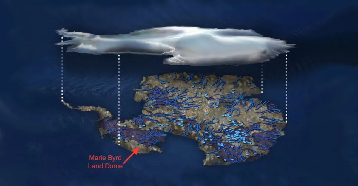
A 1.6 Million Square Kilometer Volcanic Hotbed
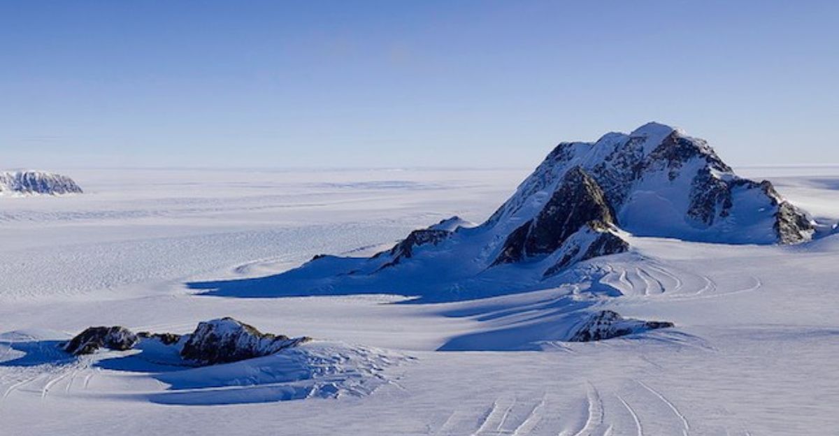
Marie Byrd Land spans 1.6 million square kilometers of West Antarctica—geologically, one of the continent’s most volcanically active regions. The magmatic activity clusters beneath Mount Takahe within the West Antarctic Rift System. This region sits directly above the thinned continental crust where Earth’s mantle lies significantly closer to the surface.
A mantle plume—a column of abnormally hot rock rising from Earth’s interior—has fed this zone with heat for millions of years.
Deep Magma Chambers
When seismic waves travel through rock, they move at predictable speeds—fast through cool, dense material, slower through hot or partially melted rock. Scientists call this difference a ‘low-velocity zone,’ appearing on seismic maps as a red flag marking melted stone.
Beneath Marie Byrd Land, magma at depths between 25 and 40 kilometers transports heat toward the surface over the course of years or decades. This isn’t an imminent eruption but steady warmth delivery from Earth’s interior.
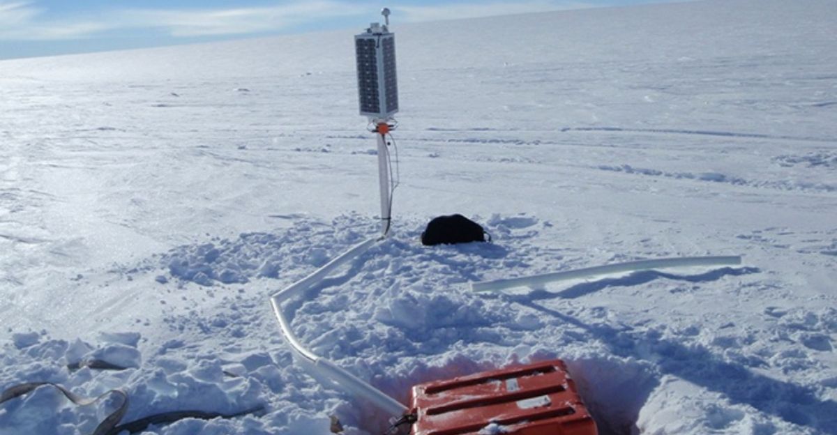
NASA Ground Magnetometers Document Magnetic Anomalies
Antarctic research programs operate magnetometer stations providing continuous ground-based verification of magnetic field variations. NASA scientists working with ground-based geomagnetic instruments documented that magnetic anomalies correlate temporally with episodic seismic activity in Marie Byrd Land.
Ground-based magnetometer data show geothermal processes produce measurable but localized magnetic field signatures. NASA’s support of Antarctic networks enabled researchers to confirm that active magmatic transport creates detectable physical signatures at depth.
Uplift Faster Than Ice Melt Models Predict
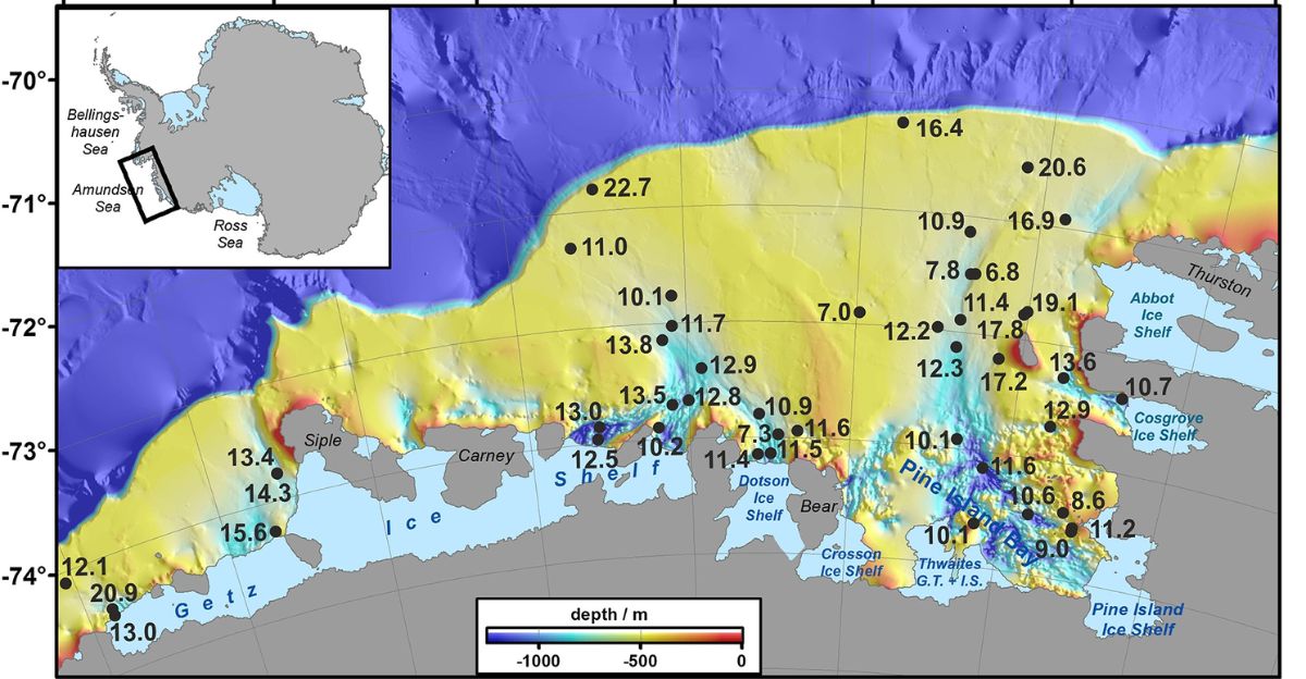
GPS receivers anchored to bedrock in the Amundsen Sea Embayment show the crust rising at rates exceeding 30 millimeters per year—faster than ice loss models alone predict. As ice melts, the overlying load decreases, allowing the crust beneath to flex upward through isostatic rebound.
However, measurements reveal more uplift than this model explains, suggesting an additional force: active geothermal processes that push the ground up from below via the magma plume.
Magma Movement Through Antarctic Crust
Antarctic seismic network earthquake records document patterns consistent with magma intrusion. Small earthquakes cluster in regions associated with Mount Takahe’s volcanic system, showing spatial and temporal patterns glaciologists recognize from magma-infected regions worldwide.
Long-period earthquakes indicate fluid movement; their presence suggests magma continuously transports through the crust, refilling reservoirs and warming rock. Research indicates ice mass loss may increase volcanic activity from Marie Byrd Land, creating potential feedback mechanisms.
138 Volcanoes Across 3,000 Kilometers
The West Antarctic Rift System spans 3,000 kilometers and contains over 138 known volcanoes. Marie Byrd Land sits at the heart of the rift—a region of abnormally high heat flow and thin continental crust. Its geologic record documents volcanism spanning 56 million years from the Eocene epoch to recent eruptions in ice core records.
The mantle plume beneath Marie Byrd Land remains actively transporting magma and heat upward—confirmed only recently through converging satellite, seismic, and magnetic observations.
‘Doomsday Glacier’
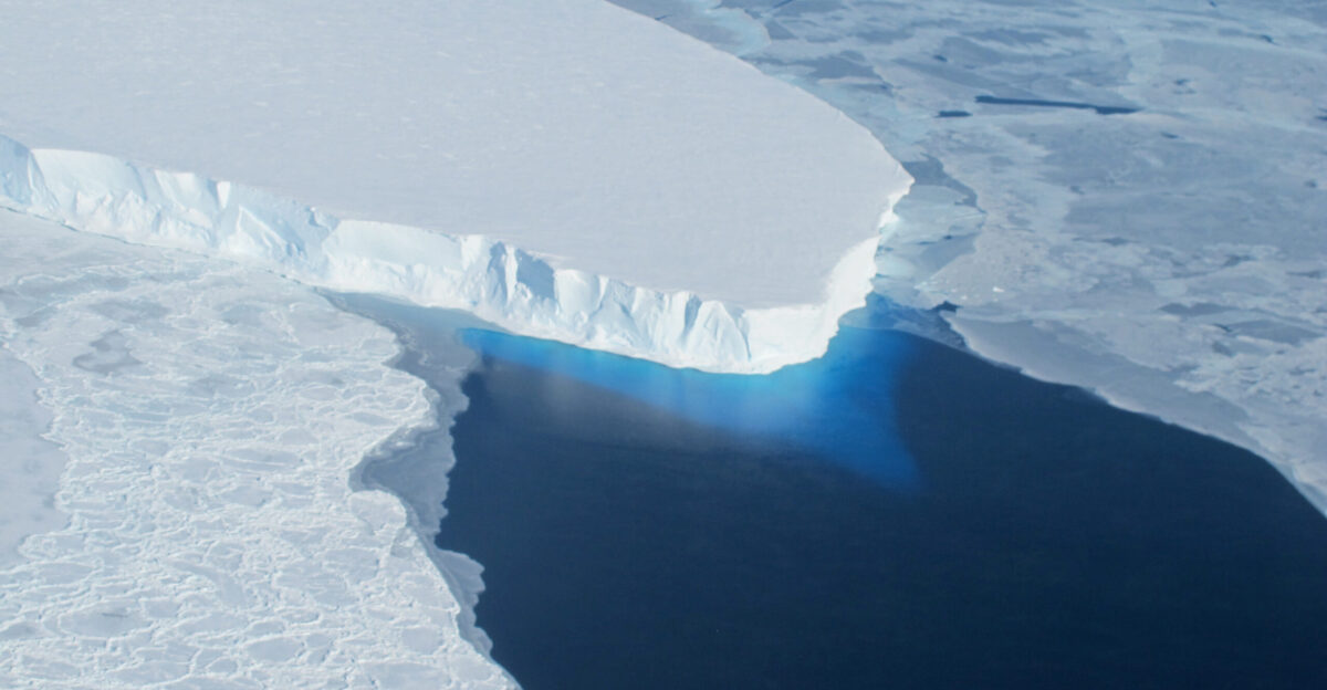
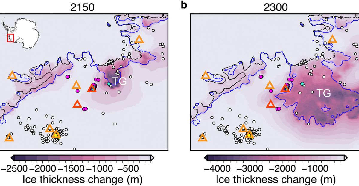
Thwaites Glacier, also known as the ‘Doomsday Glacier,’ flows across West Antarctica, underlain by an active magmatic zone. Roughly the size of Florida, it contains ice equivalent to approximately 60 centimeters of global sea-level rise. Satellite observations document warm ocean water intruding beneath its floating ice shelf, accelerating basal melting.
Nature studies from 2023 revealed that warm water was seeping into weak spots. Heat from below adds a second threat: internal warming lubricating ice flow.
Forces Combine to Destabilize West Antarctica’s Ice Streams
West Antarctica’s ice streams face converging destabilization mechanisms. Ocean warming thins ice shelves from below, forcing grounding lines to retreat inland. Reduced ice weight allows crustal rebound, redistributing stress and altering basal friction. Active geothermal heating warms the ice sheet’s base, creating lubricating liquid water.
Research indicates that subglacial volcanic activity intensifies as ice unloading progresses, suggesting a feedback loop: less ice permits more meltwater generation, which in turn accelerates ice loss further.
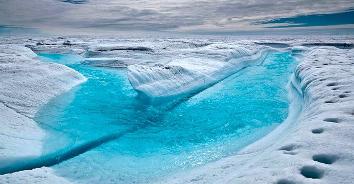
Subglacial Water Acts as Ice Lubricant
Liquid water beneath glaciers acts like oil in a hinge, allowing the overlying ice to slide rapidly over bedrock and reducing friction to nearly zero. Magma at crustal depths doesn’t directly melt vast ice sheets; instead, it heats groundwater and rock, creating subglacial lakes and melt channels.
Research indicates that even modest basal geothermal heat significantly influences basal friction and ice velocity. The subglacial lake system demonstrates the sensitivity of ice dynamics to basal water.
Magma Rise Unfolds Over Decades, Not Days or Hours
Unlike volcanoes that explode without warning, this process unfolds over years and decades. Magma rises through the crust like fermenting bread dough—slow, patient, driven by density and pressure gradients. Seismic records document episodic acceleration in magmatic activity, but the underlying process remains steady.
Two kilometers of ice overhead would suppress surface explosivity, so researchers don’t anticipate a traditional eruption. Instead, steady warming intensifies subglacial melting and heat transport on a continuous basis.
Scientists Race to Deploy New Instruments Before Antarctic Winter
Scientists are tightening airborne magnetic survey grids over Marie Byrd Land to map field variations with finer resolution. Satellite missions continuously recalibrate as magnetic field models update with new data. Researchers cross-reference earthquake catalogs with ground-based and satellite magnetic measurements to refine magma depth and heat flux estimates.
GPS station networks expand to catch horizontal crustal motion, revealing strain accumulation. Each data stream answers key questions about activity acceleration rates and seasonal responses.
Climate System Stability
Earth’s deep interior remains dynamically coupled to surface climate systems. Antarctica isn’t merely a passive ice repository but an active laboratory where mantle plumes interact with ice sheets, volcanic activity influences glacier stability, and millimeter-scale deformation is visible from space.
Converging seismic, magnetic, gravitational, and geodetic observations reveal processes that would remain invisible relying on single instruments. Understanding deep-Earth processes predicts 21st-century Antarctic sea-level rise contributions and future climate impacts.