
Tropical Storm Melissa began its ominous crawl across the Caribbean on October 19, barely moving at 2 miles per hour—a pace that transforms an already dangerous storm into a catastrophic one.
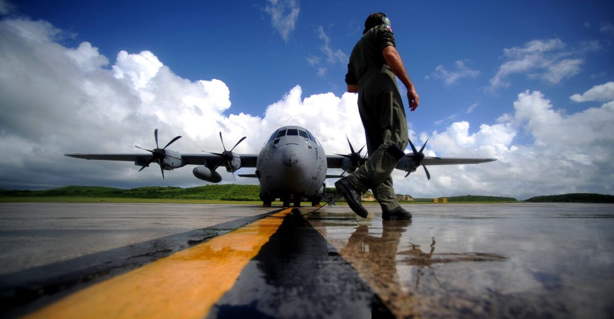
As the system inches toward Jamaica and Haiti, the U.S. Air Force’s Hurricane Hunters are flying directly into its turbulent core, gathering real-time data that will shape forecasts and emergency response decisions for millions across the region.
The WC-130J Hurricane Hunters’ Critical Mission

The 53rd Weather Reconnaissance Squadron, based at Keesler Air Force Base in Mississippi, operates a fleet of WC-130J Hercules aircraft equipped to penetrate the harshest weather systems. These specialized aircraft can stay aloft for up to 18 hours, enabling crew members to collect atmospheric measurements every minute during reconnaissance flights that often span 3,500 miles. Unlike conventional aircraft, the WC-130J flies directly into hurricane eyes to measure wind speed, temperature, pressure, and humidity—data that feeds directly into the National Hurricane Center’s forecasting models and shapes warnings that guide emergency managers.
The reconnaissance mission remains essential in an era of rapid storm intensification. On October 22, the National Hurricane Center predicted that Melissa would reach hurricane strength within 48 hours and could rapidly intensify into a major Category 3 hurricane by the weekend. Accurate reconnaissance data provides the foundation for such critical forecasts.
Jamaica Mobilizes as Danger Approaches
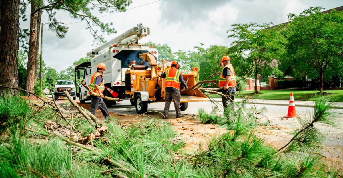
Jamaica faces the storm’s most immediate threat. As of late October, the island remained under both a tropical storm warning and hurricane watch, with eastern regions potentially receiving 12 to 20 inches of rainfall over several days. Such concentrated precipitation historically triggers devastating flash floods and landslides across the mountainous terrain.
The Jamaica Public Service Company has fully activated its emergency operations centers and positioned overseas line crews on standby, while ensuring critical infrastructure has 48-hour backup power and new Starlink communications systems in place. Minister of Energy Daryl Vaz emphasized the scale of preparation, noting that vegetation management and grid reinforcement efforts had been intensified across western and eastern parishes. The nation’s response draws from hard-earned lessons following Hurricane Beryl’s impact just months earlier.
A Storm Shaped by Warming Waters

Melissa’s trajectory highlights a growing climate change reality: tropical systems are intensifying faster over warming Caribbean waters. This year’s Atlantic basin experienced exceptionally warm sea surface temperatures, with the Caribbean averaging at least 0.5 degrees Celsius warmer than any previous late October date since 2023. Such conditions provide powerful fuel for rapid strengthening.
Researchers documented similar patterns with Hurricane Erin in August 2025, which underwent extreme rapid intensification—gaining approximately 65 mph in just 12 hours—powered by ocean temperatures made roughly 1.1 degrees Celsius warmer by human-caused climate change. Scientists conclude that climate-enhanced warming increases both the likelihood and severity of such storms, with each category increase multiplying potential wind-related damages by roughly four times. Higher rainfall rates now pose an additional threat, with warmer atmospheres retaining more moisture and increasing flood risks inland and across Caribbean islands.
Data-Driven Response in Real Time
The Hurricane Hunters’ reconnaissance data proves indispensable as Melissa approaches populated regions. The National Hurricane Center incorporated WC-130J measurements of the storm’s minimum central pressure—1000 millibars, or 29.53 inches—into its forecasting models, informing updates distributed to residents, emergency managers, and government officials.
The coordination between air reconnaissance, the National Hurricane Center, and regional agencies exemplifies modern disaster preparedness. Direct Relief has already mobilized over $3.1 million in medical supplies to potentially impacted areas, while Jamaica’s government continues coordinated preparations with utilities, transportation agencies, and regional emergency services.
A Test of Modern Forecasting
Tropical Storm Melissa represents a defining challenge of twenty-first-century hurricane preparedness. Its slow movement ensures prolonged rainfall impacts, while rapid intensification remains possible even as forecasters monitor its evolution. The data collected by Hurricane Hunters provides essential windows into storm behavior, yet uncertainty persists about Melissa’s ultimate track and strength.
As the system approaches the weekend, the fusion of cutting-edge reconnaissance, climate-informed analysis, and coordinated regional response will determine whether Jamaicans and residents across Haiti and the Dominican Republic can weather the coming impact. The Hurricane Hunters’ flights continue, gathering the intelligence that forms the foundation of life-saving forecasts.