
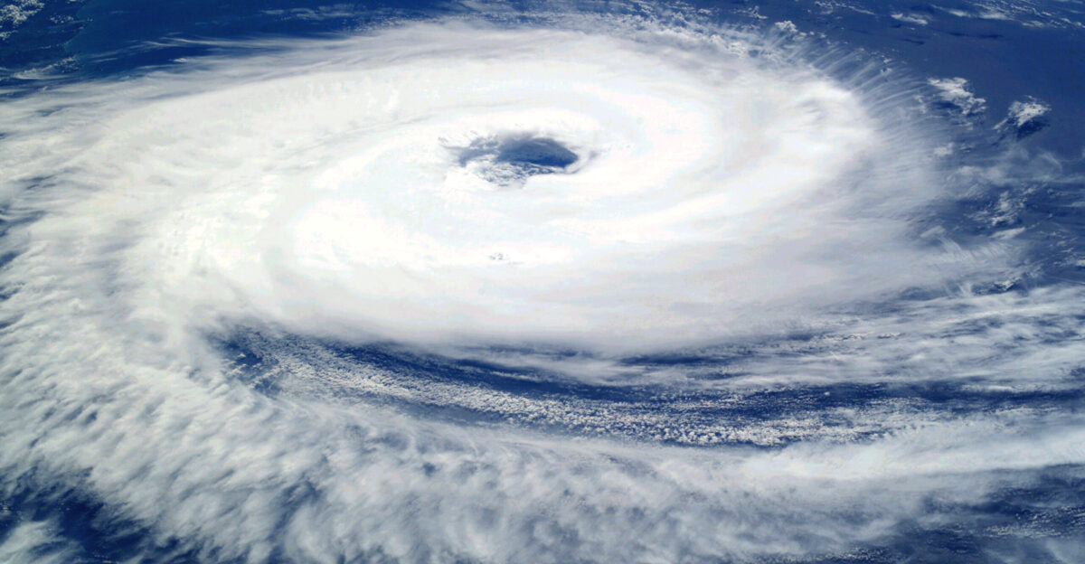
The National Hurricane Center has issued hurricane and tropical-storm watches for parts of southwestern Mexico and the Baja Peninsula as Hurricane Priscilla and Tropical Storm Octave swirl over the eastern Pacific. The agency warned that heavy rainfall, rough surf, and flash flooding were likely through Tuesday night, October 7.
Meteorologists say as the two storms move closer, their paths could shift unexpectedly—prompting local authorities to urge coastal residents to monitor official alerts and prepare for possible evacuations or power disruptions.
When Storms Start to Dance: The Fujiwhara Effect
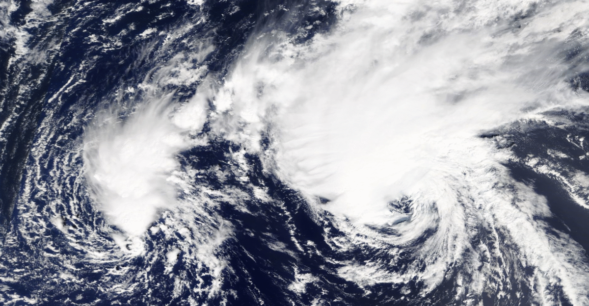
The Fujiwhara Effect sounds like something out of science fiction—but it’s a real meteorological phenomenon. When two cyclones get within about 900 miles of each other, they begin orbiting around a shared center, sometimes merging or flinging one storm away.
The National Weather Service states that the interaction can cause wild speed, direction, and strength shifts. Though rare, the effect has been documented for decades and often turns forecasting into a fast-moving puzzle for meteorologists.
Priscilla Brushes Mexico’s Coast
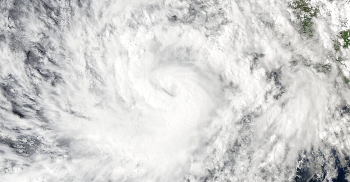
Hurricane Priscilla is staying offshore, but just barely. Its outer rainbands are already sweeping into Jalisco and Colima, bringing torrents of rain and gusty winds. The NHC said the storm’s sustained winds held near 100 mph as it churned northwest over open water.
Emergency crews warned of flash floods and small landslides in the mountains, while fishing ports suspended operations. Coastal shelters have opened as a precaution while meteorologists watch Priscilla’s next move.
Octave Gains Strength in Priscilla’s Shadow
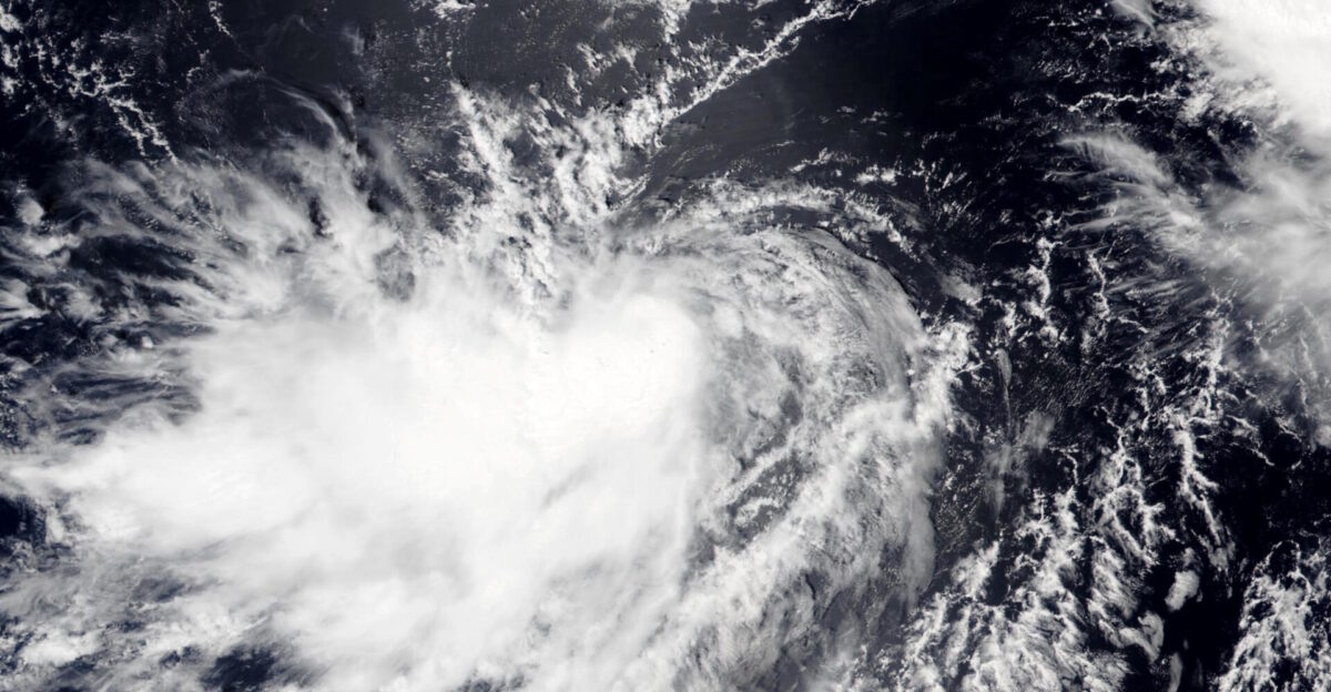
Farther west, Tropical Storm Octave feeds off warm Pacific waters while tracking almost parallel to Priscilla. The NHC noted that Octave’s path and intensity are being pulled and twisted by its larger neighbor.
Even without a direct hit on land, towering swells and dangerous surf are rolling toward Mexico’s Pacific shores and Baja California. Forecasters warn that slight changes in either storm’s motion could dramatically alter the outlook for the coming days.
Rising Surf Reaches the West Coast

Though both systems remain far from the U.S., forecasters say their combined energy could send long-period swells northward toward Southern California later this week. The Weather Prediction Center warned of rip currents and minor coastal flooding at low-lying beaches.
Officials stress there’s no risk of hurricane-force winds for the U.S., but from Baja to San Diego, beachgoers should brace for rough surf and heightened wave activity heading into the weekend.
A Charged Hurricane Season
The 2025 Pacific hurricane season has already been a busy one. The NHC reports above-average storm activity, with several systems causing floods across Mexico and Central America since May. Civil Protection officials say saturated soils mean new rainfall could quickly trigger floods or mudslides.
Relief groups are moving supplies and rescue gear to vulnerable zones ahead of what’s shaping up to be one of the most intense stretches of the season.
Flood Warnings Across Mexico’s Coast
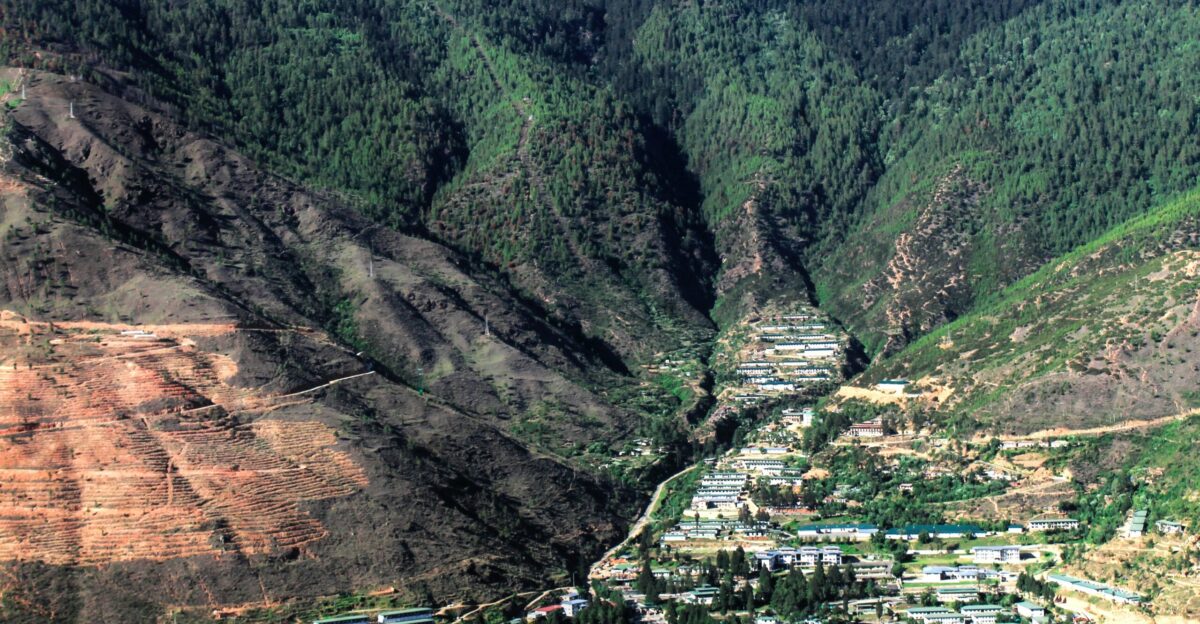
As Priscilla’s outer rainbands sweep inland, Jalisco, Colima, and Nayarit have issued flood and landslide alerts. The National Civil Protection Coordination urged people in low-lying or riverside areas to head to higher ground.
Authorities reported temporary road closures in mountain regions where runoff has caused minor slides. Emergency shelters are filling as rainfall intensifies and communities brace for worsening conditions through midweek.
Power Crews Stand Ready

Mexico’s Federal Electricity Commission (CFE) has activated its emergency plan across coastal states, positioning repair teams near critical substations, hospitals, and communication hubs. The agency said its goal is rapid restoration if winds or flooding cause power failures.
Telecom companies are also running backup systems to keep networks stable. After past Pacific hurricanes knocked out power for days, officials say they’re determined to keep infrastructure resilient this time.
Rare Twin-Storm Phenomenon

It’s not often that the Pacific basin sees two storms this close together. Meteorologists say only a handful of Fujiwhara interactions have been recorded this century—most notably in 2017, when Hurricanes Hilary and Irwin tangled offshore.
While these twin systems often stay far from land, their combined circulations can still whip up chaotic weather and dangerous surf near populated areas, challenging even the most advanced forecast models.
Hotter Seas, Stronger Storms

Scientists continue to draw connections between warmer oceans and more powerful cyclones. NOAA data show sea-surface temperatures across the eastern Pacific are running several degrees above normal, fueling rapid intensification.
Researchers from Hawaii and California warn that marine heatwaves not only spawn stronger storms but may also increase the odds of overlapping systems like Priscilla and Octave—a pattern tied to the planet’s shifting climate dynamics.
Evacuations Underway Along the Coast
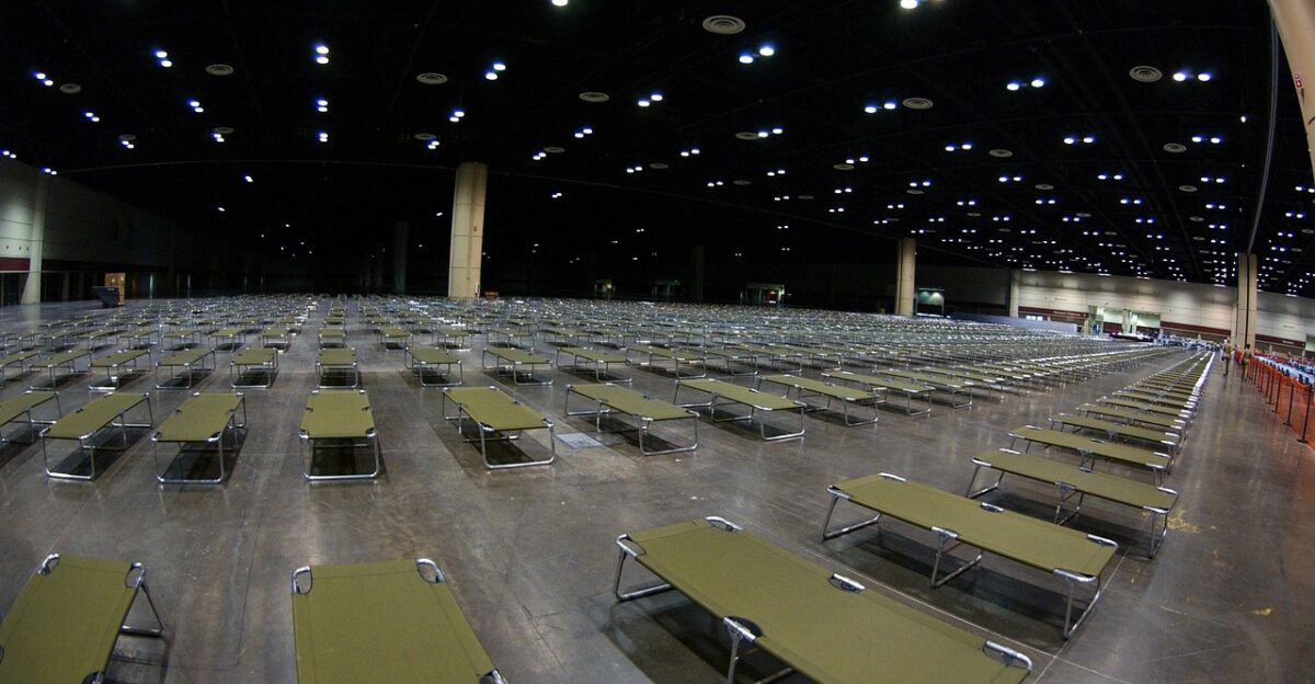
With rain intensifying, local officials in Baja California Sur, Jalisco, and Colima have opened emergency shelters and urged at-risk residents to move before conditions deteriorate. Volunteers and aid agencies are distributing food, water, and medical supplies at temporary centers.
Authorities stress that even tropical-storm-force winds can wash out roads, topple trees, and flood homes, especially in areas already drenched by earlier storms this season.
Early Economic Impacts

Mexico’s Ministry of Finance says it’s too soon to estimate the damage, but repeated tropical systems have already strained local economies this year. Analysts warn that flooding from Priscilla or Octave could further disrupt agriculture, tourism, and shipping, especially in resort towns like Manzanillo and Mazatlán.
Several ports have limited operations, and airlines prepare for possible flight delays or reroutes as conditions evolve midweek.
The Forecasting Challenge of Twin Storms
Predicting two nearby hurricanes is no easy task. Meteorologists explain that when their wind fields overlap, they interact in unpredictable ways—sometimes intensifying, sometimes spinning apart.
AccuWeather forecasters say the Fujiwhara Effect can expand the area of heavy rain and high winds, complicating emergency planning. Small shifts in steering currents could mean the difference between a brush with land or a major coastal event.
The Week Ahead

Forecast models suggest Priscilla and Octave will continue orbiting each other through midweek before weakening over cooler waters. The NHC expects rough seas and periodic downpours along Mexico’s Pacific coast to continue for several days.
Ocean swells could reach Southern California by the weekend if the system drifts farther north. Forecasters will issue new advisories every six hours as the situation develops and paths become clearer.
Staying Safe and Informed

Officials urge everyone in at-risk regions—residents, travelers, and boaters alike—to rely on verified sources such as the NHC, Mexico’s Civil Protection Coordination, and local authorities. Real-time updates on rainfall, surf, and evacuation orders are available online and via radio.
Experts emphasize that staying alert and acting early remain the best defenses against the hazards unfolding from this rare twin-hurricane event in the eastern Pacific.