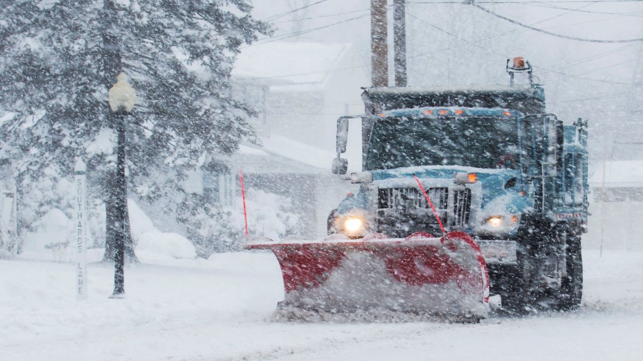
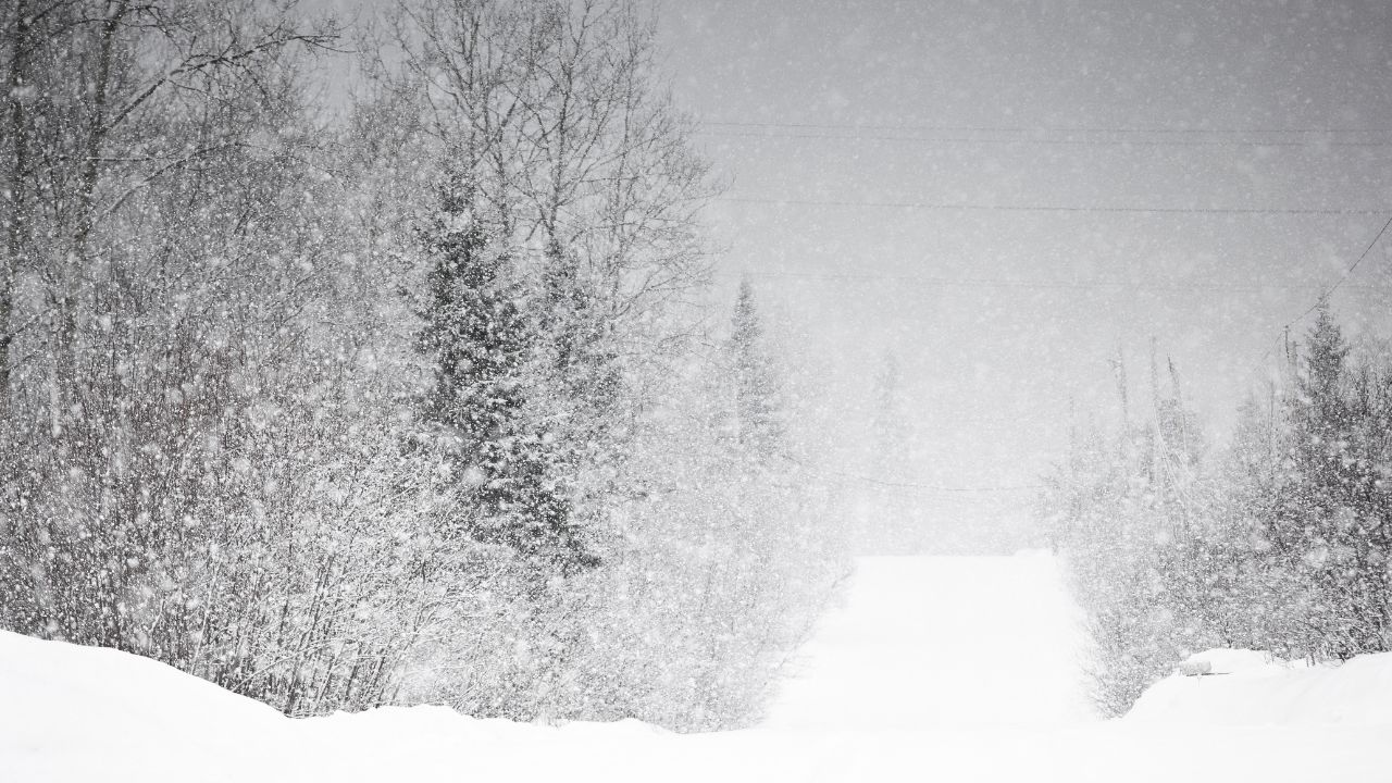
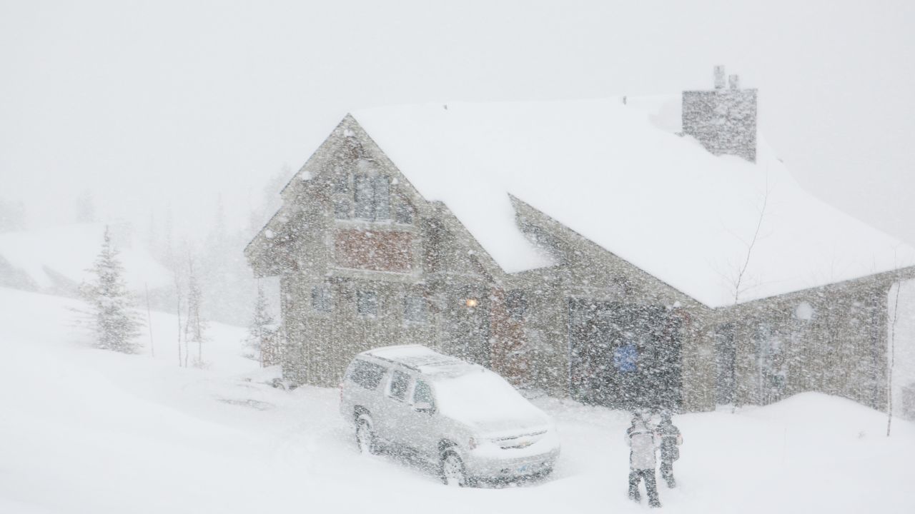
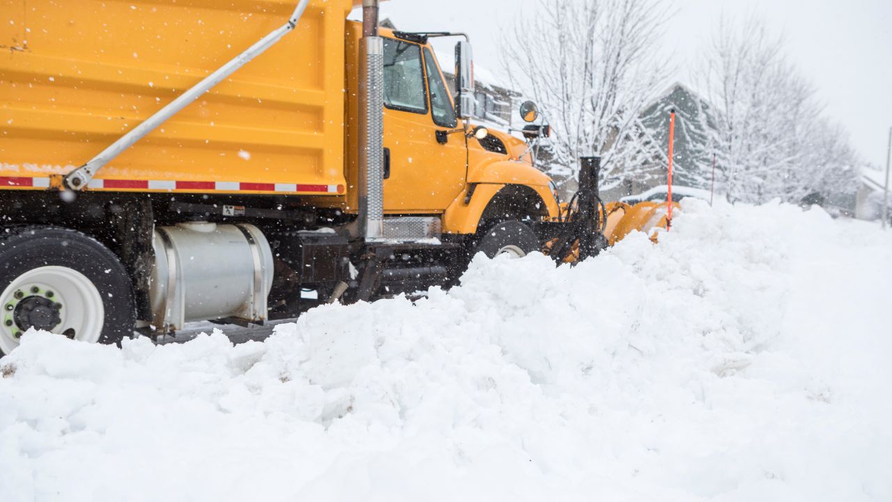
A blizzard has arrived, and highways are buried in snow. By mid-morning on January 20, 2026, the storm’s fury had already reduced visibility to near zero, with snow piling up at a rate of 4 inches per hour in some regions.
In New York’s Tug Hill region, snowfall was so intense that plows struggled to keep up. Authorities were warning residents not to travel, as whiteout conditions, combined with 50 mph winds, made the roads impassable.
For those braving the storm, the real danger wasn’t just the snow—it was the freezing temperatures, which were already dipping to −18°F. How long could this storm last, and how far would its impact reach?
Polar Vortex Leads to Life-Threatening Conditions
A disrupted polar vortex is the driving force behind this brutal storm. Normally a cold-air mass centered over the Arctic, the vortex has split, sending arctic air south into the U.S. As this cold air meets the warmer waters of the Great Lakes, it creates lake-effect snow, with rates reaching up to 4 inches per hour.
Heavy snowfall, high winds, and dangerously low temperatures are expected to continue through January 21, 2026, with travel conditions becoming life-threatening in affected zones.
Winter Weather Warnings in Seven States
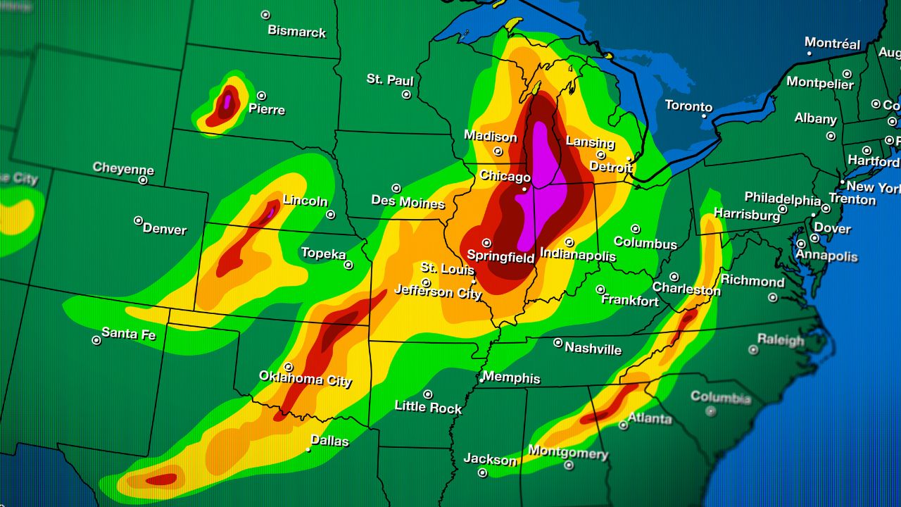
The National Weather Service issued winter storm warnings, winter weather advisories, and blizzard warnings across seven states, including Michigan, Wisconsin, Indiana, New York, Pennsylvania, Maine, and New Hampshire.
While blizzard warnings—the most severe alert—were issued for specific counties experiencing sustained winds of 35+ mph with near-zero visibility, the broader seven-state region received winter storm warnings as blizzard-level conditions were forecast to develop across multiple areas during the storm’s peak. Areas along the Great Lakes, especially those downwind, will see significant snowfall.
Tug Hill and Beyond

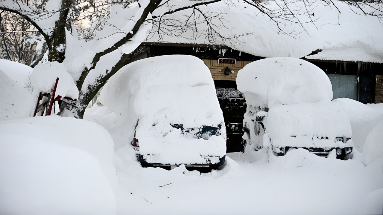
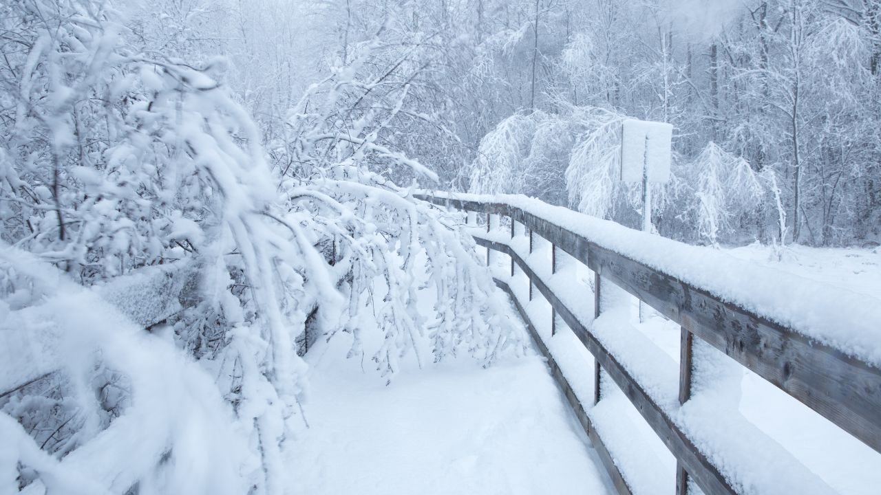
In Michigan, up to 14 inches of snow is expected, while parts of New York, particularly the Tug Hill region, could see up to 4 feet. Blowing snow and icy conditions will make travel nearly impossible, with whiteout conditions in many areas.
The Tug Hill region of New York is bracing for up to 4 feet of snow over a 48-hour period, a staggering amount even by local standards. Normally receiving an average of 180–200 inches of snow annually, this event will bring concentrated snowfall, making it one of the heaviest lake-effect snowfalls in recent years.
In other parts of western New York, including Niagara and Erie counties, 10–20 inches are forecasted. Similar amounts are expected in downwind areas of Michigan and Pennsylvania.
Winds & Wind Chills
Along with heavy snow, the storm will bring fierce winds. Gusts of up to 50 mph are expected in New York and Pennsylvania, driving snow and reducing visibility to near zero. Wind chills in western New York could drop as low as −18°F, creating dangerous conditions for anyone caught outside.
Frostbite can occur in as little as 10 to 15 minutes, and stranded motorists face the threat of hypothermia. These extreme winds and cold temperatures, combined with the snow, will create near-impossible travel conditions across the region.
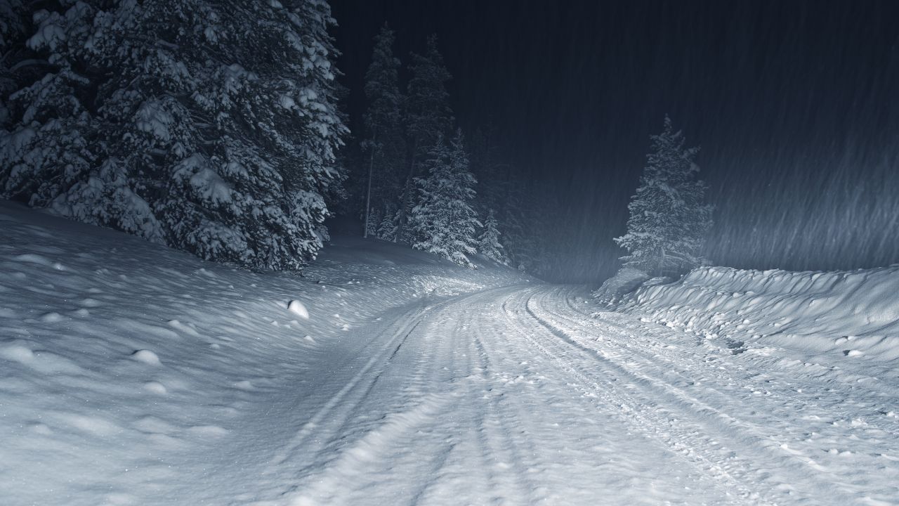
Understanding Whiteout Conditions
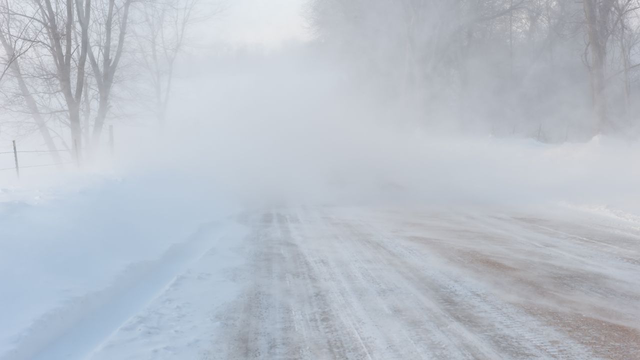
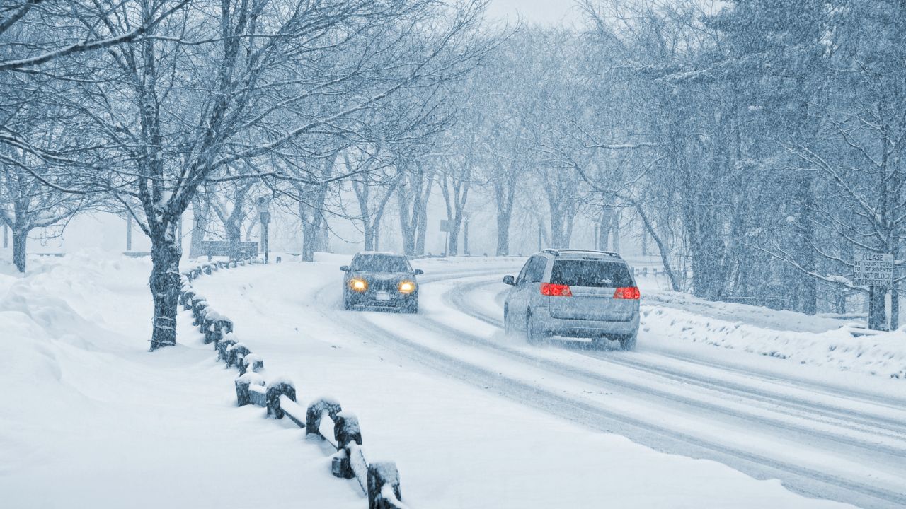
Whiteout conditions occur when snow and wind combine to eliminate visibility, making it impossible for drivers to see road edges or other vehicles. In these conditions, even experienced drivers will struggle to navigate safely.
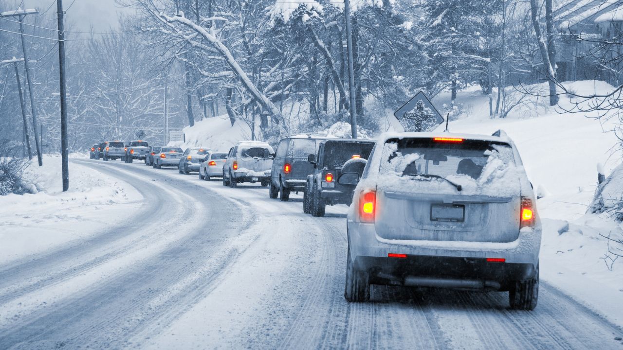
Highways will become impassable, and reports of multi-vehicle pileups are likely as the storm progresses. Airports in Buffalo, Rochester, and Syracuse are experiencing significant delays and disruptions. Emergency responders may also be unable to reach stranded vehicles in these conditions, creating life-threatening situations.
Power Outages, Road Closures
The storm’s heavy, wet snow and powerful winds are causing significant infrastructure disruptions. More than 130,000 people across the Great Lakes and Northeast have lost power, with outages expected to last 24–72 hours.
Roads are becoming impassable, with major highways like I-90 in New York and I-196 in Michigan facing closures or severe disruptions. Power lines and trees are downed by the weight of the snow and winds, exacerbating the challenges for emergency responders and making it difficult to restore services quickly.
Millions Impacted
The storm is affecting millions of people across at least seven states, with approximately 2 to 3 million residents under direct warning. A broader area spanning 10 states is experiencing severe winter weather.
Vulnerable populations, such as the elderly, homeless, and outdoor workers, face the greatest risk due to extreme cold and the potential for power loss.
The National Weather Service is urging all residents to stay indoors and avoid unnecessary travel from January 18 to 21 to minimize exposure to life-threatening conditions.
Timeline of the Storm
The storm will gradually intensify from January 18 to 19, with heavy snow beginning in Tug Hill and western New York. January 19–20 will see the peak of the storm, with snowfall rates reaching up to 4 inches per hour in some areas.
The most dangerous conditions will occur late on January 20 and early January 21, with maximum wind chills and near-zero visibility making travel virtually impossible. Conditions are expected to improve by January 22, but roads will remain hazardous as the snow tapers off.
Rare Extreme Snowfall in Tug Hill
Tug Hill is known for its heavy snowfall, but even by local standards, the forecasted 4 feet of snow in 48 hours is extraordinary.
Typically receiving 180–200 inches of snow annually, this event represents a large portion of the region’s typical yearly total.
The combination of lake-effect snow and a disrupted polar vortex makes this storm one of the most significant weather events in the area in recent years.
Life-Threatening Winter Storm Warnings
The NWS has issued life-threatening winter storm warnings and blizzard warnings for regions experiencing heavy snow, high winds, and extreme cold.
Blizzard conditions are defined as sustained winds or frequent gusts of 35 mph or higher, combined with considerable falling or blowing snow that reduces visibility to less than a quarter mile for three hours or more.
The severity of this storm meets these criteria in many areas, creating conditions where exposure to the elements can lead to frostbite or hypothermia in minutes. Travel in the hardest-hit areas is extremely dangerous.
Preparing for the Storm

Residents should prepare by stocking up on food, water, and medications. It’s important to ensure that home heating systems are working and vehicles are equipped with winter survival kits, including chains, blankets, and first-aid supplies.
During the storm, it is essential to stay indoors and avoid travel. If you must travel, use a four-wheel-drive vehicle, keep a safe distance from other cars, and reduce speed. If stranded, stay inside your vehicle and signal for help until rescuers can reach you.
Polar Vortex and Climate Change
Meteorologists are tracking an increase in polar vortex disruptions in recent years, with this storm being part of a broader shift in atmospheric patterns. Experts suggest that these disruptions are becoming more frequent due to factors like Arctic warming and jet stream instability.
While it’s unclear if this is directly linked to climate change, some scientists argue that warming temperatures in the Arctic may be contributing to these weather extremes. This event highlights the importance of being prepared for such storms in an increasingly volatile climate.
Staying Safe
It’s crucial for residents in affected areas to stay informed about the storm’s progression and follow the advice of local authorities. The NWS and FEMA are providing real-time updates, and people should sign up for emergency alerts.
Keep an eye on road conditions, and check in on vulnerable neighbors. Those without power should use flashlights and conserve heat by closing off unused rooms. If you’re outside, limit exposure to the extreme cold and make sure to cover exposed skin to prevent frostbite.
Stay Informed
For real-time updates and forecasts, residents should visit the NWS website and follow local emergency management channels. The Federal Emergency Management Agency (FEMA) and state emergency management websites also offer information on shelters and assistance.
The NWS warns that this storm presents a serious risk to life and property, and preparation is key to staying safe. The best way to weather this storm is to stay indoors, avoid travel, and monitor official sources for updates.
Sources:
“Winter storm update: Tug Hill region braces for 4 inches of snow per hour starting on Monday.” Syracuse.com, 19 Jan 2026.
“‘Brutal’ cold to continue as forecasters warn of late-week storm.” USA Today, 19 Jan 2026.
“Winter storm and blizzard alert across the U.S.: Michigan, New York and other regions hit by heavy snow.” AS USA, 17 Jan 2026.
“Polar Vortex 2026 Update: New Stratospheric Warming Event Bringing Cold United States and Canada.” Severe Weather Europe, 11 Jan 2026.