A massive winter storm has triggered freeze alerts for approximately 105 million Americans as dangerous blizzard conditions sweep across 11 states, creating life-threatening travel scenarios during peak commuting hours. The National Weather Service warns that heavy snowfall, powerful wind gusts, and near-zero visibility will combine to produce some of the season’s most hazardous conditions, with snowfall totals reaching double digits in multiple regions and winds strong enough to create widespread drifting that can rapidly render highways impassable.
Geographic Impact and Intensity
Winter storm warnings and advisories blanket a vast swath of the nation, extending from Alaska through the Midwest and Great Lakes into the Appalachians. Michigan faces 6 to 8 inches of snow with gusts approaching 40 mph, while Indiana expects 2 to 6 inches and Illinois 2 to 5 inches. The storm’s geographic diversity underscores its complexity, with every affected region confronting hazardous travel regardless of accumulation amounts. Strong pressure gradients and Arctic air interact with abundant moisture to fuel intense snowbands, while lake-effect processes dramatically amplify totals near the Great Lakes. Cold air streaming over the relatively warmer waters of Lakes Superior, Michigan, Erie, and Ontario generates narrow but ferocious snow bands capable of depositing several inches within hours, transforming clear conditions into whiteouts with little warning.
New York’s Tug Hill Plateau and Oswego region anticipate 5 to 10 inches as persistent lake-effect bands reduce visibility and create deep drifts along secondary roads. Ohio and Pennsylvania face 2 to 5 inches, sufficient to disrupt both urban commutes and isolate rural communities temporarily. Maryland expects 2 to 3 inches, a modest amount that becomes treacherous during rush hour when temperatures hover near freezing, increasing the likelihood of black ice on bridges and overpasses. Alaska contributes dramatically to the nationwide alert count, with parts of the Aleutians facing up to 20 inches of snow and wind gusts as high as 65 mph. The slow-moving nature of this system prolongs exposure to extreme conditions across all affected regions.
Critical Hazards and Travel Threats
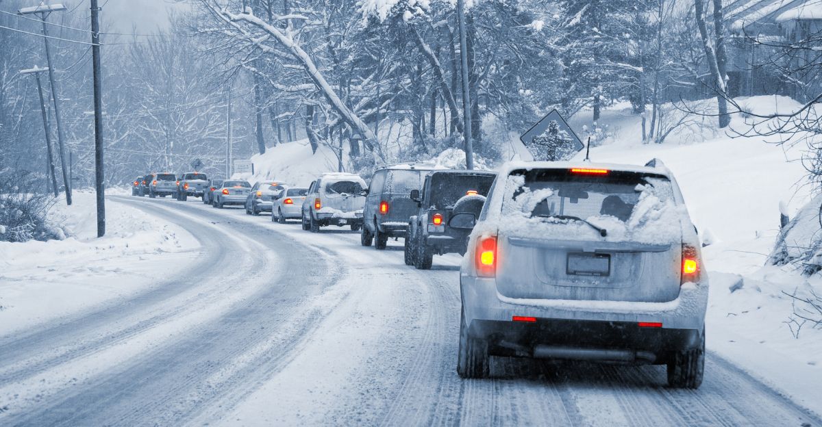
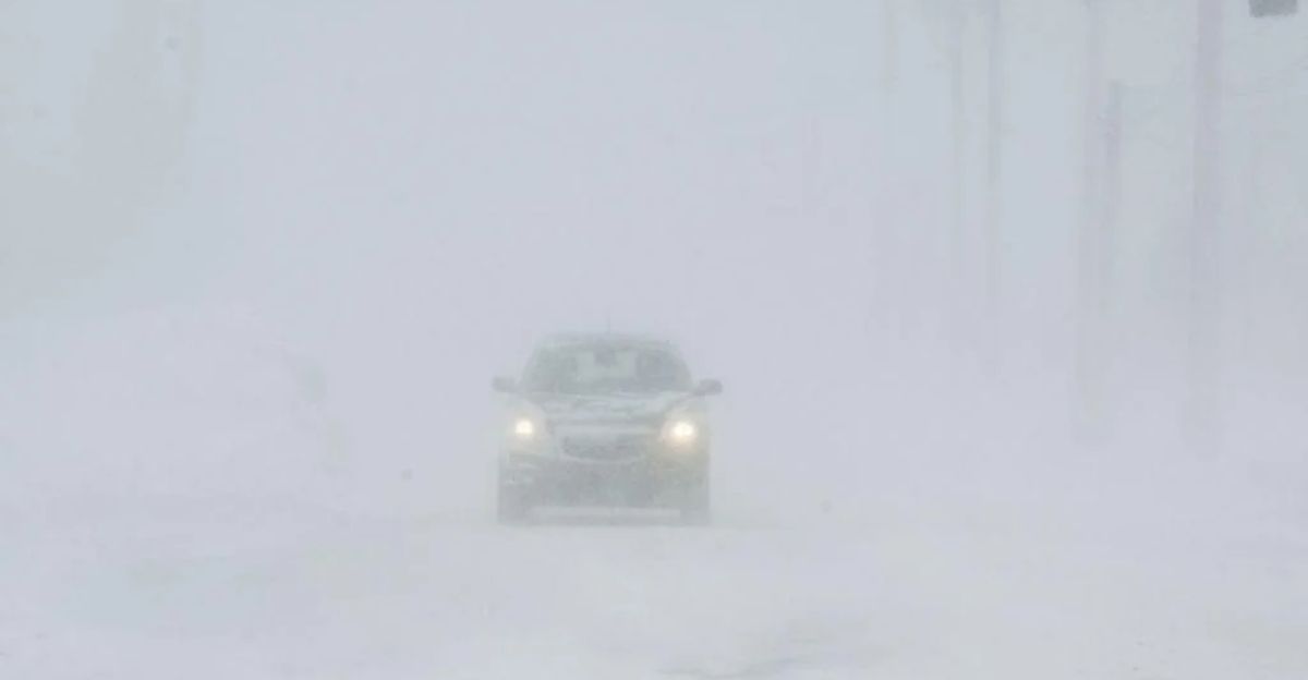
The storm’s greatest danger stems not from snowfall totals alone but from the lethal combination of wind speed, temperature, and visibility. Even regions expecting lower accumulations may experience near-whiteout conditions as winds lift fallen snow, completely obscuring lane markings and road edges. Morning and evening commutes face the highest risk when snowfall rates intensify during peak traffic hours, and drivers who become stranded may endure hours of exposure in subfreezing temperatures. Overnight travel presents particularly acute dangers as dropping temperatures harden snow, intensifying drifting and potentially burying vehicles that slide off roadways. Emergency responders warn that rescue times could extend significantly, especially in rural or mountainous terrain where access routes are limited and conditions prevent rapid deployment.
Regional Vulnerabilities

The Appalachian region confronts a dangerous intersection of snow, wind, and extreme cold. West Virginia may receive up to 6 inches with gusts reaching 40 mph and wind chills plummeting to -10°F, raising frostbite risks for anyone stranded outdoors. Tennessee’s Smoky Mountains are forecast to see 2 to 6 inches under similarly frigid conditions. Where heavy snow coincides with strong winds, power outages become likely as snow-laden branches and trees snap onto power lines. This risk peaks in Great Lakes and Appalachian regions, where hazardous road conditions may delay repair crews and extend outages during extreme cold. The storm’s reach also disrupts supply chains and regional commerce as truck traffic along major corridors halts, delaying essential goods. Businesses face staffing shortages when employees cannot travel safely, and even brief shutdowns ripple outward when multiple states experience simultaneous disruptions.
Preparedness and Outlook
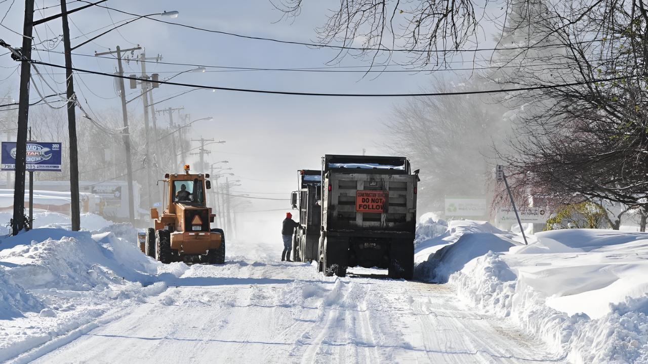
State and local agencies have activated emergency protocols across affected regions, deploying snowplows, road salt operations, and warming centers in anticipation of prolonged impacts. The storm’s slow movement increases the duration of dangerous conditions, with lake-effect snow potentially persisting even after the primary system weakens. Cold temperatures prevent rapid melting, allowing snow and ice to linger on roadways well beyond initial snowfall periods. Officials emphasize that snowfall totals alone do not define danger; wind speed, temperature, and visibility remain equally critical. The unpredictability of lake-effect bands adds another layer of risk. Authorities urge residents to avoid unnecessary travel, prepare emergency kits with charged devices and blankets for vehicles, and monitor weather updates closely. Simple precautions can reduce harm significantly, and delaying travel by even a few hours may prevent accidents and reduce strain on emergency services. With 105 million people under freeze alerts, this storm serves as a critical test of infrastructure and public readiness, highlighting how interconnected weather impacts have become across regions as crews battle snow and cold under life-threatening conditions.
Sources:
Likely title: “Weather Weeklies – Long Range Forecast: Mid-January 2026 Winter Storm Pattern”, Publication/platform: Weather Weeklies (YouTube channel)
HailTrace YouTube, Dec 30, 2025Likely title: “HailTrace – Winter Outlook: Early January 2026 Arctic Air and Storm Risk”
Publication/platform: HailTrace (YouTube channel)MSN/notes, Jan 15–16, 2026