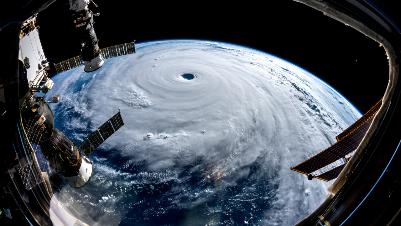
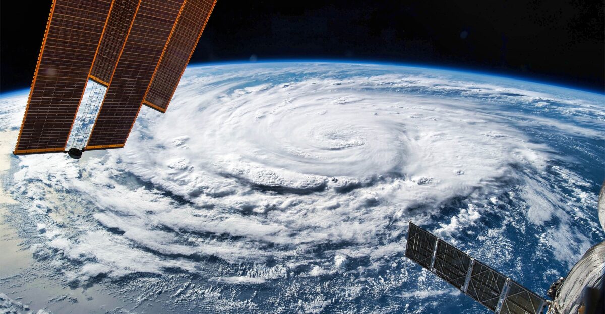
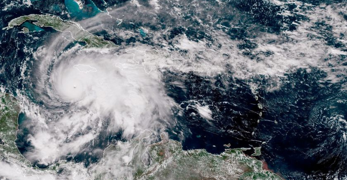
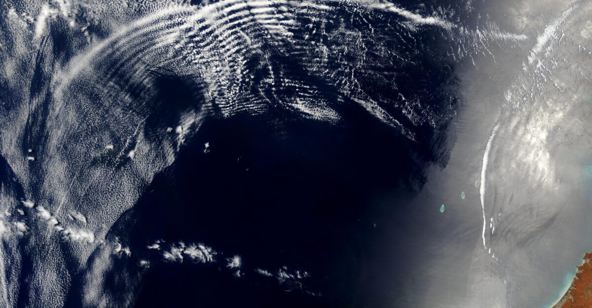
When Hurricane Helene tore into Florida’s Gulf Coast on September 26, 2024, with 140 mph winds, its devastation rippled far beyond the coastline. While emergency crews battled floodwaters and downed power lines at ground level, an instrument mounted on the International Space Station captured something extraordinary: the storm’s invisible fingerprint stretching 55 miles into space. NASA’s Atmospheric Waves Experiment revealed massive disturbances in Earth’s upper atmosphere, proving that the most powerful storms on our planet don’t just affect what we see at the surface—they shake the very edge of space itself.
A Space-Based Observatory Captures the Invisible
Installed on the exterior of the International Space Station in November 2023, the Atmospheric Waves Experiment represents a technological leap in atmospheric science. Built by Utah State University’s Space Dynamics Laboratory, the instrument uses infrared sensors to detect faint emissions from airglow—glowing bands of light in Earth’s mesosphere invisible to the naked eye.
The mesosphere extends from roughly 31 to 56 miles above Earth’s surface, a frigid realm where temperatures plunge to minus 150 degrees Fahrenheit. For decades, this atmospheric layer remained one of the least studied regions on the planet, accessible only to specialized instruments and sounding rockets. The experiment’s four telescopes scan the globe continuously, providing scientists with unprecedented views of atmospheric gravity waves—ripple-like disturbances that travel upward from violent weather events.
Helene’s Hidden Impact Revealed
“Like rings of water spreading from a drop in a pond, circular waves from Helene are seen billowing westward from Florida’s northwest coast,” said Ludger Scherliess, principal investigator at Utah State University. The images, artificially colored in red, yellow, and blue to show variations in intensity, marked the first publicly released observations from the mission and confirmed the instrument’s exceptional sensitivity. Scientists had theorized for years that major storms could generate such high-altitude disturbances, but direct evidence remained elusive until this breakthrough.
The Science Behind the Ripples
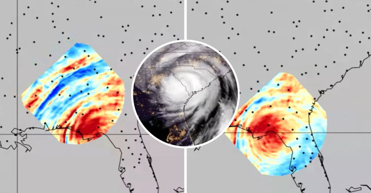
Atmospheric gravity waves form when air masses are displaced vertically and gravity pulls them back down, creating oscillations that propagate upward through the atmosphere like ripples across a pond. Unlike gravitational waves that Einstein predicted in spacetime itself, these atmospheric phenomena transfer enormous momentum and energy from Earth’s surface to the edge of space. The experiment detected these waves by monitoring temperature variations in the mesosphere using its Advanced Mesospheric Temperature Mapper.
Previous ground-based instruments in Antarctica and Norway had captured similar patterns, but geographic coverage remained severely limited. Following its first 3,000 orbits, the mission released over five million images and temperature measurements, providing researchers with a global view of how terrestrial weather influences atmospheric circulation at planetary scales. Ruth Lieberman, mission scientist at NASA’s Goddard Space Flight Center, noted that the instrument can resolve waves at finer horizontal scales than previous satellites, enabling breakthrough discoveries about atmospheric dynamics.
Real-World Consequences for Modern Technology
The practical implications of these observations extend far beyond academic curiosity. Gravity waves affect air density at high altitudes, directly impacting satellite operations, GPS accuracy, and communications systems that billions of people depend on daily. Even slight changes in mesospheric density can shift satellite orbits, disrupt signal transmissions, and degrade navigation precision. Understanding these disturbances could improve space weather forecasting, helping operators protect critical infrastructure before disruptions occur.
As climate change intensifies hurricane frequency and severity, the connection between terrestrial and space weather grows increasingly important. The 2026 Atlantic hurricane season will provide additional opportunities for the mission to gather data on how extreme storms ripple through Earth’s atmospheric layers. Whether this research will translate into operational forecasting improvements remains uncertain, but scientists now possess tools to observe what was previously invisible. The technology exists to measure these planetary-scale disturbances—the challenge ahead lies in translating observations into predictive models that protect the satellite systems modern civilization depends upon.
Sources
NASA Goddard Space Flight Center, Hurricane Helene’s Gravity Waves Revealed by NASA’s AWE, November 7, 2024
NASA Science Mission Directorate, NASA Atmospheric Wave-Studying Mission Releases Data from First 3,000 Orbits, March 13, 2025
Utah State University Digital Commons, Atmospheric Waves Experiment (AWE) Mission Overview, March 9, 2024
National Hurricane Center NOAA, Hurricane Helene Tropical Cyclone Report, September 2024
NASA Scientific Visualization Studio, Hurricane Helene’s Gravity Waves Revealed by NASA’s AWE, November 6, 2024
Utah State University Space Dynamics Laboratory, USU-Led NASA Atmospheric Wave-Studying Mission Releases Data from First 3,000 Orbits, March 16, 2025