Two coastal snowstorms barrel toward the Northeast and Mid-Atlantic, leaving meteorologists grappling with clashing forecasts just hours from impact. The I-95 corridor, home to 65 million people from Maine to Virginia, faces unprecedented uncertainty as models diverge on paths, timing, and snowfall totals.
Model Disagreement

Major forecasting systems—the European ECMWF, American GFS, and Canadian CMC—disagree sharply due to the rarity of dual low-pressure systems interacting along the coast. These models rely on varying physics and data grids, leading to rapid shifts in predictions as new observations arrive. AccuWeather meteorologists have noted that guidance has been changing repeatedly, with outcomes flipping within hours. With storms due late Wednesday, January 14, little time remains for agreement.
Forecasting Limits
The National Weather Service issued a stark statement on January 12: “We don’t know the potential impacts to travel and infrastructure due to snow and wind, especially along the I-95 corridor.” This direct admission across official channels highlights gaps in predicting exact tracks, totals, and timing. Unlike typical probabilistic forecasts, it reflects the challenge of rare events with scant historical data. Public reaction mixed shock with frustration, as many rely on confident outlooks for planning.
Regional Risks

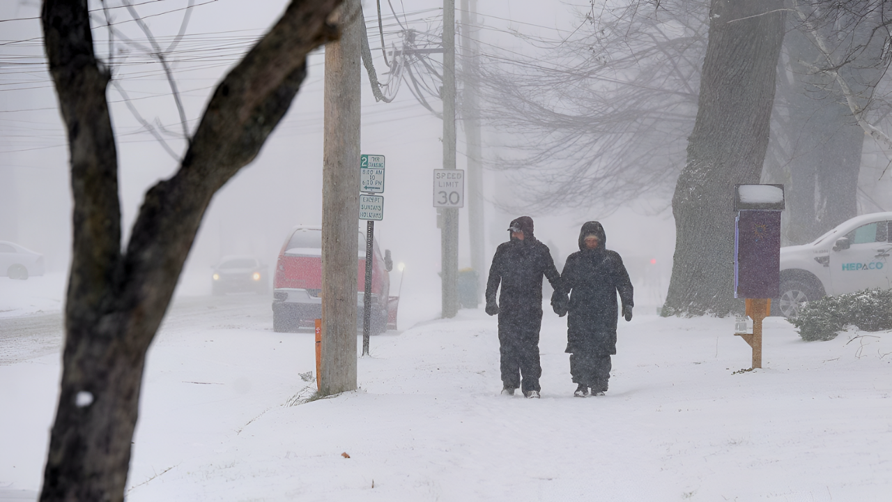
Interior areas like Maine, New Hampshire, Vermont, and the Central Appalachians face certain heavy snow, enhanced by Great Lakes lake-effect bands. The pivotal zone spans coastal New York, New Jersey, Connecticut, Massachusetts, Rhode Island, and the Baltimore-Washington area. An offshore track spares cities; a coastal hug brings 8-14 inches or more to Boston, New York, and Philadelphia, impacting 30 million directly. Lower Great Lakes snow adds regional complications.
Disruption Potential
The I-95 corridor carries millions of daily commuters, with major bottlenecks at Baltimore, the New Jersey Turnpike, and Connecticut-New York borders. Six to 10 inches causes 4-6 hour delays; 12+ inches shuts lanes for 12-24 hours. Dual storms in 48 hours could paralyze recovery, stranding workers and halting payrolls. Airlines have issued travel waivers for various East Coast airports amid winter weather; Amtrak and transit systems are on alert. Ports in New York, Newark, and Baltimore prepare for suspensions, while grocery restocking faces delays.
Wider Repercussions
Economic fallout could reach hundreds of millions of dollars if both storms hit metros hard, with analysts comparing potential impacts to previous nor’easters that have caused tens of millions in damages. Past events like the 2014 Polar Vortex cost $5 billion nationwide. Retail foot traffic drops, supply chains break at logistics hubs, and markets dip given the region’s GDP weight. States from Maine to Virginia activated operations centers; emergency management officials across the region are coordinating response preparations. National Guard units remain available for deployment if conditions warrant.
As storms unfold January 14-16, the episode tests preparation in a high-tech era where dual systems defy precision. Post-event analysis will compare models to reality, either validating caution or scrutiny. For 65 million, it underscores nature’s unpredictability amid advancing science, shaping future forecasting and response strategies.
Sources:
National Weather Service Official Statements, 12 Jan 2026
AccuWeather Forecast Operations & Senior VP Jon Porter, 12 Jan 2026
I-95 Corridor Coalition Data via National Academies, 2021
USA Today Weather Coverage, 12–13 Jan 2026
Reuters Weather & Transportation Reporting, 12–13 Jan 2026
Yahoo News / AOL News Weather Syndication, 12 Jan 2026