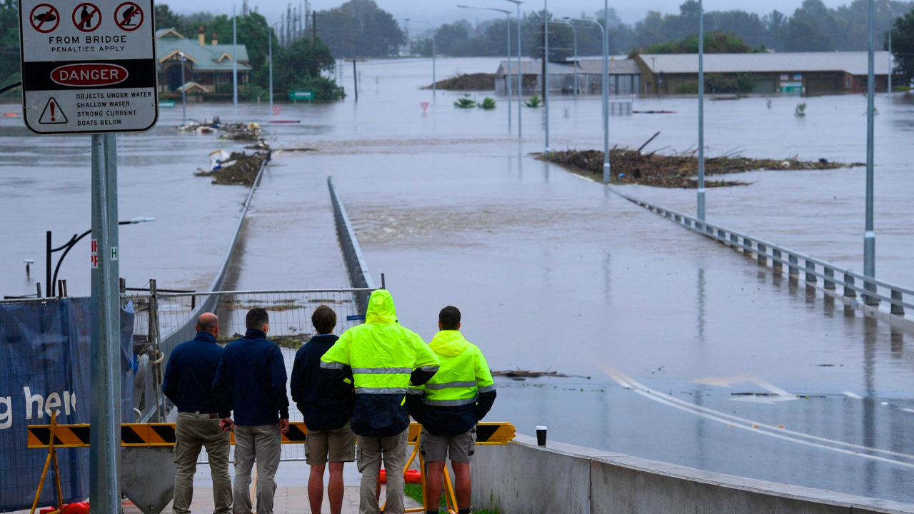
California faces catastrophic storms. Between late December 2025 and early January 2026, successive storm systems dumped record rainfall across Southern California. Mountain regions recorded 10 inches in less than a week.
The Weather Prediction Center issued Level 2 of 4 excessive rainfall warnings—rare for once-per-decade flood events. La Conchita in Ventura County absorbed over 7 inches of rain in 14 days.
This approaches the saturation point that triggered a deadly 2005 landslide killing 10 people.
Conga Line Begins
The National Weather Service and private forecasters used the phrase “conga line of storms” to describe the early January 2026 weather. Atmospheric rivers lined up to hit California through the first week of the new year.
Each brought fresh moisture to help heal burn scars from the January 2025 wildfires. Wildfires strip away vegetation that anchors hillsides and absorbs moisture, leaving them vulnerable to erosion.
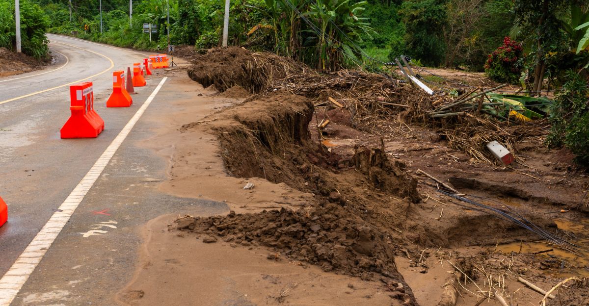
Debris flows—rapid torrents of mud, rock, and burned vegetation—threaten these zones. Officials prepared for cascading failures across a landscape still raw from fire.
Burn Scar Legacy
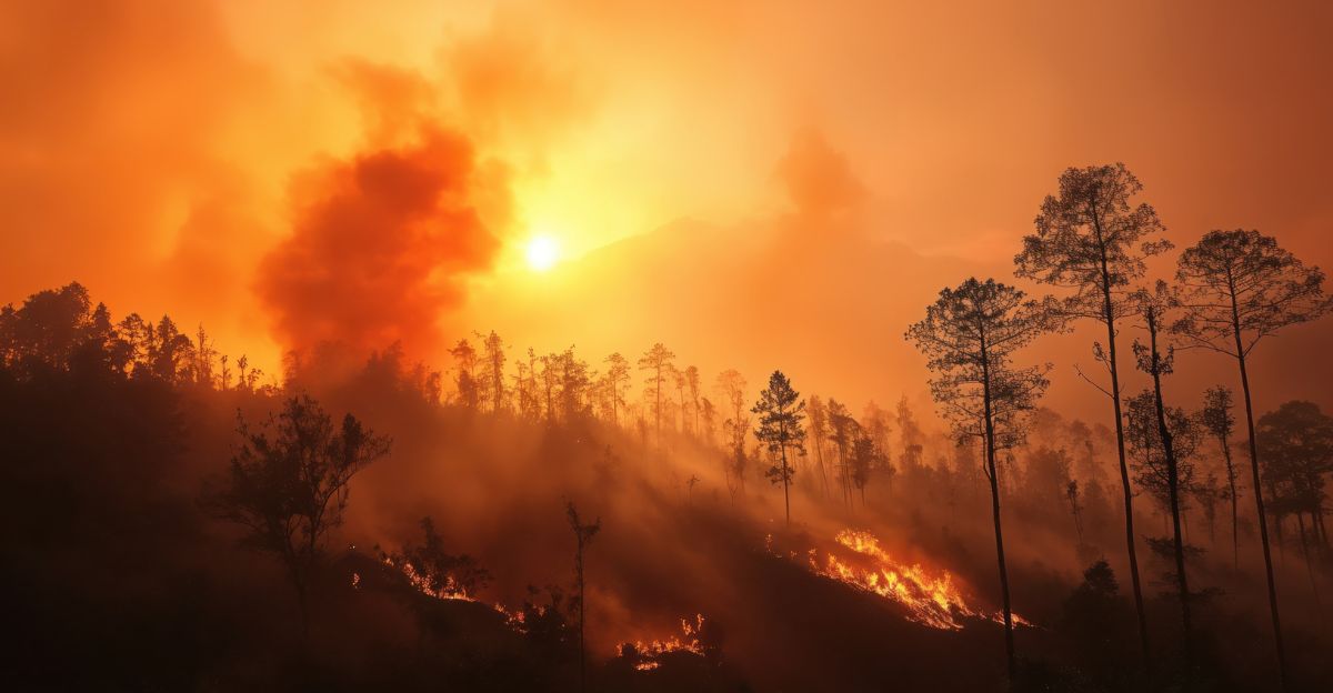
The 2025 Los Angeles wildfire season broke destruction records. Over 180,000 people evacuated. The Palisades Fire became the largest in LA County history.
Landscape engineers identified dozens of burn scar zones vulnerable to post-fire debris flows. Fire removes natural safeguards against rapid downslope movement. These zones are continuously monitored during the rainy seasons.
LA County’s Fire Department maintains evacuation maps for at least 14 such zones. The Mandeville Canyon complex alone has 12 evacuation zones.
Tension Mounts
By January 2, 2026, weather forecasts shifted from concerning to dangerous. The Weather Prediction Center upgraded its excessive rainfall outlook for coastal Southern California to Level 2 for multiple days.
Ventura County escalated its emergency response. The National Weather Service issued a warning about the compound threat: wind, rain, and debris flows.
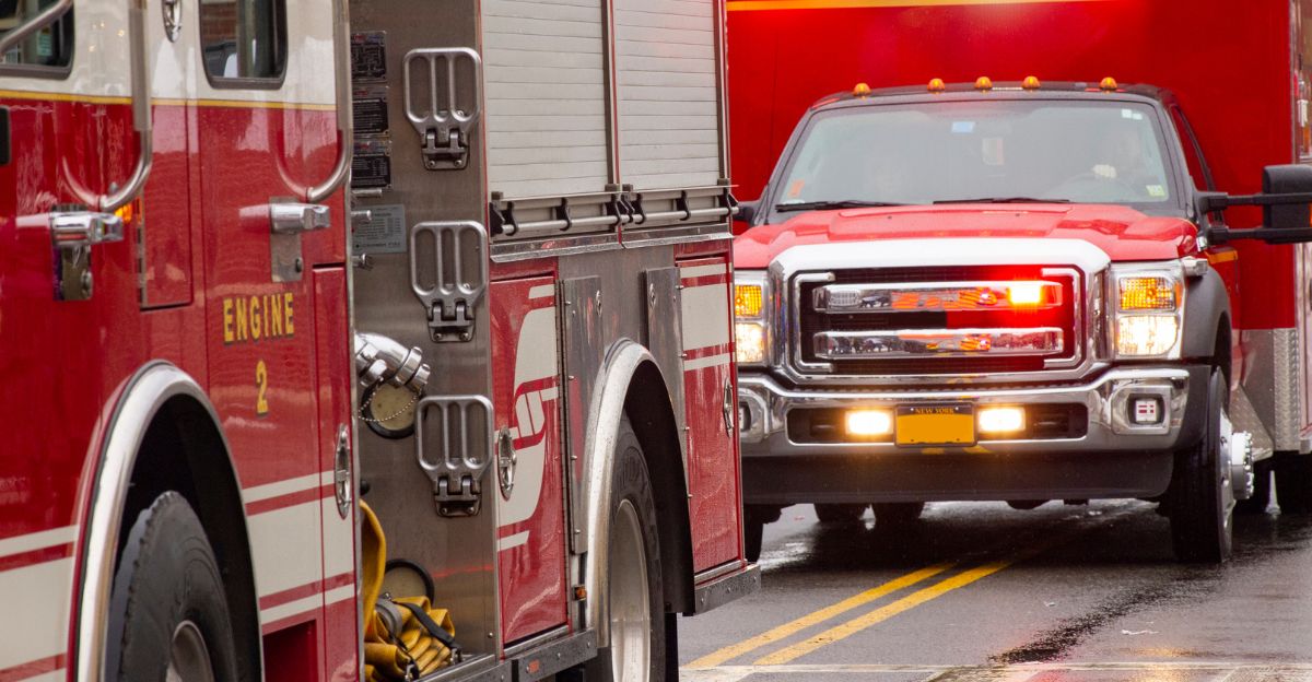
Governor Gavin Newsom positioned emergency assets—swift water rescue teams, helicopters, high-capacity pumps—across Los Angeles and Ventura counties. Moving medical helicopters before a storm hits signals officials expect casualties.
Evacuation Orders Issued
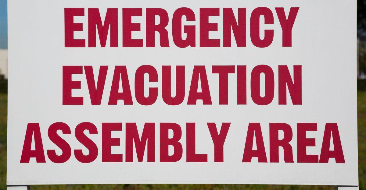
On January 3, 2026, at 10:00 AM Pacific Time, the Los Angeles Fire Department issued evacuation warnings for 14 burn scar zones.
Twelve comprise the Mandeville Canyon complex (LFD-1081, 1083, 1085, 1087, 1089, 1091, 1092, 1093, 1095, 1096, 1097, 0891). Additional zones cover Hurst Fire (LFD 0001-B) and Sunset Fire (LFD-0835).
Evacuation warnings tell residents to prepare for rapid departure. Thousands received warnings of imminent risk. Initial headline coverage cited “9” zones, which understated the scope of the action.
La Conchita in Focus
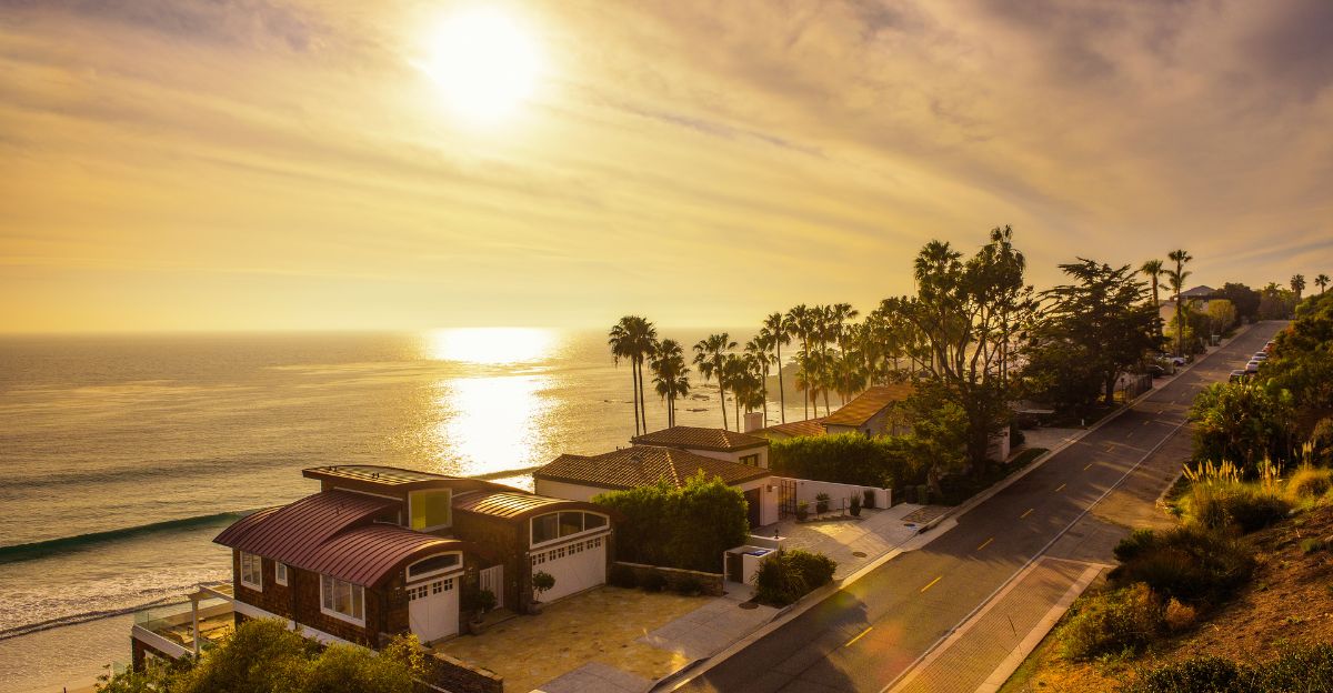
La Conchita is a specific community in Ventura County with a tragic history. On January 10, 2005, a debris flow buried the community, killing 10 people and damaging 16 homes.
Rain triggered that slide: 8 inches fell in 30 days. Twenty years later, as of January 2026, the same hillside absorbed 7 inches in just 14 days. More rain fell.
Ventura County issued a Hazardous Weather Advisory. Residents watched the same conditions that caused the deadly 2005 event return.
Predictability Problem

On January 3, 2026, Ventura County Emergency Services released a statement: “Due to complex geologic hazards at La Conchita, local public safety personnel cannot reliably predict when a hillside failure may occur.”
Engineers cannot predict the precise moment a saturated hillside will slide. Rainfall, soil saturation, pore pressure, and subsurface hydrology interact in unpredictable ways.
Officials knew the risk was rising, but they could not predict when the thresholds would be broken. Residents face an agonizing choice: leave indefinitely or stay where disaster might strike without warning.
Systemic Vulnerability
The La Conchita and burn scar problem extends beyond Southern California. Post-fire debris flows represent the dominant hazard in the American West after the megafire era of the 2020s.
In California, over 500,000 acres burned in 2025, resulting in the creation of new debris flow zones. Regulatory agencies, from the U.S. Forest Service to state emergency management, struggle to develop predictive models for debris flow initiation.
The challenge combines physical complexity with institutional limits. Residents live with official warnings containing built-in uncertainty.
New Year’s Test

The 2026 Rose Parade on New Year’s Day in Pasadena symbolized the atmospheric river crisis. For the first time since 2006, the parade proceeded in heavy rain, with 1 to 2 inches falling during the event.
Crowds braved wet conditions. Parade participants marched in downpours. Governor Newsom and emergency officials monitored rainfall in real time. Every inch added weight to saturated hillsides upslope.
A cultural celebration unfolded under genuine threat to communities 50 miles away. Emergency operations centers executed pre-positioned response plans.
Infrastructure Cascade
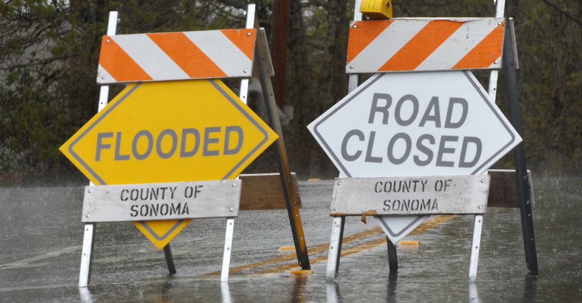
Storm and evacuation orders rippled through regional infrastructure. Road closures began on January 2, isolating communities and delaying supply deliveries.
The Pacific Coast Highway near Malibu experienced intermittent closures due to debris flow and flooding risks. County fire stations positioned additional equipment and personnel in burn scar zones.
This diverted resources from routine firefighting. Hospitals in Ventura and LA counties activated disaster preparedness protocols. Utility companies positioned crews for mudslides that could damage power and gas lines. The evacuation warning triggered region-wide operational shifts.
Resident Frustration

Evacuation zones created intense uncertainty and frustration for residents. Some individuals faced multiple wildfire evacuations in 2025 and are now receiving another evacuation warning.
Landlords and property owners faced questions regarding liability and tenant rights. Insurance companies managed 2025 fire claims while facing potential new damage. Online forums and local social media are filled with residents asking: “How long do we have?”
Emergency officials answered: “We cannot predict exact timing.” Communities that survived wildfires and rebuilt faced another round of displacement that felt like a disaster repeating itself.
Seasonal Pattern Deepens
The 2026 early-season storms fit a troubling multi-year pattern. California’s fire-flood cycle intensified. Megafires in 2024 and 2025 created burn scar inventories.
Atmospheric river forecasting has improved, but atmospheric rivers themselves are arriving more frequently and intensely. Scientists attribute this to climate change. Water vapor in the atmosphere increases.
The jet stream exhibits more pronounced fluctuations. California experiences longer and more intense wildfire seasons, followed by hazardous flood and debris flow seasons. Officials view this as a structural reality that requires permanent infrastructure and protocol adjustments.
Preparedness Advances
Despite the unpredictable timing of slope failure, officials made measurable advances in debris flow response. Pre-positioned in January 2026, the equipment included specialized debris flow barriers, high-capacity drainage pumps, and swift water rescue teams trained for debris flow environments.
LA County’s Emergency Management Agency has expanded evacuation warning systems to provide more granular zone-level smartphone alerts. Ventura County created community preparedness materials explaining the distinctions between evacuation warnings and orders.
Governor Newsom’s pre-positioned emergency assets reflected state-level recognition that debris flow response requires specialized equipment and training. These advances reduce fatalities and property damage.
Expert Skepticism

Hydrologists and geotechnical engineers remain cautiously optimistic about near-term improvements in debris flow prediction. Researchers at UC San Diego’s Jacobs School of Engineering and USGS debris flow specialists note that slope stability variables—such as soil saturation, pore pressure, subsurface hydrology, and microseismic activity—resist real-time quantification.
Ground-based sensors provide useful data but cannot cover every potential failure zone. Satellite monitoring offers promise but cannot replace on-site measurement. Slope failure is discrete: it happens or doesn’t.
But soil saturation remains continuous and highly variable. Engineers improve warning speed and response, but genuine failure moment prediction remains impossible.
The Unresolved Question
As January 2026 storms subsided and evacuation warnings gradually lifted (the last on January 5), a deeper question persisted: Can a modern metropolitan region coexist indefinitely with geologic hazards science cannot precisely predict?
California’s population growth led to development in fire-prone foothills and flood-prone canyons. Fire suppression improved, but it cannot eliminate wildfire risk. Climate change intensifies both fire and hazard seasons.
The evacuation warning system represents an acknowledgment that we have chosen to live in an area where catastrophic failure is possible but unpredictable. Communities rebuild after 2025 fires and prepare for 2026 floods, accepting a new normal: periodic, precarious coexistence with unmastered hazards.
Sources:
- Los Angeles Times, Multiple articles covering storms and evacuations, 1-5 Jan 2026
- UC San Diego Climate Extremes Center, Reports on debris flow research and climate patterns, 2025
- Ventura County Emergency Services, La Conchita hazard advisories and official statements, 3 Jan 2026
- California Governor’s Office, Emergency resource positioning statements, 30 Dec 2025
- LA County Emergency Management, Evacuation maps and preparedness updates, Jan 2026
- Los Angeles Fire Department, Evacuation warnings and alerts, 3 Jan 2026