California is bracing for a perilous week as federal forecasters issued a Level 4 “High Risk” excessive rainfall outlook, the highest tier of flood alert available. The National Weather Service (NWS) and Weather Prediction Center (WPC) placed more than 5 million residents in Southern California directly in the center of this rare warning zone.
Another 13 million people in surrounding areas remain under a moderate risk, creating a widespread threat affecting nearly half the state’s population just days before Christmas.
Rarest Alert Category Signals Extreme Danger
This Level 4 designation is historically significant and signals imminent danger for affected communities. According to data released by the WPC, these high-risk days are exceptionally rare, accounting for fewer than 4% of all days each year. However, their impact is disproportionately devastating.
Statistics show that these specific alert days are responsible for nearly 80% of all flood-related damages nationwide and more than one-third of all flood-related fatalities, making this a critical life-safety event.
‘Start Taking Protective Actions Now’
The urgency of the situation prompted officials protecting Los Angeles and the surrounding counties to use immediate and direct language. On December 22, the National Weather Service in Los Angeles issued a blunt advisory to residents, urging them to “start taking protective actions now.”
The warning comes as emergency management teams mobilize resources across the region, fearing that the window for safe preparation is closing rapidly before the heaviest deluge arrives Tuesday night.
Months of Rain Expected in Just Days

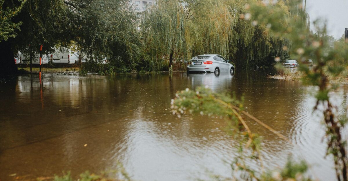
Meteorologists are tracking a deluge that could dump staggering amounts of water on soil that is already saturated. Forecasts suggest coastal and valley areas in Southern California could receive between 4 and 8 inches of rain, while foothill and mountain communities may see 8 to 12 inches through Saturday.
To put this in perspective, Los Angeles typically averages about 15 inches of rain for an entire year, meaning the city could absorb six months’ worth of precipitation in a single week.
Back-to-Back Atmospheric Rivers Strike
The source of this relentless moisture is a pair of powerful atmospheric rivers—long, narrow bands of water vapor in the sky that act like fire hoses. Forecasters explain that two of these storms are hitting back-to-back, creating a “train” of moisture that leaves no time for water to recede between events.
This compounding effect drastically increases the risk of catastrophic flooding, as the second storm will land on ground that has no capacity left to absorb it.
Tragedy Strikes Northern California First
While Southern California braces for the worst, the storm system has already turned deadly in the northern part of the state. Police in Redding, located about 150 miles north of Sacramento, confirmed that at least one person was killed after being pulled from a submerged vehicle.
The tragedy occurred as the first wave of the storm dropped more than 5 inches of rain on a local fire station in just 48 hours, overwhelming local drainage systems.
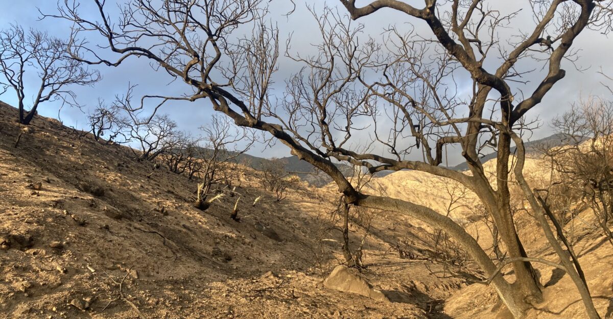
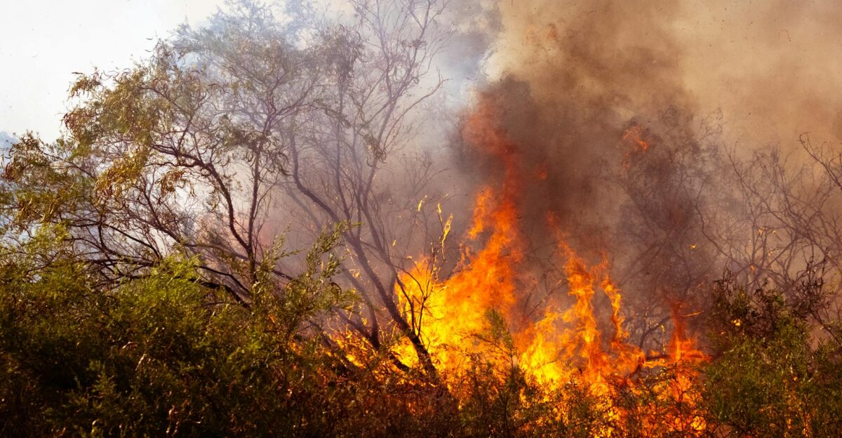
Fire Scars Create ‘Concrete Funnel’ Effect
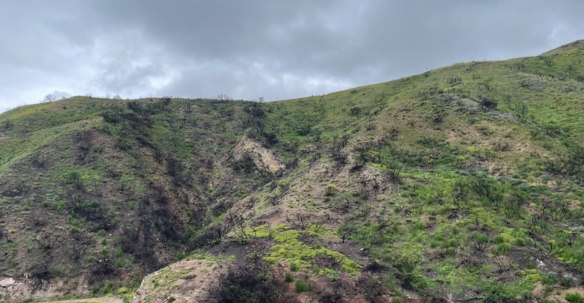
Emergency officials are most concerned about the state’s burn scars—areas where wildfires recently stripped away vegetation. The Eaton, Palisades, Hurst, and Kenneth fire zones, which burned in January 2025, are of particular concern.
Experts warn that intense heat from those fires created a waxy layer on the soil, turning the ground into a “concrete funnel” that repels water rather than absorbing it.
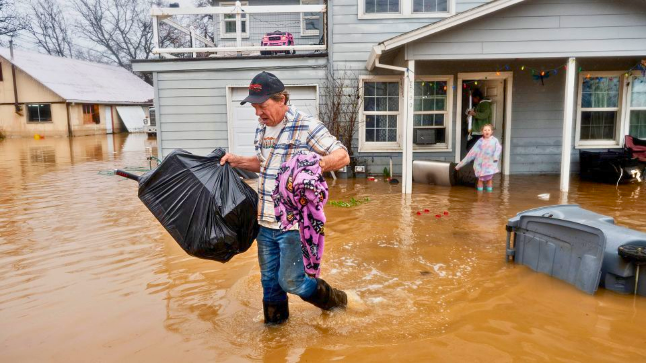
Hundreds of Properties Ordered to Evacuate
Authorities in Los Angeles County have moved quickly to clear residents out of the most dangerous paths. The LA County Office of Emergency Management issued evacuation orders for 383 properties located directly below the Eaton and Palisades fire burn scars.
These evacuations are mandatory, reflecting the high probability that mud, boulders, and trees could sweep through these neighborhoods once the rain intensity peaks later in the week.
16,000 Structures at Risk of Debris Flows
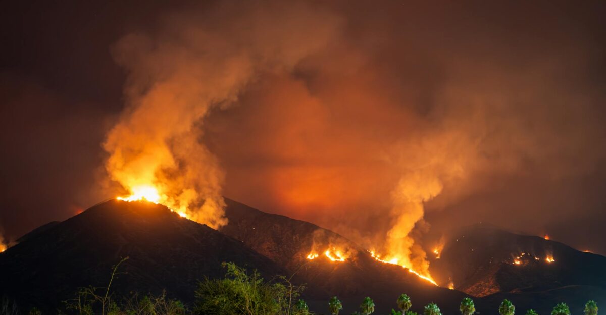
The scope of the threat extends far beyond the immediate evacuation zones. The January 2025 fires were among the most destructive in recent memory, with a combined 16,246 structures burned during that disaster. Now, the very debris and unstable earth left behind by those blazes pose a secondary threat to the homes that survived.
Officials estimate that tens of thousands of residents in these foothill communities are currently living in elevated debris flow risk zones.
Holiday Travel Plans Thrown into Chaos

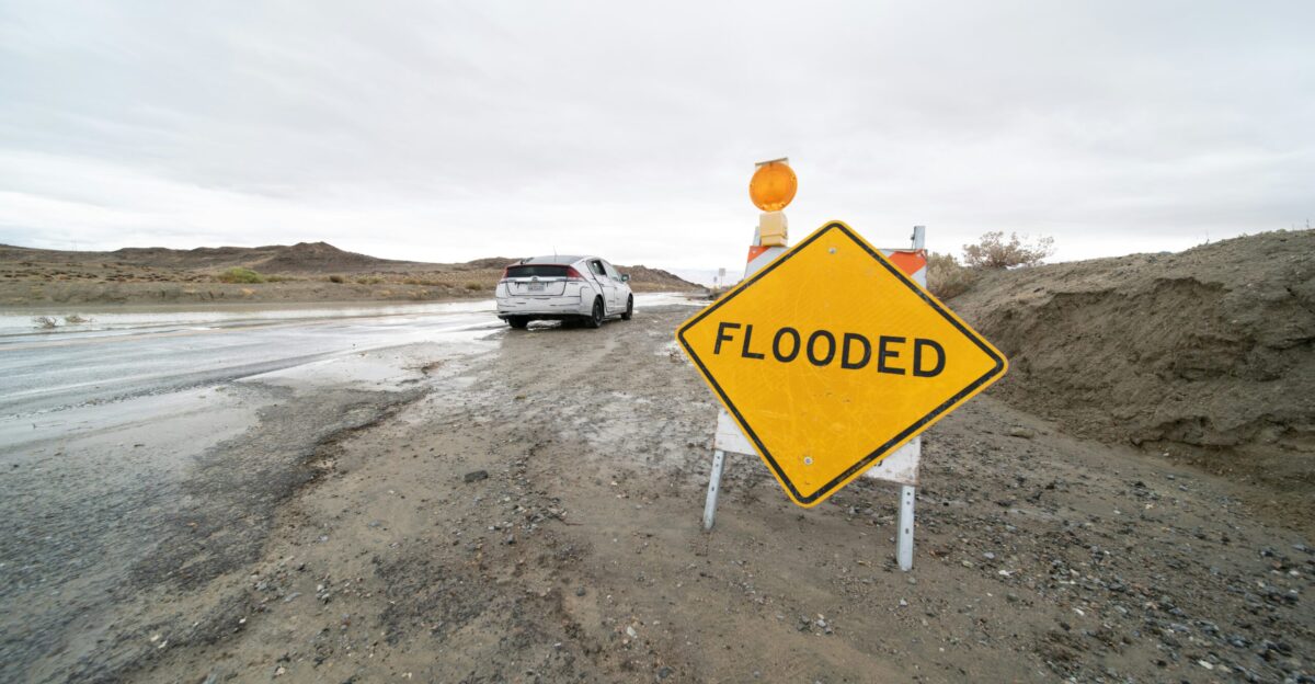
The timing of this Level 4 event could not be worse for families attempting to gather for the holidays. With the “High Risk” alert active through Christmas week, millions of travelers are facing hazardous road conditions across the state. The NWS has warned that driving could become impossible in mountain passes, while urban flooding is likely to close major freeways.
Officials are urging residents to cancel non-essential travel to avoid being trapped in rising waters.
Southern California Mountains Face Worst Impact
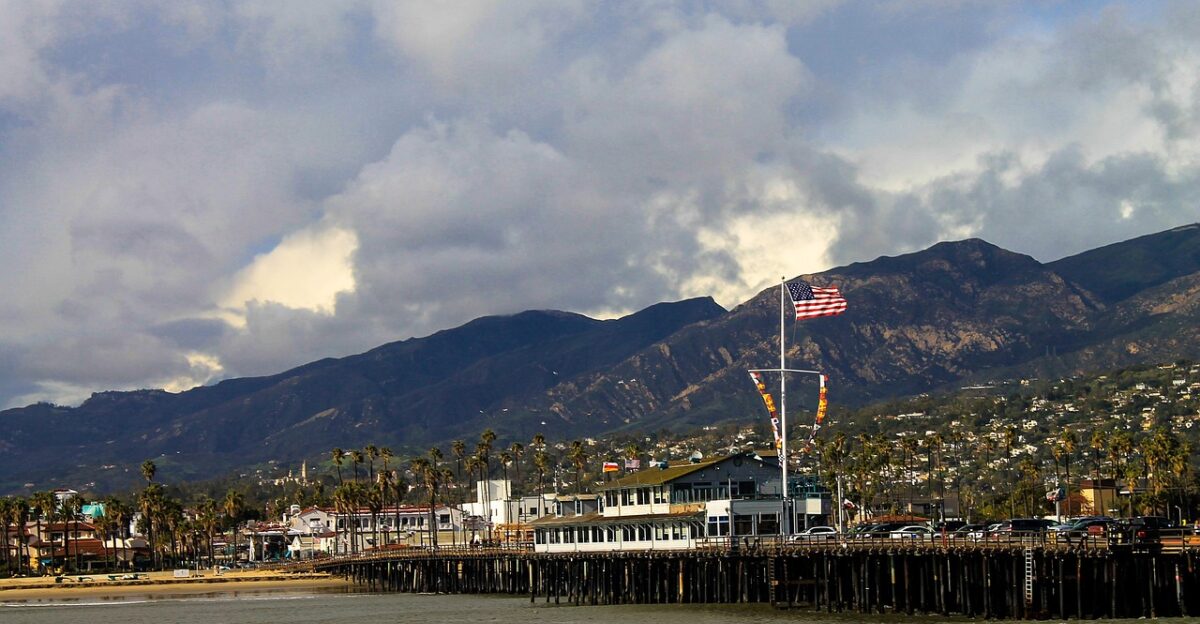
The topography of Southern California is expected to amplify the storm’s ferocity. As the atmospheric rivers collide with the transverse mountain ranges of Los Angeles, San Bernardino, and Santa Barbara counties, the air is forced upward, wringing out even more moisture.
This “orographic lift” is why forecasters are predicting the highest rainfall totals—up to a foot of rain—specifically for these high-elevation communities, increasing the runoff that will eventually cascade into the valleys below.
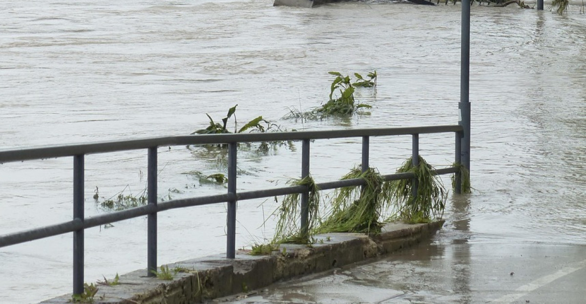
Rescues Underway as Waters Rise
Emergency responders are already active, conducting water rescues in inundated areas. Beyond the fatality in Redding, crews in Placer County successfully evacuated at least nine people from a single home surrounded by rising floodwaters.
These early incidents serve as a grim preview of what emergency services expect to see in the more densely populated southern counties.
A Cruel Twist for Fire Victims
For many Californians, this flood threat is a cruel second act to the year’s earlier disasters. Residents who spent the beginning of 2025 fleeing the Eaton and Palisades fires are now being forced to flee again, this time from water and mud.
The psychological toll is immense, as families scramble to secure homes that were only recently saved from flames. “It’s a double tragedy,” noted local reports, highlighting the relentless nature of this year’s weather extremes.
Flood Watch Remains Until Friday
There is little relief in the immediate forecast. The National Weather Service has extended flood watches for much of California through Friday, covering the peak of the second atmospheric river. This prolonged duration means that even if the rain pauses briefly, the threat level remains high.
Saturated levees and riverbanks will continue to be tested for days, and officials warn that flooding can occur even after the rain has technically stopped falling.
California on High Alert Through Christmas

As the state heads into the holiday weekend, the message from the National Weather Service is clear: do not underestimate this storm. With a Level 4 risk active, the probability of life-threatening flooding is now higher than at almost any other time of year.
Residents are urged to monitor updates from the WPC and local emergency management offices regularly, have their “go bags” ready, and heed all evacuation orders promptly to ensure a safe holiday season.
Sources
National Weather Service Los Angeles, December 22, 2025 Excessive Rainfall Outlook
Weather Prediction Center, U.S. Department of Commerce, December 23, 2025 High Risk Assessment
California Governor’s Office of Emergency Services (CalOES), December 23, 2025 Evacuation Advisory
LA County Office of Emergency Management, December 23, 2025 Property Evacuation Orders
Shasta County Sheriff’s Office, December 23, 2025 Flood Fatality Report
California Department of Forestry and Fire Protection (CalFire), January 2025 Fire Statistics Summary