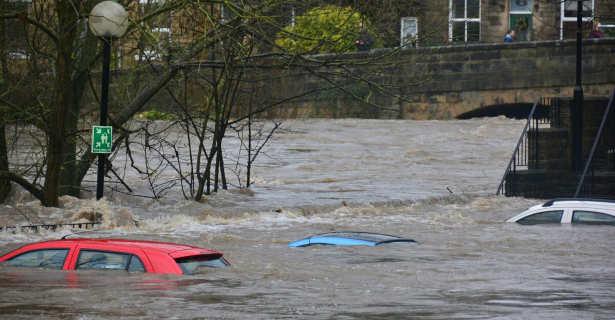
Water surges across Northern California highways as rescue crews pull drivers from submerged vehicles. In Redding, floodwater rose fast enough to trap a car, killing one person after nearly five inches of rain fell in just 24 hours.
This scene unfolds as forecasters warn the worst is still ahead. With Christmas days away, a rare sequence of back-to-back atmospheric rivers is now putting 30 million Americans under flood alerts—most of them in California.
Escalating Crisis
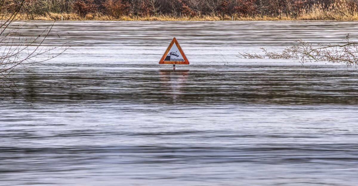
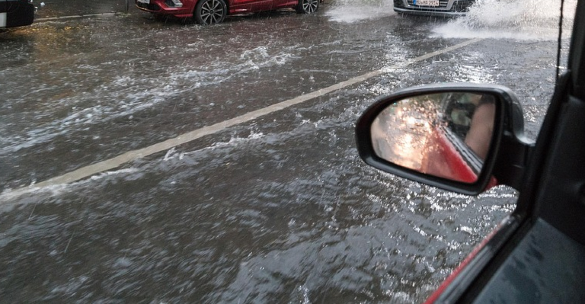
What began as seasonal rain has turned into a statewide emergency. California is now fully under flood watch as saturated soils lose their ability to absorb more water. Rivers, creeks, and urban drainage systems are already strained.
The danger is amplified by timing: holiday travel, closed offices, and full homes reduce response flexibility. Forecasters stress that impacts will escalate rapidly, especially as a second storm arrives before the first one recedes.
The Rarest Risk
The National Weather Service has issued its Level 4 of 4 “High Risk” excessive rainfall outlook—its most extreme category. This alert appears on fewer than 4% of days each year, yet historically accounts for over 80% of U.S. flood damage.
About 36% of flood deaths are tied to these rare warnings. More than 5 million people are under this top-tier alert, making it one of the most serious flood threats California has faced in years.
Storm Origins
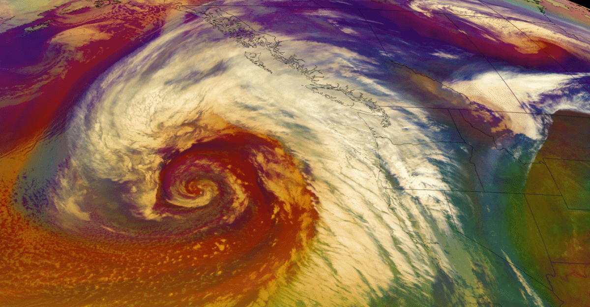
The driver of this crisis is a pair of atmospheric rivers—long, narrow corridors of moisture stretching across the Pacific Ocean. Fueled by warmer ocean waters, these storms transport immense amounts of water into California’s mountains and valleys.
The first system drenched Northern California, while the second is lining up behind it. With no recovery window between storms, rainfall totals are compounding at a dangerous pace.
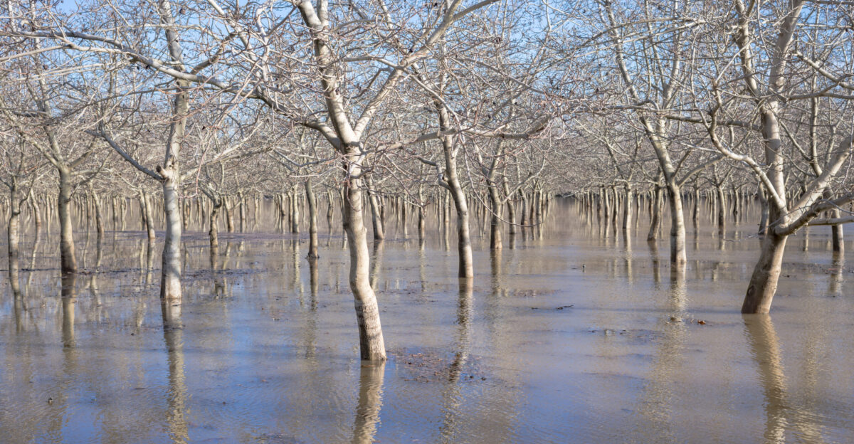
Saturated State
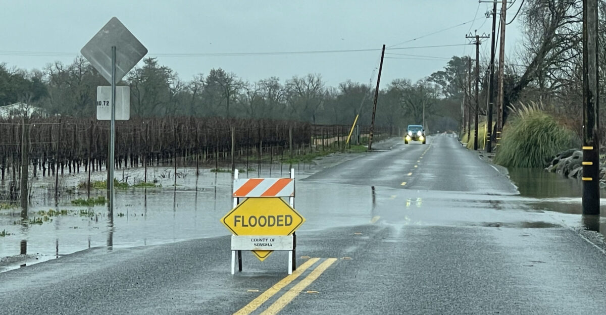
California’s landscape is already primed for flooding. Recent storms left soils saturated, streams swollen, and hillsides unstable. In many areas, rain now runs off instead of soaking into the ground.
This is especially dangerous near burn scars, where wildfire-altered soil repels water like concrete. Flood watches remain in effect statewide through Friday, with officials warning that even moderate rain could trigger flash flooding.
High Risk Revealed
At the center of concern is Southern California. The Weather Prediction Center’s Level 4 outlook covers parts of Los Angeles, San Bernardino, and Santa Barbara counties, while 13 million more people fall under Level 3 risk.
The warning targets Tuesday night into Wednesday, when rainfall rates could overwhelm drainage systems. Officials stress this category is reserved for life-threatening scenarios—not routine winter storms.
Southern Surge
Rainfall projections are extreme. Coastal and valley areas in Southern California could receive 4–8 inches, while foothills and mountains may see 8–12 inches through Saturday.
For Los Angeles, that could equal two months to nearly half a year of rain in a single week. Such totals sharply increase the likelihood of flash flooding, road washouts, and slope failures.
LA Evacuations
Los Angeles County has ordered evacuations for 383 properties in burn-scar areas, with deputies conducting door-to-door notifications. Zones affected include Eaton, Palisades, Hurst, and Kenneth.
These areas were sites of recent wildfires that destroyed 16,246 structures combined. Officials warn slopes could send fast-moving debris downhill with little warning, urging residents to leave early.
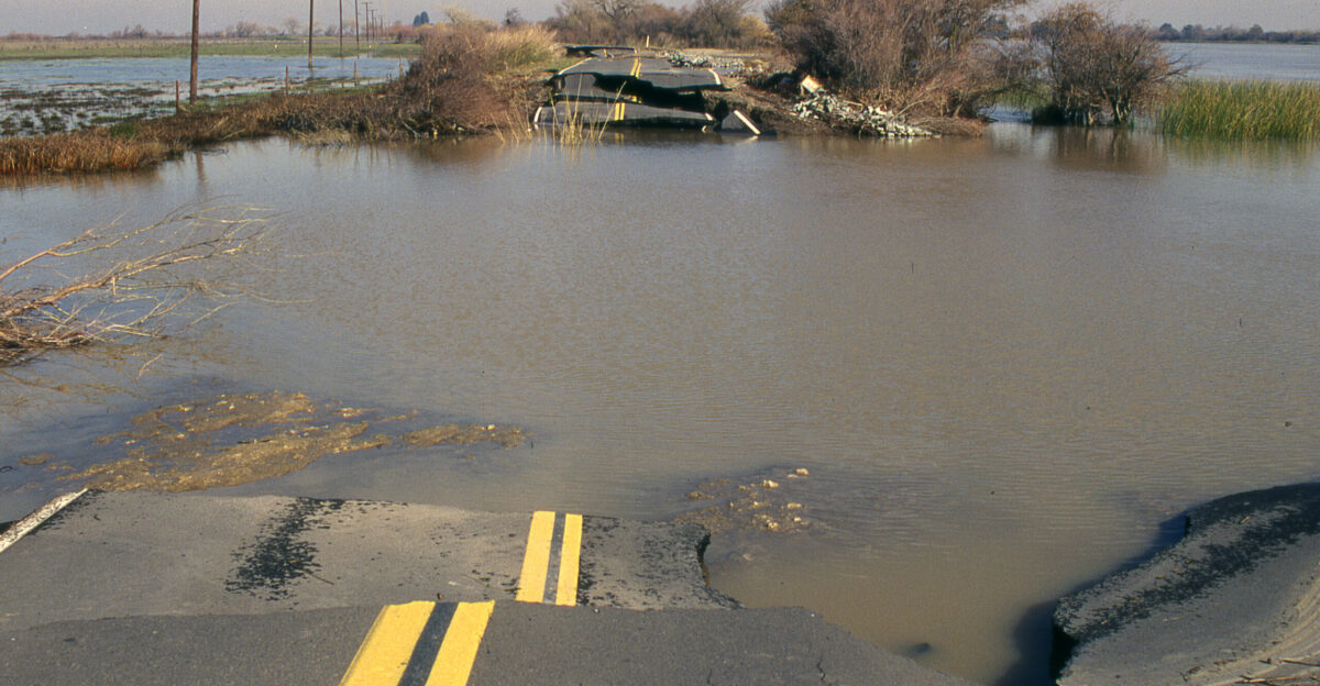
Northern Toll
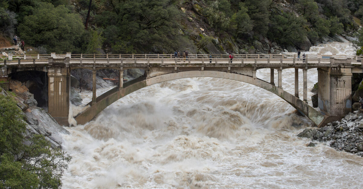
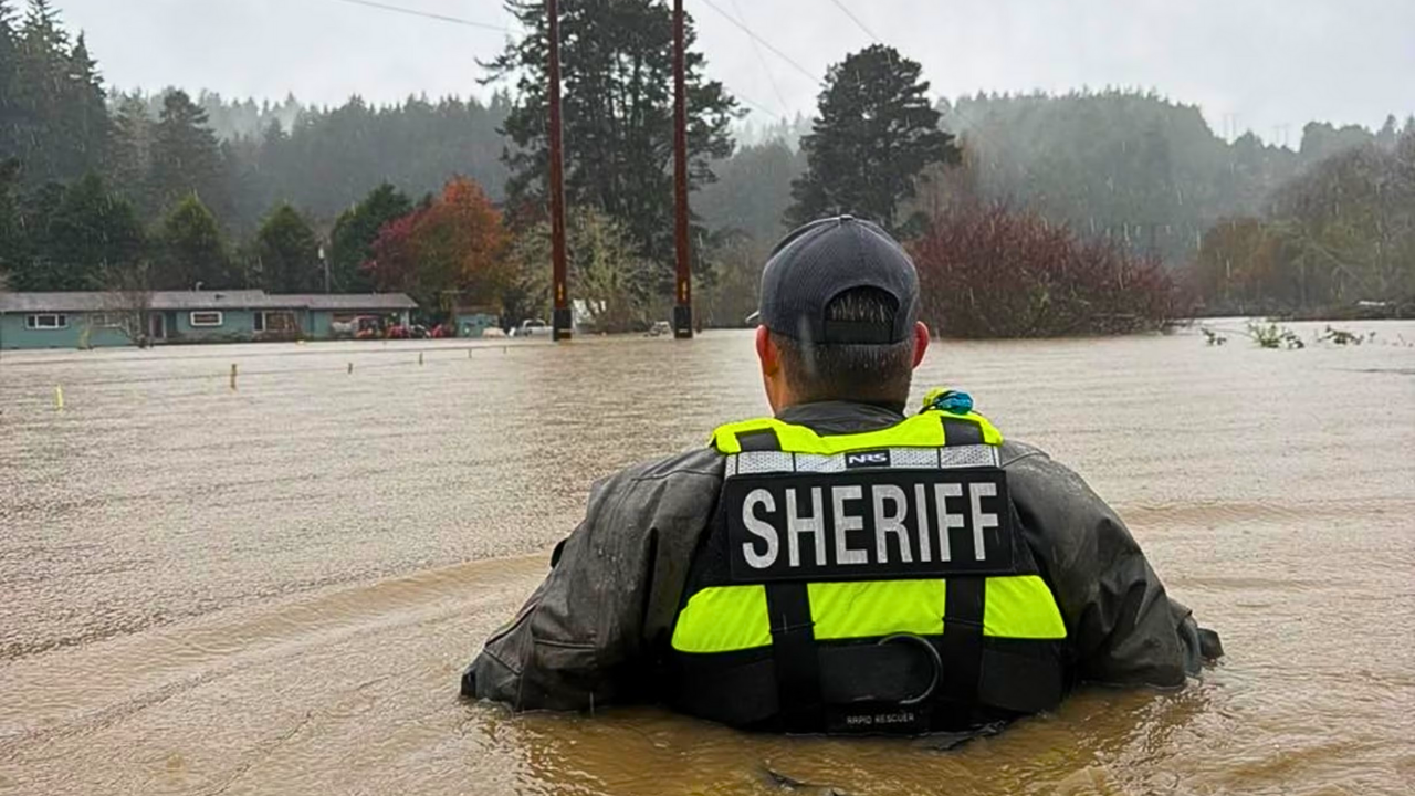
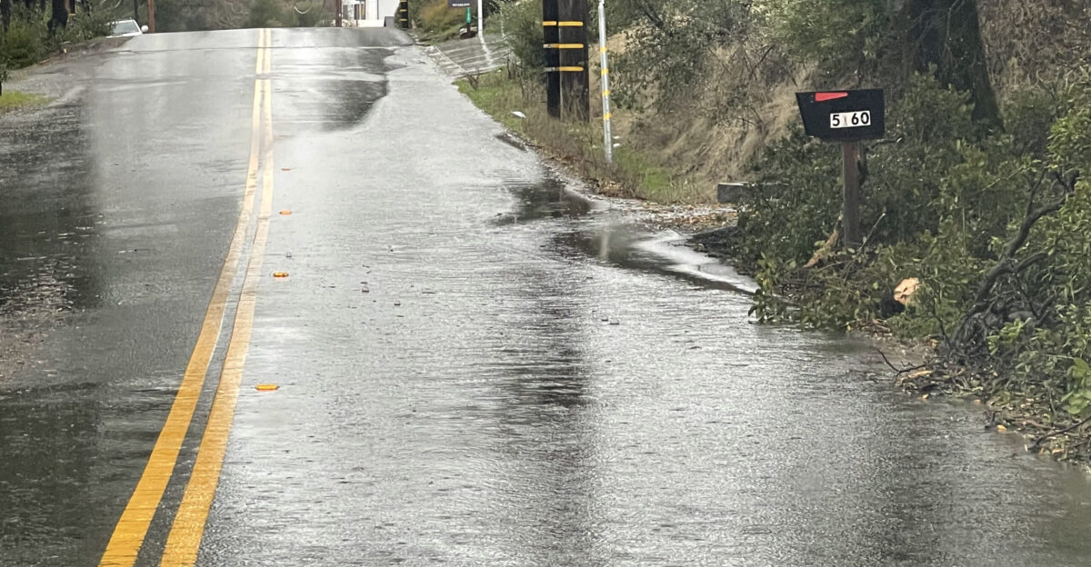
Northern California has already paid a price. One person died near Redding after being pulled from a flooded vehicle. In Humboldt County, water rose to chest depth in some neighborhoods.
Rescues by boat and jet ski were reported across Humboldt, Sonoma, Shasta, and Placer counties. Interstate 5 closures, debris flows, and washed-out roads offered a preview of what may follow farther south.
Burn Scar Peril
Burn scars transform rainfall into destruction. Without vegetation, water accelerates downhill, carrying rocks, mud, and debris into neighborhoods with little warning.
Los Angeles officials caution that mudslides can occur suddenly, even outside main rain bands. Communities that survived wildfire devastation now face a second disaster within the same year.
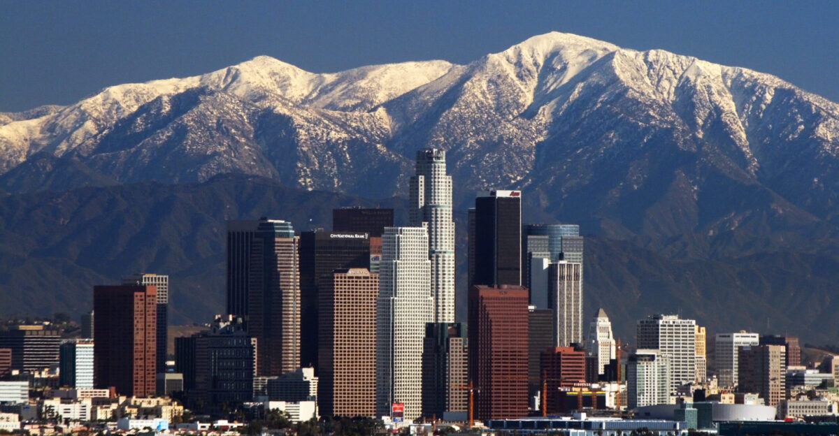
Sierra Snowfall
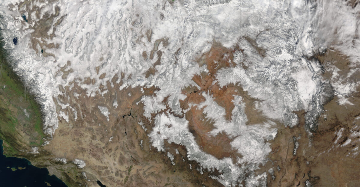
While rain floods lower elevations, the Sierra Nevada is being buried under feet of snow. Heavy snowfall is closing mountain passes and isolating communities.
Meteorologists note that warmer storms push snow lines higher, worsening low-elevation flooding while still dumping massive snow at elevation—creating a split disaster across the state.
Second Wave
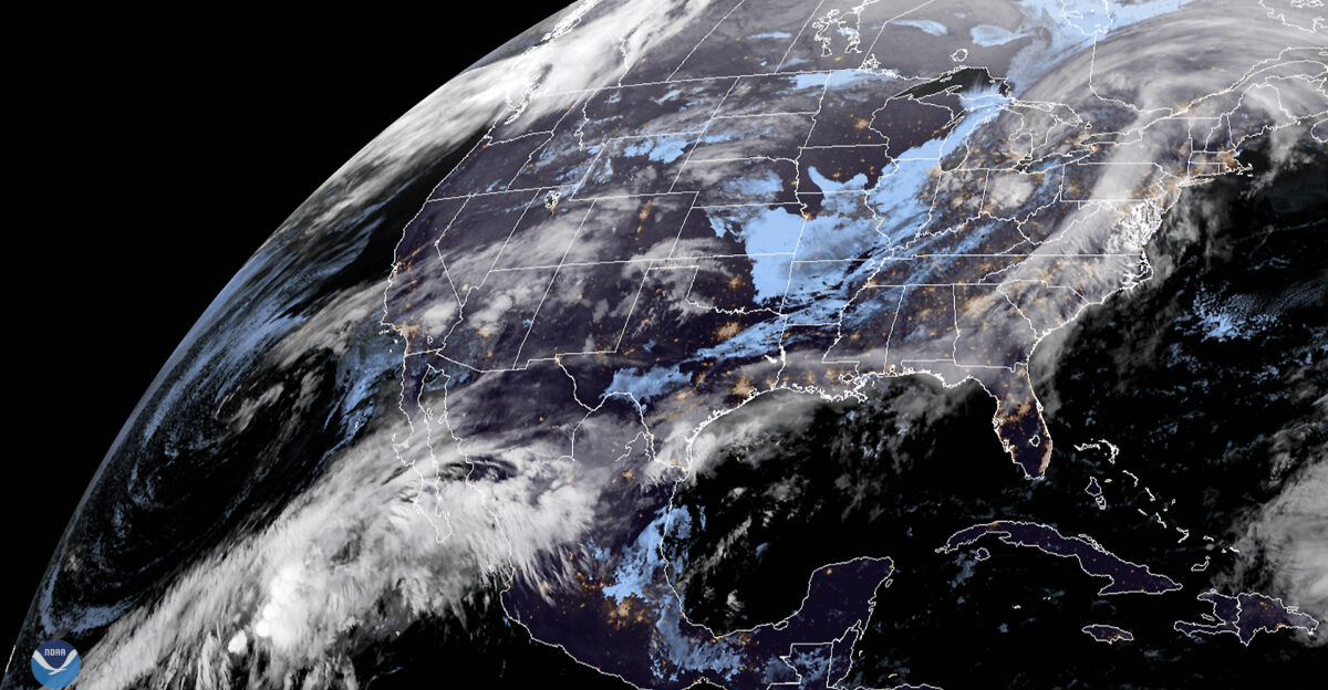
Before waters can recede, another atmospheric river is expected Thursday through Friday. This second surge threatens areas already weakened by the first storm.
With 30 million people under flood alerts, officials describe the event as a prolonged siege rather than a single storm. Relief is not expected until the weekend.
Urgent Directive
The National Weather Service in Los Angeles issued a blunt warning: “START TAKING PROTECTIVE ACTIONS NOW.” Residents are sandbagging homes and seeking shelters.
Holiday travel plans are being canceled as emergency managers stress that waiting until flooding begins may be too late, especially with Christmas Eve approaching.
Leadership Response
State and local leaders have shifted fully into flood response mode. County officials are prioritizing burn-scar neighborhoods, while the governor’s office has activated emergency resources statewide.
Cleanup crews race to clear debris from highways like Interstate 5, knowing another storm is imminent. Schools are closing, shelters opening, and utilities bracing for outages.
Holiday Horizon
As Christmas nears, California stands at a crossroads. With 30 million people on alert, 18 million under high-end flood risk, and one confirmed fatality, the stakes are clear.
Rare warnings, relentless storms, and fragile landscapes are converging at once. The outcome now depends on preparation, timing—and whether residents can stay ahead of the water.
Sources:
CNN – Rare ‘high risk’ for flooding spurs evacuations in Southern California – December 22, 2025
National Weather Service Los Angeles/Oxnard – Area Forecast Discussion – December 22, 2025
NBC News – 1 killed in California as heavy rain and flooding threaten parts of state over holidays – December 22, 2025
Los Angeles Times – Biggest Christmas storm in years set to hit SoCal: Timeline for the week – December 21, 2025
Center for Western Weather and Water Extremes (CW3E) – CW3E AR Update: 22 December 2025 Outlook – December 21, 2025