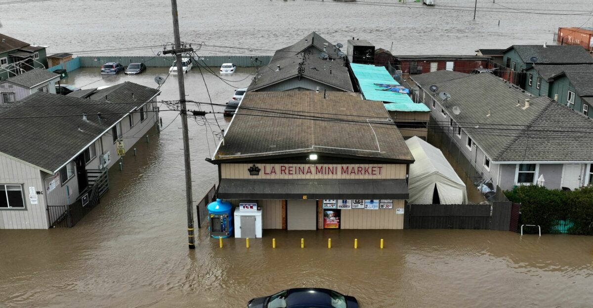
For roughly 10 to 15 million Californians, the final countdown to Christmas has turned into a race against the elements. After weeks of dry skies, a massive weather shift is placing major population centers—from the San Francisco Bay Area to the Sacramento Valley—under flood alerts.
The National Weather Service describes the incoming system as an “atmospheric river trilogy,” a relentless series of three storms threatening to wash out holiday plans across the state.
‘Drought-To-Deluge’ Holiday Whiplash
The state’s recent conditions amplify the psychological toll of this storm sequence. Just days ago, the northern Sierra Nevada snowpack sat at a historic low of just 4 to 5 percent of normal. Now, the region faces a sudden, violent correction.
Meteorologists warn that this “whiplash” effect—swinging from extreme dryness to extreme saturation in under a week—leaves the parched landscape unable to absorb the water quickly enough, heightening runoff risks.
A Christmas Obstacle Course
The timing could not be worse for the estimated 500,000 to 1 million people expecting to travel through California this week. Major hubs like LAX, SFO, and Sacramento International are preparing for delays as the storms approach.
On the ground, families heading over mountain passes on I-80 or navigating the I-5 corridor face a dangerous mix of hydroplaning risks and whiteout conditions, turning the holiday commute into a high-stakes navigation challenge.
‘Pineapple Express’ Fuels A Level 3 Flood Threat
This isn’t just standard winter rain; it is a classic “Pineapple Express” setup channeling moisture directly from Hawaii. The Weather Prediction Center has issued a Level 3 moderate risk of flash flooding for the Napa-to-Chico corridor, a designation that puts local emergency services on high alert.
With Integrated Vapor Transport values hitting extreme levels, this tropical funnel is predicted to dump a month’s worth of rain in a matter of days.
A ‘Bomb Cyclone’ Could Explode Off The Coast
The narrative of this storm week takes a darker turn early Wednesday morning. Forecasters are monitoring the second storm system for signs of rapid intensification, which could potentially evolve into a “bomb cyclone” as it approaches the coast.
If this rapid pressure drop occurs, residents can expect the weather to turn violent quickly, bringing the potential for hurricane-force gusts up to 80 mph that could topple trees and cut power right before Christmas Eve.
Wettest-Christmas Record
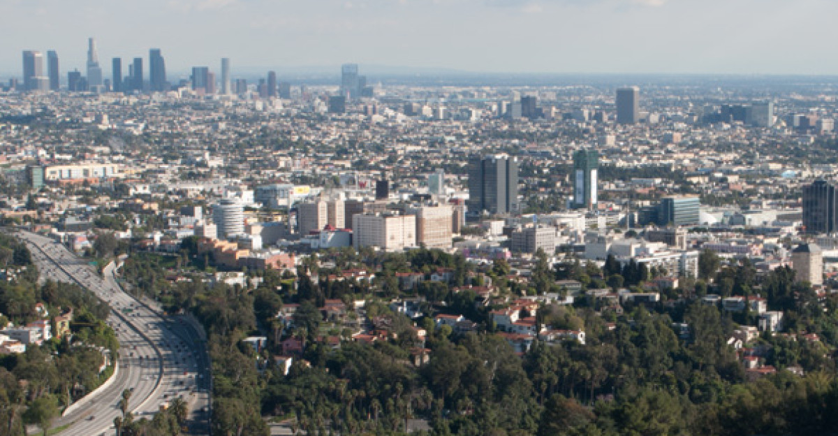
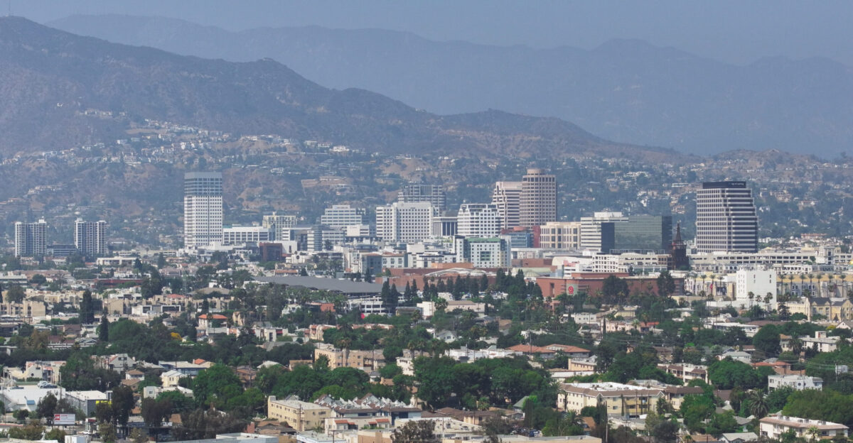
While Northern California takes the brunt of the flood risk, the Southland is facing its own historic soak. If Los Angeles receives more than 3.82 inches during the peak of the system, it would mark the wettest two-day Christmas Eve and Christmas Day period on record.
For a city famous for its sunny holiday parades, this forecast threatens to rewrite the record books and force millions of residents to move their celebrations indoors.
From Bare Ground To 20 Inches Of Water
The volume of water predicted to fall on the Sierra Nevada is staggering. Over a seven-day period, forecasts predict 10 to 20 inches of liquid precipitation. Initially, warmer temperatures mean this will fall as rain, washing over the snow-packed mountains.
This massive injection of liquid water into the high country is a double-edged sword: it refills reservoirs but simultaneously spikes the immediate danger of rapid snowmelt and downstream flooding.
Uncomfortable Odds For Homeowners
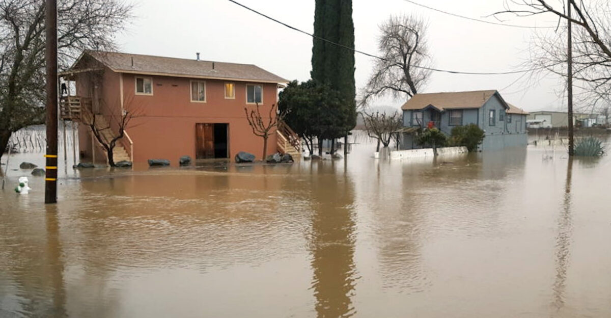
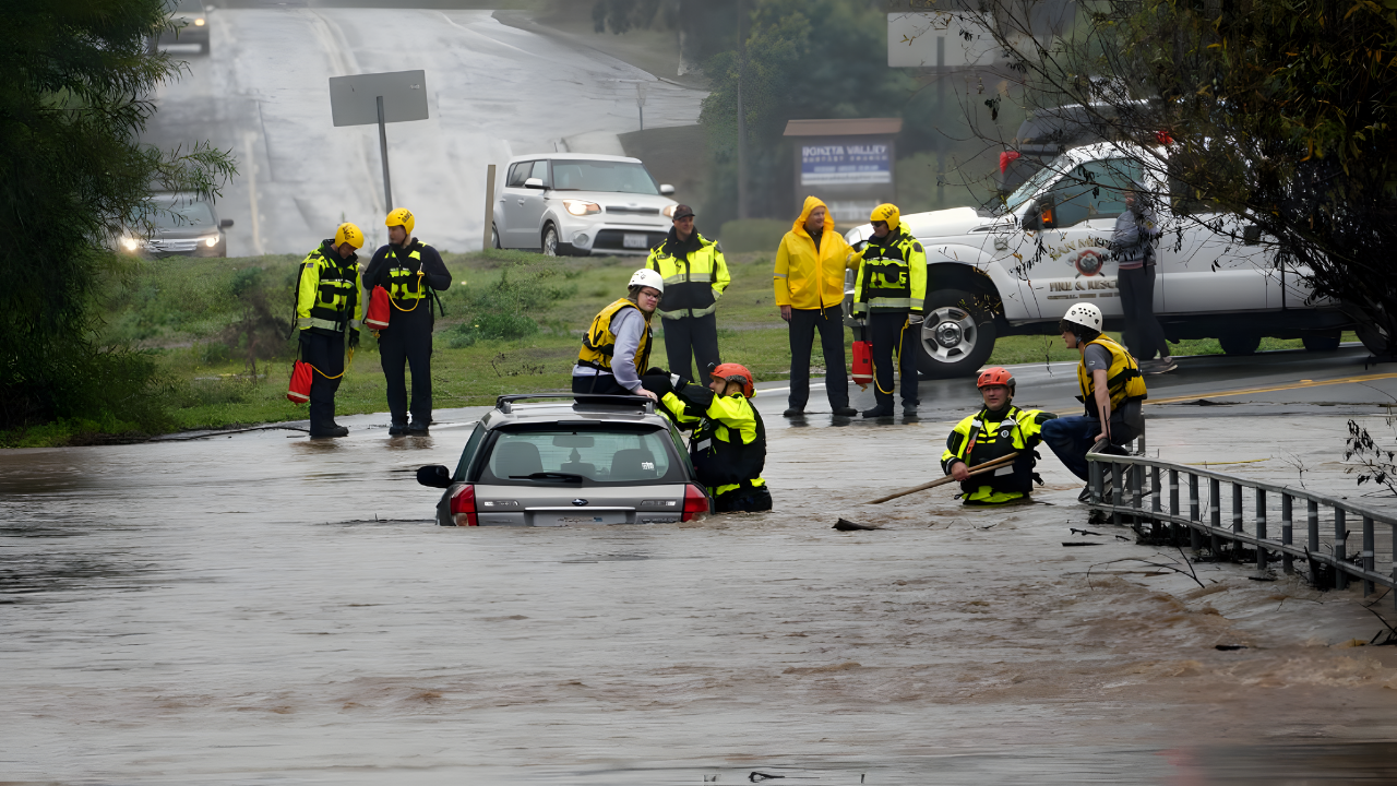
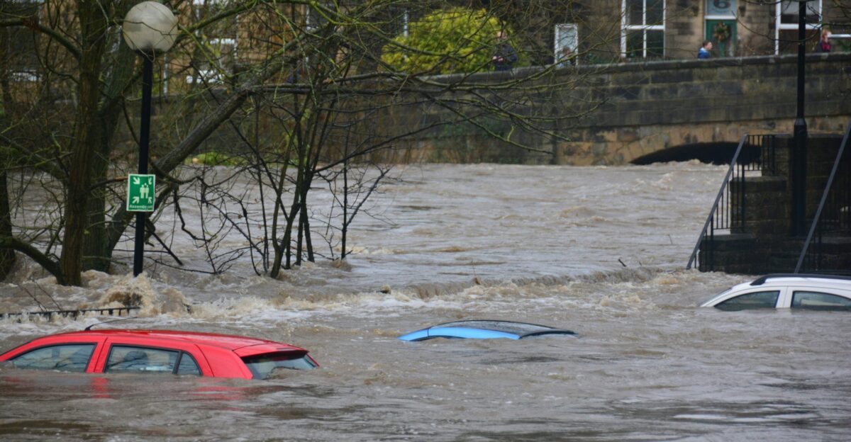
For residents living along riverbanks, the holiday week brings a tense waiting game. Hydrologic models currently show a 47 percent probability that the Russian River at Hopland will exceed flood stage within ten days, while the Ventura River sits at a 31 percent risk.
These aren’t just abstract percentages; they represent a very real coin toss for thousands of homeowners who must decide whether to deploy sandbags or trust the levees.
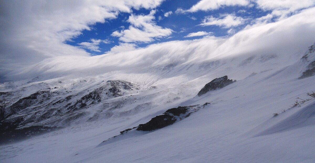
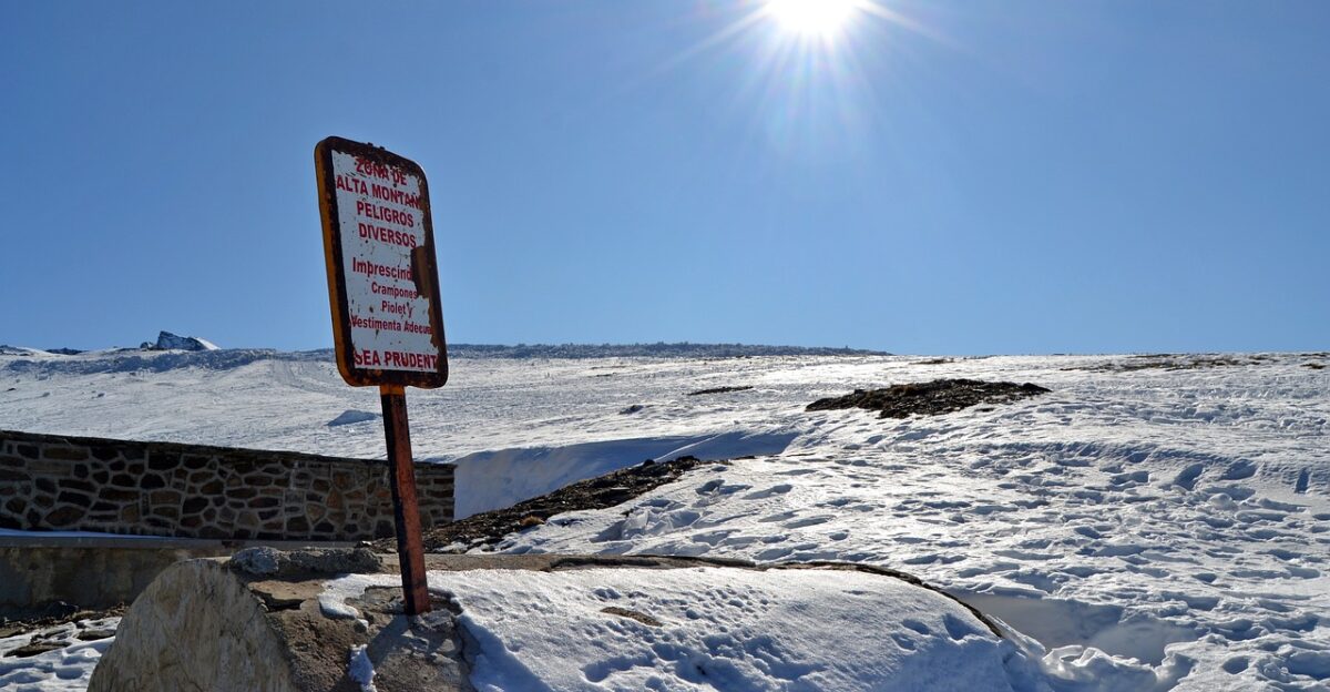
Ski Resorts Get Their Wish, But At A Cost
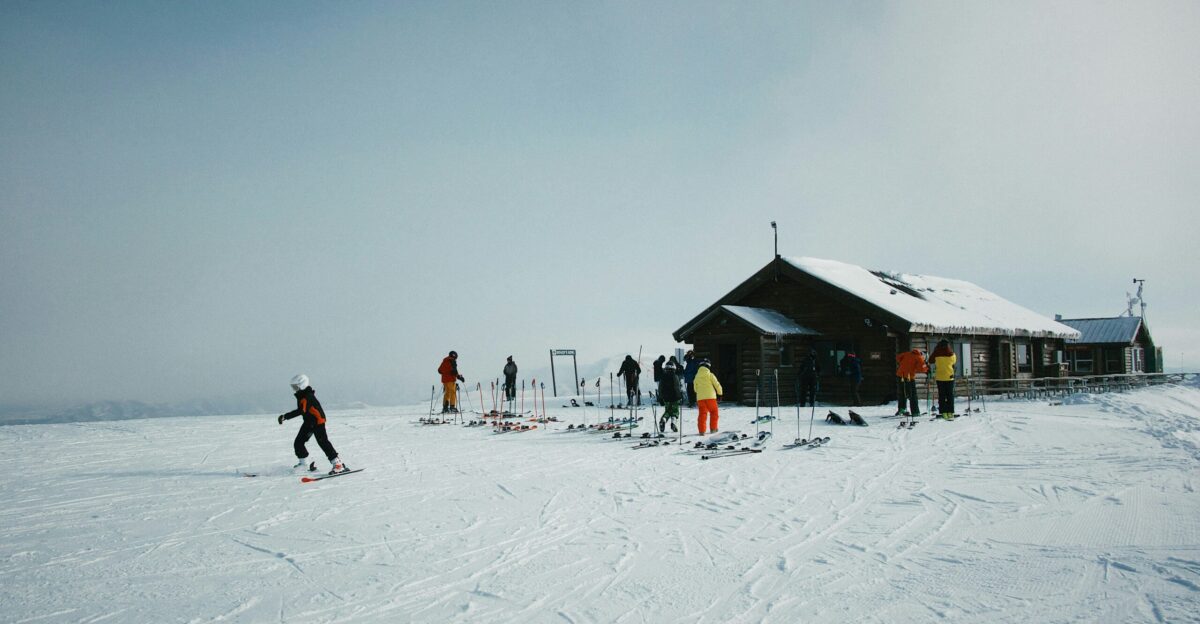
The storm brings salvation to California’s ski industry, which has been languishing with a 96 percent snowpack deficit. Tuolumne Meadows has a 55 percent chance of seeing over six feet of snow by Christmas. However, this bounty comes with severe strings attached.
The sheer intensity of the snowfall, combined with fluctuating snow levels, creates extreme avalanche danger and likely road closures, making the fresh powder inaccessible to holiday skiers.
The ‘Multiplier Effect’ Of Three Back-To-Back Storms
The actual danger of this event lies in the sequencing. The first two atmospheric rivers, which will hit between December 20 and 22, will act as a primer, thoroughly soaking the ground. When the third and strongest wave arrives on Christmas Eve, there will be nowhere for the water to go.
Forecasters warn this saturation creates a “flash flood multiplier effect,” making the final leg of the trilogy exponentially more dangerous than the first.
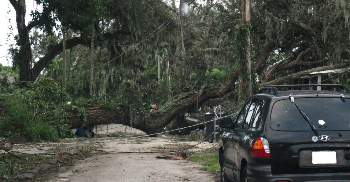
Winds Up To 80 MPH Threaten Holiday Power
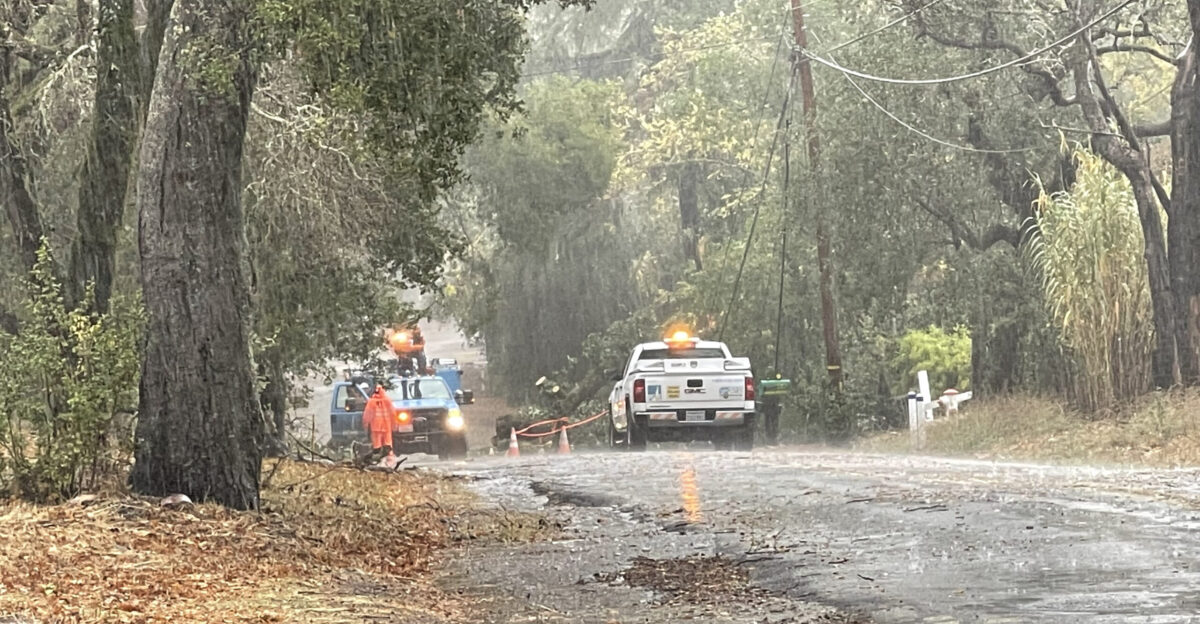
Beyond the water, the wind remains a silent but destructive partner in this weather event. Coastal communities are preparing for gusts that could scream up to 80 mph between Tuesday and Wednesday. With soil already loosened by rain, these winds have a high probability of uprooting trees.
Utility companies are warning that widespread outages are possible, threatening to leave thousands of families in the dark during their Christmas dinners.
Snow Levels Trap Drivers At 5,000 Feet
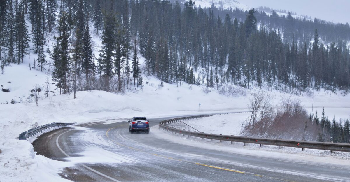
A treacherous thermal shift awaits drivers late in the week. While the storms begin warm, colder air will eventually crash in, dropping snow levels to between 5,000 and 6,000 feet by Christmas Eve. This transition zone is critical; rain will turn to heavy, wet snow on major passes, potentially stranding motorists.
The National Weather Service advises that travel through the Sierra could become impossible, urging people to complete their journeys before the transition occurs.
Economic Fallout Could Top $1 Billion
As the state braces for impact, economists are eyeing the price tag. The disruption to one of the year’s busiest commerce weeks, combined with physical damage to infrastructure and agriculture, could lead to an economic impact ranging from $500 million to $1 billion.
With up to 100,000 homes in high-risk zones, the financial anxiety is palpable for families already navigating the pressures of holiday spending.
Burn Scars Haunt The Northern Valleys
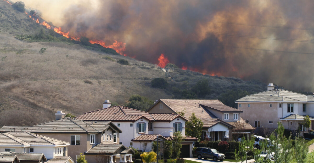
For communities near recent wildfires, the forecast brings a specific, terrifying dread. The Level 3 flash flood risk over the northern Sierra foothills raises the specter of debris flows—fast-moving landslides of mud and ash that can bury homes in minutes.
Emergency officials are closely monitoring these burn scars, warning that the intense rainfall rates forecast for Tuesday could trigger landslides in areas that have not yet fully recovered from past fires.
Christmas in California
Despite the high-tech modeling, an element of mystery remains. Heather Richards, a meteorologist with the National Weather Service in Reno, emphasized the uncertainty of the snow transition on December 20. “It remains to be seen how much of it will stick around the lake,” she noted, highlighting the volatile nature of this system.
As Californians head into the holiday, the only certainty is that this Christmas will be one for the history books.
Sources:
10M Californians Under Level 3 Flash Flood Alert As ‘Pineapple Express’ Drops 20 Inches Through Christmas] – MSN
California could see Christmastime rain and snow, risking floods and landslides and snarling travel – Yahoo News
Next storm could become bomb cyclone as it hits California – San Francisco Chronicle
Pineapple Express Storm Threatens Record California Christmas Rain – Evri Magaci
Powerful atmospheric river packing heavy rain, mountain snow targets California Christmas – Fox Weather
Atmospheric river could deliver warm, wet Christmas to the Bay Area – Yahoo News