The National Weather Service Prediction Center issued a comprehensive report on December 18, 2025, detailing catastrophic winter storm impacts across 16 states spanning from the Rocky Mountains to the Great Lakes.
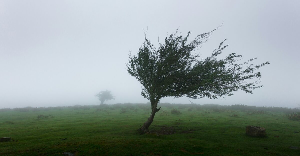
The multi-state system unleashed unprecedented weather conditions combining hurricane-force winds, heavy snowfall, and blizzard conditions. An estimated 50-60 million Americans face dangerous weather across Minnesota, Colorado, Kansas, Montana, Nebraska, North Dakota, South Dakota, Wyoming, Iowa, Wisconsin, Michigan, Illinois, Indiana, Ohio, Pennsylvania, and New York during peak winter travel season.
Record-Breaking Wind Speeds Rival Hurricane Force
Wyoming recorded extraordinary wind speeds unprecedented in modern meteorological records. A staggering 144 mph wind gust was measured near Smoot at Mount Coffin on December 17, making it one of the strongest wind measurements ever recorded in Wyoming’s history.
Additional extreme measurements included 123 mph on South Pass between Farson and Lander and 121 mph along the Salt River in Lincoln County. These wind speeds rival Category 4-5 hurricane intensity, typically associated only with tropical cyclones.
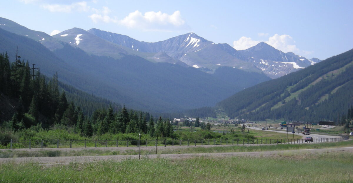
Colorado Mountains Experience Catastrophic Winds
Colorado’s mountainous regions experienced similarly devastating wind conditions during the storm system. Berthoud Pass and Copper Mountain recorded peak gusts of 124 mph, among the most extreme non-tornado wind speeds ever documented in continental U.S. winter weather.
The NCAR Mesa in Boulder measured 108 mph winds, while other Colorado mountainous areas sustained gusts between 86 and 113 mph. These hurricane-force conditions created structural damage to buildings, transmission towers, and infrastructure throughout the region.
Extended High-Wind Zone Across Western States
High-speed winds extended far beyond the Rocky Mountain peaks. Montana experienced sustained valley winds of 40-50 mph with mountain passes exceeding 90 mph. Additional extreme winds were documented in Kansas, Nebraska, North Dakota, South Dakota, Minnesota, and Nevada.
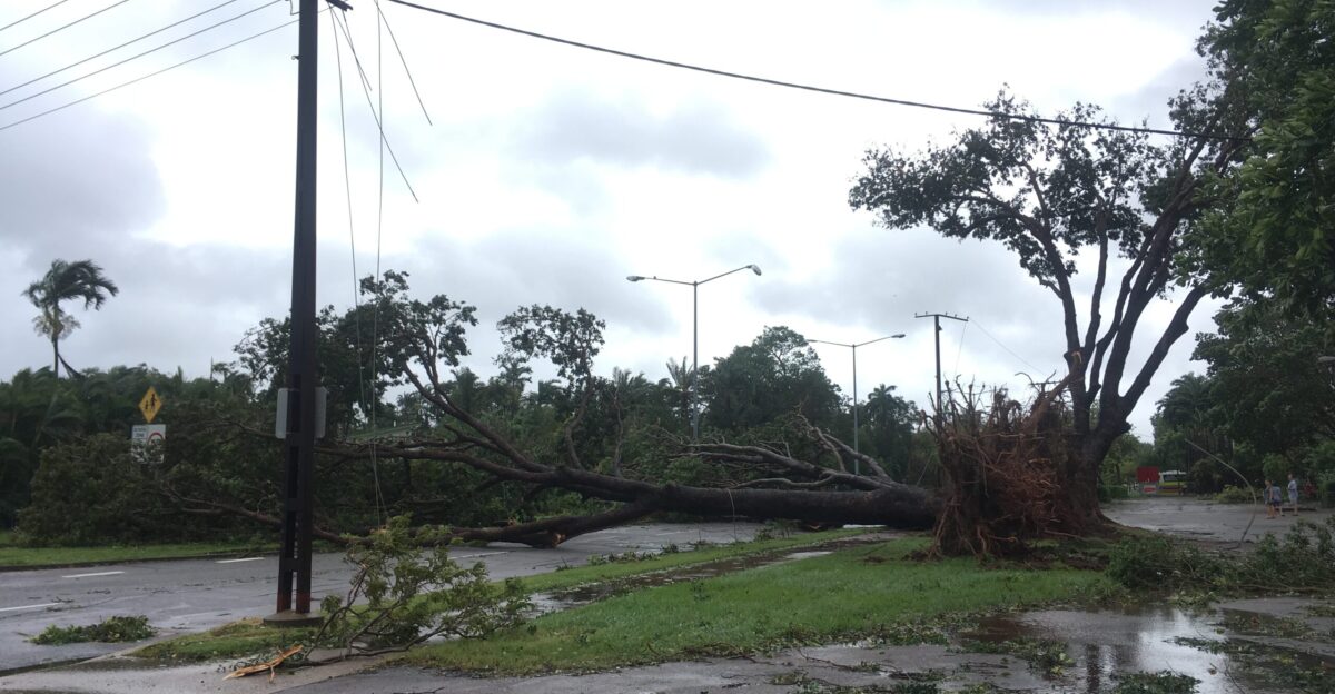
Wind-related infrastructure damage occurred throughout these states, with numerous reports of downed trees, damaged structures, and blown-over vehicles on highways and interstates throughout the affected region.
Heavy Snowfall and Blizzard Conditions Develop
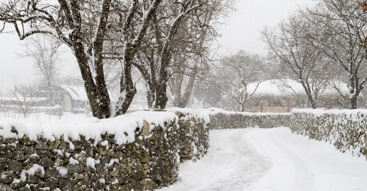
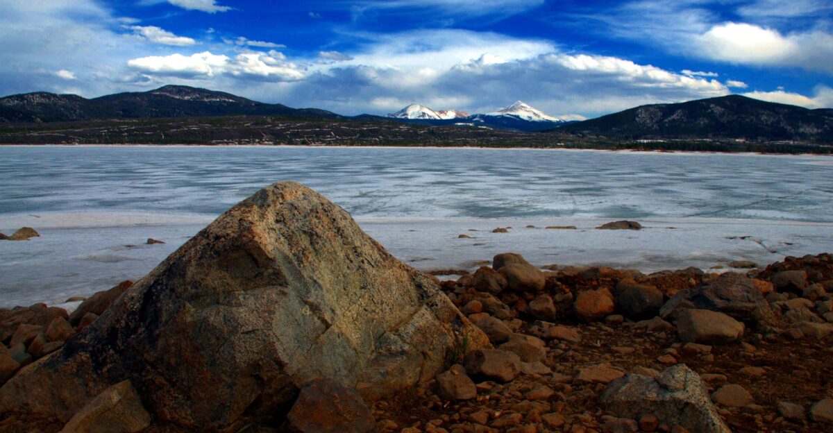
The winter storm delivered significant snowfall across affected regions. Montana experienced 10-12 inches of snow in multiple areas, while other regions received lighter accumulations. Mountain terrain throughout Wyoming saw 2-6 inches across the Absarokas and 4-8 inches across the Tetons and Gros Ventres.
Blizzard conditions developed across eight states in the Upper Midwest and Great Lakes, creating whiteout situations that reduced visibility to near zero.
Blizzard Warnings Span Multiple States
Active blizzard warnings remain in effect across multiple regions. Southeast Minnesota, northeast Iowa, and east-central Iowa face particularly severe blizzard conditions with ongoing winter storm warnings.
Wisconsin, Michigan, Indiana, Ohio, Pennsylvania, and New York are also under blizzard or winter storm warnings. The National Weather Service warns that conditions continue to create life-threatening situations for travelers and residents in all affected areas during this dangerous period.
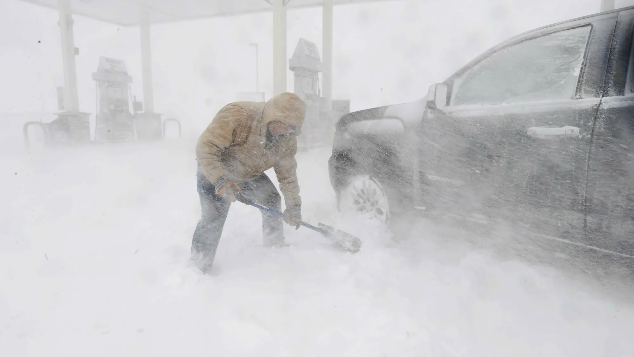
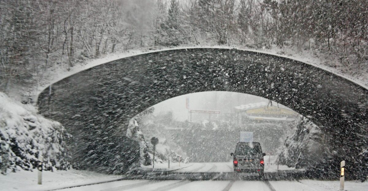
Travel Grinds to Halt Across Nation
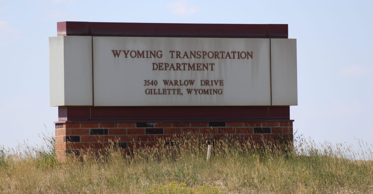
Travel has become extremely hazardous throughout the storm zone. Wyoming’s Department of Transportation reported nearly 40 blow-over crashes involving high-profile vehicles over three days, forcing closures of Interstate 80 and Interstate 25 to light trailers and high-profile vehicles.
Mountain passes throughout Colorado, Wyoming, and Montana have become impassable danger zones. Authorities issued urgent warnings against all non-essential travel, emphasizing that emergency responders may be unable to reach stranded motorists during peak wind conditions.
Massive Power Outages Leave Hundreds of Thousands Without Electricity

The extreme winds caused catastrophic infrastructure failures across affected regions. At peak impact, three-quarters of a million customers lost power from Seattle to Denver, with approximately 325,000 still without electricity by Thursday morning, December 18.
Montana alone experienced over 15,000 customers without power, with repair crews unable to operate bucket trucks safely in winds exceeding 35 mph. Restoration efforts progressed slowly due to ongoing dangerous wind conditions throughout the affected area.
Critical Infrastructure Damaged Across Multiple States
Infrastructure damage extended throughout the storm zone. In Kansas, the KLOE 730 AM transmitter tower near Goodland suffered catastrophic failure when base insulators gave way under extreme wind loads.
South Dakota witnessed a radio tower collapse on Skyline Drive in Rapid City, where four schools remained closed on December 19 due to persistent power outages. Montana reported portions of an elementary school roof being partially stripped by hurricane-force winds during the height of the storm.
Unprecedented Fire Weather Threat Compounds Crisis
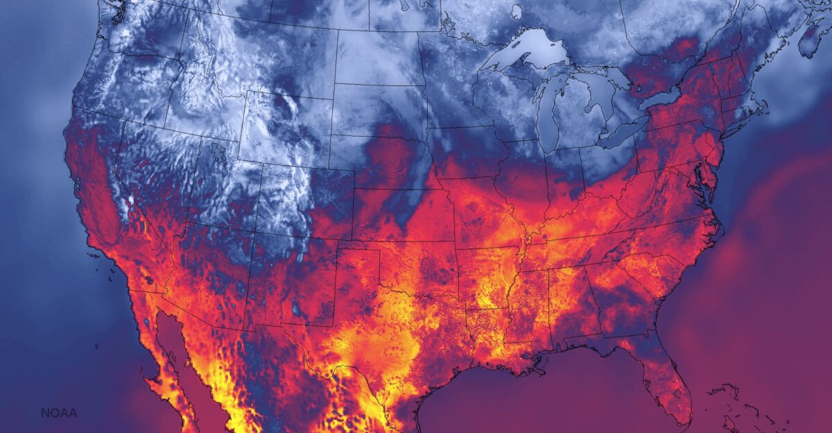
Adding to the dangerous weather situation, the National Weather Service Boulder office issued its first-ever “Particularly Dangerous Situation” Red Flag Warning for Colorado on December 19.
A similar warning was issued for parts of Wyoming’s Laramie County due to extreme and erratic wildfire behavior threats. Sustained winds of 45-55 mph with gusts exceeding 100 mph, combined with extremely dry air and near-record warmth, created critical fire weather conditions. This represents an unprecedented dual threat of winter storm conditions and fire weather occurring simultaneously.
Major Wildfire Burns Thousands of Acres in Colorado
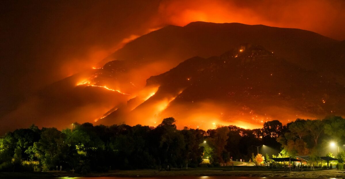
The combination of extreme winds and critical fire weather sparked major wildfires. A large fire designated “Fire 33” burned approximately 12,000-40,000 acres in Yuma County, Colorado during the storm event.
To mitigate wildfire risks from downed power lines, Xcel Energy proactively shut off power to over 69,000 customers in Colorado, leaving some residents without electricity for extended periods. The simultaneous occurrence of blizzard conditions and critical fire weather created an unprecedented emergency management challenge.
Atmospheric Dynamics Create Perfect Storm Conditions
Meteorologists identified the extreme weather event resulted from rare atmospheric alignment. A powerful jet stream with core speeds exceeding 170 mph created massive pressure gradients across the Central Plains. An intense mid-latitude cyclone underwent rapid cyclogenesis over the Rocky Mountains, generating hurricane-force surface winds.
The system drew exceptionally warm and dry air from the Desert Southwest, resulting in downslope heating. This rare configuration created what meteorologists described as a “perfect storm” combining multiple extreme weather threats simultaneously.
Temperature Records Shattered in Unusual December Heat
Adding to the storm’s unusual nature was extraordinary warmth in affected regions. Denver recorded 71°F on December 19, shattering previous daily records. Oklahoma City reached 76°F and Dallas-Fort Worth hit 79°F, both setting new December records.
This near-record heat, combined with extreme drought and high winds, created desert-like conditions in mid-December. Multiple grass fires near Amarillo in the Texas Panhandle demonstrated the fire threat’s severity despite winter season timing.
Human Toll and Safety Concerns Mount

The historic storm has proven deadly with confirmed fatalities. At least one death was confirmed in Idaho as of December 18, with widespread damage including trees toppling onto homes and vehicles. Multiple school districts across Western Montana shifted to early releases or remote learning on December 18 for student safety.
Authorities urged residents to assemble emergency supply kits, know evacuation routes, and avoid all non-essential activities that could cause sparks or flames in high-risk fire zones.
National Weather Service Continues Monitoring as Storm Persists
The National Weather Service continues closely monitoring the multi-state system as blizzard warnings remain in effect. Officials emphasize that the combination of hurricane-force winds, heavy snowfall, and widespread whiteout conditions represents one of the most extensive winter storm events of the 2025 season.
Impacts are expected to persist through December 20 as the system gradually moves eastward across the continent. The unprecedented scope and intensity—trapping an estimated 50-60 million Americans in hazardous conditions—underscores the critical importance of heeding all National Weather Service safety warnings.
Sources:
“National Weather Service Details Winter Storm Impacts Across 16 States, 144 MPH Wind and 12 Inches of Snow.” National Weather Service Prediction Center, December 18, 2025.
“December 17–20, 2025 North American Storm Complex.” Wikipedia, December 16–20, 2025.
“144 MPH Wind Gust Is Strongest Ever Recorded in Wyoming.” Cowboy State Daily, December 18, 2025.
“Forecasters Warn of ‘Particularly Dangerous’ Fire Threat in Colorado and Wyoming.” KTVZ/CNN Weather, December 19, 2025.
“Wyoming Clocks 100-Plus MPH Winds, Causing Vehicle Blow-Overs.” Wyoming Public Media, December 17, 2025.