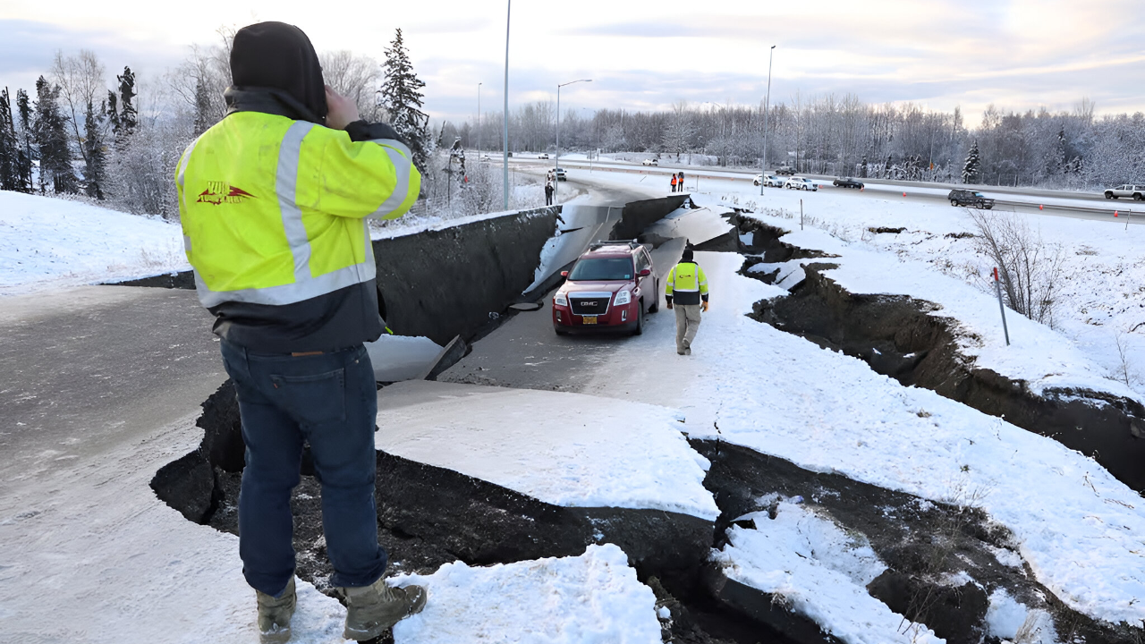
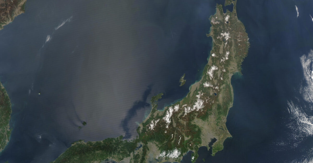
Two powerful earthquakes rattled opposite sides of the Pacific within 48 hours, hitting Alaska on December 6 and Japan on December 8. A magnitude 7.0 quake struck near Yakutat, Alaska, while Japan experienced a magnitude 7.6 tremor off Aomori Prefecture’s coast.
Both struck along the Pacific Ring of Fire, where roughly 90 percent of the world’s earthquakes occur. The timing raised an urgent question: could these be foreshocks to something far more catastrophic?
Japan’s Rare Alert
The Japan Meteorological Agency (JMA) issued an extraordinary megaquake advisory on December 8—only the second such warning in three years. The advisory warned of a one percent probability that a magnitude 8.0 or greater earthquake could strike within one week through December 16.
That one percent figure represents roughly 100 times the normal background risk, elevating the scenario to near-crisis levels. The advisory covered 182 municipalities stretching across approximately 500 miles of coastline, from Hokkaido in the north to Chiba Prefecture east of Tokyo.
Ground Won’t Stop Moving
Japan’s seismic network recorded 25 earthquakes in just three days following the initial 7.6 tremor. The most significant aftershock, measuring 6.7 magnitude, struck off Aomori Prefecture on December 12, followed by a 5.7 magnitude quake and numerous more minor tremors.
Alaska’s December 6 event generated 164 aftershocks within the first 24 hours alone, with the most significant measuring magnitude 5.8.
Evacuation Orders And Disruptions
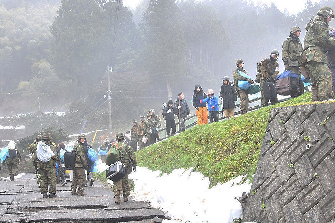
Japanese authorities ordered nearly 90,000 residents to evacuate their homes in the immediate aftermath of the 7.6 magnitude quake. Emergency shelters at the Hachinohe Self-Defense Forces air base provided refuge for approximately 480 people.
Two hundred train passengers became stranded overnight after rail service was suspended. Residents in the advisory zone were instructed to sleep in day clothes with helmets and emergency grab bags at their bedsides—precious seconds shaved off escape time if a larger quake struck.
The Initial Impact
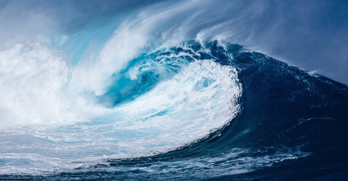
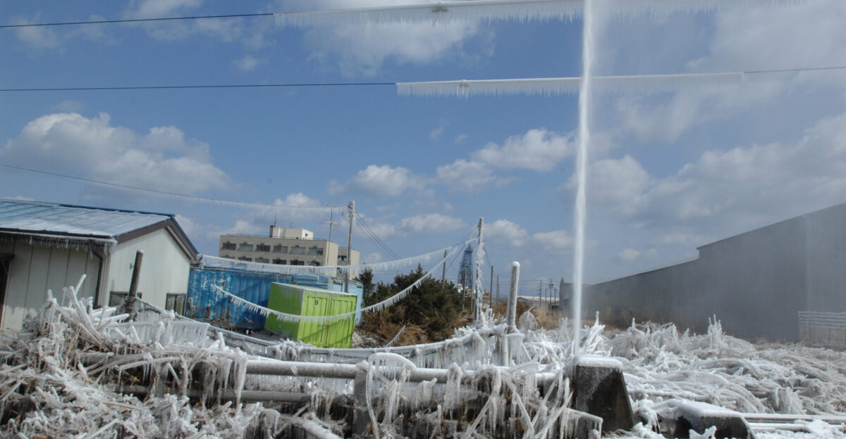
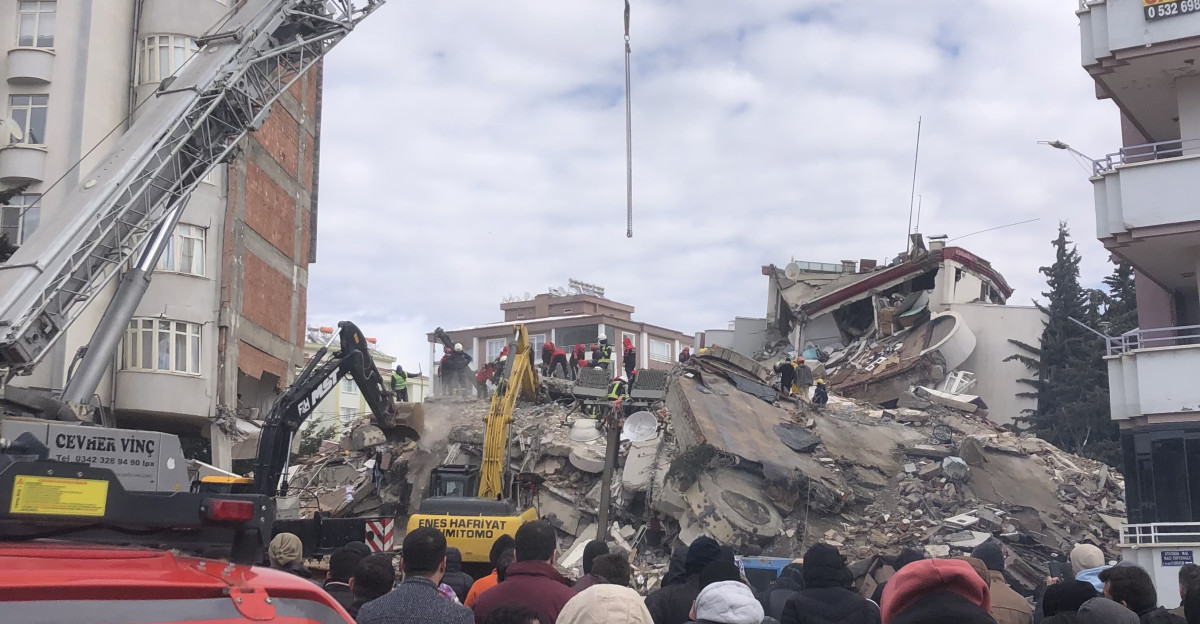
The December 8 earthquake caused at least 30 confirmed injuries, mostly from falling debris across affected coastal regions. Tsunami waves reached 70 centimeters (27 inches) along Japan’s northeastern coastline.
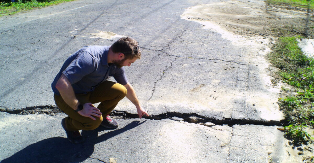
Several hundred homes sustained damage, power outages affected thousands of households, and roads cracked, hindering rescue operations.
Why Foreshocks Matter

An NHK reporter in Hokkaido described the initial tremor as “around 30 seconds of intense horizontal shaking so strong he could not stand,” capturing the terror residents experienced. Scientists cannot immediately distinguish whether a large quake is the main event or merely a foreshock—the preliminary rupture before an even larger one.
Historical data show that approximately 15 to 43 percent of significant earthquakes are followed by larger events within days. This uncertainty drove the JMA’s cautious stance and kept residents on high alert.
The 2019 Ridgecrest Precedent
The 2019 Ridgecrest earthquake sequence in California provided a sobering historical parallel. A magnitude 6.4 foreshock struck on July 4, followed just 34 hours later by a magnitude 7.1 mainshock that caused significantly more damage.
The foreshock-mainshock pattern demonstrated that early large earthquakes do not always represent the ultimate rupture. Scientists stress this pattern occurs in roughly five percent of major earthquake sequences, making Japan’s megaquake advisory a reasonable precaution.
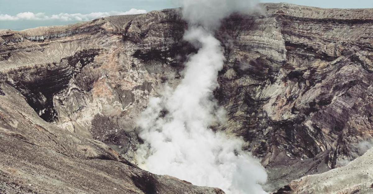
The Ring Of Fire’s Violent Activity
The Pacific Ring of Fire accounts for roughly 90 percent of Earth’s annual seismic energy release and hosts approximately 75 percent of the world’s active volcanoes. Both the December 6 Alaska and December 8 Japan earthquakes ruptured along this subduction zone boundary, where oceanic plates collide with continental plates at extreme pressure.
The Ring stretches across 40,000 kilometers in a horseshoe pattern encircling the Pacific Basin. This geological reality makes the Pacific Northwest and northeastern Japan perpetually vulnerable to catastrophic seismic events.
Cascadia’s Hidden Threat
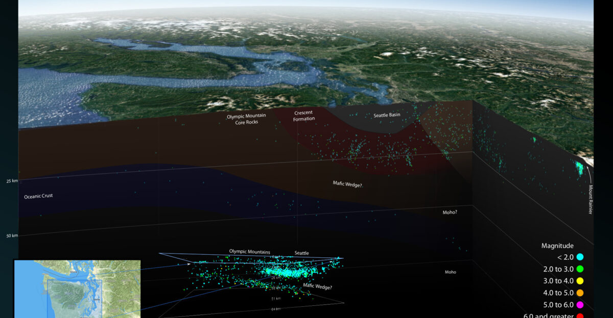
North America’s Cascadia Subduction Zone—a 700-mile fault stretching from northern California through Oregon and Washington to British Columbia—faces a 37 percent probability of a magnitude 7.1 or larger earthquake within the next 50 years.
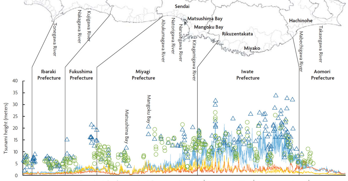
A full Cascadia megathrust rupture could generate earthquakes exceeding magnitude 9.0 and tsunamis reaching heights of 80 to 100 feet, threatening millions in the Pacific Northwest.
A 324-Year Silence
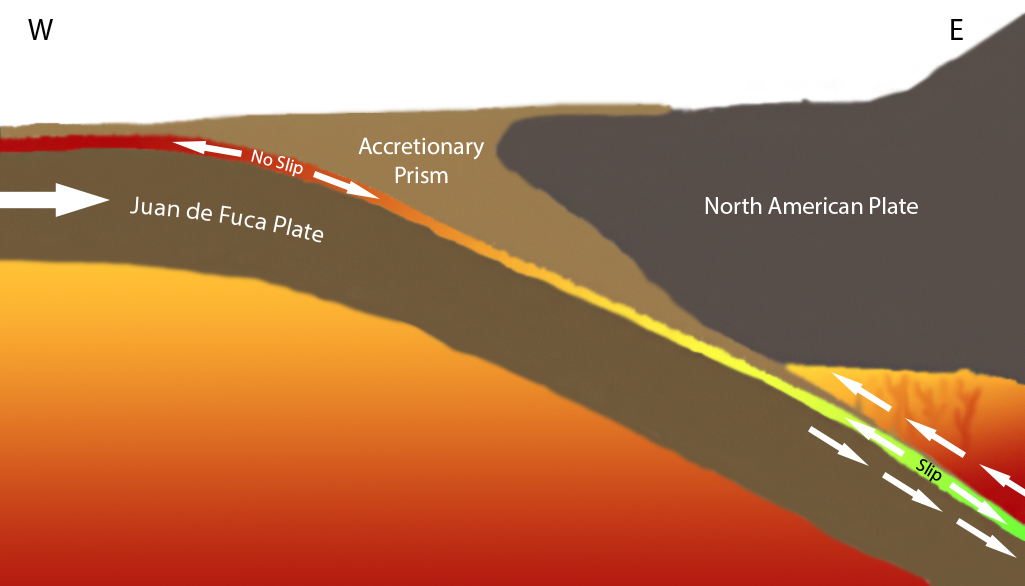
The last confirmed megathrust earthquake along Cascadia occurred on January 26, 1700—more than 324 years ago. Geological evidence indicates such great earthquakes have struck at least seven times in the past 3,500 years, establishing a recurrence interval of 400 to 600 years.
We are entering the statistical danger window where a major rupture becomes increasingly probable. Scientists stress that Cascadia is currently locked, with stress accumulating as the Juan de Fuca Plate slides beneath the North American Plate.
Global Earthquake Patterns
Globally, the world experiences approximately 15 to 16 earthquakes of magnitude 7.0 or greater annually, according to long-term seismic records maintained by the U.S. Geological Survey. Two such quakes within 48 hours, while striking to the public, fall within expected statistical clustering rather than indicating fundamental changes in tectonic activity.
Improved detection networks capture more small earthquakes than ever before; however, the frequencies of large earthquakes have remained consistent since approximately 1900.
The Limits Of Prediction
Despite advanced monitoring technology and decades of historical data, scientists are still unable to predict earthquake timing, location, or magnitude with precision. The JMA’s megaquake advisory represents elevated probability—a statistical flag rather than a forecast. Seismic experts can only raise likelihood estimates when seismic activity spikes, as happened in Japan.
Foreshocks themselves cannot be reliably distinguished from mainshocks until days or weeks afterward, creating inherent uncertainty.
A Question Without An Answer
Did the magnitude 7.6 earthquake that struck Japan on December 8 represent the main event or merely a precursor? Scientists cannot say with certainty. Residents across 182 municipalities—potentially representing 5 to 10 million people based on typical Japanese coastal populations—were asked to live in a state of preparedness for a week.
The advisory created a peculiar temporal bubble where everyday life persisted alongside protocols for catastrophe: workplaces remained open, schools continued, yet evacuation drills ran constantly, and emergency supplies flew off store shelves.
Lessons From Past Warnings

Japan’s previous megaquake advisory, issued in August 2024 for the Nankai Trough region along the southern Pacific coast, generated widespread panic buying, event cancellations, and business shutdowns despite no major earthquake materializing within the one-week window.
That experience prompted the JMA to issue more measured language with the December advisory. Seismologists emphasize that megaquake advisories serve essential functions—keeping residents aware and prepared—while acknowledging inherent uncertainty.
Living With Uncertainty
The December advisory expired on December 16 without triggering a megaquake, allowing residents to exhale temporarily. Yet the scientific message remained sobering: major earthquakes remain a certainty along these subduction zones, although their timing remains unpredictable.
Millions in Japan and the Pacific Northwest continue to live atop geological boundaries primed for rupture, where preparation and vigilance represent the only defenses against disasters that science cannot predict. Awareness and readiness matter far more than prediction.
Sources:
USGS Earthquake Hazards Program – Magnitude 7.0 Alaska Earthquake December 6, 2025
Japan Meteorological Agency – Megaquake Advisory December 8, 2025
NHK World – Mega Quake Advisory for Northern, Eastern Japan Ends December 16, 2025
The Guardian – Japan Issues Megaquake Advisory in North After Magnitude 7.5 Earthquake
U.S. Geological Survey – Global Earthquake Statistics and Long-term Records
Pacific Northwest Seismic Network – 1700 Cascadia Subduction Zone Earthquake Documentation