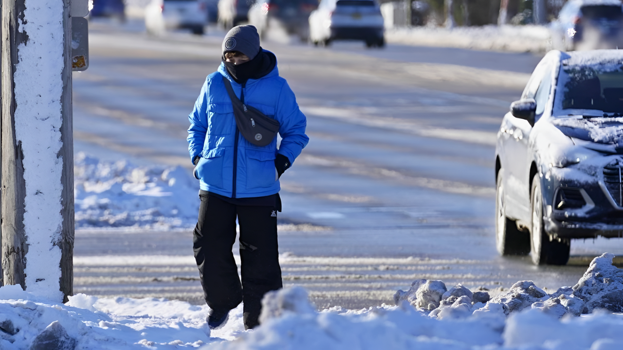
An early-season blast of Arctic air has plunged much of the central and eastern United States into mid-December deep freeze, delivering record lows, heavy snow and dangerous wind chills from the Midwest to the Northeast. Temperatures as low as minus-19°F in Spencer, Iowa, and single-digit readings in cities like Detroit and New York signaled a winter pattern that forecasters say could bring repeated spells of extreme cold in the weeks ahead.
Eight States Brace for Hazardous Cold
By Saturday, December 13, the National Weather Service had issued a range of winter storm and cold-weather alerts spanning eight states, including North Dakota, Pennsylvania and Virginia. Residents were warned to expect temperatures 20 to 30 degrees below seasonal norms as Arctic air pushed east, combining with snow and ice to create hazardous travel.
Local officials urged people to monitor forecasts closely and prepare homes and vehicles for the sharp drop in temperatures. Across small towns and major cities alike, families stocked up on essentials and made contingency plans in case power failed or roads became impassable.
Meteorologists linked the outbreak to a disrupted polar vortex and shifts in the jet stream that allowed frigid air to spill south into heavily populated regions. The evolving pattern, they noted, followed several earlier systems that had already delivered snow and freezing conditions to parts of the Midwest and Northeast during the first half of December.
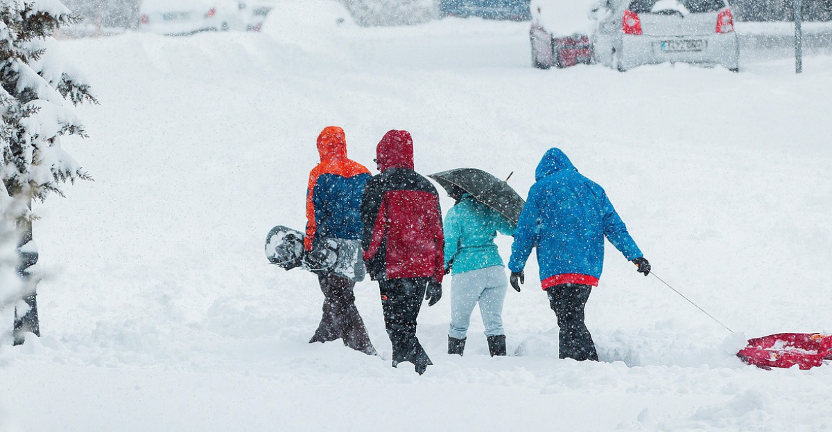
Snowstorm Builds Over the Northeast
As the cold intensified, forecasters tracked the development of a coastal low expected to move along the Mid-Atlantic and New England shoreline. Drawing moisture from the Atlantic into an entrenched Arctic air mass, the system was projected to produce a quick but disruptive snowstorm from Pennsylvania through New York and into parts of New Jersey.
During the December 13–14 period, National Weather Service offices in Pittsburgh and northern West Virginia strongly advised residents to stay indoors until conditions improved, citing heavy snowfall, sub-freezing temperatures and perilous wind chills. New York City Emergency Management issued similar guidance, recommending that people remain inside where possible during the peak of the storm.
The fast-moving system ultimately dropped 6 to 12 inches of snow across large portions of Pennsylvania and New York, with some New Jersey communities reporting more than 8 inches. Wind gusts in the 30–40 mph range drove wind chills toward zero and worsened blowing and drifting snow, complicating plowing and raising the risk of black ice and frostbite.
Power Outages and Infrastructure Strain
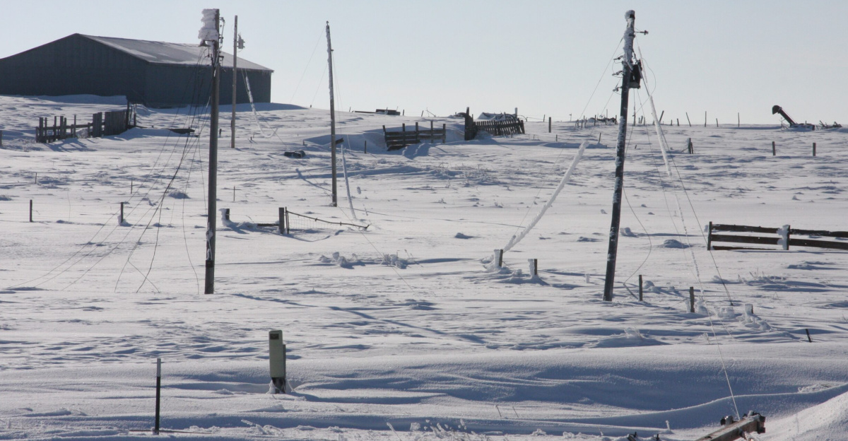
The combination of heavy, wet snow and strong winds quickly tested local infrastructure, particularly in New Jersey. By the afternoon of December 14, more than 19,000 electric customers were without power as tree limbs and branches, weighed down by accumulation, fell onto lines.
Major utilities including JCP&L, PSE&G and Atlantic City Electric reported peak outages while dispatching repair crews across multiple counties. Companies attributed the majority of service interruptions to downed trees and lines in difficult conditions and urged customers to report outages and avoid any fallen wires.
The scale of the disruptions, despite the relatively short duration of the storm, drew attention to the vulnerability of above-ground power networks during intense winter weather. Officials and residents alike questioned how similar events might be managed later in the season if storms become more frequent or severe.
Inside darkened homes, families layered clothing, used blankets to retain warmth and checked on older neighbors as indoor temperatures fell. Emergency services prepared for a higher volume of calls related to both the cold and the outages, while local shelters opened their doors to those needing heat, light and basic supplies.
Travel Disruptions Across the Region
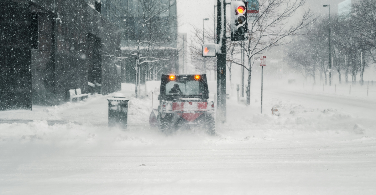
Transportation networks across the Northeast experienced significant strain as the storm peaked. On December 14, major airports including Newark Liberty, John F. Kennedy and LaGuardia reported delays of two hours or more as snow removal operations struggled to keep runways clear and de-icing slowed departures.
Highways and secondary roads grew increasingly treacherous, with reports of spinouts, fender-benders and temporary closures as plows attempted to keep pace with rapid accumulation. Authorities urged drivers to stay off the roads unless travel was essential, warning that visibility, black ice and drifting snow could quickly turn routine trips into emergencies.
The storm’s impact on mobility also affected emergency response, deliveries and commuter rail systems. Many businesses faced short-notice closures, while some workers were unable to reach job sites. The disruption underlined how closely economic activity and access to services are tied to transportation reliability during extreme weather.
Looking Ahead: A Harsher Winter Pattern
The December snowstorm and cold wave followed a series of early-month temperature records that suggested a harsher winter pattern was already underway. Spencer, Iowa’s minus-19°F reading and Detroit’s 5°F record, along with record early-season lows around 20°F at New York City airports, stood out as signals of the intensity of the Arctic air mass.
Meteorologists and climatologists say such outbreaks may become more common as shifts in the polar vortex and broader atmospheric changes influence North American winters. Researchers emphasize that communities will need to adapt by reinforcing infrastructure, refining emergency plans and educating residents about the risks of severe cold, from hypothermia and frostbite to extended power loss.
Local governments and utilities are reviewing their performance during the December storm, examining snow removal strategies, grid resilience and restoration timelines. Community groups and nonprofits, which played a visible role in providing warmth, food and support to affected families, are also assessing how to strengthen networks before the next major system arrives.
As winter progresses, officials, businesses and residents across the Midwest and Northeast face the prospect of additional storms and cold snaps. The December event has sharpened discussions about preparedness, from home insulation and backup power options to regional coordination on transportation and emergency sheltering. The experience is likely to inform planning efforts aimed at limiting disruption, protecting public health and safeguarding essential services through the remainder of the season and in future winters.
Sources
Yahoo News – Winter Storm Warnings Issued in 8 States Expecting Hazardous Weather
NJ.com – N.J. power outage update: Thousands without power as heavy snow hits the state
Reuters – Arctic blast grips central, northeastern US in sub-freezing cold
CNN – Millions wake up to extreme cold that’s breaking records as polar vortex keeps US in the freezer
Fox Weather – Travel nightmare: Winter snowstorm causes delays and power outages across the Northeast
Wikipedia – December 13–14, 2025 United States winter storm