Buried beneath a slowly-moving mountainside in Alaska’s Prince William Sound, something is screaming. Every autumn, strange, impulsive seismic signals erupt from deep underground—sharp, high-frequency pulses that intensify throughout fall and winter, then vanish completely by spring.
For three years, researchers have puzzled over these anomalies. Now they know the shocking truth: water is literally freezing solid inside bedrock cracks.
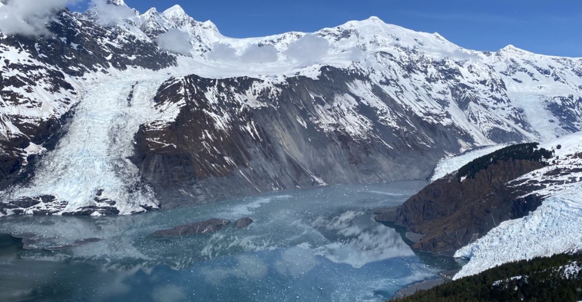
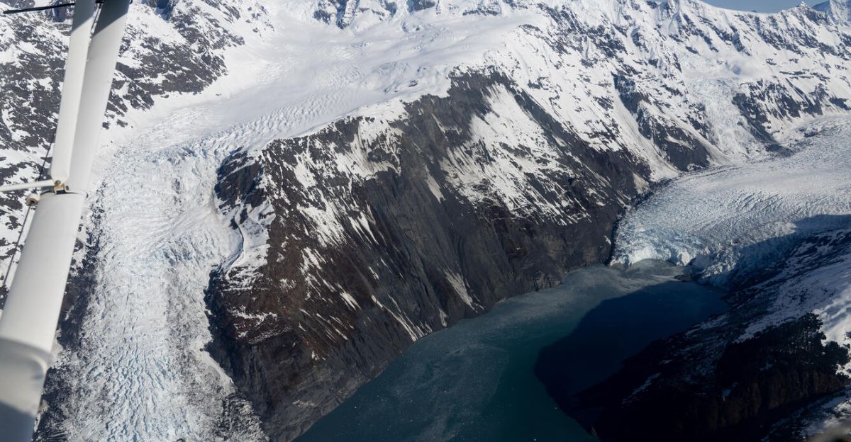
A Landslide the Size of a City Block Threatening Whittier
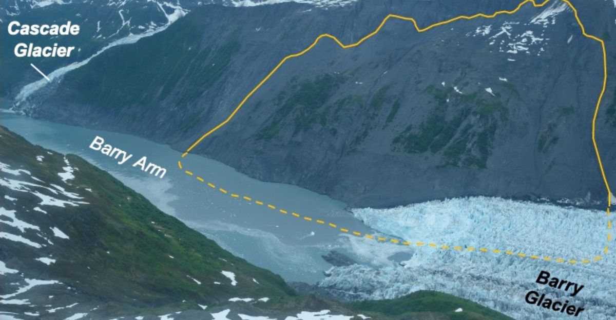
The Barry Arm landslide measures approximately 500 million cubic meters—enough rock to bury the entire island of Manhattan under a 200-foot-thick layer of debris.
Located just 30 miles from the small Alaskan town of Whittier, this unstable slope has been creeping downward for over a century, photographed in images dating back to at least 1913. Today, it remains one of North America’s deadliest tsunami threats.
When Disaster Strikes: A 30-Foot Wave Could Arrive in Minutes
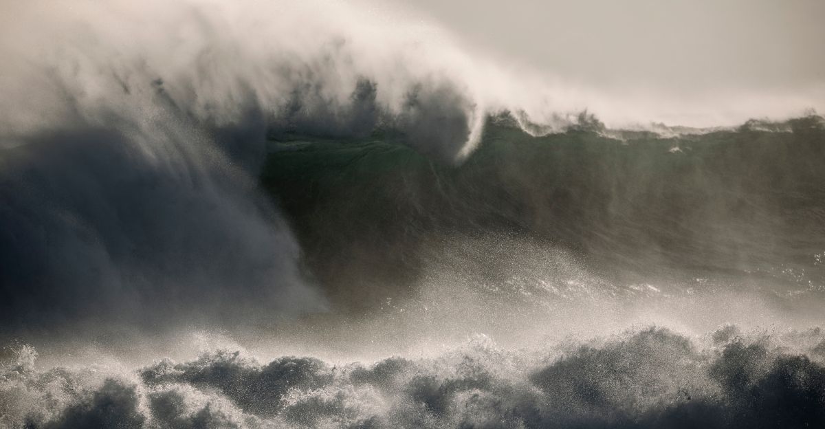
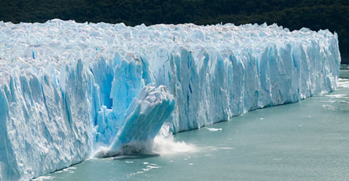
If Barry Arm suddenly fails, a cascade of 500 million cubic meters would plunge into the fjord below, generating a tsunami with peak wave heights potentially exceeding 980 feet at impact—rivaling Mount Everest. Within approximately twenty minutes, a 30-foot wave could slam Whittier, a town of only 260 residents.
The fjord’s popularity with cruise ships, kayakers, and fishermen puts hundreds of tourists at risk.
The Breakthrough: Gabrielle Davy’s Year-Long Investigation
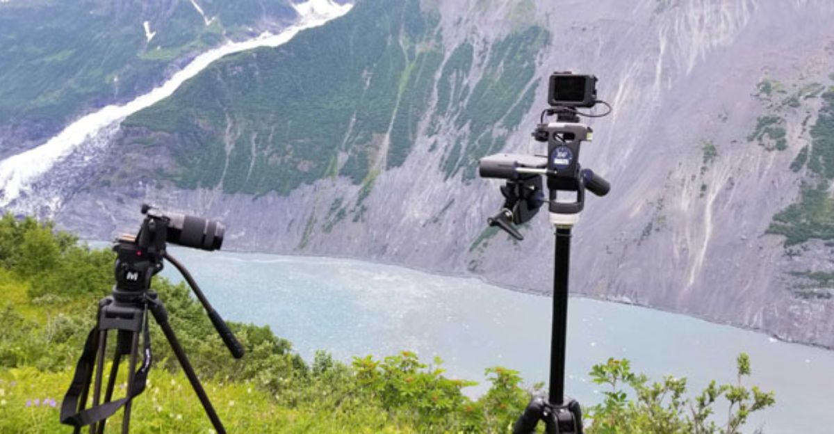
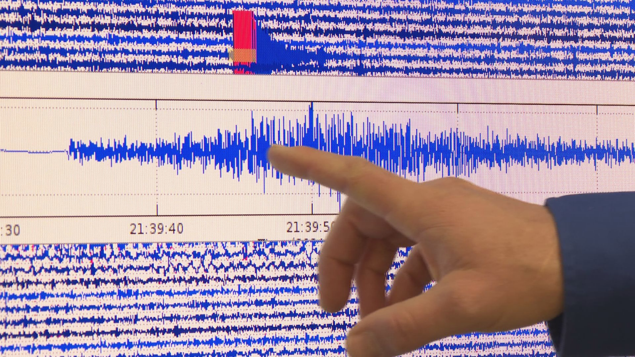
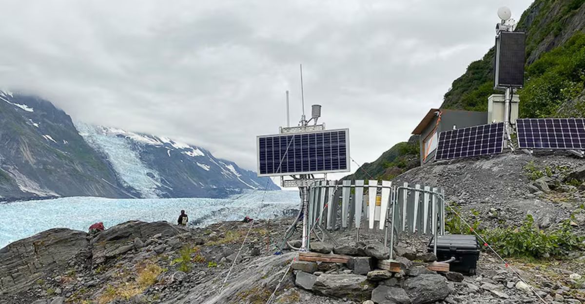
Gabrielle Davy, a geophysicist at the University of Alaska Fairbanks, spent an entire year manually reviewing continuous seismic data from Barry Arm—a tedious task that yielded extraordinary results.
By cross-referencing weather patterns, rainfall records, and ground-based radar measurements, Davy’s team cracked the code: seasonal freeze-thaw cycles beneath Cascade Glacier generate these distinctive seismic fingerprints.
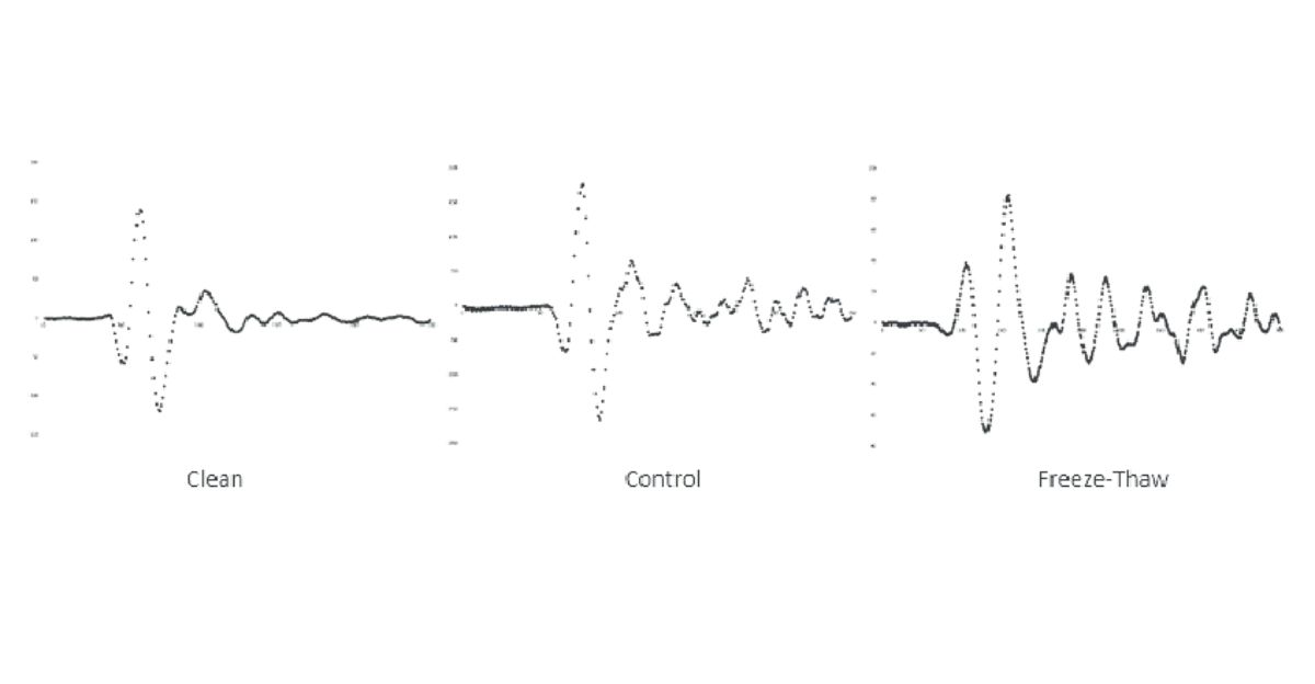
Freeze-Thaw Processes: Nature’s Invisible Warning System
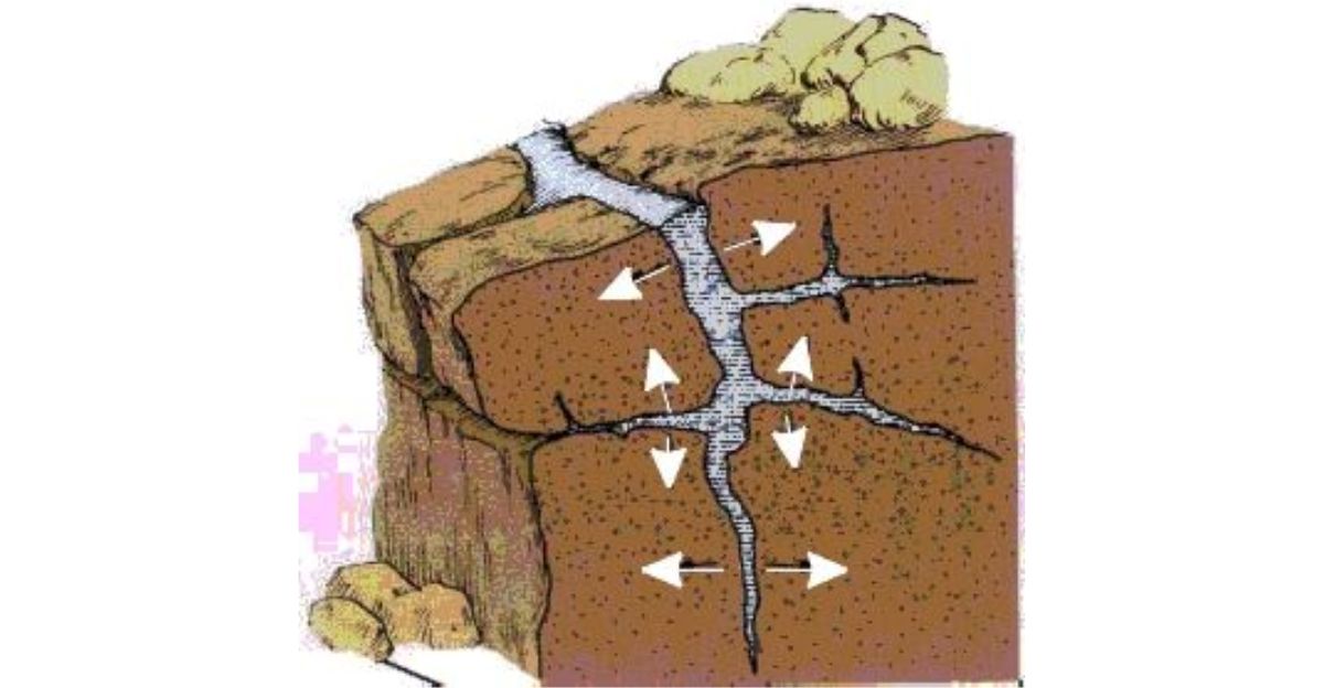
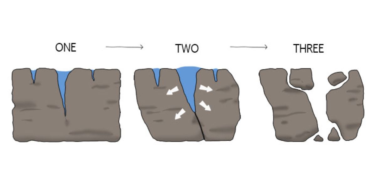
Water penetrating bedrock cracks expands as it freezes, creating brittle fracture events that produce the characteristic high-frequency seismic signals.
These impulsive events increase steadily from August through December, reach peak intensity in mid-winter, then abruptly cease by early spring. This seasonal pattern repeats reliably annually, providing an unexpected window into subsurface hydrology.
The Hydraulic Connection: Why This Discovery Matters
Although freeze-thaw signals don’t directly indicate landslide movement, they offer invaluable insight into subsurface water pressure—a critical factor determining slope stability.
Groundwater pressure acts like a hydraulic wedge; excess water weakens the bonds between bedrock and reduces the friction that holds the slope in place. Understanding these water dynamics could provide researchers with critical insight into potential catastrophic failures.
The Tracy Arm Event: Nature’s Unexpected Confirmation
On August 10, 2025, scientists received startling confirmation of seismic warning capabilities.
A 100-million-cubic-meter landslide collapsed at Tracy Arm, generating the world’s second-tallest megatsunami with wave run-ups reaching 1,640 feet. Remarkably, seismic instruments detected approximately one hundred precursor earthquakes during the eighteen hours before collapse—an unprecedented finding for landslide prediction.
From Precursor Detection to Real-Time Monitoring Systems
The Alaska Earthquake Center deployed a revolutionary algorithm that scans three-minute seismic data chunks every thirty seconds across dozens of monitoring stations.
Since August 2023, this system has detected twenty-eight landslides across Prince William Sound in near-real time. The algorithm identifies slope failures within three to four minutes—critical timing for issuing tsunami warnings to vulnerable communities.
A Region Under Siege: 43 Landslides Identified, 11 Pose Tsunami Threats
A 2024 USGS study using satellite data identified 43 landslide sites in Prince William Sound where collapses occurred between 2016 and 2022, with 11 possessing significant tsunami-generating potential.
Additional hazards include Surprise Inlet, which experienced five successive landslides in September 2024, and Pedersen Lagoon, where a fifty-six-foot tsunami struck in August 2024.
Climate Change’s Hidden Cost: Glacial Retreat and Slope Destabilization
Alaska has warmed by 4.5 degrees Fahrenheit since 1950, faster than any other state in the United States. Barry Glacier’s dramatic retreat over the past century eliminated crucial ice buttressing that stabilized mountainsides for millennia.
Scientists term this “debuttressing”—when rapid glacier loss destabilizes heavily faulted bedrock, creating conditions for paraglacial landslides throughout the region.
Alaska’s Staggering Glacier Loss: 25 Percent of Global Meltdown
Alaska accounts for approximately 25 percent of all glacier mass loss globally, losing roughly 68 billion tons annually despite containing only twelve percent of Earth’s glacier volume.
Between 2000 and 2023, Alaskan glaciers thinned from 36 centimeters annually to 69 centimeters—a 92-percent acceleration in melting. This warming-driven cascade directly fuels increased landslide hazards.
One Thousand Hidden Threats: The Larger Alaska Crisis
Scientists have documented over 1,000 slow-moving landslides across Alaska, with some advancing merely inches annually and others creeping more than ten feet yearly.
Permafrost degradation, intensified rainfall, and extreme temperature fluctuations create expanding fracture networks throughout bedrock. Most remain completely unmonitored, leaving scientists to wonder what dangerous slopes lie hidden from detection systems.
Infrastructure at Risk: Why Monitoring is Crumbling
Despite Barry Arm’s sophisticated monitoring network, administrative changes have delayed critical equipment repairs and service renewals.
More alarmingly, proposed funding cuts threaten nine seismic stations across Alaska, potentially blinding early-warning systems protecting West Coast communities. Scientists emphasize that these infrastructure threats emerge precisely when climate-driven hazards are accelerating most rapidly.
Expert Quote: The Growing Recognition of Seismic Precursors
“As research on landslide seismology grows, there’s increasing recognition that precursor seismic activity—when it does occur—can be an important source of early warning,” explained Ezgi Karasözen, Alaska Earthquake Center research scientist.
“That motivates broader investigations not only at Barry Arm, but also at other sites in southern Alaska where similar hazards exist.”
The Path Forward: Freeze-Thaw Signals as a Breakthrough Tool
The discovery of seasonal freeze-thaw seismic signals represents a revolutionary advance in landslide prediction science. By monitoring these signals alongside slope deformation, rainfall patterns, and glacier retreat rates, scientists are building predictive models for catastrophic failures.
If funding and infrastructure hold, these mysterious signals emanating from Alaska’s depths could ultimately save countless lives in one of Earth’s most rapidly warming, and increasingly dangerous, regions.
Sources
Seismological Society of America; Searching for Landslide Clues in Seismic Signals from Alaska’s Barry Arm (December 2025)
Phys.org/University of Alaska Fairbanks; Seismic signals research partnership on Barry Arm landslide hazard assessment
U.S. Geological Survey; 2025 Tracy Arm Landslide-Generated Tsunami report and landslide hazards program
Alaska Division of Geological and Geophysical Surveys; Barry Arm Landslide and Tsunami Hazard documentation
Alaska Earthquake Center; Landslide detection algorithm and Prince William Sound monitoring network data
NASA Landsat; Retreating glacier and landslide threat analysis in Alaskan fjords