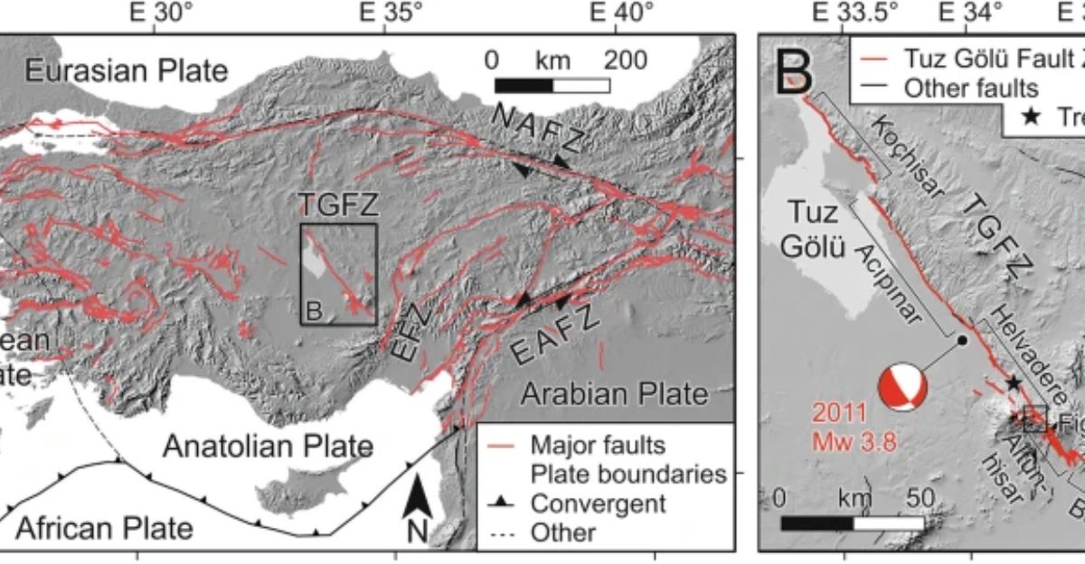
For many years, scientists thought they understood how the Tuz Gölü Fault in central Turkey moves, sideways, like a giant sliding crack in the ground. GPS satellites seemed to confirm this, showing small horizontal shifts over time. This idea shaped maps and building rules meant to keep people safe.
But in 2025, a new study turned this understanding upside down. The fault isn’t primarily sliding sideways, it’s actually pulling the Earth’s crust apart vertically. This new discovery means millions of people living nearby might face a bigger earthquake threat than experts realized.
Rethinking a Huge Fault
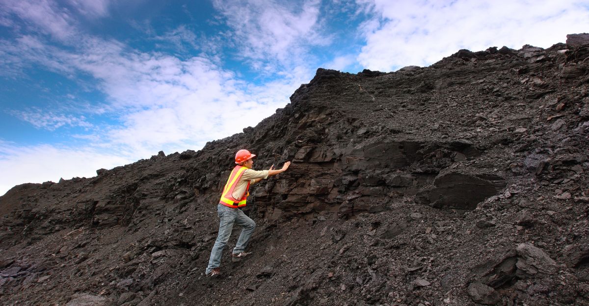
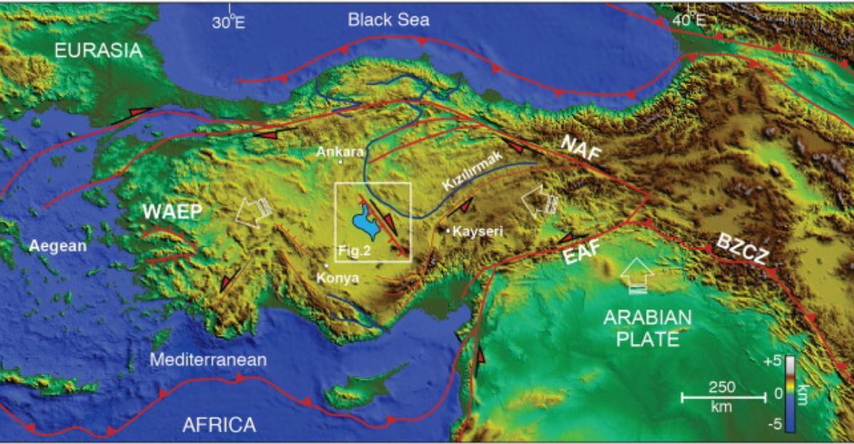
Axel Schmitt and his team at Curtin University uncovered surprising evidence about a long fault line running nearly 200 kilometers across central Anatolia. Before, everyone thought it mostly slid sideways. But examining ancient lava from a nearby volcano revealed vertical cracks where the ground is pulling apart, not sliding.
This changes how we view the entire region’s earthquake risk. Hundreds of millions of people live along this vast Alpine-Himalayan seismic belt, and now scientists realize this fault adds a new twist to earthquake danger. The research shows how important it is to revisit old assumptions with fresh eyes and new techniques.
A Fault with a Long Story
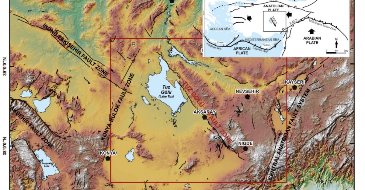
The Tuz Gölü Fault Zone, sometimes called the Koçhisar-Aksaray Fault, has been known since the late 1900s. It runs about 200 kilometers from Lake Tuz in the north to near Kemerhisar in the south, slicing through central Turkey’s large valleys. Scientists used to think it was mainly a right-lateral strike-slip fault, meaning the two sides slide past each other horizontally.
The fault dips inward at angles between 15 and 60 degrees. This fit with ideas about the big tectonic plates pushing and sliding in the area, until recent discoveries proved that assumption wrong.
Conflicting Clues from GPS and the Ground
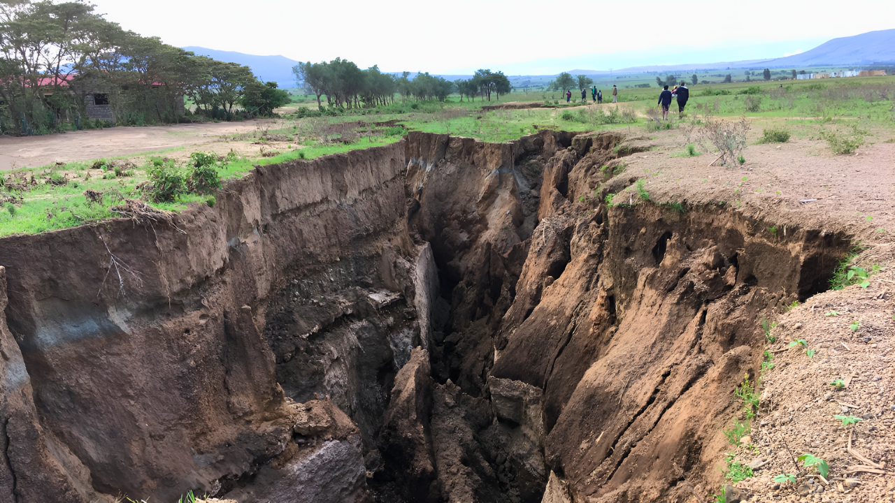
GPS devices tracking the fault showed it moved sideways by about 1 to 3 millimeters each year. This matched the long-held belief that the Anatolian plate was pushed westwards by neighboring plates sliding past. However, geologists studying the land found strange signs, steep cliffs and fractures often caused by the Earth’s crust pulling apart vertically.
These clues didn’t fit the slide-only model. It hinted that the fault’s movement was more complicated than anyone thought, and that bigger risks could be hidden beneath the surface.
Lava Tells the True Story
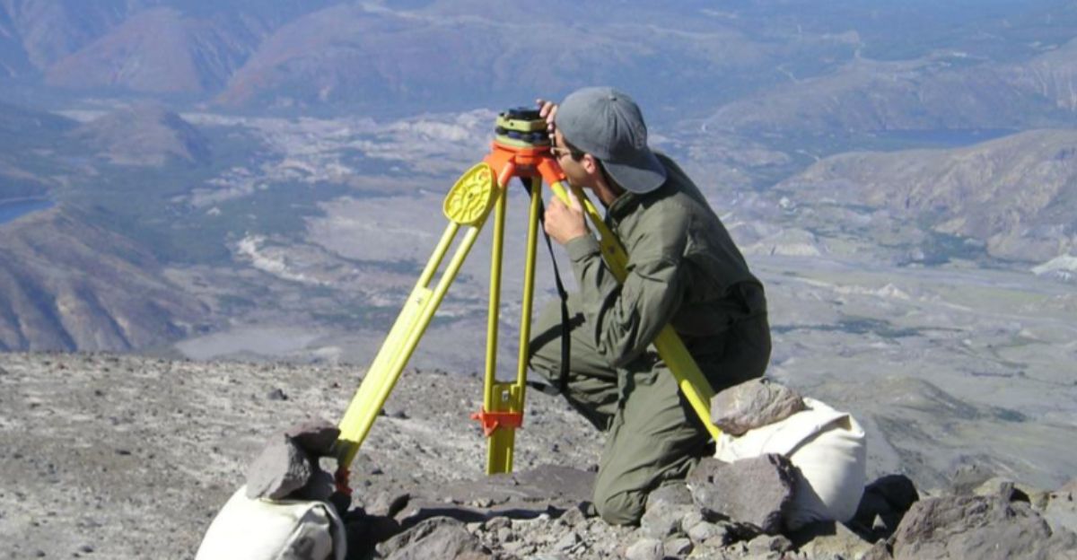
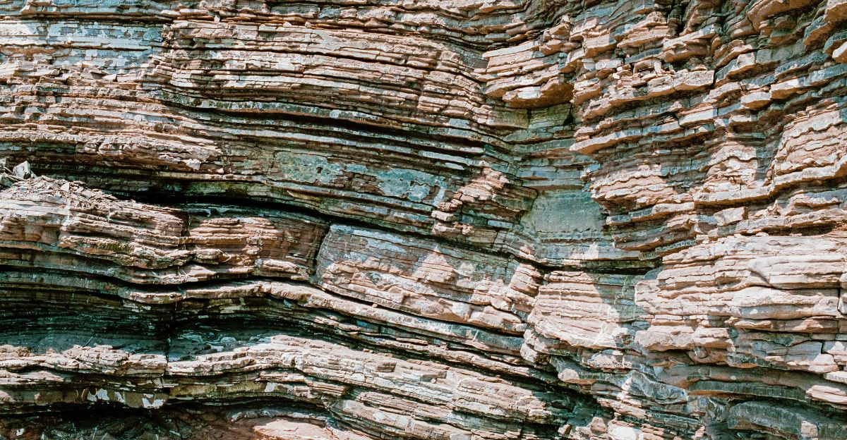
A breakthrough came when researchers used zircon double-dating on volcanic lava flows near Hasandağ volcano. These lava layers, formed around 150,000 to 39,000 years ago, were cracked by the fault. Measuring the vertical offset in these old rocks gave scientists a new rate of vertical ground motion, about 0.90 to 1.23 millimeters per year.
Meanwhile, sideways movement was almost zero. This means the fault is pulling the crust apart rather than sliding sideways, a big surprise changing how we think about future earthquakes in central Turkey.
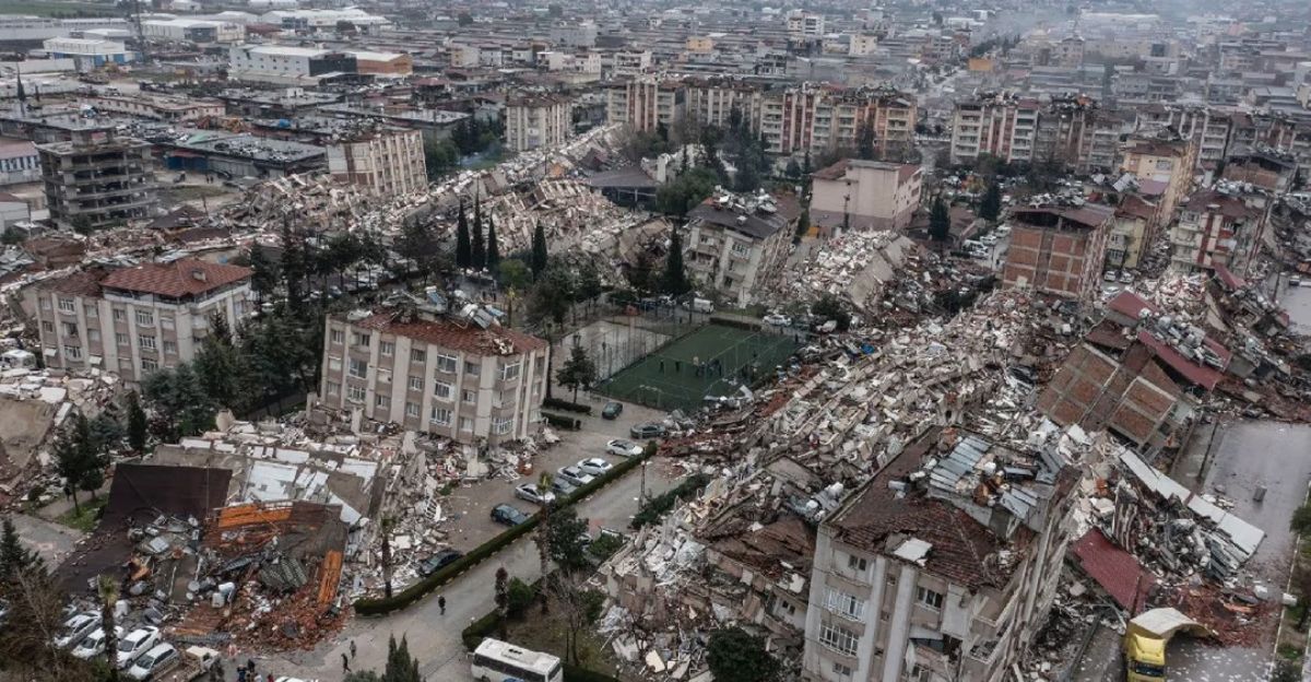
Millions of People in the Danger Zone
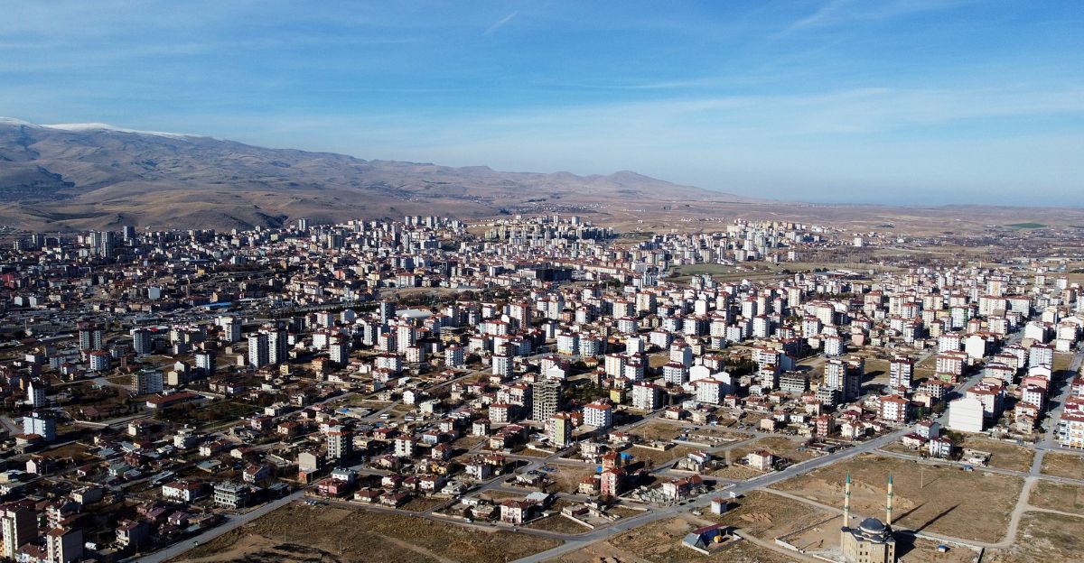
The Tuz Gölü basin lies in the heart of Turkey, including cities like Aksaray and Niğde, where millions live and farm. The new research means the fault’s vertical pulling, stretching the ground, has been stronger and more active than previous models showed.
Since older earthquake hazard maps mostly focused on sideways faulting, they may have underestimated the true risk to these communities. This discovery could mean a major update is needed in how we prepare for earthquakes, especially in central Turkey’s crowded and developing areas.
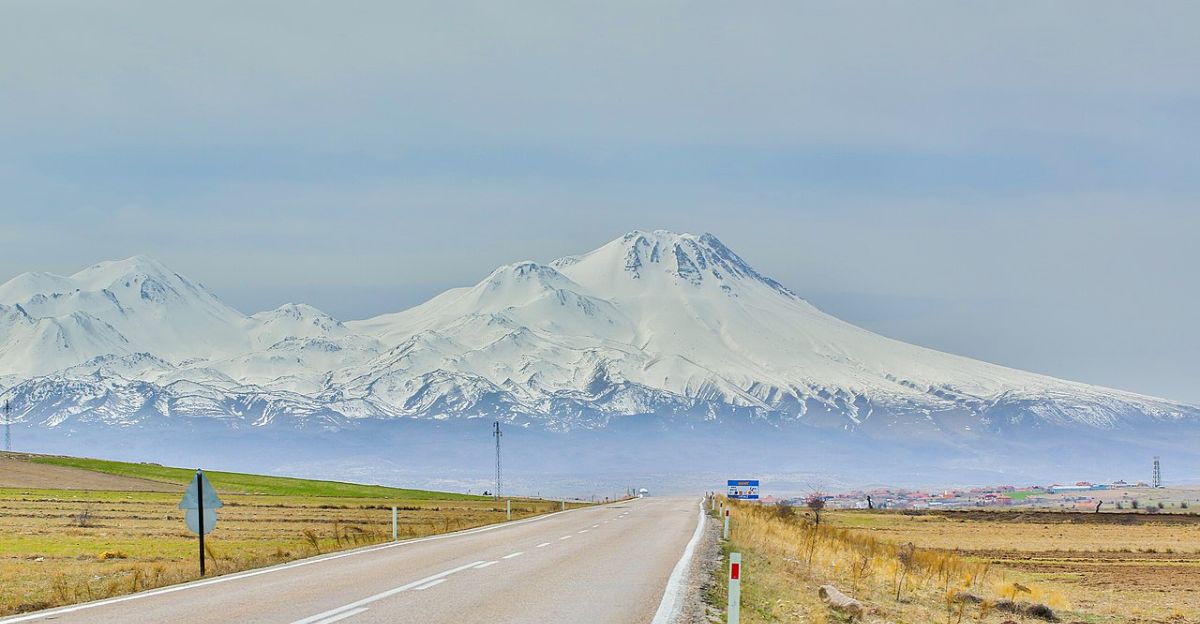
A Volcano Under Pressure
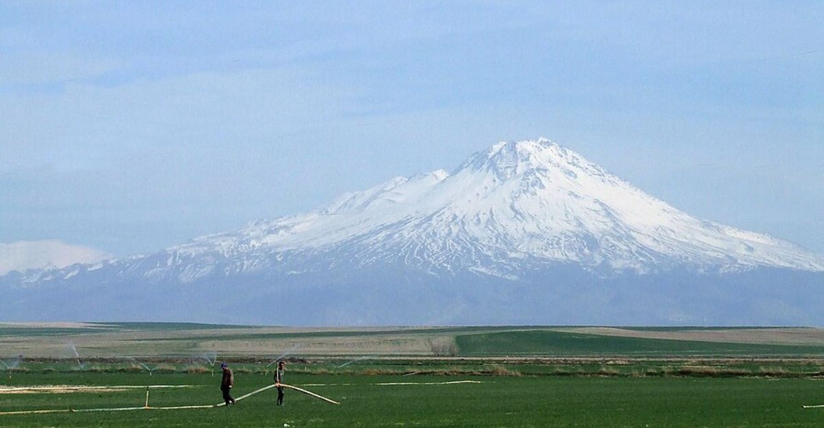
Mount Hasan, known locally as Hasandağ, is a tall volcano right on the fault line. The fault slices across volcanic rocks on one side of the mountain. If a strong earthquake shakes this fault, it might release pressure on the volcano’s underground magma chamber, possibly triggering eruptions.
Signs like steam vents and small tremors show the volcano’s magma is still moving. This mix of earthquake faults and volcanic activity makes the region especially risky for nearby towns, meaning emergency planning must consider both threats together.
Old Models Meet New Facts
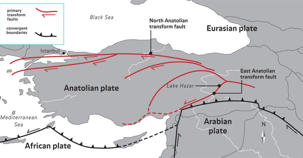
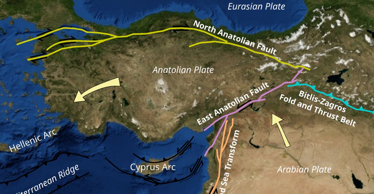
Traditional maps show the Anatolian plate moving sideways westwards at about 20 to 30 millimeters each year due to surrounding plates pushing on it. Faults like the North and East Anatolian Faults carry most of this side-slide motion.
The Tuz Gölü Fault was thought to be a minor player, just sliding less. The new findings flip this idea, showing the fault is actually stretching the crust vertically. This challenges the tectonic escape model and suggests scientists must rethink how central Turkey’s ground moves and breaks.
A Huge Region at Risk
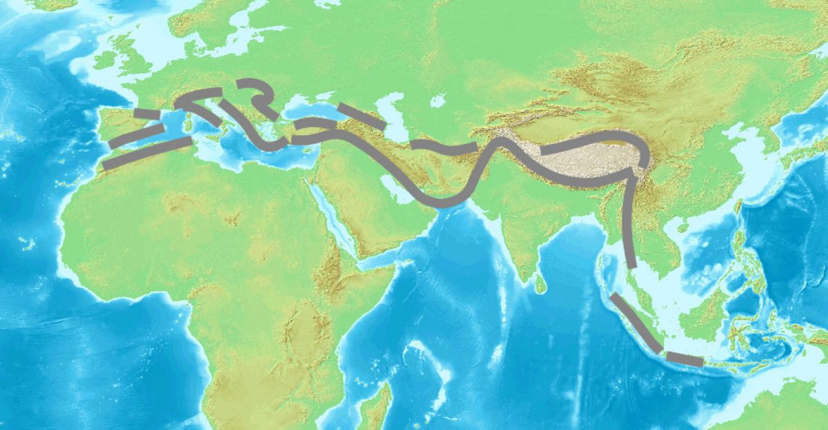
The Alpine-Himalayan belt stretches thousands of kilometers across many countries and is home to hundreds of millions. Tuz Gölü’s surprise is a wake-up call: similar hidden dangers might exist on other faults along this vast zone.
Some faults look quiet on satellite data but could be cracking upward underneath, storing energy for future earthquakes. Understanding these quiet-but-dangerous faults is key to keeping people safe from unexpected quake risks across this busy seismic belt.
Why GPS Can Miss Vertical Moves
GPS technology is great at tracking sideways (horizontal) movements of Earth’s crust, but it struggles to detect small vertical shifts. Atmospheric conditions and technical limits can hide vertical ground movement over short timescales like decades.
But over thousands of years, vertical stretching can add up to big changes. This means we could be missing vertical fault activity in many places, making some faults seem less active than they really are. It’s like GPS has a blind spot for this kind of movement.
Earthquake Hazard Maps Need Updating
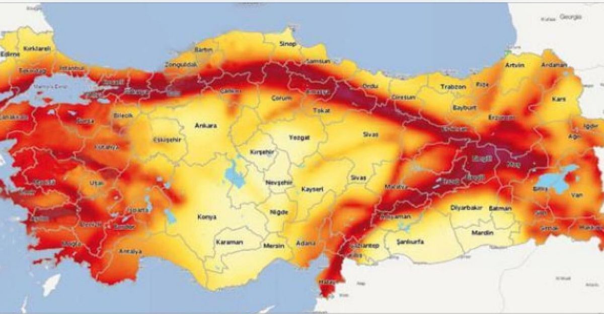
Turkey’s official earthquake hazard maps focus heavily on big, fast-moving faults like the North and East Anatolian Faults. Tuz Gölü has been considered a minor and slower fault, so less emphasis was placed on it when designing buildings or emergency plans.
The new findings suggest the fault is more active than expected, meaning current hazard maps could be underestimating risks for large parts of central Turkey. Changing these maps will require agreement from Turkish and global scientists before safety plans can catch up.
Scientists Leading Change
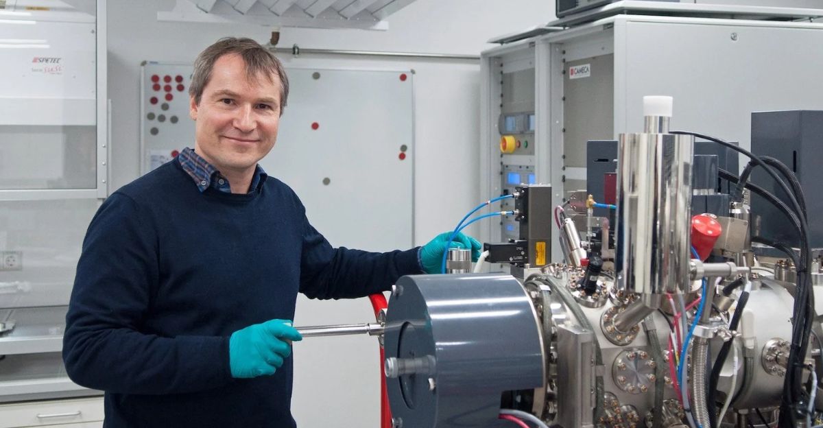
Axel Schmitt from Curtin University led the international team who used new dating methods to rethink the fault’s motion. Researchers from Turkish and European universities collaborated on this work, published in the respected journal Nature Communications Earth & Environment.
Turkey’s government agencies have started reviewing the findings. Recognizing the fault’s real behavior is the first big step towards updating safety rules and preparing the public for earthquake risks.
Rebuilding Earthquake Models
Fixing our understanding of earthquakes in central Turkey means mixing new vertical movement data with old earthquake records and GPS facts. The Tuz Gölü Fault is split into six parts, each with its own characteristics. Scientists are measuring slip rates for each segment to see where the danger is highest.
These updates could lead to better building designs and safer infrastructure tailored to local risks, helping communities prepare for more accurate threats.
Some Experts Remain Cautious
Not all scientists agree fully with the new findings yet. Some say the dating technique might not perfectly match where the fault actually breaks in the rock, or that volcanic effects may affect the results.
Peer reviews are ongoing, and debates like this are part of how science improves our understanding. It shows how tricky it is to read millions-of-years’ worth of Earth movements from ancient lava and rocks.
The Next Steps for Research
The team wants to date lava and study other sections of the Tuz Gölü Fault to see if vertical stretching is common along the entire fault. They’re also checking if other faults in the bigger Alpine-Himalayan belt act the same way.
This could lead to a global rethink of earthquake risks in regions where tectonic plates crash into each other. The big question: how many other faults have we misunderstood?
What This Means for Building Safety
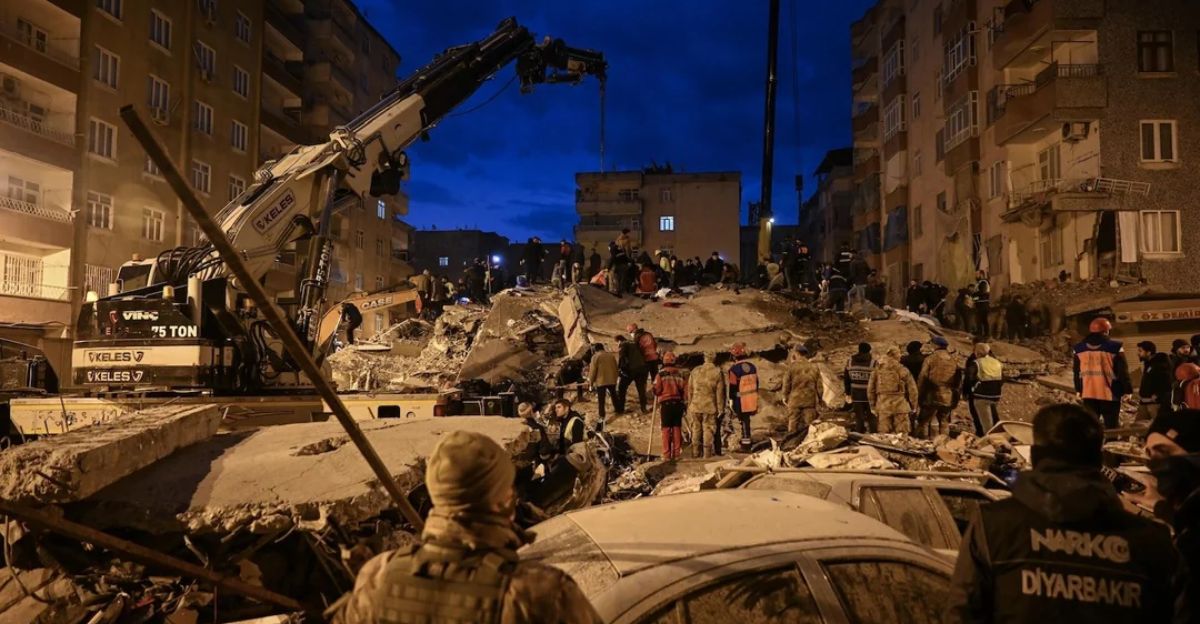
Turkey’s building codes were updated after major earthquakes in 2023, based on the old fault movement models. If the new findings hold true, cities like Aksaray and Niğde may need stricter rules for constructing buildings to withstand stronger earthquakes than previously thought.
This will be costly and challenging but important to save lives. International groups like the United Nations Office for Disaster Risk Reduction are watching closely to help guide safe policies.
A Global Ripple Effect
The discovery has sparked interest across countries along the Alpine-Himalayan belt—from Iran to China. Scientists using similar dating methods are checking their own faults for hidden vertical movements. If many faults turn out to be misread, from Istanbul all the way to Beijing, earthquake hazard maps worldwide will need revising.
Organizations like the International Seismological Centre are sharing data and techniques to respond to this challenge collaboratively.
Environmental and Water Concerns
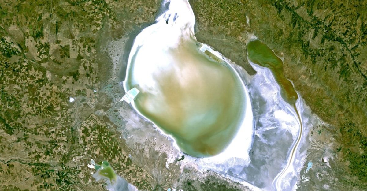
The Tuz Gölü basin hosts Turkey’s largest salt lake, vital for industry and nature. Vertical fault activity affects groundwater and the lake’s water levels. Earthquakes could change underground water flow or pollute wells used by millions.
Climate change is already stressing Turkey’s water supply, so understanding how the fault changes the ground is important for planning and protecting this delicate environment.
A New Generation’s Techniques
This discovery shows how young scientists are using new tools like zircon double-dating to rethink old ideas about earthquakes. Combining geology, chemistry, and paleoseismology (study of ancient quakes) gives a fuller picture than just short-term GPS data.
This approach will likely change how we understand earthquake risks worldwide as we look deeper into Earth’s long history rather than relying on recent data.
Why This Matters
The Tuz Gölü Fault change is more than a scientific update, it shows how even well-established ideas can miss crucial facts. Millions in Turkey and beyond live with underestimated earthquake risks. We must look beyond satellite data alone to truly understand Earth’s hidden forces.
In a world facing climate change and growing cities, getting these details right isn’t just about science, it’s about protecting lives.
Sources:
- Pure dip-slip along the Tuz Gölü Fault Zone – Nature Communications Earth & Environment
- Deep in Turkey, a Fault Is Ripping Open the Ground – Daily Galaxy
- Tuz Gölü Fault Zone – Wikipedia