Dark storm bands are lining up over the Pacific, and western Washington and Oregon are facing a week-long barrage of rain that forecasters warn could push already swollen rivers into significant flooding.
Stakes Rising for the Pacific Northwest
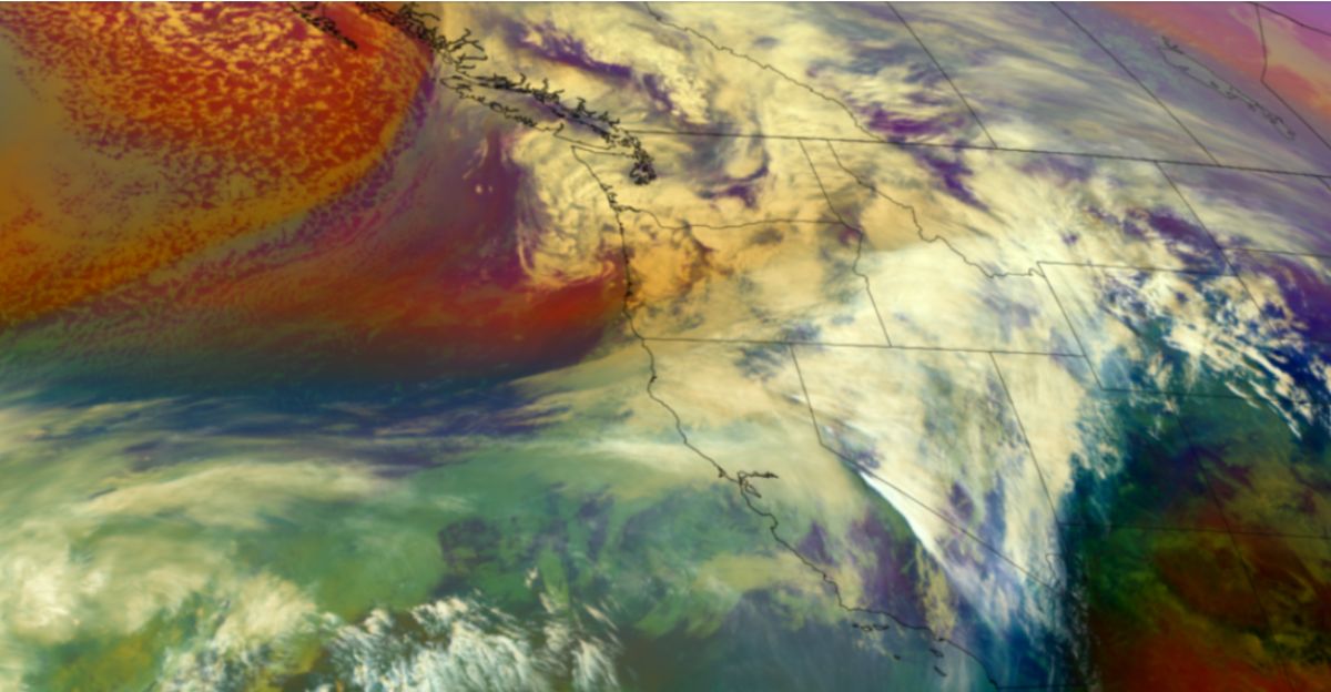
Multiple atmospheric rivers are forecast to strike the region in rapid succession, focusing on the western lowlands and windward slopes of the Cascades. Instead of a single, short-lived system, a series of storms will repeatedly drench the same watersheds, allowing little time for rivers and streams to recede between waves of rainfall.
Hydrologists and meteorologists warn that this pattern sharply increases the risk of larger, more damaging floods. Soils are already saturated and rivers are running high, creating conditions in which additional rain translates quickly into runoff rather than absorption, especially in flood-prone valleys and urban corridors.
A Week of Successive Storms
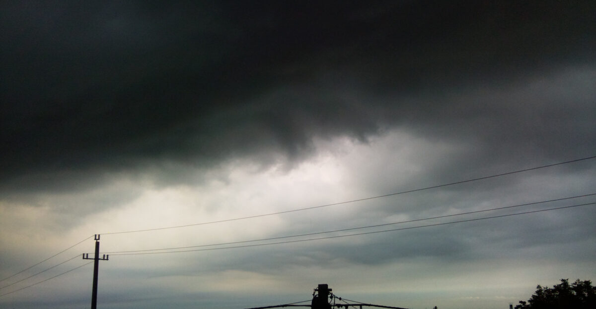
Atmospheric rivers are a familiar part of life in the Pacific Northwest, but the current sequence has drawn particular concern. These long, narrow plumes of concentrated moisture transport large amounts of water vapor from the Pacific Ocean toward the coast, where it is released as heavy rain when it encounters land and mountains.
In this case, three distinct atmospheric river events are expected in close succession. The storms will tap into deep Pacific moisture, setting up several days of near-continuous precipitation over parts of Washington and Oregon. Officials caution that even moderate rainfall rates could quickly drive sharp rises on rivers and streams already under strain.
Storm Timing and Rainfall Totals
Forecasts outline a “triple threat” pattern unfolding over the first full week of December. The first atmospheric river is projected to arrive on December 3, with a second system following on December 5 and a third, stronger event anticipated on December 8.
Across the Washington Cascades and adjacent foothills, combined rainfall totals from the sequence are expected to reach 5 to more than 10 inches over several days. The initial storms will act to “prime” the landscape, saturating soils and swelling tributaries. By the time the third, most intense system comes ashore, the region will have little remaining capacity to absorb additional water.
Forecast discussions indicate that the first event could deliver 2 to 4 inches of rain to Cascade watersheds over a 72-hour period. The second system, though shorter in duration, is expected to add up to an inch in some lowland areas. The third storm may then bring more than 5 inches of rain in roughly three days, significantly magnifying flood concerns as its moisture plume targets ground that is already waterlogged.
Rising Rivers, Infrastructure Strain, and Secondary Hazards
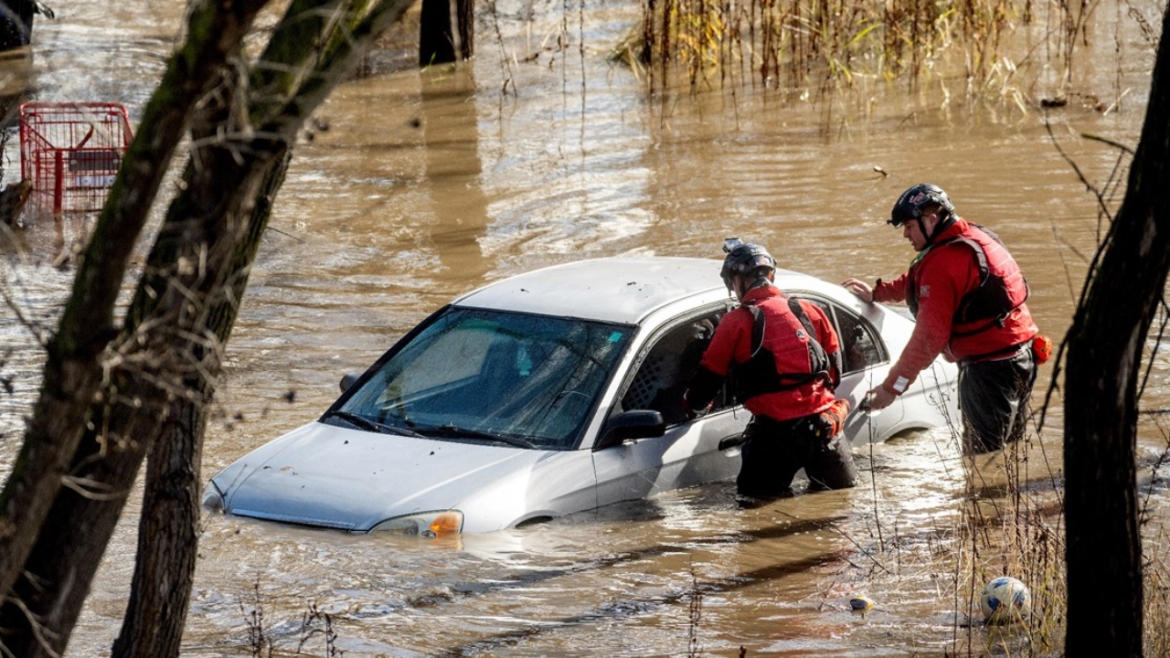
River levels in western Washington and Oregon are already elevated, and forecasters anticipate substantial additional rises as runoff from the Cascades and other upland areas feeds major basins downstream. Mountain catchments that funnel water into large rivers could push some locations toward flood stage, prompting evacuations, road closures, and disruptions to travel and commerce.
The potential impacts extend beyond river channels. Consecutive days of heavy rain can destabilize hillsides, increasing the likelihood of landslides that block highways and isolate communities. Urban areas face the possibility of overwhelmed storm drains and localized street flooding, while saturated soils raise the risk of falling trees and related power outages.
Critical infrastructure — including levees, culverts, and stormwater systems — will be tested by the sustained onslaught. Continuous wet conditions leave little opportunity for inspection or repairs between storms. Local and state agencies are monitoring levees and vulnerable crossings, coordinating responses across emergency operations centers, and preparing high-water vehicles, shelters, and communication plans should evacuation orders become necessary.
Communities on Alert and the Road Ahead
Communities situated along rivers and in low-lying or landslide-prone areas are being urged to take early, practical steps to get ready. Emergency managers recommend assembling basic supplies, moving valuables above potential water levels, reviewing evacuation routes, and signing up for local alert systems. Authorities emphasize that preparing before the heaviest rain arrives can reduce last-minute pressure on emergency services once conditions deteriorate.
Forecasters note that, while confidence is high that multiple atmospheric rivers will strike, there is still some uncertainty about the precise placement of the most intense rain bands. Even a modest shift in where the moisture plume comes ashore could substantially change which river basins face the greatest risk. As a result, officials stress the importance of following day-to-day updates and local statements as the pattern evolves.
For the Pacific Northwest, the incoming week serves as a reminder of the region’s exposure to back-to-back atmospheric rivers and the challenges they pose to both long-standing infrastructure and rapidly growing communities in flood-prone zones. How this sequence unfolds is likely to inform future planning for flood defenses, land use, and emergency preparedness across Washington and Oregon, as residents and officials watch closely to see how river systems, slopes, and cities absorb the strain.
Sources
Center for Western Weather and Water Extremes (CW3E) – AR Update: 3 December 2025 OutlookOrganization: UC San Diego/NOAA-affiliated research centerPublished: December 3, 2025
National Weather Service Seattle Area Forecast DiscussionOrganization: NOAA/National Weather ServicePublished: December 3, 2025
Emerald City Weather – Atmospheric River Storms AnalysisOrganization: Independent Pacific Northwest meteorology sourcePublished: December 2, 2025
AccuWeather – Pacific Northwest December Storm System ForecastOrganization: AccuWeather Professional ServicesPublished: December 4, 2025
Yahoo News/National News Consortium – Atmospheric Rivers 10 Days of RainOrganization: Major news outlet aggregating NWS/CW3E dataPublished: December 4, 2025
National Weather Service Hydrologic Outlook / Newsweek ReportOrganization: NOAA/NWS with Newsweek verificationPublished: December 4, 2025 (released by NWS December 3)