A powerful nor’easter is currently sweeping across the Eastern United States, triggering winter weather alerts for millions as the holiday travel season reaches its peak.
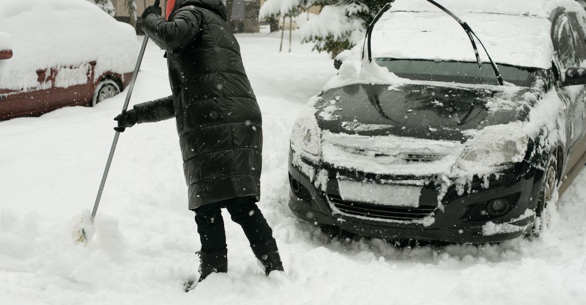
From the Ohio Valley to Maine, residents are facing a dangerous mix of heavy snow, ice, and rain. Major airports and highways are already experiencing significant disruptions.
Arriving during one of the busiest travel weeks of the year, the storm threatens to strand travelers and disrupt holiday plans nationwide.
The Scale Becomes Clear
More than 75 million Americans are now under winter weather alerts that span multiple states and regions.
The nor’easter is intensifying as it tracks northeastward along the densely populated I-95 corridor, from Washington, D.C., to Boston and beyond.
Forecast centers have issued blizzard watches and winter storm warnings across the affected zone. A state of emergency has already been declared in parts of New Jersey, signaling the severity officials anticipate in the coming hours.
The I-95 Corridor Under Siege
The I-95 corridor—one of the most densely populated regions in the United States, home to tens of millions of people—faces the brunt of this nor’easter’s mixed precipitation threat.
A razor-sharp rain-snow line is expected to pivot across the region, creating a narrow band where ice accumulation poses extreme hazards. Northern New Jersey, the mid-Hudson Valley, and Connecticut are particularly vulnerable to ice buildup.
The Appalachian region, particularly West Virginia and Virginia, is expected to experience up to a quarter-inch of ice accumulation, posing a threat to power infrastructure and travel safety.
Holiday Travel Already Strained
The timing could not be worse. More than 80 million Americans were expected to travel for the Thanksgiving holiday period, with tens of millions more traveling through early December.
A preceding Midwest winter storm already triggered roughly 12,000 to 15,000 delayed flights and around 1,000 to 1,400 cancellations in a single day, overwhelming major hubs such as Chicago O’Hare and several East Coast airports.
Airlines and road networks are already stretched thin. This nor’easter arrives when the system has the least capacity to absorb additional disruptions.
The Nor’easter Officially Arrives
The nor’easter is now confirmed to be impacting the Eastern Seaboard with classic characteristics: northeast winds, heavy precipitation, and a well-defined low-pressure system tracking up the coast.
Snow totals of 5 to 8 inches are forecast for parts of New York, Vermont, New Hampshire, and Maine through Wednesday morning. The system is bringing rain to lower elevations and coastal areas while dumping heavy snow inland.
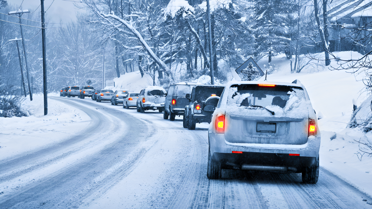
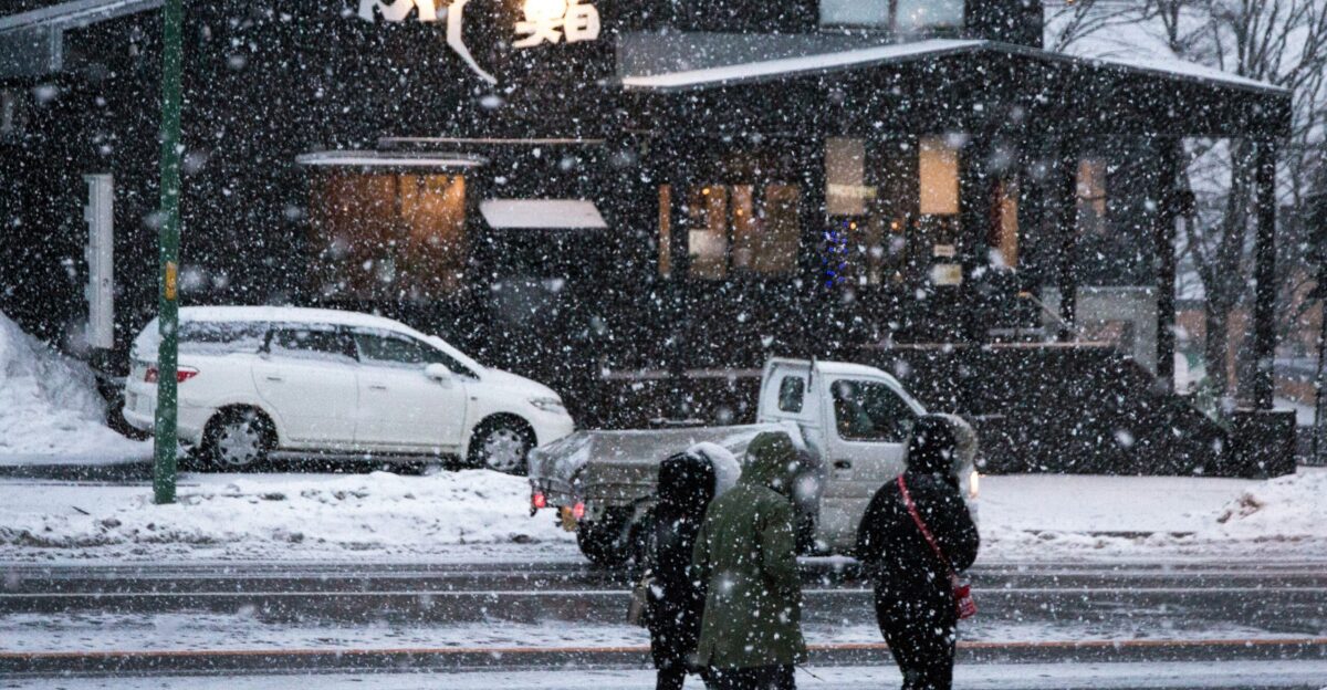
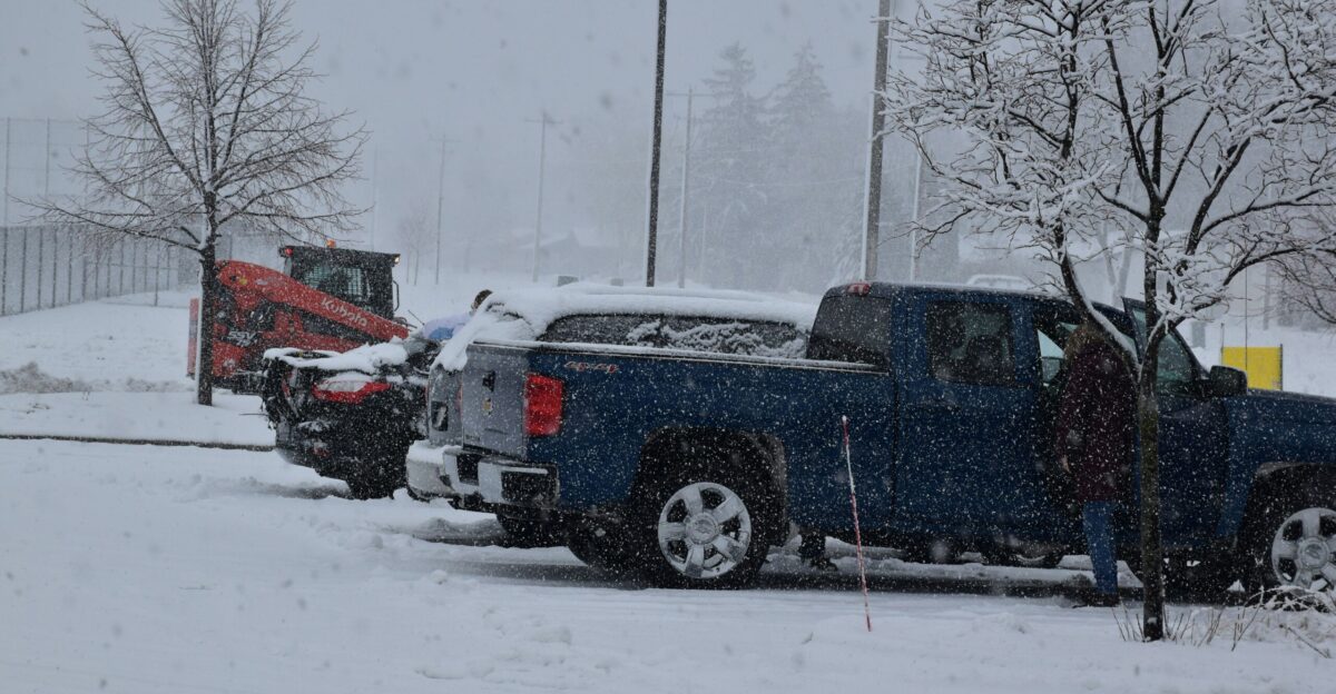
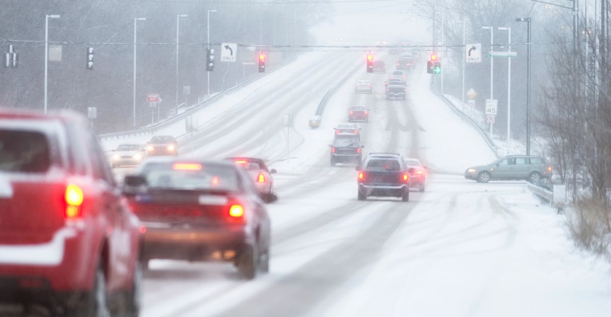
Hundreds of accidents have already been reported from Kentucky to Massachusetts as conditions deteriorate rapidly.
Dangerous Roads and Rescue Operations
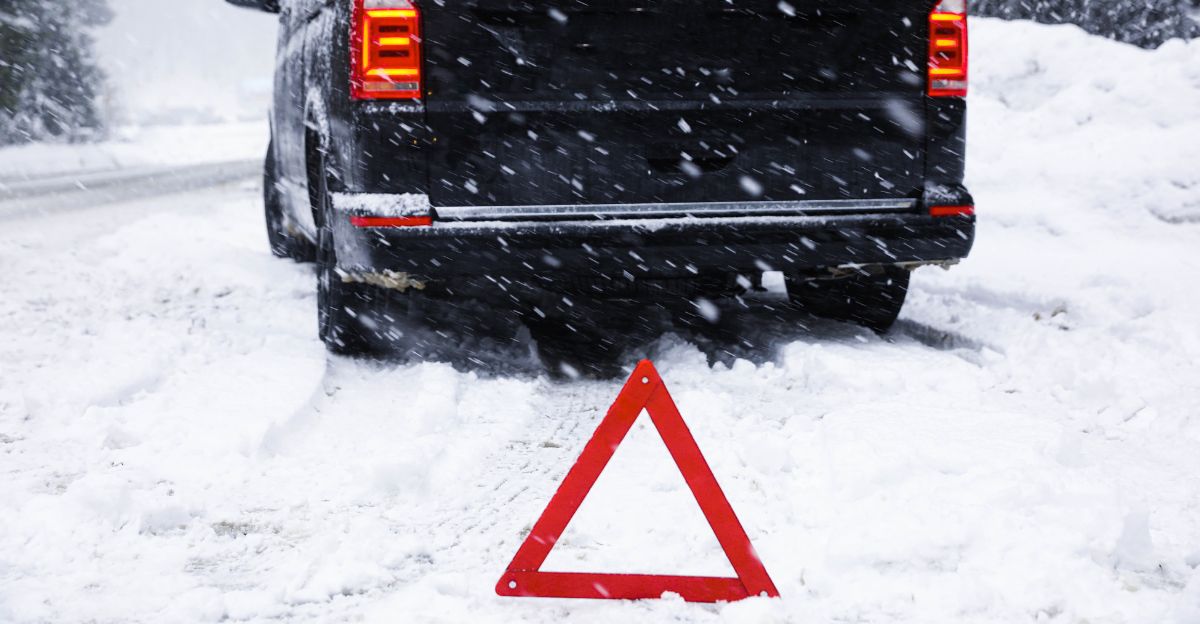
Treacherous driving conditions have spawned multiple multi-vehicle pile-ups and accidents across the region. In West Virginia, a semi-truck cab dangled precariously from an icy bridge about 100 feet above the ground for more than five hours before rescue crews extracted the driver using ropes.
In Connecticut, a blue semi-truck lost control on Interstate 84, jackknifing and flipping over the guardrail. These dramatic incidents underscore the extreme hazard posed by ice and snow on major highways during the storm’s peak.
Communities in the Direct Path
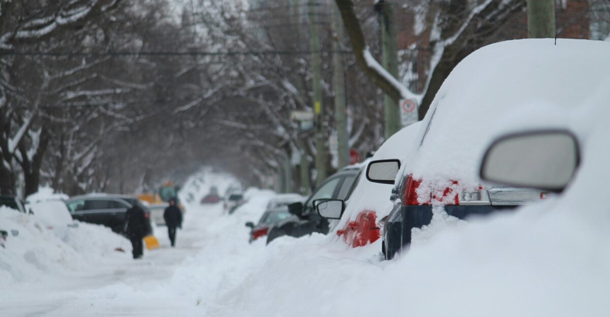
Residents in the heaviest snow bands are likely to face the most severe impacts. The Western North Carolina mountains, still recovering from Hurricane Helene in 2024, now face icy winter conditions that could further strain already damaged infrastructure.
Appalachian communities face an elevated risk of prolonged power outages, with widespread outages possible as ice-laden tree limbs and power lines fail.
Vulnerable populations, including the elderly and those without backup heating, face particular danger during the arctic cold that will follow.
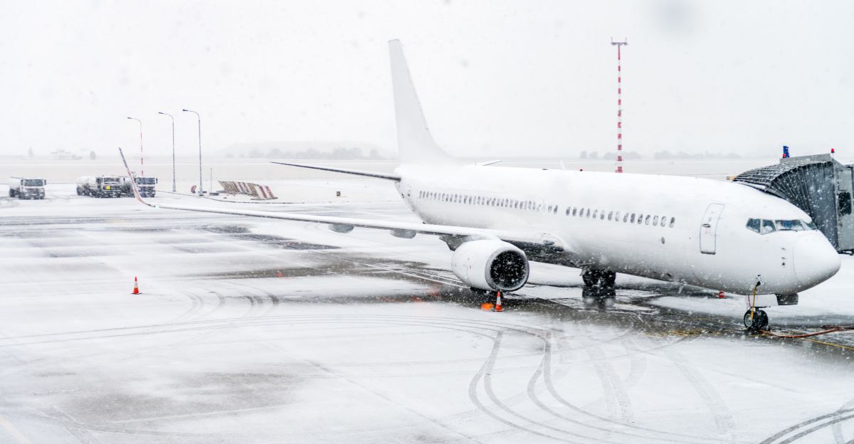
Airport Chaos Spreads Nationwide

Major East Coast airports, including Reagan National (Washington, D.C.), Philadelphia International, Newark Liberty, LaGuardia (New York), and Boston Logan, are experiencing severe operational disruptions.
Thousands of flights are delayed or canceled across these five hubs alone. Airlines are implementing ground stops and reducing schedules as visibility drops and runways become hazardous.
The ripple effect extends nationwide, as connecting flights and crew repositioning create cascading delays across the entire U.S. air network during peak holiday demand.
The Broader Climate Pattern
A La Niña climate pattern is historically associated with more frequent nor’easters along the East Coast during winter months.
The National Oceanic and Atmospheric Administration (NOAA) indicates the U.S. may shift toward neutral conditions around the start of the new year, potentially reducing the frequency of such storms later in the season.
However, for the remainder of December, forecasters expect additional coastal systems to develop. This nor’easter may be the first of several significant winter storms to impact the region before winter’s end.
The Arctic Aftermath
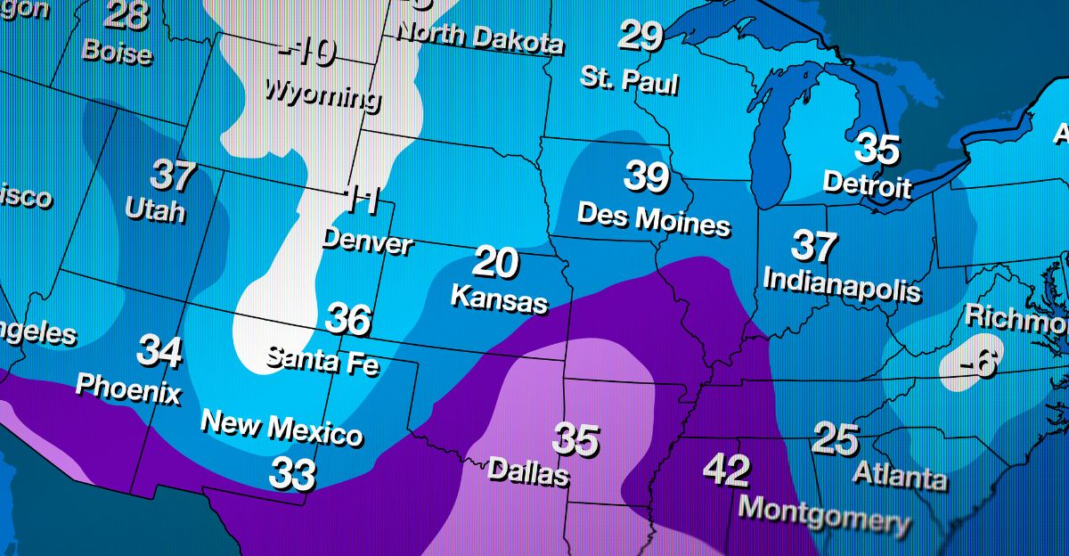
Behind the nor’easter lies an even more dangerous threat: a massive arctic air mass set to plunge into the East Coast by Thursday morning.
Actual air temperatures are forecast to drop well below zero in parts of the Upper Midwest, including Des Moines and Sioux Falls, threatening or breaking daily records. Chicago to Baltimore, and even Portland, Maine, could see record-low temperatures by Friday.
This arctic surge will create a freeze-thaw cycle that produces black ice on roads even after precipitation stops, extending the travel hazard window well beyond the storm’s passage.
Emergency Officials Mobilize

New Jersey Governor Phil Murphy declared a state of emergency beginning at 5 a.m. ET on Tuesday, activating emergency response protocols and pre-positioning resources in several counties.
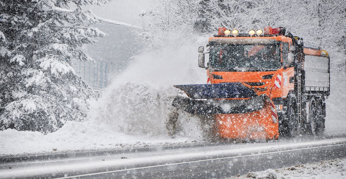
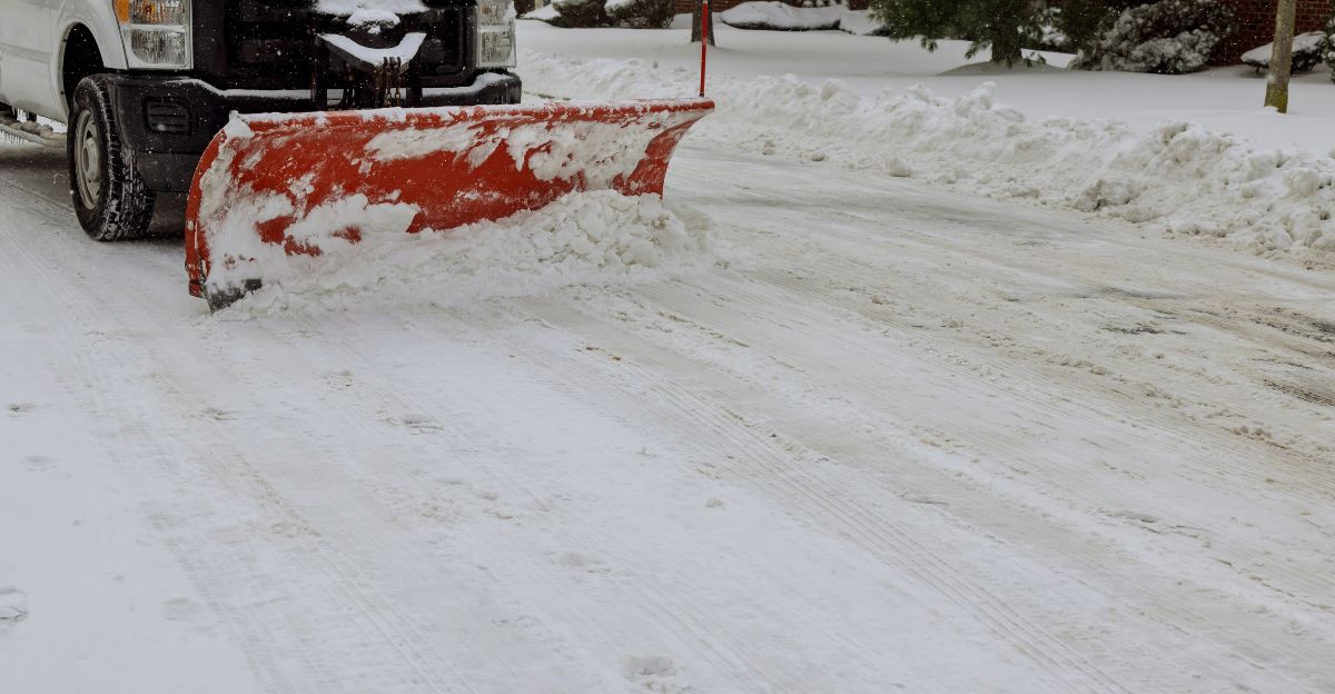
State highway departments across the Northeast have deployed snow plows and salt trucks around the clock to treat roads.
The National Weather Service has issued winter storm warnings and blizzard watches across multiple states. Emergency management agencies are urging residents to avoid travel, stock supplies, and prepare for potential power outages and extended road closures.
Forecast Center Warnings Escalate

The FOX Weather Forecast Center issued an explicit warning: “Even small accumulations, even a quarter of an inch of ice, can be extremely dangerous for drivers and pedestrians alike.” This stark advisory highlights the specific hazard posed by ice in densely populated areas, where millions commute daily.
The National Weather Service echoes this concern, emphasizing that ice-covered roads and sidewalks create slip-and-fall risks for pedestrians and loss-of-control hazards for vehicles.
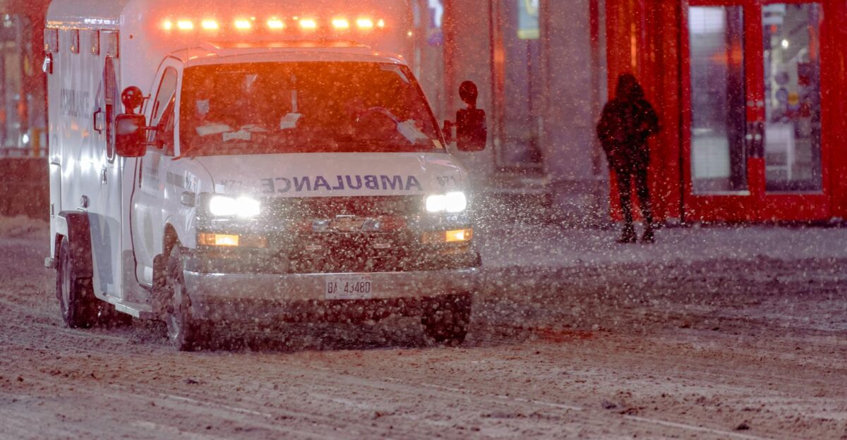
Public health officials are preparing for an increase in emergency room visits related to weather-related injuries.
Supply Chain and Infrastructure Strain

Power utilities across the Appalachian region are on high alert for widespread outages caused by ice-laden tree limbs and power lines. Utility companies have pre-positioned repair crews and equipment to respond to outages as quickly as possible.
However, the combination of heavy ice and arctic cold may overwhelm response capacity. Hospitals, emergency services, and water treatment facilities have activated backup power systems.
Fuel suppliers and grocery distributors are accelerating deliveries ahead of the storm to help prevent shortages during potential road closures.
Commuter Outlook Darkens
Thursday morning’s commute will be particularly hazardous, as the freeze-thaw cycle creates black ice on roads that were treated the previous day. Meteorologists warn that even roads that appear dry may have slick patches where moisture has refrozen overnight.
Public transit agencies are preparing for reduced service due to weather-related mechanical issues and reduced ridership.
Employers across the region are encouraging remote work and flexible schedules. Schools in affected areas are monitoring conditions and preparing for potential closures or delayed openings.
What Comes Next?

As this nor’easter moves offshore by Thursday, forecasters are already tracking the potential for additional winter systems to develop in the coming weeks.
The La Niña pattern and positioning of the Arctic air mass suggest that the Northeast may experience a more active winter than average. Travel disruptions could persist through the holiday season if multiple storms develop in succession.
Residents and travelers should prepare for an extended period of winter weather challenges and plan accordingly for holiday commitments.
Political and Policy Implications
State and federal emergency management agencies have activated standard response protocols.
The storm underscores ongoing debates about climate resilience, infrastructure investment, and emergency preparedness in densely populated coastal regions.
While major winter storms can lead to requests for federal disaster assistance, the full extent of damage and any potential congressional action remain to be determined.
International Travel Disruptions
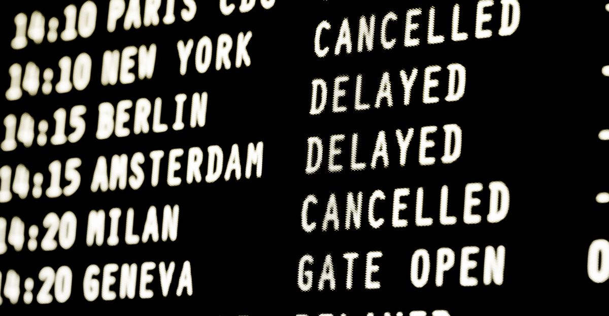
The nor’easter’s impact extends beyond domestic travel, affecting international flights at major East Coast hubs. Passengers traveling to and from Europe, the Caribbean, and Latin America face significant delays and cancellations.
Airlines operating transatlantic routes are rerouting flights through alternative hubs or delaying departures. International travelers are advised to contact airlines directly and consider travel insurance. The disruption highlights the vulnerability of concentrated air traffic infrastructure to regional weather events.
Environmental and Infrastructure Concerns
The combination of heavy snow, ice, and arctic cold poses risks to aging infrastructure across the Northeast. Water mains may freeze and rupture in areas experiencing record-low temperatures.
Natural gas demand is expected to surge as heating systems operate at full capacity, potentially straining supply networks.
Environmental concerns include salt runoff from de-icing operations contaminating groundwater and surface water supplies. Ecosystems already stressed by climate variability face additional pressure from extreme weather swings.
Generational Shifts in Winter Preparedness

Younger and less experienced drivers tend to have higher crash rates, and limited experience driving in snow and ice can make winter storms especially hazardous for them.
Social media commentary during early‑season storms often notes that people “forget how to drive in the snow,” reflecting anxiety about driver behavior in the first major winter events.
In response, transportation and emergency management agencies regularly promote winter driving education and preparedness campaigns—particularly for young and novice drivers—to improve safety across all age groups.
The Broader Reckoning
This nor’easter represents more than a single weather event—it signals the vulnerability of modern American infrastructure and society to extreme weather disruptions.
With more than 75 million people under winter weather alerts and holiday travel severely disrupted, the storm exposes how interconnected systems (power, transportation, supply chains) can cascade into widespread disruption.
As climate patterns shift and extreme weather becomes more frequent, the nation faces critical questions about resilience, preparedness, and adaptation. The coming weeks will reveal whether current emergency response systems can adequately protect vulnerable populations and restore normalcy.
Sources:
ABC News coverage December 2–3, 2025
FOX Weather Forecast Center advisories December 2025
National Weather Service winter storm warnings and blizzard watches
National Oceanic and Atmospheric Administration (NOAA) La Niña and climate pattern analysis
New Jersey Governor’s Office emergency declarations December 2, 2025
U.S. Federal Emergency Management Agency (FEMA) coordination protocols
Major East Coast airport operational reports December 2025