For decades, satellites have shown Turkey’s Tuz Gölü Fault Zone sliding sideways at a rate of 4.7 millimeters per year. Models predicted strike-slip motion.
But beneath central Anatolia’s plains near Lake Tuz, something different was happening. Ancient lava flows, fractured over 100,000 years, reveal the true story.
Satellites, limited to recent decades, missed what geology revealed: the ground was moving vertically, not horizontally.
The Setting
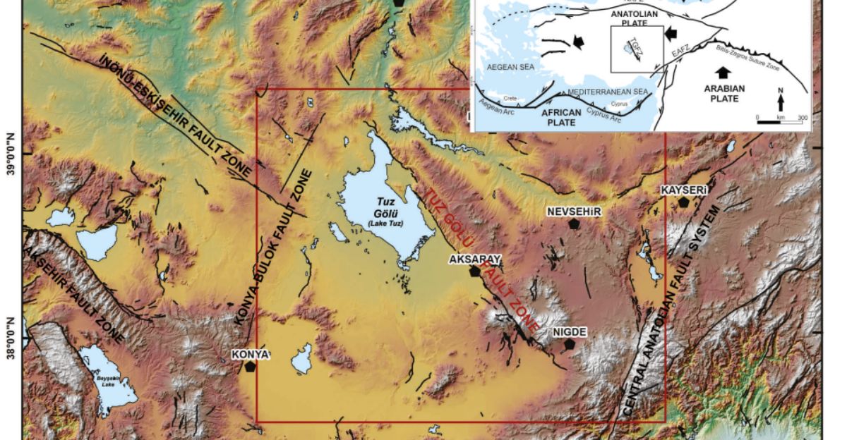
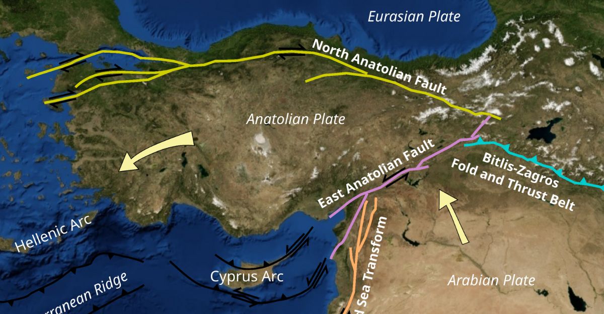
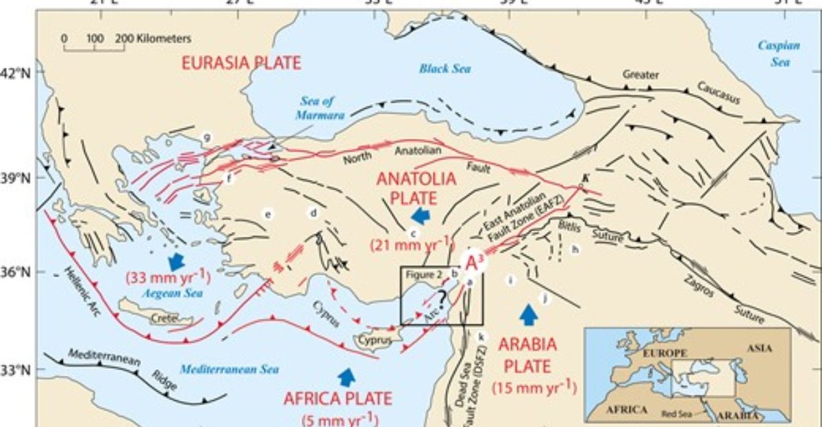
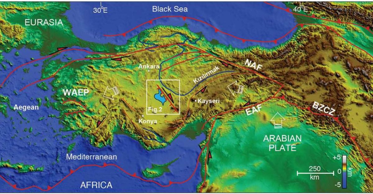
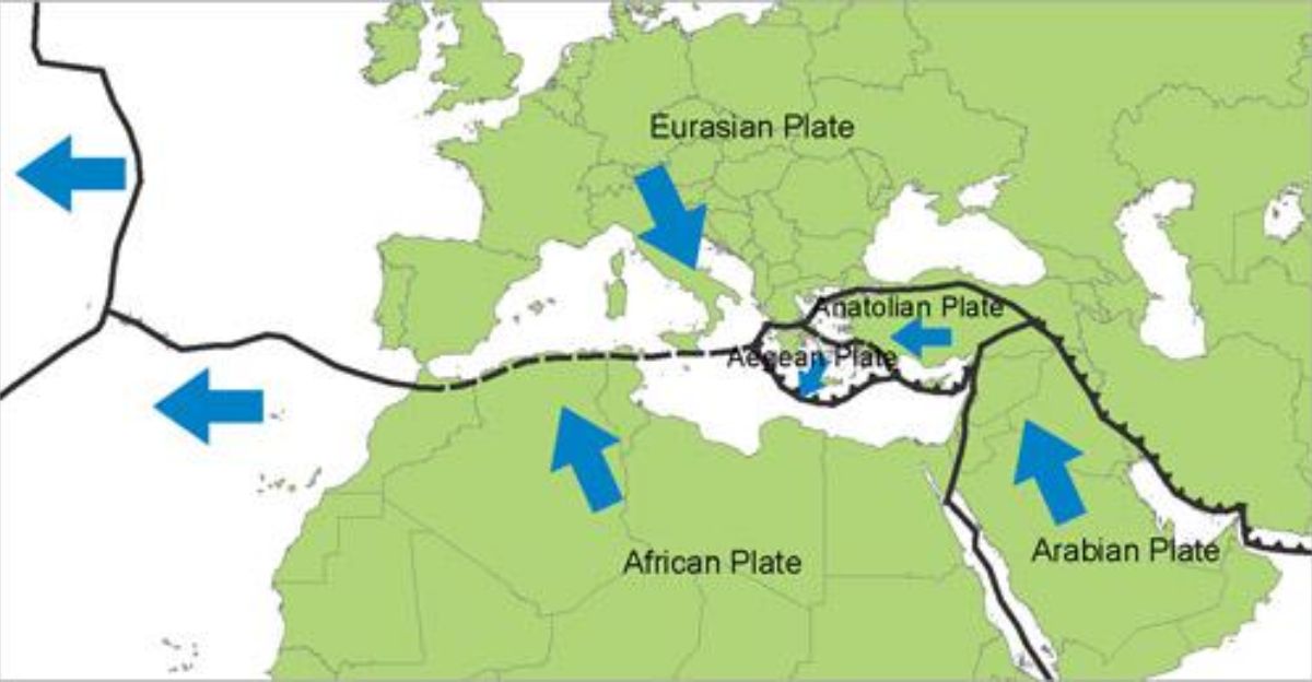
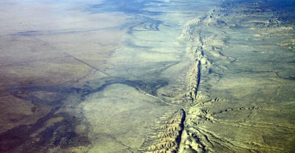
The Tuz Gölü Fault Zone cuts through central Anatolia, where the Eurasian, Arabian, and African continental plates converge. Turkey sits at this geological crossroads, experiencing extreme crustal instability.
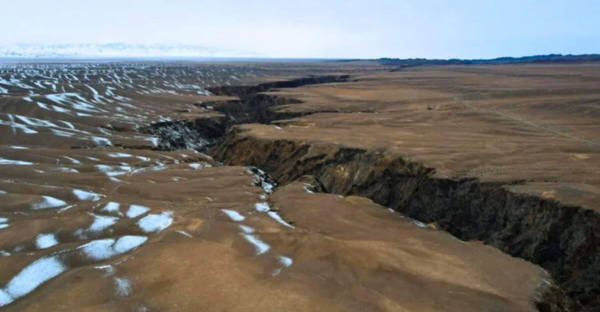
Lake Tuz—a salt lake 105 kilometers northeast of Konya—occupies a tectonic basin created by millions of years of stretching.
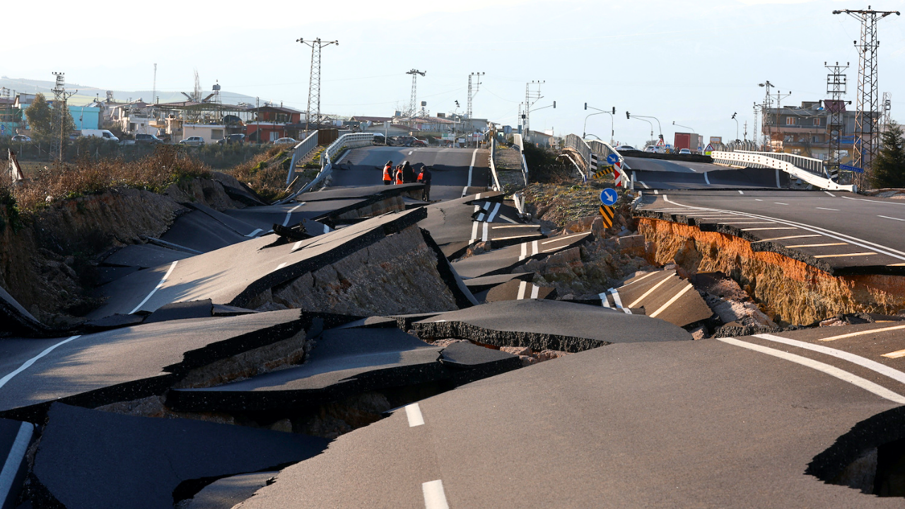
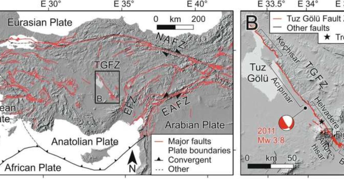
The fault extends nearly 200 kilometers, comprising multiple segments. Recent earthquakes have masked dramatic geological activity that has been happening slowly underground.
The Confidence Problem
Geologists confidently classified the Tuz Gölü Fault as right-lateral strike-slip, fitting the “Anatolian tectonic escape” model.
This model explained how the Anatolian plate, squeezed between the Arabian and Eurasian blocks, moved westward via lateral-motion faults.
GPS networks seemed to confirm this picture—they detected sideways movement but showed no significant vertical motion.
Scientists had long believed this assumption, incorporating it into seismic hazard maps. Nobody expected this 200-kilometer fault to behave differently.
Digging Into Deep Time
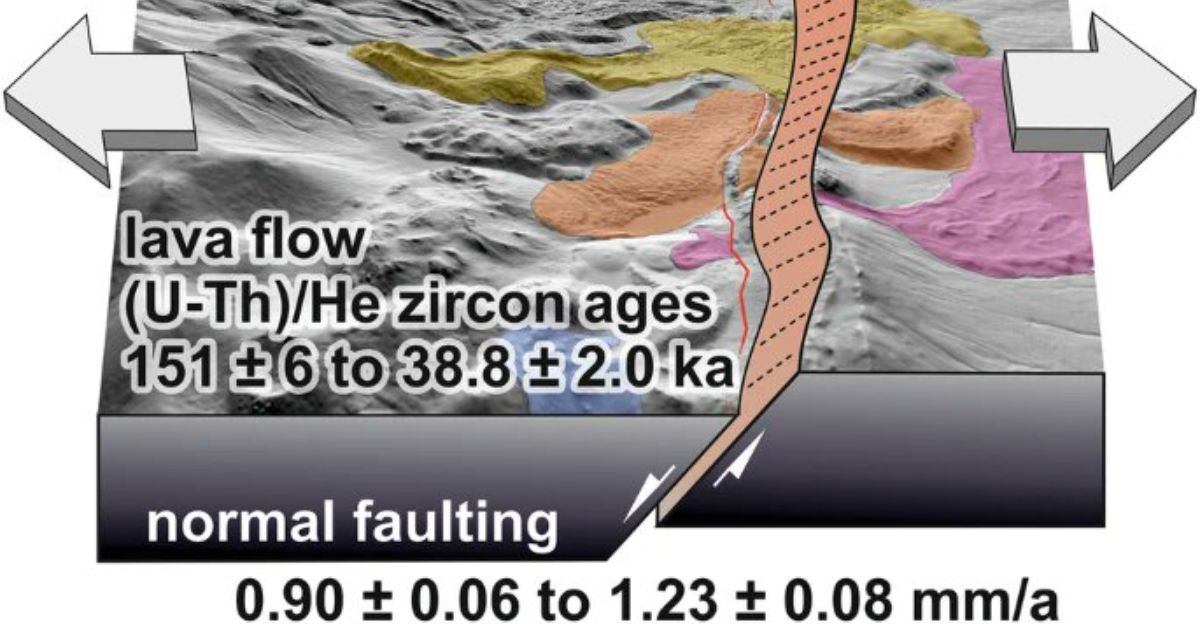
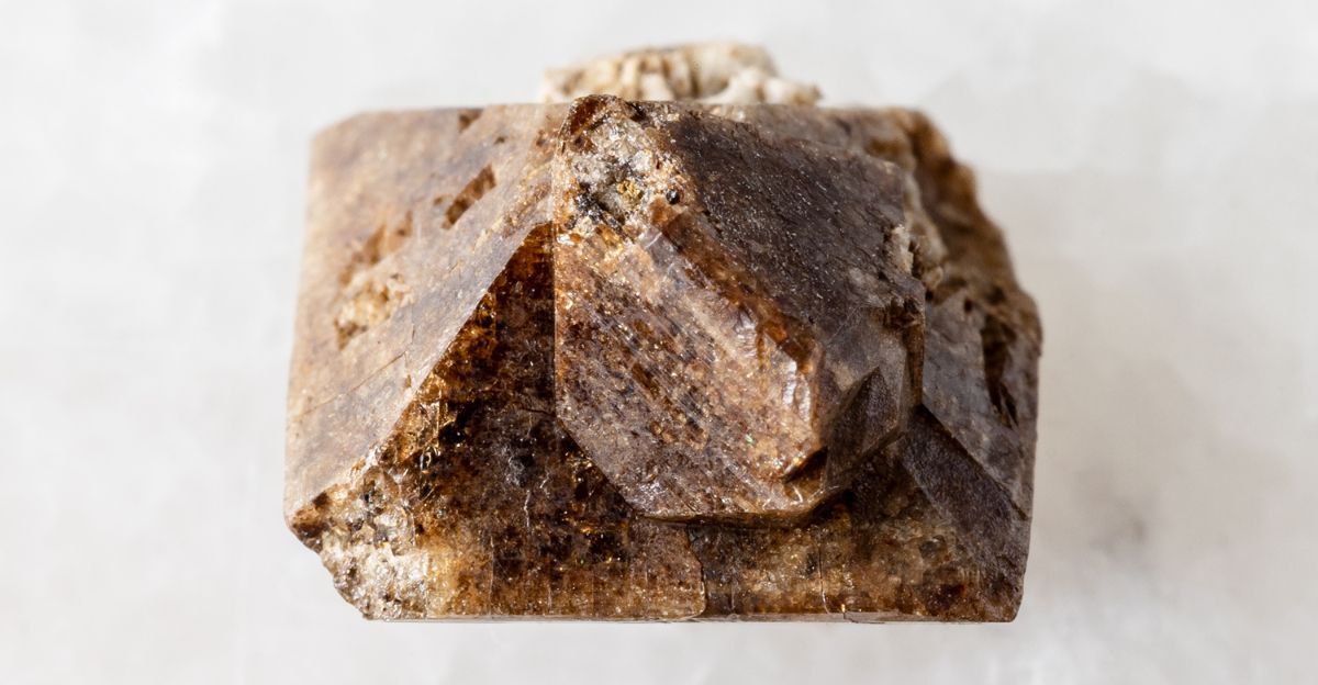
The answer lay in stone, not satellites. Professor Axel Schmitt’s team at Curtin University selected four Pleistocene lava flows from Hasandağ, a dormant volcano, sliced vertically by the fault.
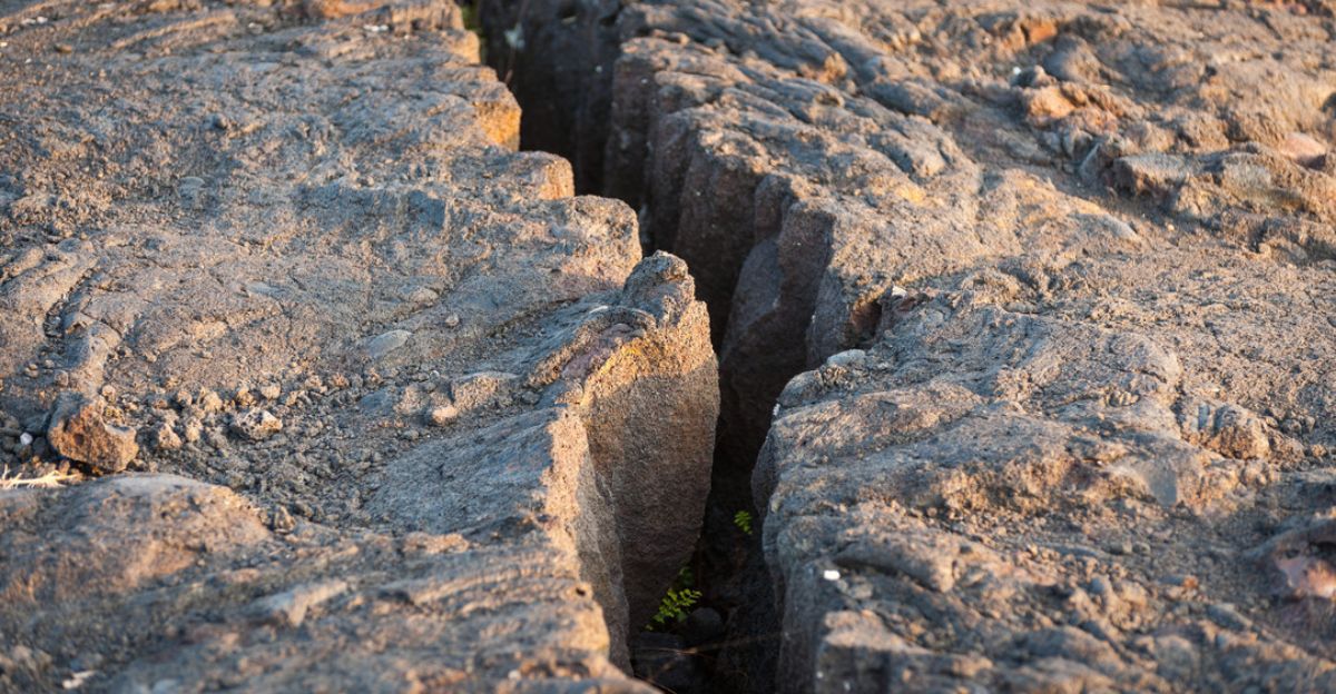
These flows are dated 151,000 to 38,800 years old—old enough to record tectonic motion but young enough for precise dating. Normal faults separate the ground as they open vertical gaps.
The team predicted that if vertical rupture caused the offset, blocks would shift up and down but stay aligned left to right.
Vertical, Not Lateral
Using zircon double-dating (combining uranium-thorium and helium isotope measurements), researchers measured vertical displacement rates with extraordinary precision. Results showed that the Helvadere segment moved vertically by 0.90 to 1.23 millimeters per year. Strike-slip motion?
Nearly zero. The fault ripped Earth’s crust open vertically through normal faulting—opposite to what decades of models predicted.
Nature’s November 2025 publication confirmed the Tuz Gölü Fault as a normal (extensional) fault, overturning decades of geological classification.
Why Central Anatolia Matters
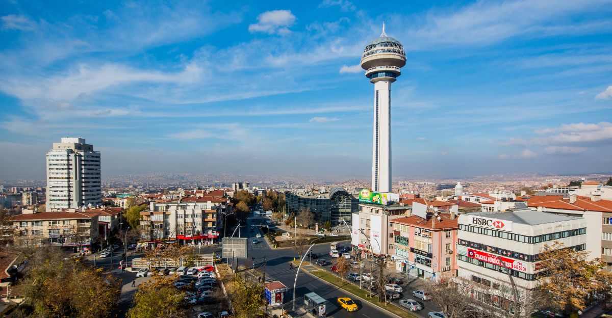
Central Anatolia is home to approximately 80 million people across Turkey’s inland plateau. Major cities—Ankara (capital), Konya, Aksaray, Kayseri—sit in or near the seismically active zone.
The region contains critical infrastructure, including factories, farms, roads, and natural gas storage facilities. Lake Tuz produces over 60 percent of Turkey’s salt through active mining.
Any error in assessing seismic hazard can directly affect millions of lives and billions of dollars in economic value.
A Volcano and the Fault
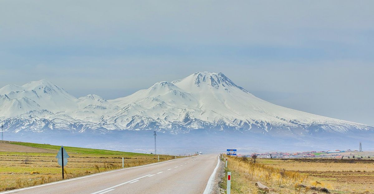
The Helvadere segment cuts through Mount Hasan? volcanic complex, a dormant stratovolcano with an active magma chamber.
Geological surveys detected volcanic vents and crustal seismic anomalies indicating active magma systems. A large earthquake—magnitude 5.8 to 6.8—could release subsurface stress and destabilize the magma chamber.
The vertical displacement of 1.23 millimeters per year causes the magma reservoir to approach critical failure over thousands of years. The fault’s quiet seismic history masks this underlying hazard.
The Model’s Blind Spot
GPS networks excel at detecting horizontal motion but struggle with slow vertical deformation.
Contemporary GPS networks resolve horizontal displacements of a few millimeters per year but often miss gradual vertical separations of less than one millimeter per year. Satellites track position changes over months and years—they cannot access records spanning 100,000 years.
Schmitt’s team calculated that 1.23 mm/year over 100,000 years creates 123 meters of vertical separation—a dramatic displacement that satellites observing decades would completely miss.
Zircon: Nature’s Atomic Clock
Zircon crystals (silicon dioxide minerals) form in magma and incorporate uranium atoms. Uranium decays into lead at a known rate.
Measuring uranium-lead isotope ratios, along with helium decay, enables researchers to calculate crystallization dates with extraordinary accuracy. The CA-ID-TIMS technique yields precision to 0.1 percent.
When faults fracture and displace lava flows containing zircon, the crystals keep their original ages but shift position. Dating crystals from different flow levels reveals the extent of vertical separation and the corresponding timespan.
4.7 mm/Year Becomes Zero
GPS models predicted that the fault should slide laterally at a rate of 4.7 millimeters per year. Lava-flow data revealed the opposite: strike-slip motion was negligible—essentially zero. Instead, the fault opened vertically at a rate of 0.9-1.2 mm/year.
This is not minor. GPS models were off by roughly 75 percent in magnitude and completely wrong about direction.
This suggests the foundational “tectonic escape” model—Anatolia migrating west through lateral faulting—needs revision, especially in central Anatolia, where extensional normal faulting dominates.
Quiet on the Surface, Busy Beneath
The Tuz Gölü Fault evaded detection because it produced few recent earthquakes. Unlike Turkey’s famous North Anatolian Fault (devastating 1999 earthquakes), the Tuz Gölü zone experienced few major quakes historically.
Networks have recorded magnitude 4–5 earthquakes, but nothing catastrophic has occurred recently.
Paleoseismic studies have found only a handful of large earthquakes over the past 31,000 years, with recurrence intervals of around 9,000–10,000 years.
Yet this apparent quiet masked relentless deep crustal motion: millimeter by millimeter, strain accumulating across geological timescales.
Reclassifying the Fault
The discovery forced reclassification of the entire Tuz Gölü Fault from strike-slip to normal faulting—not merely academic. Normal faults produce different earthquake rupture patterns than strike-slip faults.
Normal ruptures propagate vertically, with blocks moving apart at angles of 45–60 degrees, generating strong vertical ground motion. Strike-slip ruptures propagate horizontally, shearing blocks sideways, generating horizontal motion.
Buildings designed for strike-slip earthquakes may fail under normal-faulting earthquakes. Central Anatolia’s seismic design codes likely require a complete reevaluation.
The Tectonic Escape Model Under Scrutiny
The discovery challenges the Anatolian tectonic escape model, which has dominated geology since the 1970s. The model explains how Arabia’s collision with Eurasia squeezes the Anatolian plate westward—like squeezing a watermelon seed.
Strike-slip faults accommodate this escape. But if the Tuz Gölü Fault—a major 200-kilometer structure—is primarily extensional, it suggests east-west crustal extension, not westward escape. The model may be incomplete.
Perhaps Anatolia simultaneously escapes laterally while extending internally, requiring a recalibration of tectonic models.
The Helvadere Segment’s Hazard
Among multiple segments, the Helvadere segment, where researchers sampled lava flows, shows the highest seismic risk.
Paleoseismic evidence and stream-gradient analysis suggest that it accumulates stress more rapidly than adjacent segments. Structural calculations predict earthquakes with magnitudes of 6.8–7.0—significant, damaging events.
Given recurrence intervals spanning thousands of years and roughly 5,500 years since the last major rupture, the Helvadere segment has accumulated elastic strain for millennia. This newly recognized vertical-slip rate updates earthquake probability estimates in national seismic hazard maps.
Open Questions
The discovery raises fundamental questions: How many “quiet” faults worldwide face misclassification? How many zones incorrectly mapped as strike-slip belong in normal or reverse categories?
If a 200-kilometer fault in a seismically active region evaded correct classification for decades despite dense GPS coverage, what does this reveal about satellite-based fault monitoring reliability?
Conversely, do long-term geological data—such as volcanic deposits, displaced layers, and ancient surfaces—outperform modern technology in revealing tectonic motion? Research suggests fundamental geological detective work may surpass high-tech remote sensing.
Emerging Research & Regulatory Implications
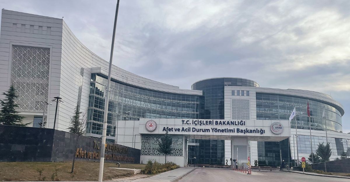
Following the November 2025 publication, Turkish seismic hazard agencies and the Disaster and Emergency Management Authority (AFAD) reassess central Anatolia’s earthquake risk maps.
The findings warrant updates to building codes and infrastructure design. Researchers investigate whether other central and eastern Anatolian faults exhibit hidden extensional behavior.
International teams apply zircon double-dating to other faults that have been historically classified as strike-slip. Natural gas storage facilities near Lake Tuz require new hazard assessments. Insurance companies review regional risk models.
Ripple Effects Across Geosciences
The zircon dating methodology opens avenues across adjacent fields. Paleoseismologists now date and quantify ancient earthquake fault motion with greater precision.
Volcanic hazard assessment improves: researchers quantify how fault stress accumulation affects adjacent magma systems. Salt mining operations at Lake Tuz enhance understanding of subsurface deformation.
Carbon capture and storage projects benefit from detailed fault characterization, preventing leakage. Understanding which faults actively extend versus shear proves crucial for predicting subsurface fluid flow pathways.
Public Reaction and Awareness

The discovery generated considerable interest in Turkish and international science media, reaching millions. Social media highlighted both scientific achievement and the human angle: millions live above unrecognized seismic hazards.
In Turkey, where the devastating 1999 İzmit earthquake killed over 17,000 people and recent seismic activity remains vivid, findings resonated as reminders of geological unpredictability.
GPS technology, despite its sophistication, failed to detect the true behavior of this fault—a humbling reminder that modern instruments have limitations.
Lessons from Reclassified Faults
The Tuz Gölü discovery lacks precedent. California’s San Andreas Fault, long understood as purely strike-slip, revealed significant vertical (contractional) motion, complicating rupture models. Alaska’s Denali Fault similarly exhibited unexpected deformation over longer timescales.
Turkey’s North Anatolian Fault exhibits variable rupture behavior, combining strike-slip and extensional segments—this recognition took decades. These precedents suggest major faults often prove more complex than initial classifications indicate.
The Tuz Gölü case illustrates why long-term geological records—such as lava flows, displaced strata, and paleoseismic evidence—remain indispensable, despite the advent of satellite technology.
Geological Time Trumps Sensor Time

GPS and satellites are powerful, but cannot see 100,000 years—only recent decades. The Tuz Gölü Fault starkly revealed this limitation.
A 200-kilometer structure ripped Earth’s crust open vertically, yet satellite models incorrectly described sideways sliding. The discovery underscores a fundamental principle: geological understanding requires an understanding of geological timescales. Rocks do not lie—they operate on timescales exceeding human lifespans and instrumental records.
For 80 million central Anatolians, implications prove sobering: a fault they thought they understood does something entirely different. Seismic hazard assessment requires a comprehensive reevaluation.
Sources:
Daily Galaxy, November 29, 2025
Curtin University press release, April 30, 2025
Nature Communications Earth & Environment, November 2025
Structural geology literature
Geology journal articles, 2020-2025
Wikipedia, Extensional Fault article