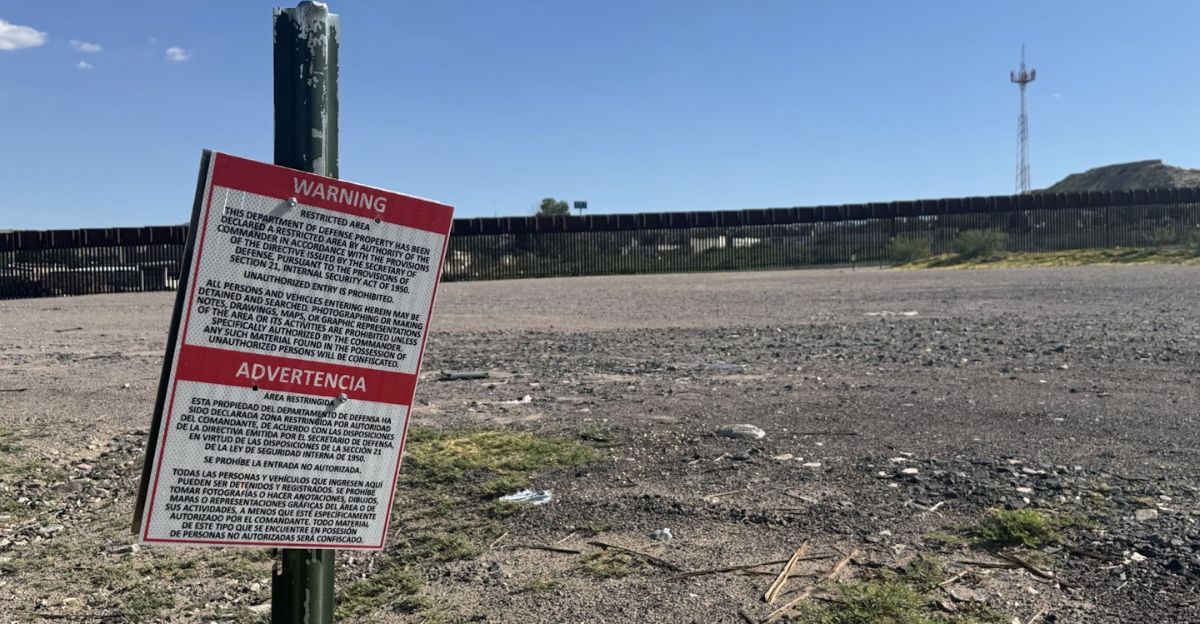
On November 17, 2025, Pentagon contractors placed six warning signs on Playa Bagdad, a beach in Mexico roughly 12 miles south of the US border. The signs, reading “Warning: Restricted Area” and “Department of Defense Property” in English and Spanish, declared the location off-limits under the commander’s orders. Within hours, Mexican Navy personnel discovered the markers on sovereign Mexican territory and removed all six, triggering a diplomatic crisis that exposed fundamental challenges in managing a border shaped by an unpredictable natural force.
The Discovery and Initial Confusion
When Mexico’s Foreign Affairs Ministry demanded answers about the unauthorized signs, confusion reigned. The Pentagon’s explanation arrived through the US Embassy in Mexico: contractors tasked with marking National Defense Areas as part of the Trump administration’s 2025 border security initiative had misread the boundary. Changes in water depth and topography of the Rio Grande had altered their perception of where the international line actually lay.
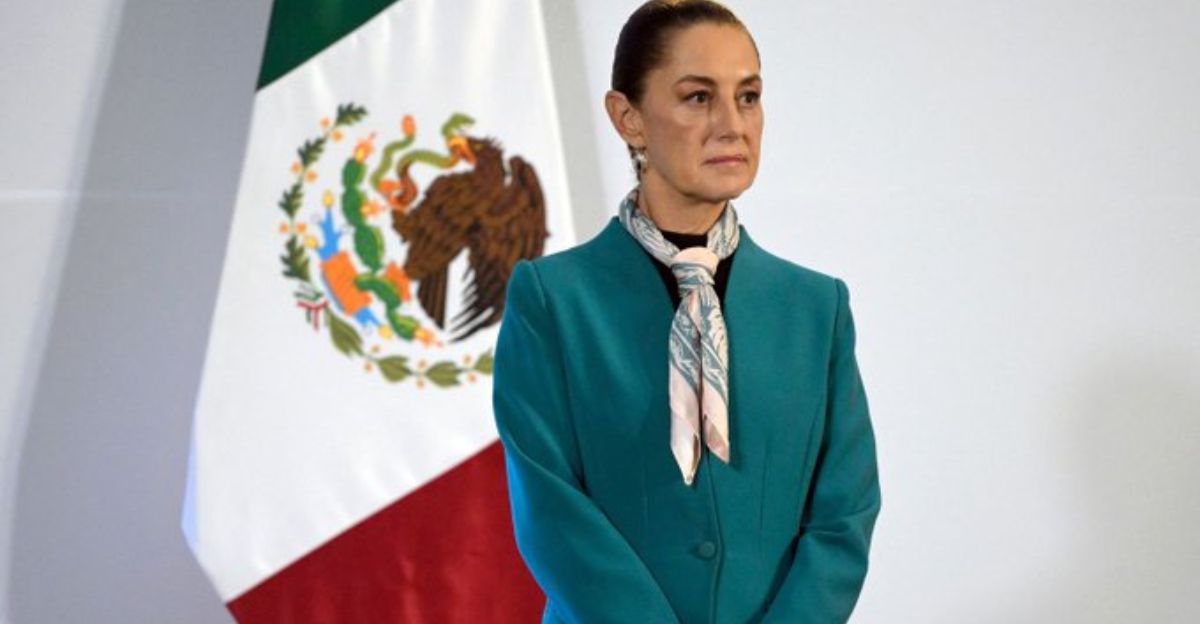
The admission came only after initial denial. When Mexican President Claudia Sheinbaum’s government first contacted US officials in Brownsville and Mexico City, American representatives claimed they could not verify US involvement. Days later, the Pentagon acknowledged that its own contractors had installed the signs.
The Rio Grande’s Restless Geography
The Rio Grande has redrawn the map of sovereignty repeatedly throughout history. The river’s constant shifting due to sediment and erosion forced a major reckoning in 1963, when the Chamizal Convention resolved nearly a century of territorial disputes by transferring approximately 600 acres between the two nations. The 1970 Boundary Treaty that followed anchored the border to the river’s deepest channel, acknowledging that this line would never remain truly fixed.
The treaty established that the boundary runs “at the midpoint of the most modern and deepest channel of the Rio Grande as it enters the Gulf of Mexico.” Yet this language, while precise in intent, depends entirely on accurate measurement and constant monitoring. The Rio Grande’s natural dynamism means that what appears on a map today may shift tomorrow.
Treaty Compliance and Diplomatic Response
Stephen Mumme, a professor of border water law at Colorado State University, noted that placing signs without prior consultation with the International Boundary and Water Commission appeared to violate the 1970 treaty. The IBWC, established in its current form in 1944 and operating for over 135 years, serves as the binational arbiter of border demarcation, water distribution, flood control, and sanitation across 3,000 kilometers of international territory.
Mexican President Sheinbaum confirmed that the IBWC would be called in to conduct technical consultations. Both governments initiated diplomatic channels rather than escalation. The US Embassy pledged cooperation, and the Pentagon promised that contractors would “coordinate with appropriate agencies to avoid confusion in the future.”
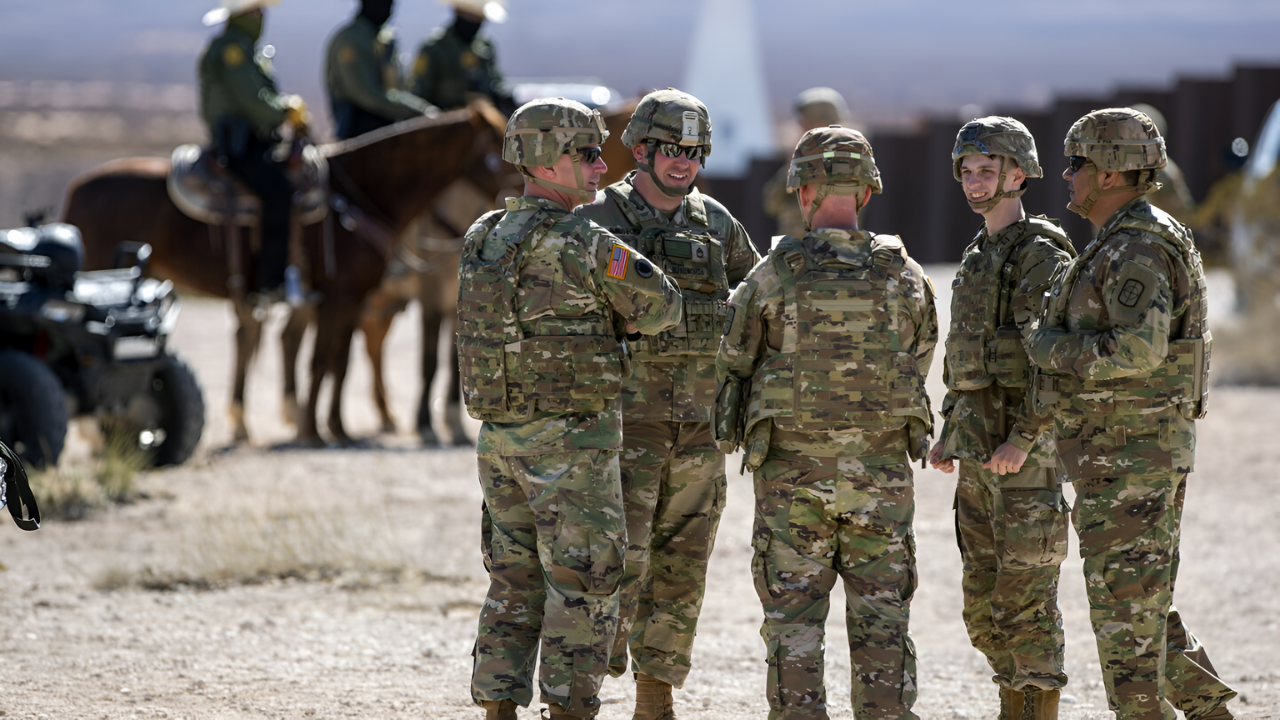
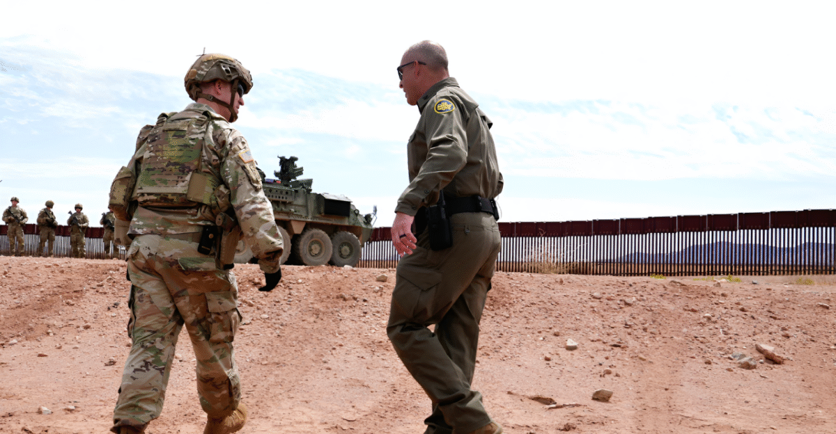
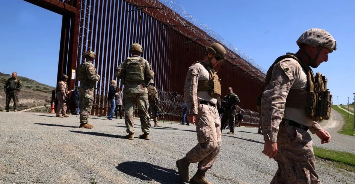
Militarization and Heightened Tensions
The incident occurred within a broader context of unprecedented militarization. National Defense Areas now sprawl across 250 miles of Texas coastline, administered by the US Air Force through Joint Base San Antonio. Since Trump’s January 2025 inauguration, thousands of troops have deployed to the southern border. Military sources reported a 94 percent reduction in unlawful crossings, while the administration designated Mexican cartels as foreign terrorist organizations equivalent to ISIS-level threats.
The timing carried additional weight. On the same day the signs were discovered, Mexican President Sheinbaum rejected Trump administration suggestions of military strikes against cartels on Mexican soil, stating flatly: “That’s not going to happen.” The border incident served as a reminder that when nations position troops and rhetoric heats up, even honest mistakes can become flashpoints.
Lessons and Path Forward
The Pentagon confirmed that sign-planting operations would continue but with enhanced coordination protocols. The incident exposed a fundamental vulnerability: the Rio Grande’s course has shifted, maps can deceive, and borders drawn by nature rather than treaties are vulnerable to misinterpretation.
Treaty compliance is not an optional technicality but the foundation of sovereignty. Technological accuracy in border demarcation is not a luxury but a necessity when the ground itself refuses to stay still. Both nations reaffirmed their commitment to established channels and the slow, deliberate work of negotiation through the IBWC. The lesson burned bright: in an age of militarization, precision and agreement matter more than ever before.
Sources
CBS News — “Warning signs appear on Mexican beach declaring area US Department of Defense property” (November 18, 2025)
Pentagon Statement via US Embassy in Mexico — Official Department of Defense explanation of incident and contractor involvement
Mexico’s Foreign Affairs Ministry & Mexican Navy Joint Statement — Official confirmation of sign removal and sovereignty response
President Claudia Sheinbaum — Official statements regarding IBWC involvement, treaty implications, and diplomatic response
International Boundary and Water Commission (IBWC/CILA) — Binational agency official history, treaty framework, and technical authority on border demarcation
DOD News / Department of Defense — “Securing the southern border: two months of decisive action” (March 2025) and Trump administration border security policy