At 8:11 a.m. on Thanksgiving morning, the earth didn’t wait for anyone’s gratitude. A magnitude 6.0 earthquake jolted roughly 300,000 Anchorage residents awake as they prepared for one of America’s most sacred family meals. What began as an ordinary holiday became a seismic alarm clock—powerful enough to shake families from their beds, yet deep enough to spare the city from devastation.
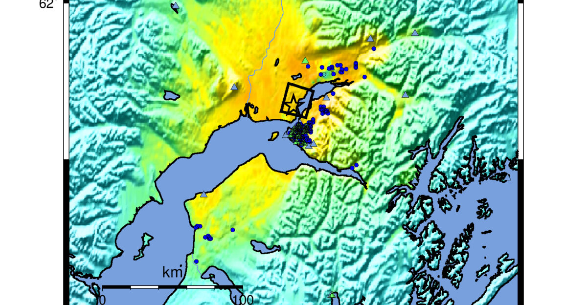
The epicenter, 12 kilometers west-northwest of Susitna at a depth of 69 kilometers, reminded Alaska that the ground beneath it is far from stable.
A City Holds Its Breath
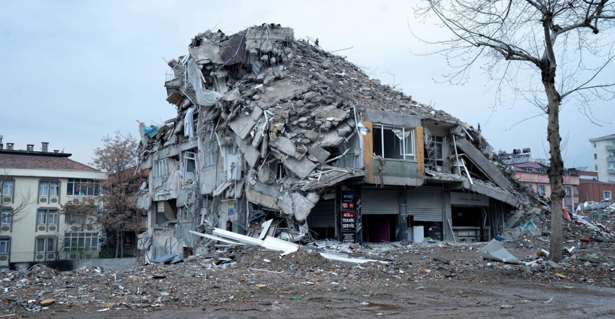
Early Wednesday revealed a stroke of geological luck. Despite the violent jolt felt across Cook Inlet, Homer, and as far north as Fairbanks—350 miles away—no significant structural damage materialized. No collapsed buildings. No power outages. No critical infrastructure failures.
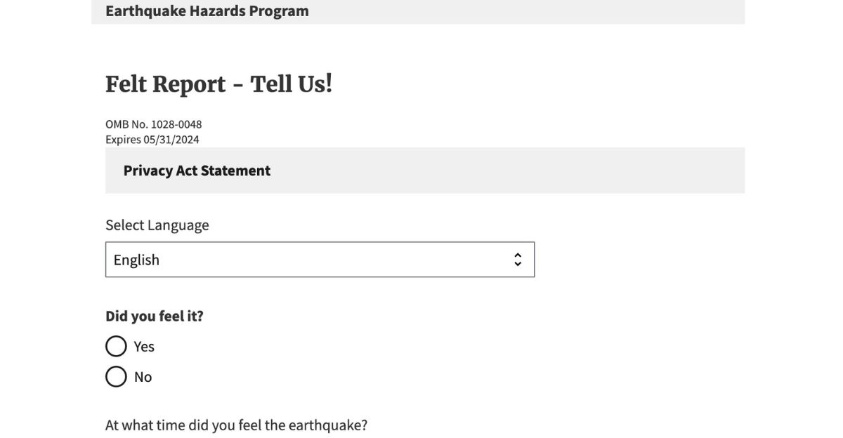
The USGS confirmed 6,827 residents reported the event through their “Did You Feel It?” system, creating a real-time earthquake map that transformed citizen observations into valuable seismic data.
Why 69 Kilometers Saved Lives
At 69 kilometers below the surface, this quake dissipated its violent energy across enormous distances before reaching human infrastructure. The exact magnitude 6.0 at just 10 kilometers depth would have created an entirely different disaster scenario—shattered glass, toppled chimneys, structural damage.
Alaska’s seismic experts confirmed this event occurred within the subducting Pacific Plate as it creeps deeper into Earth’s mantle—a relatively common occurrence here, but one that typically delivers less surface destruction than shallower crustal earthquakes.
Welcome to “Shakesgiving”
Alaskans responded to chaos the way they always do—with dark humor and resilience. Within hours, the #Shakesgiving trend took off across social media as residents shared videos of spilled gravy, toppled holiday dishes, and premature wake-up calls. One viral post captured an overturned cranberry sauce, accompanied by the caption: “At least the earthquake didn’t ruin Thanksgiving—gravity did.”
Interrupted breakfast preparations became comedy gold. The collective response revealed something about Alaska’s character: when geological disaster arrives, laughter arrives alongside it.
Why Weeks Will Bring More Tremors
The USGS issued a sobering forecast that turned nervous anticipation into cautious concern. Scientists predicted a 28 percent chance of magnitude five or greater aftershocks within one week—earthquakes significant enough to damage buildings and rattle residents again.
More concerning, a 97 percent probability of magnitude three or larger aftershocks would likely persist for weeks. For Anchorage residents, the morning’s violence was just the opening act.
Was This Related to 2018?
Scientists rushed to address fears of a terrifying scenario. Some residents wondered: Could this be an aftershock of the catastrophic 7.1 magnitude earthquake that shook Anchorage on November 30, 2018—striking on nearly the same calendar date seven years later? The answer, delivered by Alaska’s seismologists: No.
The Susitna event fell geographically and mechanologically outside the 2018 aftershock zone. This quake resulted from lateral slip within the subducting Pacific Plate—a different fault mechanism entirely from the 2018 thrusting motion.
Most Powerful in Four Years
The magnitude 6.0 earthquake on Thanksgiving 2025 reset the seismic baseline in south-central Alaska. The last quake of comparable power—a 6.1 magnitude event—struck near Chickaloon on May 31, 2021, roughly 100 miles northeast of Anchorage.
Four years of relative quiet had lulled residents into a state of complacency. This quake shattered that illusion.
How 6,800+ Residents Became Earthquake Data

Citizen scientists documented swaying buildings, rattling dishes, moments of vertigo, and varied reactions across different geographic zones. The accumulated data created a real-time intensity map showing how seismic waves amplified through sedimentary basins like Cook Inlet.
Locations such as Nikiski and Anchorage, situated in sediment-filled basins, experienced prolonged shaking compared to communities on bedrock.
America’s Earthquake Capital
Few Americans comprehend a geological truth that Alaskans live with daily: this state experiences more earthquakes than the other 49 combined. Alaska doesn’t sit peacefully on stable ground—it straddles a collision zone of planetary proportions.
The subduction zone, where the Pacific Plate slides beneath the North American Plate, generates seismic energy continuously. Alaska averages approximately one magnitude seven earthquake per year.
Alaska’s Place in Earth’s Most Violent Zone
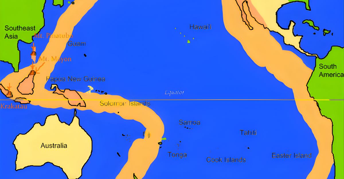
The Pacific Ring of Fire—a horseshoe-shaped zone of intense tectonic activity encircling the entire Pacific Ocean—passes directly through Alaska. This region produces roughly 80 percent of Earth’s earthquakes. Alaska’s subduction zone generates earthquakes rivaling any on Earth.
Scientists identify three of the twelve largest earthquakes ever recorded in Alaska—a distinction that places this state in genuinely rare geological company.
A Magnitude 9.2 That Reshaped Everything
On March 27, 1964, the Good Friday Earthquake struck Prince William Sound—a magnitude 9.2 cataclysm ranking as the second-largest earthquake ever recorded globally. The USGS documented 131 deaths and devastating tsunami waves that crossed the Pacific. That earthquake reshaped Alaska’s coastlines and residents’ relationship with the earth itself.
Every significant quake since carries that shadow. The magnitude 6.0 earthquake on Thanksgiving pales in comparison, yet it serves as a reminder that worse is possible.
The Frequency of Great Earthquakes
Alaska experiences a magnitude 8 earthquake approximately once every 13 to 14 years. Within a typical human lifetime, residents will witness at least five great earthquakes capable of reshaping landscapes and fundamentally altering lives.
The region sits on borrowed time, waiting for a catastrophic seismic event. Geologists monitor relentlessly, knowing another major earthquake isn’t a question of if, but when.
How Depth Protected the Coast
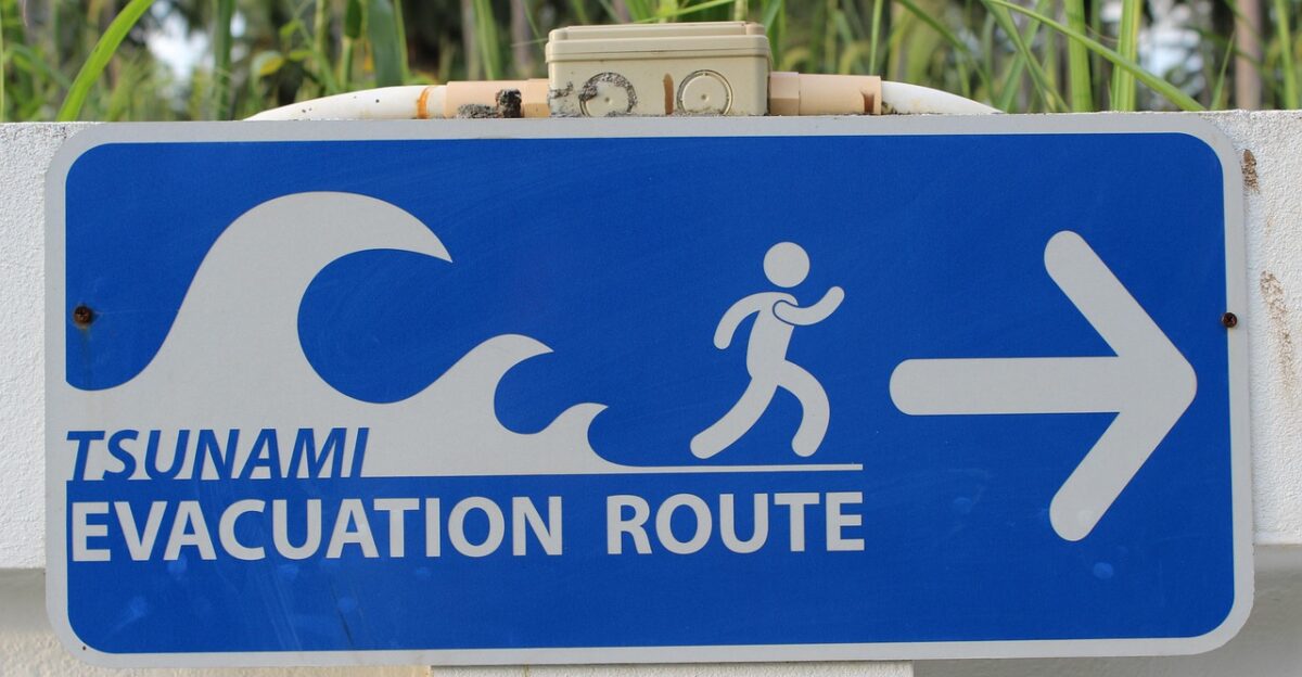
The U.S. Tsunami Warning Center held its collective breath while calculating carefully. Would this quake trigger a tsunami? The 69-kilometer depth, location away from major offshore fault zones, and the rupture characteristics all suggested minimal water displacement.
No sudden seafloor rupture. No catastrophic wave generation. The quake’s deep origin spared Alaska’s vulnerable coastline from a secondary catastrophe that would have been layered atop the earthquake itself.
What Residents Face Now
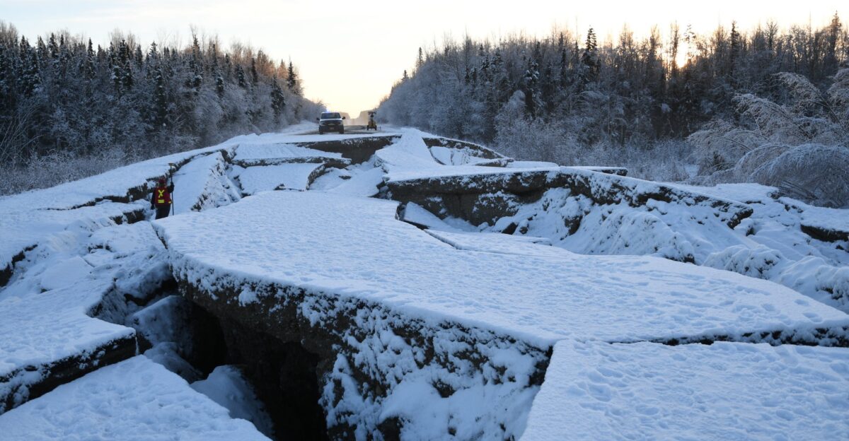
Aftershocks will arrive. Weeks of tremors stretch ahead as the Earth settles from its violent motion. Some will be barely perceptible. Others will rattle dishes, trigger car alarms, and wake sleeping families again.
Each aftershock carries psychological weight—a reminder that stability is temporary. Residents must adapt to the geological uncertainty that defines life in Alaska.
Alaskans Embrace the Chaos

Thanksgiving dinners resumed. Families returned to tables. Conversations continued. Because here’s what defines Alaska: life doesn’t pause for geological chaos. After an earthquake reshakes the morning, Alaskans laugh, share meals, celebrate holidays, and live fully anyway.
They embrace uncertainty because they possess no alternative. They dwell at the edge of seismic catastrophe on a planet that refuses to stay still. That might be the most powerful story of all.
Sources:
U.S. Geological Survey (USGS) Earthquake Hazards Program
Alaska Earthquake Center
National Tsunami Warning Center (NOAA)
U.S. Geological Survey – Earthquake History & Statistics
Alaska Department of Homeland Security & Emergency Management / Ready Alaska