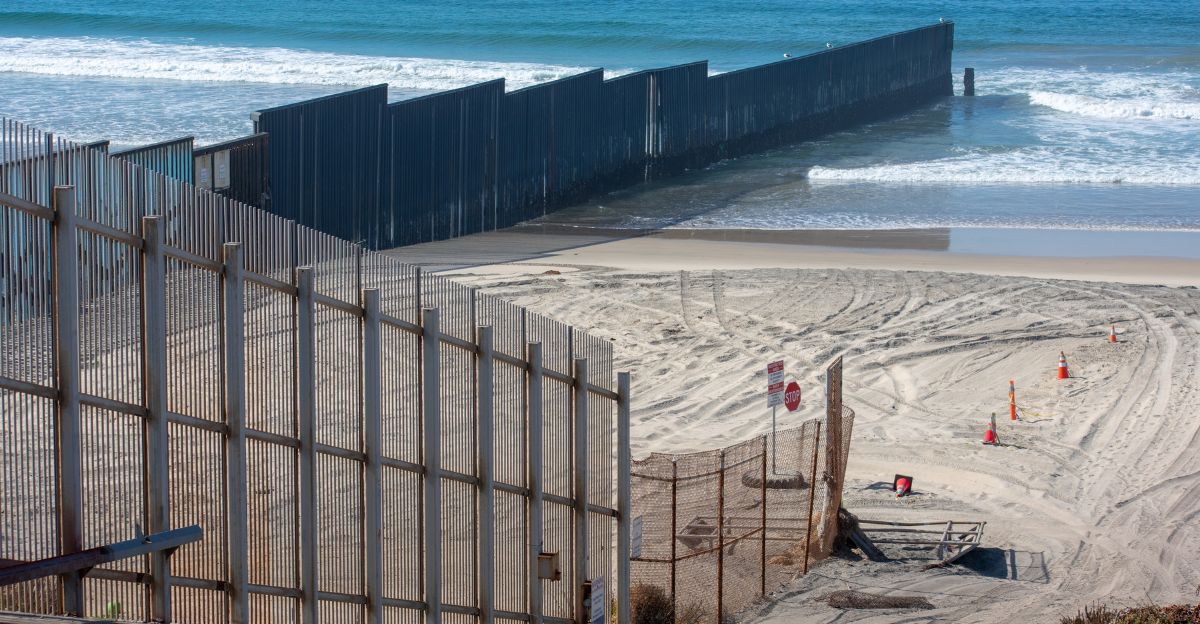
Night cloaked Playa Bagdad as unseen boots struck the sand—Pentagon contractors, maps in hand, marking a “National Defense Area” with six steel warnings driven into Mexico’s wind-whipped shore. Startled fishermen and Navy patrols would find these English and Spanish signs—unwitting sparks of an international incident hours from erupting.
On November 17, 2025, roughly 12 miles south of the invisible line that divides two nations, a mistake was made that would ricochet from the Rio Grande to the Oval Office.
Mexican Officials Discover “Department of Defense” Signs
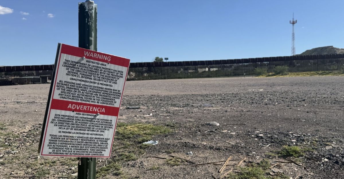
Six signs reading “Warning: Restricted Area” and “Department of Defense Property” stood sentinel on Mexico’s sovereign ground, their English and Spanish warnings proclaiming authority “under the commander’s” orders. Unauthorized access prohibited. Photography forbidden. But who had authorized this?
When Mexico’s Foreign Affairs Ministry demanded answers, confusion reigned—the signs’ origin and placement remained a mystery.
Pentagon Blames Water and Topography for Border Miscalculation
The Pentagon’s confession landed like a stone. Through the US Embassy in Mexico, the Department of Defense admitted what nobody wanted to hear: “changes in water depth and topography altered the perception of the international boundary’s location.”
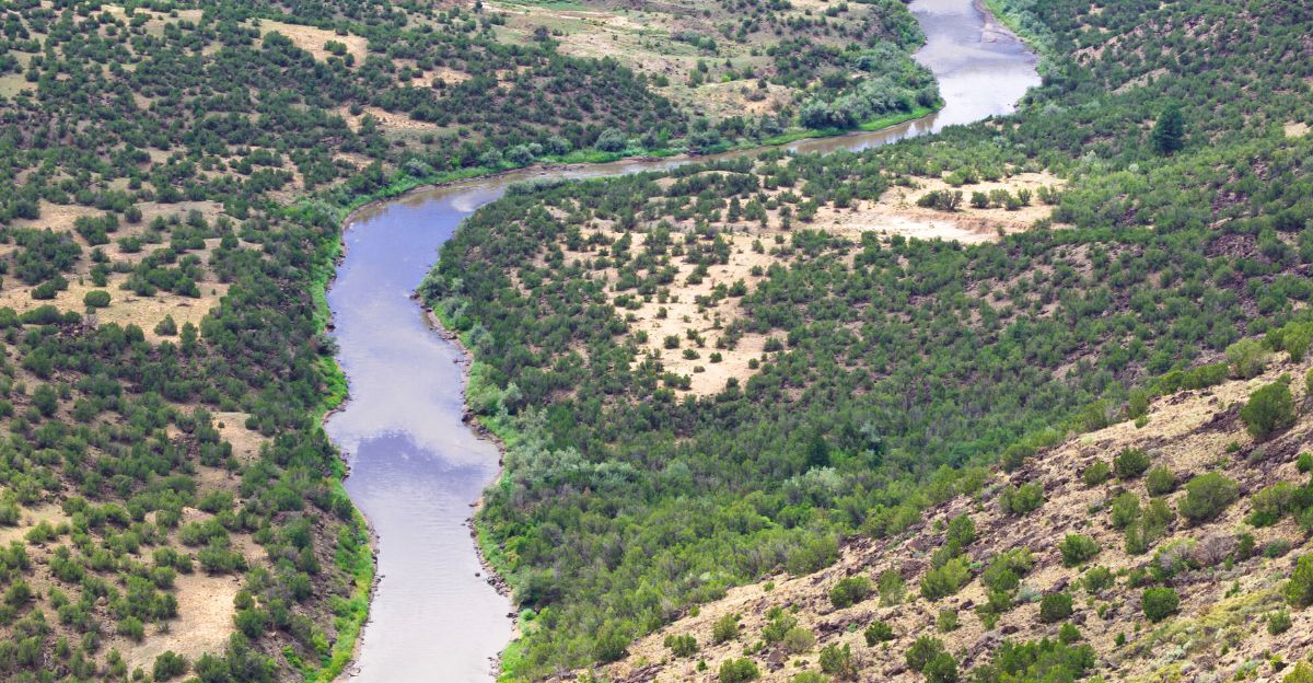
The Rio Grande, that restless giant of sand and current, had shifted again—and American contractors, tasked with marking National Defense Areas as part of Trump’s 2025 border security push across South Texas, had read the map wrong.
Mexican Navy Intercepts Group
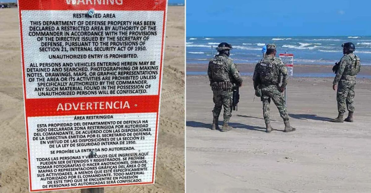
Mexican Navy personnel swept across Playa Bagdad like a tide reclaiming what was taken. The group was intercepted. Every sign—all six—was ripped from Mexican soil and hauled away.
Mexico’s Foreign Affairs Ministry and Navy issued a joint statement that echoed across the Gulf: they had acted to “defend national sovereignty,” and their message was crystal clear: this beach, this coast, this land belonged to Mexico.
Both Governments Launch Diplomatic Consultations
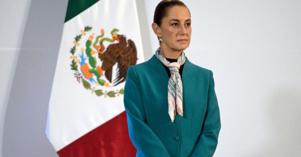
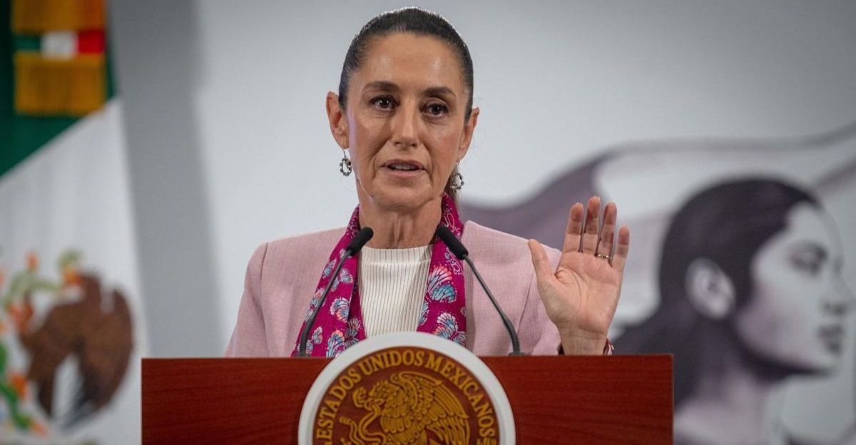
Both capitals knew what was at stake—not just a border, but the fragile threads of bilateral trust. Mexican President Claudia Sheinbaum confirmed it: the International Boundary and Water Commission (IBWC/CILA), the binational arbiter of where one nation ends and another begins, would be called in.
The US Embassy in Mexico pledged cooperation, and the Pentagon promised contractors would “coordinate with appropriate agencies to avoid confusion in the future.”
What Is the International Boundary and Water Commission?
The IBWC—born as the International Boundary Commission in 1889, renamed and reimagined in 1944—has wielded treaty law like a cartographer’s compass for over 135 years. Three thousand kilometers of international territory fall under its watch: border demarcation, water distribution, flood control, and sanitation.
U.S. and Mexican commissioners meet weekly, their voices alternating between El Paso and Ciudad Juárez. This is where nations negotiate not in war rooms, but in conference halls where maps are law.
International Treaty May Have Been Violated
The shadow of 1970 hung heavy. Stephen Mumme, a professor of border water law from Colorado State University, broke the silence: placing signs without prior IBWC consultation appeared to violate the 1970 Boundary Treaty—the document that established the border “at the midpoint of the most modern and deepest channel of the Rio Grande as it enters the Gulf of Mexico.”
President Sheinbaum’s words carried the weight of precedent: yes, the Rio Grande shifts over time due to sediment and erosion, but the treaty demands clarity, demarcation, and agreement. Not unilateral action in the dark.
Why the Rio Grande Is Notoriously Hard to Map
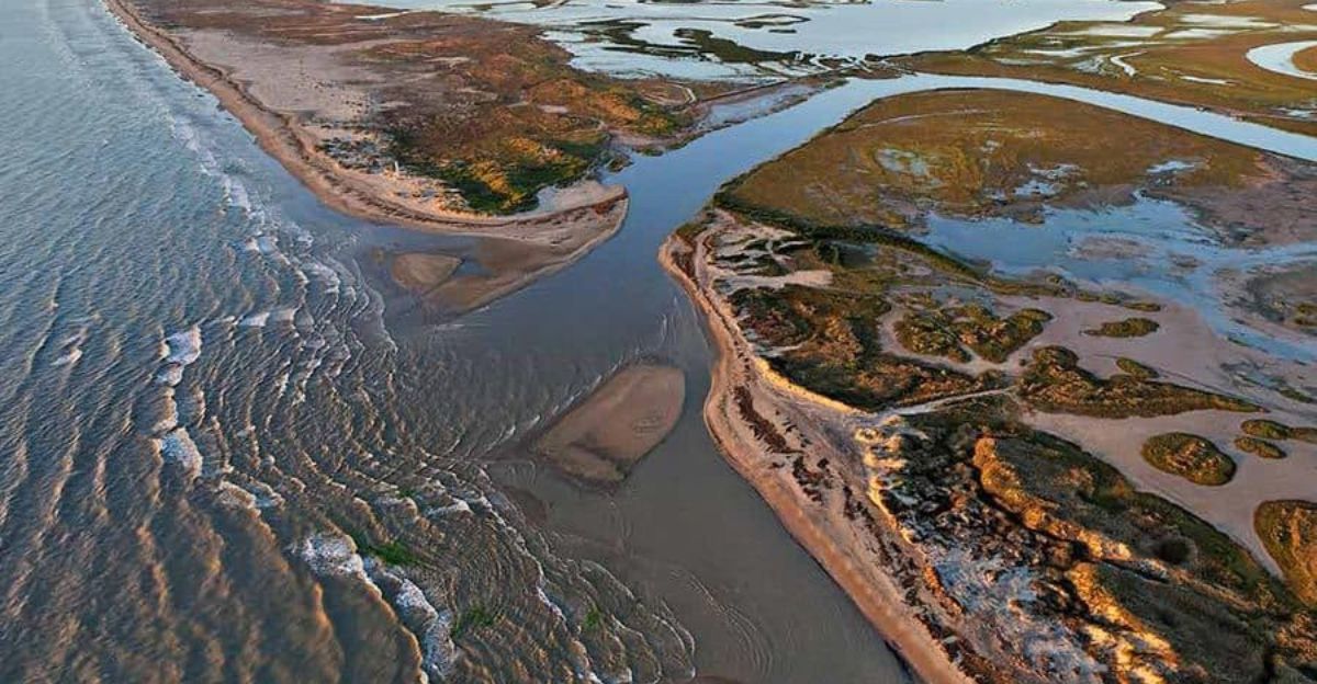
The Rio Grande has redrawn the map of sovereignty so many times that history itself has become a record of its restlessness. In 1963, the Chamizal Convention resolved what nearly a century of dispute could not—when the river shifted, it transferred approximately 600 acres of territory between nations, forcing a reckoning.
The 1970 Treaty came next, anchoring the boundary to the river’s deepest channel, acknowledging that this line would never be truly fixed. Constant IBWC monitoring became not a luxury, but a necessity.
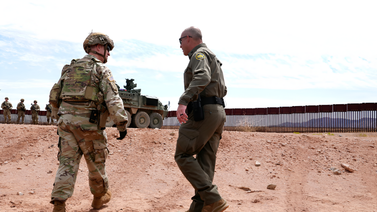
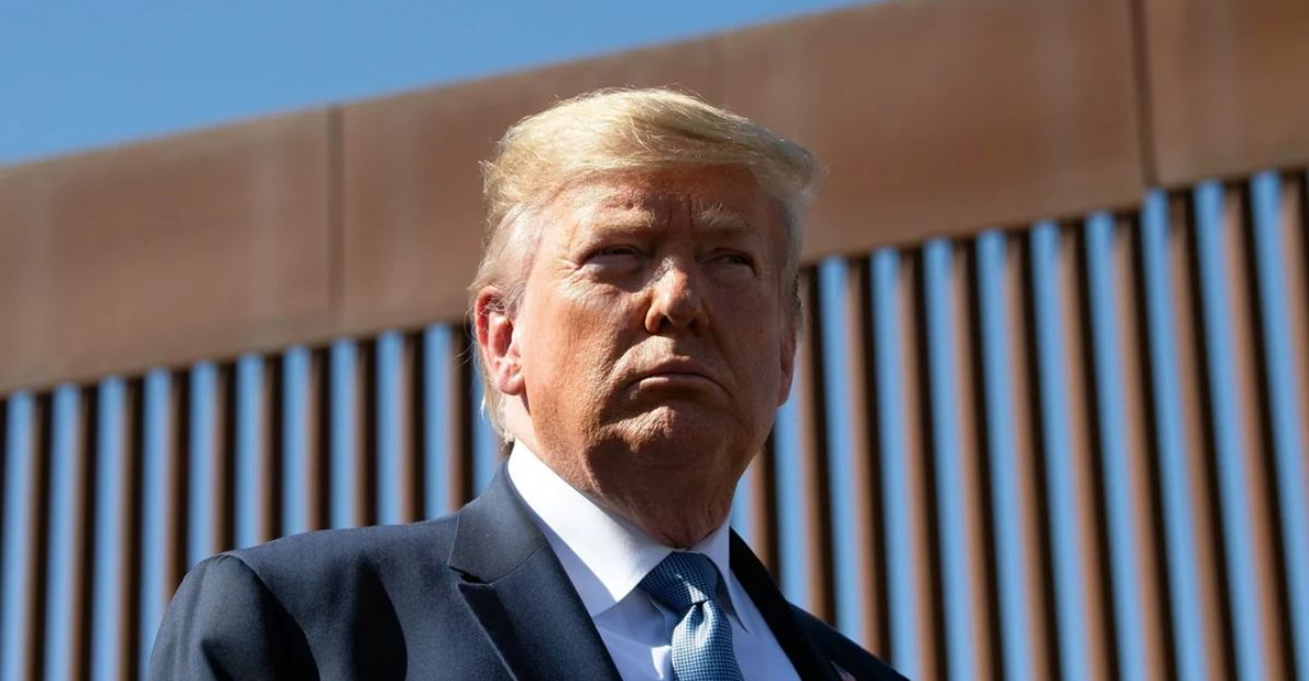
Trump’s Expanded Border Security Initiative
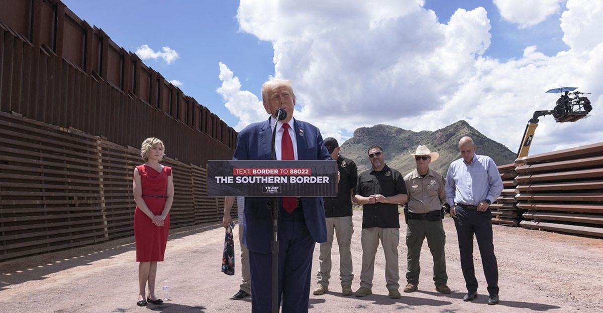
National Defense Areas sprawl across 250 miles of Texas coastline, part of Trump’s 2025 border security offensive that also designated Mexican cartels as foreign terrorist organizations. Defense Secretary Pete Hegseth had declared it plainly: “This is Department of Defense property.” Illegal entry attempts would meet detention by “U.S. troops and border patrol working together.”
The areas, administered by the US Air Force through Joint Base San Antonio, represented a militarization unlike any since the Cold War.
Trump Administration’s Broader Militarization Strategy
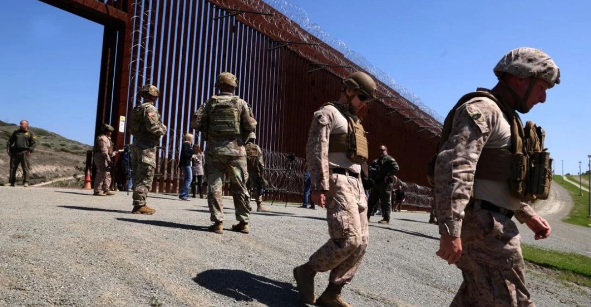
Since Trump’s January 2025 inauguration, thousands of troops descended on the southern border like a wave—and the numbers told a story of transformation. A 94% reduction in unlawful border crossings, according to military sources. Cartels elevated to threat levels “equivalent to ISIS,” their designation reshaping how America understood its southern flank.
AI-driven military databases tracked movement. Advanced surveillance technology watched every grain of sand. Expanded law enforcement authorities granted muscle to this new machinery. The border was no longer just a line—it was a battlefield, militarized and monitored, tensed and ready.
Initial US Denial Followed by Admission of Pentagon Involvement

When Mexican President Sheinbaum’s government contacted the US consulate in Brownsville and the US Embassy in Mexico, American officials stonewalled: “We cannot verify that any US authority had installed the signs.”
A US office later admitted what was undeniable—the Pentagon had hired contractors to place the signs, according to Sheinbaum’s own account. The delay in acknowledgment stung. It raised questions. It corroded trust.
Mexico Initiates Technical Review Through Binational Border Commission
The Foreign Affairs Ministry initiated technical consultations through the IBWC/CILA, demanding clarity: pull out the maps, dust off the instruments, show us where this border truly lies. Both countries confirmed what could not be denied—coordination had failed, and the cost had been measured in an international incident.
Yet Mexico’s response, even firm, chose the language of diplomacy over escalation. Not through confrontation, but through consultation.
Trump Administration’s Aggressive Stance
The timing was no accident of the calendar. President Trump had floated the unthinkable: military strikes against cartels on Mexican soil. And on the same day those signs were discovered on Playa Bagdad, Mexican President Sheinbaum had shut the door: “That’s not going to happen.”
The incident served as a stark reminder: when borders are militarized, when rhetoric heats up, and when nations position troops and threats, even honest mistakes can become flashpoints.
Pentagon Vows Continued Operations
The Pentagon did not flinch. Sign-planting operations would continue, officials confirmed—but with one crucial difference. Enhanced coordination protocols would be implemented. The incident had exposed a wound: the Rio Grande’s course has shifted, maps can deceive, and borders drawn by nature rather than treaties are vulnerable to misinterpretation.
Future operations would be choreographed with agencies designed to prevent exactly this kind of confusion—born of water, geography, and human error.
Lessons for Future Border Management and Sovereignty
Treaty compliance is not an optional technicality—it is the skeleton of sovereignty. Technological accuracy in border demarcation is not luxury—it is necessity when the ground itself refuses to stay still. Both nations reaffirmed their commitment to the established channels, to the IBWC/CILA, to the slow and deliberate work of negotiation.
The Rio Grande’s natural dynamism demands constant monitoring by trained engineers and legal experts. And the lesson burned bright: in the age of militarization, precision—and agreement—matter more than ever before.
Sources
CBS News — “Warning signs appear on Mexican beach declaring area US Department of Defense property” (November 18, 2025)
Pentagon Statement via US Embassy in Mexico — Official Department of Defense explanation of incident and contractor involvement
Mexico’s Foreign Affairs Ministry & Mexican Navy Joint Statement — Official confirmation of sign removal and sovereignty response
President Claudia Sheinbaum — Official statements regarding IBWC involvement, treaty implications, and diplomatic response
International Boundary and Water Commission (IBWC/CILA) — Binational agency official history, treaty framework, and technical authority on border demarcation
DOD News / Department of Defense — “Securing the southern border: two months of decisive action” (March 2025) and Trump administration border security policy