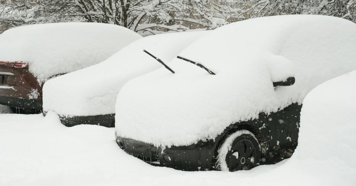
Sunday brought ashocking change to the Northeast. Central Park saw its earliest snow since 2019. Parts of New York received nearly 24 inches of snow. Yet this only hints at a bigger problem.
Forecasters warn of an aggressive winter pattern that is expected to last six weeks. A broken polar vortex released cold Arctic air southward. Meteorologists expect major disruptions, not this week but weeks ahead.
Escalating Human Cost
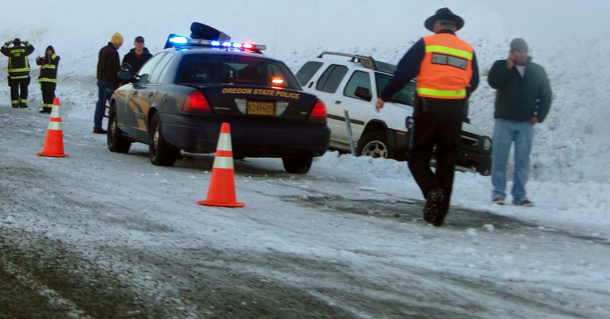
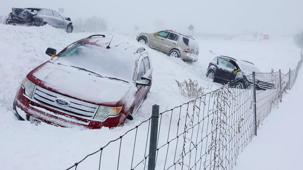
The December 13-14 storm killed at least four people. Most died in weather-related car crashes across the Midwest and Northeast.
Multiple vehicles collided on Interstate 55 near Springfield, Illinois, and Interstate 57 near Champaign. Long Island suffered another tragedy Sunday when a 20-year-old crashed into a tree on the Southern State Parkway.
Winter storms kill in two ways: through blizzards and through sudden rain-to-ice transitions.
Polar Vortex Breakdown: Winter’s New Frontier
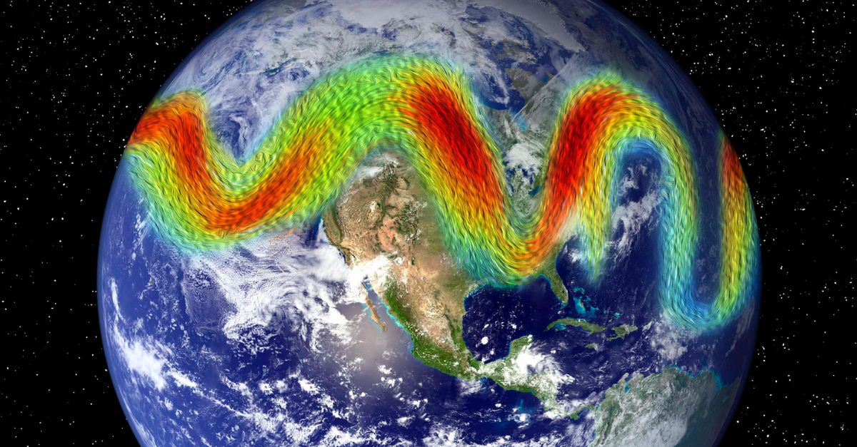
Late November saw the polar vortex—a massive Arctic cold center—weaken and split. This allowed frigid Arctic air to rush south. By early December, over 200 million Americans faced record cold.
Changing jet streams caused this shift. It marks a departure from past decades. Long-range meteorologist Paul Pastelok said: “The polar vortex stayed weakened and stretched since late November.”
This creates the wild temperature swings defining December 2025.
The Atmospheric River Squeeze

While the East recovered, the Pacific Northwest faced new danger. Starting December 8, a historic atmospheric river—rated Category 5, the strongest ever recorded in the Puget Sound—dumped torrential rain on western Washington.
By December 10, the Snohomish, Skagit, and Cedar rivers set all-time flood records. A second atmospheric river is expected to arrive on Thursday, December 18, bringing 7-10 inches of rain across the Cascades.
Extreme rain, unseasonable warmth, and melting snow create an unprecedented combined risk.
Winter’s Dual Threat Framework
Here emerges the hidden truth: December 2025 faces not a typical winter but a split climate emergency. The East experiences a polar vortex deep freeze with multiple Arctic waves, lake-effect snow, and sub-zero wind chills through mid-January.
The West is being pounded by back-to-back atmospheric rivers, fueled by warm oceans and La Niña conditions, which deliver record rainfall and flooding in just 72 hours. Forecasters warn that this dual-extreme pattern will persist through the holidays, with a third storm expected to hit from December 23 to 25.
New York’s Heaviest Snow Since 2022
The December 13-14 storm dumped massive snow across the Northeast. Kennedy International Airport recorded 4.6 inches daily—a record. Islip on Long Island got 5.8 inches, the most since January 29, 2022. Inland totals exploded: Perrysburg, New York, received 23.7 inches.
The storm redeveloped off the Delmarva Peninsula as a coastal low, intensifying rapidly as it moved northeast. The 6-12 inch totals across the Mid-Atlantic and New England stood out sharply.
Pennsylvania’s Power Crisis and Human Impact
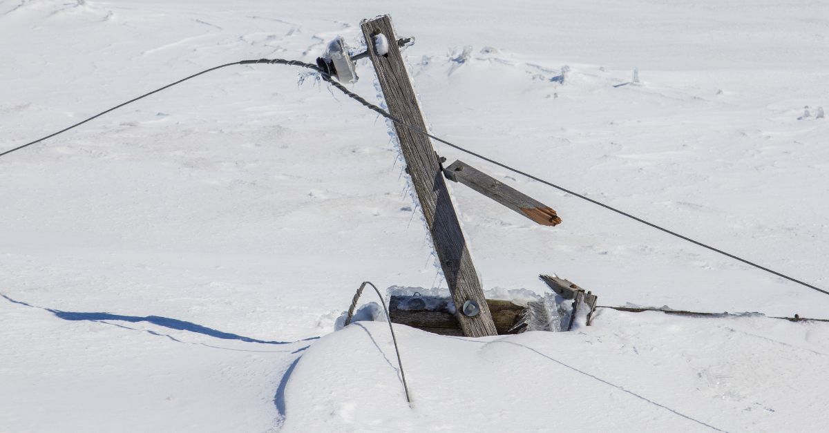
Pennsylvania suffered the most from this storm. State officials reduced speed limits on certain interstates and urged extreme caution. Central Pennsylvania experienced 6-8 inches of snow, with the highest accumulation of 8.6 inches in Howell Township. In neighboring New Jersey, at least 2,000 people lost power in Mercer County alone on December 14.
Governor Phil Murphy urged residents to avoid unnecessary travel. Across Pennsylvania, New Jersey, New York, and Ohio, roughly 41,100 people lost power. Schools closed or delayed across both states, frustrating families during holiday planning.
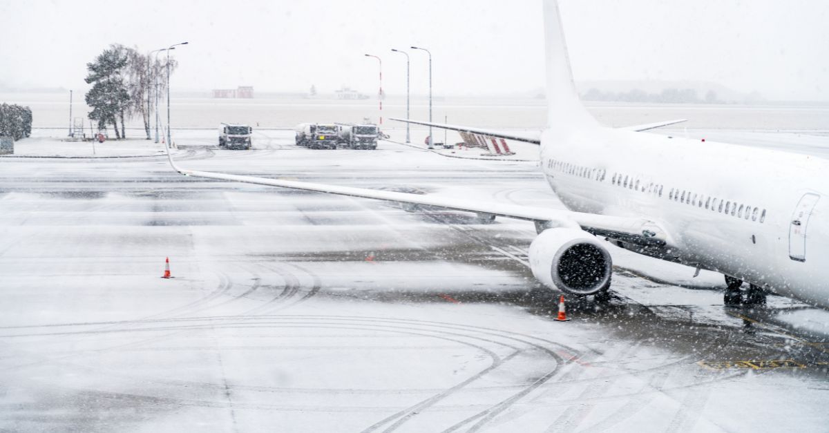
Travel Chaos: 1,000+ Delayed Flights
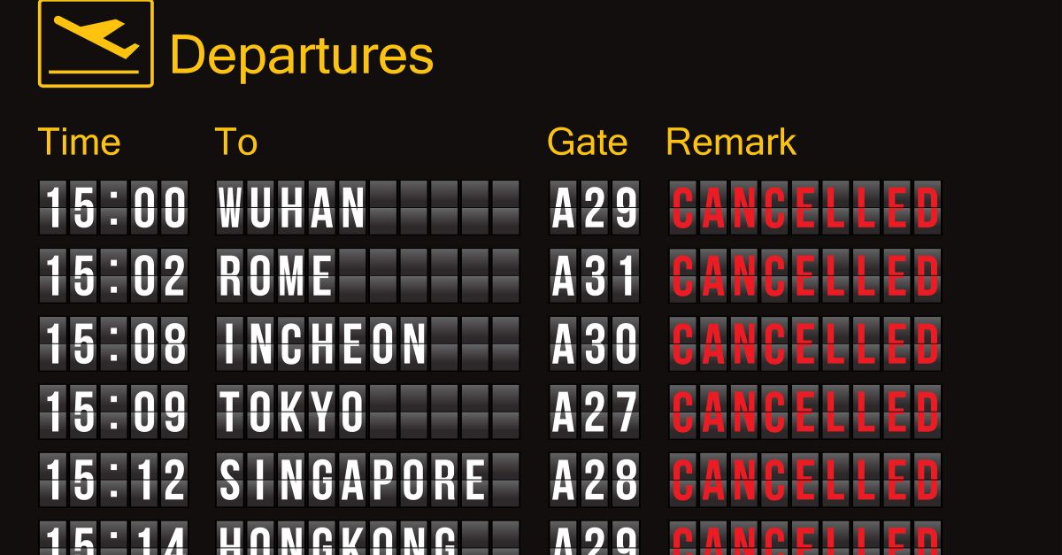
Disruptions spread beyond roads. Over 1,000 flights faced delays, and at least 100 were cancelled at U.S. airports during the storm’s peak on December 13-14. Ground stops happened at both John F. Kennedy International and Philadelphia International—two of America’s busiest airports.
The New York City transit system saw delays on the 1, A, and R subway lines. Airlines scrambled to reroute crews and planes, but the timing proved disastrous: this was peak Christmas travel season. Families faced missed connections and stranded luggage.
The Polar Vortex Persistence: Cold Through January
Meteorologists project that Arctic cold waves will last through mid-January. AccuWeather’s long-range forecast indicates that each successive cold wave is becoming colder than the previous one, especially in areas where fresh snow covers the ground.
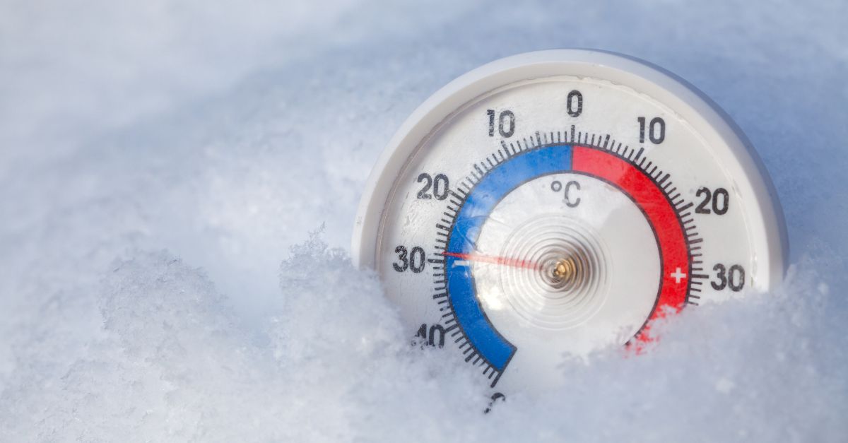
The persistent weakness of the polar vortex means repeated Arctic pushes, not just one cold snap. Chicago dropped to 4 degrees on December 4—nearly matching its all-time December record of 4 degrees from 1898. Milwaukee hit a low of minus 15 degrees; Fargo reached a low of minus 29 degrees. These mark season-defining extremes, not fleeting cold spells.
The Holiday Pattern Inversion
Raw weather data reveals a striking shift: the traditional December holiday pattern flipped. Typically, the Northeast anticipates a stable cold system by mid-December, followed by a warming trend before Christmas, allowing for outdoor fun and potentially creating a white Christmas scenario.
In 2025, the opposite happens. Mid-month warmth will likely melt the snowfall from December 13-14. Then, December 23-25 brings another major winter storm hitting the central and eastern U.S.—mostly rain south of Interstate 80, but snow north. Holiday travelers face three separate weather systems over a 12-day period.
Christmas Tree Farms Brace for Loss
Behind the headlines, farm losses mount silently. Christmas tree farms across the Midwest and Northeast are battling the effects of the polar vortex. Many report water damage from sudden freeze-thaw cycles.
Worse: the December 23-25 storm threatens to hit days before shipments, potentially damaging inventory still on lots. Farmers express frustration over impossible pre-harvest decisions amid the chaos of the weather. The USDA tracks potential losses, but early reports remain incomplete.
Industry groups warn consumers may face supply shortages and higher prices.
Lake-Effect Snow: The Unstoppable Inland Machine
After the December 13-14 storm, conditions fueled extreme lake-effect snow across the Great Lakes. Arctic air settled over still-warm lakes, spawning explosive snow bands downwind. Michigan, western New York, Pennsylvania, and Ohio issued lake-effect snow warnings.
Marquette, Michigan, is expected to receive 12-24 inches of snow through late December. The Upper Peninsula already shows close to 24 inches. Conditions are expected to continue through Friday, then ease as the system moves east.
The Tug Hill Plateau region in New York is expected to see similar totals. Communities deployed extra plow fleets and pre-applied salt.
Pacific Northwest Flooding: Cascading Disaster
While the Northeast digs out, the Pacific Northwest faces a flooding crisis. The first atmospheric river (December 8-10) already overwhelmed river systems. The Snohomish River shattered its all-time flood record on December 11. The Skagit and Cedar rivers matched it. Now, a second atmospheric river is expected to arrive on Thursday, December 18, bringing 7-10 inches of rain, according to the forecast.
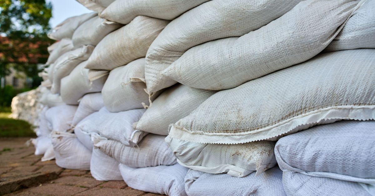
The National Weather Service issued a marginal-to-slight excessive rainfall risk for western Washington, Oregon, and Northern California. Mudslides closed all highways connecting the Lower Mainland to interior British Columbia. Communities sandbagged structures and evacuated flood zones.
Federal Preparedness and Expert Skepticism

FEMA deployed resources across three regions: the Northeast (for storm recovery and cold), the Pacific Northwest (for flood response), and Colorado/Wyoming (for a potential third storm). Yet meteorologists express caution about predictions past December 25.
The December 23-25 storm remains uncertain in track and strength—a 50-plus mile shift northward could mean rain instead of snow for millions. Forecaster Paul Pastelok stated: “The track controls late snow chances, but the storm stays uncertain and may shift.” NOAA projects above-normal temperatures in late December, which may limit snow even if rain falls.
Redefining Winter: The Question Ahead

Three major weather systems hit in 12 days: a blizzard, a polar vortex, and a holiday storm. This raises a key question: Is December 2025 unique, or does it show winter’s future? The split polar vortex, back-to-back atmospheric rivers, and La Niña conditions suggest the traditional winter season is breaking apart.
Meteorologists warn the 2025-26 winter could prove historic, with repeated Arctic pushes and extreme rainfall extending through February. Seasonal forecasts predict above-normal rain and below-normal temperatures for the Upper Midwest and Northeast through winter. Holiday planners now face an unsettling reality: stable, predictable winters may be coming to an end.
Sources:
- Wikipedia, “December 13–15, 2025 North American winter storm”, December 12, 2025
- AccuWeather, General long-range forecasts and polar vortex analysis, December 9-17, 2025
- National Weather Service, High Wind Warnings and weather advisories, December 13-18, 2025
- NOAA Weather Prediction Center, Storm forecasts and seasonal outlook, December 17-18, 2025
- CW3E AR Update, “17 December 2025 Outlook” (Atmospheric River tracking), December 17, 2025
- Fox Weather, “America cross-country storm wind rain snow travel delay holiday winter”, December 16, 2025