The National Weather Service just issued a serious warning for the Deep South. A Level 2 risk of severe thunderstorms now covers the Lower Mississippi and Tennessee valleys on Friday, affecting more than eight million people. Cities like Memphis, Jackson, and Baton Rouge are all in the danger zone.
Meteorologists say damaging winds, large hail, and possible tornadoes threaten the region. At the same time, a separate flash-flood warning is emerging over Tennessee, Mississippi, and Alabama. The ground in these areas has already absorbed heavy rain from recent weeks, making flooding even more likely.
Two Storms in Quick Succession
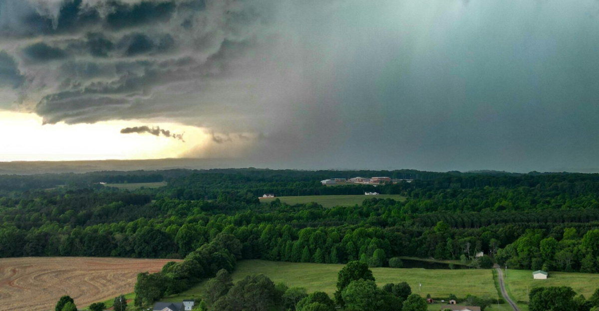
Meteorologists are tracking something unusual: two major storms racing across the country one after another. The first storm is sweeping from the Southwest toward the Mississippi Valley, bringing rain and severe thunderstorms to Oklahoma, north Texas, Arkansas, and southern Missouri. Before that first storm even exits, a second storm is already forming in the southern Rockies, ready to reinforce rain and storm chances over many of the same areas.
This back-to-back setup is dangerous because it increases flooding risks and creates overlapping hazards that can overwhelm first responders and emergency systems. Forecasters warn that travel disruptions could linger for days.
Heavy Snow Blankets the West

While the Deep South braces for tornadoes and storms, the same weather system is delivering heavy snow across the western mountains. New Mexico, Colorado, Utah, and Arizona are all seeing significant snow accumulation, with winter storm warnings stretching hundreds of miles. Forecasters expect several inches to more than a foot of snow in mountain areas, creating dangerous driving conditions.
The National Weather Service warns that roads will become slick, visibility will drop dramatically, and chain controls will be necessary for many highways. Drivers are urged to avoid travel if possible and prepare for long delays. The combination of snow and high winds creates what officials call “extremely challenging” conditions. Roads like Interstate 25 between Raton and Las Vegas are particularly vulnerable to closure.
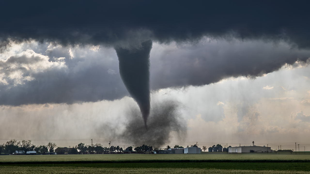
When Tornadoes Become Possible
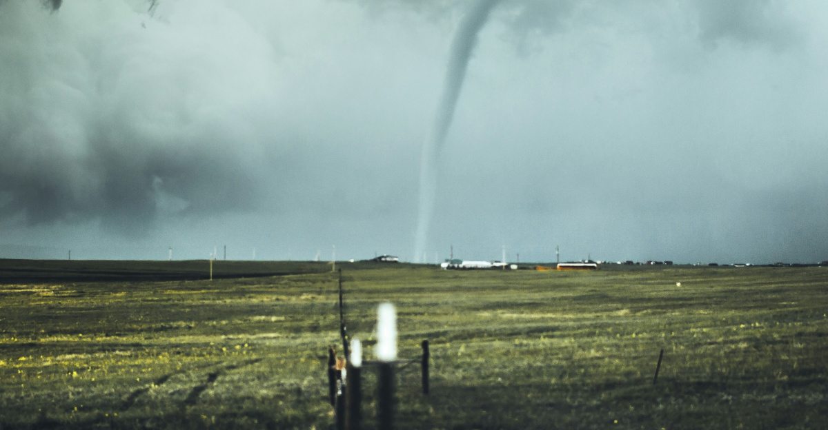
The real danger on Friday comes from a specific threat that meteorologists are taking very seriously: tornadoes. The Storm Prediction Center confirmed that conditions are shaping up for rotating supercell storms, the kind that can spin up tornadoes with little warning. Warm, moist air streaming from the Gulf of Mexico, combined with strong wind shear aloft, creates the perfect recipe for tornado formation.
Forecasters note that “rich Gulf moisture and strong low- and deep-layer wind shear will support semi-discrete supercells and clusters, posing a risk of damaging gusts and a couple tornadoes” across the Deep South and Tennessee Valley. This language from the National Oceanic and Atmospheric Administration reflects elevated concern.
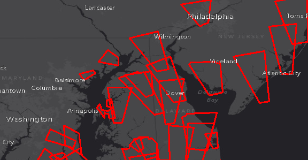
The Danger Zone Stretches South
On Friday, the severe weather risk spreads south and east, zeroing in on the Lower Mississippi and Tennessee valleys. Cities like Memphis, Jackson, Baton Rouge, and parts of western Tennessee sit right in the danger zone. Storms along a cold front will tap into warm, humid air, increasing the potential for damaging straight-line winds and isolated tornadoes.
The region’s situation is especially serious because it just experienced repeated heavy rain events over recent weeks. That means the ground is already waterlogged, and soil stability is compromised. Drainage systems that worked fine during normal rainfall could fail under the weight of another major rain event.
The First Warnings Already Sound
Before Friday’s peak danger, tornado warnings were already issued in the Oklahoma City area, and radar confirmed tornadoes were spotted as the first storm moved through on Thursday. These early impacts showed just how quickly conditions can turn dangerous when strong wind shear is present. The National Weather Service urged residents across the Lower Mississippi Valley and Tennessee Valley to take precautions immediately.
Families should keep phones charged, review shelter plans, and avoid unnecessary travel at night as storms capable of producing tornadoes and damaging winds approach. The human toll from this system may hinge on how well those warnings are heeded and how prepared families are.
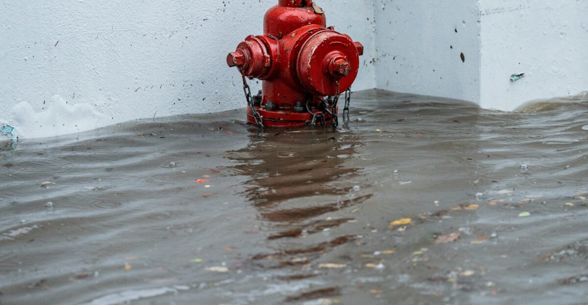
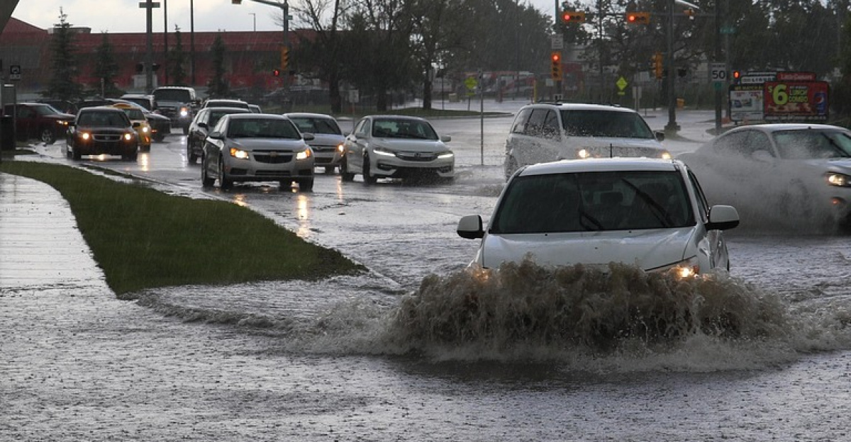
Flash Flooding Becomes the Real Concern

Beyond wind and tornadoes, flash flooding is emerging as the growing concern. The National Weather Service issued a Level 2 of 4 excessive rainfall risk for Middle Tennessee, northeast Mississippi, and northern Alabama, including Nashville and Huntsville. Forecasters predict two to three inches of rain will fall in just 24 to 36 hours, landing on soil that’s already damp from recent storms. Even worse, some areas could receive four to eight inches, with isolated pockets possibly getting ten inches.
The Weather Service warns: “Small streams will rapidly become swollen, and flash flooding will be possible in areas receiving heaviest rainfall.” Roads will wash out, drainage systems will overflow, and low-lying neighborhoods face real danger.
Highways Become Danger Zones
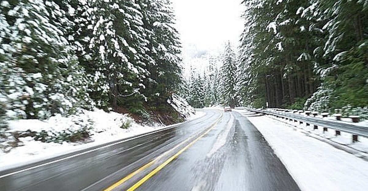
In the interior West, travel is already becoming hazardous as snow blankets high terrain. The National Weather Service issued a winter weather advisory warning that “travel could be extremely challenging. Tire traction is likely to be diminished.” Interstate 25 between Raton and Las Vegas, New Mexico, is already seeing treacherous conditions. Similar alerts from Colorado and neighboring states cite snow-covered roads, slippery conditions, and delayed commutes.
Modest snowfall might not sound serious, but when it falls during peak travel periods and affects major highways, the disruption becomes massive. Hundreds of vehicles can become stranded within hours. Officials are urging drivers: “Avoid travel if possible. Those who must travel should reduce speed, use caution, and allow extra time.”
A Hidden Threat
A lesser-known hazard is emerging across Wisconsin and Michigan: ice jam flooding. Meteorologists explain that the combination of thawing temperatures and heavy rain could loosen river ice, forcing it downstream where it piles up and blocks water flow. When ice jams fail, water can rapidly spill over riverbanks in localized areas, causing sudden flooding that catches residents off guard.
This secondary hazard isn’t directly connected to the Deep South severe storms, but it flows from the same broad weather system and moisture plume. The storm’s effects ripple across the entire continent, creating multiple different hazards in different regions.
Every Commute Becomes a Struggle

From Denver to Nashville and Boston, commuters face multiple days of serious disruptions. Rain, snow, and storms will repeatedly sweep across key highways and transportation corridors. In the Midwest and Tennessee Valley, waves of heavy rain threaten to slow traffic, reduce visibility, and cause water to pool on interstates near Chicago and St. Louis. The Northeast will experience rain arriving Friday that could snarl traffic around Washington, Philadelphia, New York City, and Boston.
Aviation impacts are equally serious, low cloud ceilings, gusty winds, and thunderstorms will introduce flight delays during already busy winter travel periods. Airlines are warning passengers to expect cancellations. Highways departments urge: “Plan extra time, allow following distance, and be prepared for sudden stops.”
Alaska Gets Buried Under Snow
Far from the Deep South, the broader weather pattern is expected to deliver up to thirty inches of snow near Anchorage, Alaska. Heavy snow beginning Friday will significantly impact local travel and operations, from road maintenance to traffic at Ted Stevens Anchorage International Airport. This dramatic snowfall underscores just how enormous this storm system truly is.
The same overarching weather pattern that threatens tornadoes in the Lower Mississippi Valley is simultaneously driving major snow in Alaska. That tells meteorologists something important: this is an unusually broad geographic reach for a single storm system.
From Dry to Dangerous in Hours
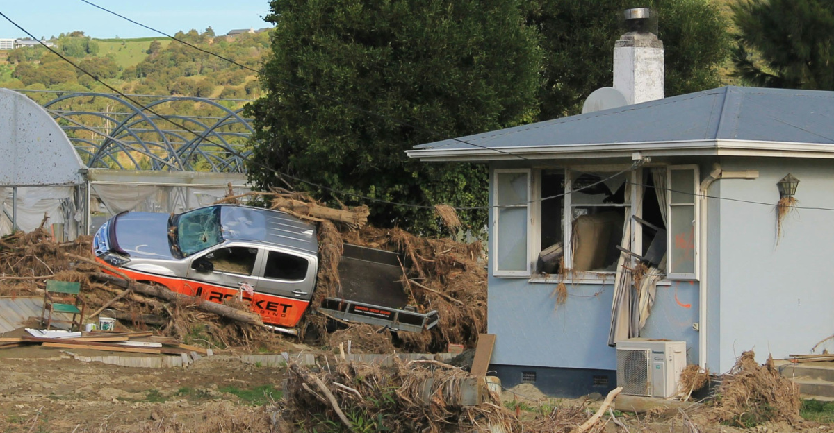
In the Appalachians, this storm marks a dramatic swing from dryness to potential flooding. Asheville, North Carolina, had recorded just 0.01 inches of rain through January seventh, ranking among its ten driest starts to the year since 1946. Now the region faces forecasts showing one to four inches of rain as the moisture plume lifts into the Carolinas and southern Appalachian Mountains.
Such rapid transitions stress stormwater systems and increase landslide or debris-flow risk on steep, saturated slopes. Heavy rain hitting dry ground initially allows good drainage, but once soils become saturated, water runs off rapidly and dangerously.
Emergency Services Face the Rush

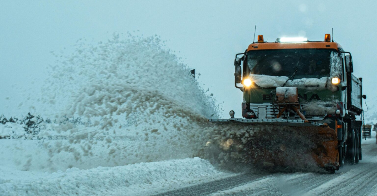
Emergency managers, transportation departments, and utilities across more than thirty states are preparing for cascading impacts. Power crews are on alert for outages from strong winds, heavy wet snow, and possible tornadoes in the Deep South. Road agencies warn of plowable snow in western high terrain and water-covered roads in the Tennessee Valley and Northeast.
With two storms striking in quick succession, there’s limited time to clear debris, restore power, and recover between rounds. This increases operational strain significantly. Fire departments expect increased emergency calls. Hospitals are preparing for surge capacity.
The Storm Finally Passes

Forecasts suggest conditions will slowly improve by late Sunday, with most regions drying out by Monday. Yet this event raises important questions about how communities adapt to frequent, overlapping hazards, from tornado risks in the Deep South to snow-choked passes in the Rockies and ice jam floods in the Upper Midwest.
As more than one hundred million people experience some part of this storm sequence, officials and residents will likely reassess warning systems, infrastructure resilience, and personal preparedness before the next cross-country system arrives. Meteorologists note that such broad systems are becoming more common.
The Storm Becomes History
By Tuesday, this historic storm will be moving into the Atlantic Ocean, leaving behind a trail of damage, disruption, and lessons learned. For millions of Americans who experienced some part of this system, the impact will linger, canceled plans, damaged property, lost work days, and memories of a rare event. Meteorologists have documented one of the broadest severe weather and snow threats to affect the continental United States in recent memory.
More than one hundred million people felt its effects across multiple states. Emergency responders will spend weeks cleaning up debris, repairing infrastructure, and assisting survivors. As this system moves offshore, the urgent question becomes: how well did communities respond?
Sources:
FOX Weather, “Severe weather, rain, floods for Midwest, South and East,” 6 January 2026
FOX Weather, “Pair of cross-country storms to bring rain, snow and severe weather,” 3 January 2026
AccuWeather, “First Major Storm Of 2026 Brings Threat Of Heavy Rains And Snow To Millions,” 6 January 2026
NOAA Storm Prediction Center, “Day 2 Convective Outlook,” 8 January 2026
NOAA Weather Prediction Center, “Excessive Rainfall Discussion,” 8 January 2026
NWS Albuquerque, “Winter Weather Advisory for Northern and Central New Mexico,” 8 January 2026